India
(July-August 2019): A meandrous 24-day trek in the Kargil
and Kishtwar districts of Ladakh
and Jammu & Kashmir
Leg
3: Agsho to Sani across Agsho
La and Muni La (Part 1/3)
|
|
Return
to main India 2019 webpage
Views of the itinerary in Google
Earth:
[Reminder: Click here
(kmz file) and open the downloaded file in Google
Earth to access the GPS waypoints that I recorded during the trek: red pins for
starts and finishes, green for camps, brown for passes, and yellow for other
waypoints. Orange markers have been added by hand; they are not GPS waypoints.]
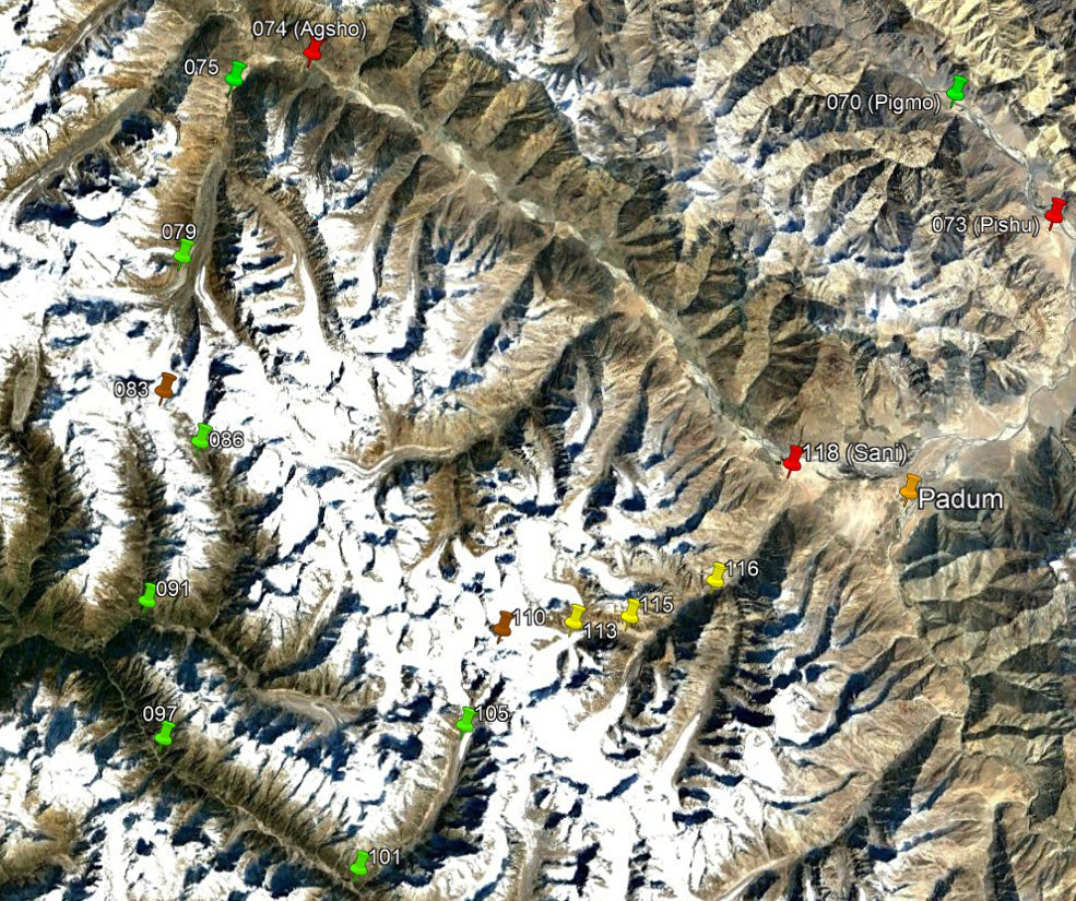
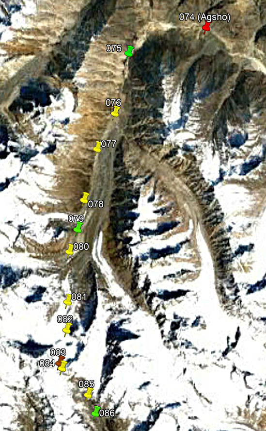
Left: View of the entire third leg, with
only a subset of GPS waypoints. Right: View of the first part of the third leg,
with all the waypoints.
|
|
|
Brief description:
This third and last leg of the trek
begins in Agsho village located some 50km northwest
of Padum, slightly off the road between Padum and Kargil. It ends in
Sani, another village on the same road, 9km from Padum,
after crossing two highly glaciated passes, Agsho La
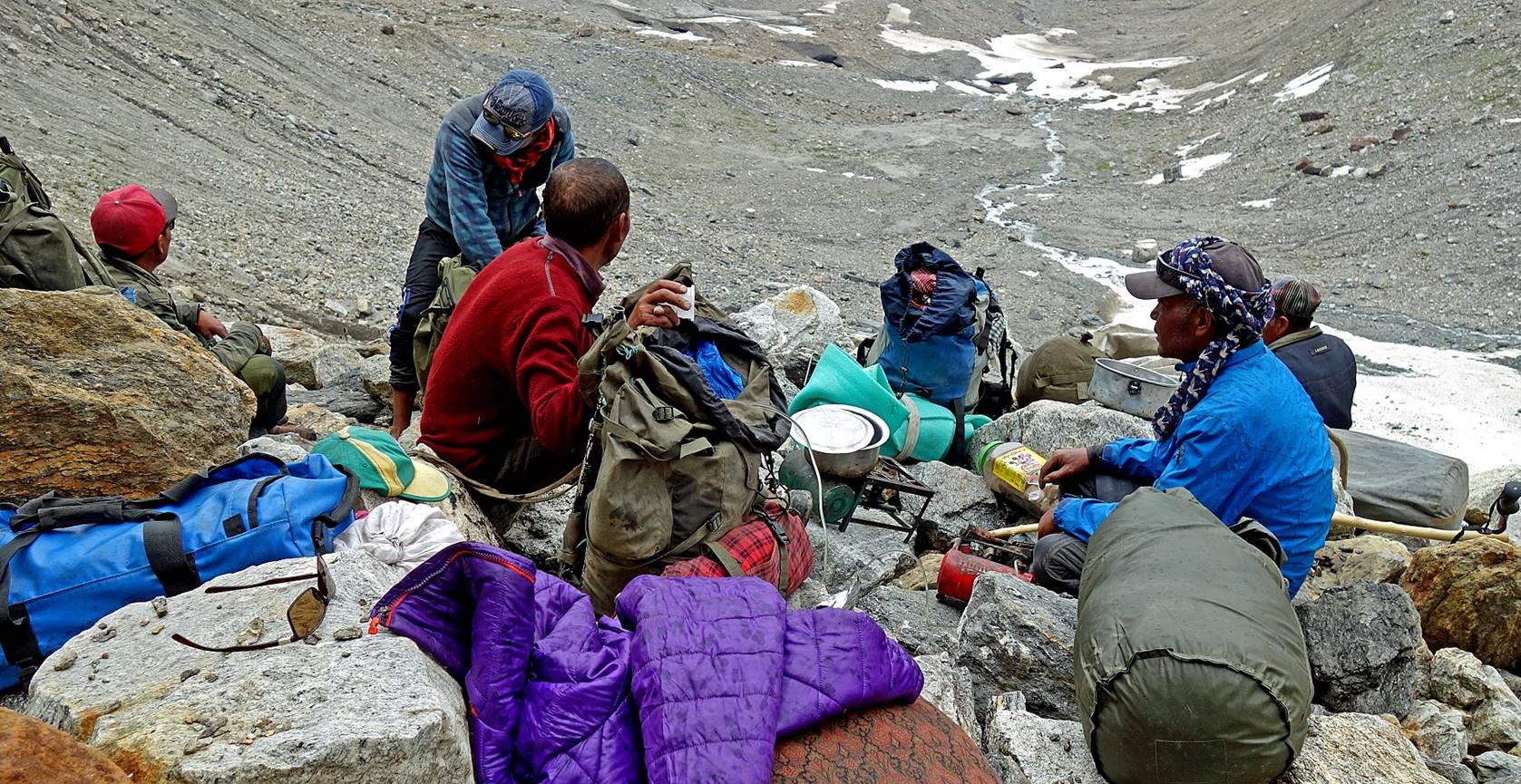
(WP #083, 5070m) and Muni La (WP #110, 5480m). On the morning of the first day Tundup, Nurbo, and I drove from Padum to the village of Agsho,
where we met our new support team of 5 porters, all Zanskaris
from around Agsho. We crossed the first pass, Agsho La, on the third day. The ascent to the pass was
long, but relatively easy. On the other hand, the descent was very steep and
difficult, and occasionally dangerous. But both sides of the pass offered
amazing sceneries of high peaks and glaciers. We set the last camp of this part
of the third leg near a lake in the valley south of Agsho
La.
Day 16 (of
trek): A short walk from the village of Agsho (WP
#074) to camp at WP #075
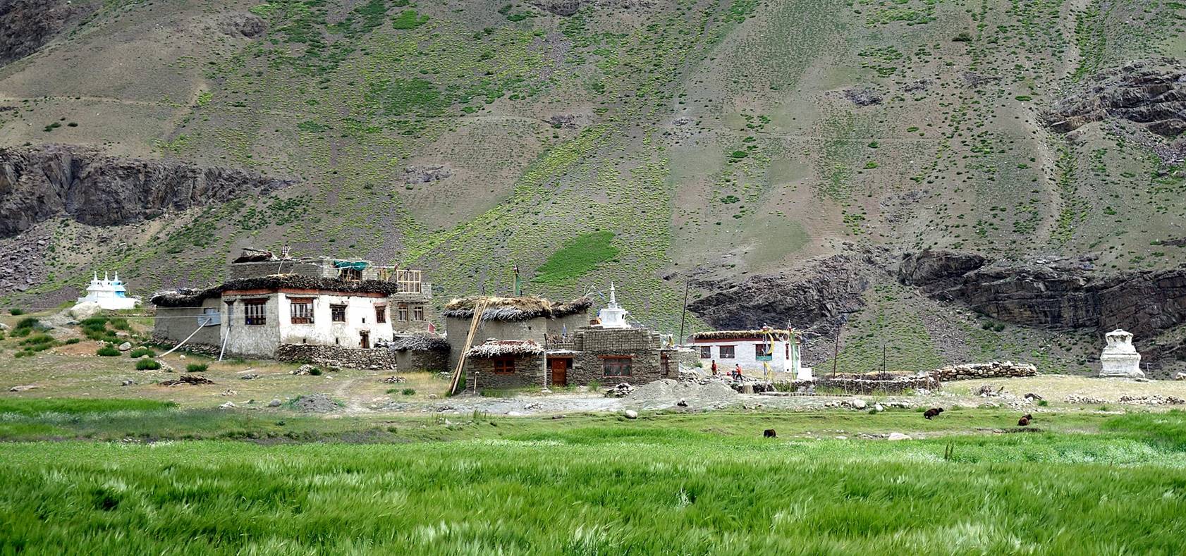
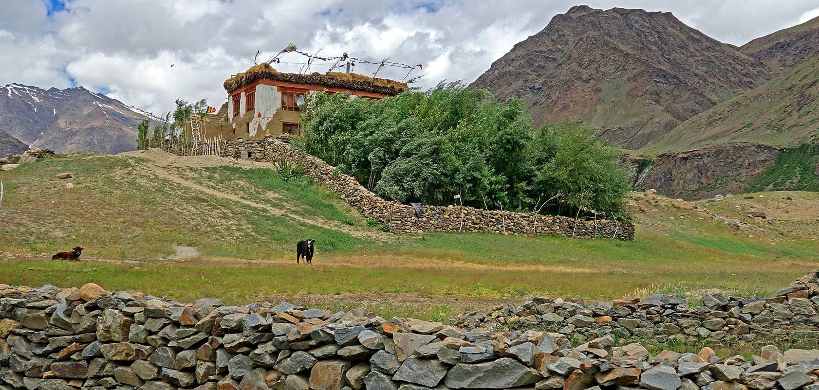
The village of Agsho
is more a collection of farms spread among buckwheat fields and pastures than a
real village.
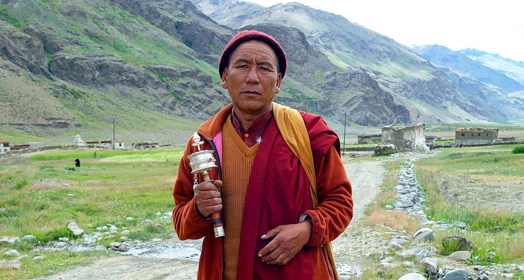
Monk holding a hand prayer wheel in Agsho.
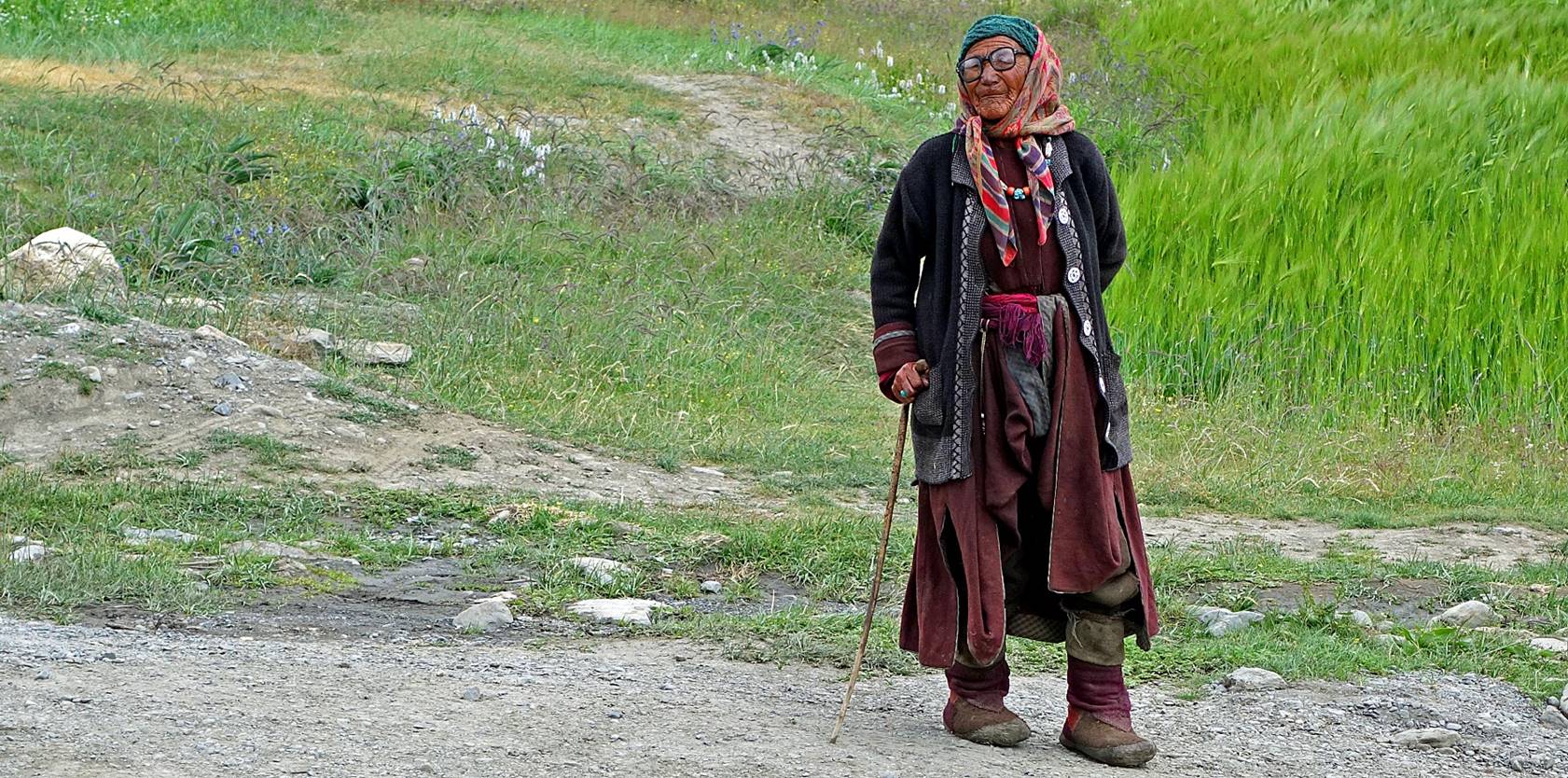
Woman in Agsho.
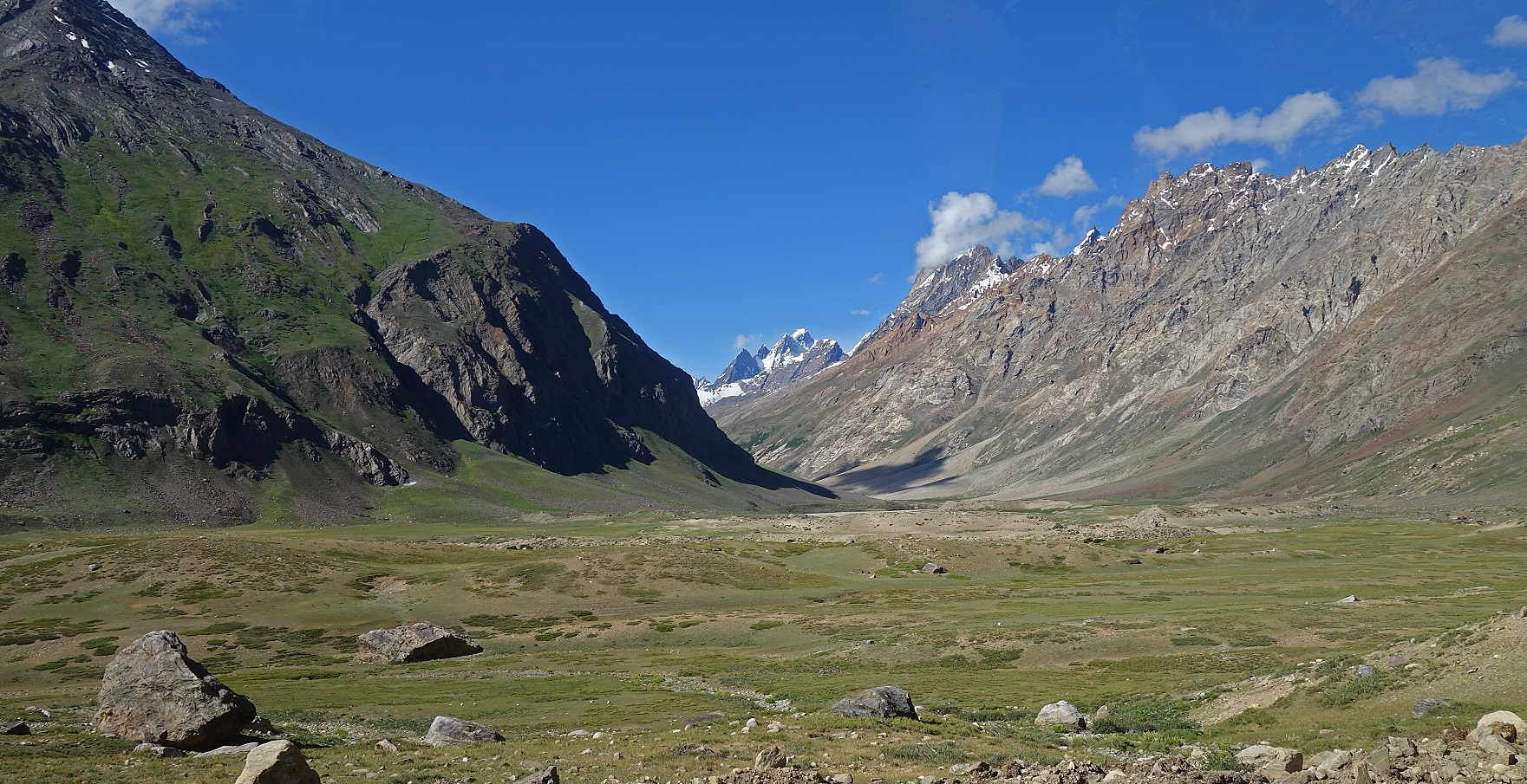
View of the valley that leads to Agsho La, seen from the Padum-Kargil
road. We set our first camp in the lower part of the valley, a rather flat
pasture area where inhabitants of Agsho village bring
their cattle.
Day 17: From
WP #075 to WP #079
We quickly
reached the moraine of the glacier flowing down from Agsho
La and other side-valleys. For a while we stayed above the moraine on the right
(when looking up toward the pass) slope of the Agsho
valley. Later on, the sides of the valley became too steep and we had to hike
on the moraine and the glacier.
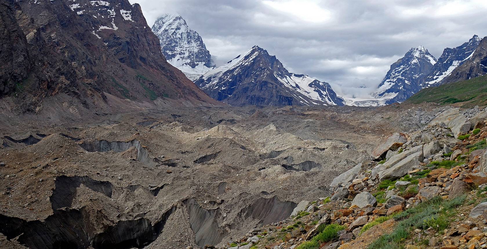
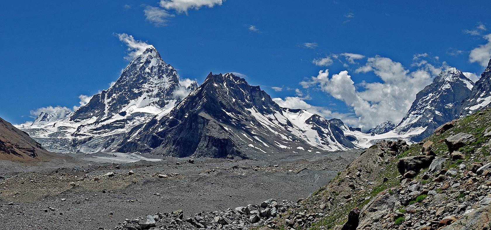
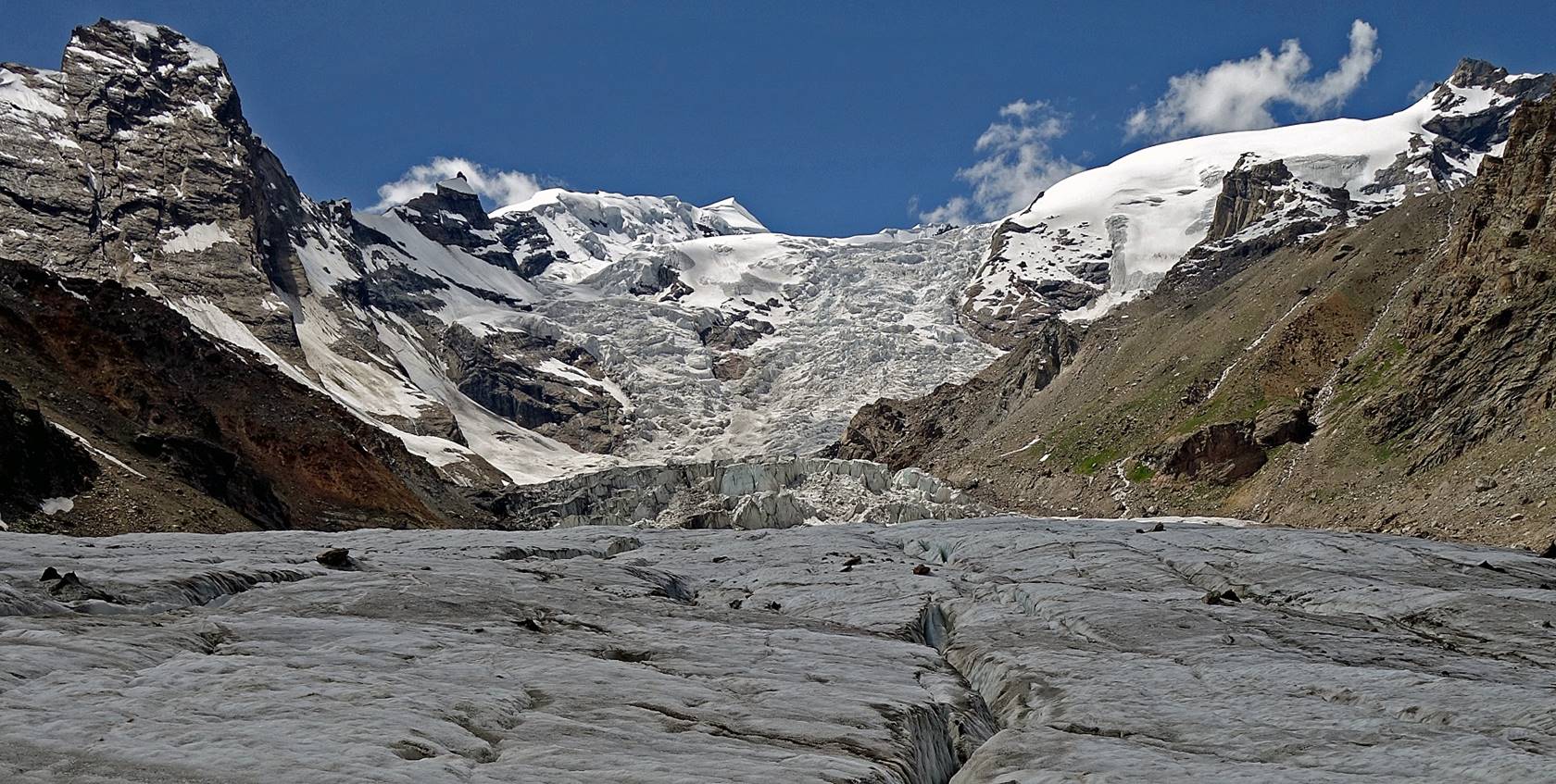
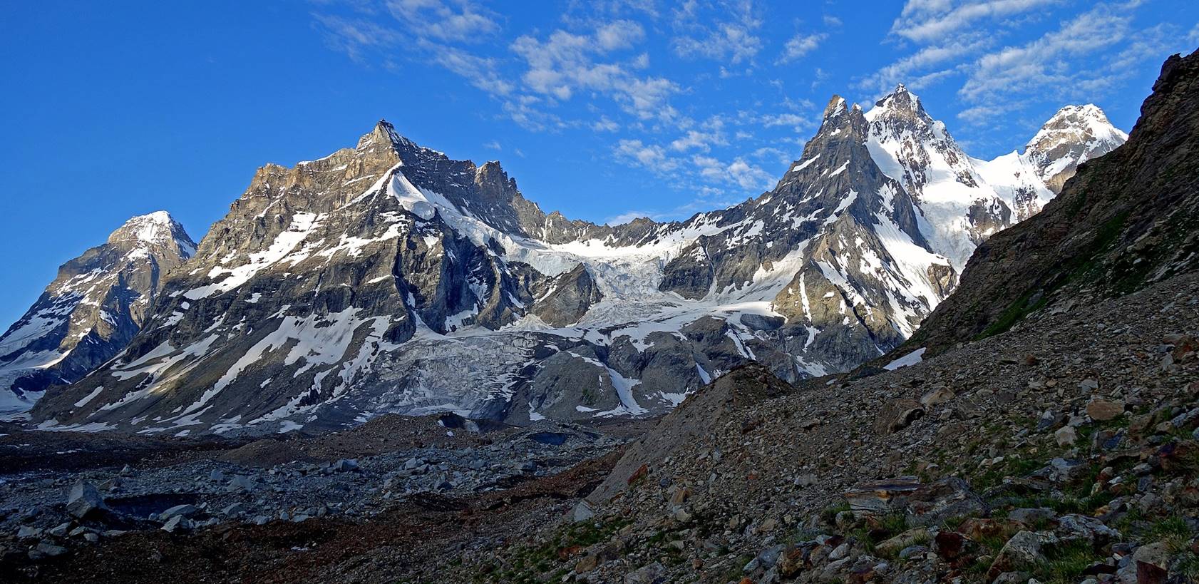
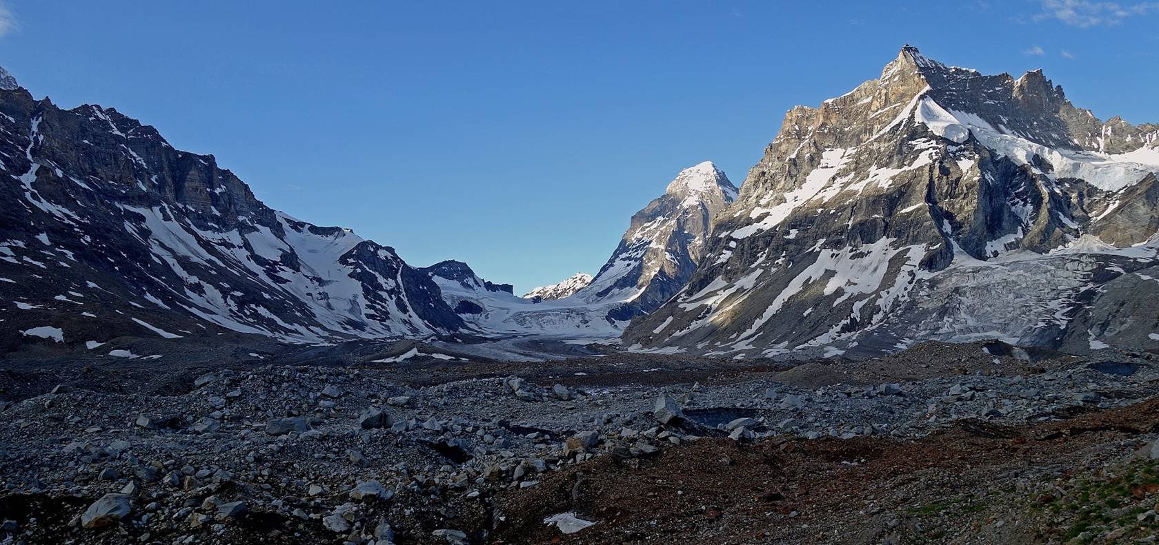
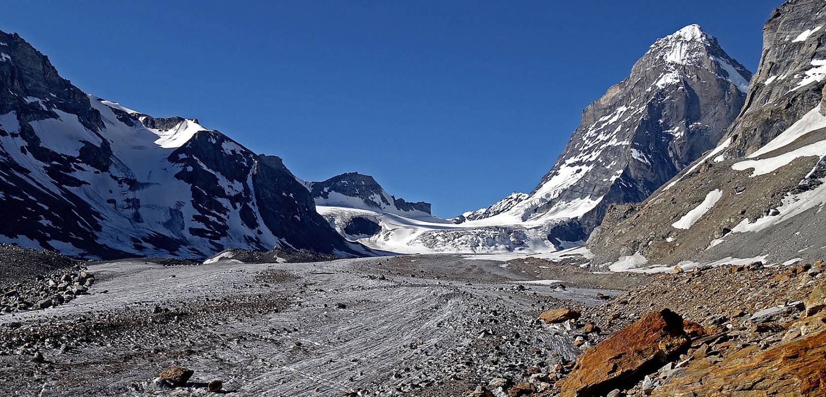
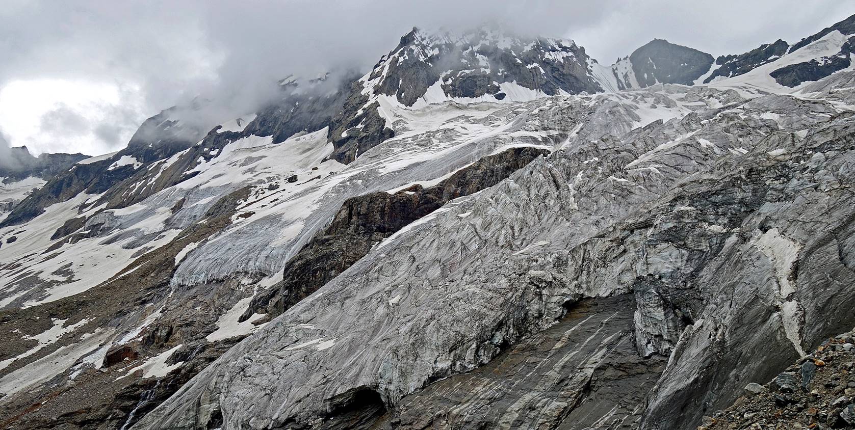
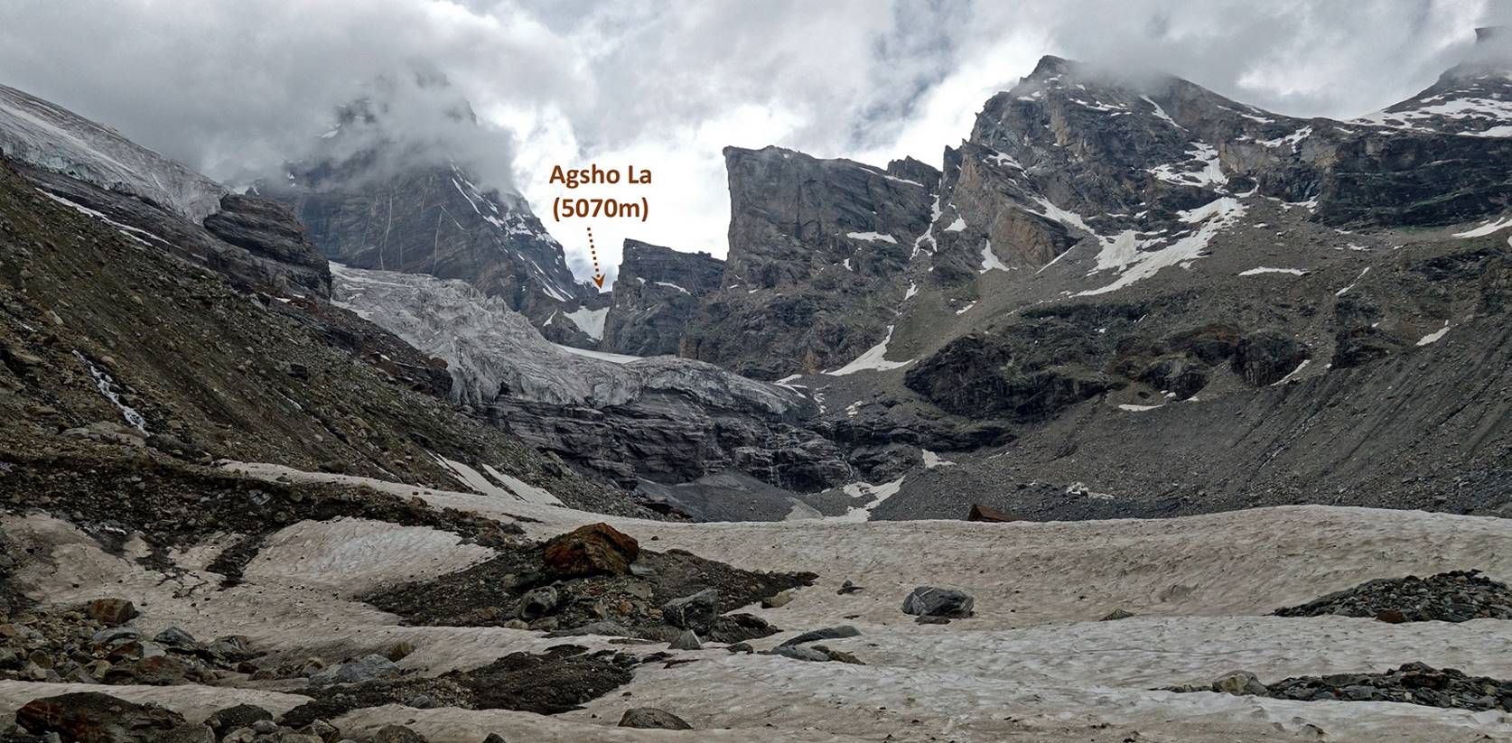
The pass can
be seen on the right of the photo below. The highest peak on its left is Agsho (6300m). The first peak on its right of the pass is Chiring (5450m).
Another view further up.
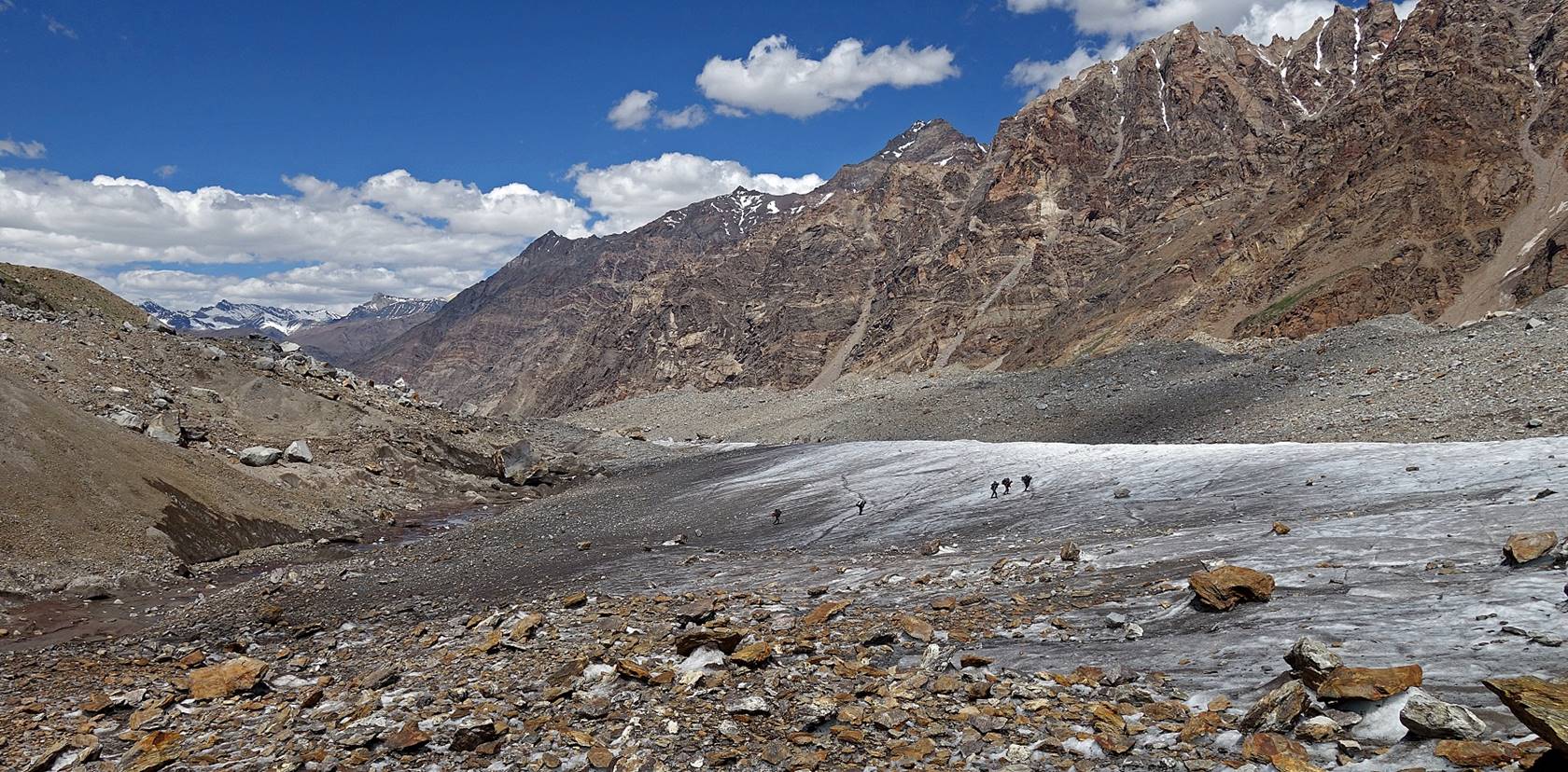
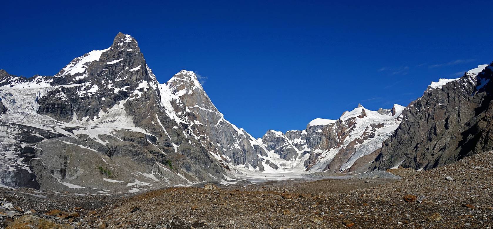
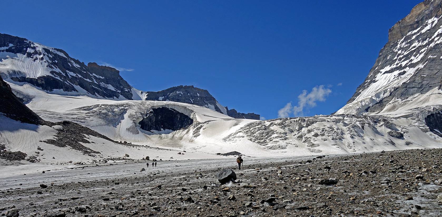
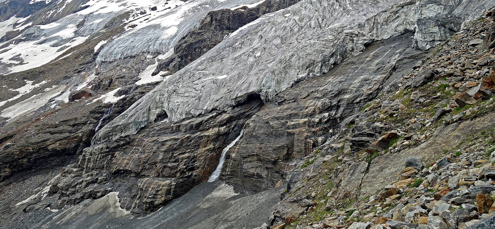
Reaching the confluence of three
glaciers flowing from Agsho La and two side valleys.
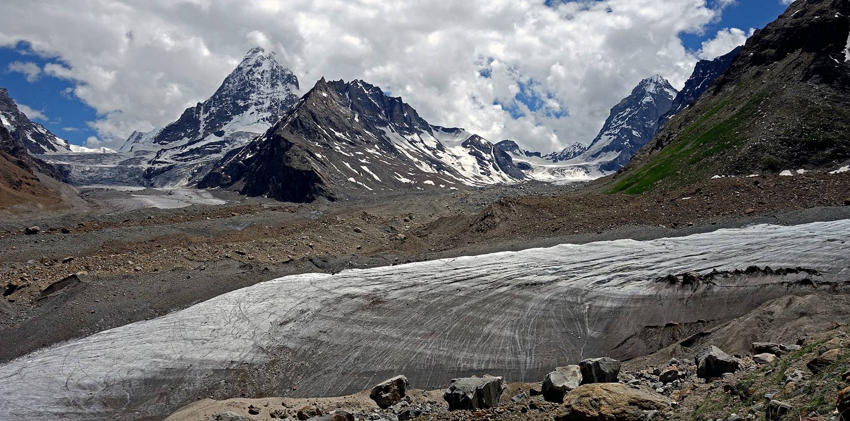
Views of the glacier in the side-valley
on the right, with Tundup taking a short rest in the
second photo below.
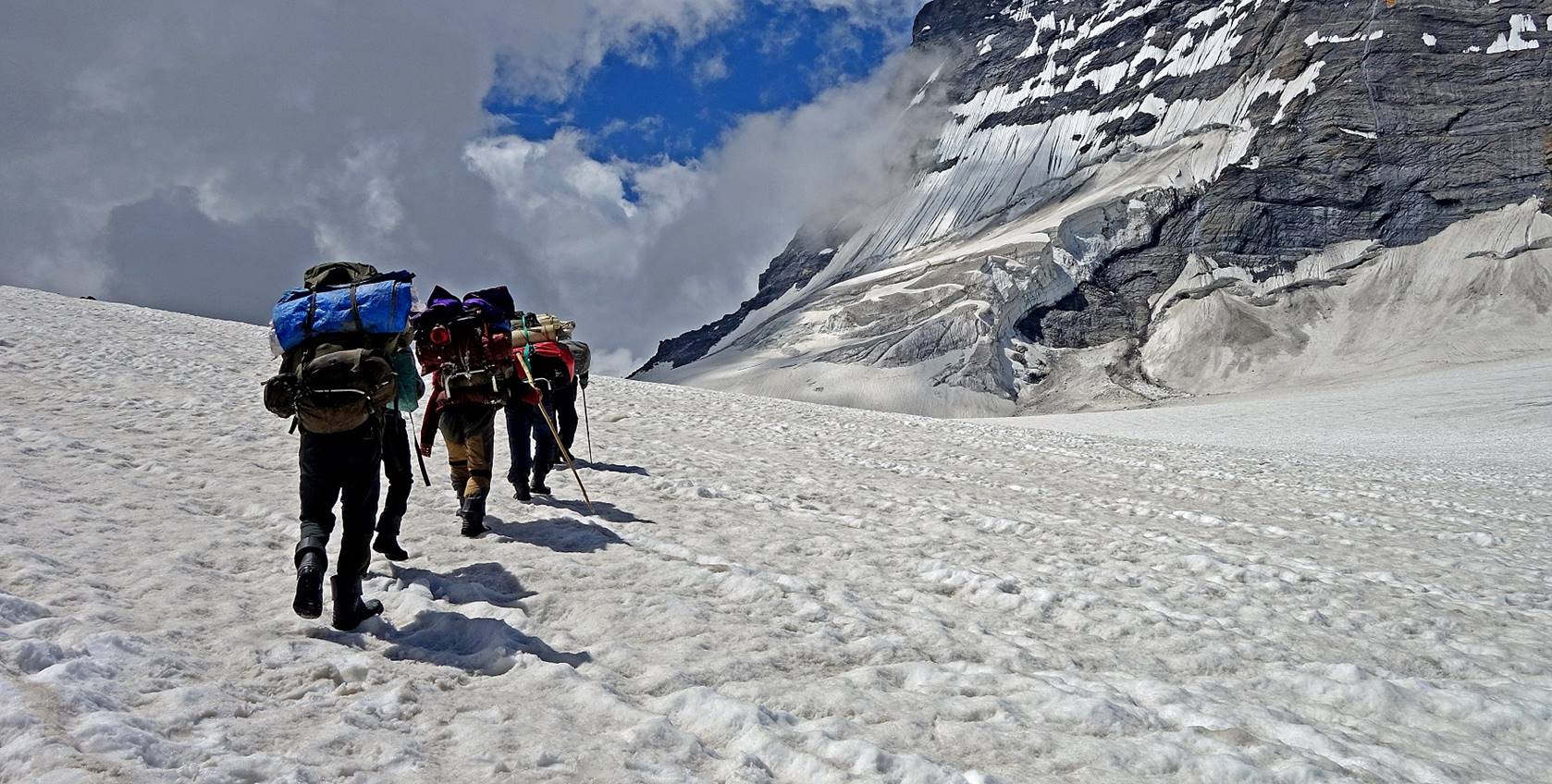
Our porters on the central part of the
glacier. (In fact, most the time they were way ahead of me.)
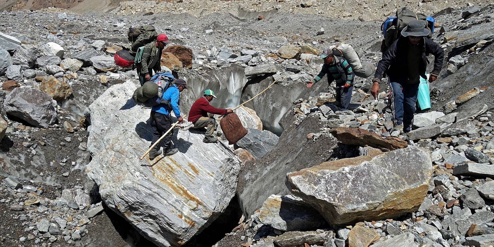
Crossing a crevasse using a big rock as
a natural bridge.
Colorful cliff on the left of the
glacier.
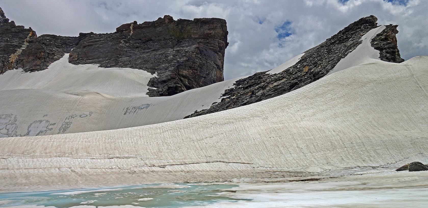
We set our second camp (WP #079) near
this small lake, on one of the last patches of grass below the pass.
Day 18: From
WP #079, across Agsho La (WP #083), to our next camp
(WP #086) on the shore of another lake
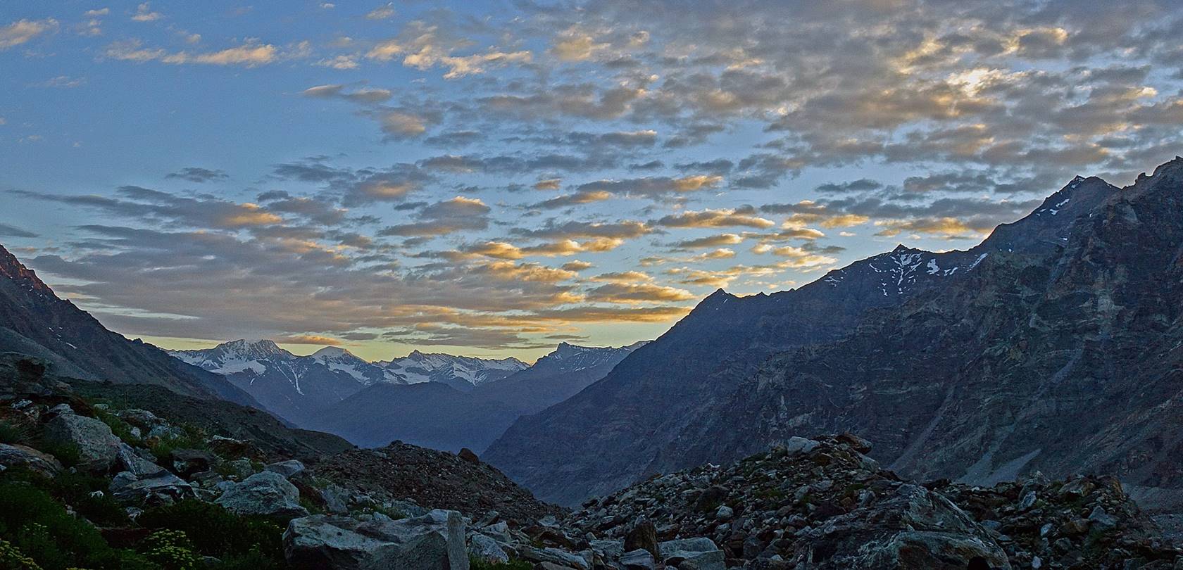
Sunrise over the Agsho
valley seen from our camp.
Rocky peak lit by the rising sun.
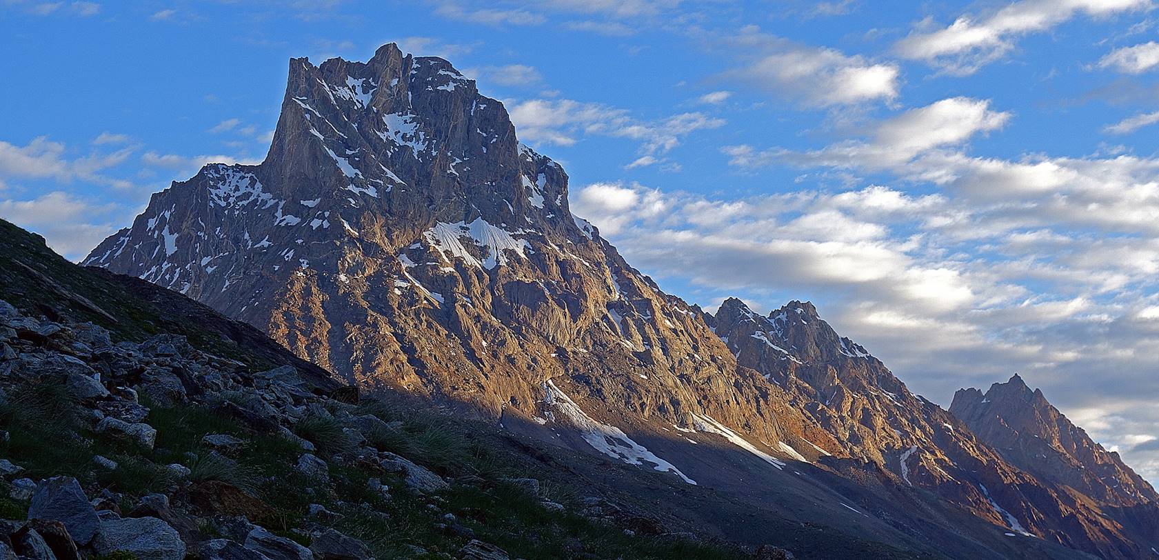
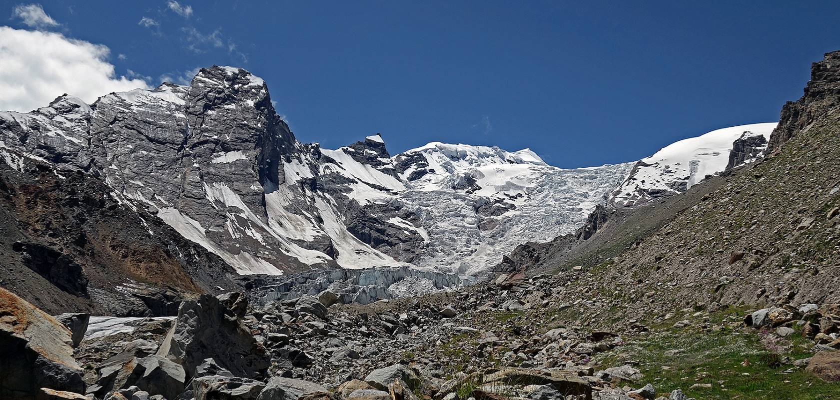
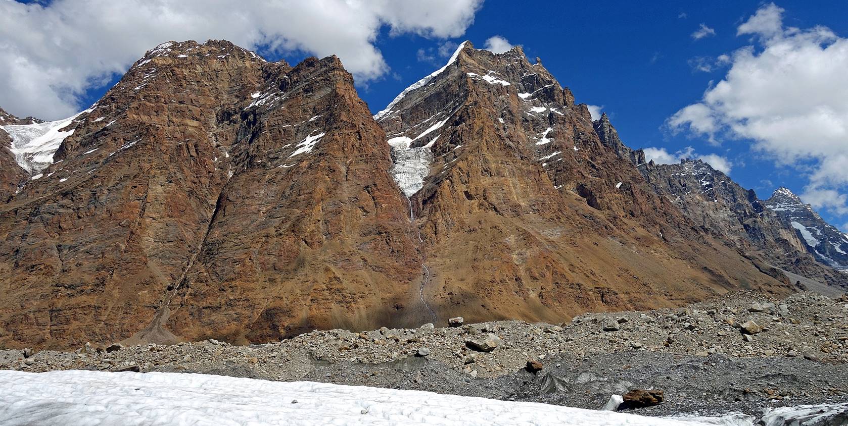
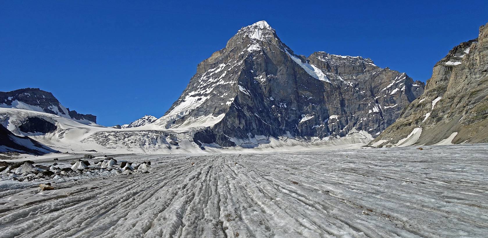
Three peaks on the right side (west) of Agsho La. From left to right: Chiring
(5450m), Barnaj III (6000m), and Barnaj
II (6300m).
Another view of Agsho
La.
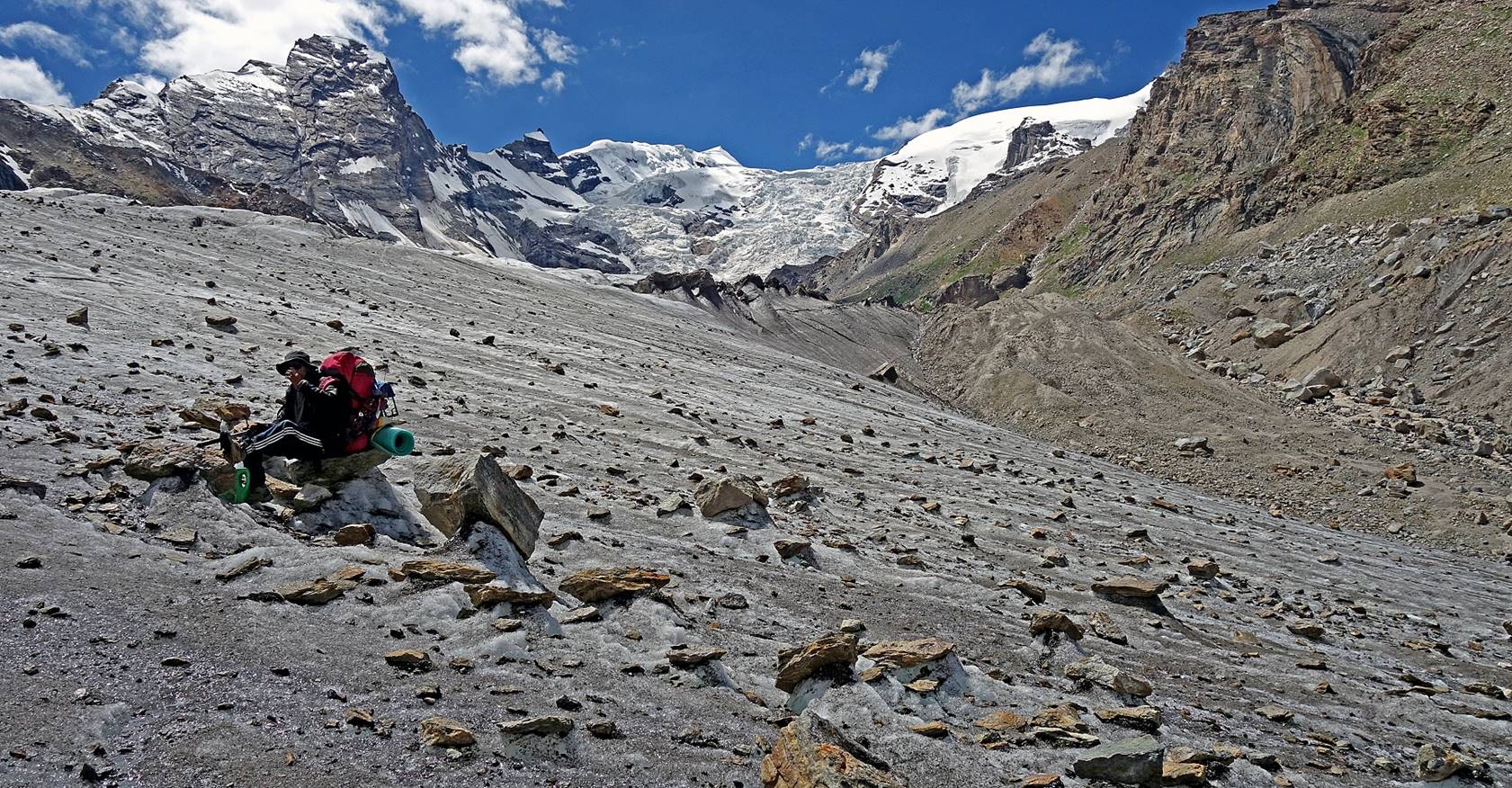
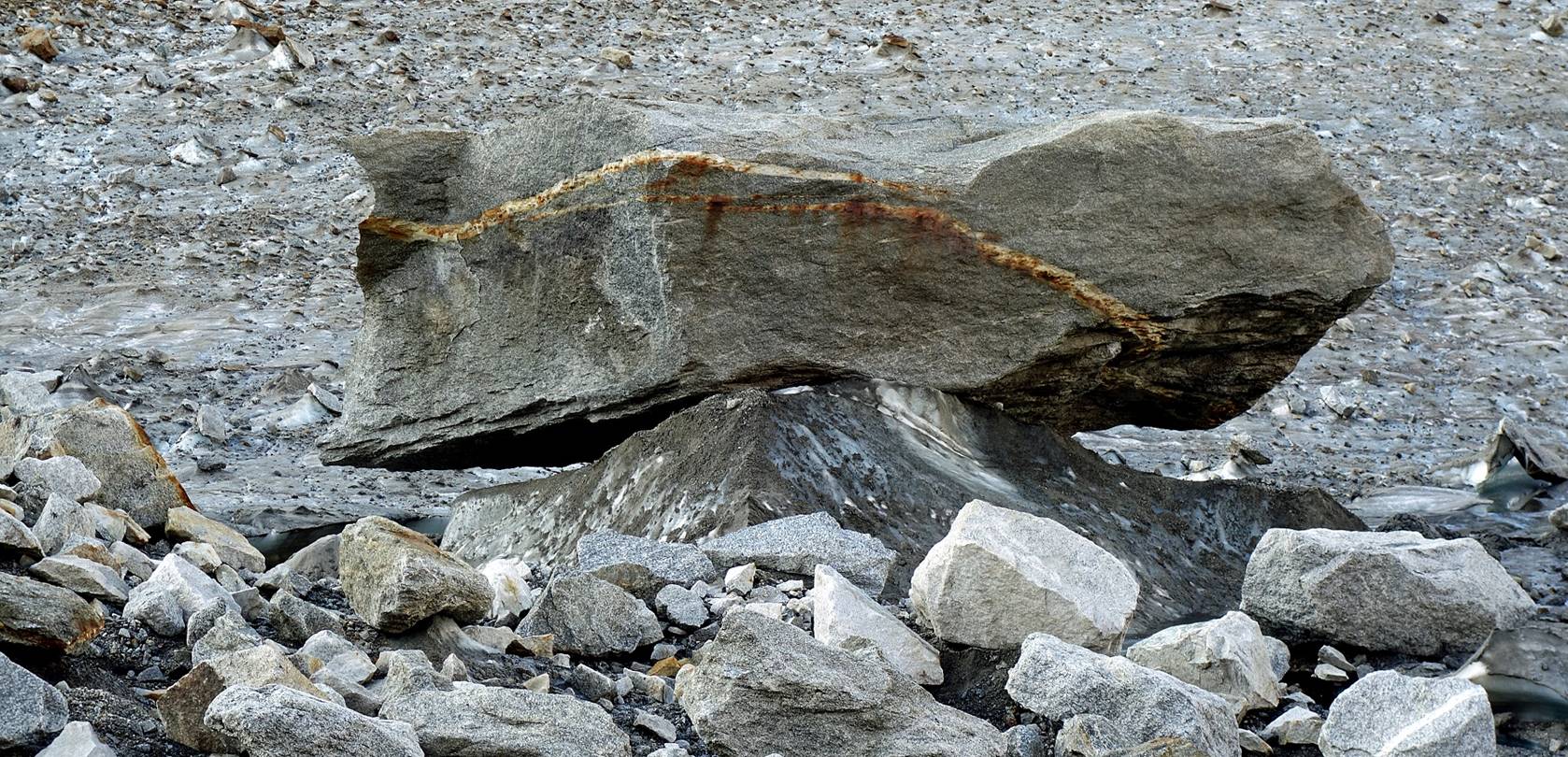
Big rock resting on an ice support on
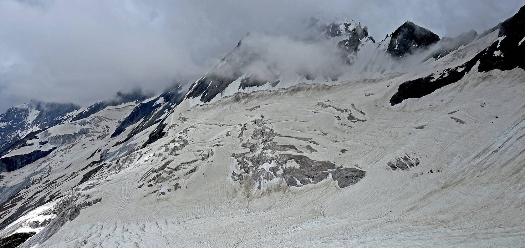
the glacier.
Another glacier flowing from the right,
below the Barnaj peaks
Hiking on very uncomfortable rocky
terrain.
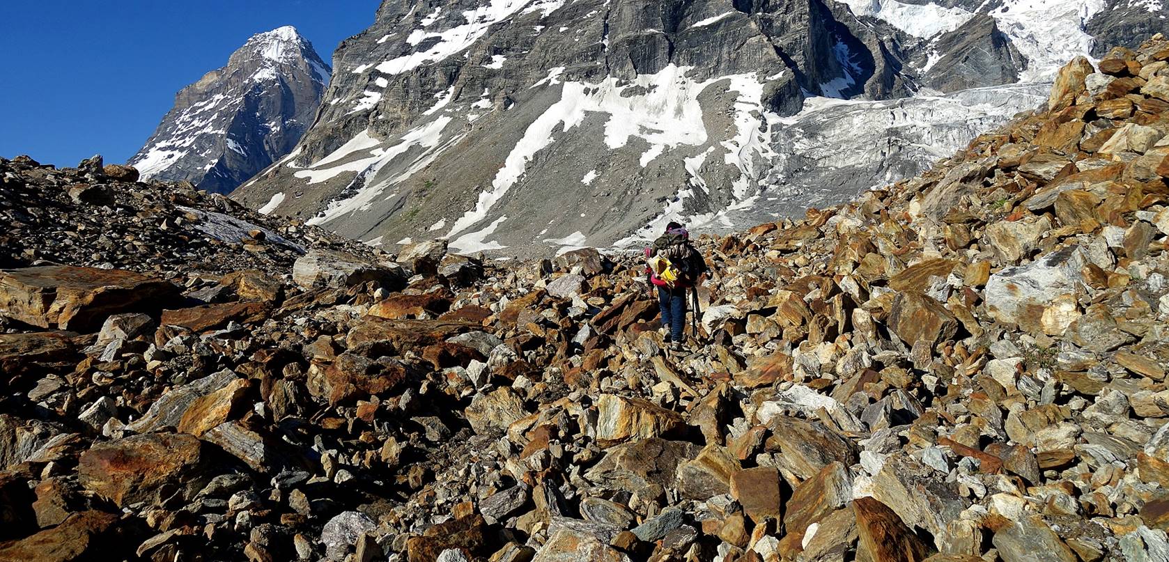
Slowly, we were getting closer to the
pass.
Looking back at the valley toward Agsho village.
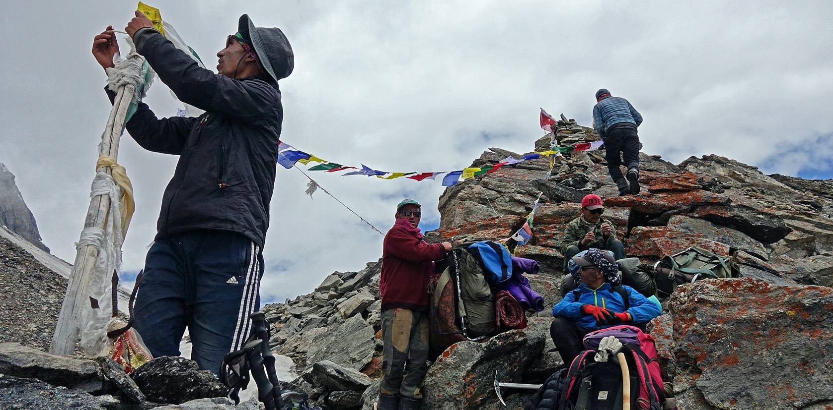
The 5 porters reaching the pass.
View of the base of Chiring
peak on the right side of the pass.
Rock
formations on the left side of Agsho La. The vertical
walls on the other side of the pass make me realize that the descent might be
very steep...
...a concern that was quickly confirmed.
|
|
[Later on that day we will establish our camp on
the shore of the lake visible in the above photo at the bottom in the
valley.] |
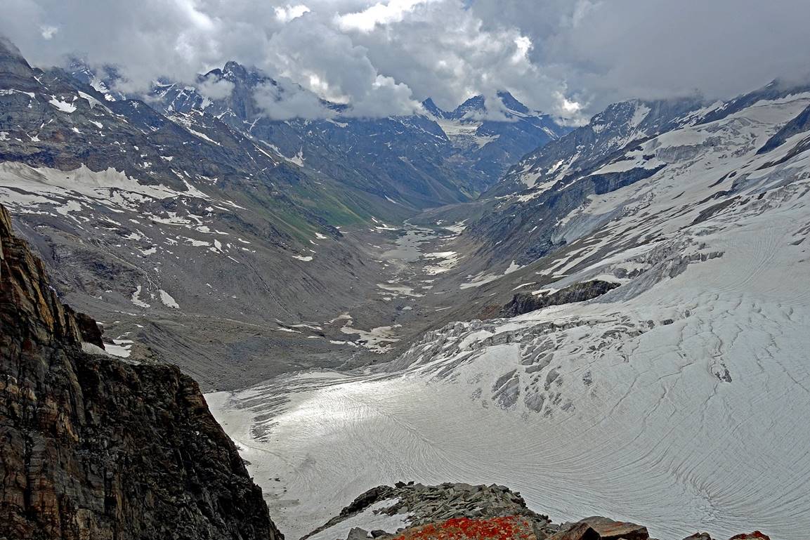
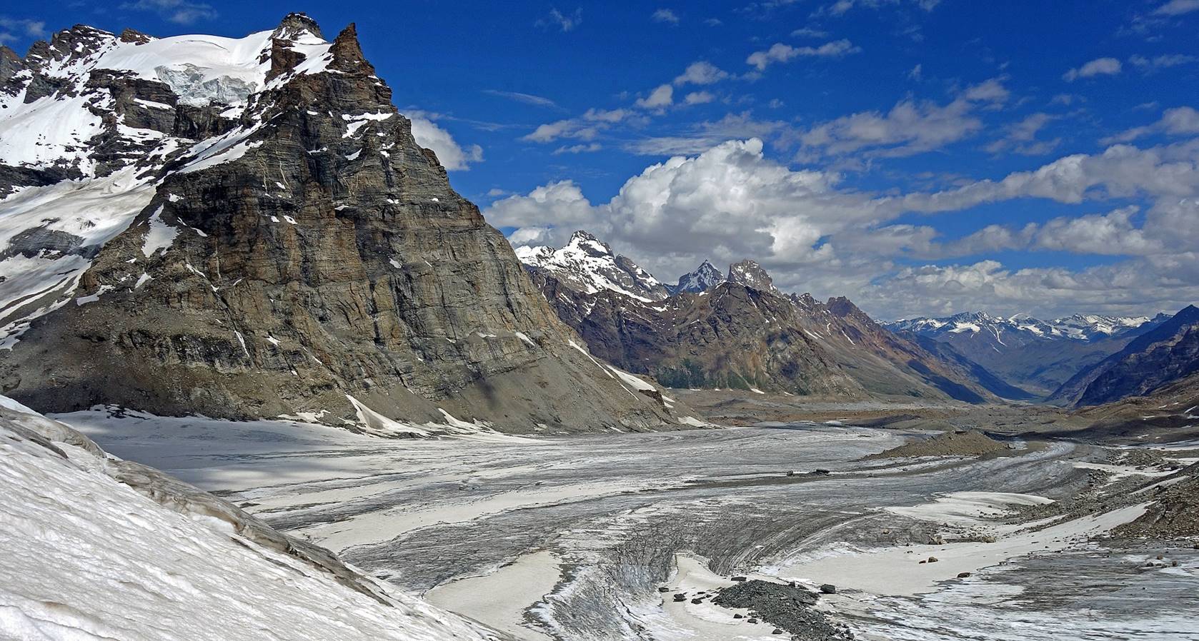
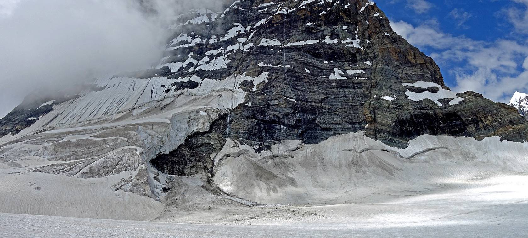
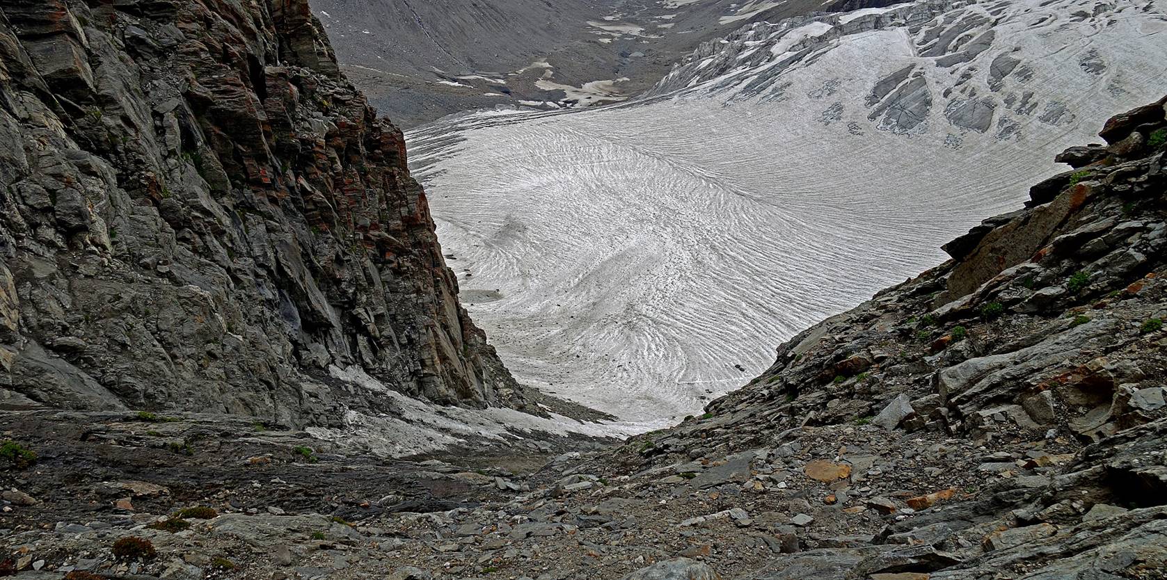
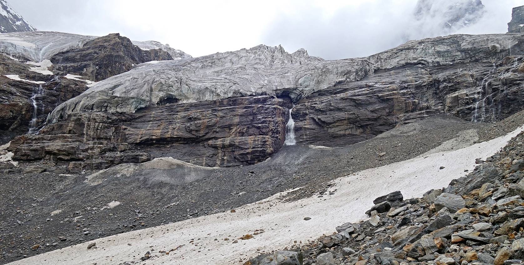
View from the pass of a glacier located
on the right side of our descent, on the southern shoulder of Chiring.
Tundup (left) and porters hanging fresh prayer
flags at the pass. The ceremony was short, as everyone was worried about the
descent.
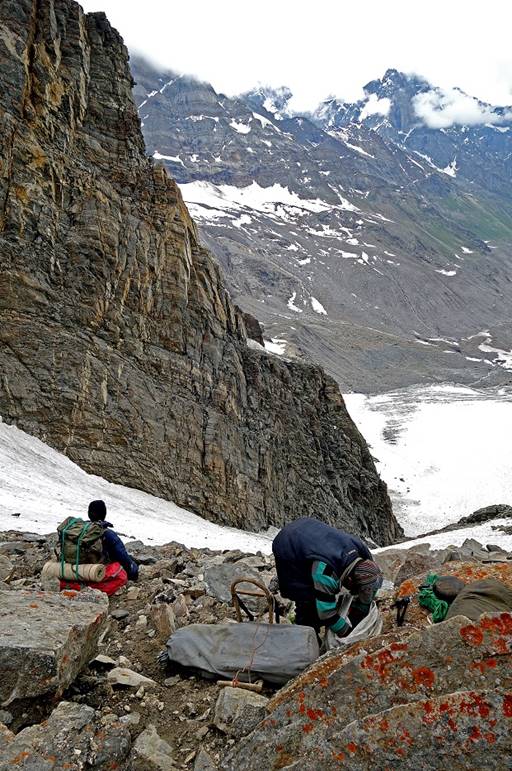
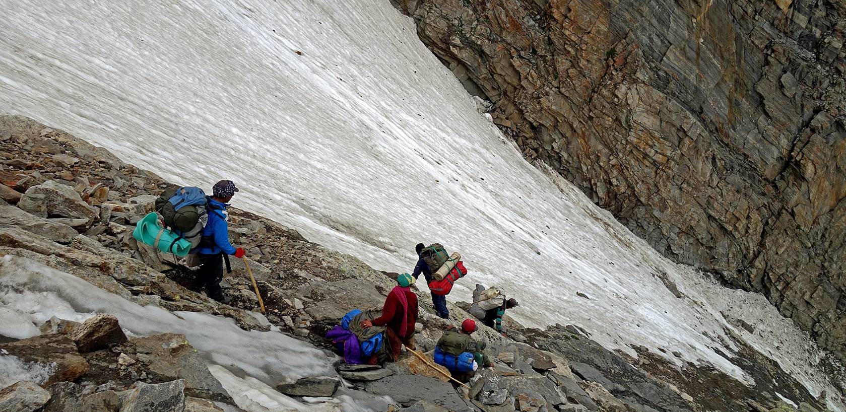
Not only was the descent steep, most of
it was also on unstable rock slabs and rotten snow.
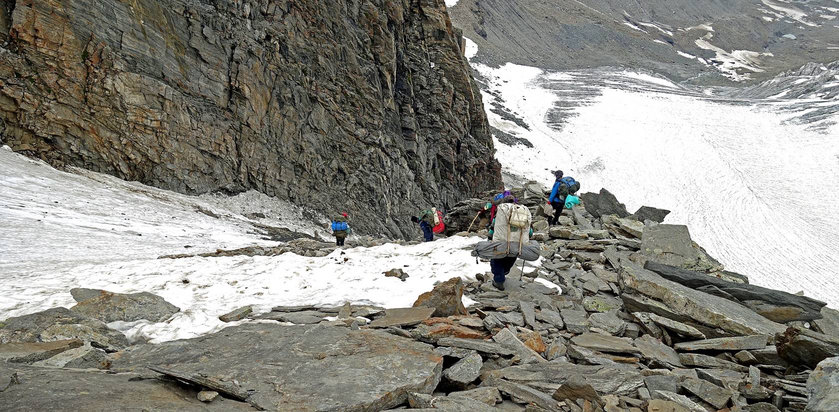
We stopped briefly beneath the hardest
section of the descent to drink hot tea, relax a bit...
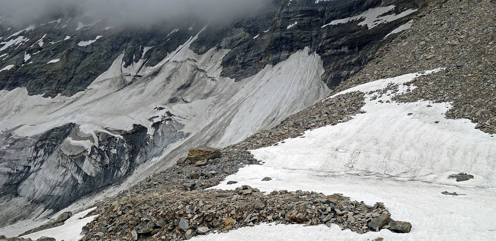
...and admire the amazing glacier on the
right side.
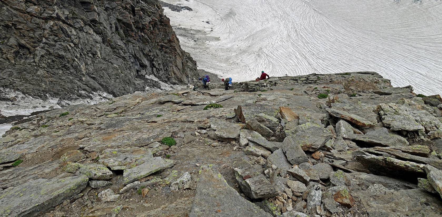
Reaching the bottom of the valley below
the glacier.
The view back toward the pass was truly
awesome.
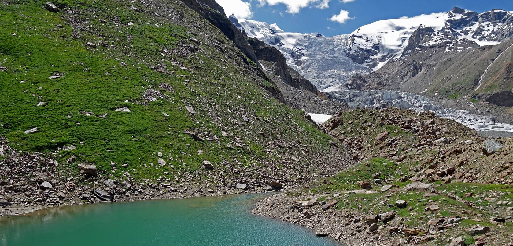
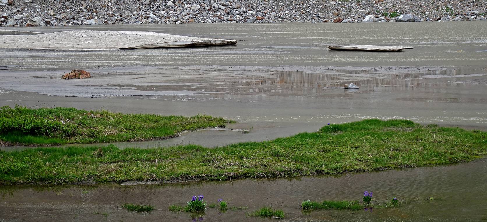
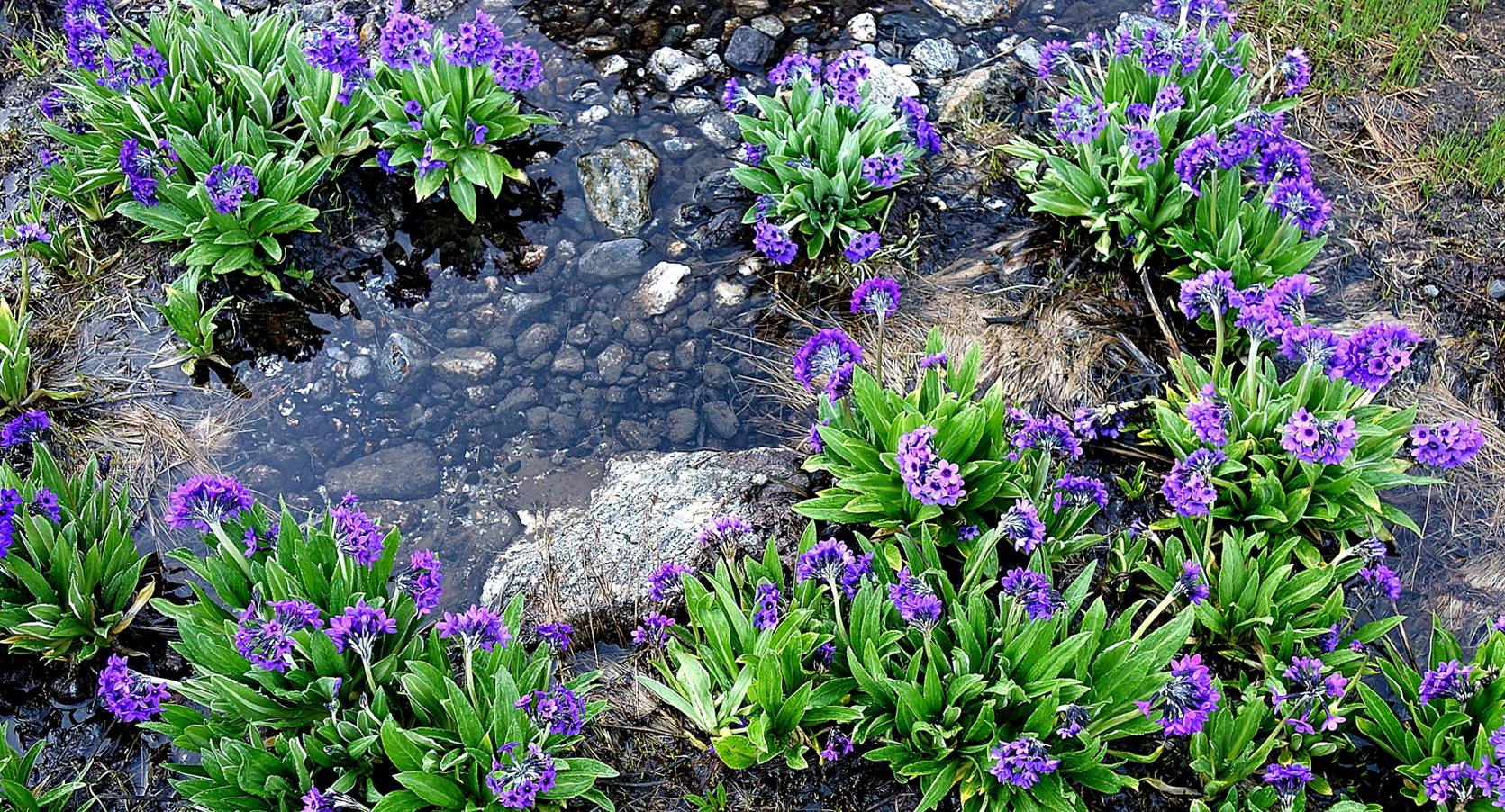
We set our camp (WP #086) at the lake
that we saw earlier from the pass. The lake was bordered with beautiful
flowers.
![]()