India
(July-August 2019): A meandrous 24-day trek in the Kargil
and Kishtwar districts of Ladakh
and Jammu & Kashmir
Leg
1: From Mulbekh to Rangdum
(Part 1/3)
|
|
Return
to main India 2019 webpage
Views of the itinerary in Google
Earth:
[Reminder: Click here (kmz file) and open the
downloaded file in Google Earth to access the GPS waypoints that I recorded
during the trek: red pins for starts and finishes, green for camps, brown for
passes, and yellow for other waypoints. Orange markers have been added by hand;
they are not GPS waypoints.]
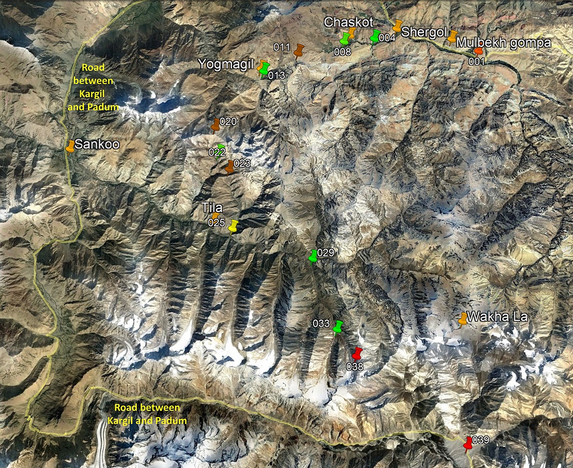
View of the entire first leg, with only
a subset of GPS waypoints.
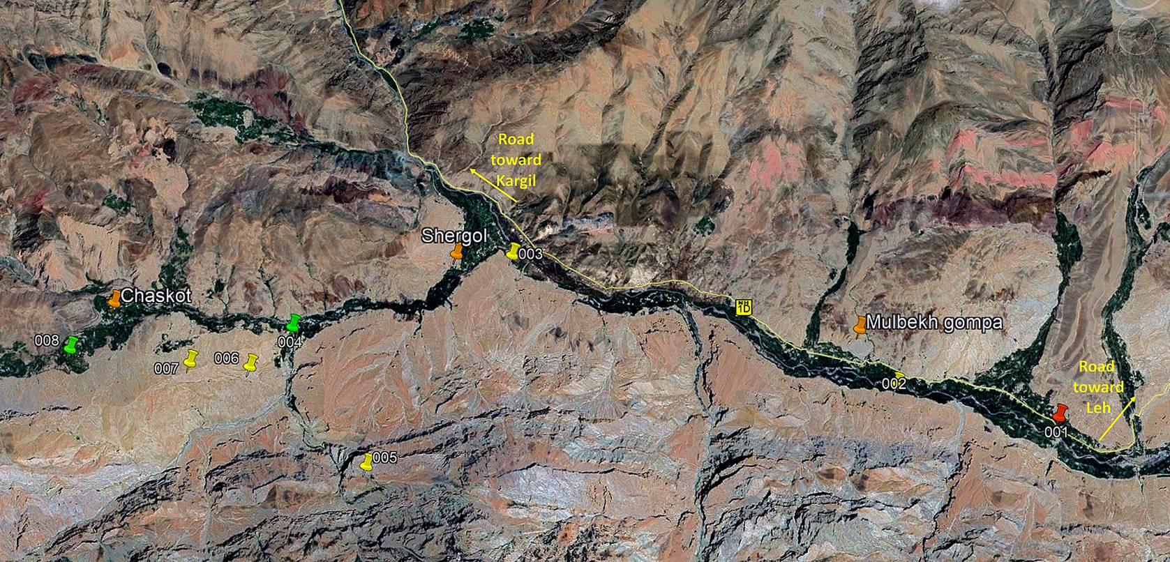
View of the first part of the first leg, with all waypoints.
Brief description:
This part of the trek begins at WP #001
on the eastern side of the town of Mulbekh, on the
right bank of the Wakha Chu (river). It immediately
crosses the Wakha Chu on one of the few bridges in
the area, then follows a crude trail toward the west along the left bank of the
Wakha Chu, at the limit between dry rocky terrain and
cultivated fields. Just after WP #003 it switches into a side-valley (Phokka river) to reach Shergol
and then Yoge (WP #004), where we spent the first
night. On the second day, Nima and I did a round-trip
to the old secluded Buddhist hermitage of Urgyen Dzong (WP #005) reached after ascending a very narrow
canyon south of Yoge. After returning to Yoge we hiked toward the west to our next camp (WP #008)
opposite to the village of Chaskot.
Mulbekh:
Sonam Dawa, Nima, Nurbo, and I drove from Leh to Mulbekh on the eve of the
trek. (Sonam Dawa came with
us just to visit Urgyen Dzong
that he had never visited before and returned to Leh
immediately after his visit.) Our horseman for the first two legs of the trek, Dorje Tundup, came to Mulbekh separately with his four horses.
View of the valley of the Wakha Chu at Mulbekh. On the next
day we will start trekking on the opposite side of the river.
Cliffs above the left bank of the Wakha Chu, seen from Mulbekh.
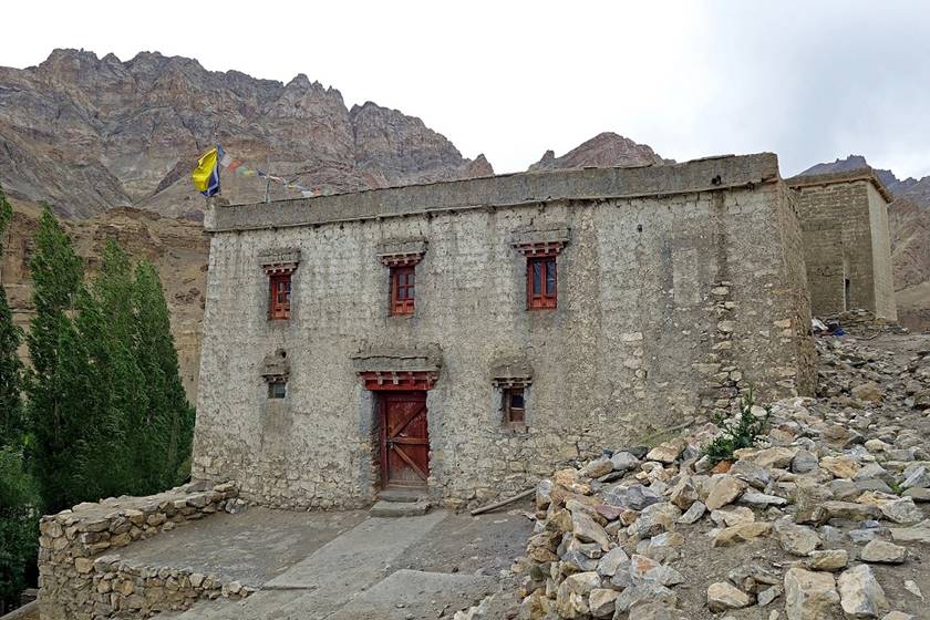
Large traditional houses in Mulbekh. (The Mulbekh gompa is visible in the photo on the right below, in its
upper left corner.)
|
|
|
Views of the Mulbekh
gompa, which stands on top of a huge rocky outcrop
some 200m above the valley floor. Parts of this gompa
are believed to have been built 800 years ago.
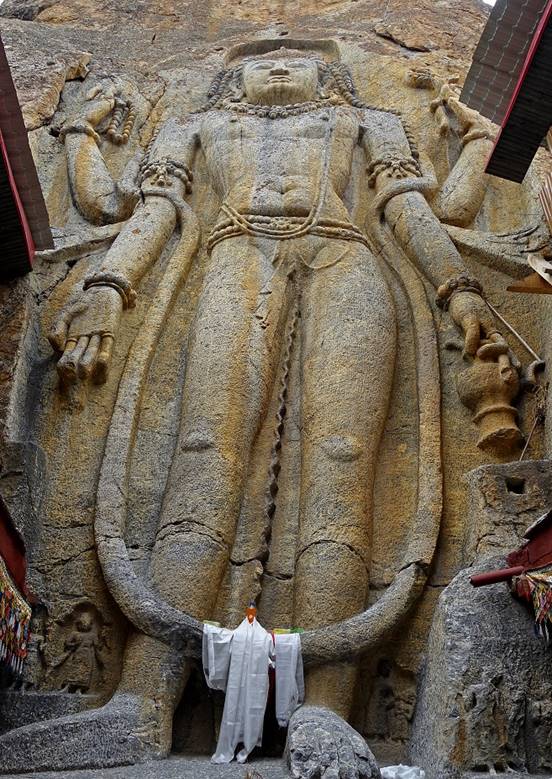
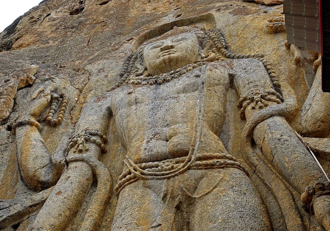
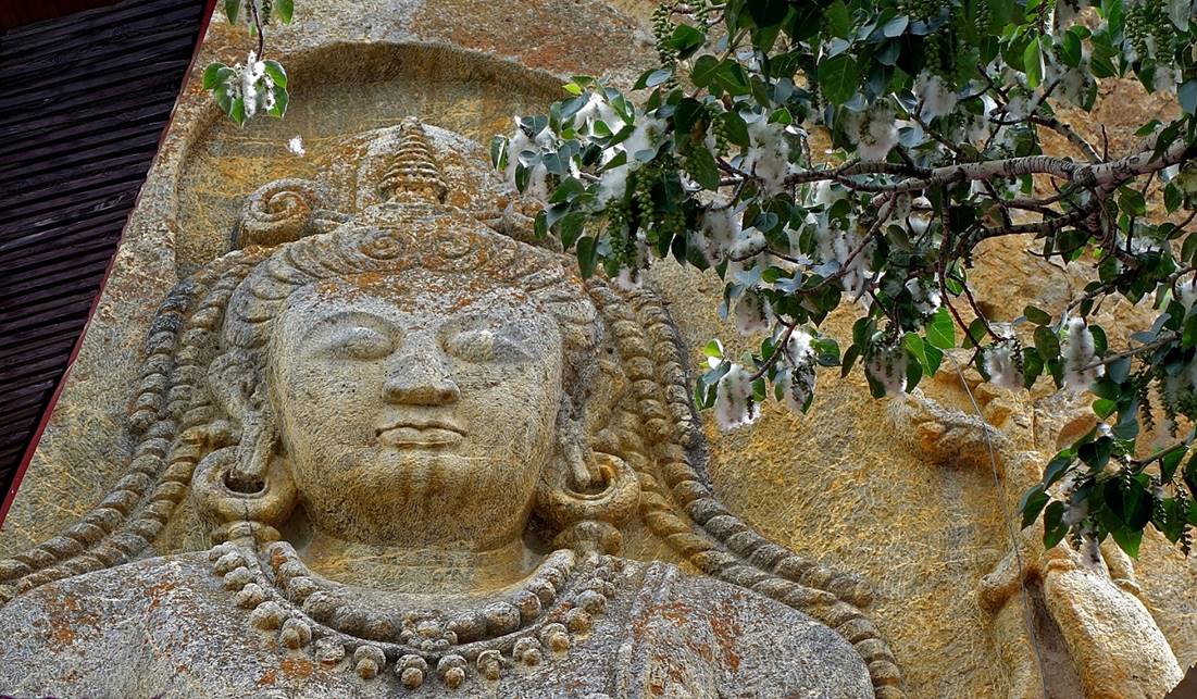
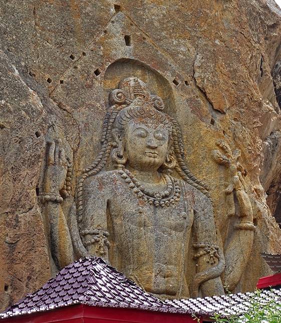
Beautiful sculpture (9m high) of a
standing Maitreya Buddha, a future Buddha. It is
believed to have been carved around the 8th century CE. It is amazingly well
preserved.
|
|
|
|
|
|
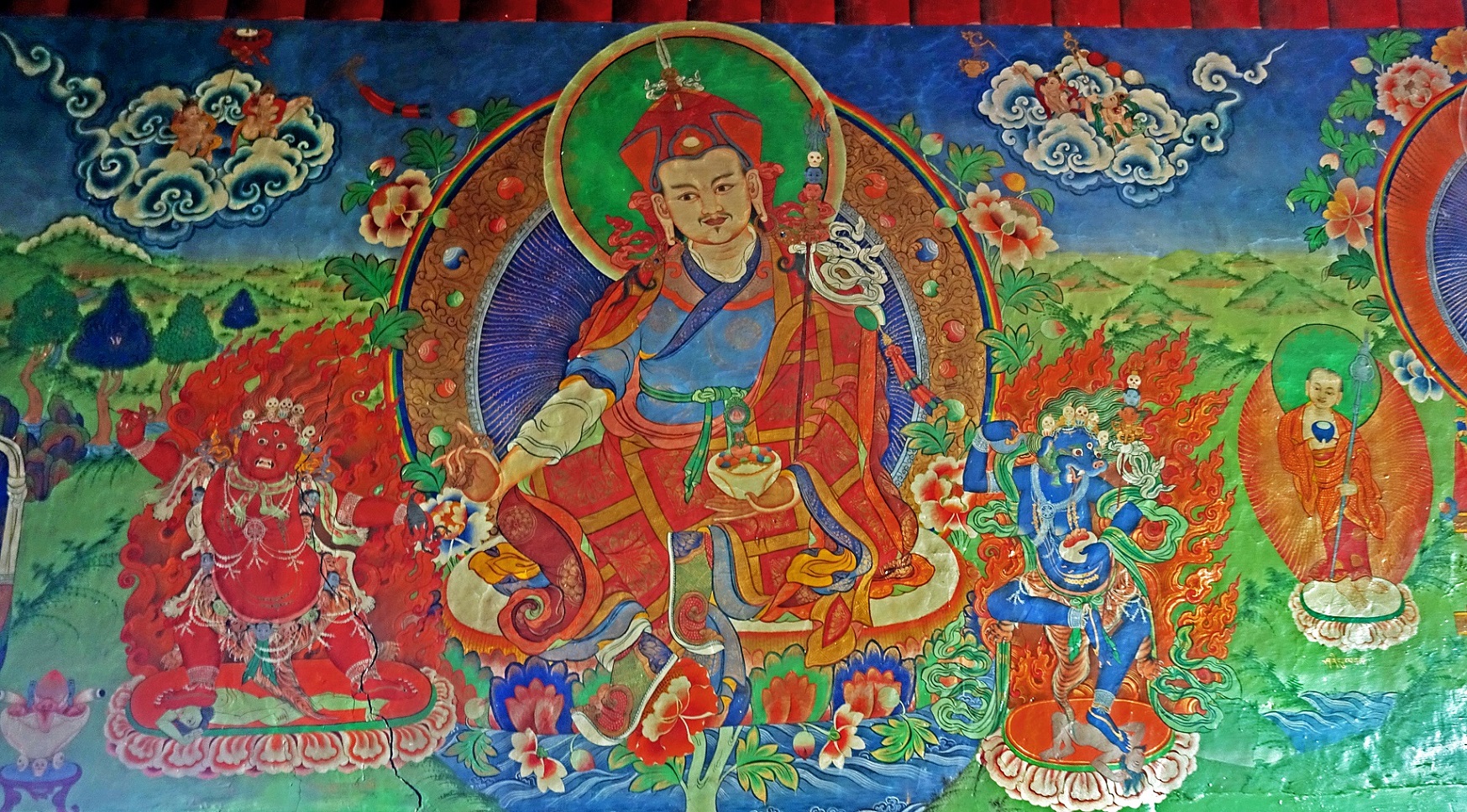
Wall painting in the small temple at the base of the
sculpture.
Day 1 (of
trek): Mulbekh to Yoge (WP
#004)
Although Yoge can be reached by car, Nima and I hiked from Mulbekh to Yoge along small trails. This mild hike was a good way to
appreciate the impressive cliffs above the Wakha Chu
and exert our legs after the long road trip of the previous day.
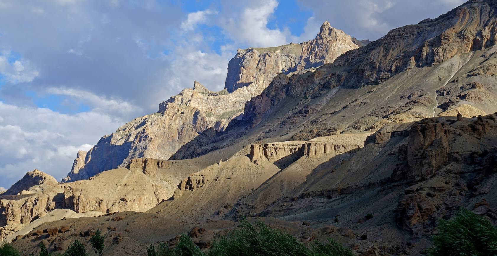
Cliffs looking like huge mud cakes above the left bank of the Wakha Chu.
Traditional houses of Mulbekh seen from the
left bank of the Wakha Chu.
The outcrop on top of which the Mulbekh gompa was built looks much more impressive from the left
bank of the river than from Mulbekh itself.
Another ″mud pie″ cliff on the left bank. This one seems to
be melting.
Bridge over the Wakha Chu west of Mulbekh.
Side-valley before WP #003.
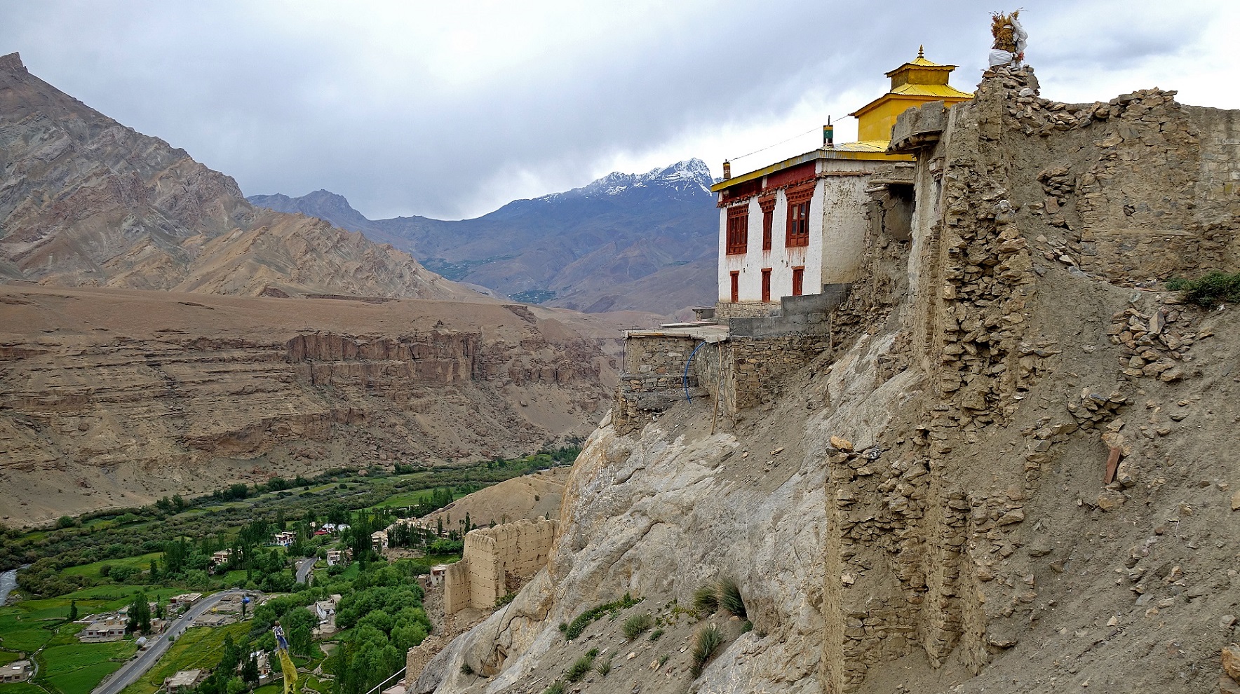
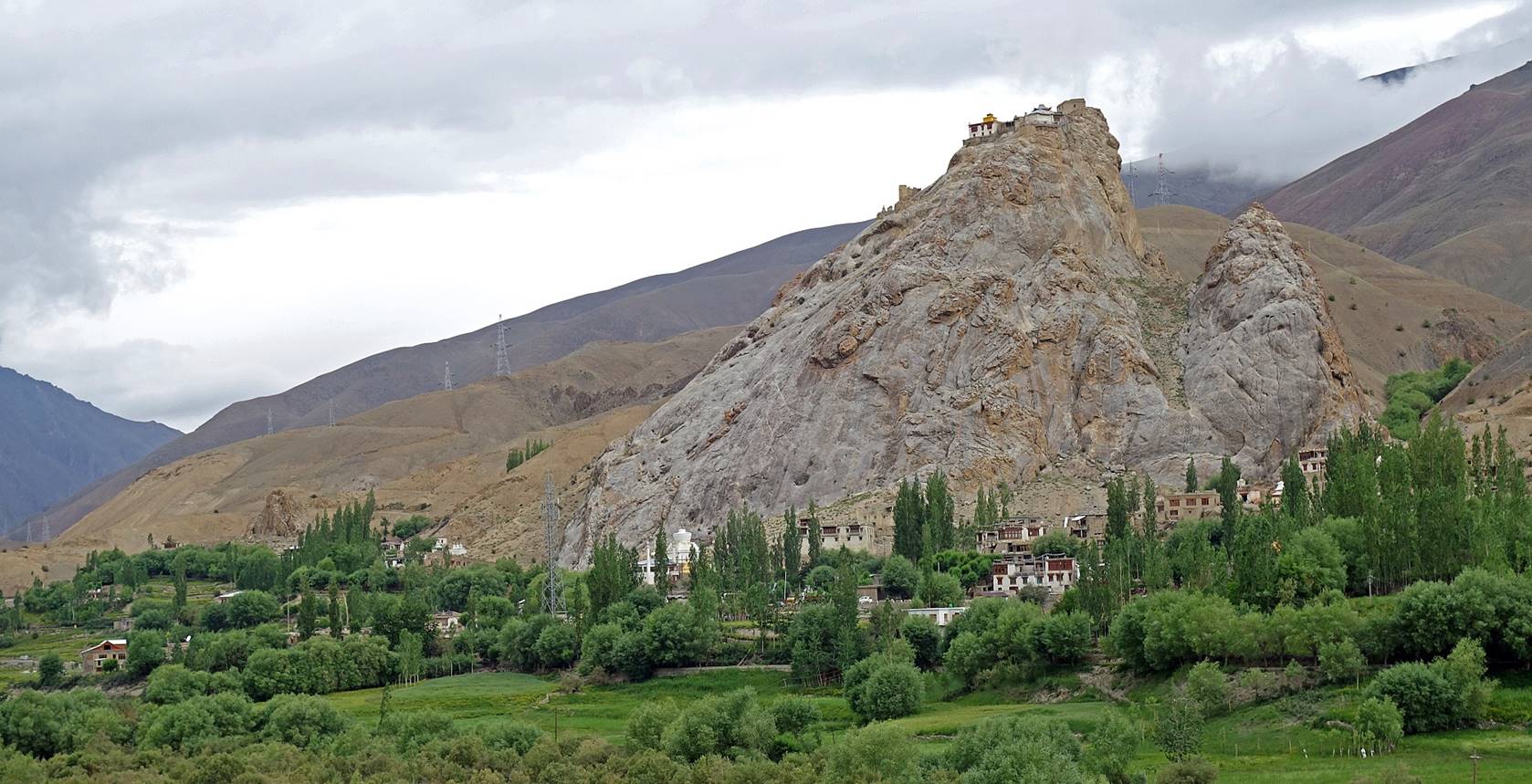
The gompa of Shergol
built in a vertical cliff. I regret that we did not stop to visit the gompa, as we had time to do it.
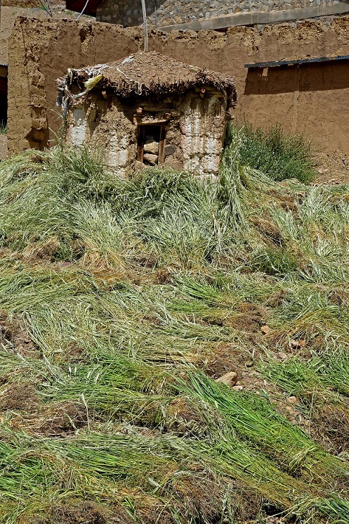
Drying buckwheat stems in Shergol. Buckwheat is one of the staple foods of Ladakhis. It is a fast-growing crop adapted to the short
warm seasons of Ladakh and it tolerates poor soils.
Its grain has excellent nutritional quality for people and its hay provides
good forage for animals during the cold months.
|
|
|
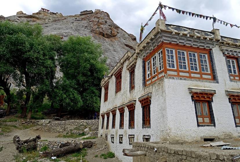
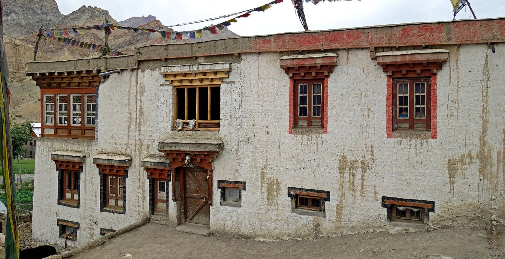
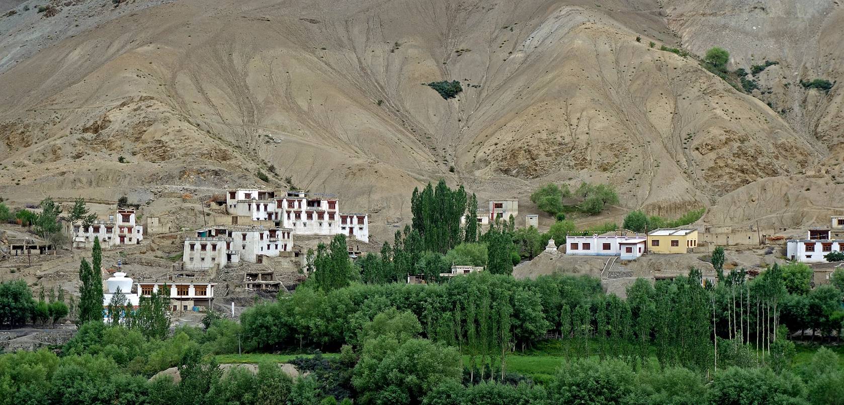
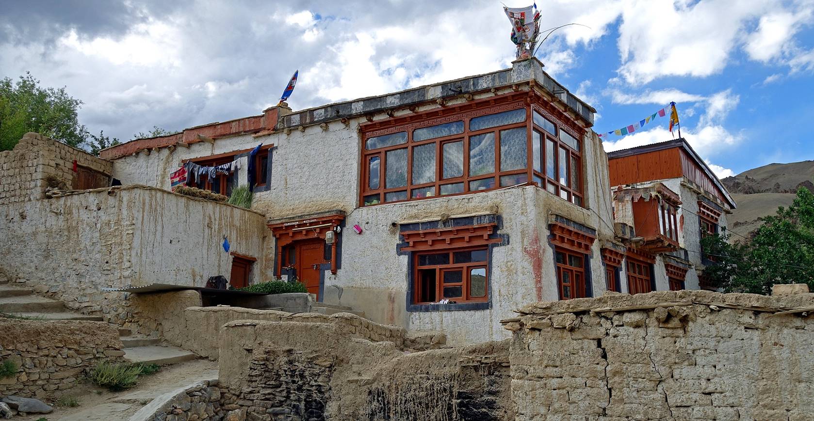
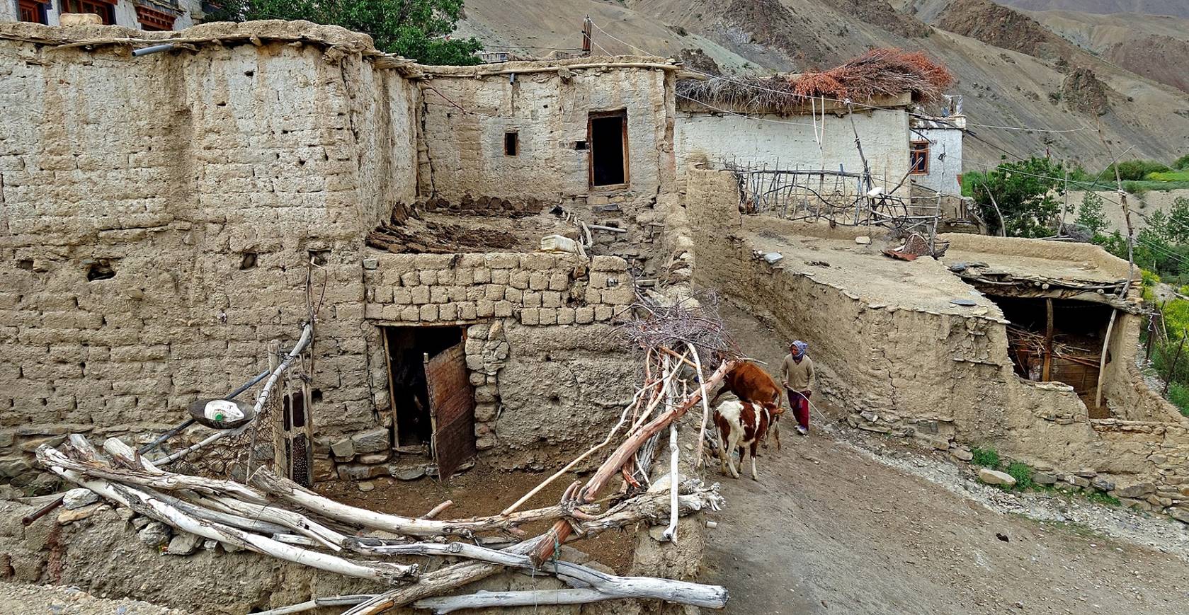
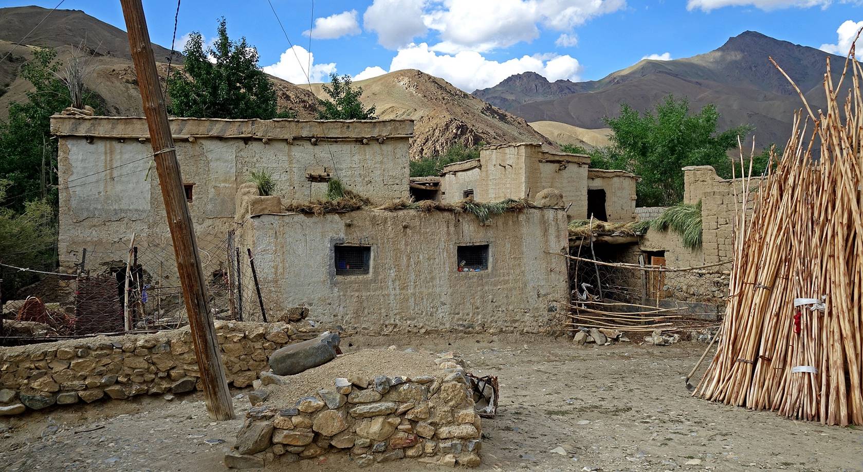
Houses in the village of Yoge.
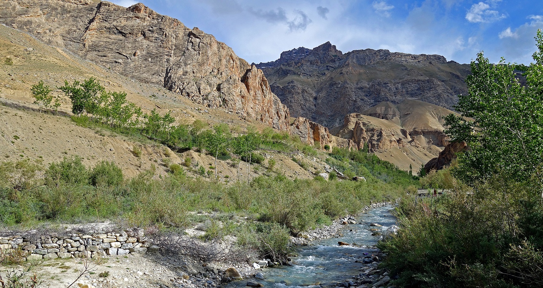
River flowing across Yoge.
Day 2: Yoge to Urgyen
Dzong (WP #005) and to the camp (WP #008) near Chaskot below Sapi La (WP #011)
We did the roundtrip to Urgyen Dzong in the morning and
the move to the camp at WP #008 in the afternoon.
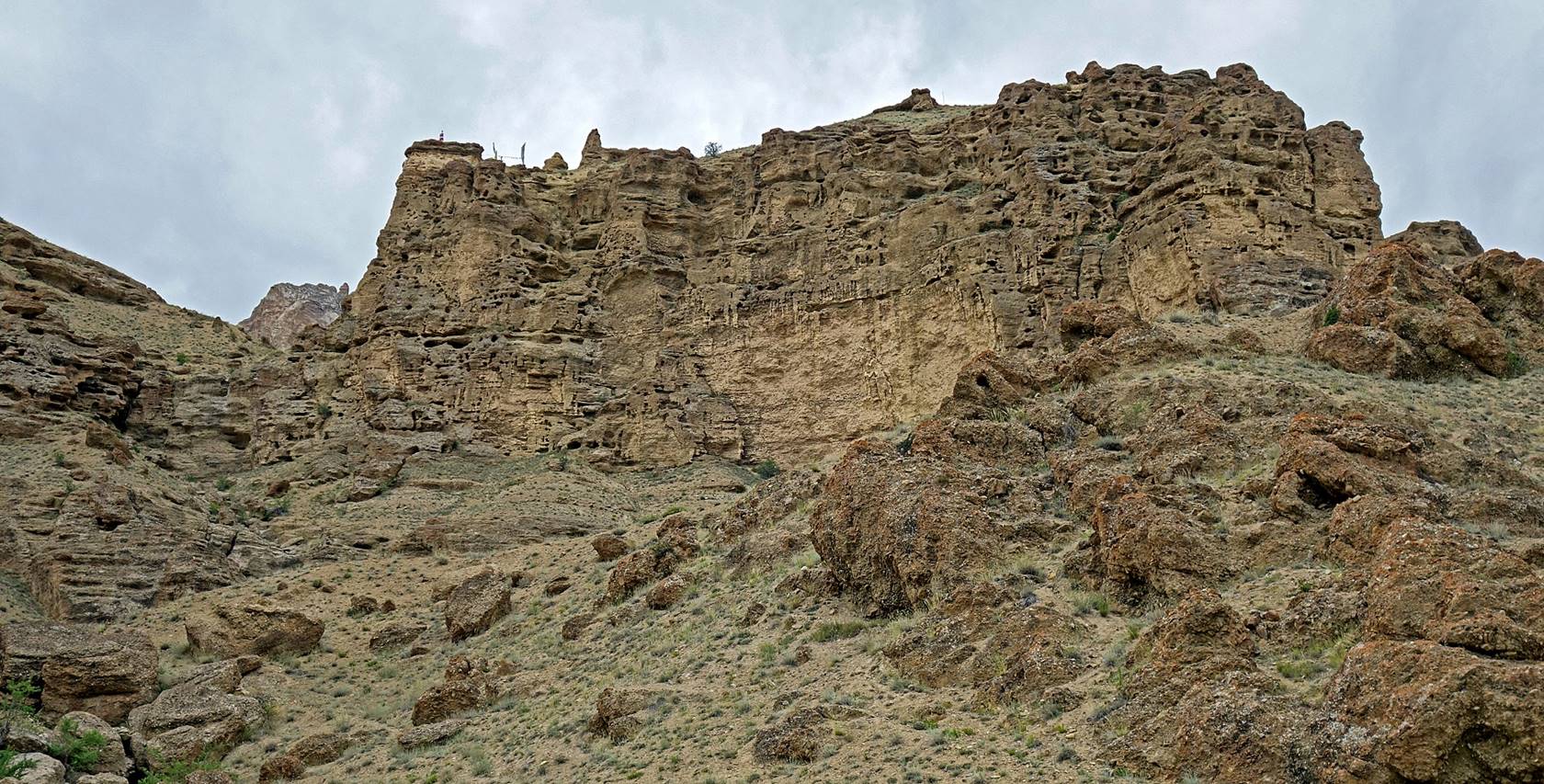
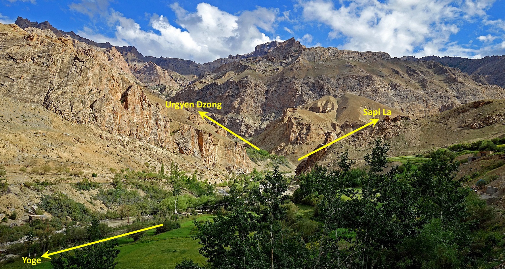
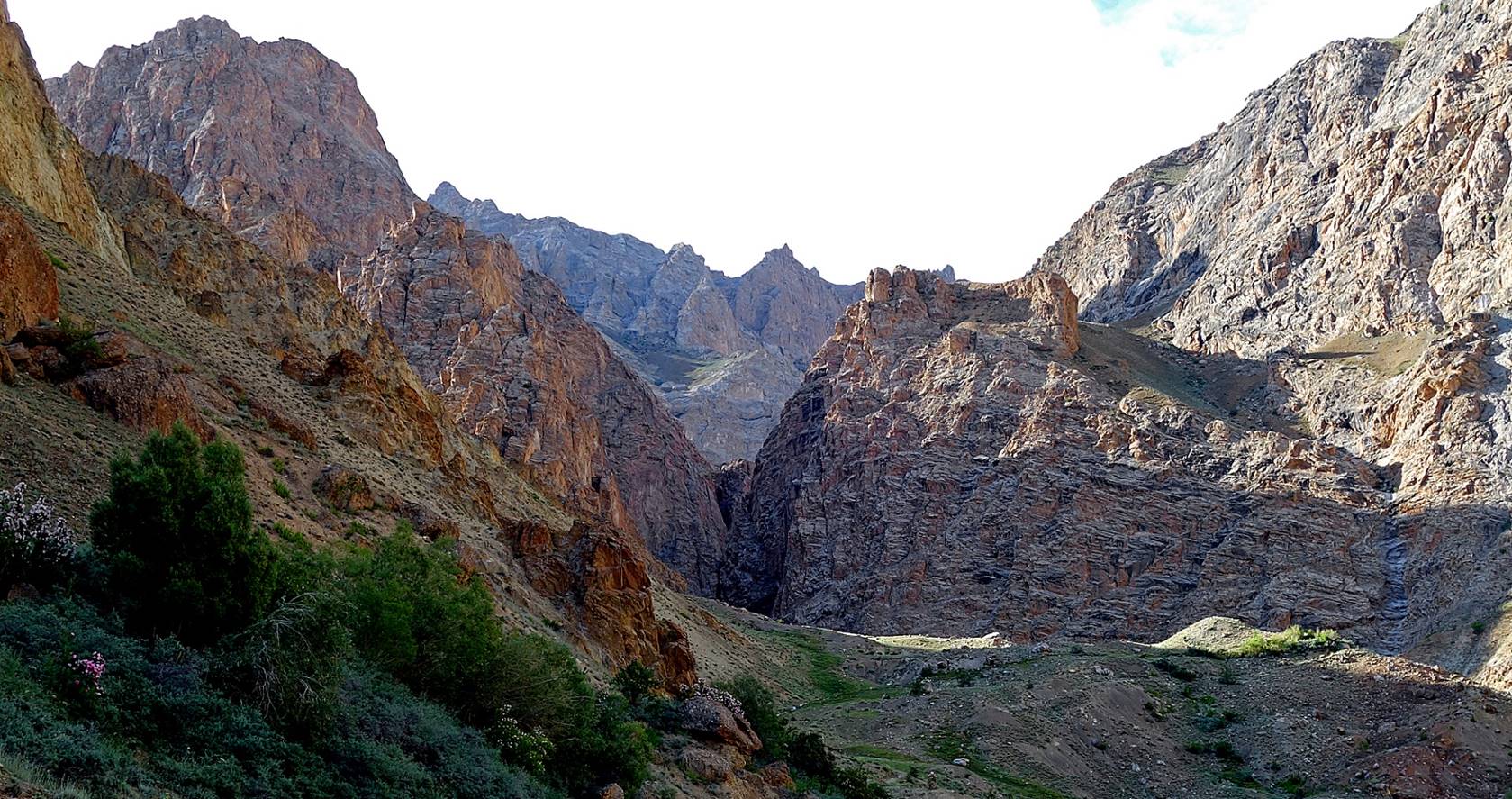
Bifurcation of the paths to Urgyen Dzong and toward Sapi La, after leaving Yoge.
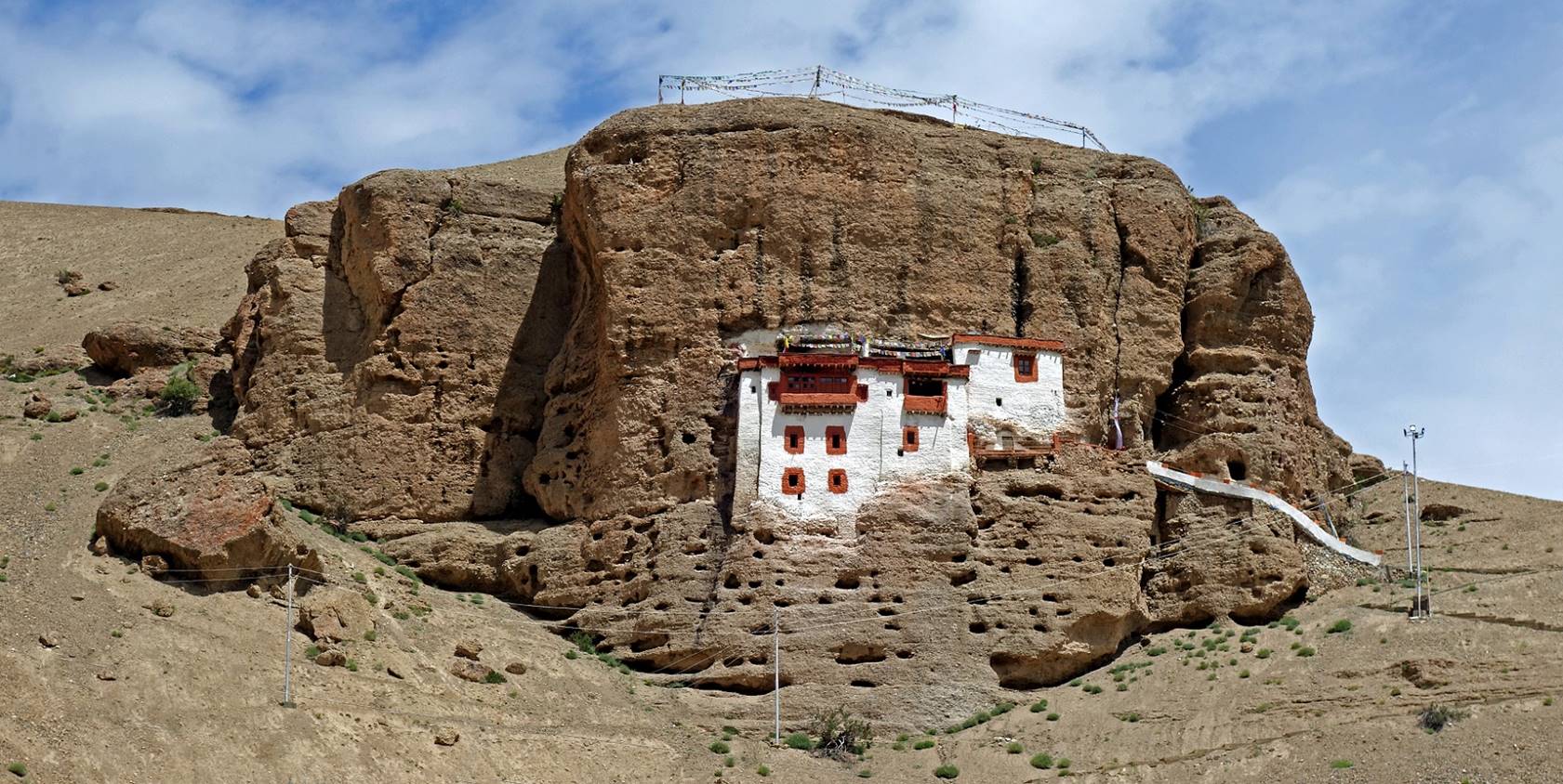
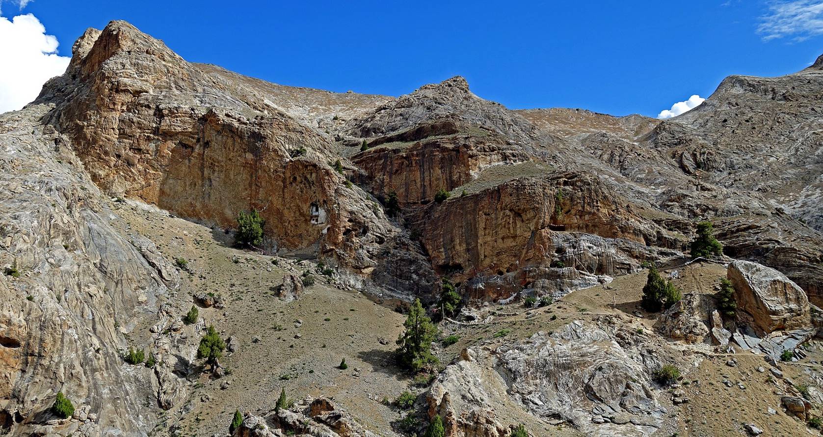
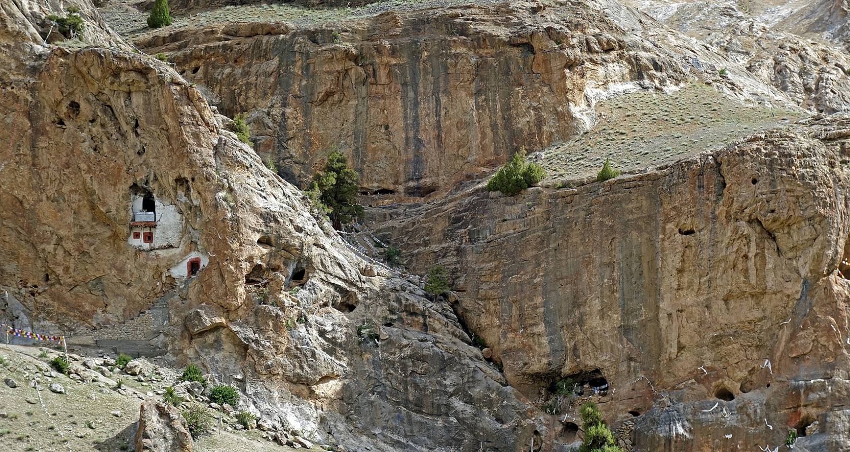
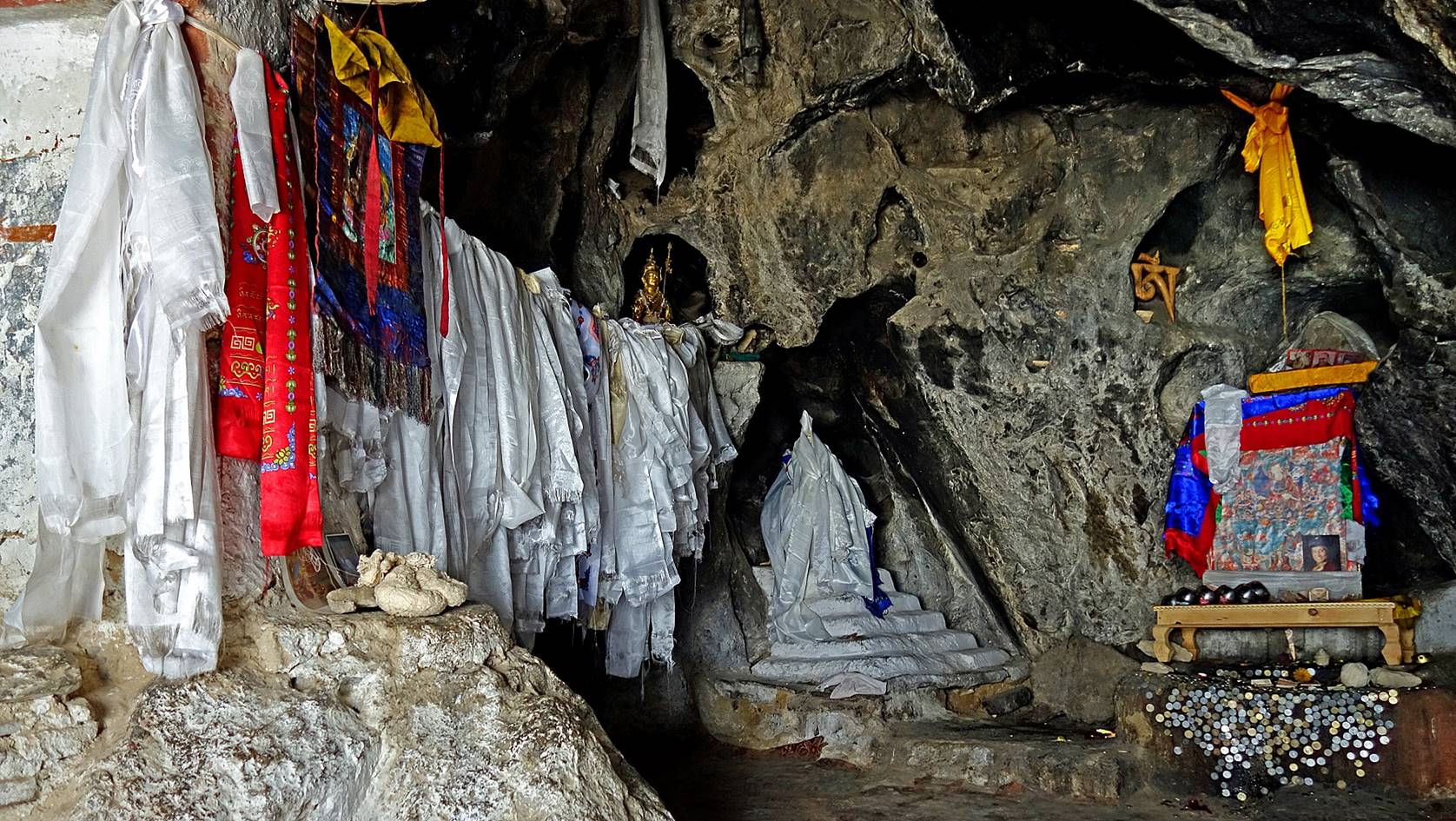
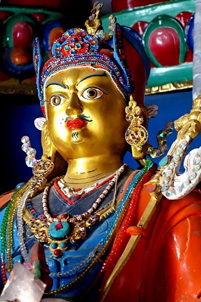
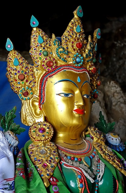
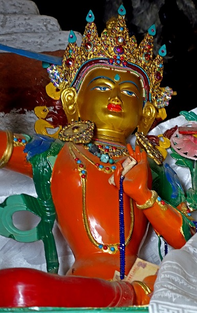
Urgyen Dzong is a
Buddhist hermitage with multiple caves where important monks have meditated.
The most famous of them is Guru Rinpoche, also known as Padmasambhava,
an 8th-century master considered to be the founder of Tibetan Buddhism. Though
being only two kilometers south of Yoge, the
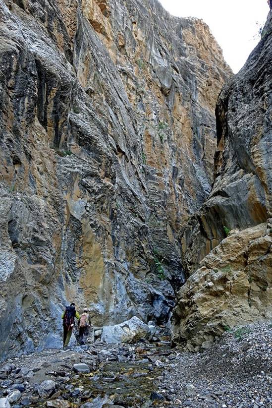
hermitage is surrounded by higher mountains in almost all directions. It can
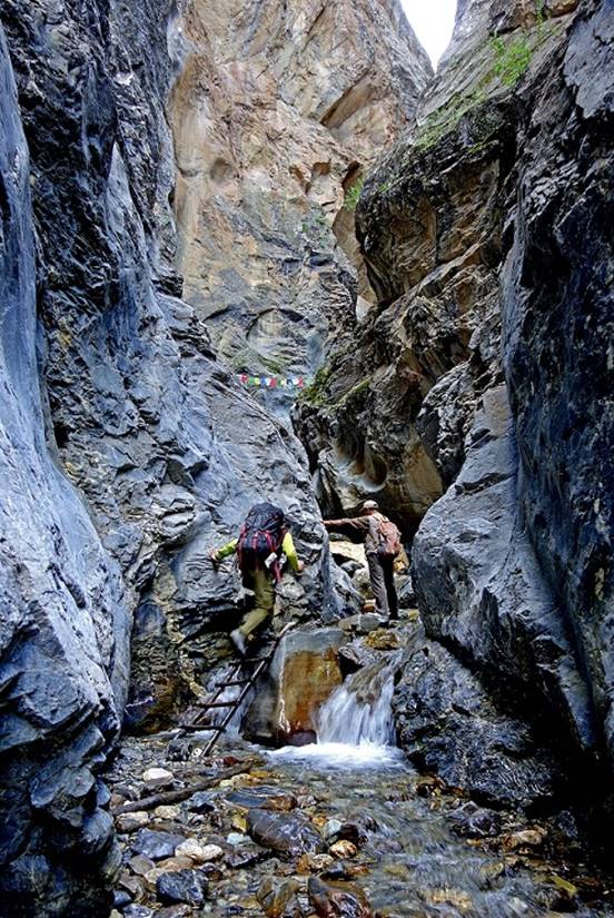
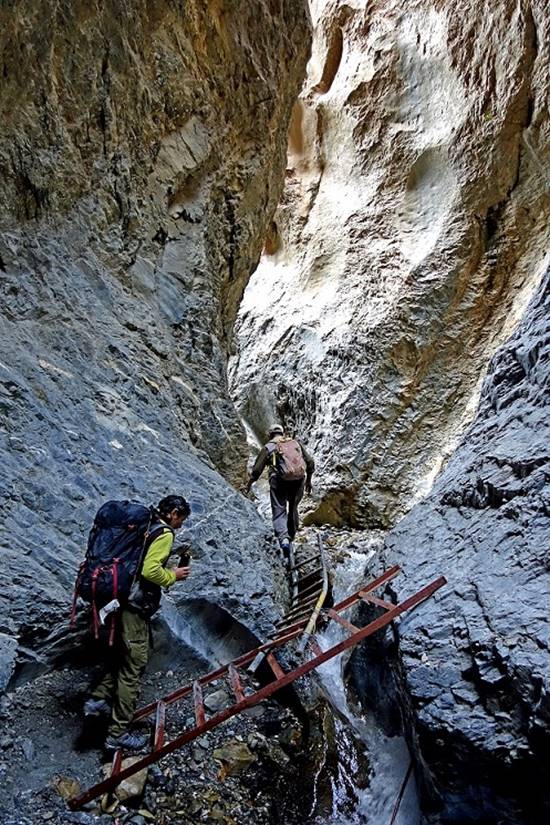
only be reached via a deep narrow canyon equipped with wooden and metallic
ladders. An inhabitant of Yoge came with us to open
the doors of the main caves and the gompa.
Looking back toward the north before
entering the gorge. (Yoge is hidden on the right side
of the picture.)
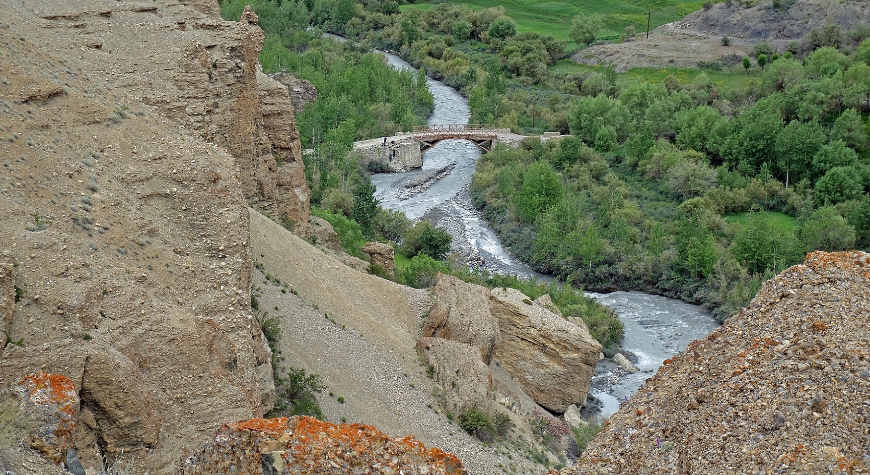
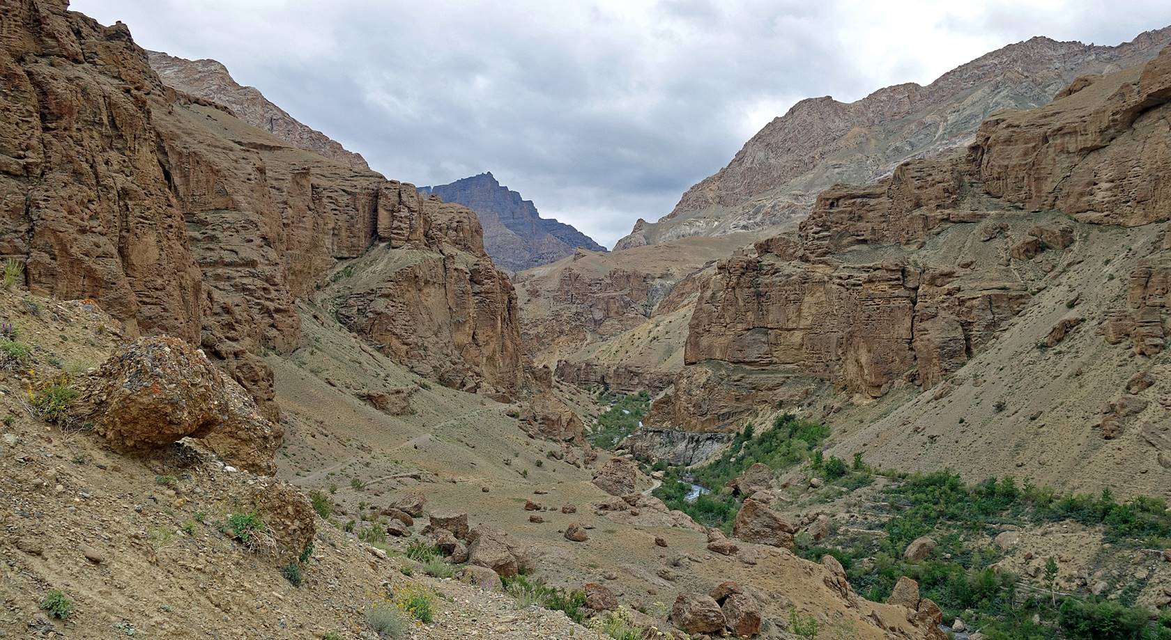
Reaching the entrance of the canyon.
|
|
|
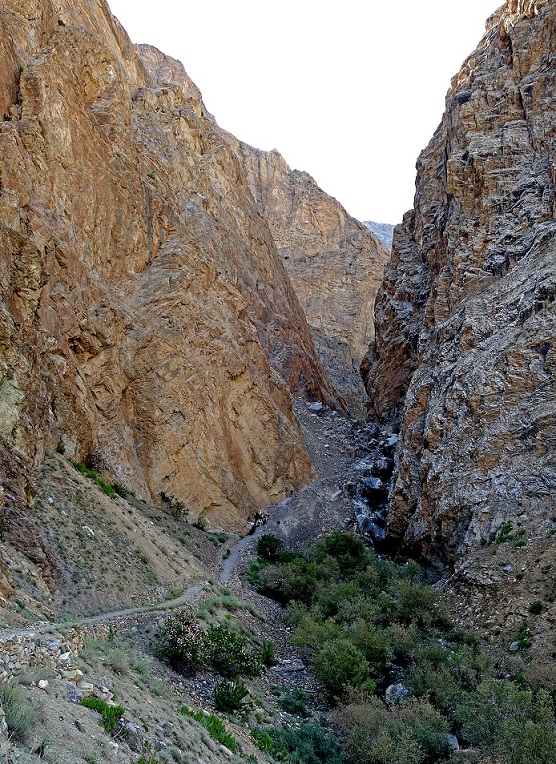
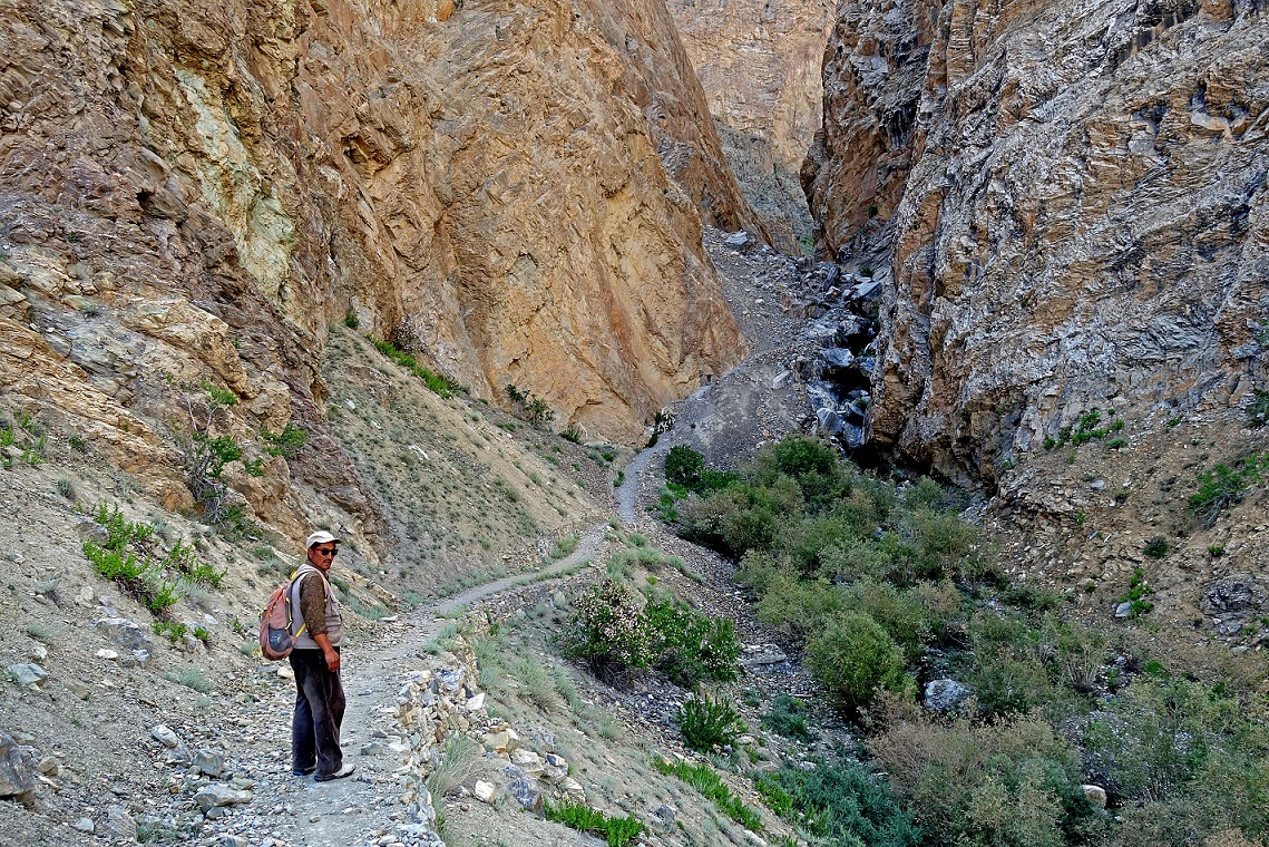
In the canyon.
|
|
|
|
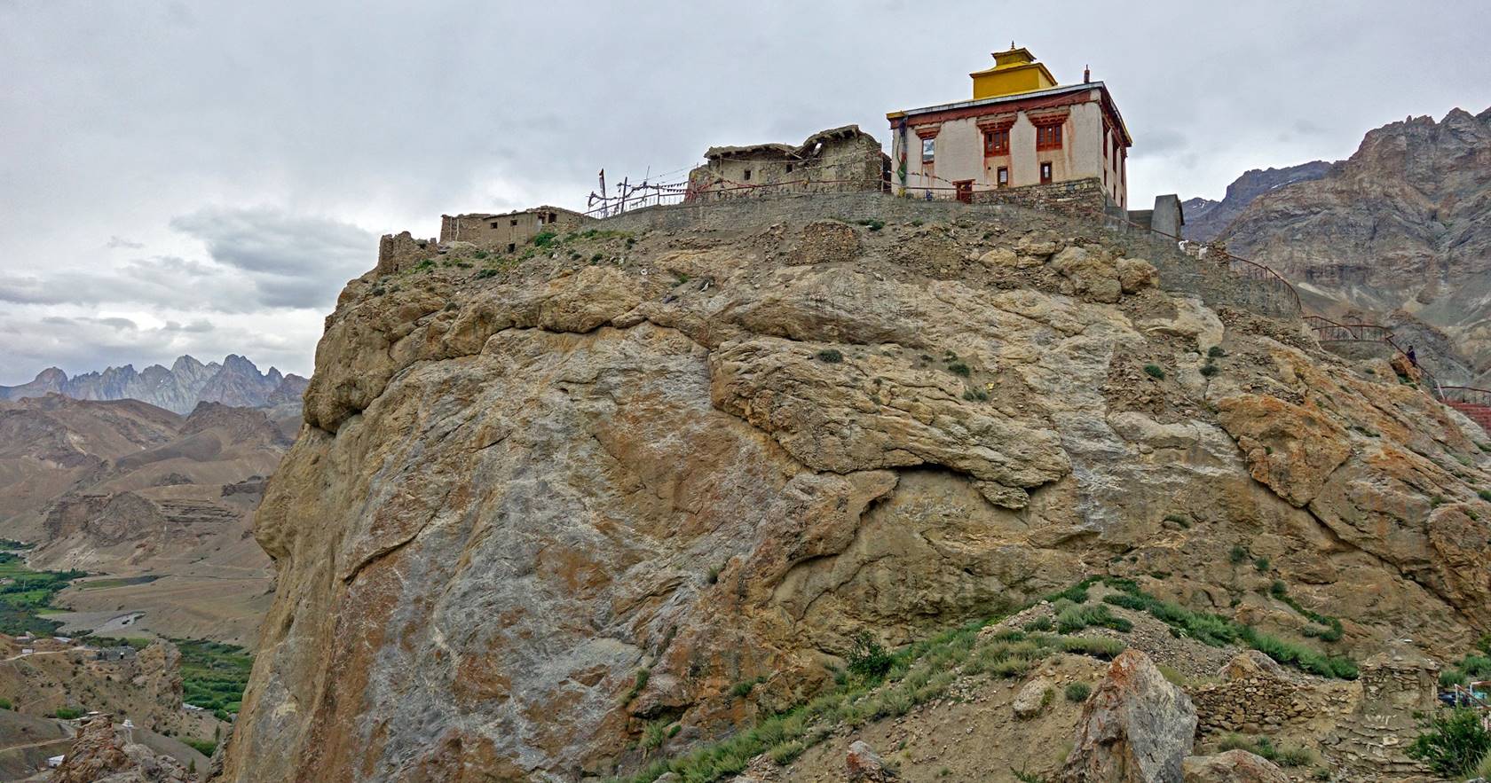
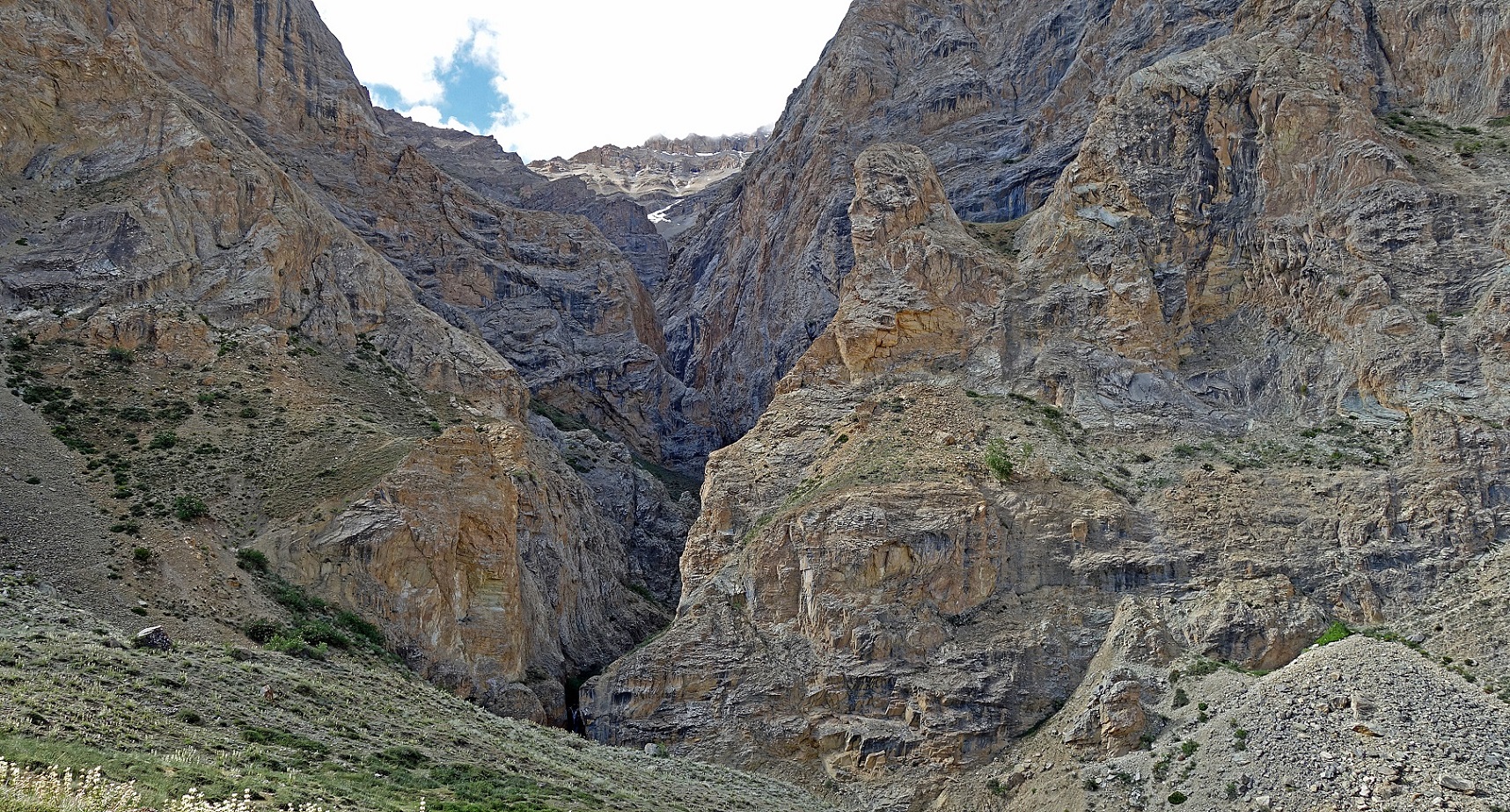
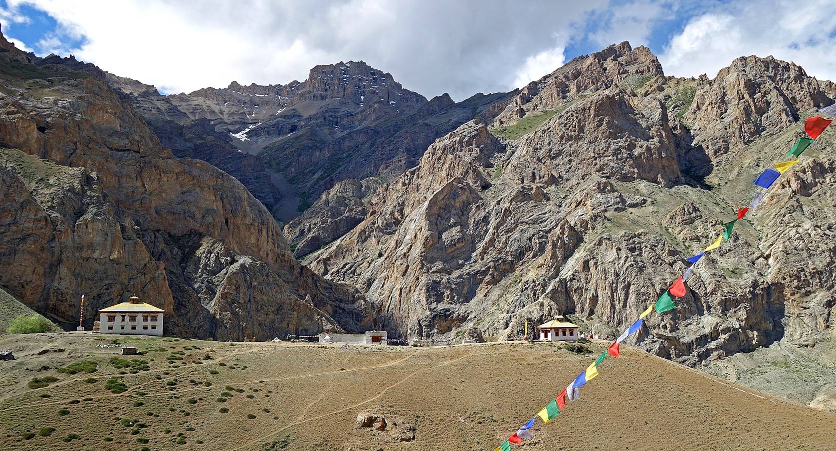
At one point the canyon widens slightly
and a trail climbs up its left slope to reach a small plateau where the Urgyen Dzong gompa
(a relatively recent structure) has been built. The photo below shows the
continuation of the canyon (toward the south) past that trail.
View toward the north from the western edge
of the plateau. The narrow canyon is on the left. The green patches at the
center-right of the photo are located in the valley between Yoge
and Chaskot.
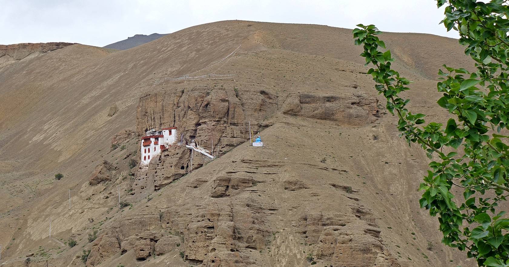
The small gompa
(center-right) and a Mani wall. The canyon is between the gompa
and the rocky outcrop behind it.
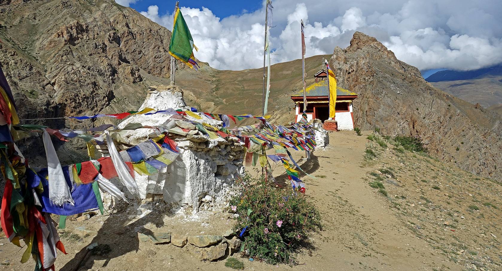
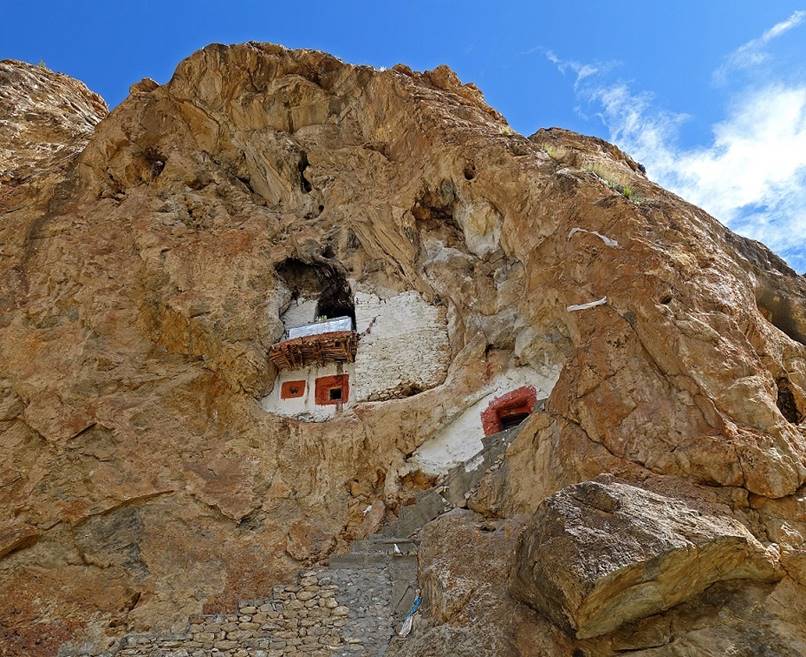
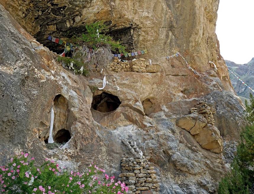
Meditation caves seen from the gompa. The most religiously significant caves are behind
the white walls. They form a series of chambers on multiple levels connected by
narrow passages.
|
|
|
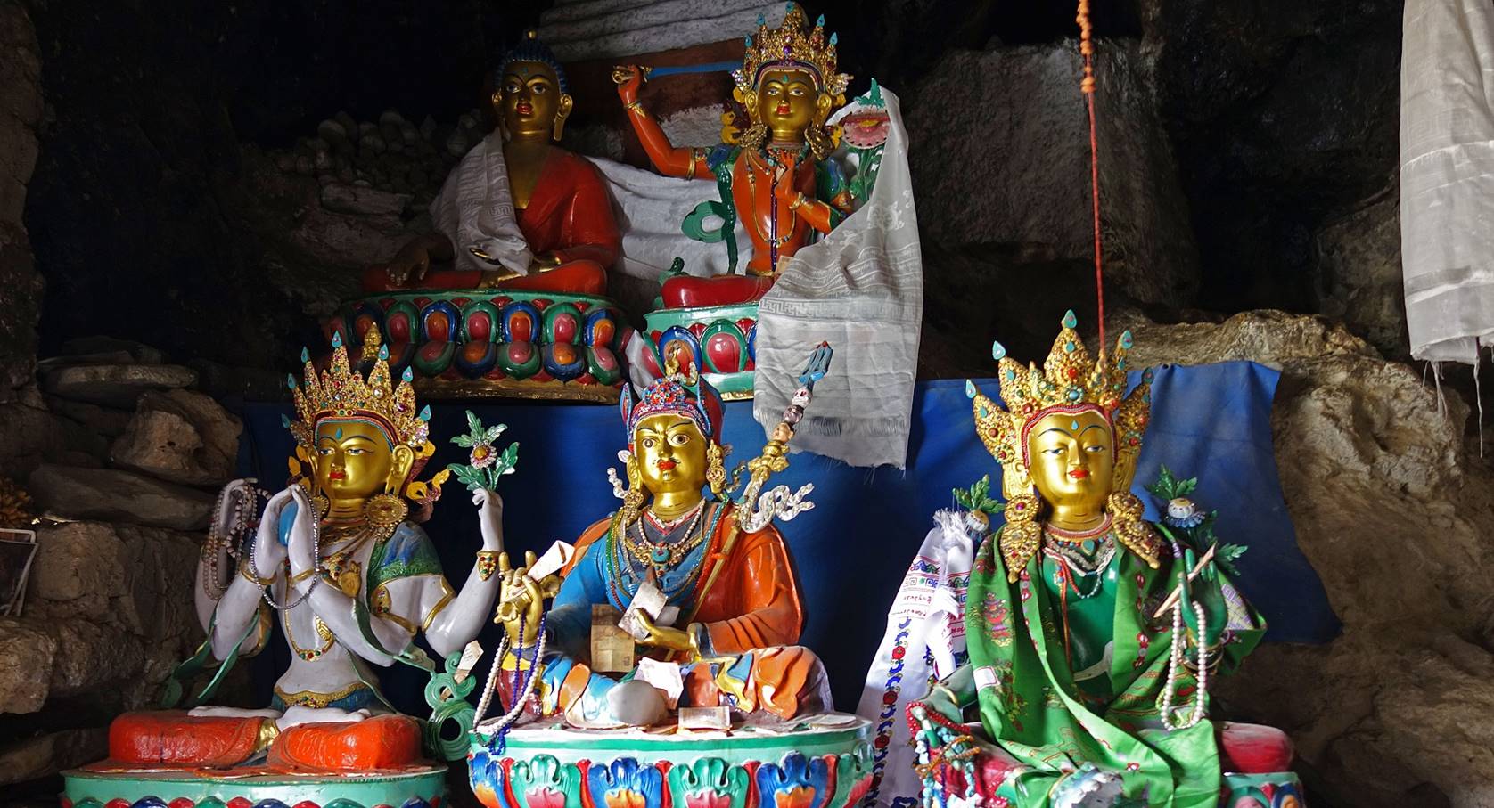
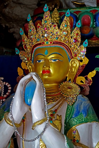
In the main chamber.
|
|
|
|
|
View of the gompa
(right) from the caves. The larger building on the left provides accommodation
for pilgrims.
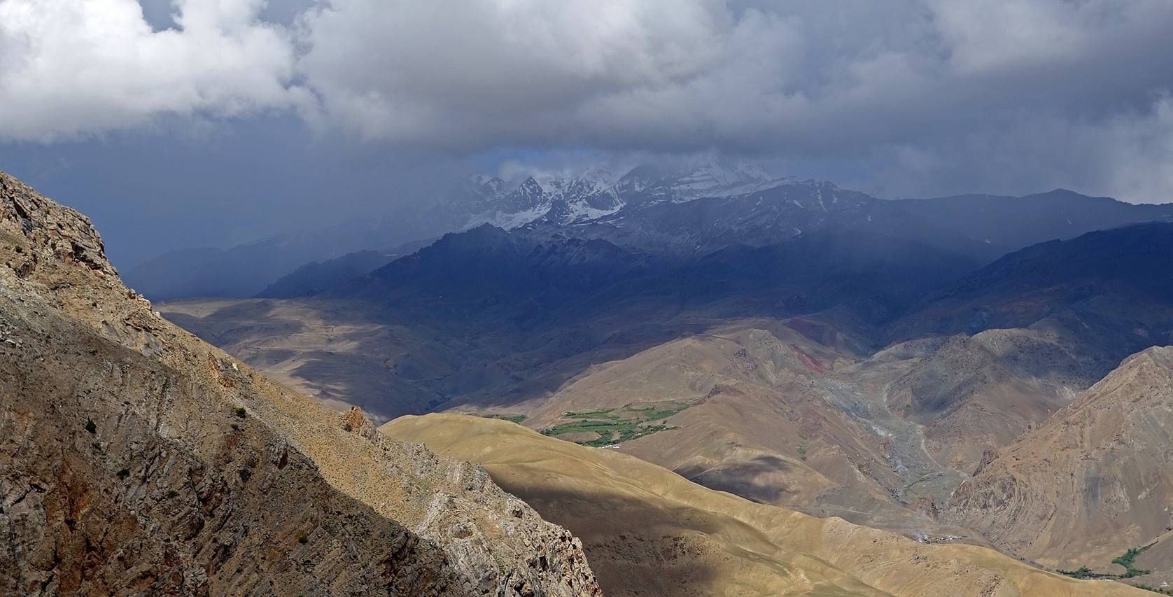
Storm brewing in the mountains above Chaskot as we started our descent back to Yoge.
Just before reaching Yoge,
we turned left (toward the west) and climbed the yellow ridge seen in the photo
below to reach our next camp above Chaskot (WP #008),
some 3km away.
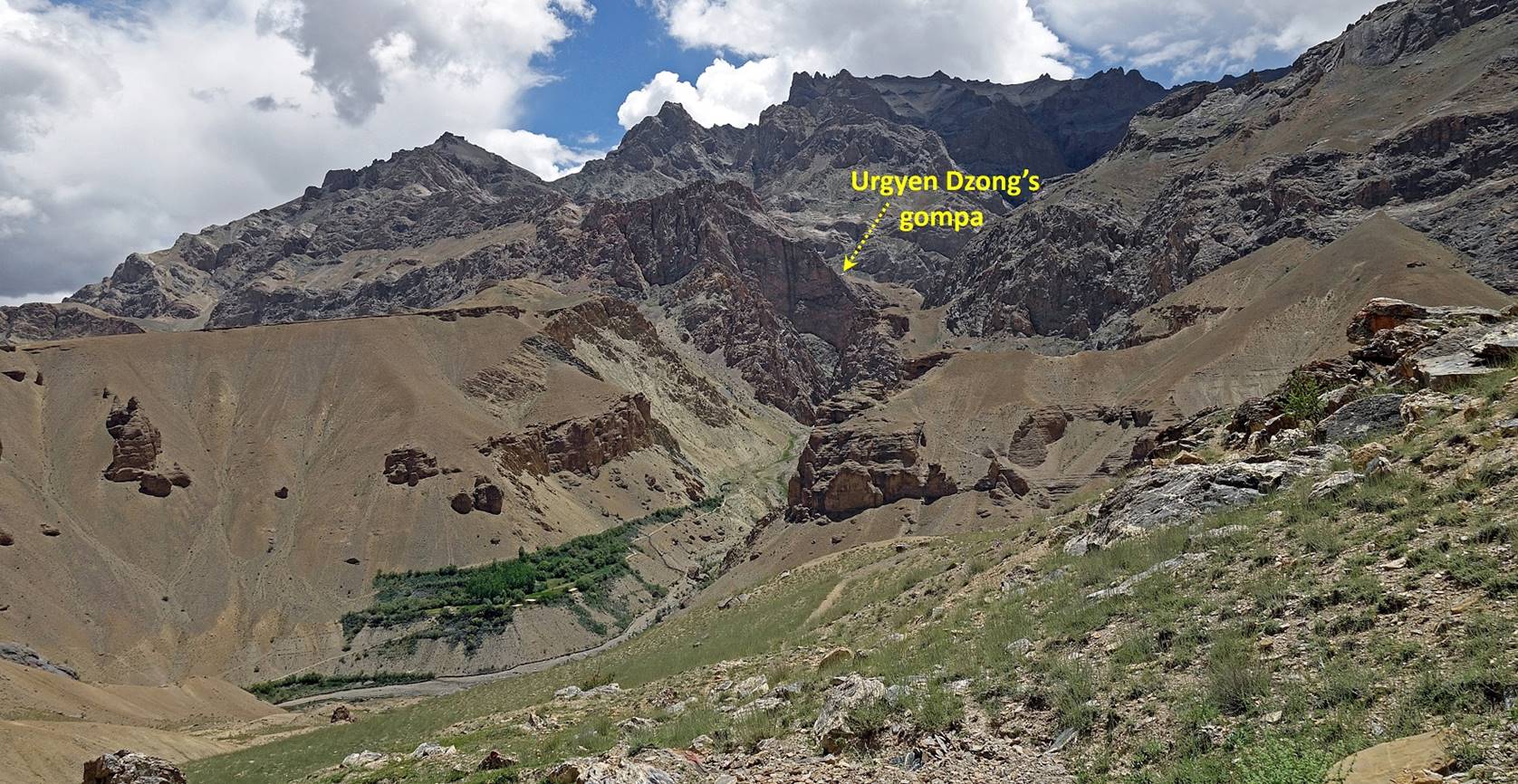
At some point along the ridge (roughly
at WP #007) we could get a rare glimpse of the site of Urgyen
Dzong. (The tiny white dot is the gompa.)
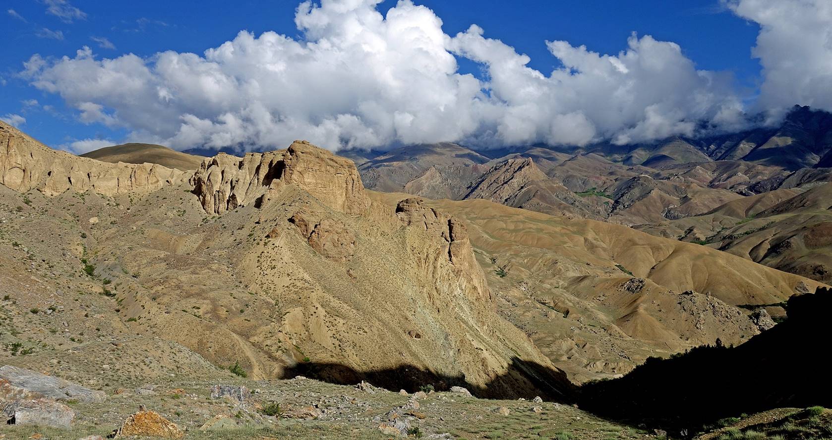
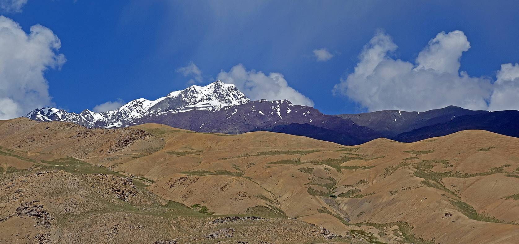
View over the valley between Yoge and Chaskot.
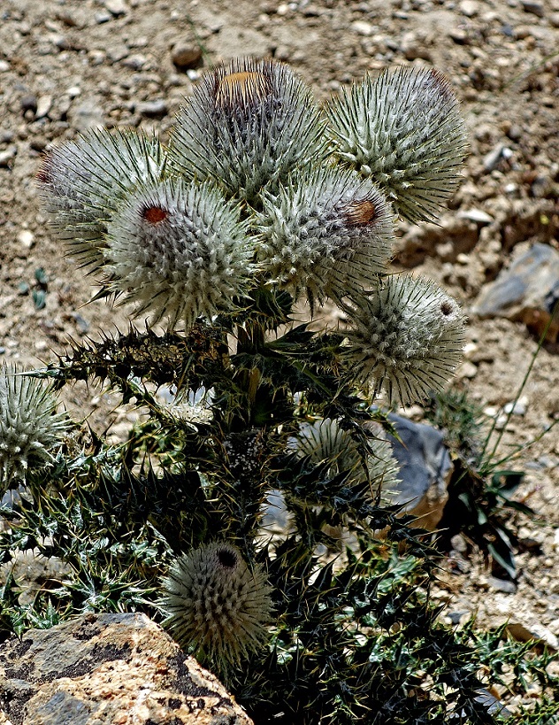
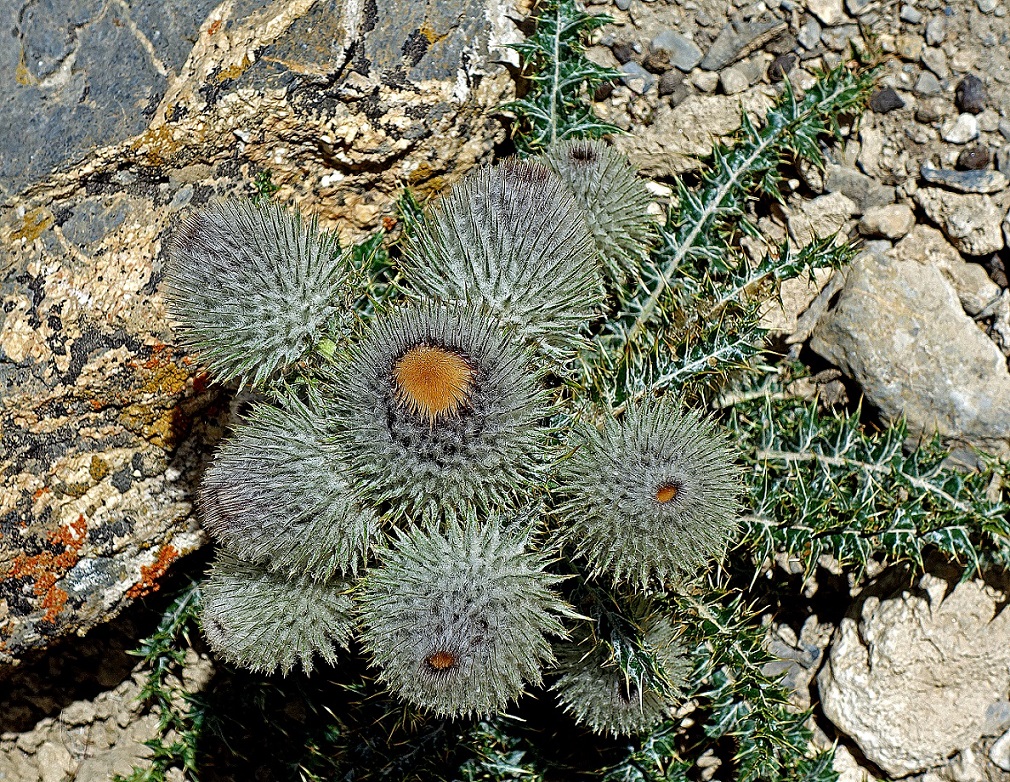
Some beautifully shaped thistle along the way.
|
|
|
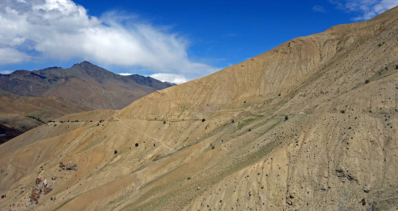
Looking back at the barren land crossed
before reaching the camp.
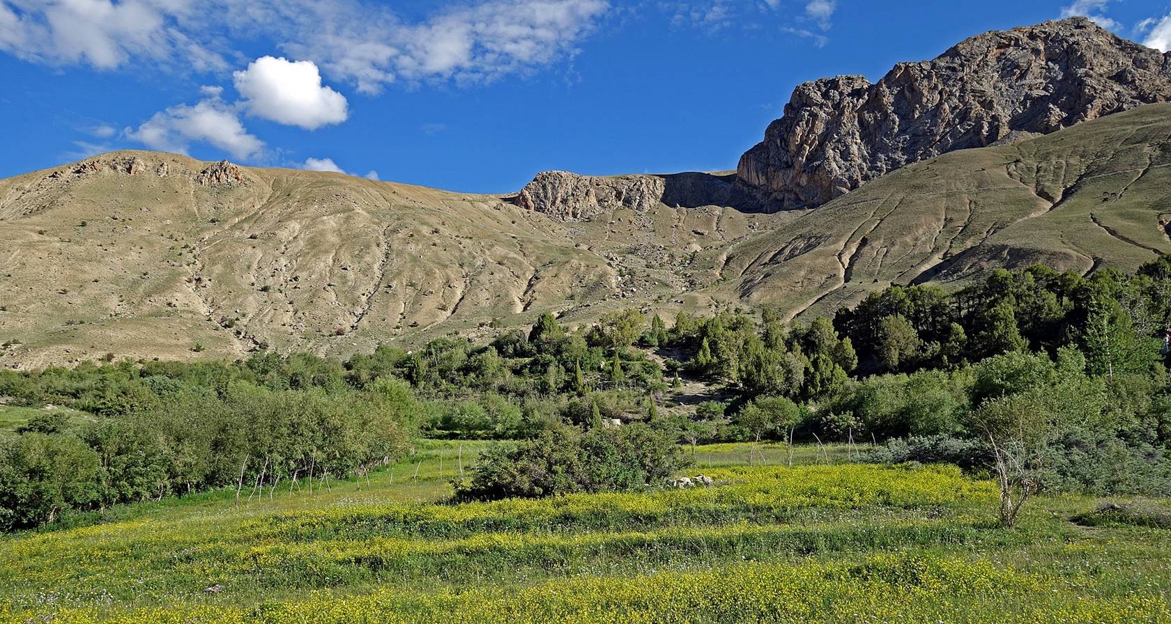
Field of yellow flowers next to our camp
(WP #008).
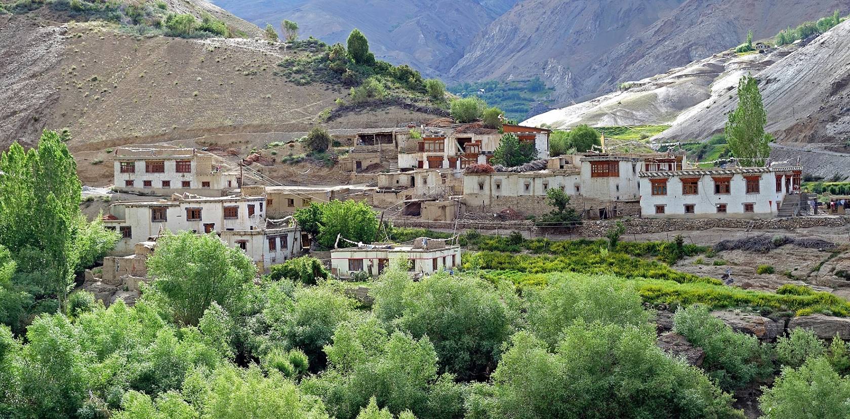
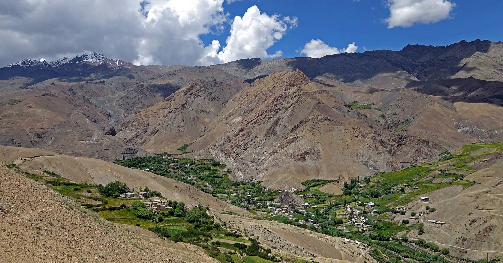
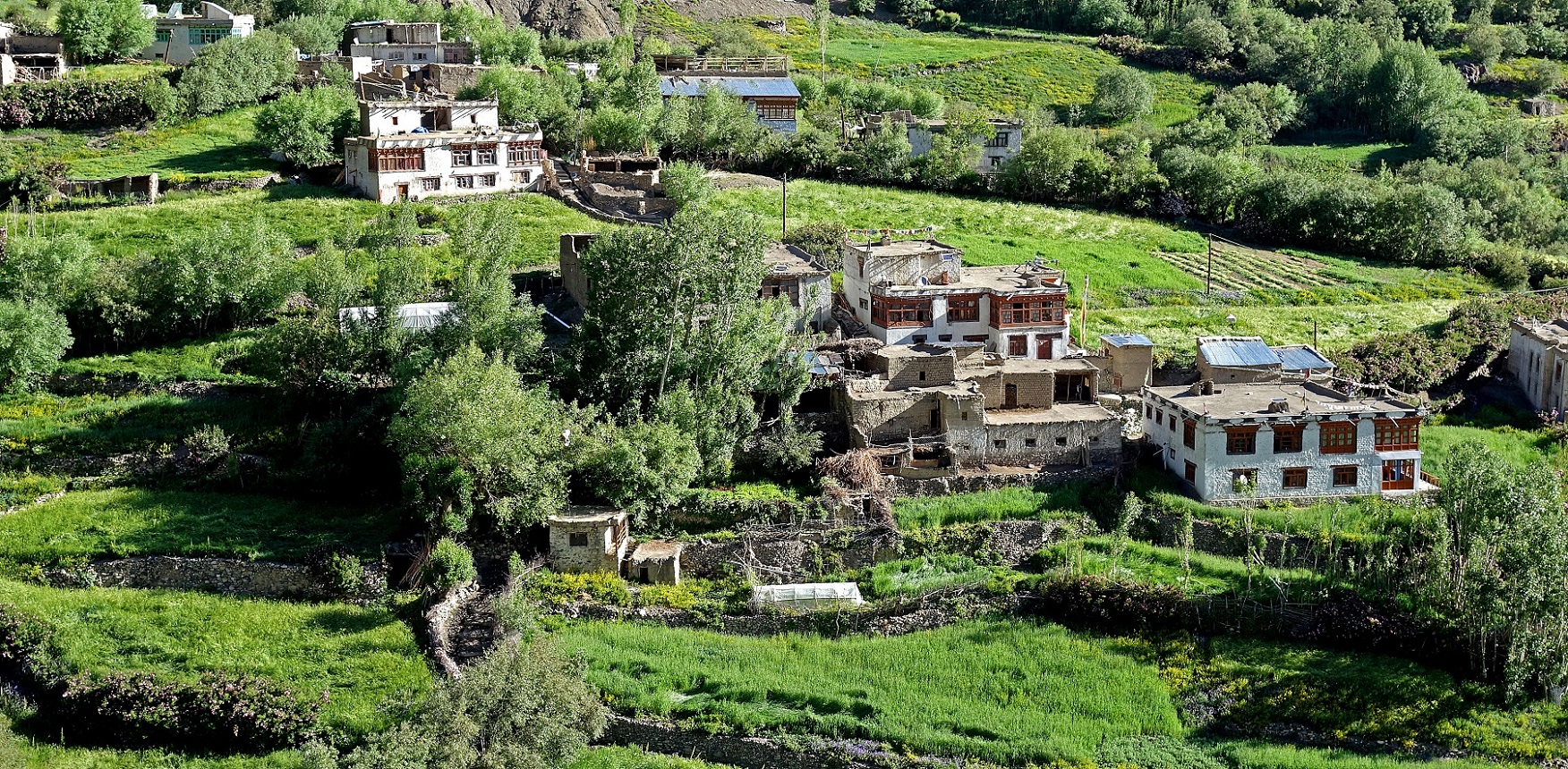
Houses of Chaskot
seen from the camp.
![]()