Kerman and Around (April 2014)
|
|
|
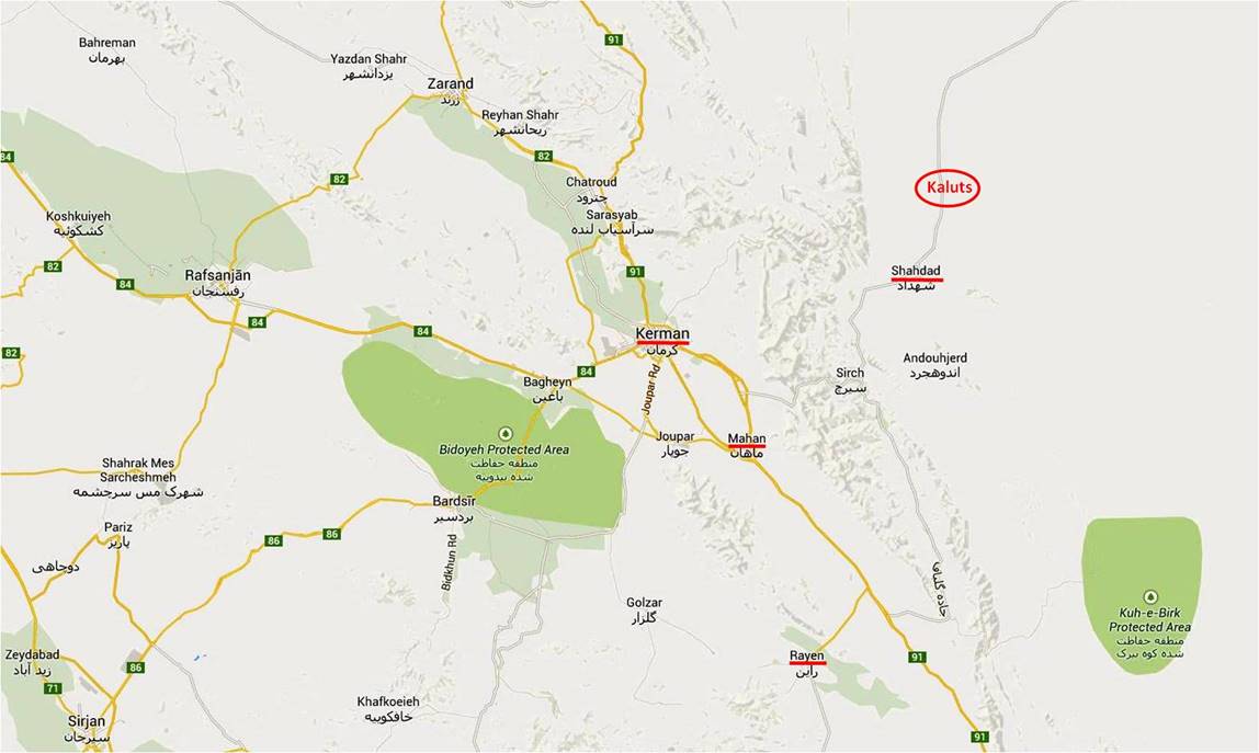
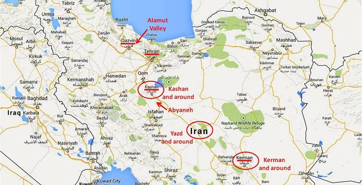
At an elevation of 1755m the city of Kerman is located on the edge of the Dasht-e Lut (meaning Emptiness Desert), just north of a mountain range culminating at Mt. Hezar (4420m), which is the highest summit in southern Iran. Due to its proximity with Pakistan, Kerman′s population includes a large minority of Balochis. Around Kerman I visited the town of Mahan, the adobe castle of Arg-e Rayen, and the Kaluts (natural ′′sand castles′′).
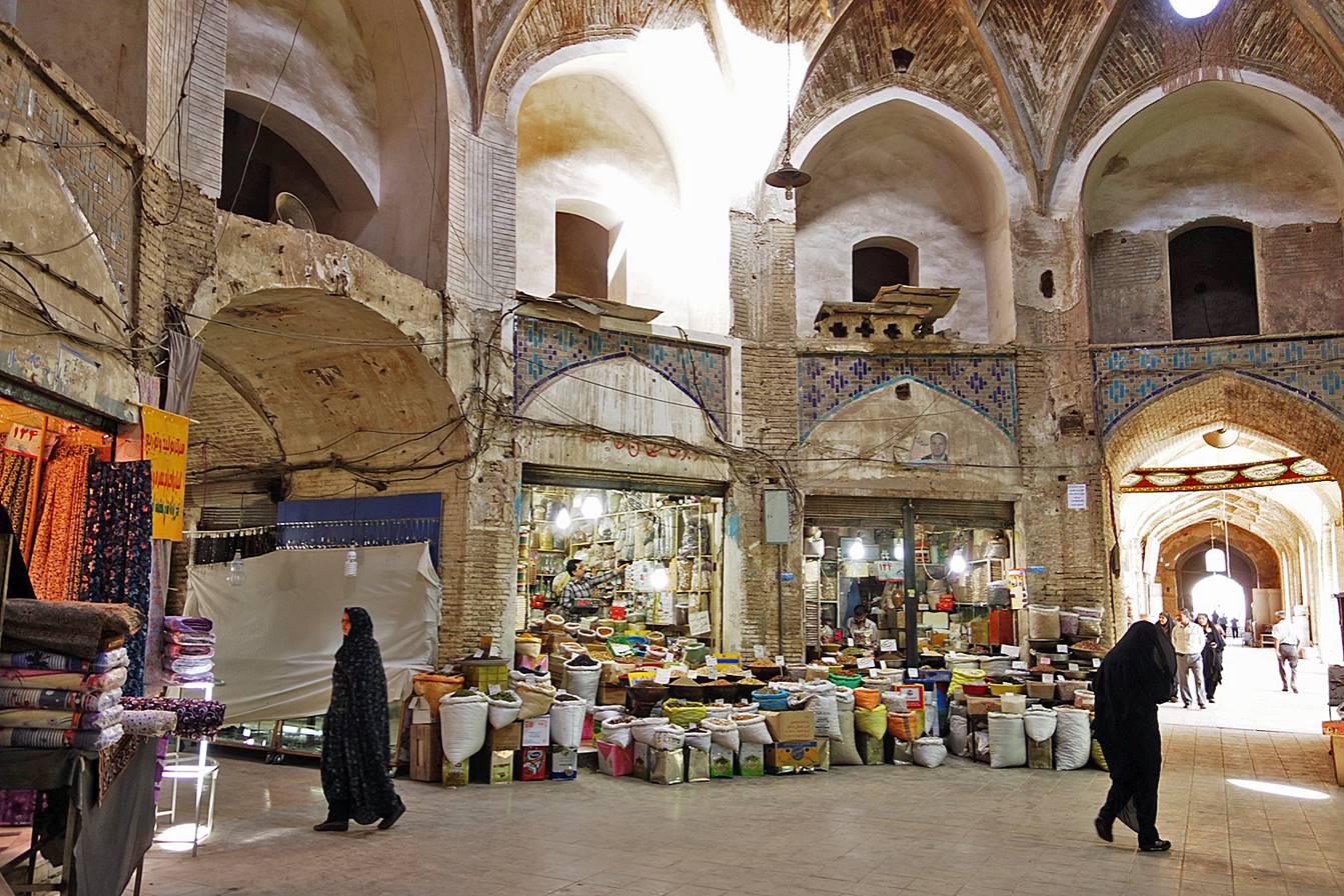
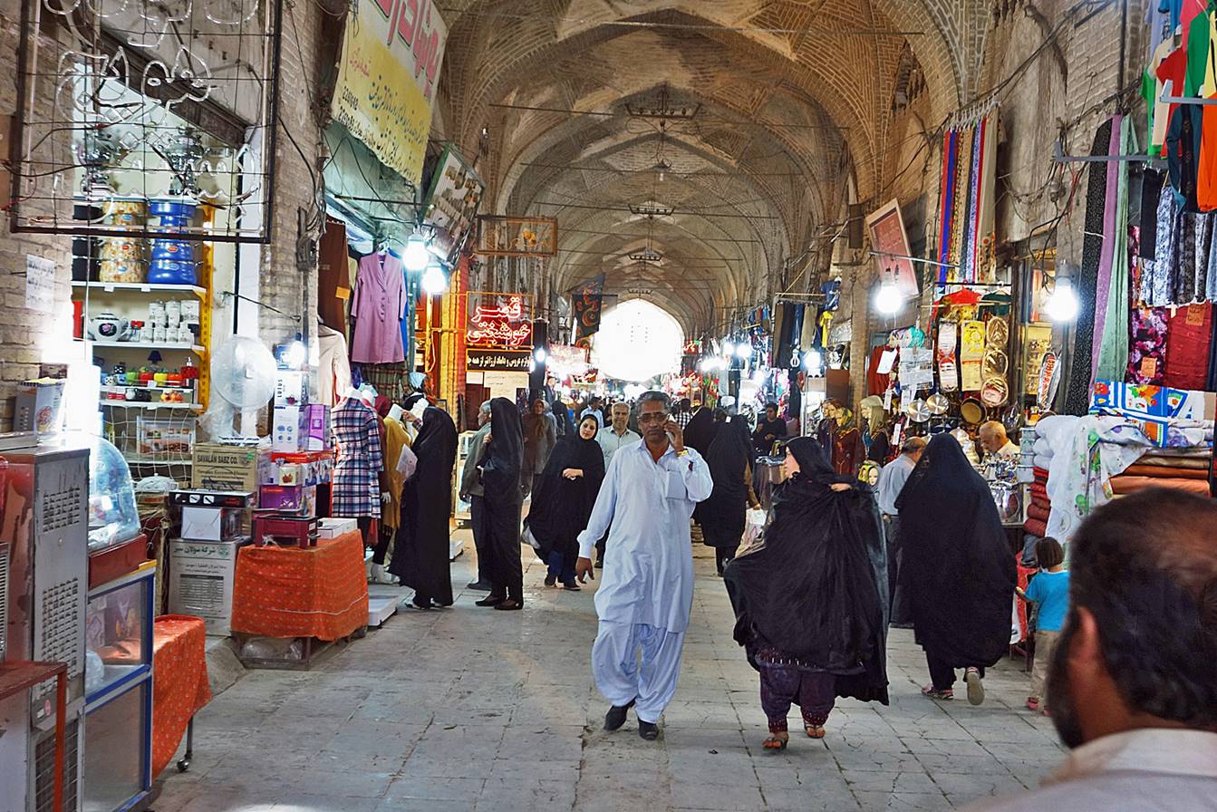
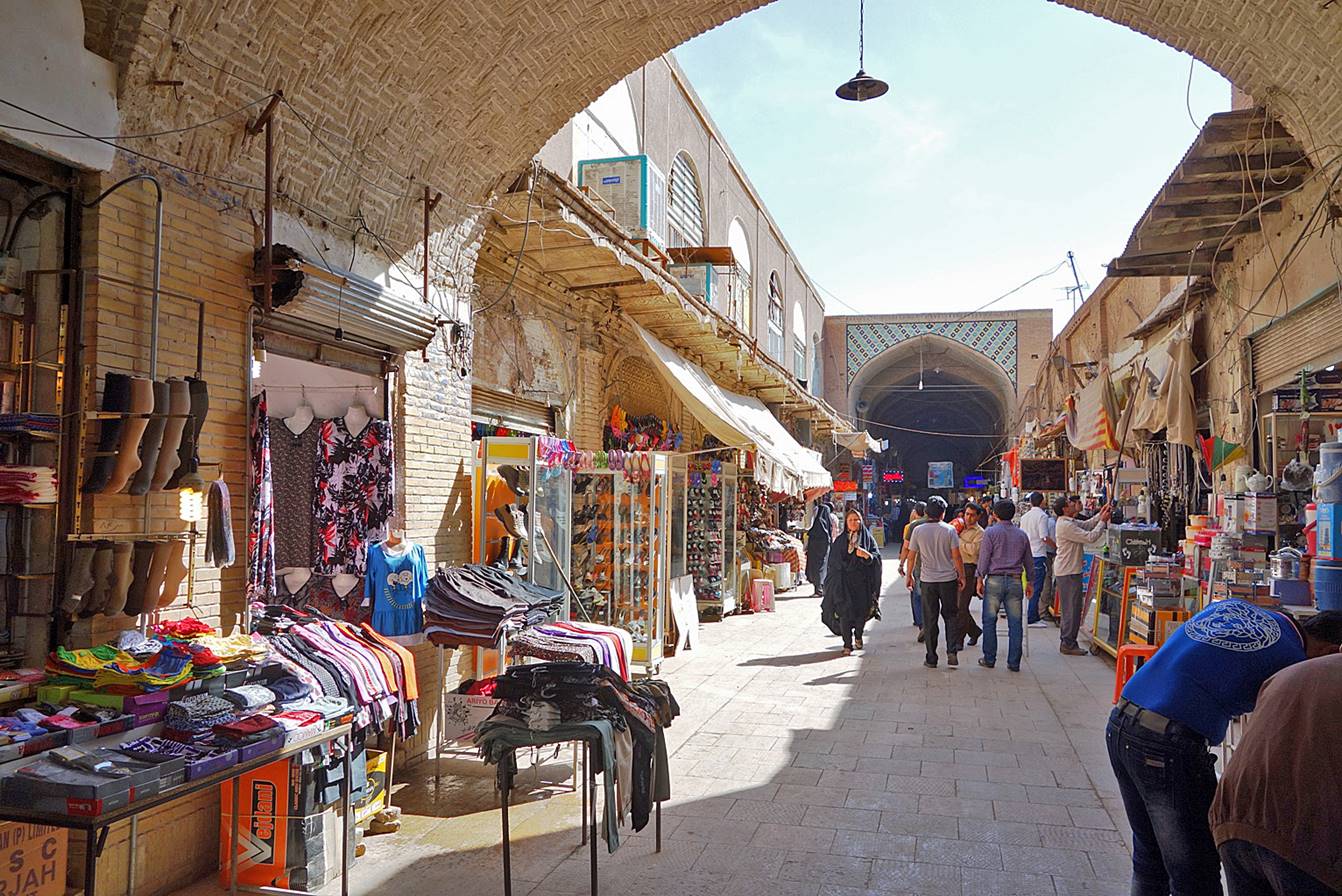
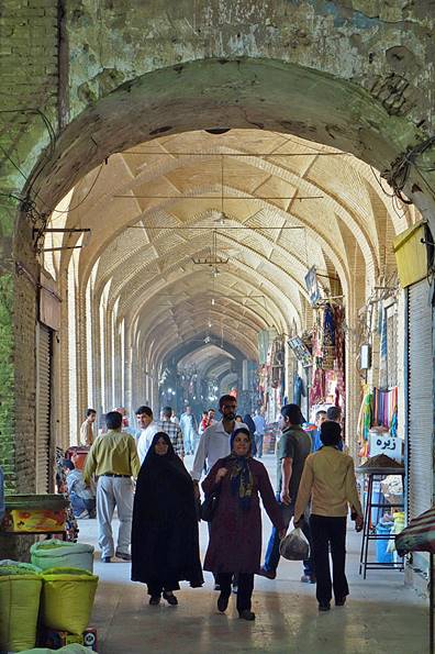
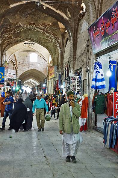
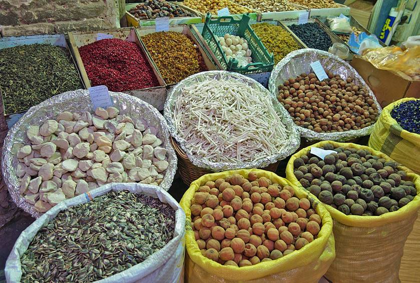
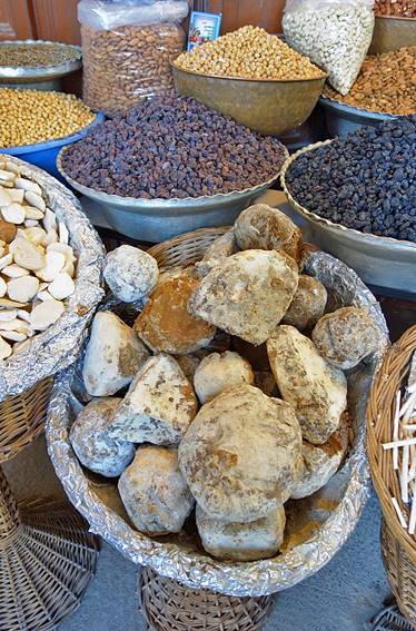
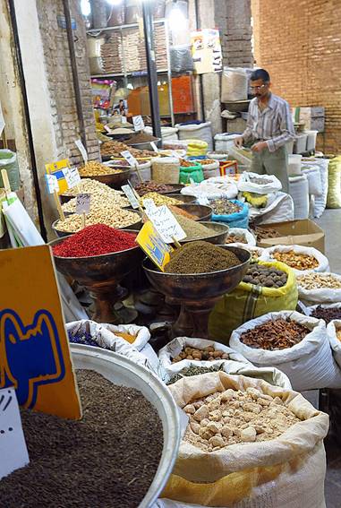
In the old bazaar of Kerman.
|
|
|
|
|
|
|
|
|
|
|
|

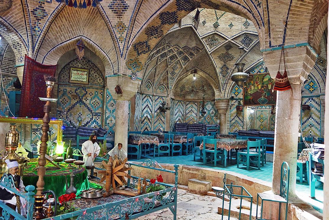
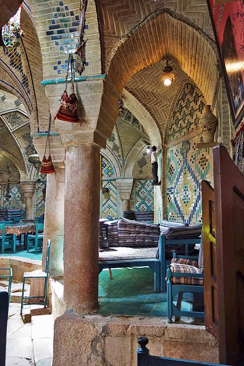
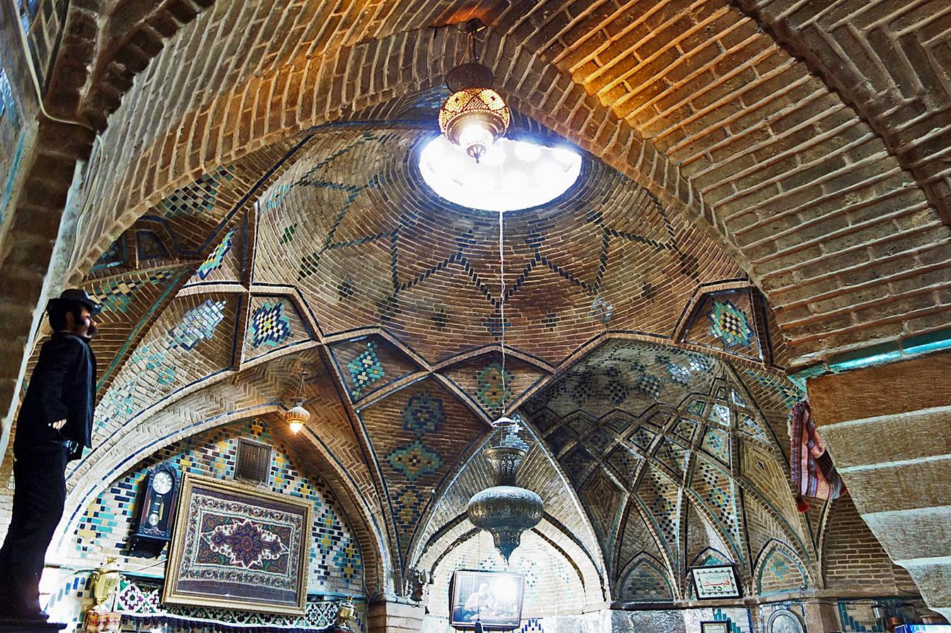
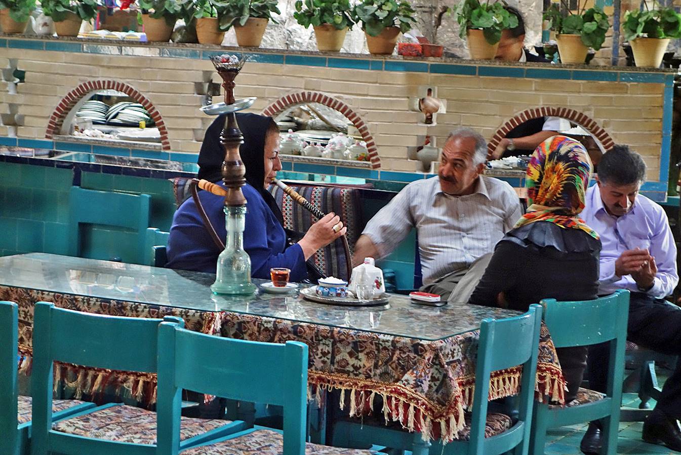
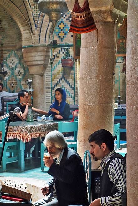
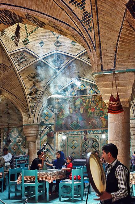
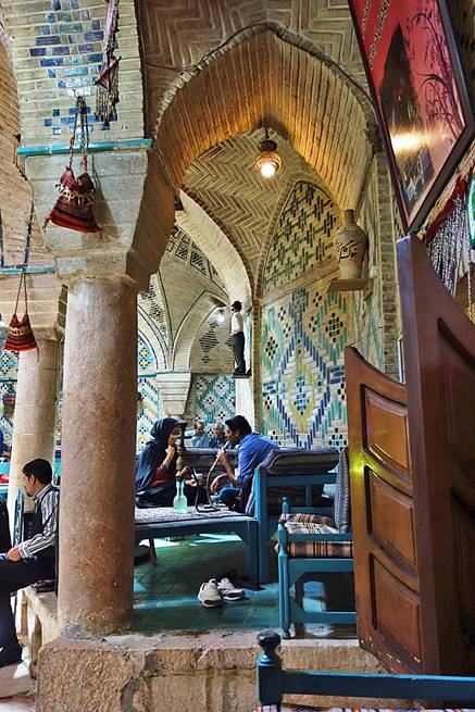
Vakil hammam (located in the old bazaar) remodeled into a beautiful teahouse.
|
|
|
|
|
|
|
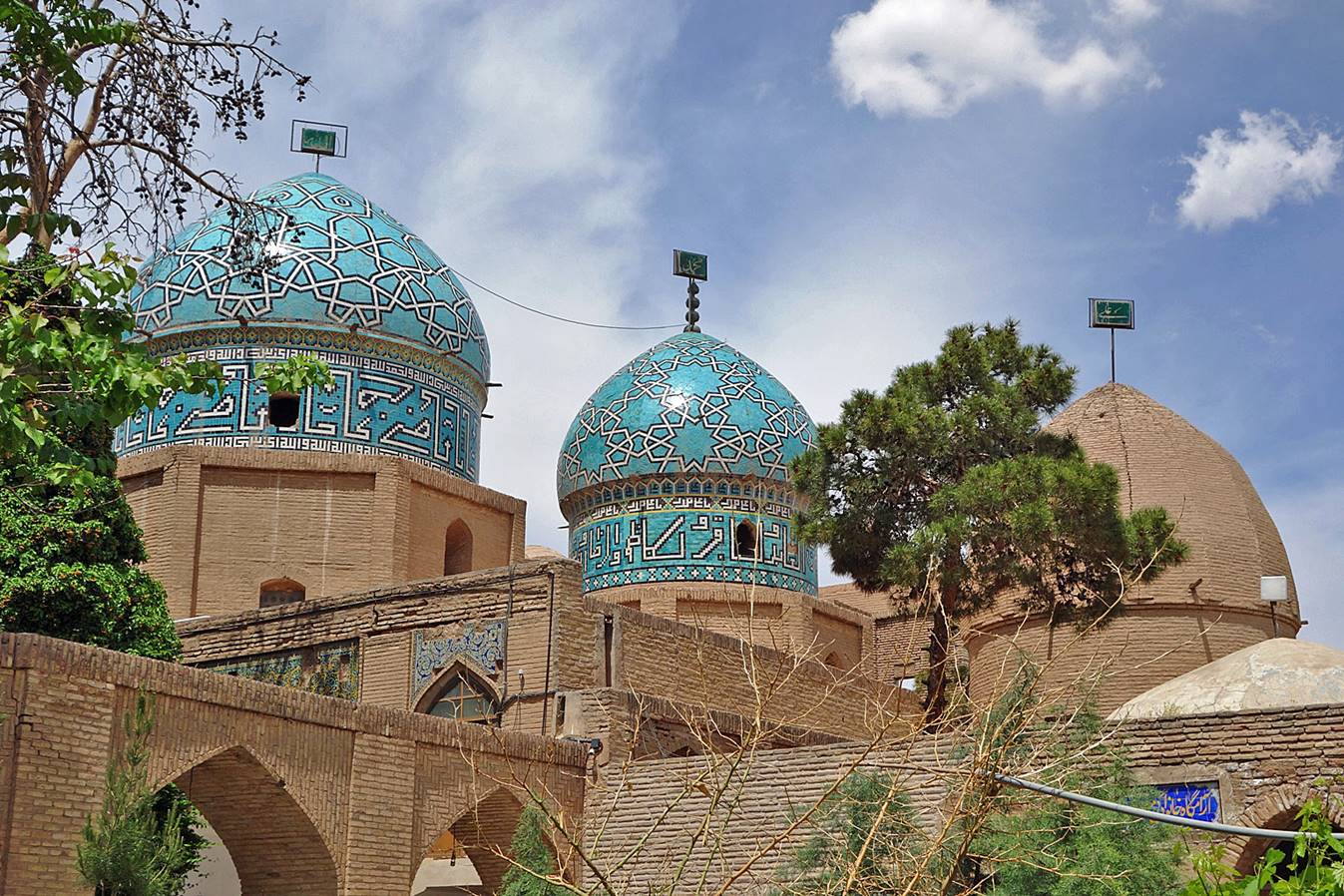
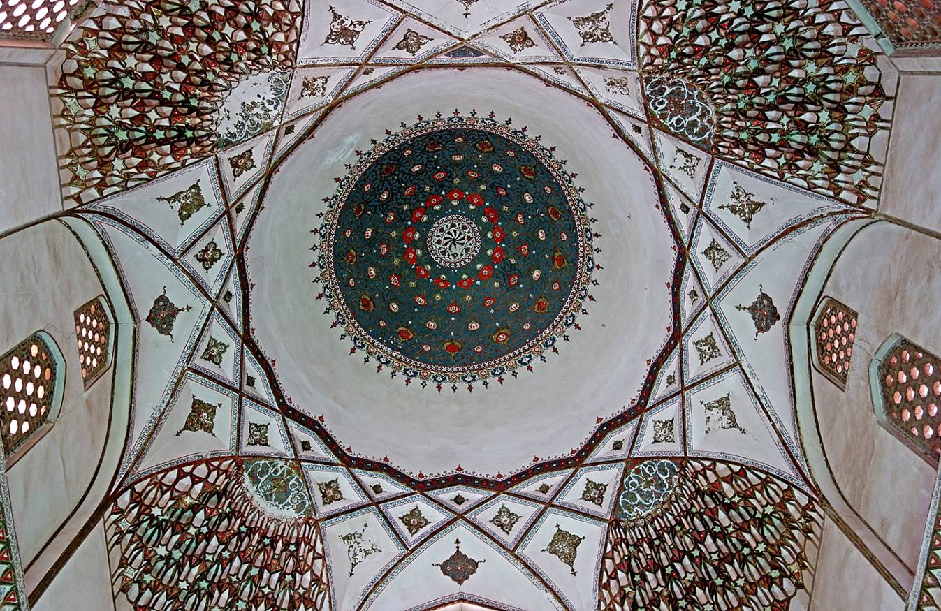
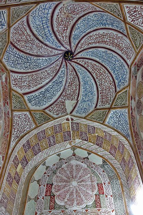
Three-dome mausoleum of Sufi mystic Moshtaq Ali Shah.
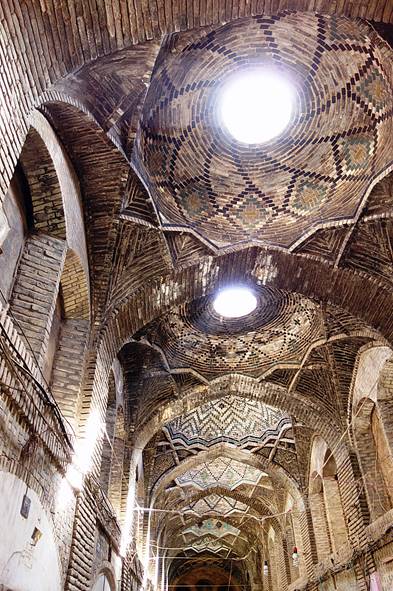
Ceiling of one of the domes.
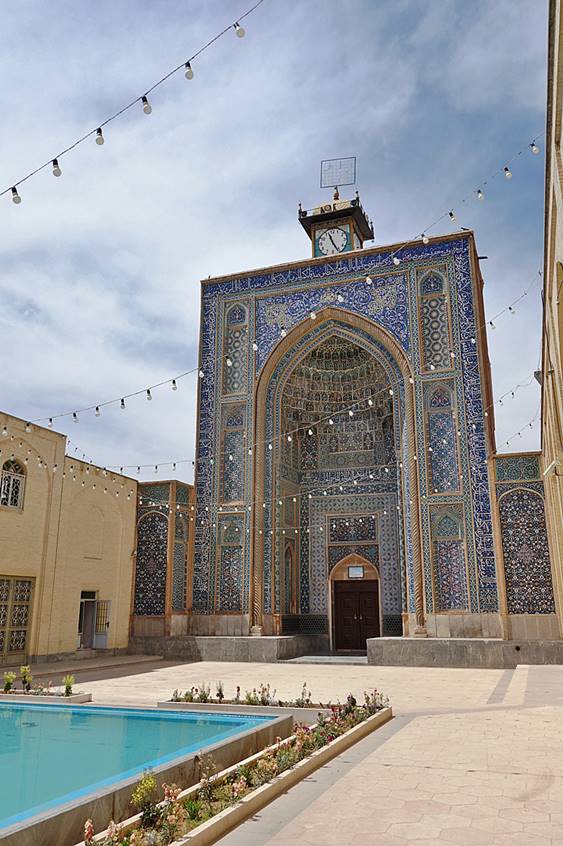
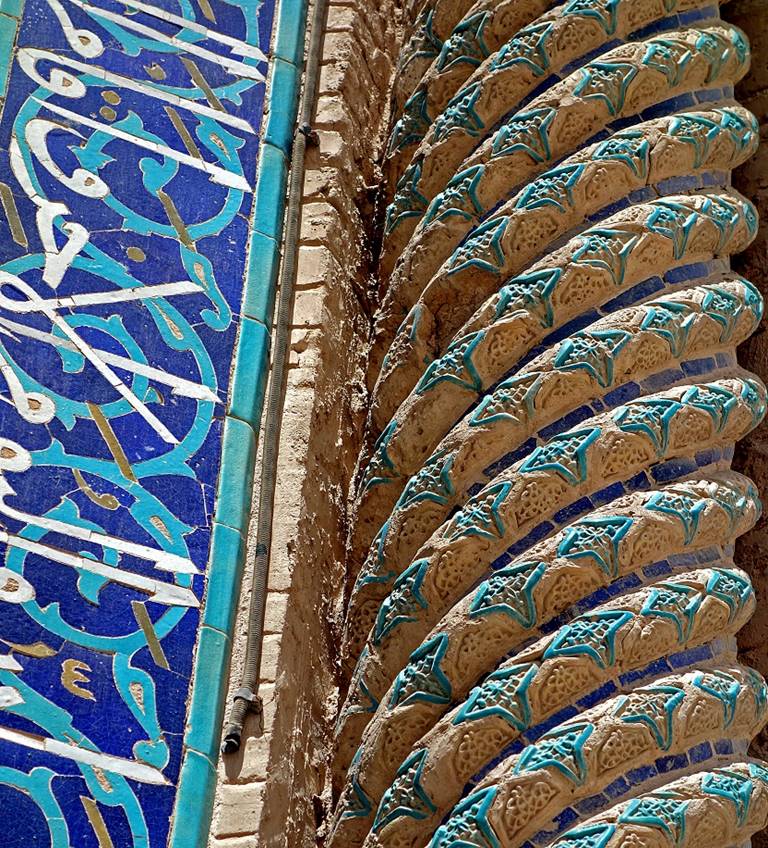
Jameh mosque, with a clock tower but no minaret, and detail of the twisted column on the right of the iwan.
|
|
|
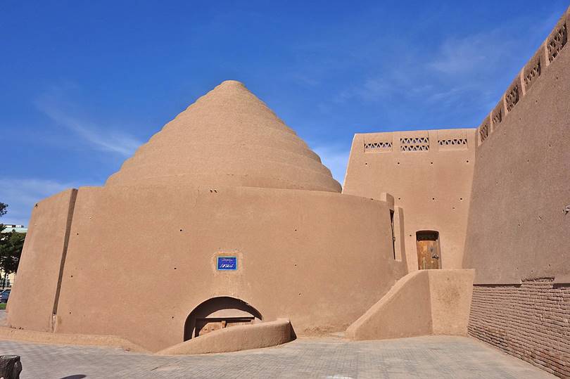
Two ice houses (yakhchal) in Kerman.
|
|
|
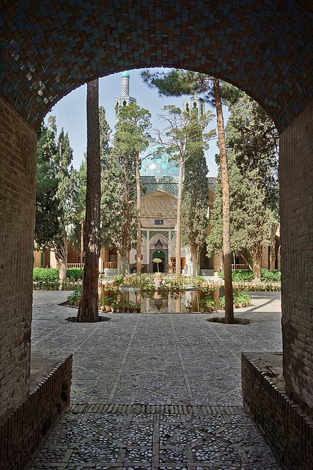
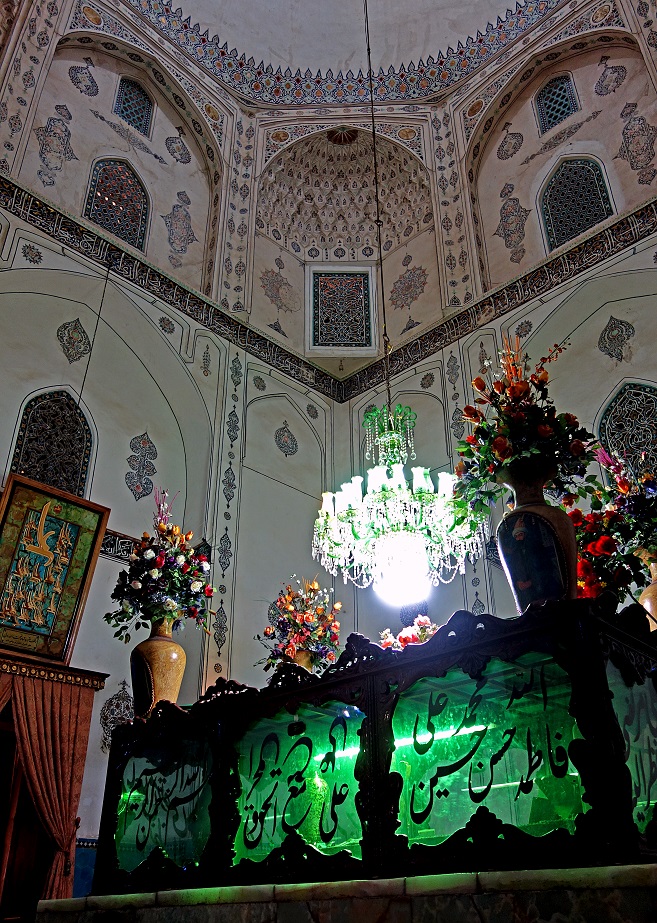
Mausoleum of the Sufi leader Shah Ne'emat Ollah-e-Vali in Mahan.
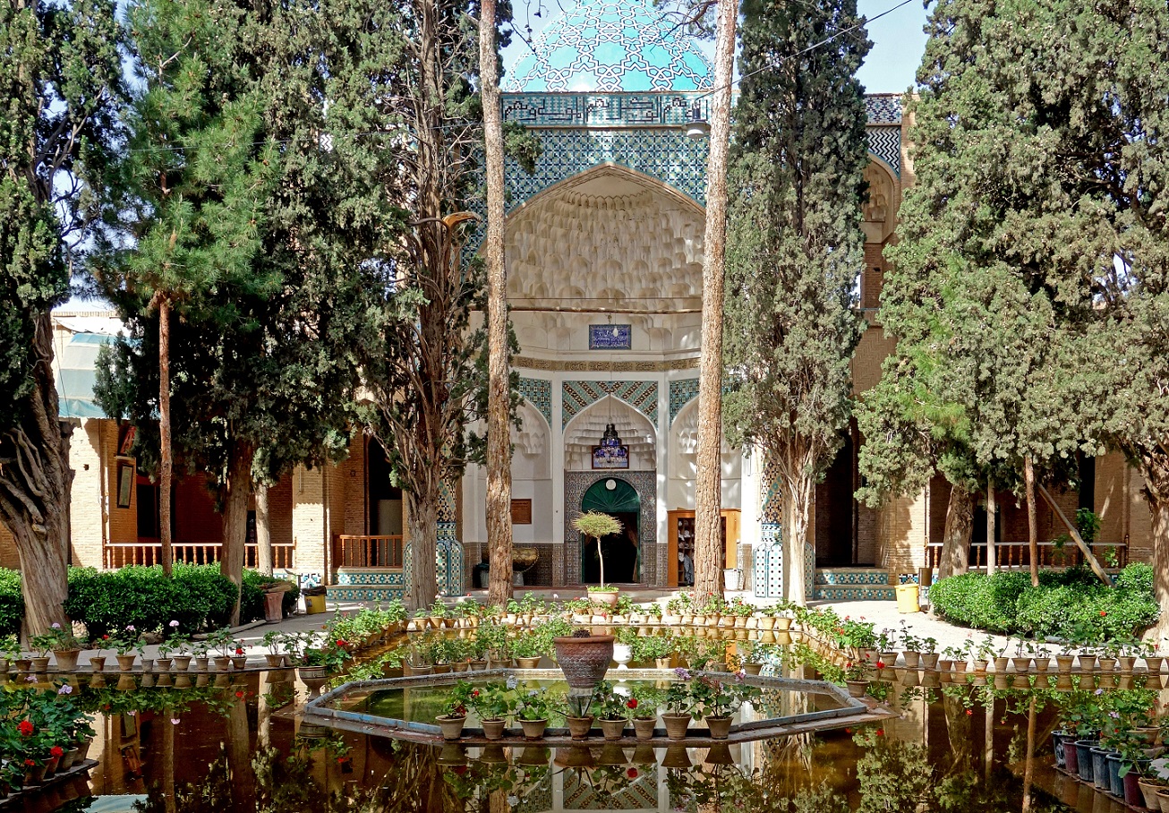
Right: Tomb room.
|
|
|
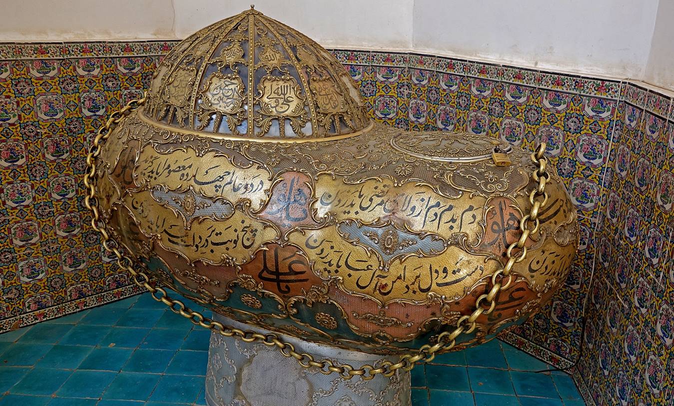
Large Kashkul bowl (Beggar′s bowl) in the mausoleum′s museum. Small such bowls were used by Sufi mystics who had renounced their worldly possessions and subsisted by collecting alms.
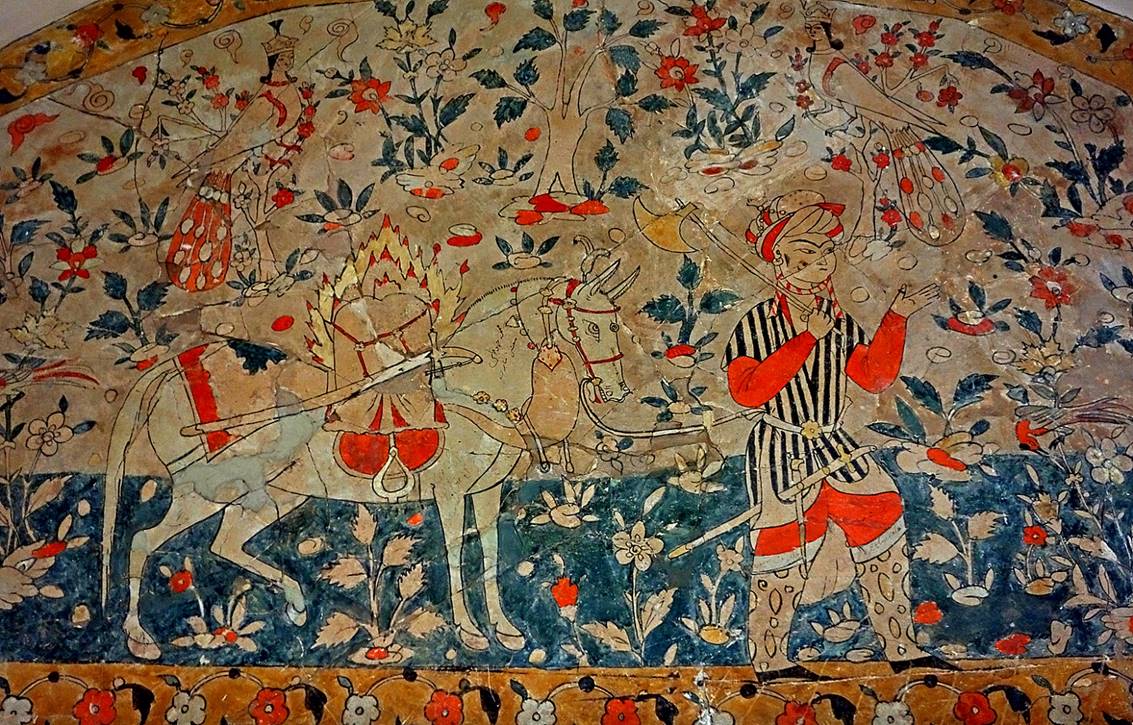
Left: Wall and ceiling painting in the mausoleum′s meditation room. Right: Wall painting in another room.
|
|
|
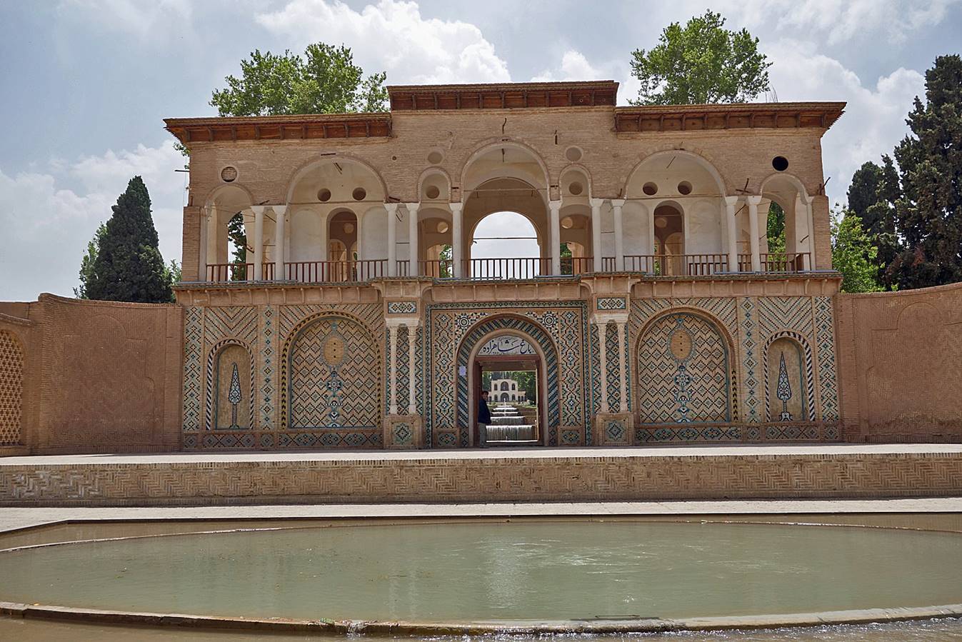
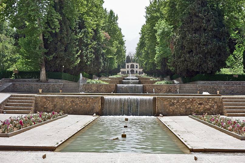
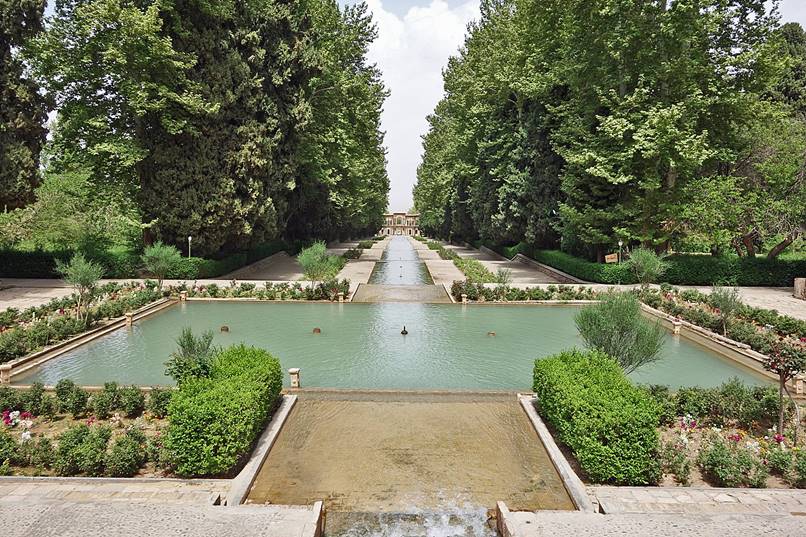
Shazdeh Garden (Prince′s Garden) in Mahan.
|
|
|
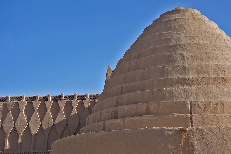
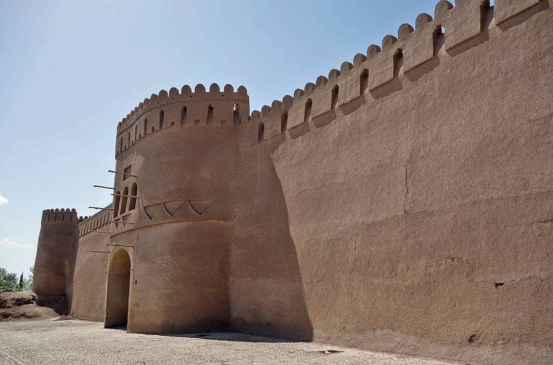
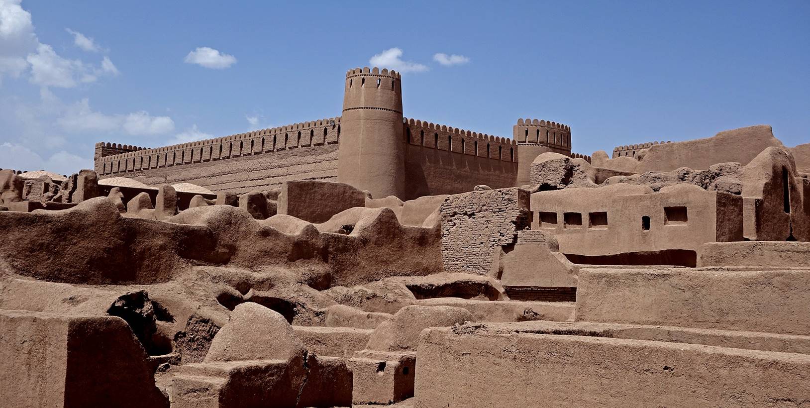
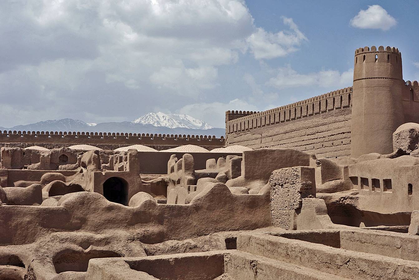
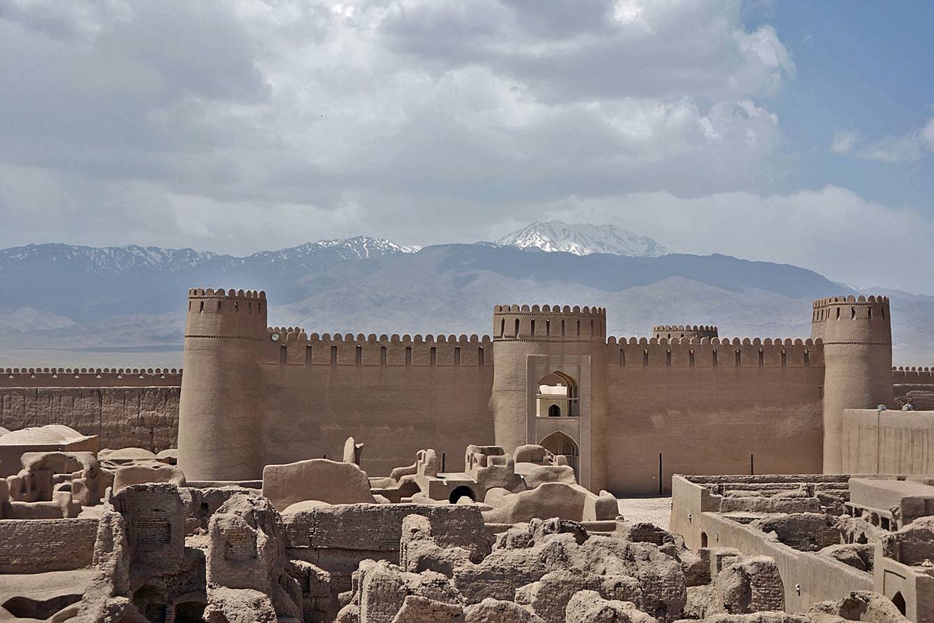
Arg-e Rayen (Rayen Castle) is a well preserved/renovated medieval adobe castle. It bears some resemblance with Arg-e Bam located further east, but it is much smaller and less impressive. Unfortunately, Arg-e Bam was destroyed in an earthquake in December 2003. See here for photos of Arg-e Bam that I took in 1970.
|
|
|
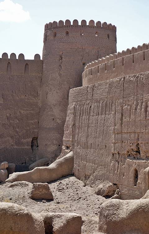
The inner citadel of Rayen (with Mt. Hezar in the background in the second and third photos below).
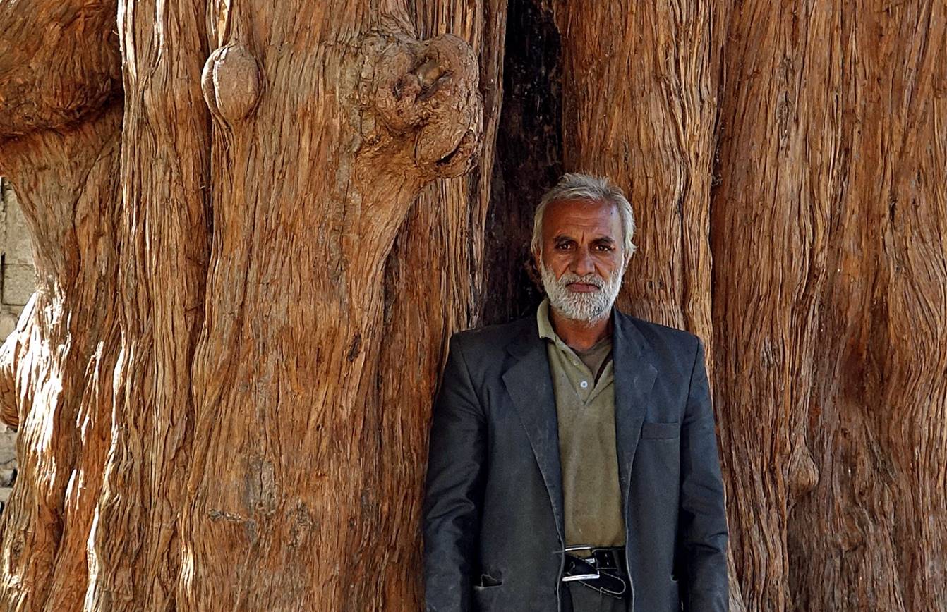
Man in front of a large Juniper tree trunk along the road between Kerman and Shahdad (see map at the top of the page).
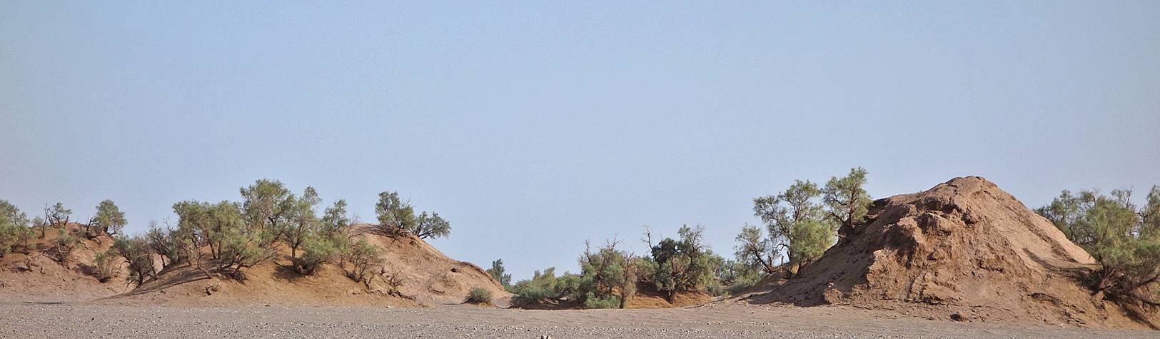
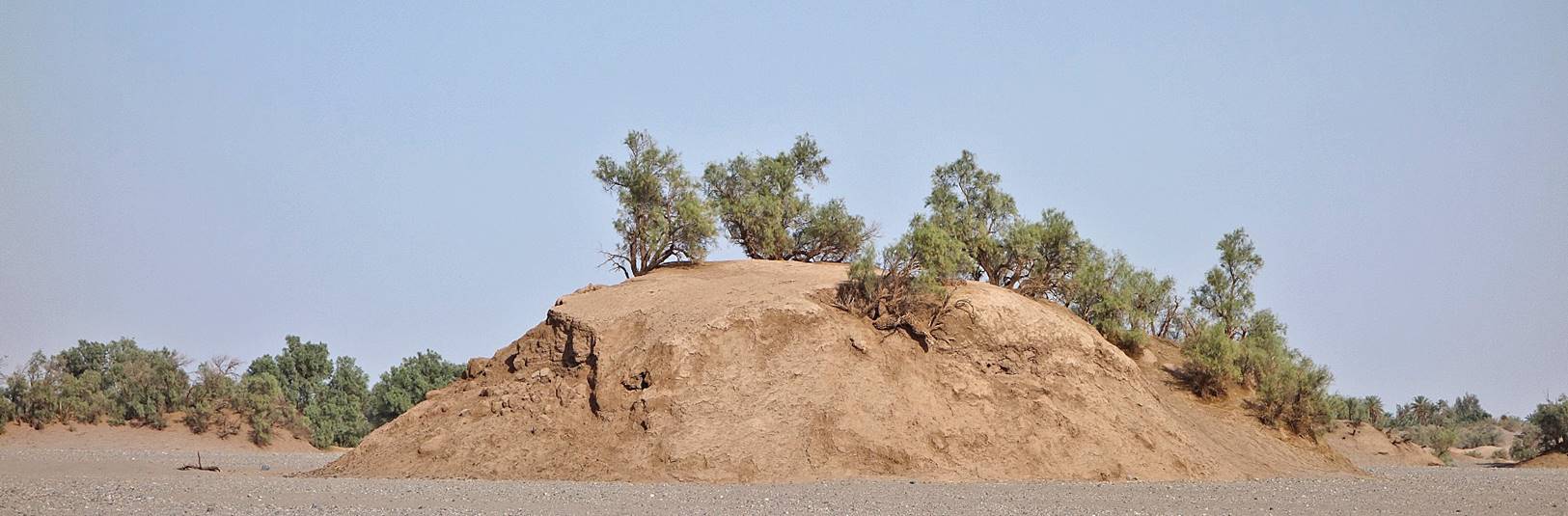
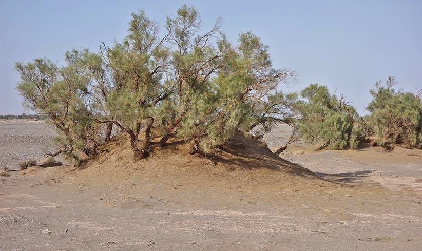
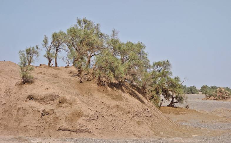
These small hills, called nebkas, can be seen a few kilometers north of Shahdad, before reaching the small village of Shafi Abad (south of the Kaluts). Initially, a small accumulation of sand allows tamarinds to grow. In turn, the tamarinds retain more sand, the hill keeps growing, and the tamarinds get taller. However, at some point the roots of the tamarinds can no longer reach underground water and the trees die (see the nebka on the right in the first photo).
|
|
|
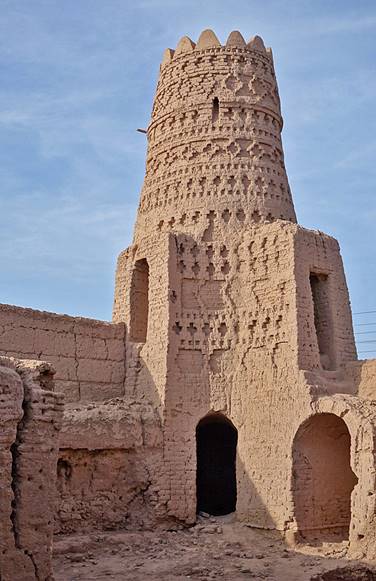
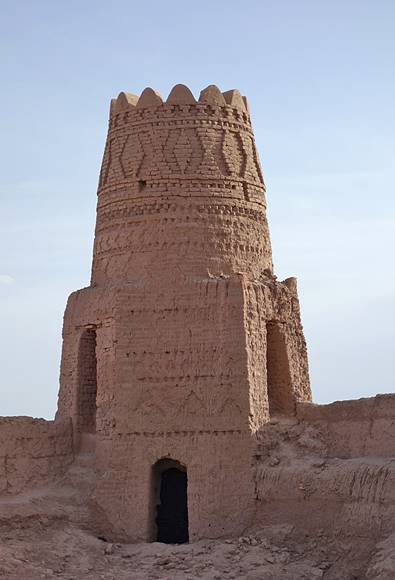
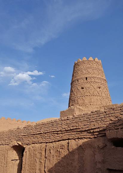
Decorated towers of the Seljuk-era adobe caravanserai in the village of Shafi Abad.
|
|
|
|
|

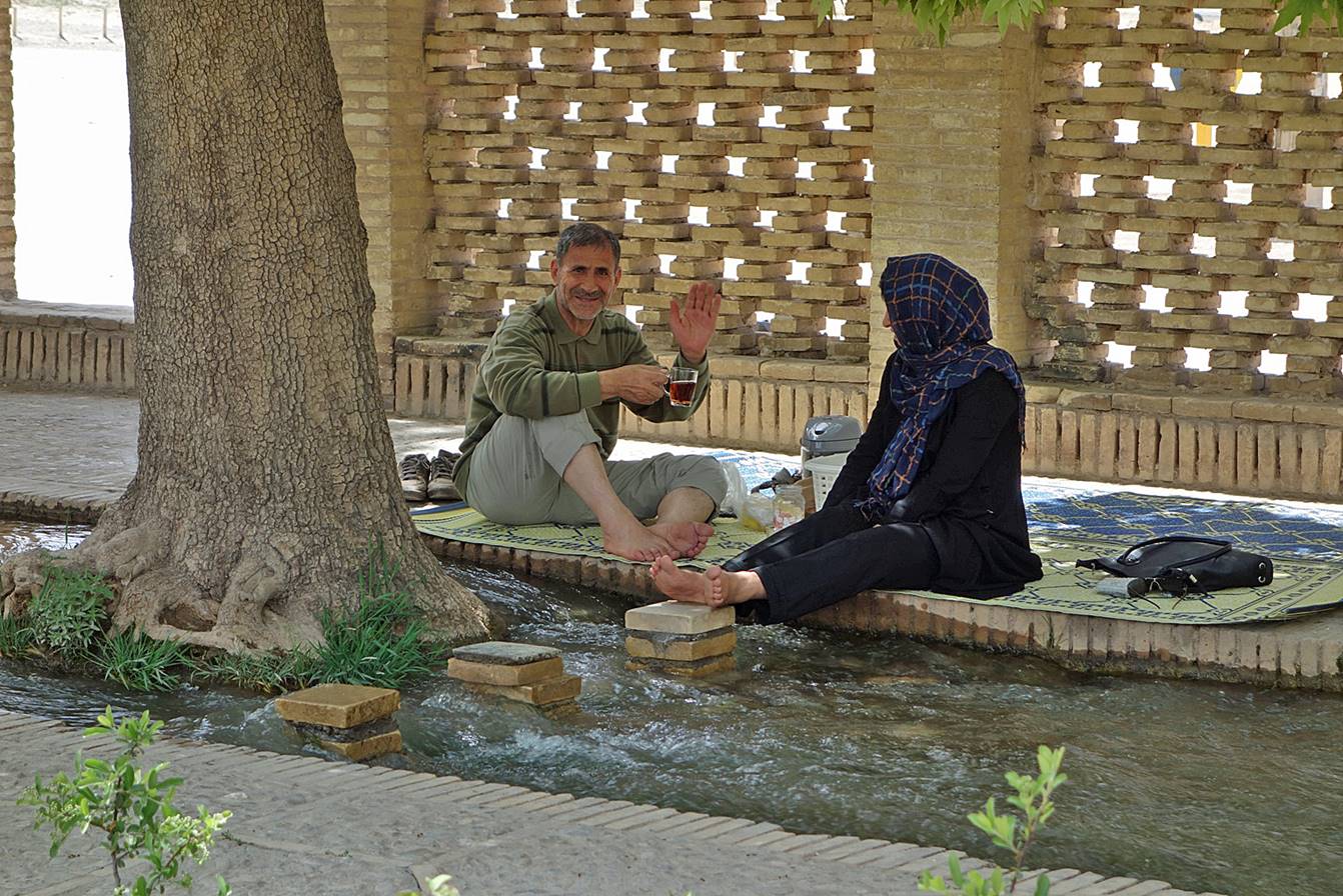
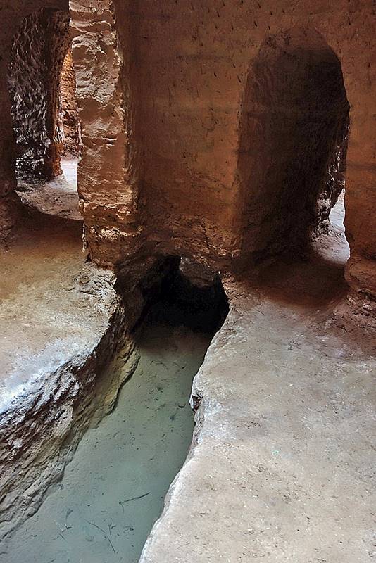
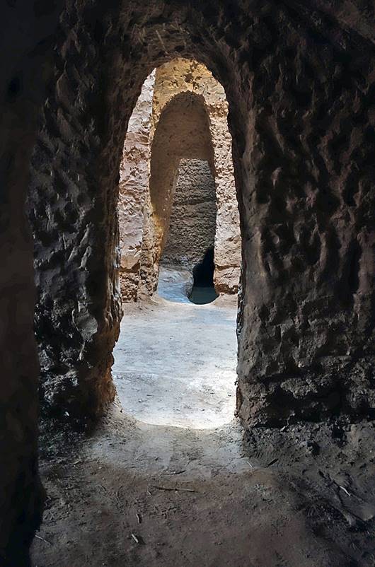
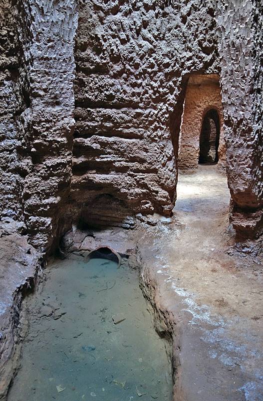
Qanat in the village of Shafi Abad. Qanats are underground water channels that have been dug by people of southern Iran for at least 2000 years to supply water for humans and crops in desert areas. Taking advantage of the presence of nearby high mountains that provide reliable sources of water, qanats allow water to be transported over long distances without much loss to evaporation.
|
|
|
|
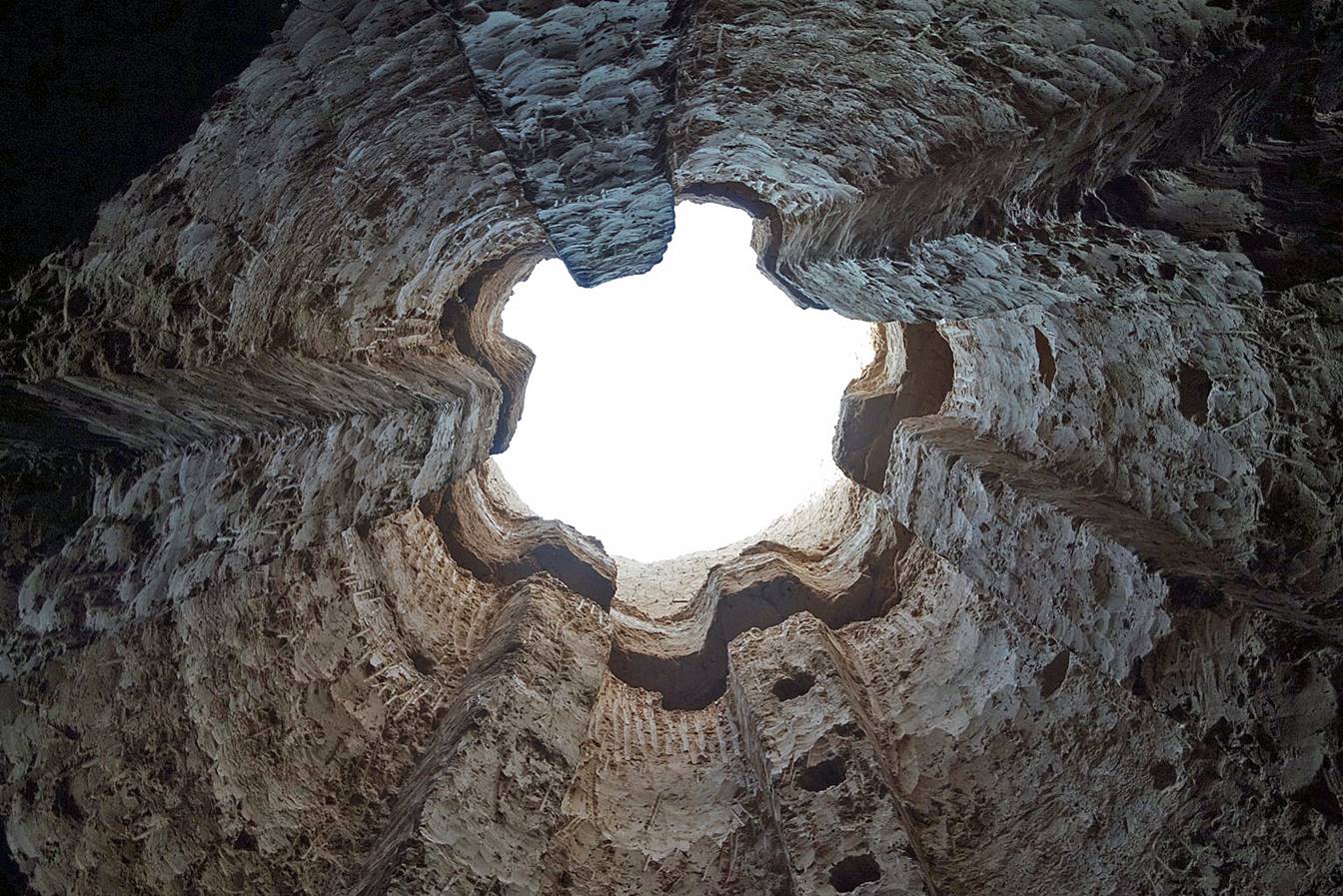
Access shaft to a qanat (seen from the bottom of the qanat) used for maintenance.
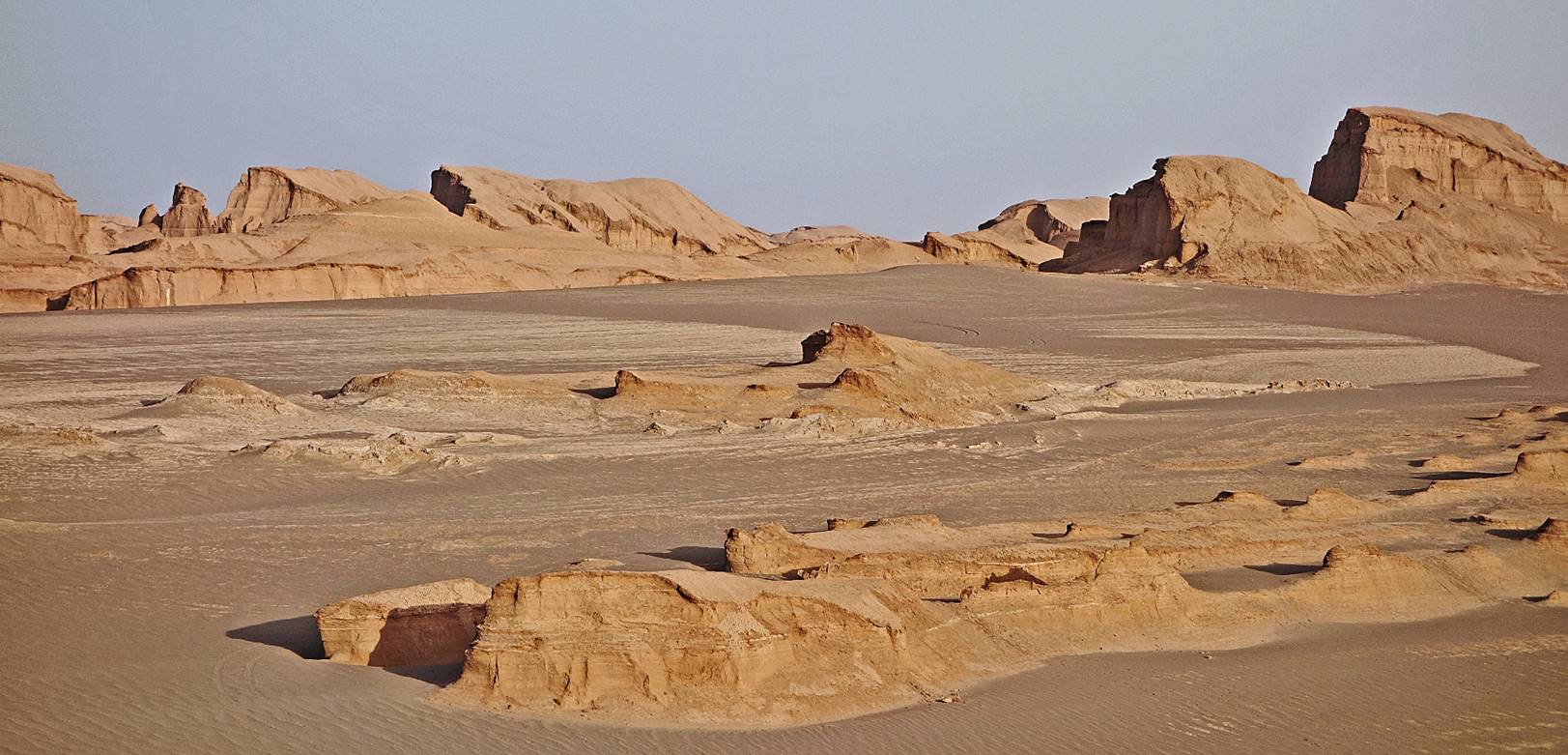
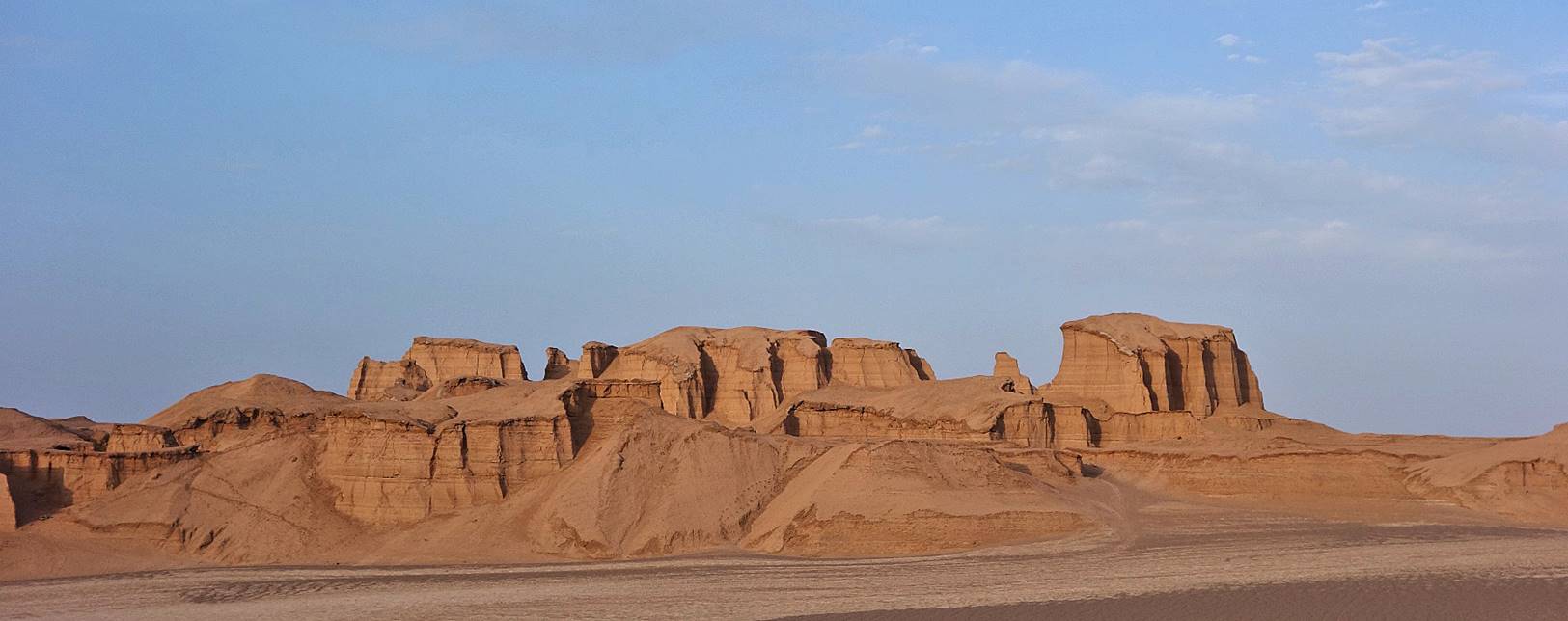
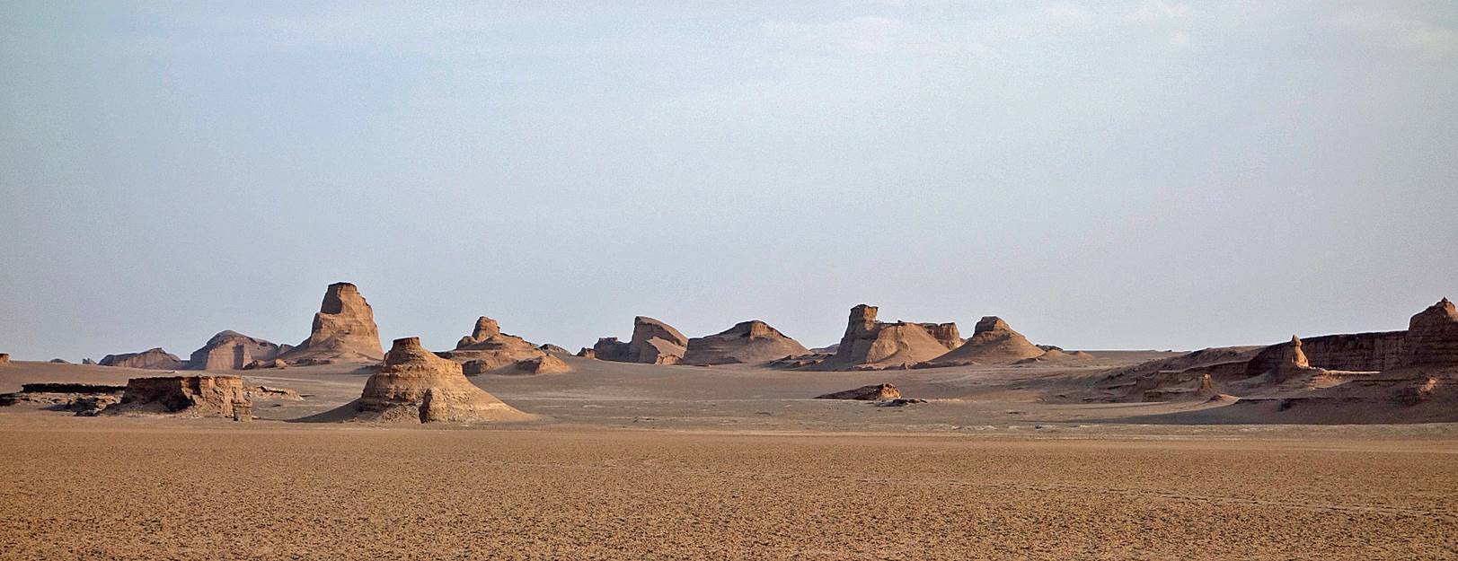
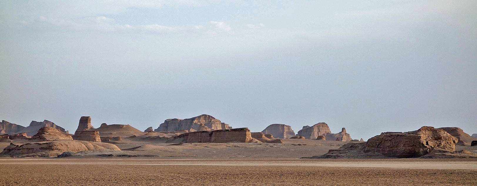
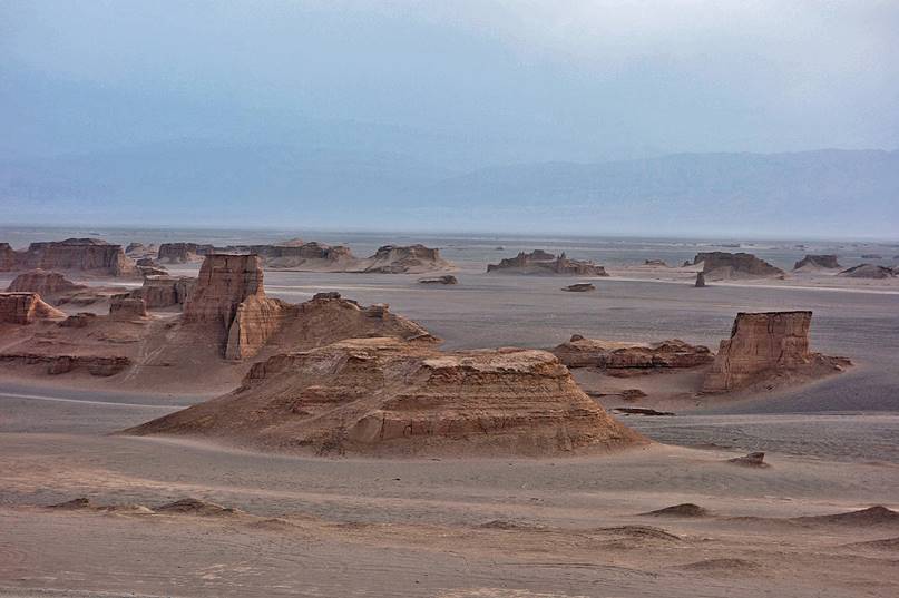
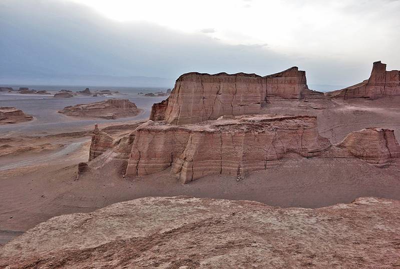
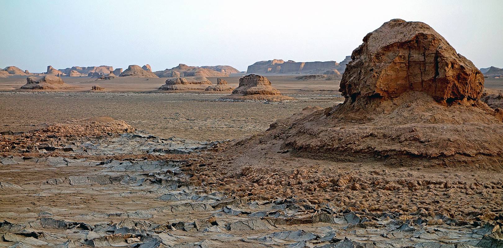
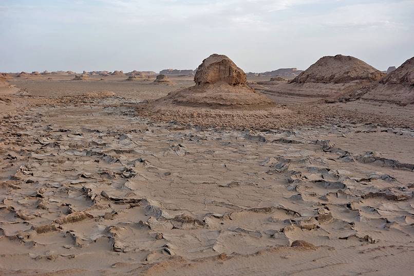
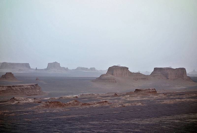
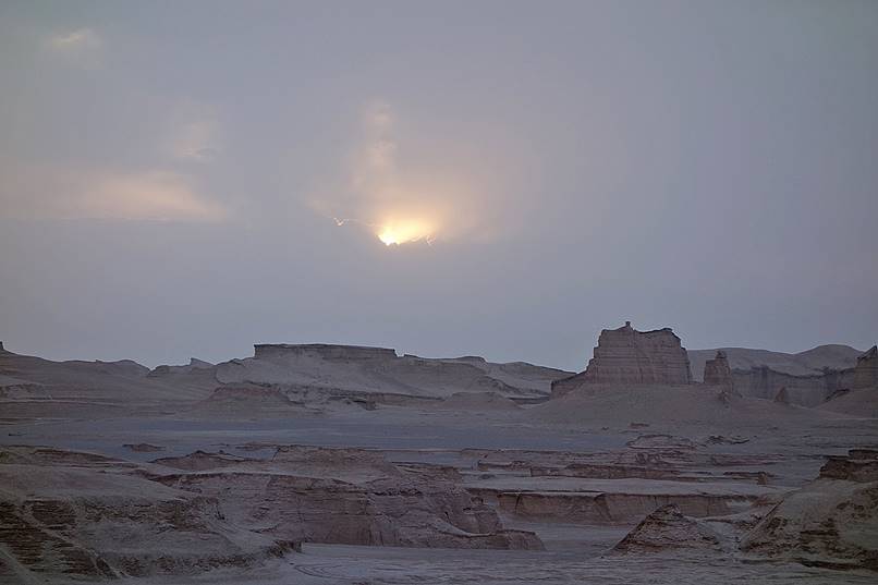
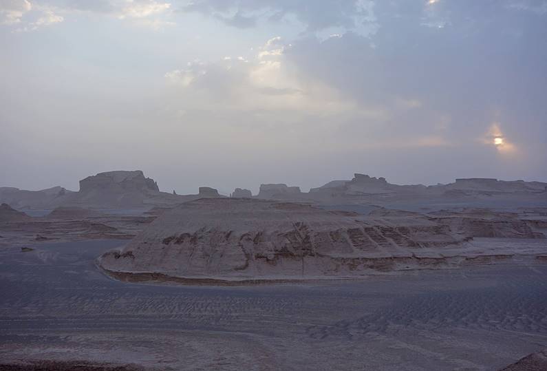
The Kaluts (high natural sand castle formations) a few kilometers north of the village of Shafi Abad. Some pictures were taken in the evening, others at sun rise.
|
|
|
|
|
|
|
|
|
![]()
|
Click the following links to see photos of other parts of the trip: - Tehran, - Qazvin, - Abyaneh, |
|
|
|