Kyrgystan, 1998: Ala Archa, Terskey
Ala-Too, Tian-Shan, Khan Tengri
|
|
|
|

(This banner
alternates two pictures. One shows the central area of the Kyrgyz flag: a red
field with a yellow sun containing a stylized representation of the tunduk (the top of a Kyrgyz yurt). The other picture shows
a statue of Manas, the legendary Kyrgyz hero.)
Return to my mountaineering/trekking/travel webpage
I went to
Kyrgyzstan in July 1998, with Kathy Cosley, Mark Houston, and Mike Christianson to trek and
climb in the Tian Shan mountains. I first did a small trek alone in Ala Archa National Park, which is close to Kyrgyzstan's
capital, Bishkek. Next we went altogether on an acclimatization trek in the Terskey Ala-Too mountains (just
south of Karakol and Lake Issyk-kul).
Finally we went to the far-East of Kyrgyzstan to climb Khan Tengri
(6995m, or 7010m with its glacial cap).
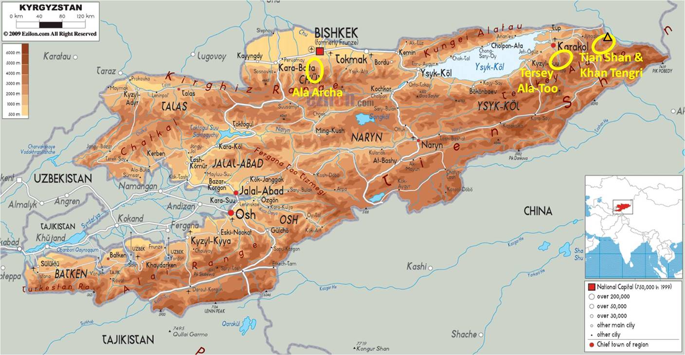
Map of
Kyrgyzstan, with the three visited areas marked in yellow. See here
for a more recent trip (2011) in the Tersey Ala-Too.
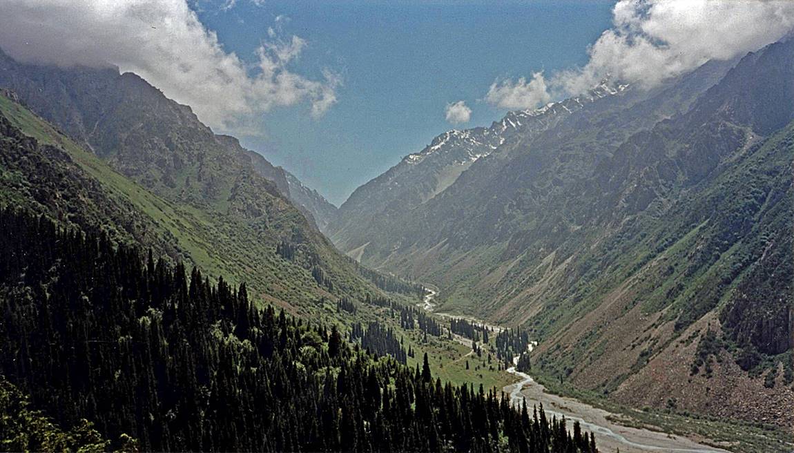
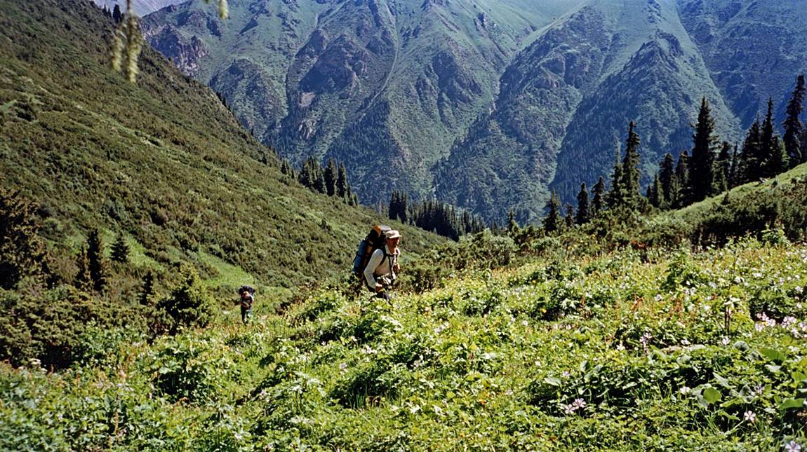
Ala Archa:
General view of the Ala Archa Canyon.
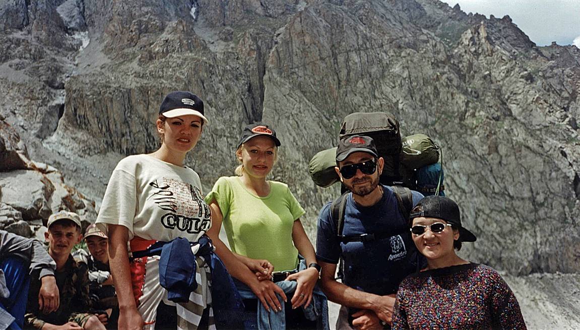
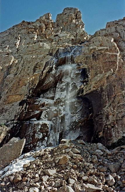
Left: nice encounter near the Ratsek refuge. Right: waterfall on the way to the refuge.
|
|
|
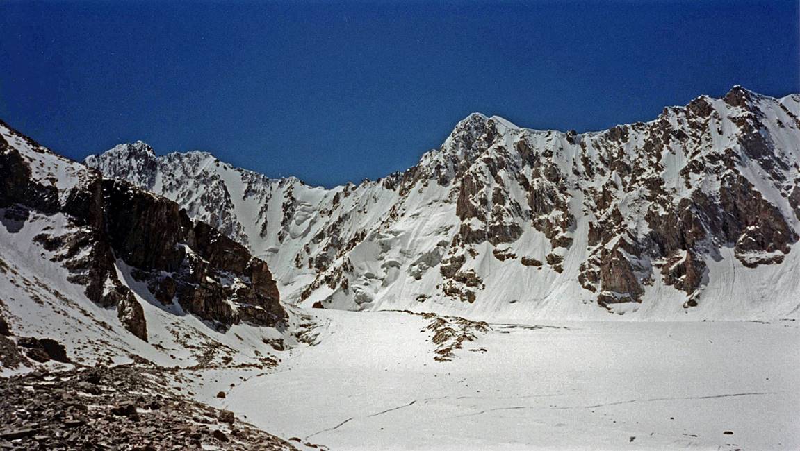
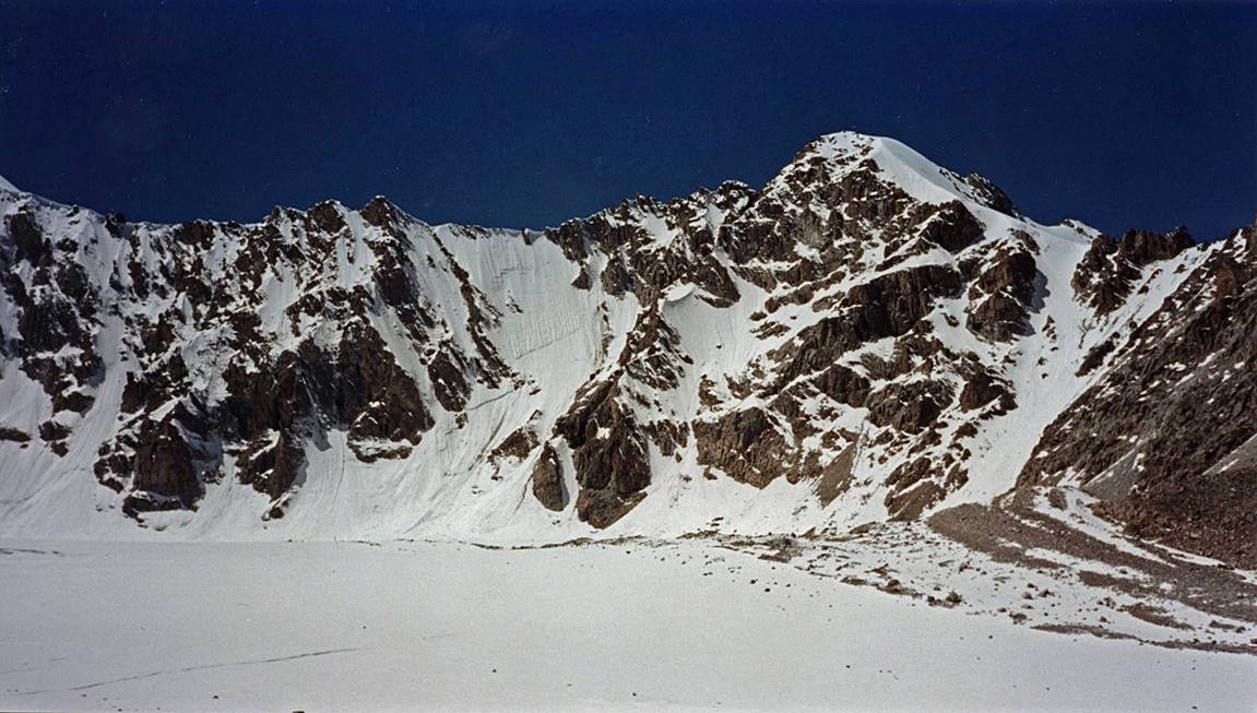
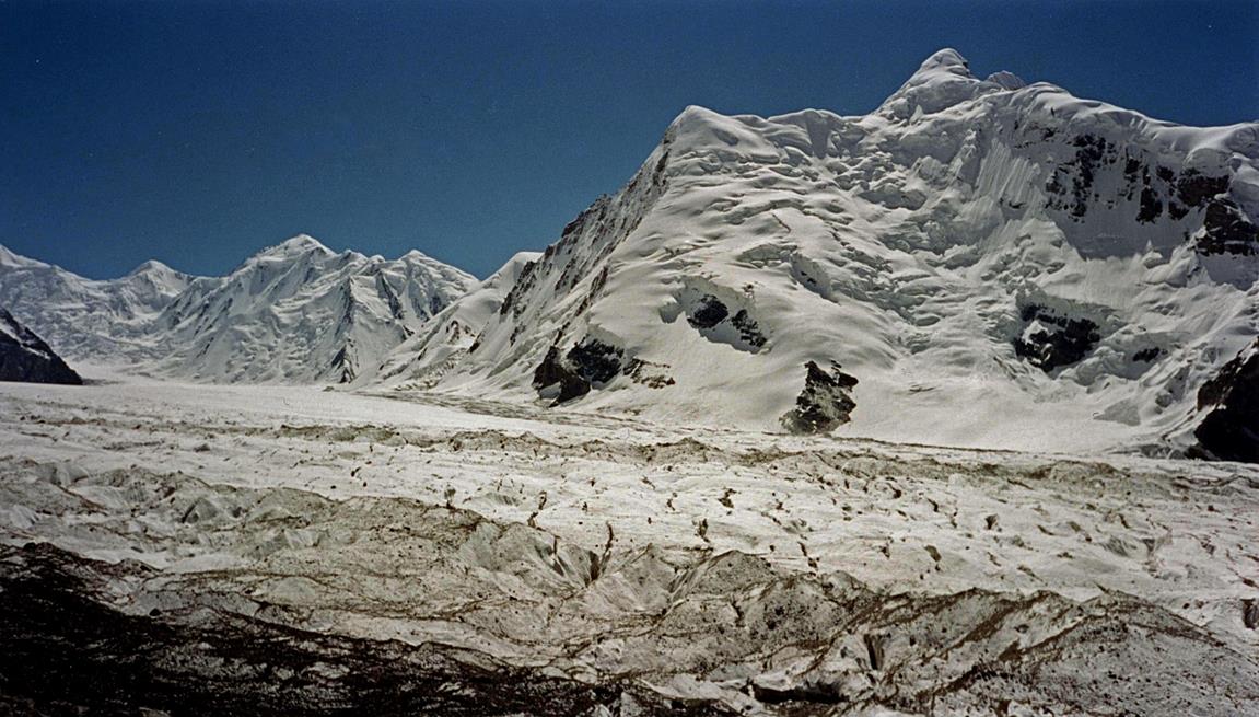
Aksay glacier dominated by several high
peaks, including Box (4250m), Teketor (4441m), Svobodnaya (4740m), and Korona (4860m).

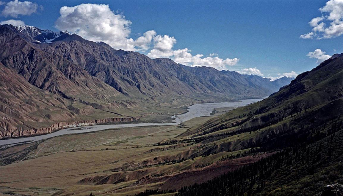
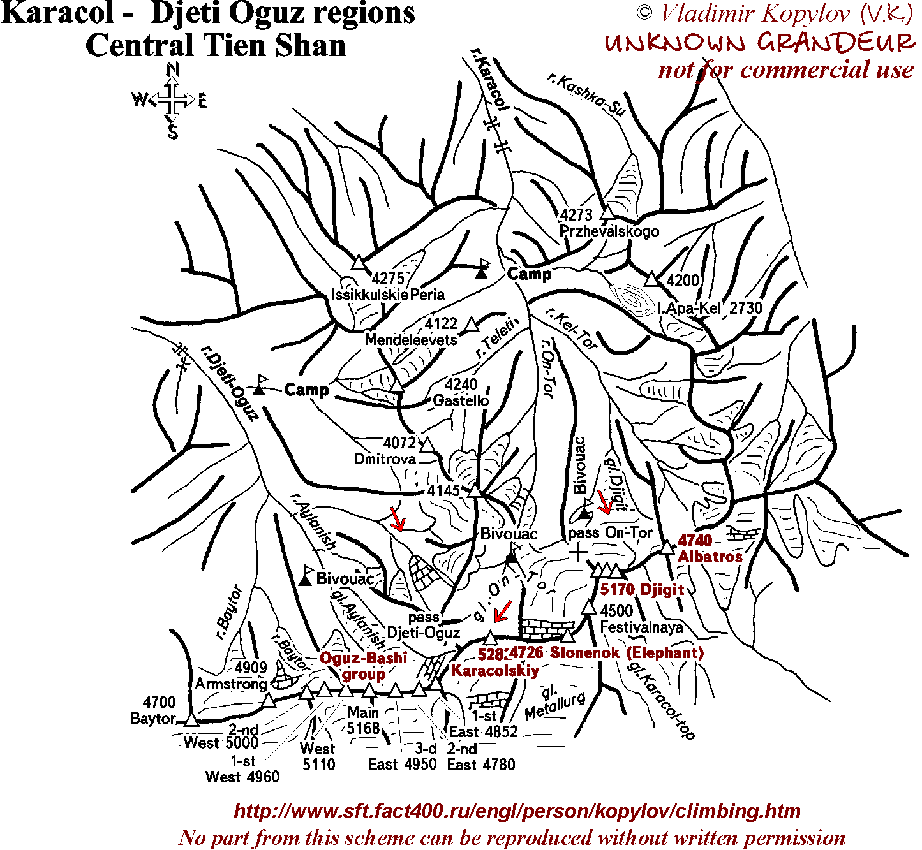
Terkeu Ala-Too:
Terskey Ala-Too is a subrange of the Tian Shan,
with several peaks above 5000m. We trekked for 5 days from Altyn
Arashan to Jeti-Oghuz (see map1
and map2)
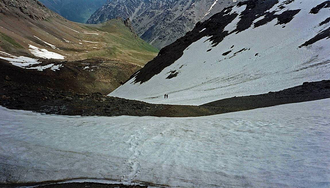
through Ala-Kol pass (3860m), Ala-Kol
lake, and Teleti pass
(3800m). The scenery is much like in the European Alps, without towns and
roads, and with very few hikers (in 1998).
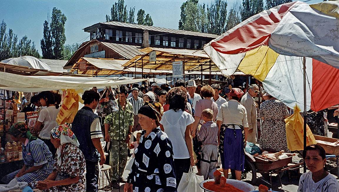
Market scene in Karakol.
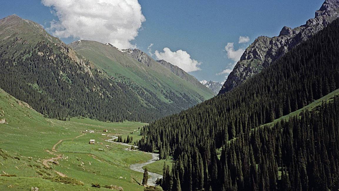
In the valley of the Arashan river.
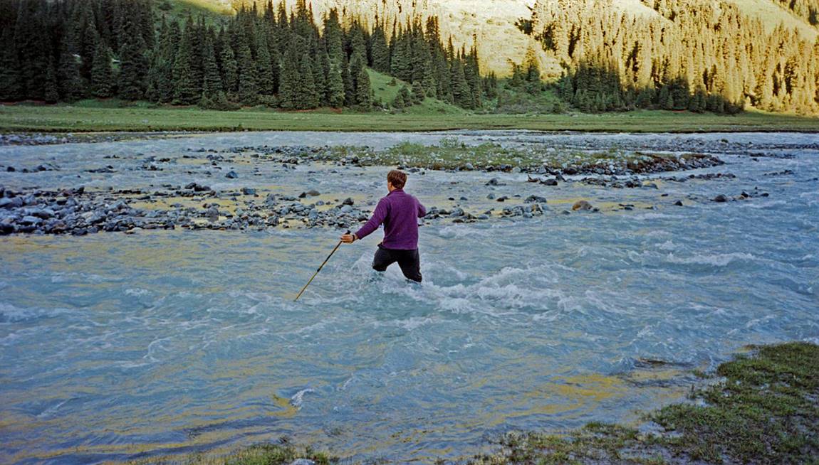
Mark fording the Arashan river.
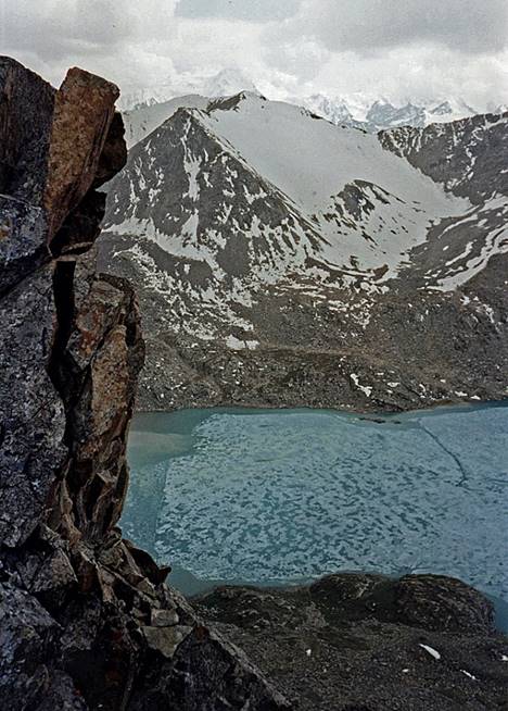
View of Ala-Kol lake from Ala-Kol pass (photo
on the left) and during the descent from the pass (photo on the right).
|
|
|
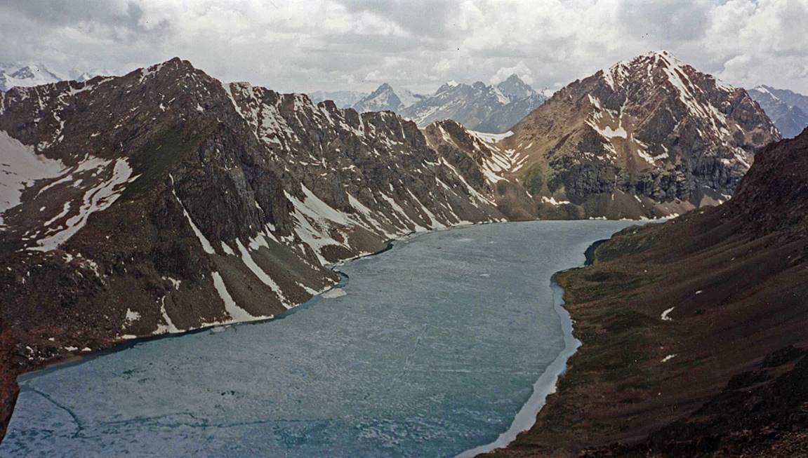
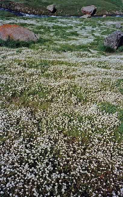
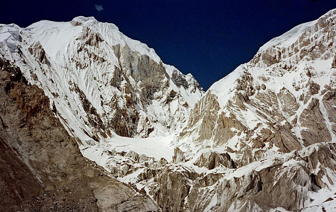
Left: another view of Ala-Kol lake. Right: the canyon below Ala-Kol
lake seen from the lake′s outlet.
|
|
|

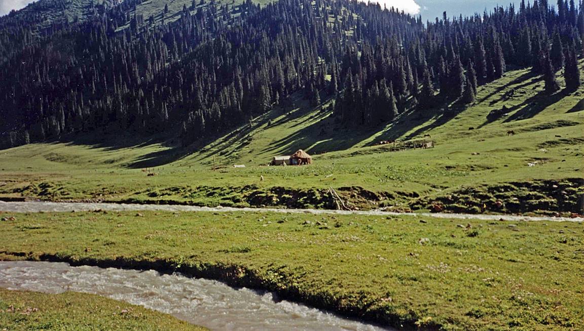
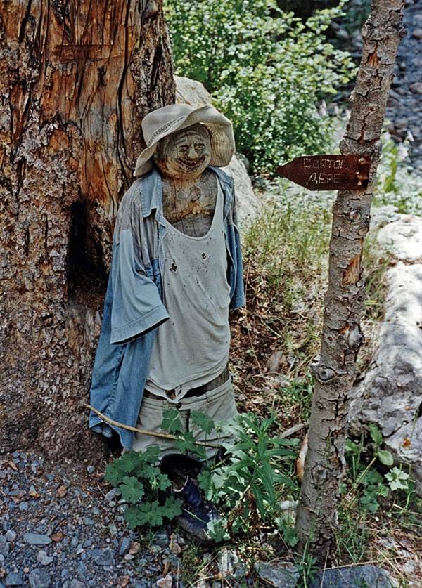
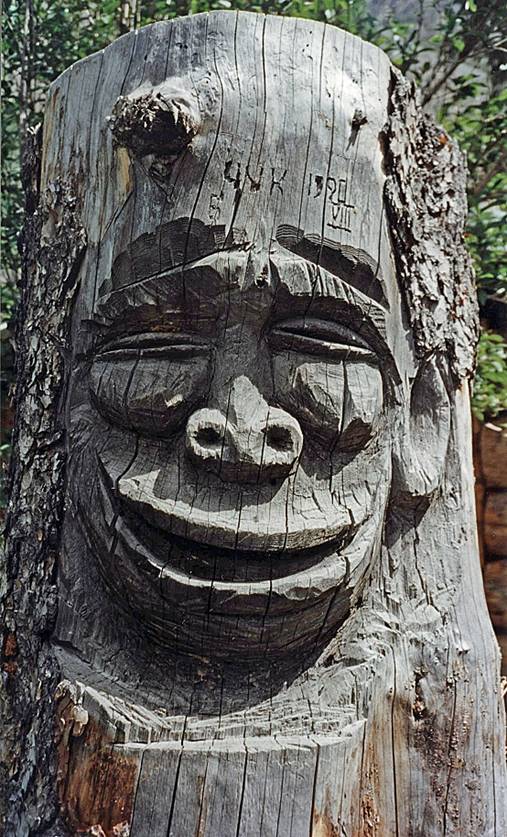
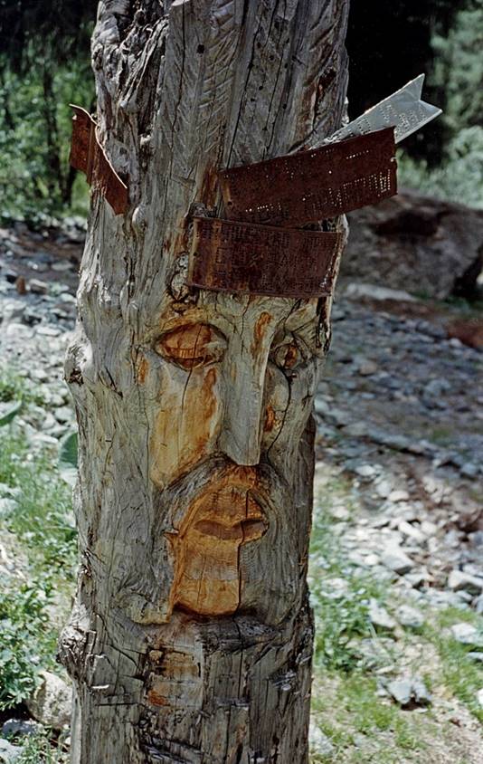
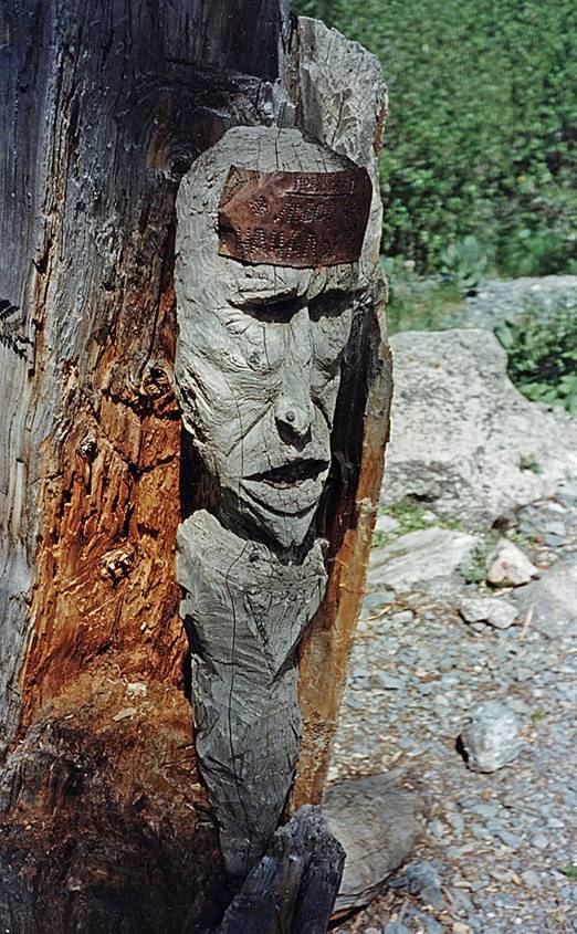
Me at a hut below Ala-Kol lake, near Karakol river.
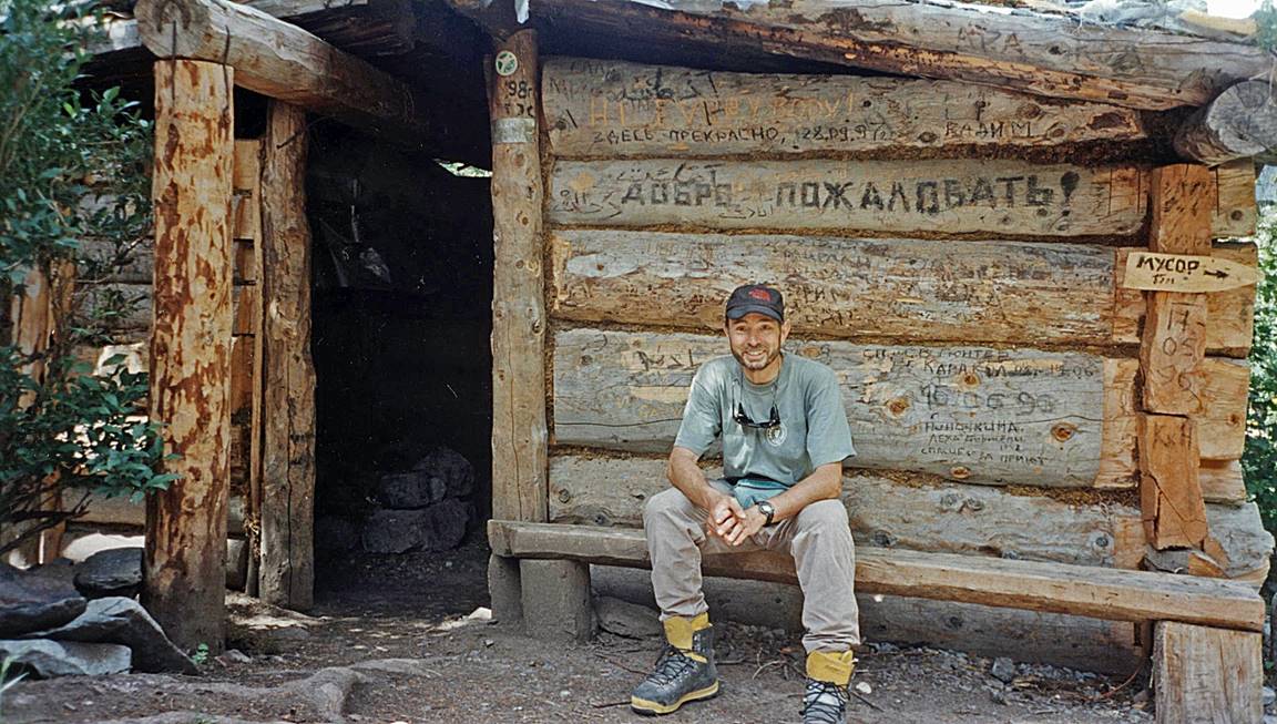
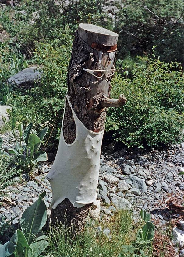
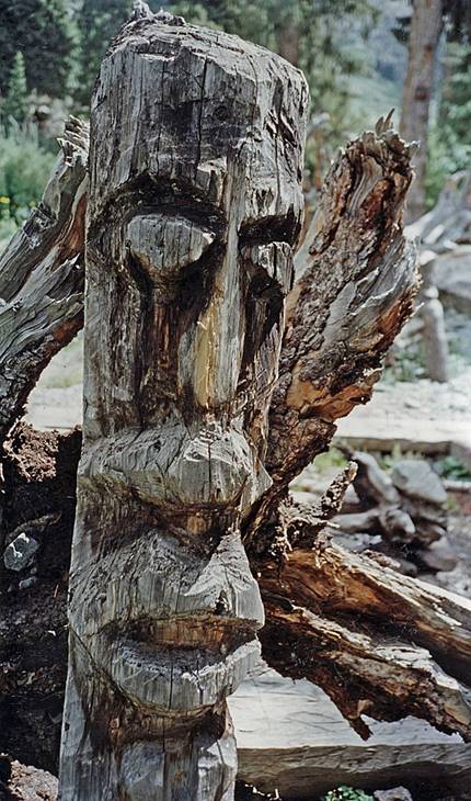
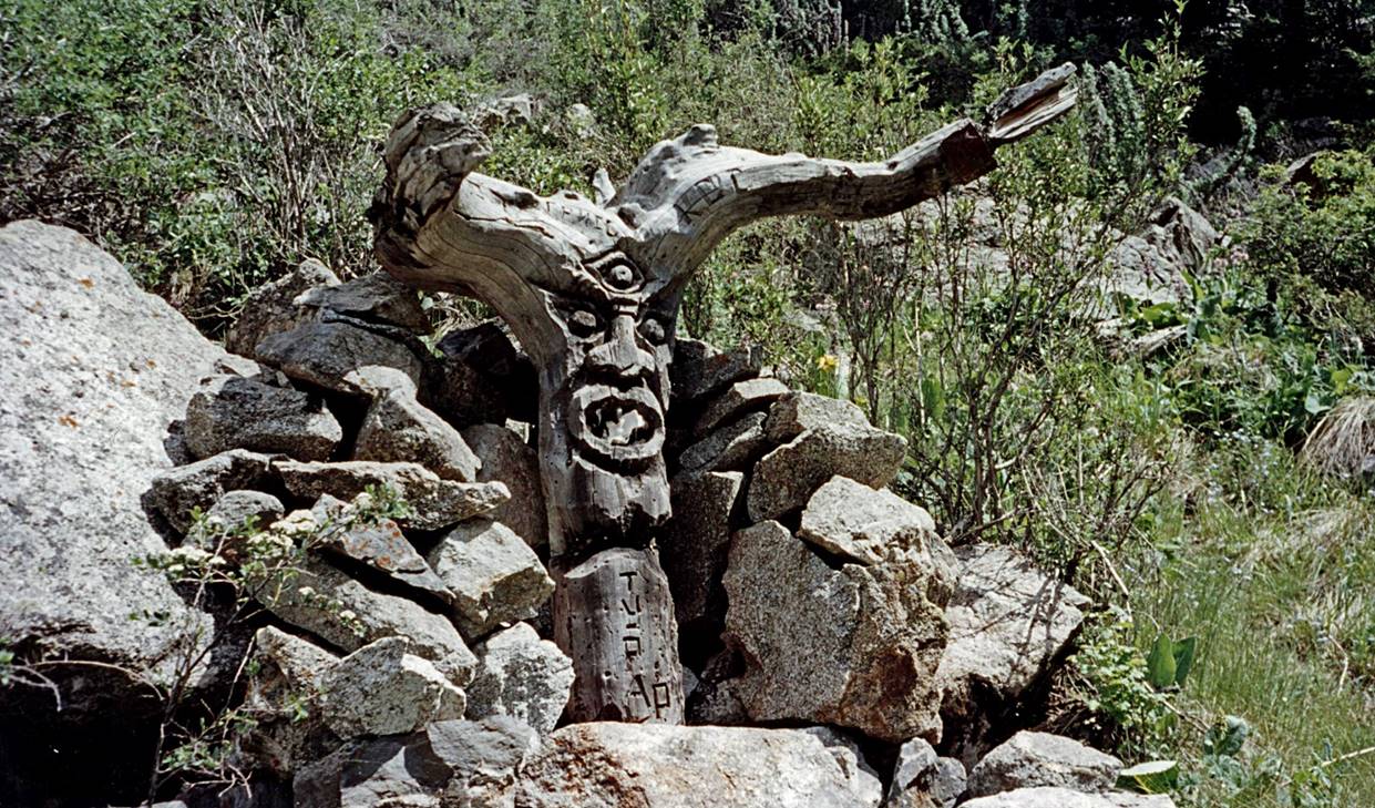
Wood sculptures around this hut. I guess
that people made them during bad weather. If this is true, it says a lot about
the local weather.
|
|
|
|

|
|
|
|
|
|
|
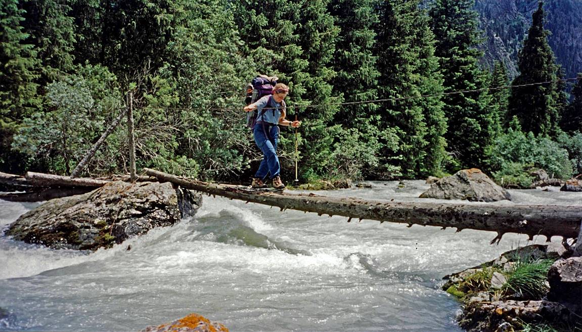
Kathy crossing Karakol river.
Climbing toward Teleti
pass.
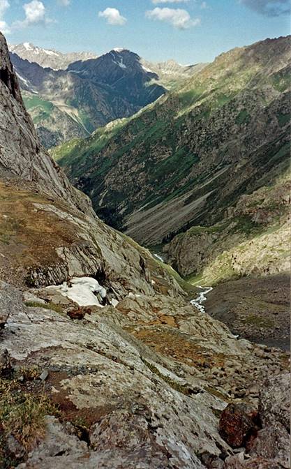
View from Teleti pass.
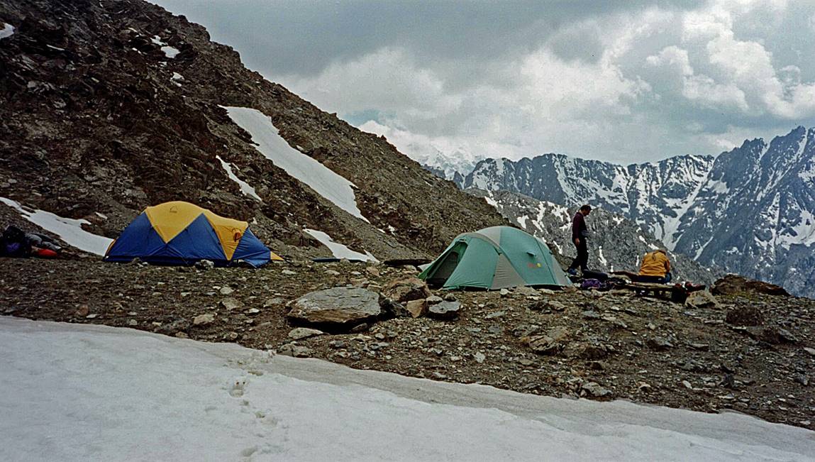
Our camp below Teleti
pass.
Along the Jeti-Oghuz
river.
|
|
|

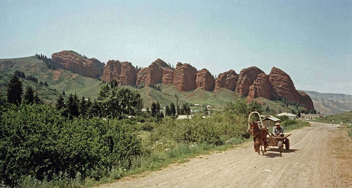
Red sandstone formations at the end of the Jeti-Oghuz valley.
Tian Shan and Khan Tengri:
The Tian Shan (Celestial Mountains) is a
2000-km long and 400-km wide mountain range. About two thirds lie in Kyrgyzstan
(the rest lying in Kazakhstan and Xinjiang). The two highest peaks are Peak
Pobeda (7439m) and Khan Tengri (6995m, or 7010m
with its glacial cap). Khan Tengri (see map below) is located at the border between
Kyrgyzstan and Kazakhstan, less than 5 km away from Xinjiang, between the south
branch (Kyrgyzstan) and the north branch (Kazakhstan) of the Inylchek glacier. The south branch of the Inylchek glacier is 60-km long.
A truck took us from Karakol
to Maidadyr Camp (Russian military camp in 1998) at
the base of the Inylchek glacier, west of Khan Tengri. From there, a helicopter of Kyrgyz Airlines flew us
to base camp. We arrived at the base camp of Khan Tengri
on July 11. We spent 14 days on the mountain, but only got 2 days of excellent
weather. We spent 4 days and 4 nights at Camp 3, with almost continuously bad
weather. We had to leave without even trying to summit, in order to catch our
return flight to the US from Almaty (Kazakhstan). A few hours after our
descent, the route was swept by an avalanche that destroyed several tents at
Camp 2.
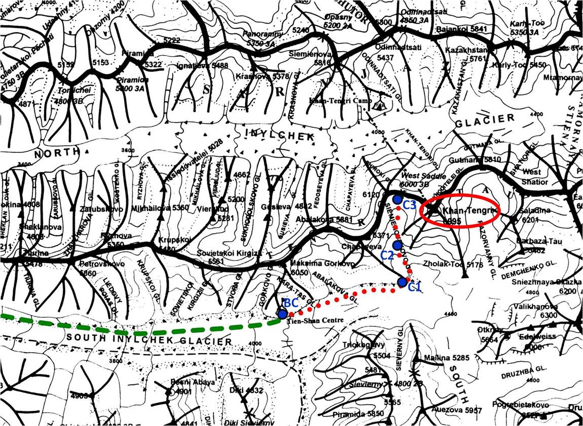
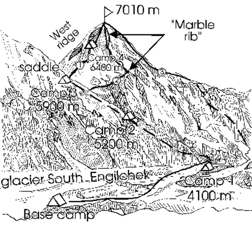
Left: Map showing the location of Khan Tengri between the two branches of the Inylchek
glacier. Green dashed line: travel by helicopter. Red dotted line: our climbing
route. Blue dots: camp locations. Right: Climbing routes on the South face of
Khan Tengri.
|
|
|
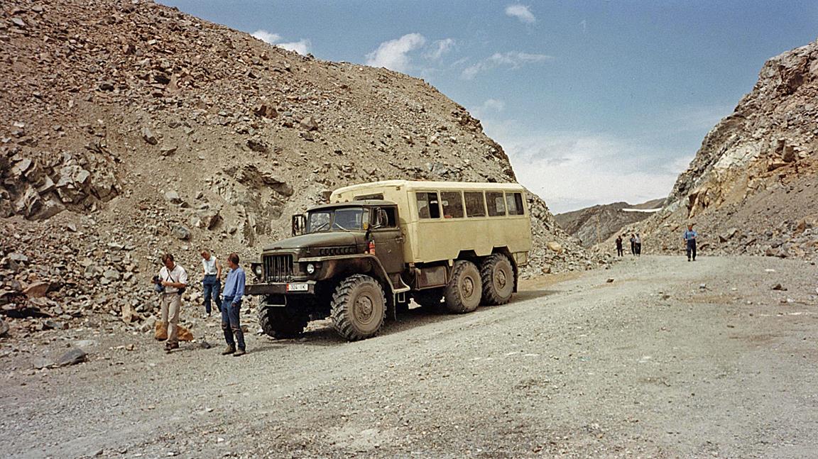
Our truck in Karakol.
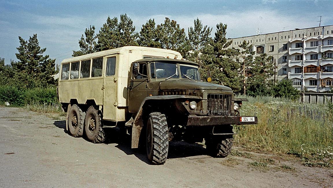
Our truck on the road between Karakol and Maidadyr Camp (from
left to right: Mark, Kathy, and Mike).
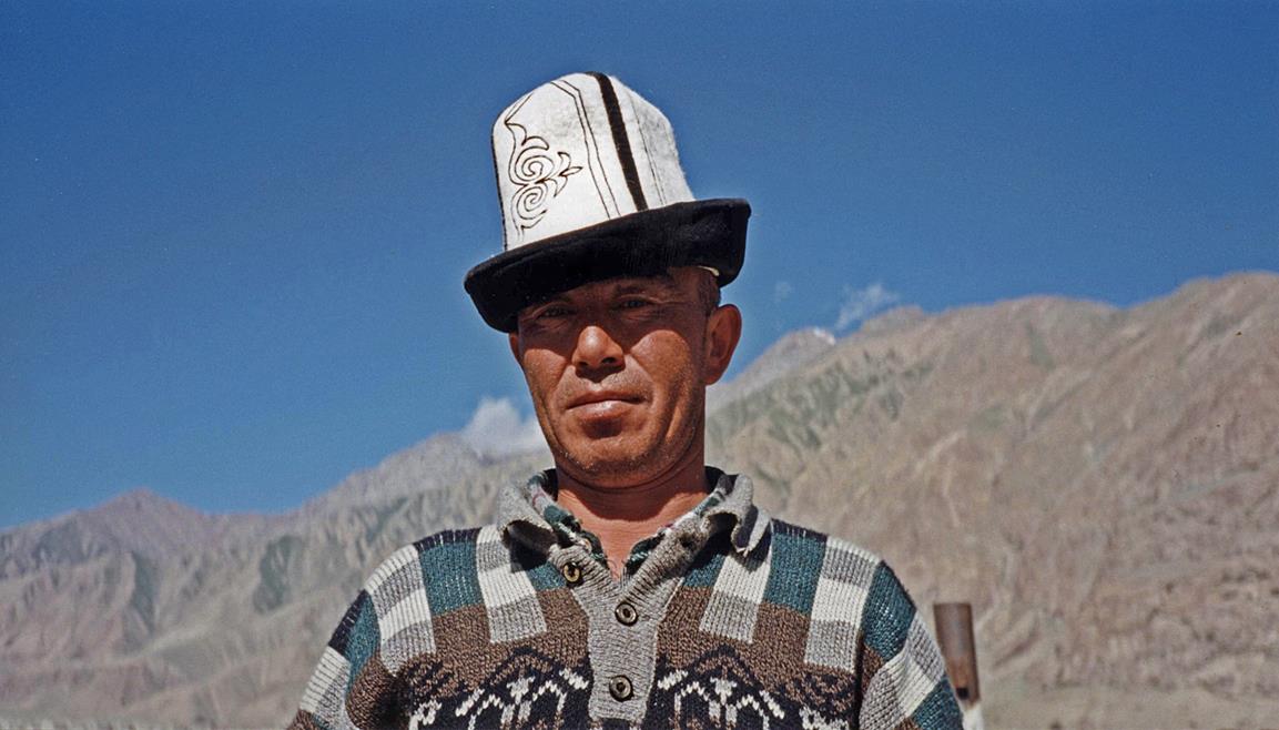
Kyrghyz man near Maidadyr
Camp with traditional Kyrgyz hat.
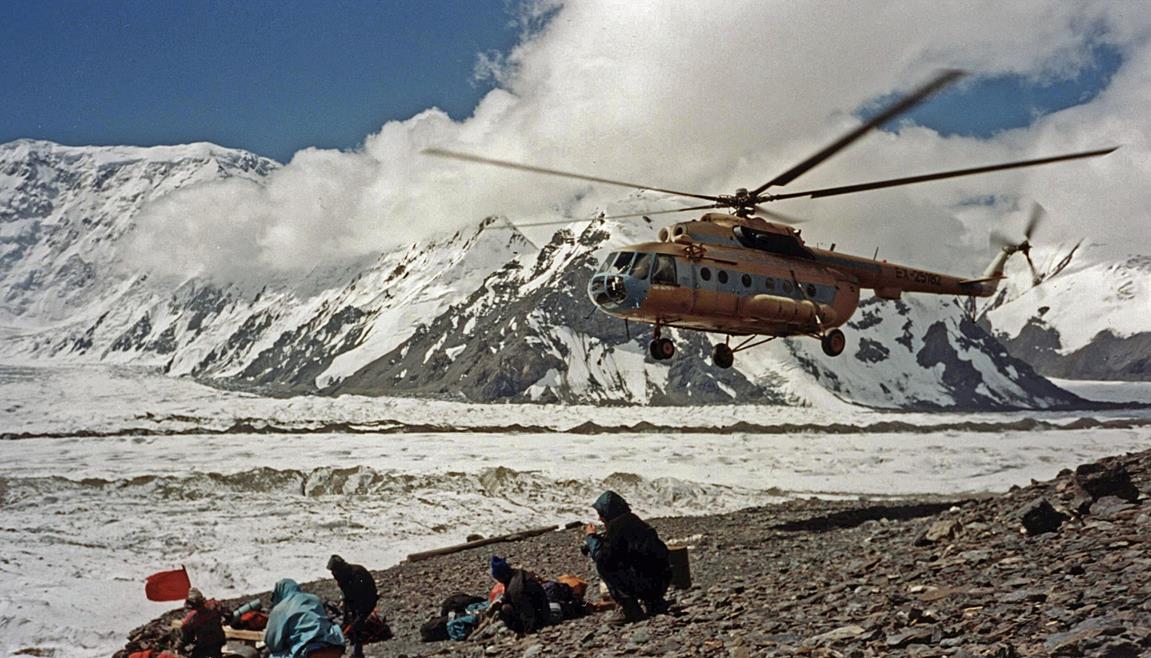
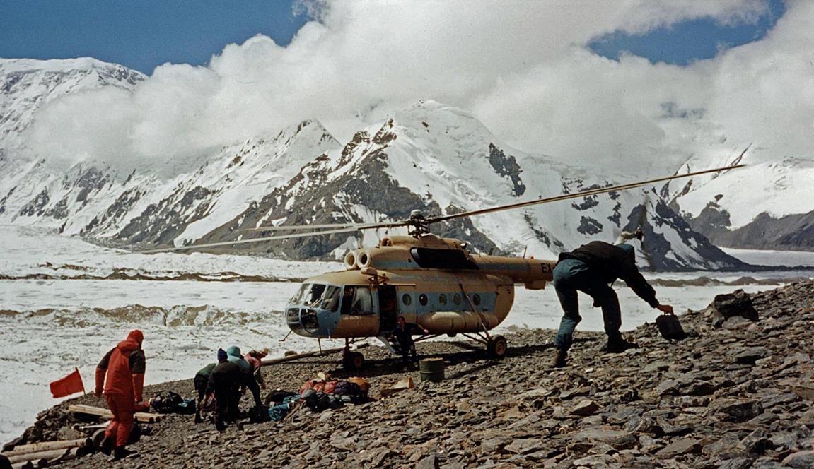
Inylchek river at Maidadyr Camp. A helicopter flied us from here to the base camp
of Khan Tengri on the south branch of the Inylchek glacier.
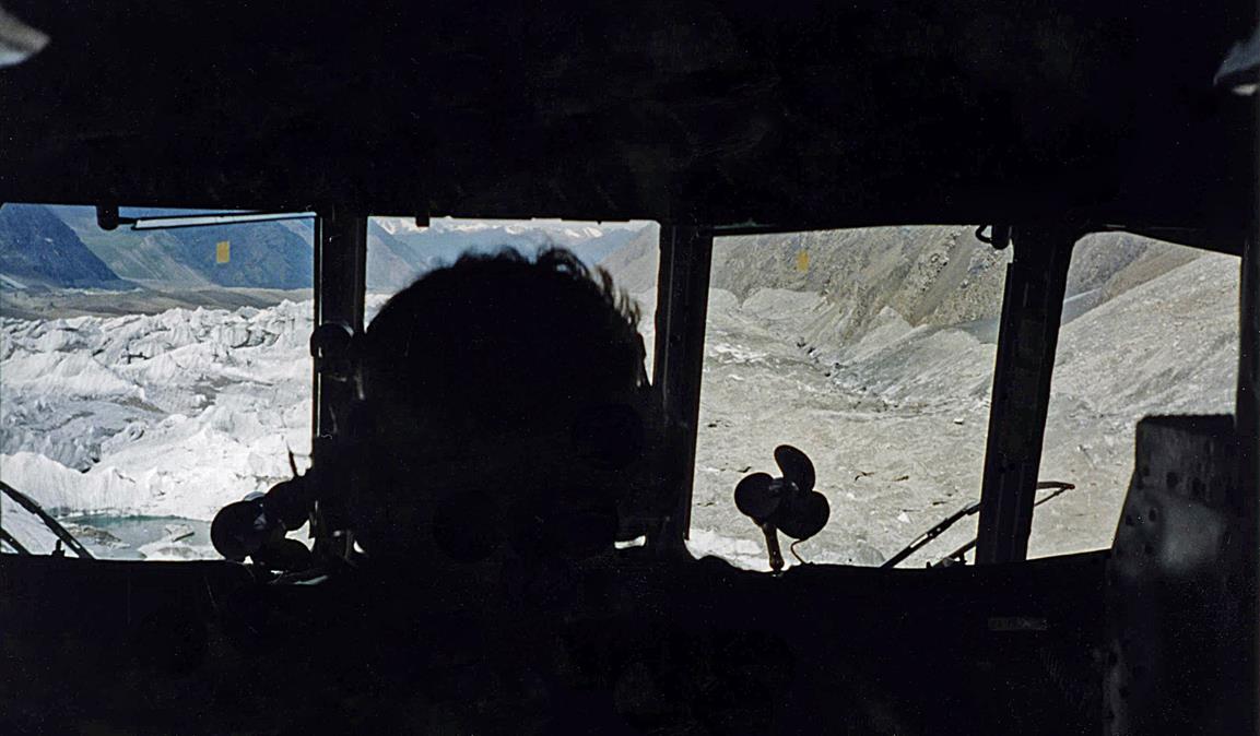
View from the helicopter over the south
branch of the Inylchek glacier during the flight to
base camp. For the entire trip the helicopter was flying low above the glacier.
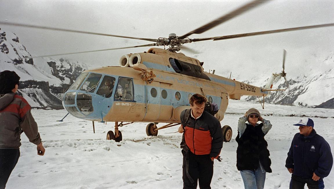
For safety, the helicopter first landed
on a flat area of the Inylchek glacier not far from
base camp to unload its passengers. Then it took off to land again at a more
precarious spot very close to base camp and unload boxes and bags.
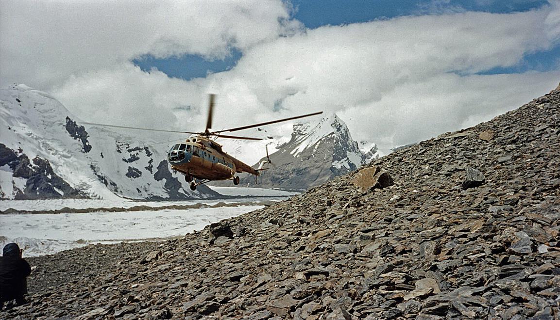
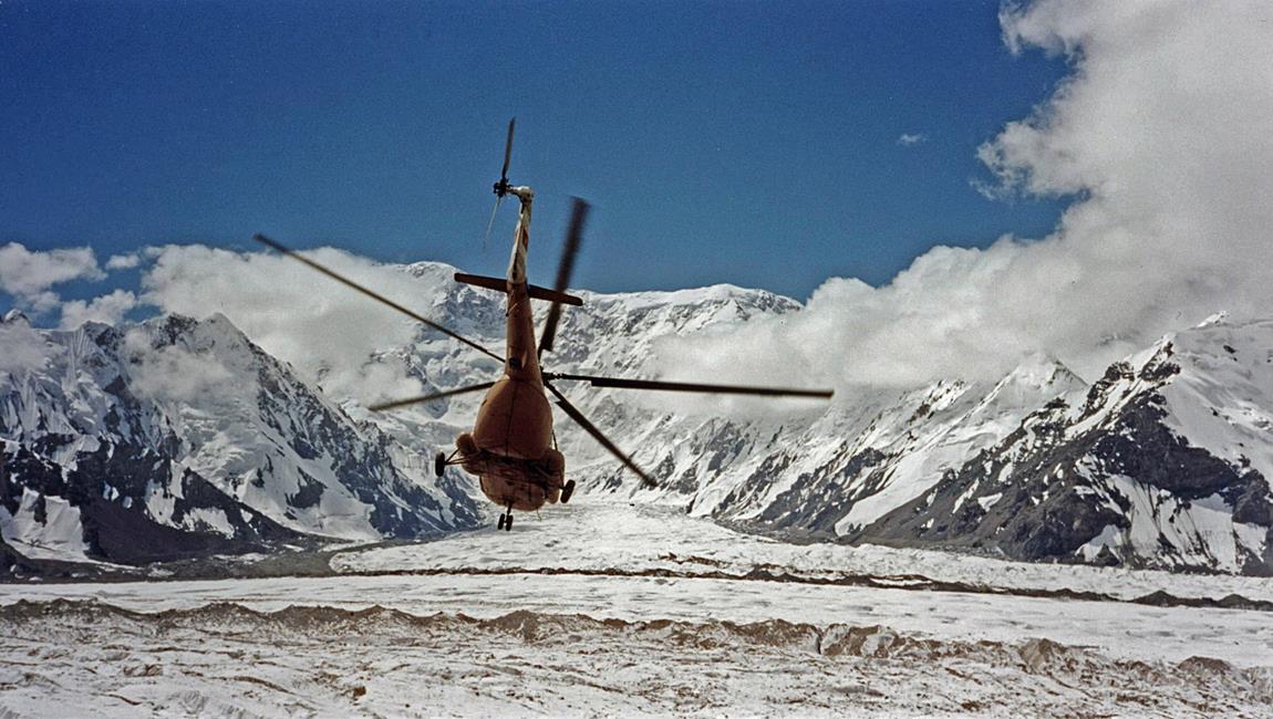
The helicopter taking off to return to Maidadyr Camp. Peak Podeba
(7439m), the highest peak in Kyrgyzstan, whose official Kyrgyz name is Jengish Chkusu, is visible on the
left of the tail of the helicopter. It is about 15km south of base camp.
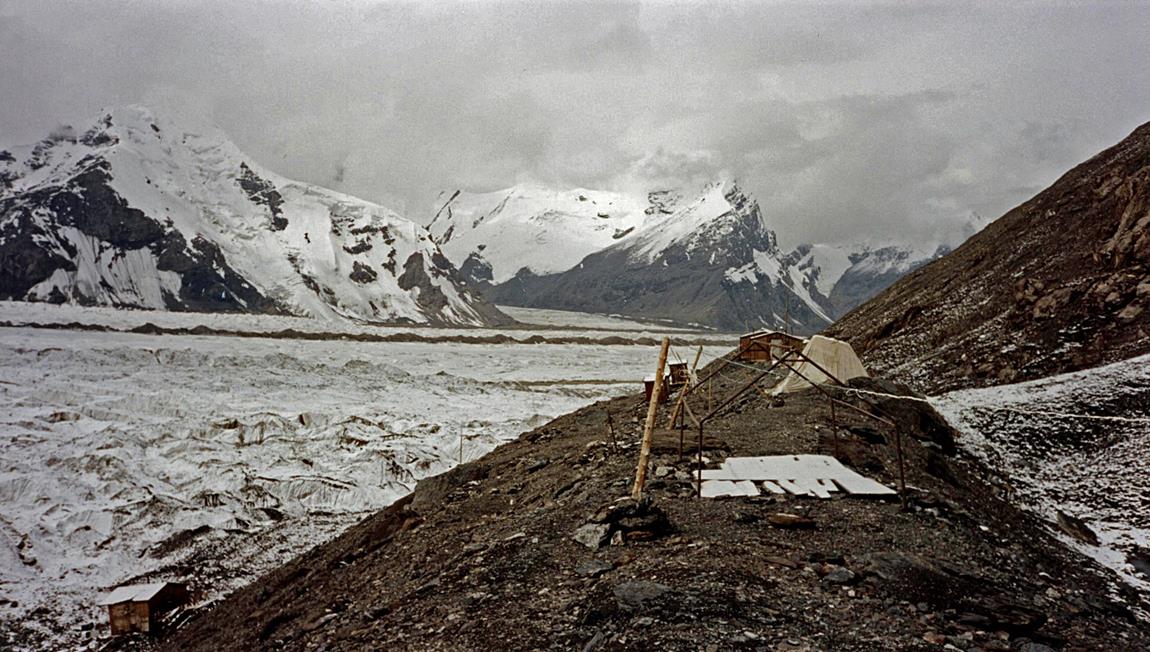
Base camp at 4000m on a moraine on the
northern side of the south branch of the Inylchek
glacier. In 1998, the camp consisted of some tents, a few wood cabins in very
bad shape, a kitchen/dining room, and a working sauna, all built when
Kyrgyzstan was part of the Soviet Union.
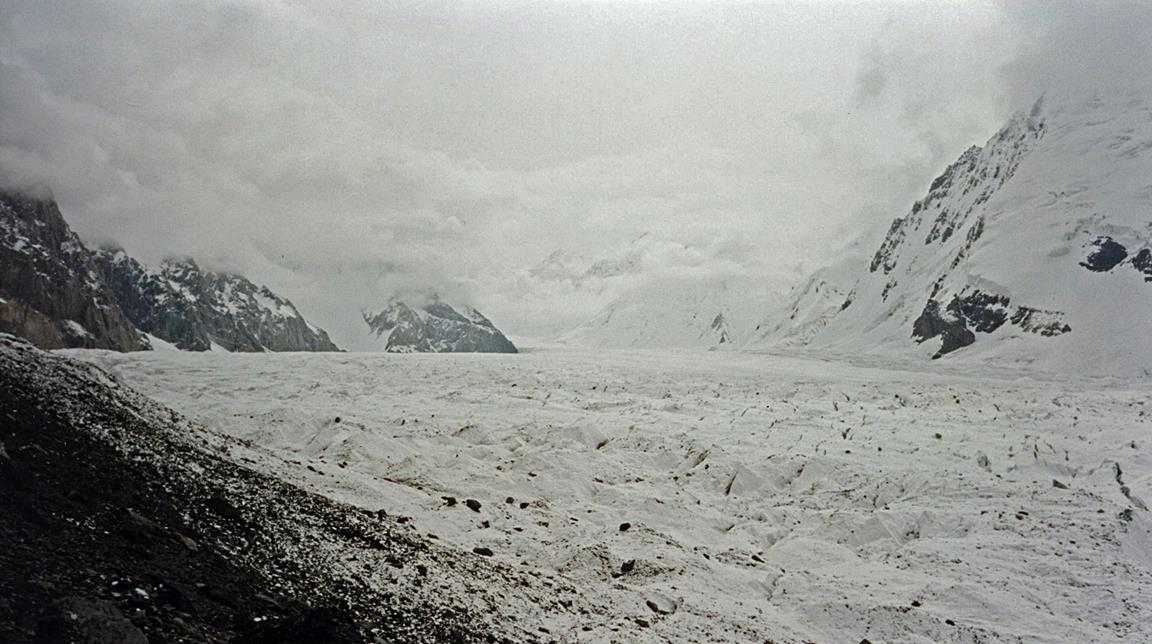
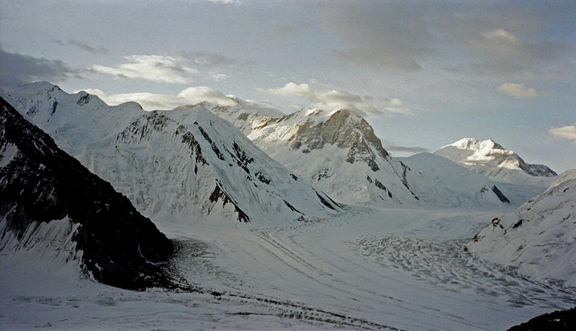
The Inylchek
glacier seen from base camp (view toward the east).
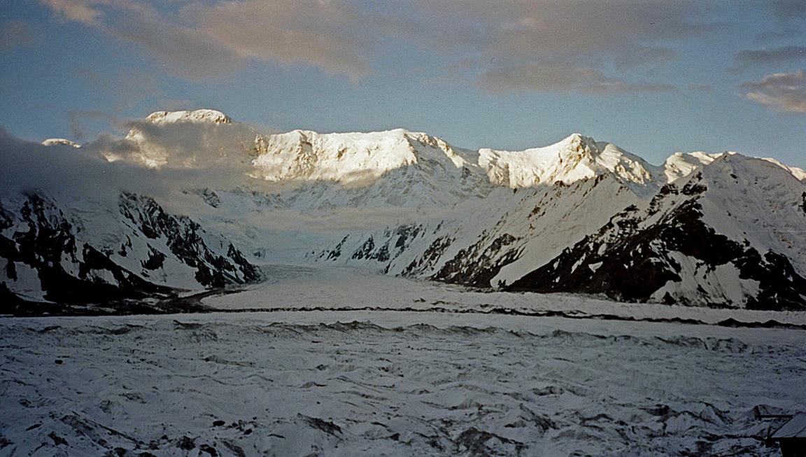
Peak Podeba
seen from base camp with the Inylchek glacier in the foreground.
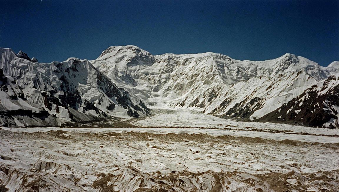
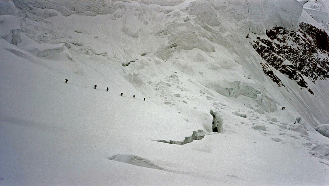
On the Inylchek
glacier between BC and Camp 1.
View from the Inylchek
glacier.
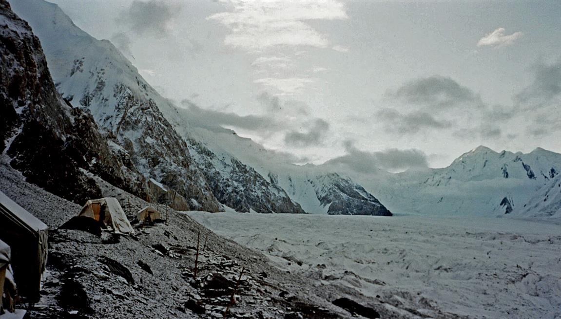
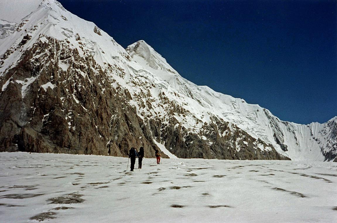
Our Camp 1 at 4100m below the Semenovskogo glacier.
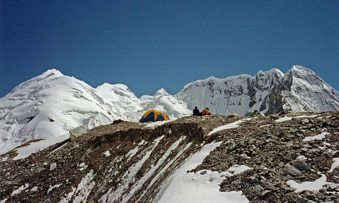
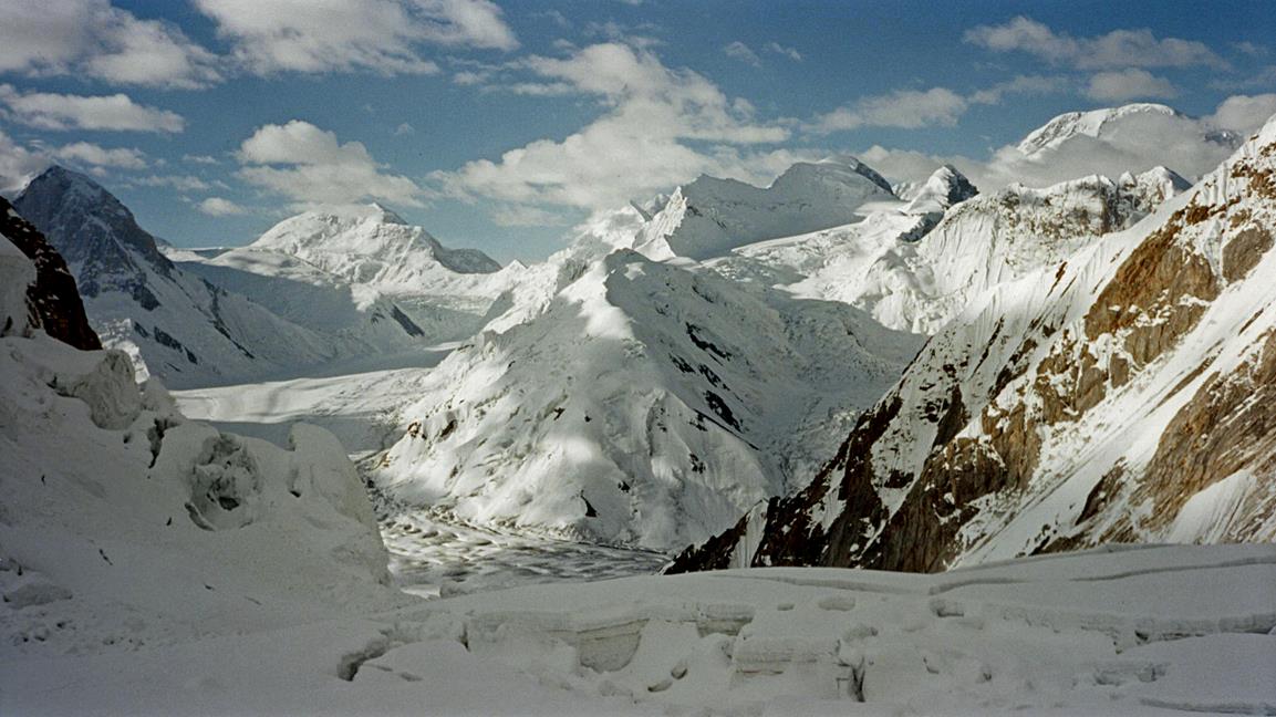
Views between Camps 1 and 2.
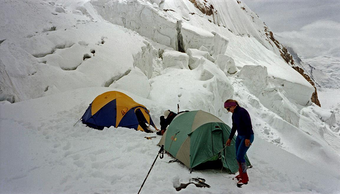
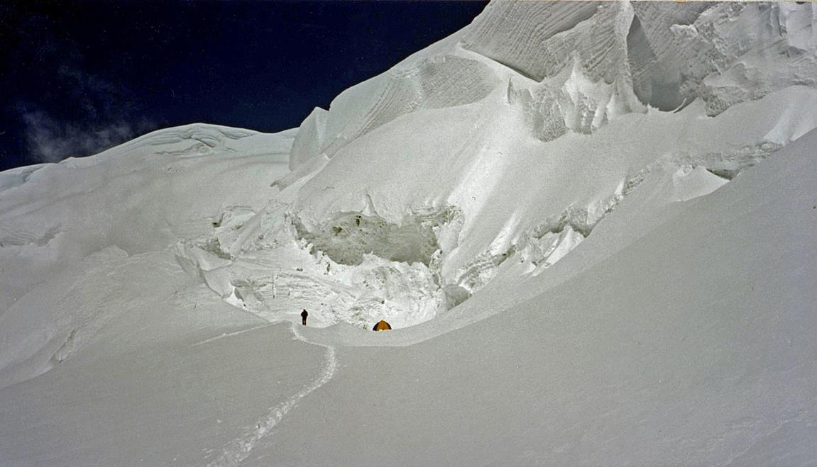
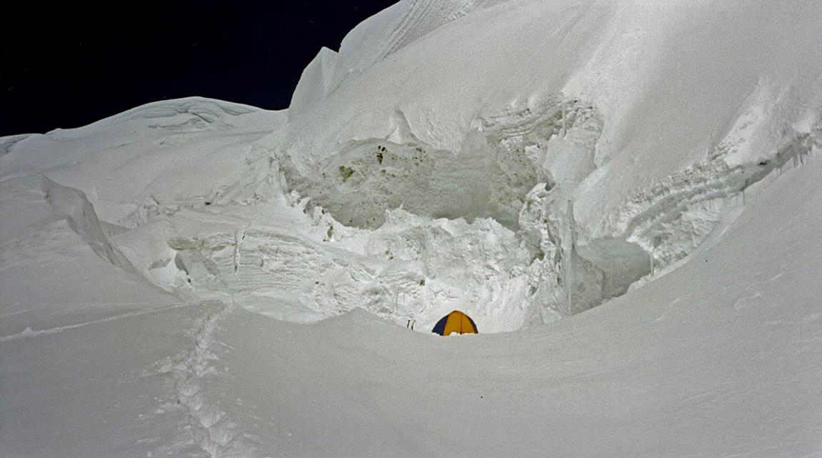
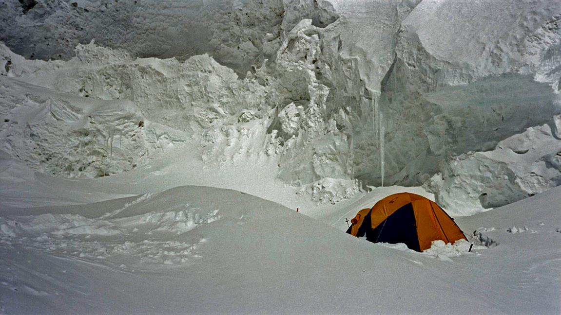
Camp 2 at 4900m nested between
crevasses, on the Semenovskogo glacier.
|
|
|
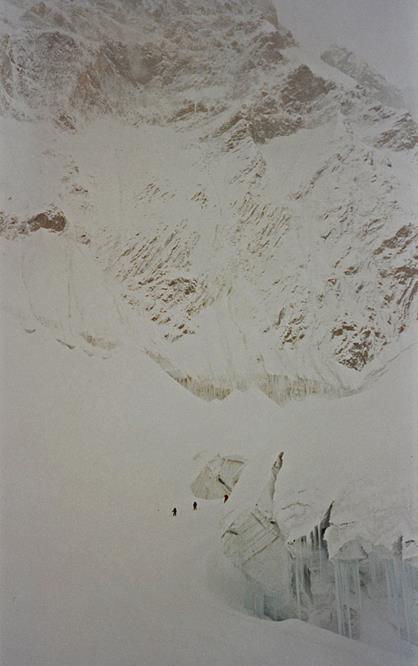
Three Spanish climbers in the mist just
above Camp 2.
|
|
|

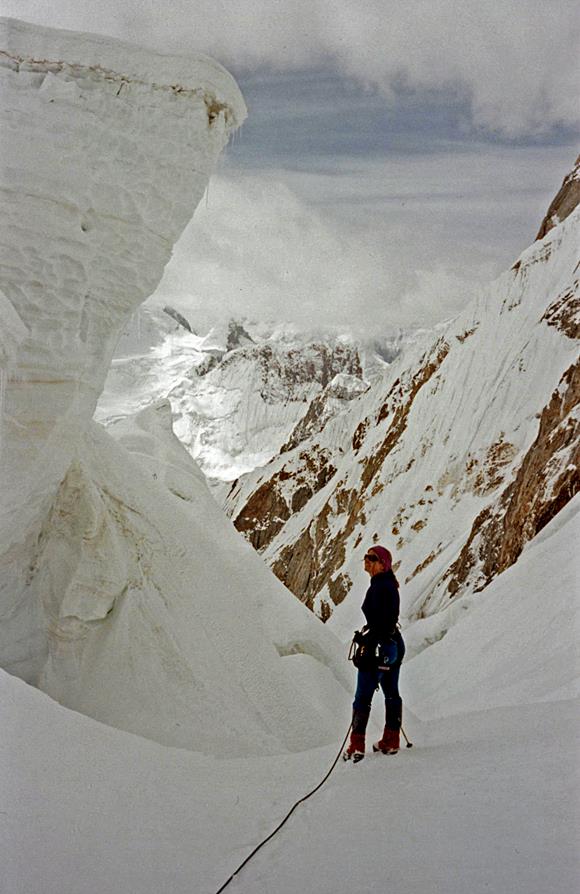
Left: Kathy among seracs
between Camps 2 and 3. Right: Snow/ice blocks in precarious equilibrium.
|
|
|
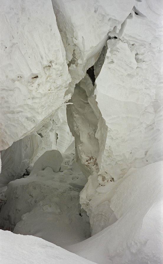
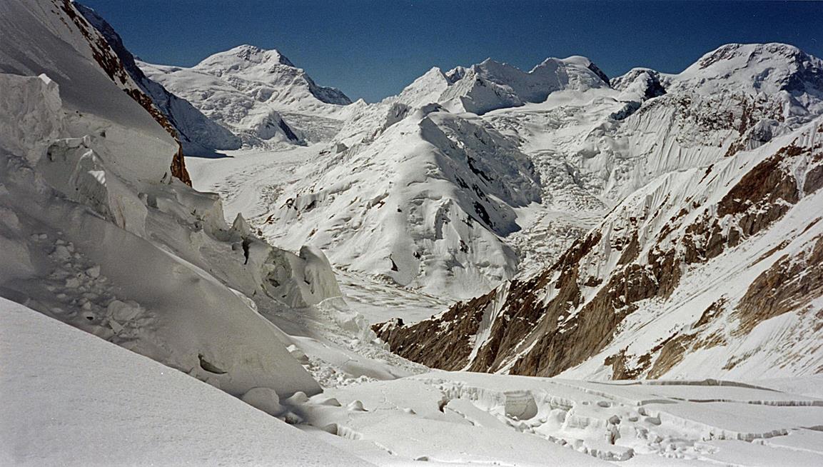
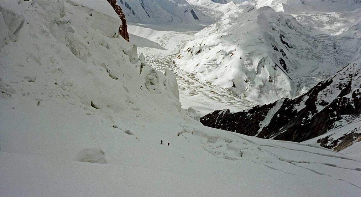
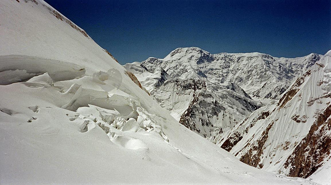
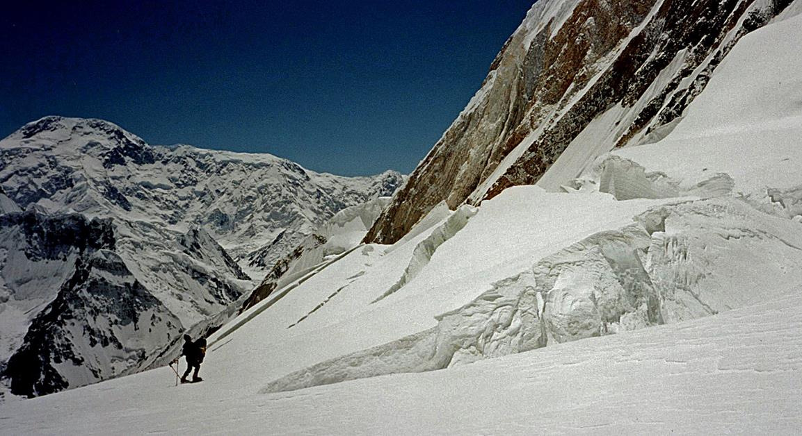
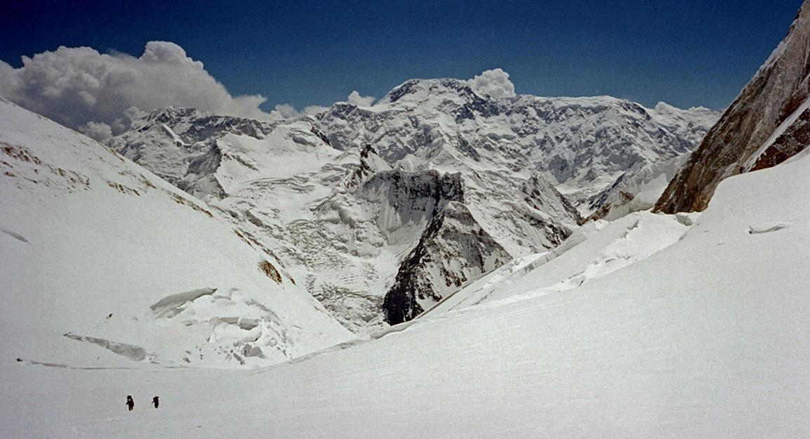
Successive views looking downward while
climbing on the Semenovskogo glacier. The Inylchek glacier progressively gets out of sight. (Some of
these pictures were taken during our ascent, others during our descent.)
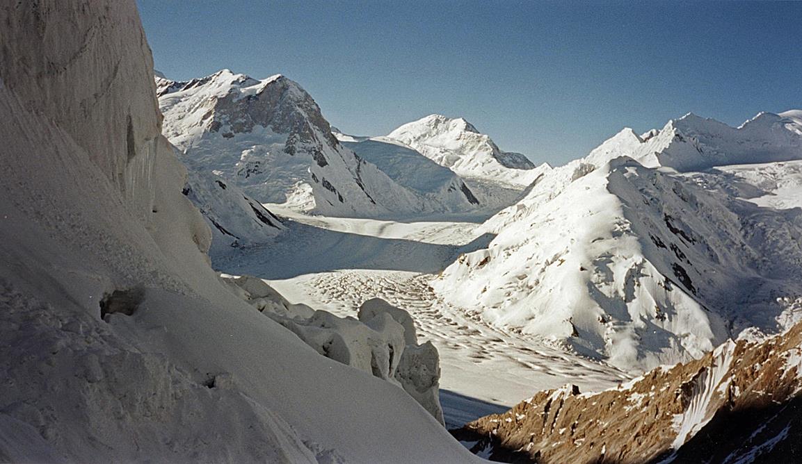
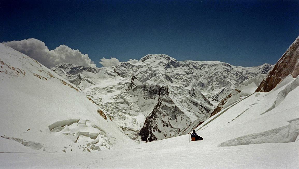
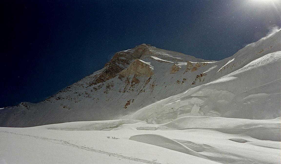
View of Khan Tengri
from the upper part of the Semenovskogo glacier.
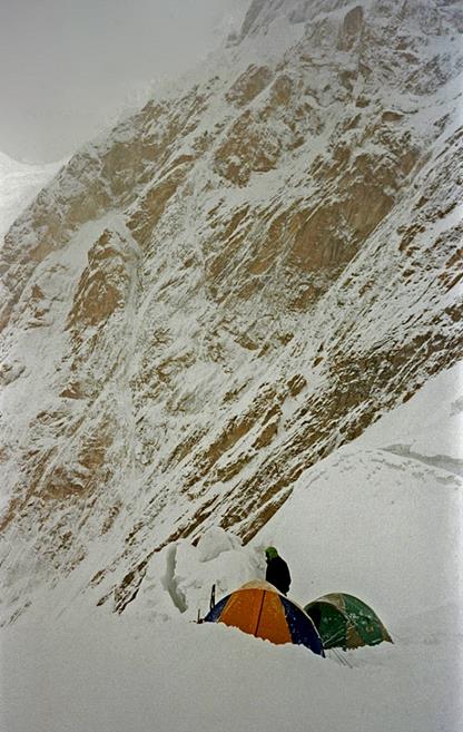
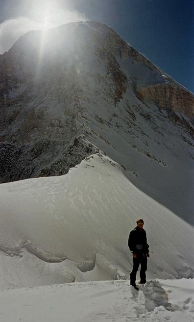
Camp 3 at 5900m at the saddle on the
west side of the summit.
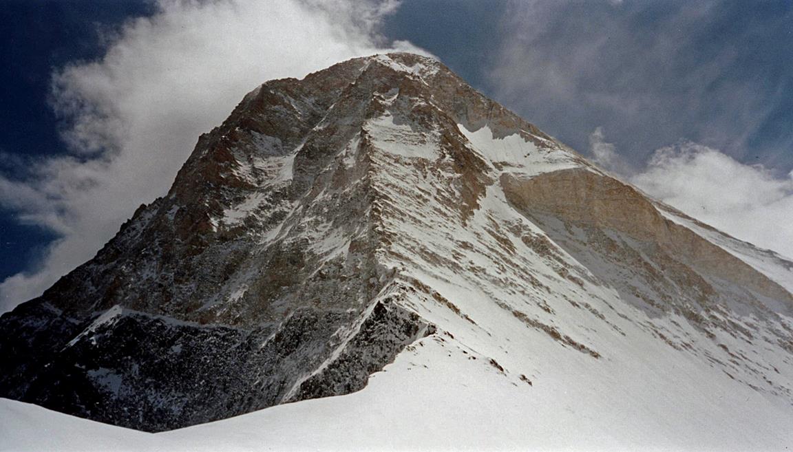
Pyramidal summit of Khan Tengri seen from Camp 3 in the morning (first two photos)
and in the afternoon (third photo). The West Ridge (normal route) is in the
middle of the photos.
|
|
|

|
|
|
|
