Morocco (February 2020): (1/3) Ouarzazate,
Tagounite, Tiraf, and Day 1
of trek
![]()
Return
to main Morocco 2020 webpage
Maps:
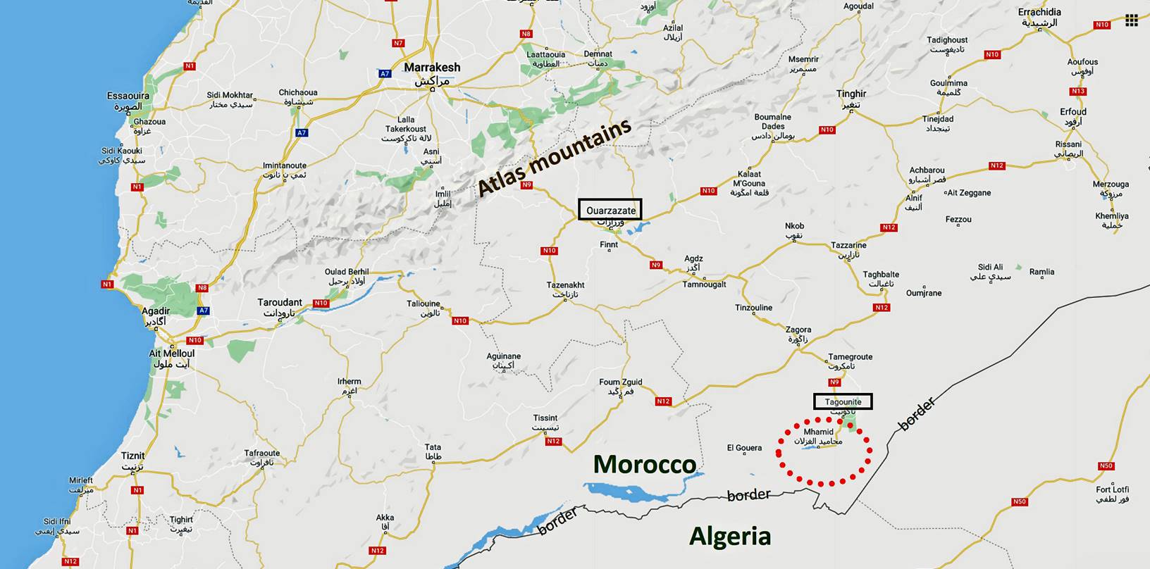
Ouarzazate:
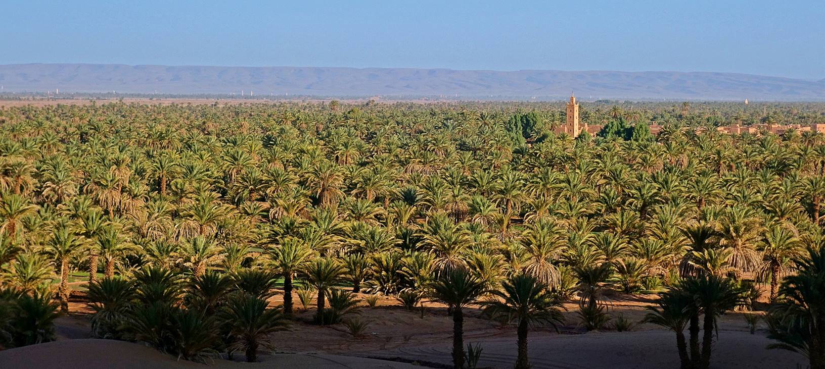
Ouarzazate
(pop. 71,000) is a city located about 200km southeast of Marrakesh, on the
southern side of the Atlas mountain range. It is home to one of the largest
movie studios in the world. Several famous movies were shot here and around,
including Lawrence of Arabia, the Man Who Would be King, The Mummy, Gladiator,
Babel, Prince of Persia, Body of Lies, Black Hawk Down, and Queen of the
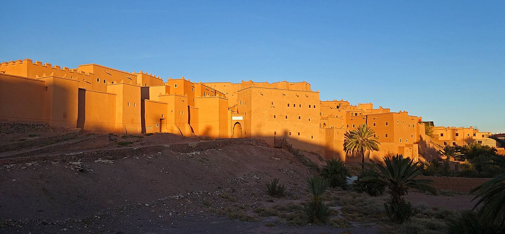
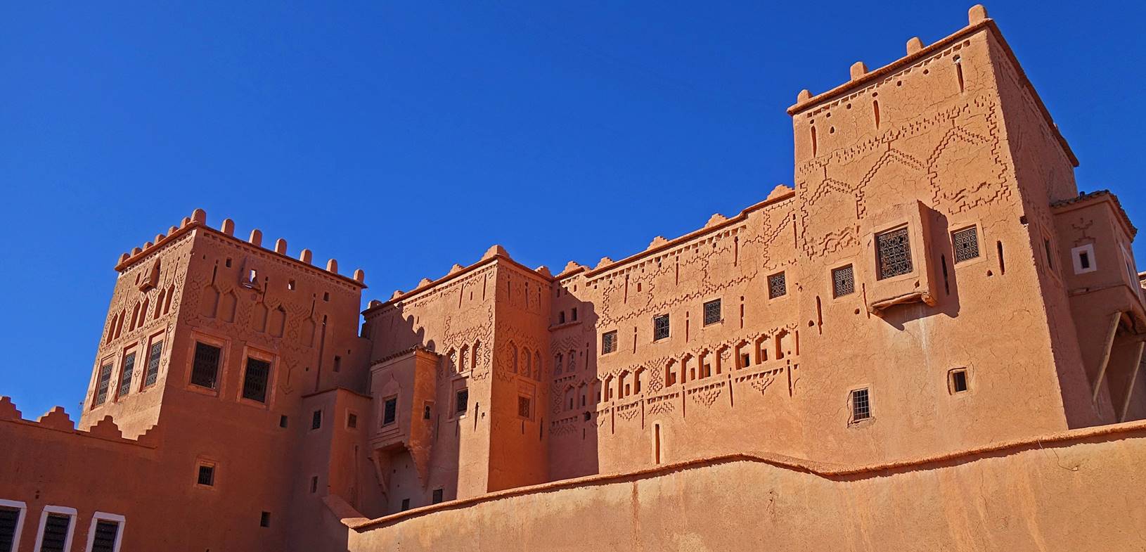
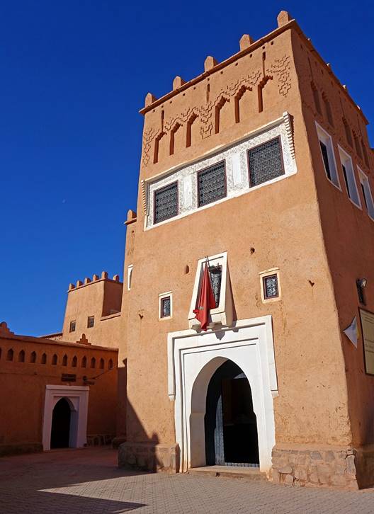
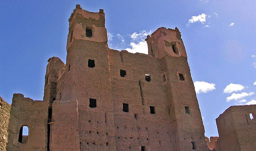
Desert, to only cite a few. Taourirt Kasbah at the
southeastern edge of the city is one of the few remaining Glaoui
kasbahs. Thanks to the fact that it is often used as
a backdrop stage by the movie industry, part of it is relatively well
maintained.
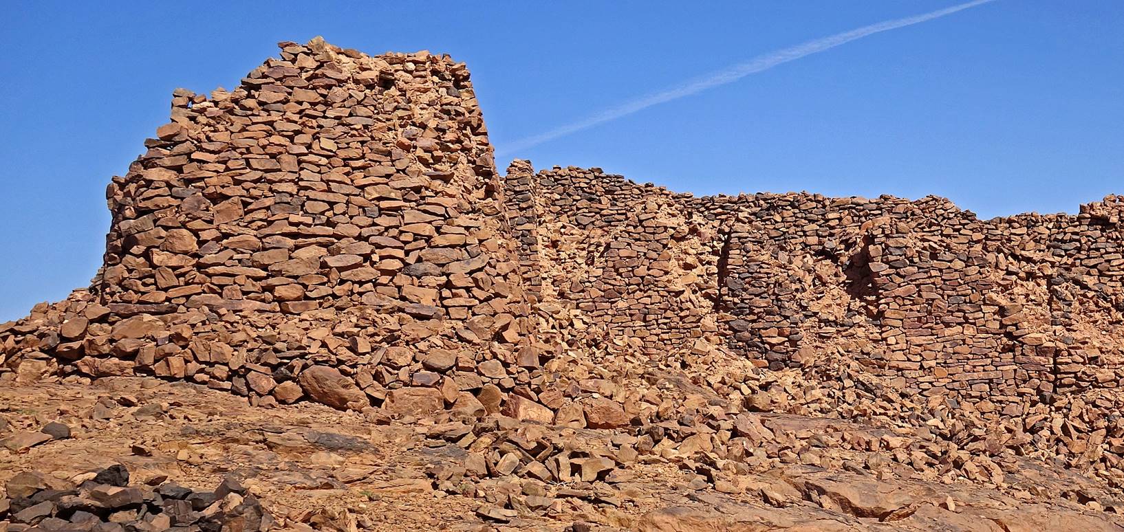
Southern
wall of Kasbah Taourirt, seen just before sunset.
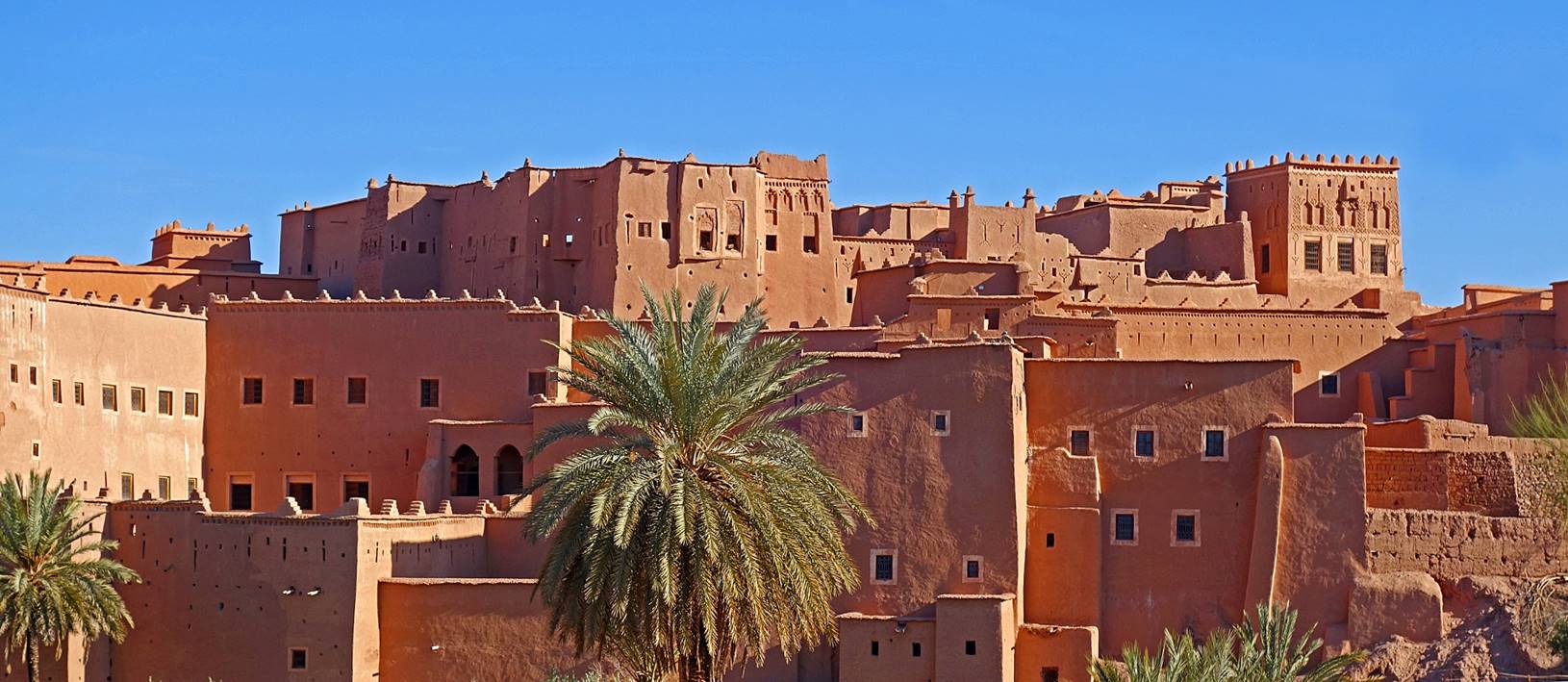
Another photo of a
portion of the Kasbah taken in the morning.
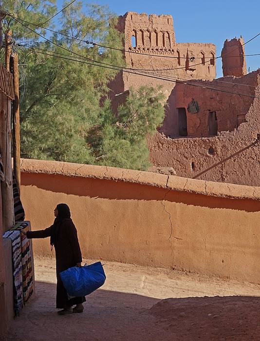
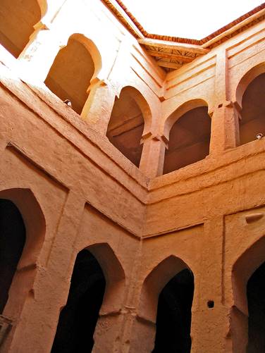
Former palace of the Glaoui in the kasbah.
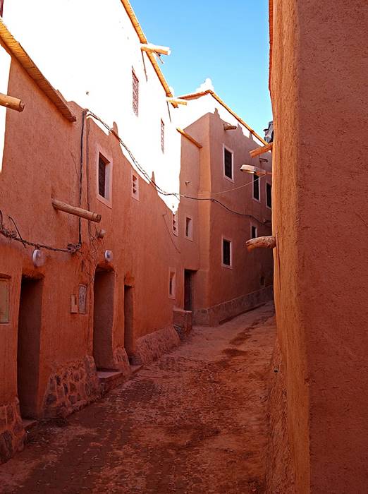
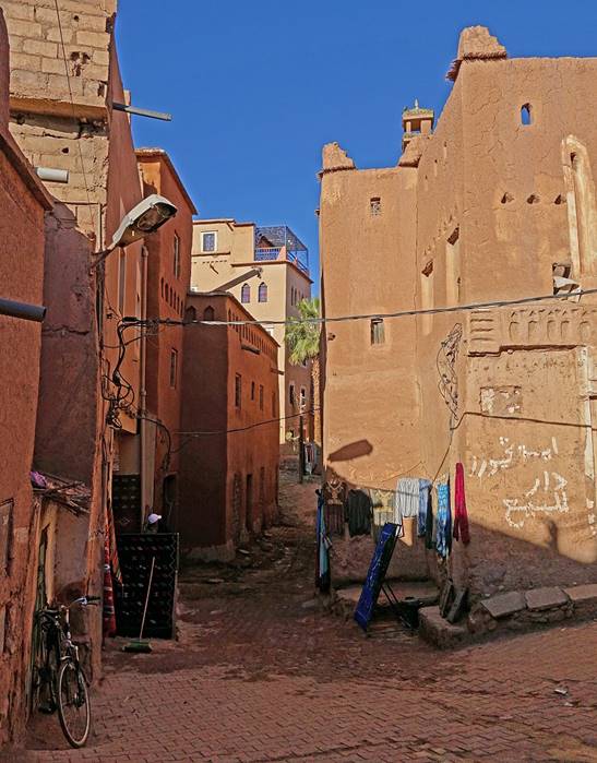
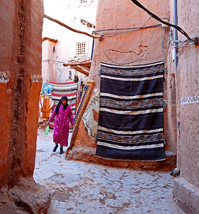
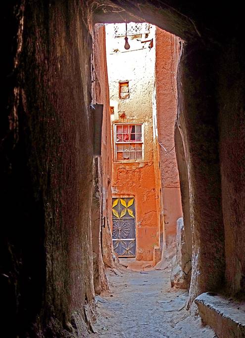
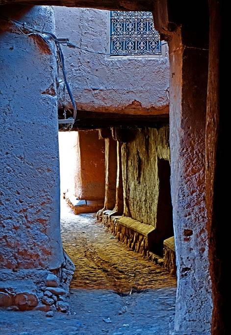
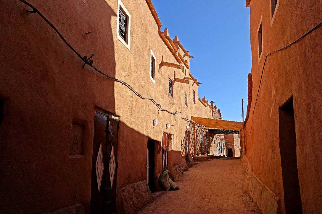
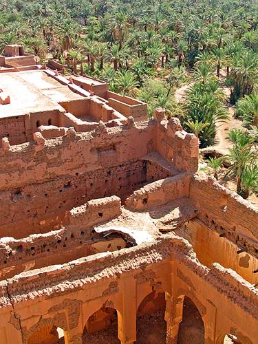
Streets, houses, and
buildings of the village inside the walls of the kasbah.
|
|
|
|
|
|
|
|
|
|
|
![]()
Old photos from around
Ouarzazate and the Draa valley between Ouarzazate and Zagora:
I visited the region of Morocco around Ouarzazate in 1968 and a few times during the 1970′s
and early 2000′s. Unfortunately, I took few photos during those visits,
and most were of poor quality. Below are some of them.
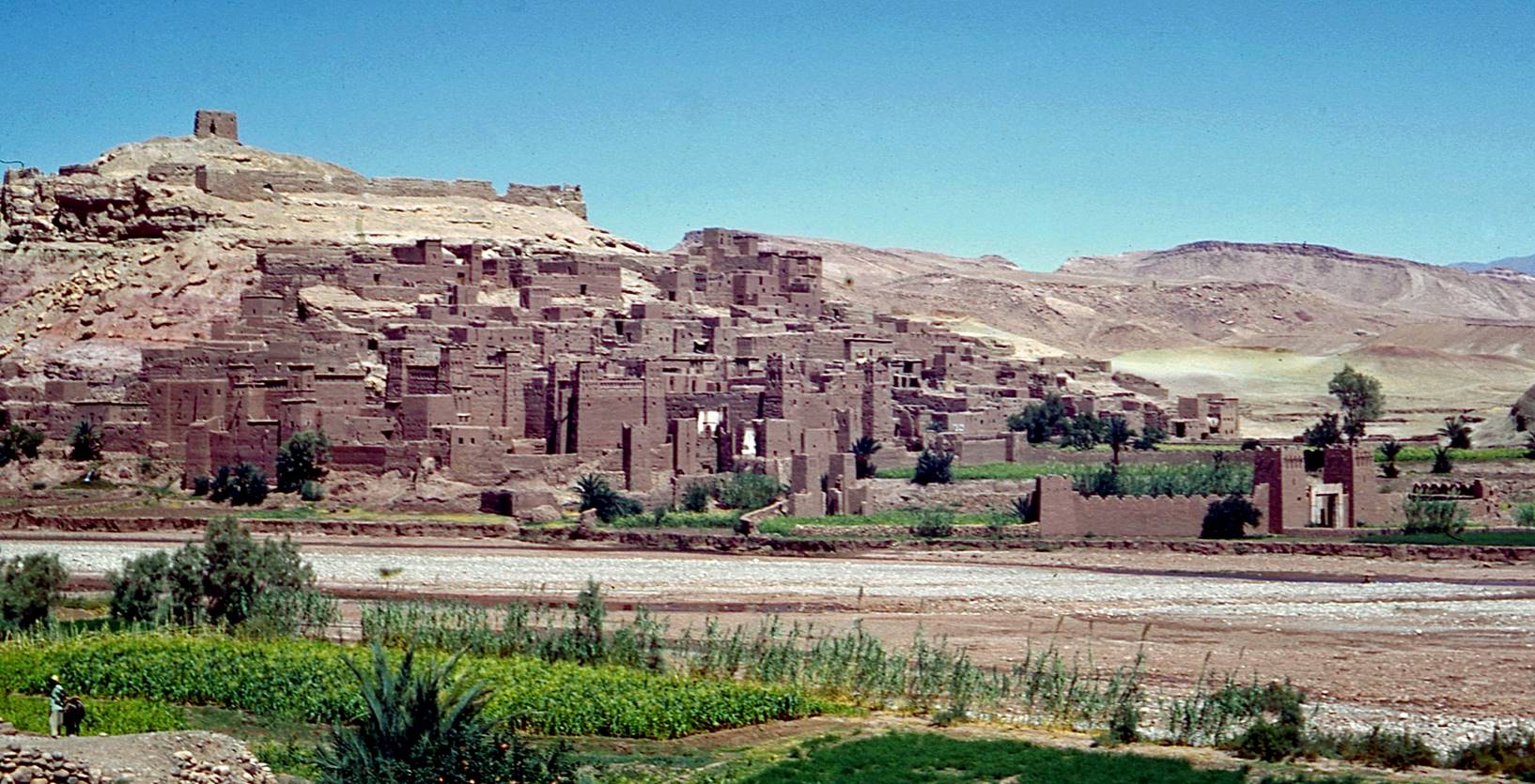
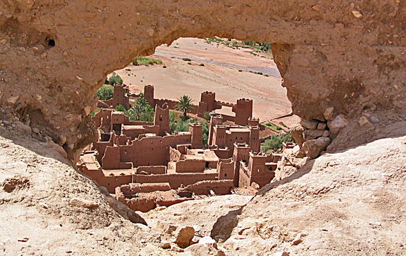
Ksar of Ait Benhaddou (1968).
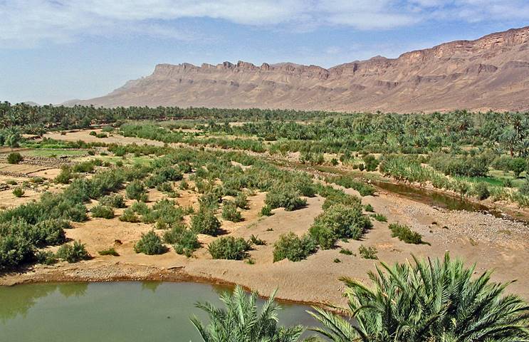
Oasis of Finnt,
south of Ouarzazate (2004).
|
|
|
Left: Ait Benhaddou, north-west of Ouarzazate
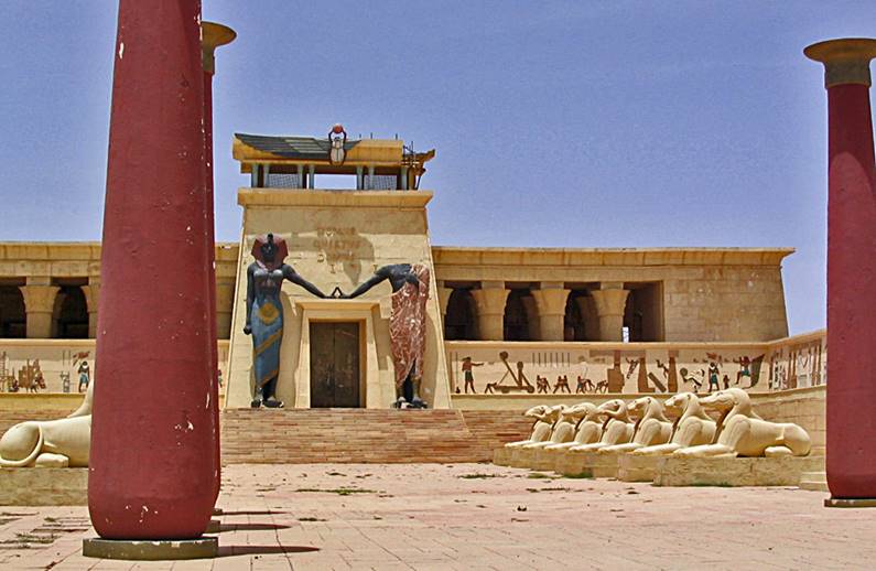
(2004). Right: Outdoor movie set in a Ouarzazate′s studio (2004).
|
|
|
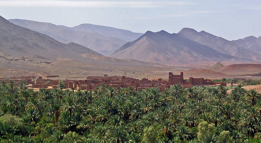
Draa valley between Ouarzazate
and Zagora (2003).
|
|
|
Kasbahs and granaries in the Draa valley (2003).
|
|
|
|
![]()
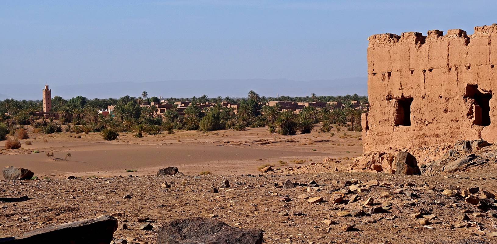
Tagounite:
It is the last small
town that we traversed before reaching the start of the trek at Magag. We only briefly stopped there.
[A more interesting town north of Tagounite is Tamegroute, which
used to be a major starting point for caravans headed to Timbuktu on the other
side of the Sahara desert. Somewhat like Timbuktu, Tamegroute
also served as a center of religious learning and its 17th-century shrine (zawiya) still includes a Koranic library with 4,000 ancient
religious books. We stopped in Tamegroute to visit
this library both on our way to Magag and on our
return. Unfortunately, the library seems to have hectic opening hours and we
found it closed twice.]
|
|
|
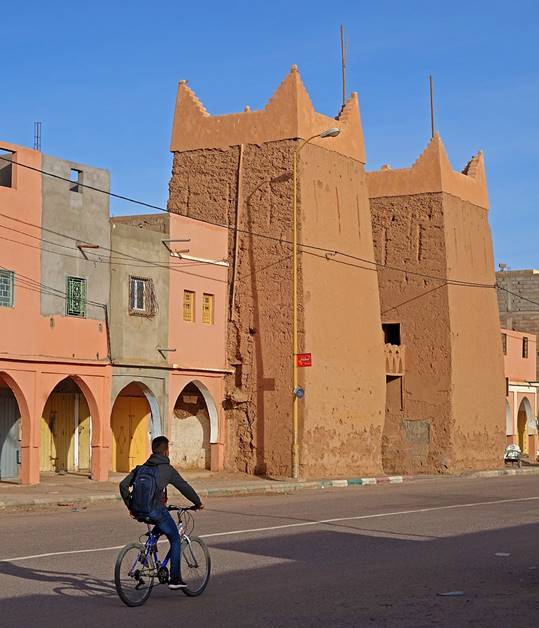
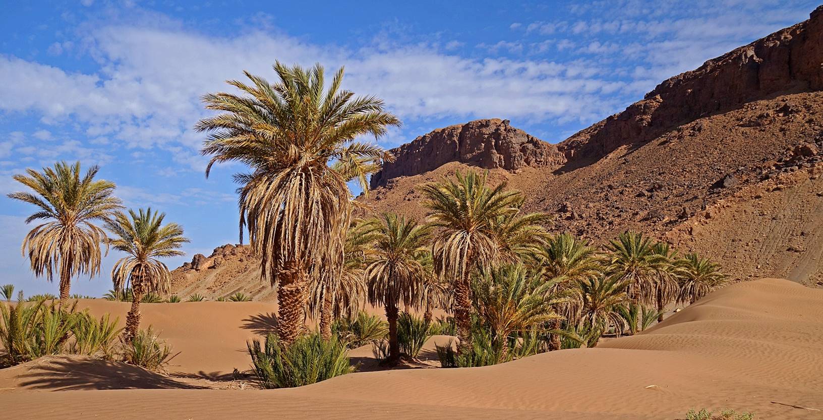
Tiraf:
Tiraf is the last village
southeast of Tagounite before the empty desert. It is
set in a scenic palm grove (also the last one before the desert) on the left
bank of Oued Draa. Despite
this location, the palm drive suffers from lack of rain, as most of the year
this part of Oued Draa is
dry. Water is occasionally released from the El Mansour Eddahbi
dam (located near Ouarzazate), but only a few times a
year. The village is populated by both Berber and Arab people. The later are
descendants of migrants who came as traders through the Sahara desert.
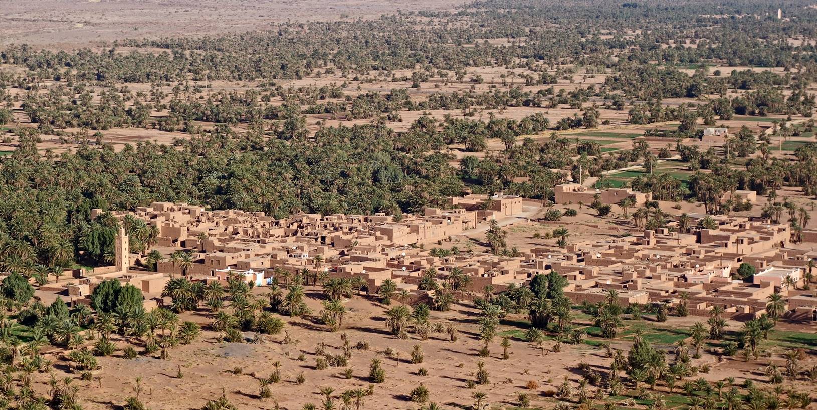
Aerial view of the
village of Tiraf, with Oued
Draa visible on the left of the photo.
View over Tiraf, with its minaret on the left.
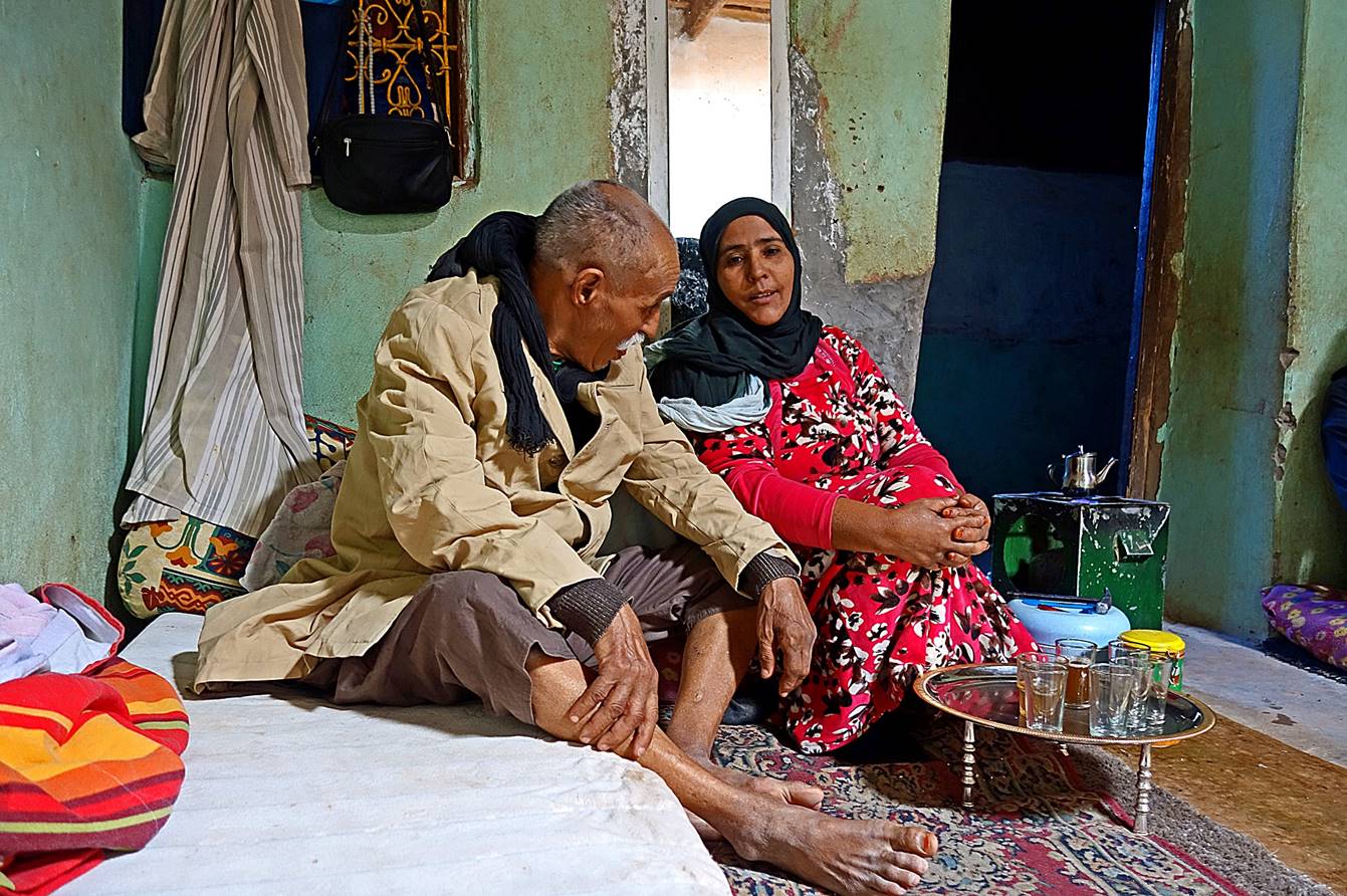
Inside a house of Tiraf. The man (in his 80′s) was a soldier in the
French army in the late 1950′s and early 1960′s. He invited Oumar and me to drink tea in his home. In this photo he is
sitting with the youngest of his three wives.
Palm grove
surrounding the village of Tiraf. Minarets of Tagounite are visible in the far background on the left
side of the photo.
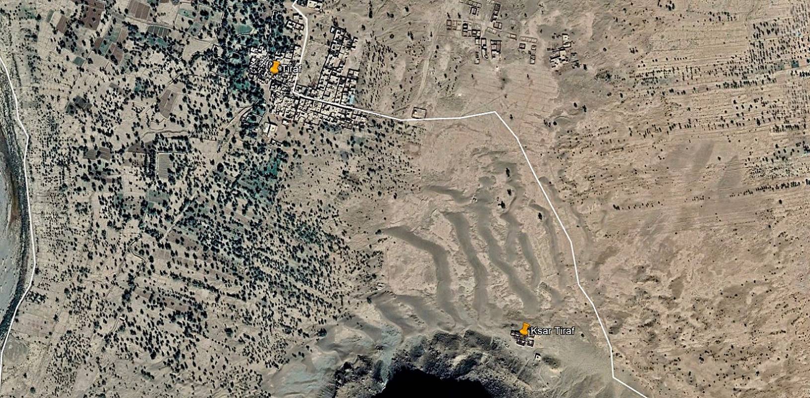
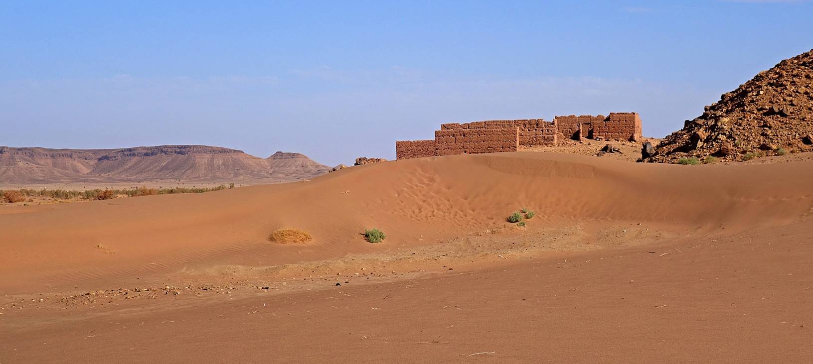
Ksar Tiraf,
located a short distance from the village, just north of Jbel
Magag (see the aerial view above). It used to be a
kind of fort with a granary. It is also the site of the grave of Sid El Madani, a saint man who was well-known as a healer. Every
month of August a local moussem (festival) takes
place here in his honor.
|
|
|
Tiraf village seen from Ksar Tiraf.
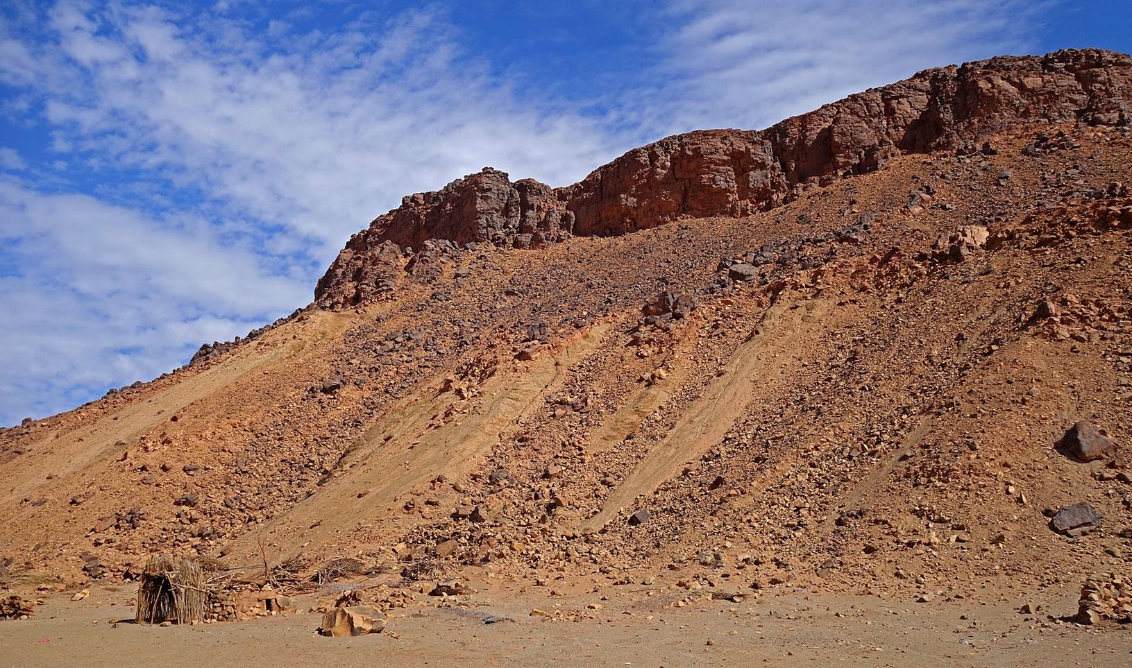
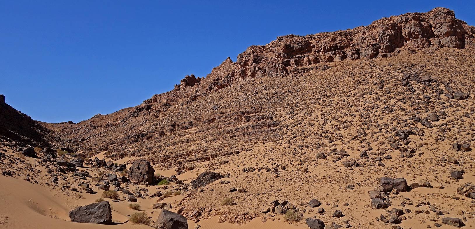
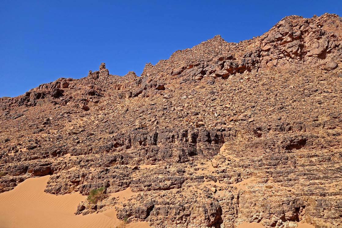
Northern slope of Jbel Magag (that we will ascend
on the next morning) seen from the edge of the Tiraf
palm grove.
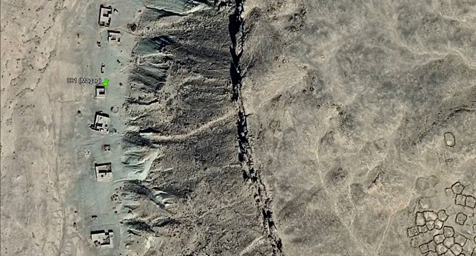
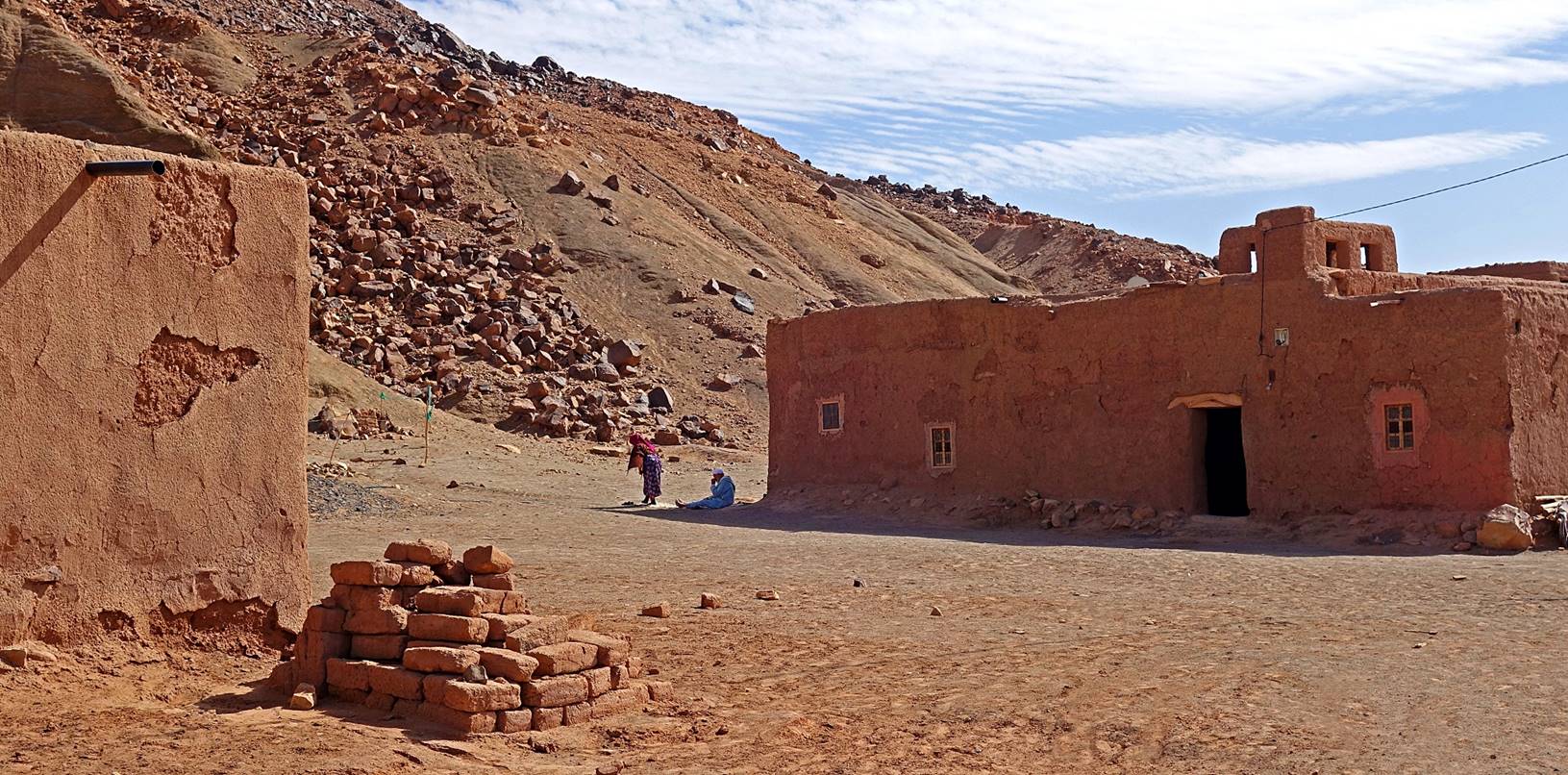
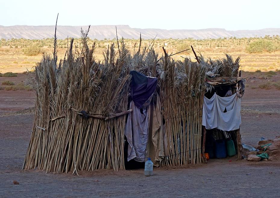
Hamlet
of Magag:
The bleak hamlet of Magag, the start of the trek, is located 1.2km south of the
village of Tiraf. It consists of a few adobe houses
aligned below the western escarpment of Jbel Magag, which culminates some 150m above the hamlet.
Aerial view of the
hamlet. We spent the night prior to the trek in the house marked with the
waypoint 001. The aerial view also shows the western escarpment of Jbel Magag and a portion of the
flat top of this mountain.
The
adobe houses in the hamlet stand at a close distance from rocks fallen from the
Jbel Magag′s escarpment.
View of the
escarpment from the hamlet.
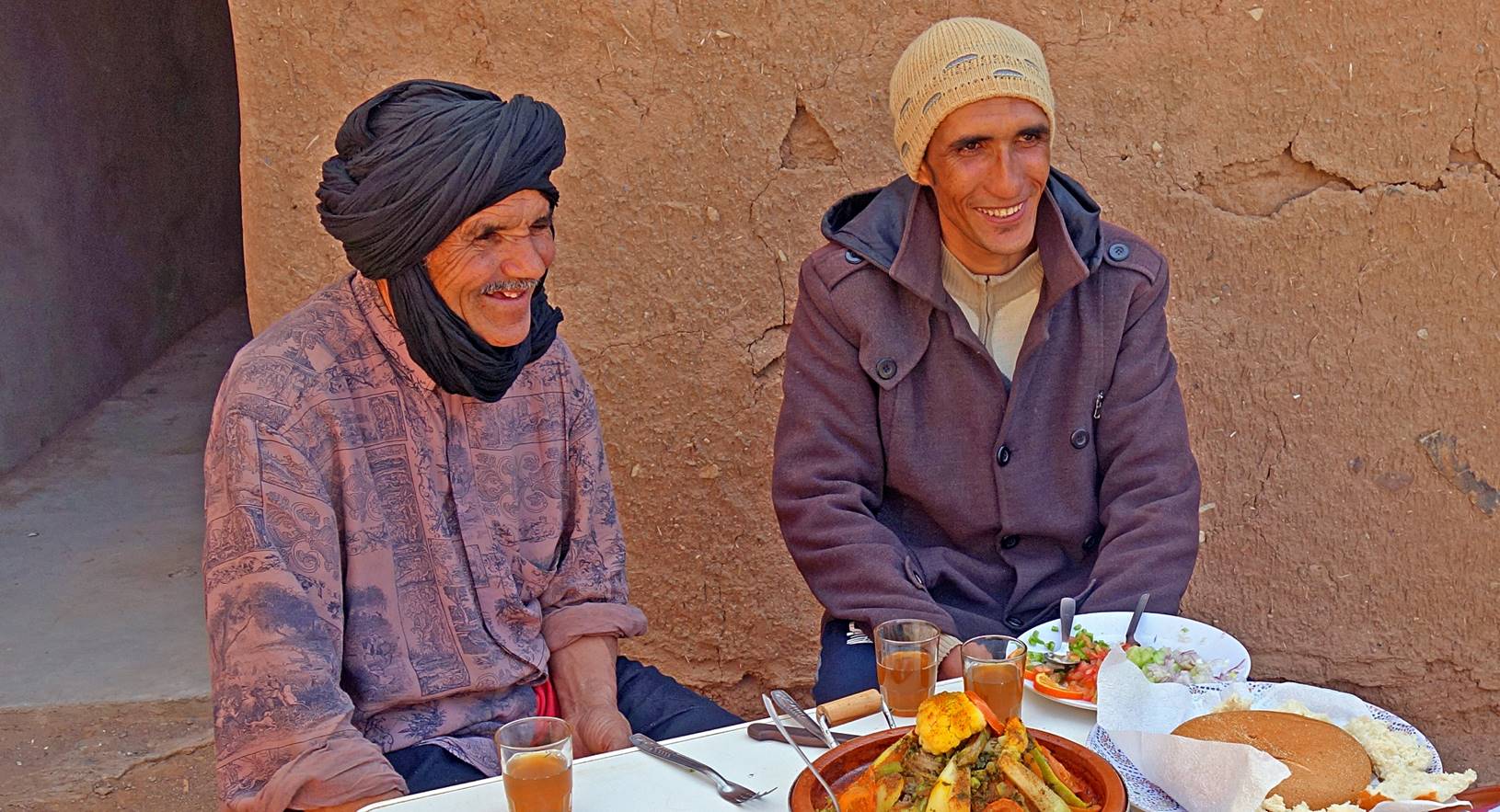
Bada (left) and one of
our hosts in Magag.
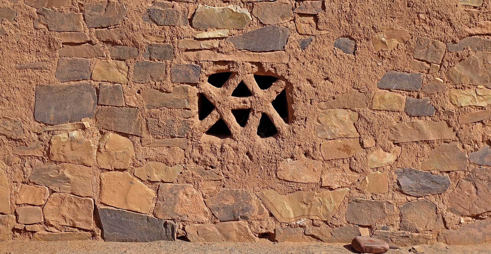
Window of a house.
Most windows are quite small to protect house interiors against heat and sand.
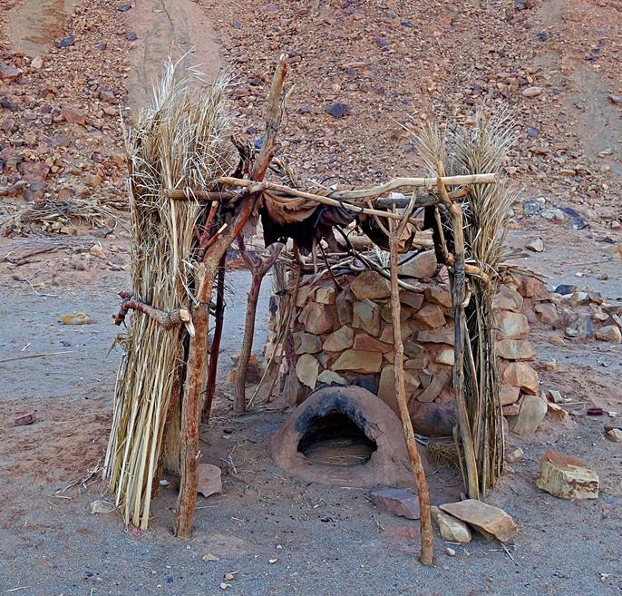
Left: traditional
oven to cook bread. Right: water reserve. This reserve consists of an
underground tank (whose access is visible on the right of the photo) and large
plastic jerrycans that are protected by a curtain of
cane stems. A truck delivers water about once a month.
|
|
|
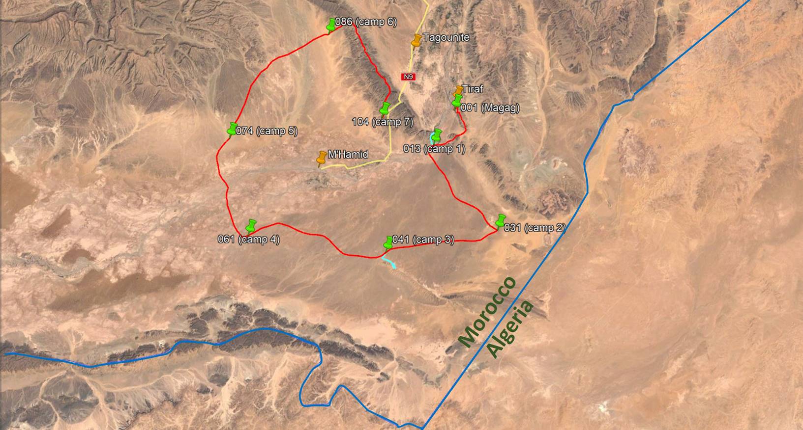
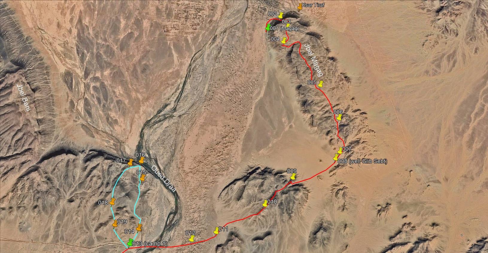
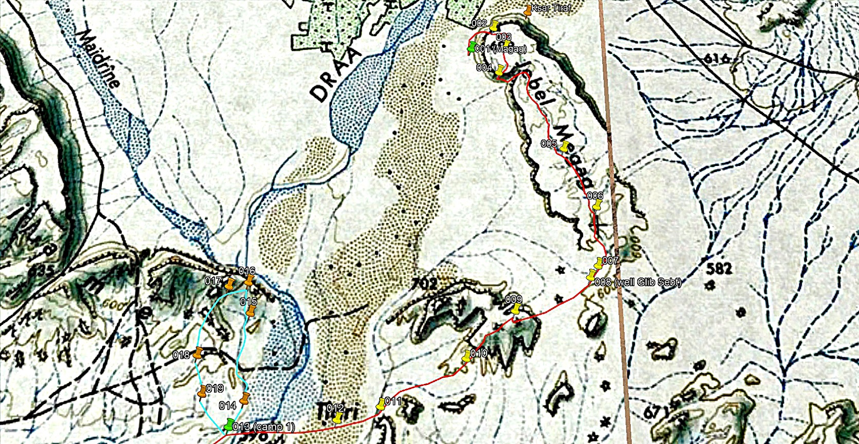
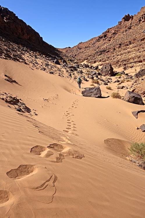
Day 1 of trek (from waypoint 001 to waypoint
013, plus side-trip via waypoints 014 to 019, 15km):
Path followed on Day
1 (red line for the main path between the start of the trek and camp 1, light
blue line for the side-trip north of camp 1).
[Reminder:
To access the GPS-recorded waypoints first click here
to download the morocco-2020.kmz file and then open this file in Google Earth.]
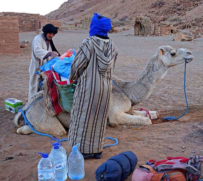
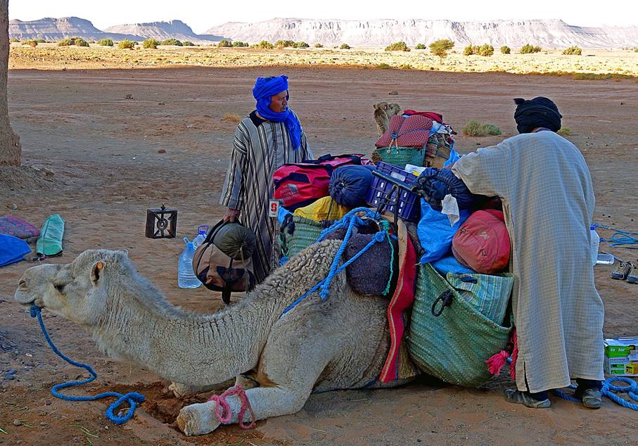
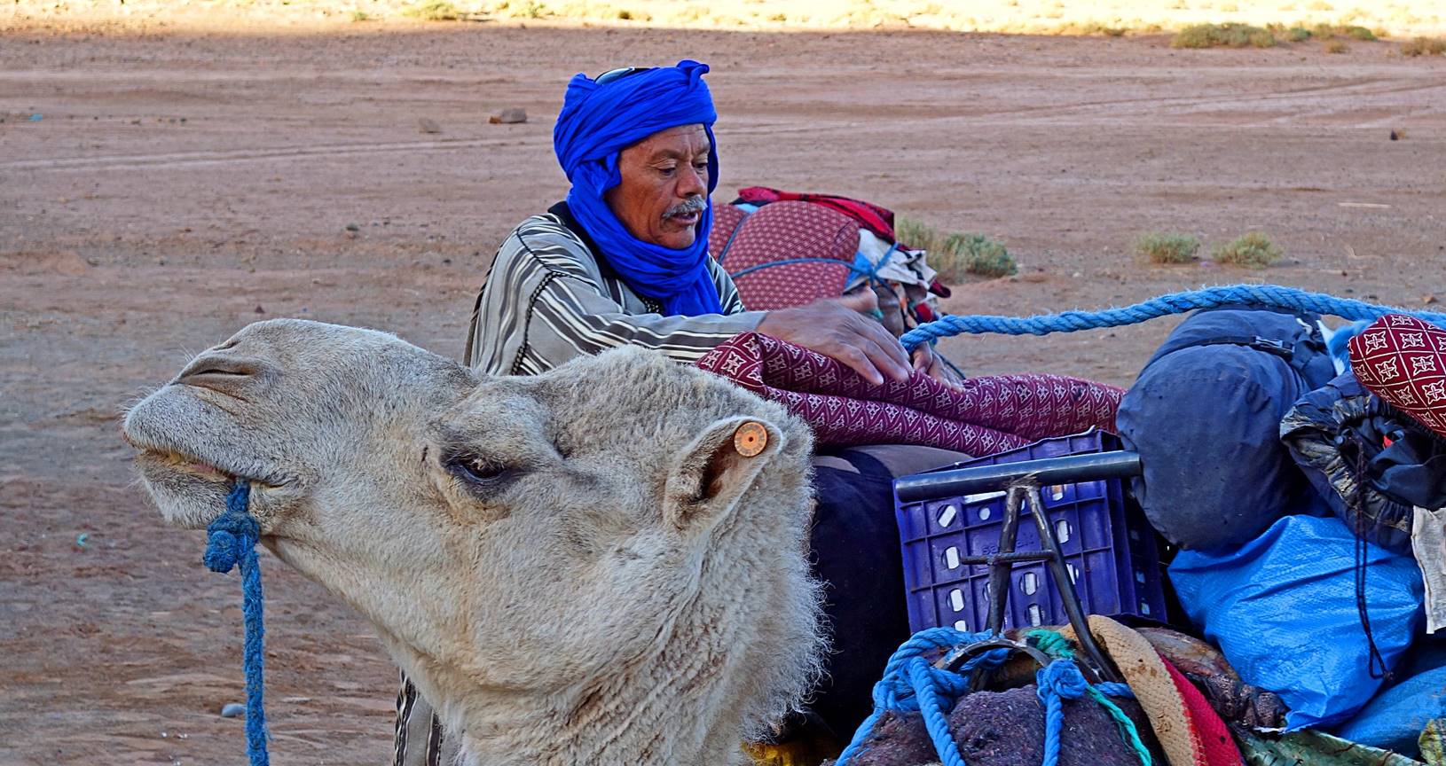
Bada and Hada
loading the dromedaries in Magag.
[On
that day, Bada, Hada,
Mohamed, and the two dromedaries took a more direct route to camp 1 than Oumar and me in order to avoid the rocky
mountains.]
|
|
|
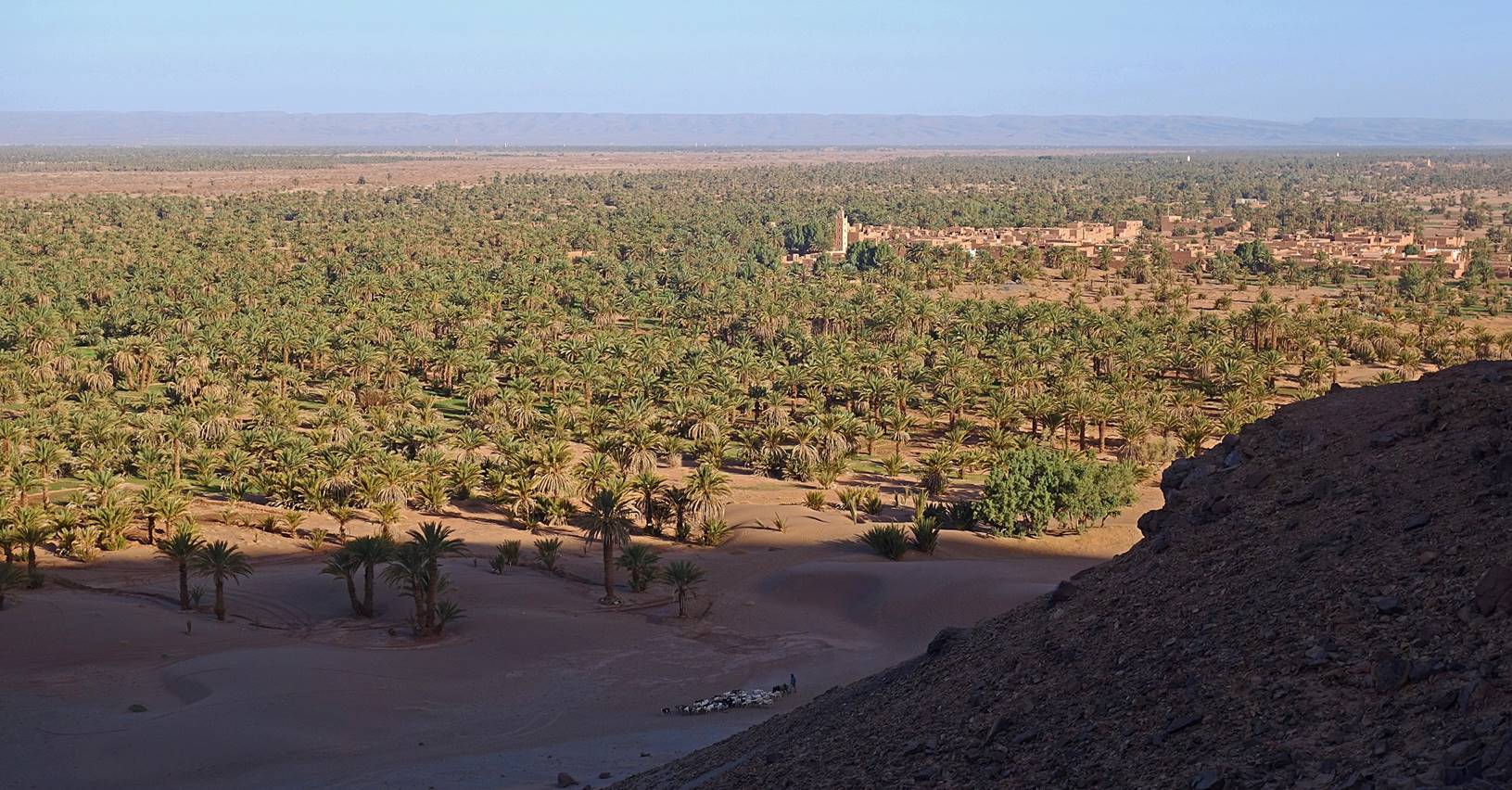
View
over the Tiraf palm grove and village while ascending
the northern slope of Jbel Magag.
Oumar reaching the northern top of Jbel Magag.
View
toward the north from Jbel Magag,
with Tiraf on the left of the photo and Tagounite further behind.
Flat
top of Jbel Magag (view
toward the south).
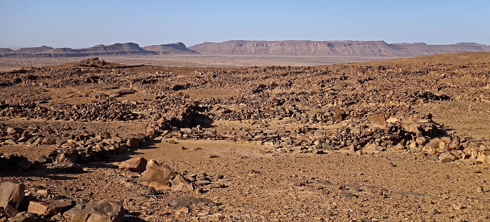
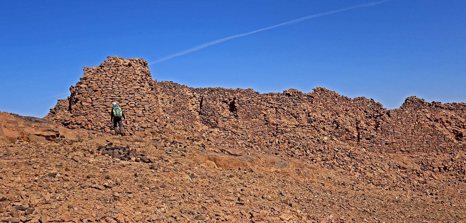
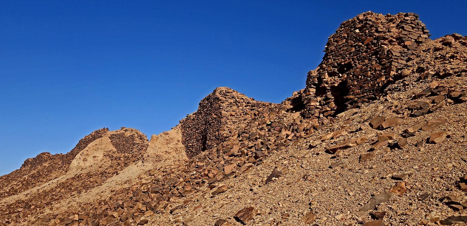
Aerial
view of ruins on top of Jbel Magag
between waypoints 003 and 004.
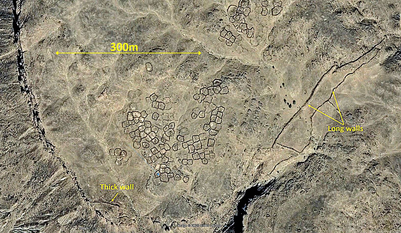
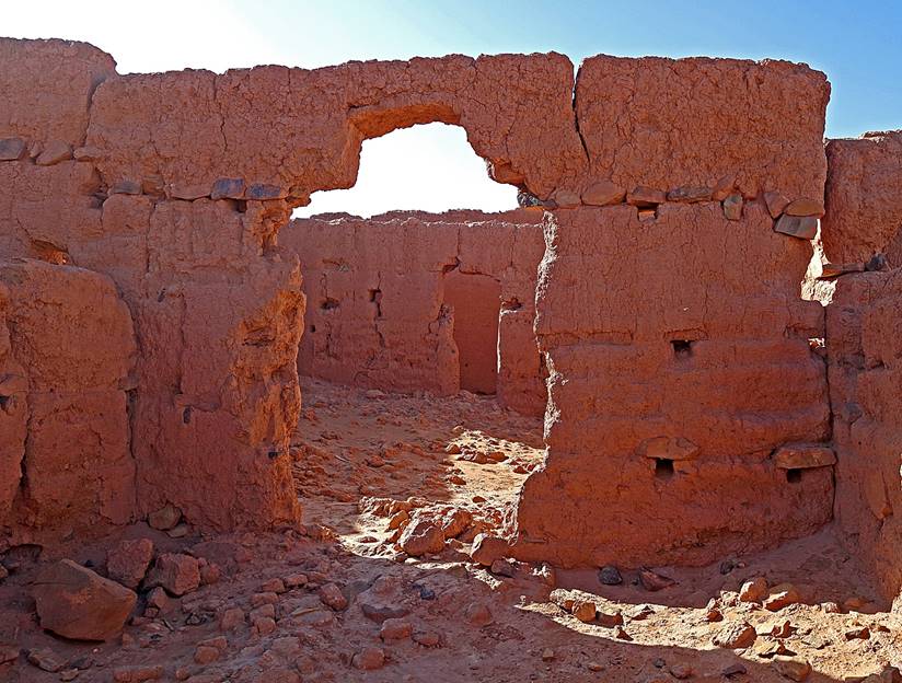
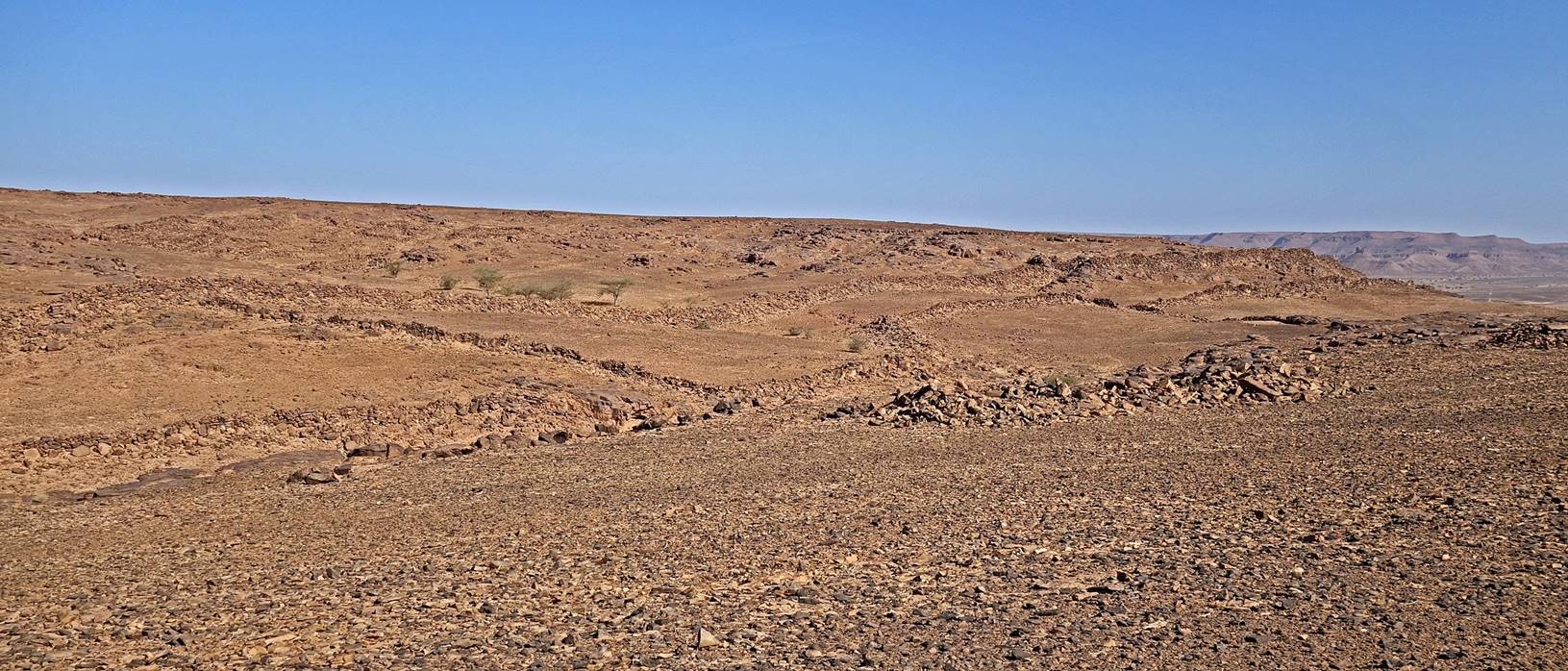
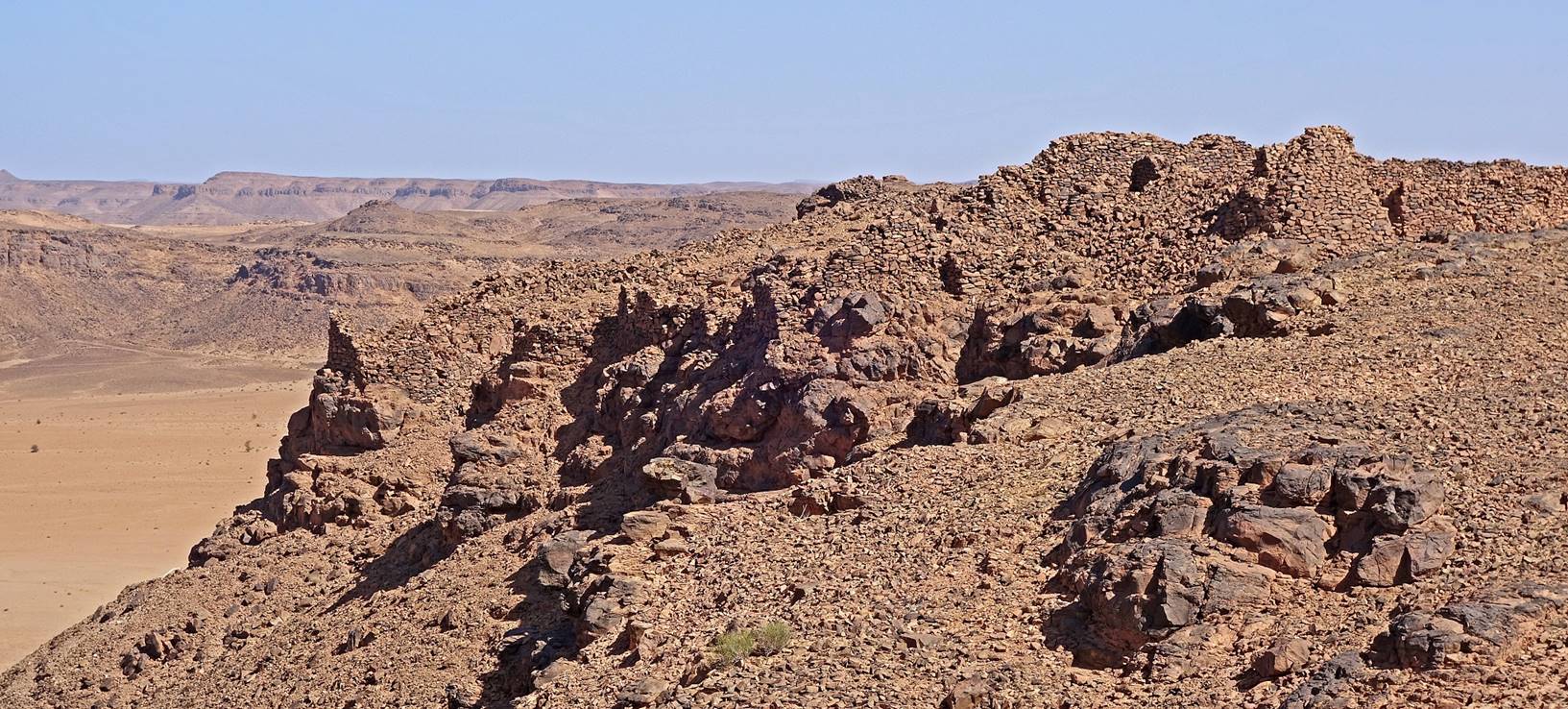
Views of the ruins
from the ground. Bada and other locals say that those
ruins date from Roman time, which is highly unlikely. Most of the site consists
of adjacent, almost circular walled parcels. These parcels are too close to
each other to be old sheep/goat pens. Their layout is more reminiscent of a
former hut village.
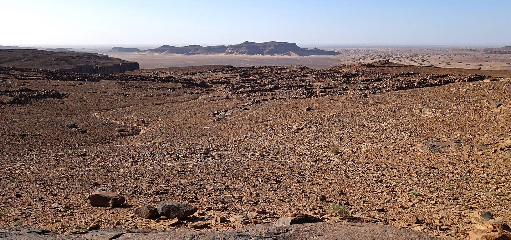
Remain
of a thick wall at waypoint 004, which looks like a former watchtower set above
the plain on the western side of Jbel Magag.
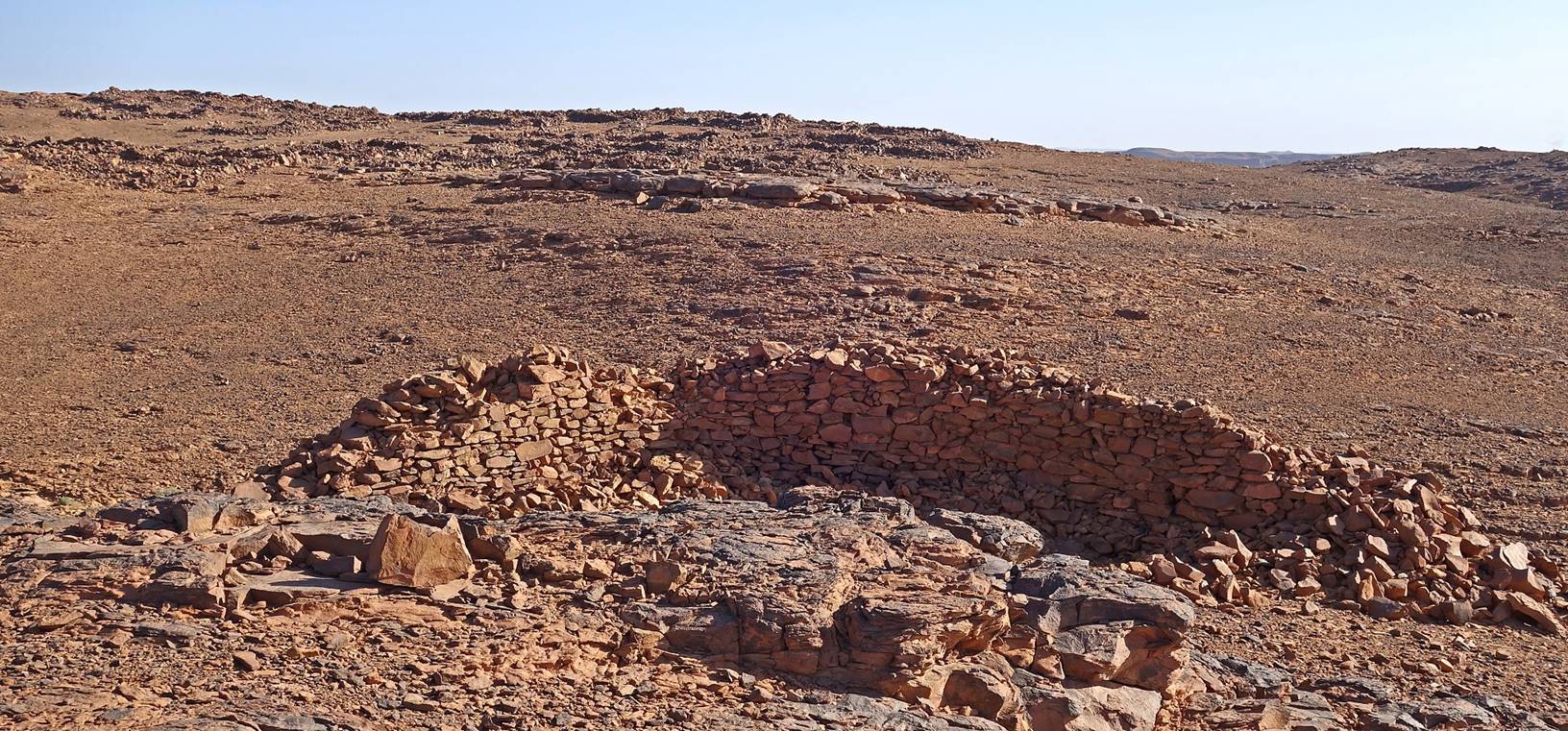
Views
from the edge of Jbel Magag
near the thick wall.
|
|
|
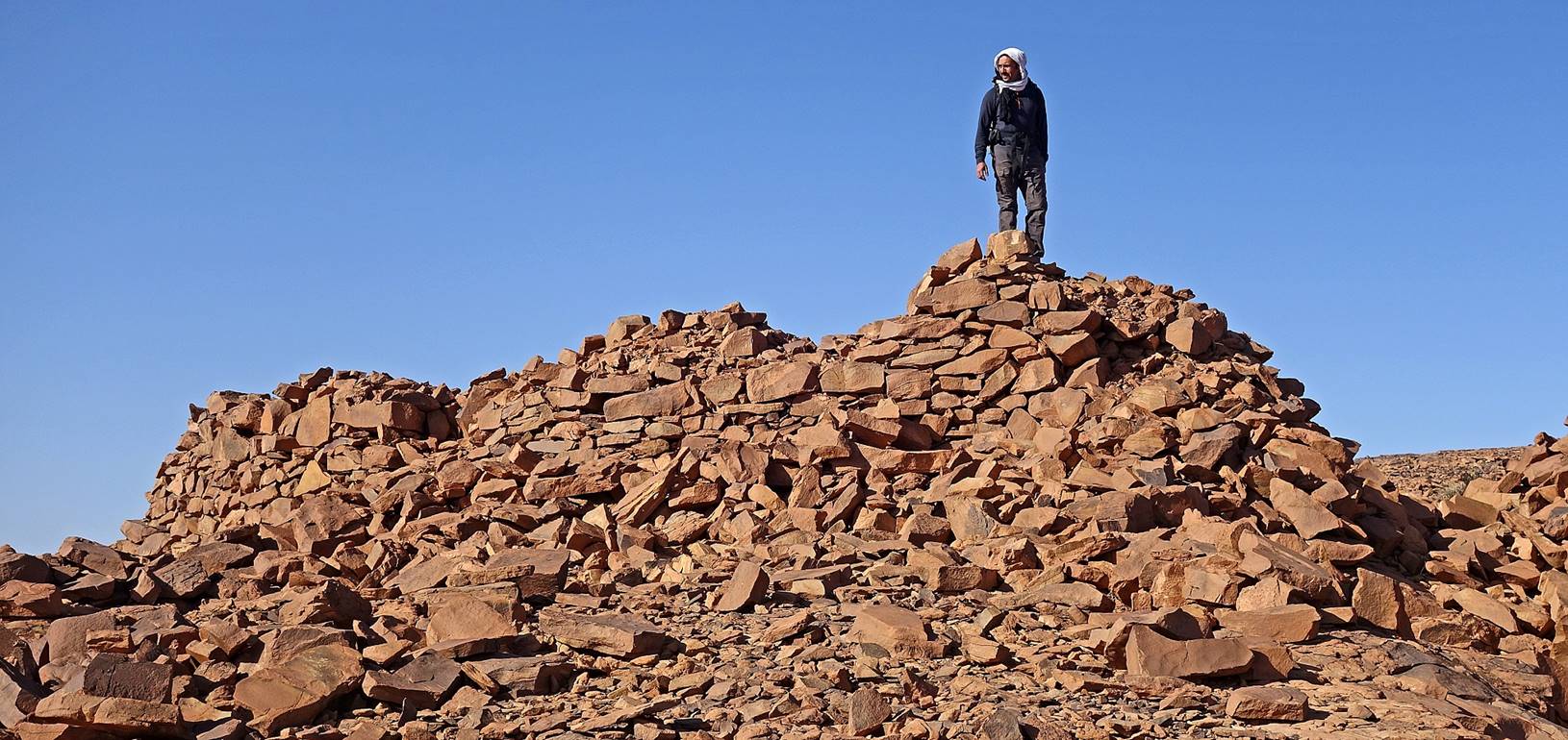
Long
walls south of the walled parcels.
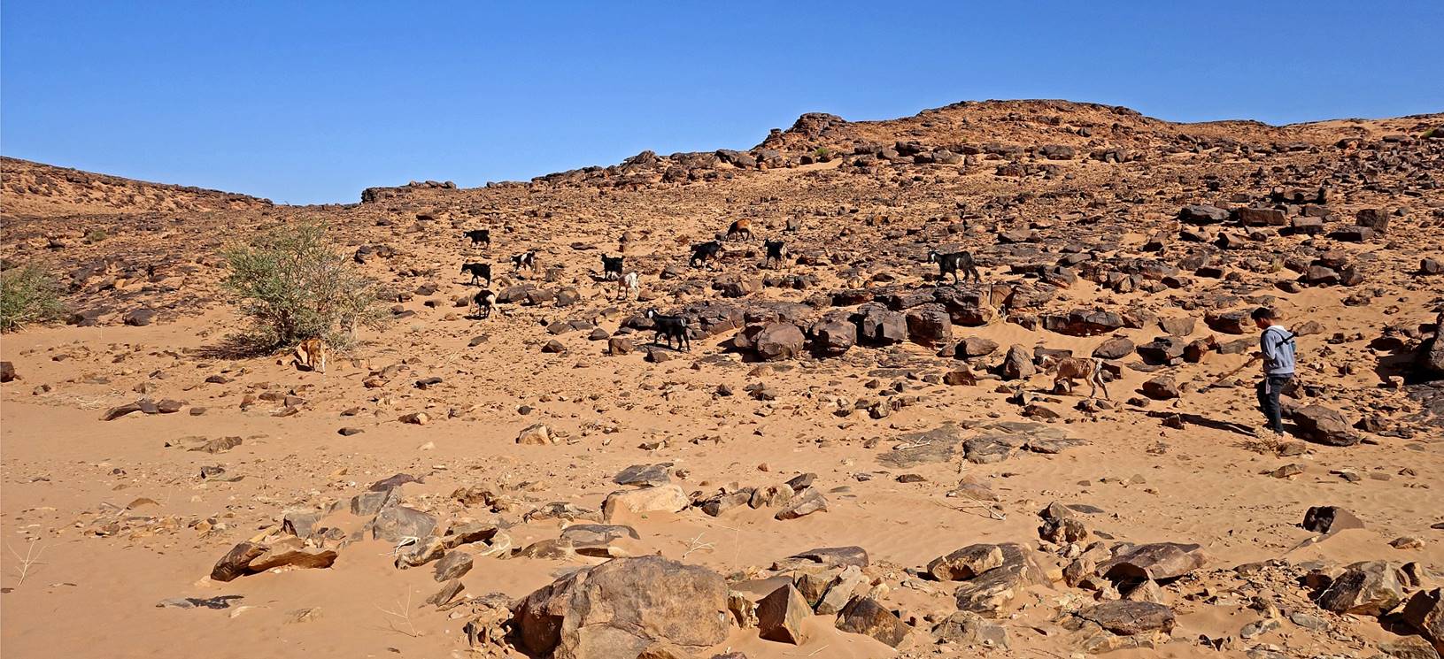
Landscape
and goat herder between waypoints 005 and 006.
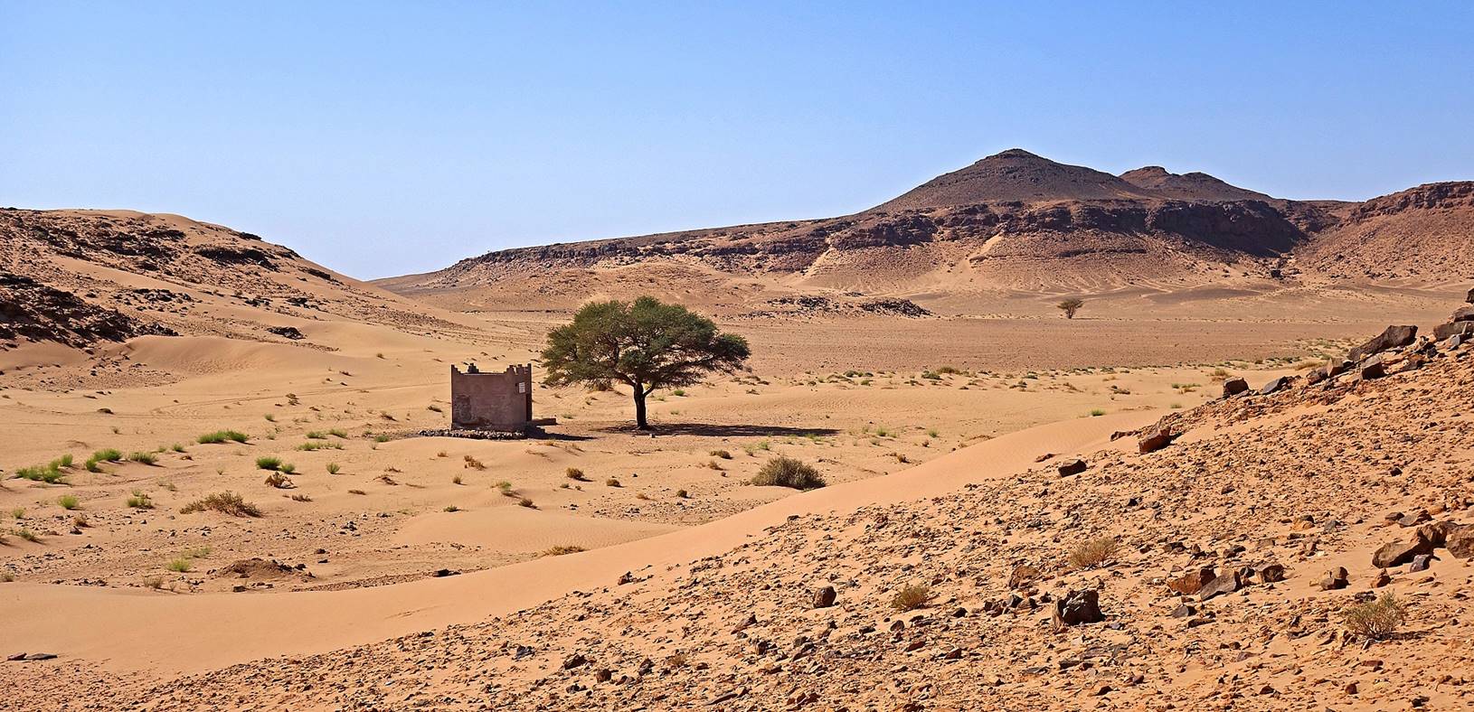
Gilb Sebt well
and its acacia tree at waypoint 008. In Tamazight (Berber language) ″Gilb Sebt″ means ″Heart
of a Plant″.
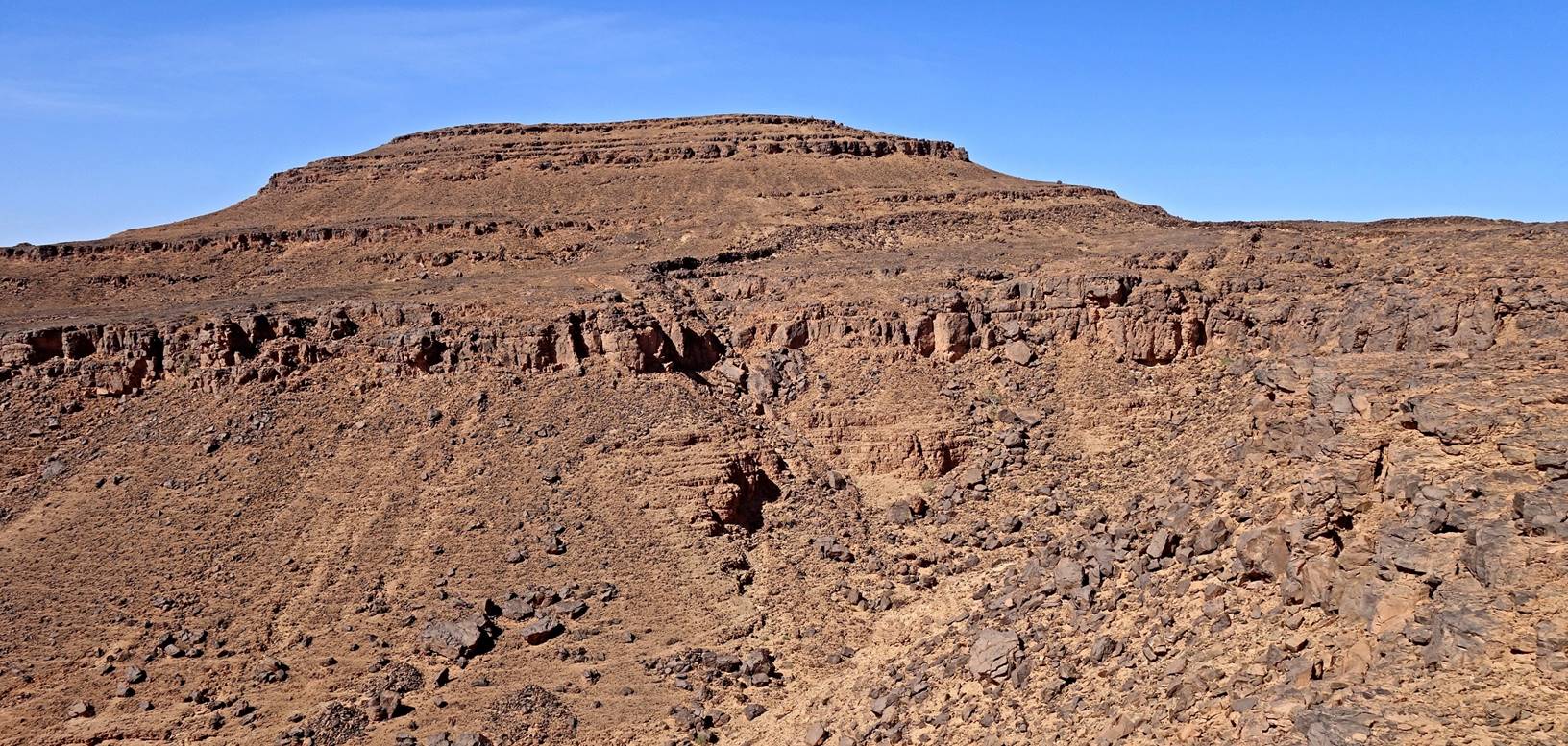
Jbel Magag seen
from a location close to waypoint 009.
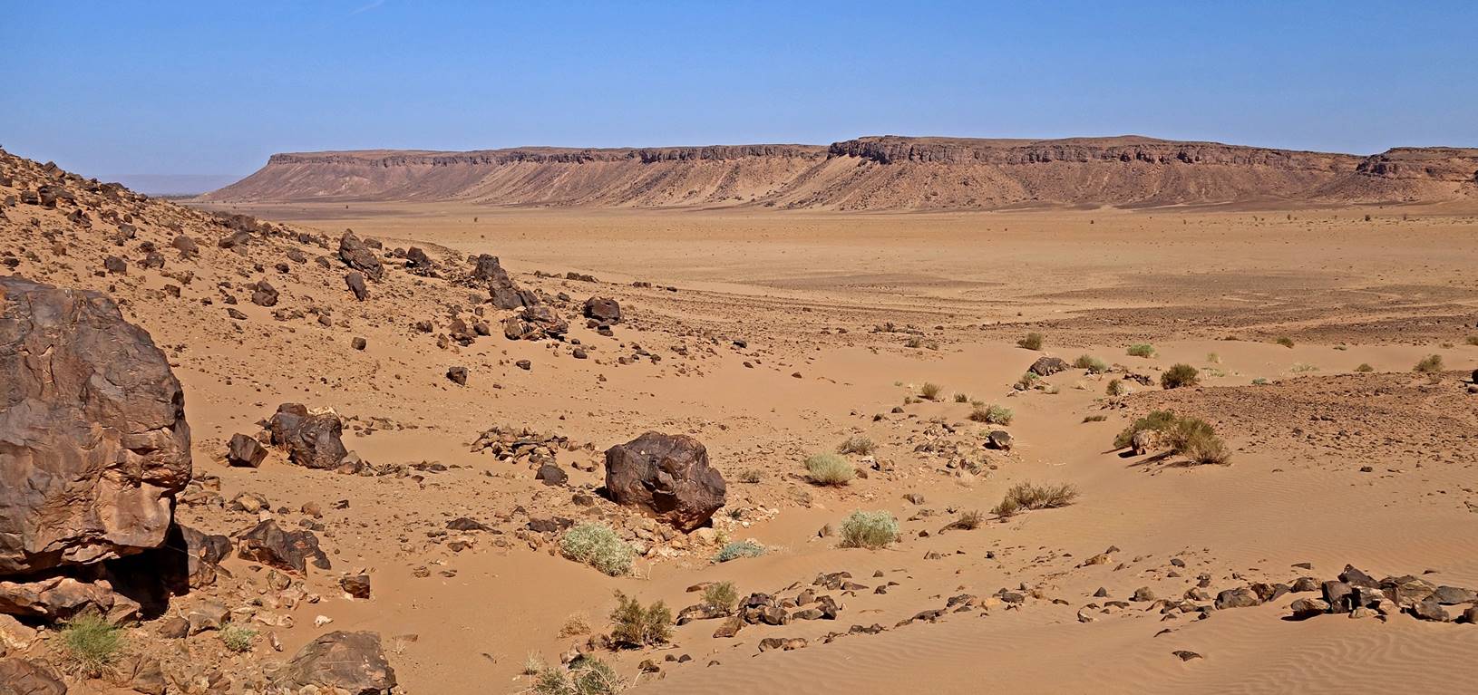
View
toward the east from the same location. The Gilb Sebt well is barely visible in the background next to the
leftmost tree.
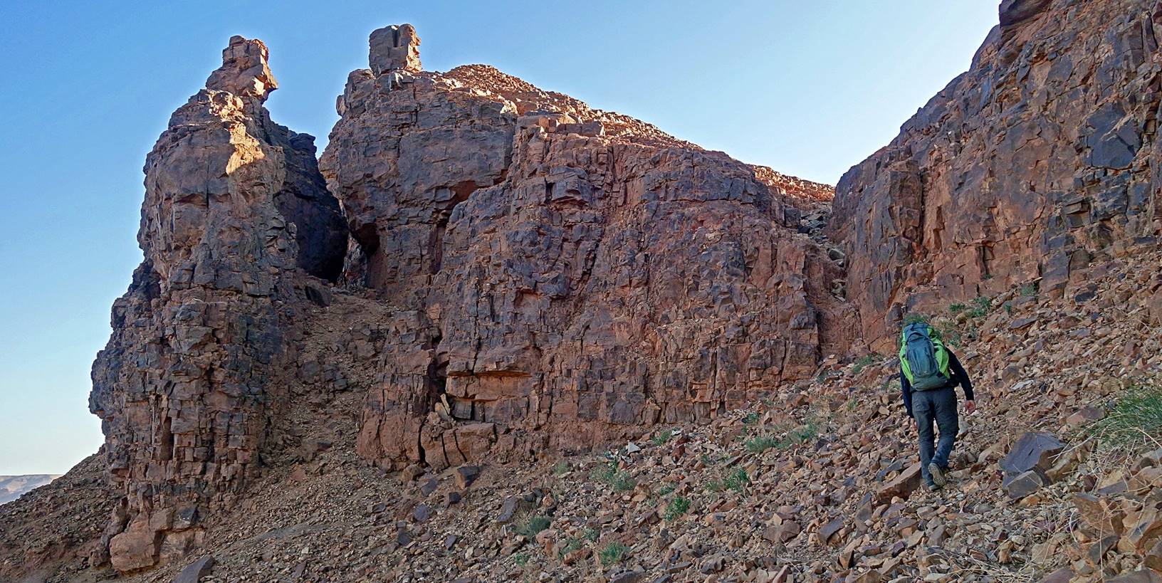
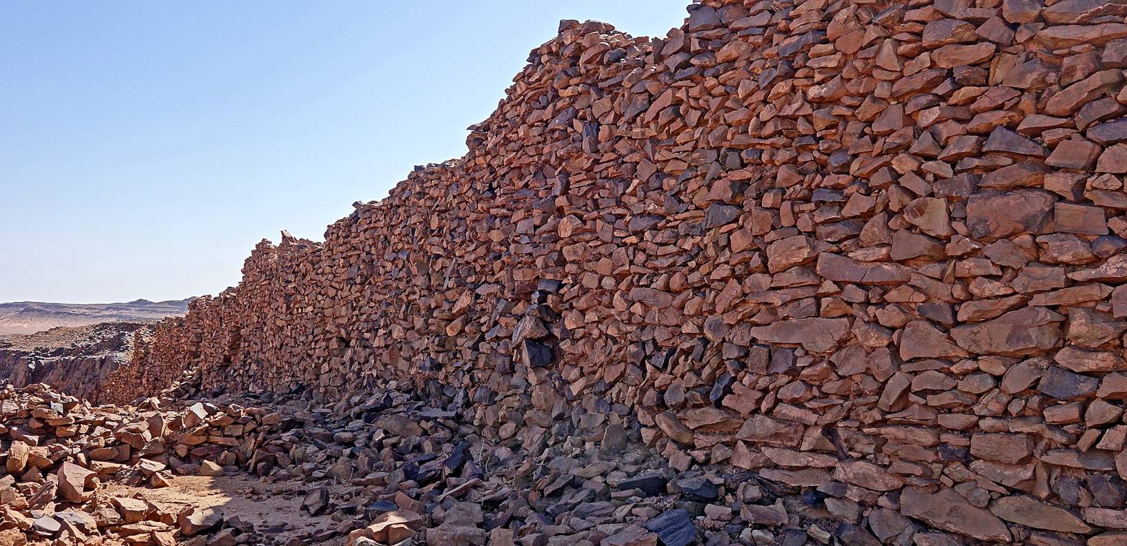
View
during the ascent to the ruins of a fortification wall at waypoint 009. The
wall is visible in each one of the three photos below.
|
|
|
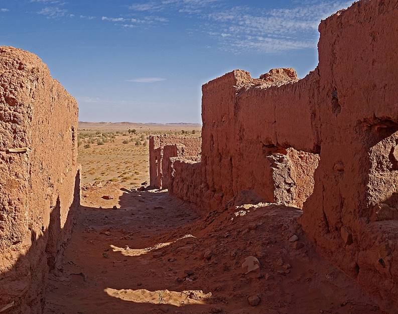
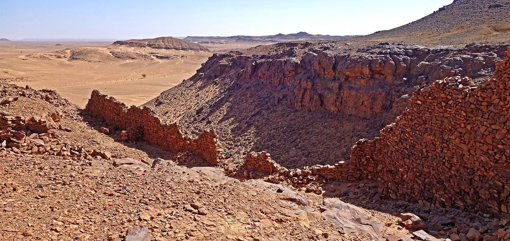
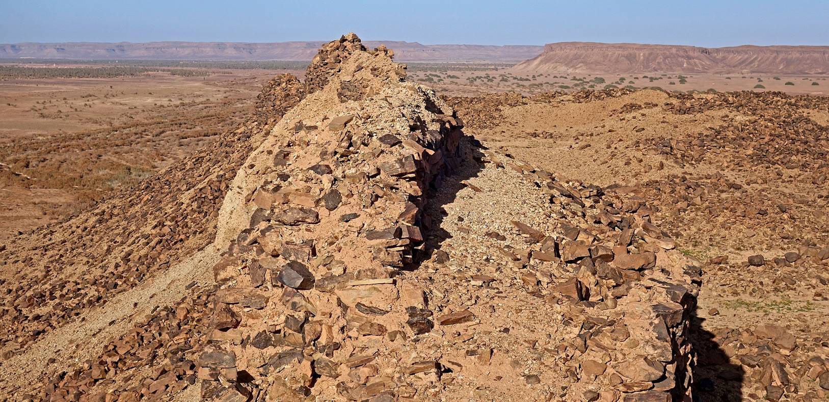
Aerial
view of the ruins at waypoint 009.

Turret
and wall on the western side of the ruins. According to Bada
the name of these ruins is Timgagin.
Southern
wall (first photo below) and western wall (second photo) seen from inside the
ruins.
View of Jbel Magag from the ruins, with Tindaf′s palm grove visible on its left. The larger Tagounite′s palm grove is visible further in the
background on the left side of the photo.
Oval
shaped summit west of waypoint 009 and north of waypoint 010. Aerial views in
Google Earth show that there are additional ruins behind this mountain.
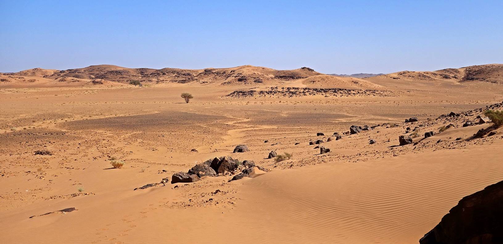
View
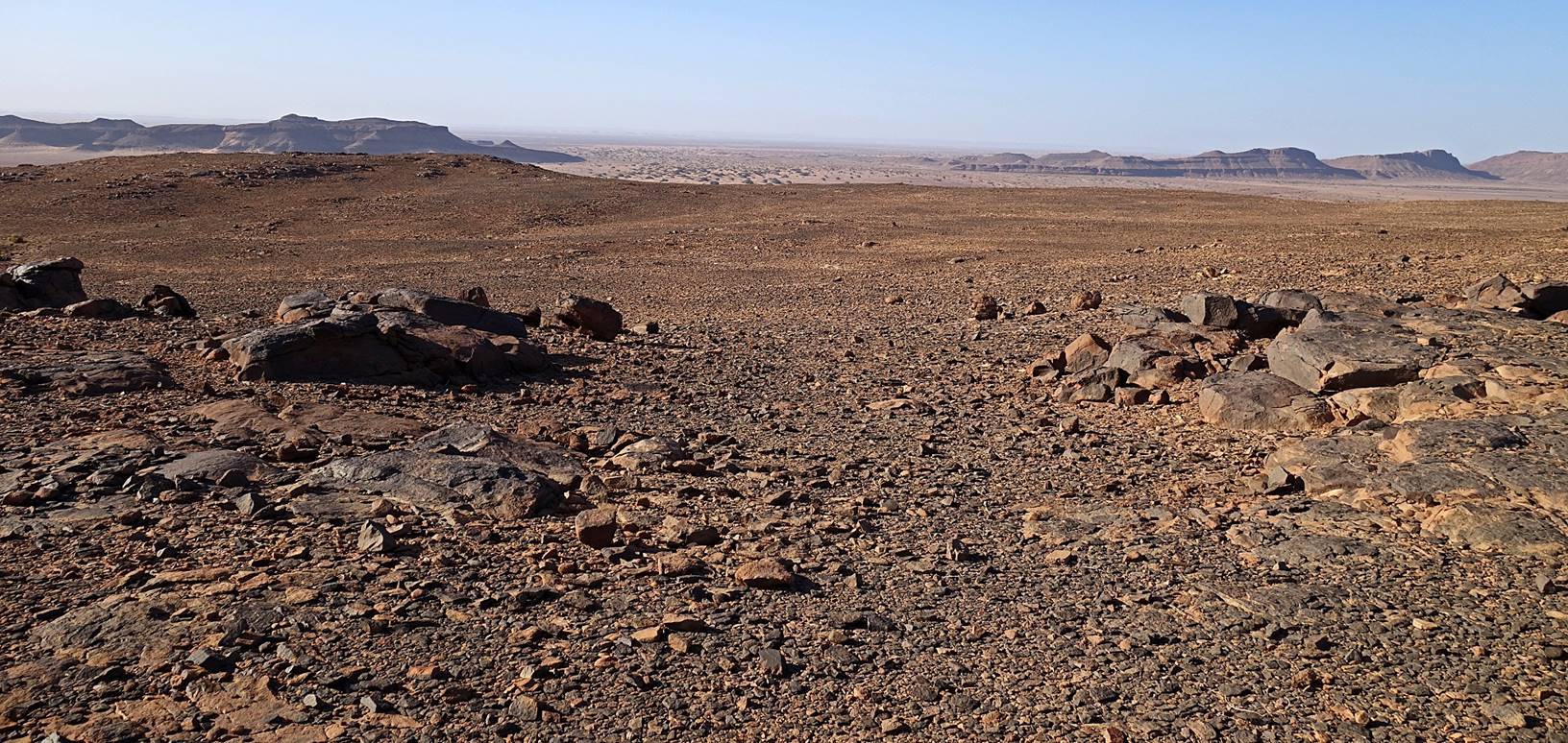
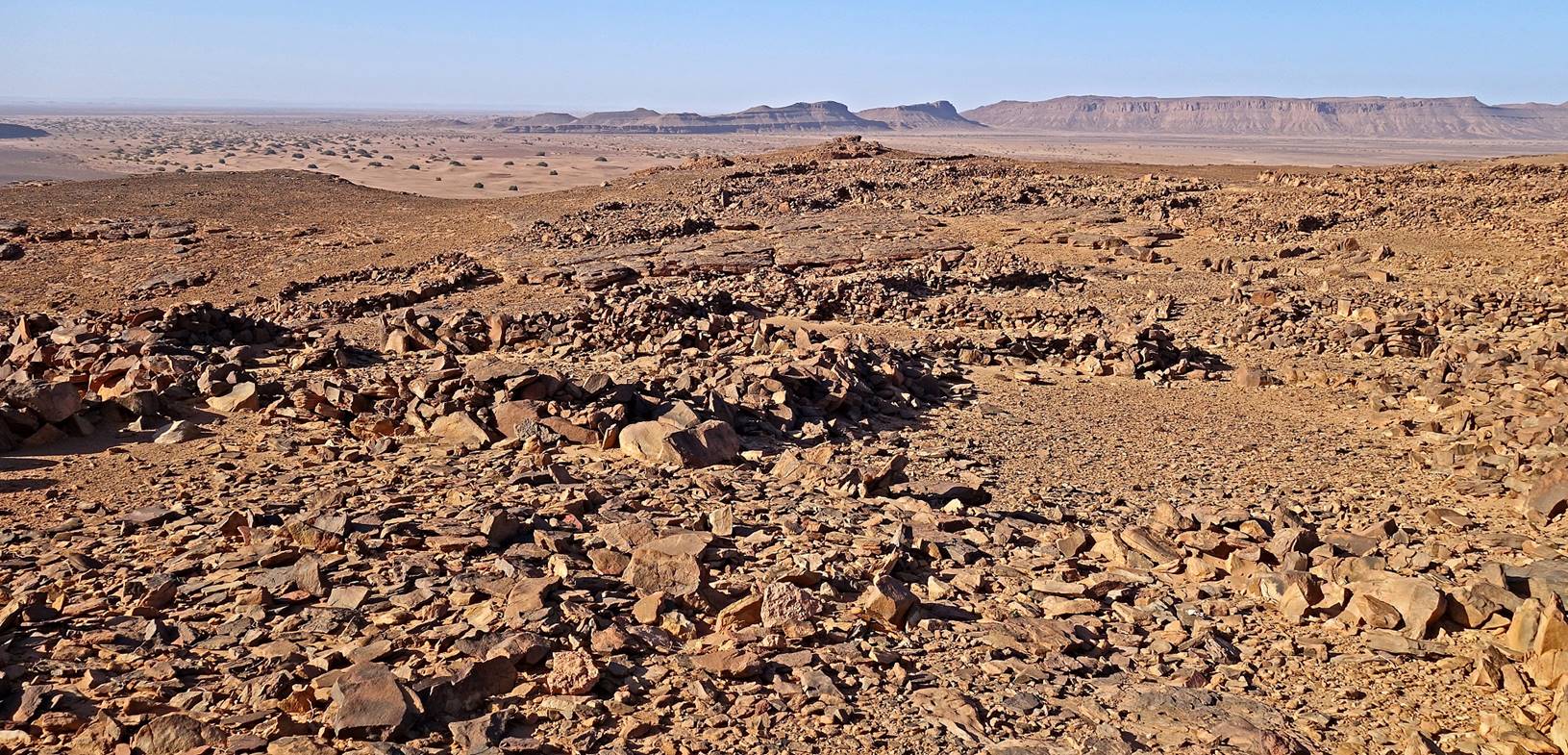
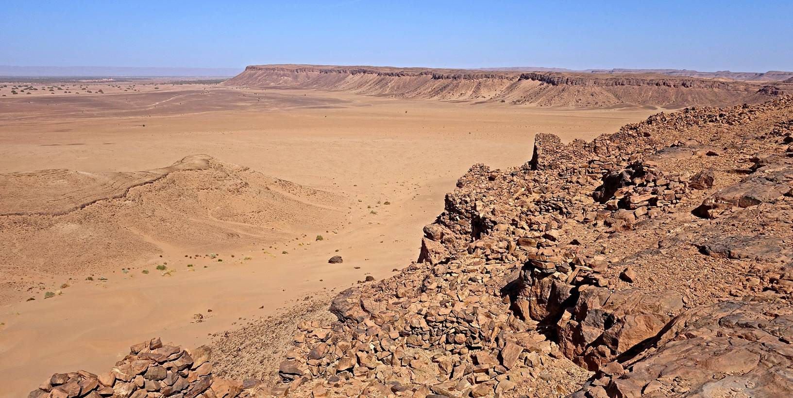
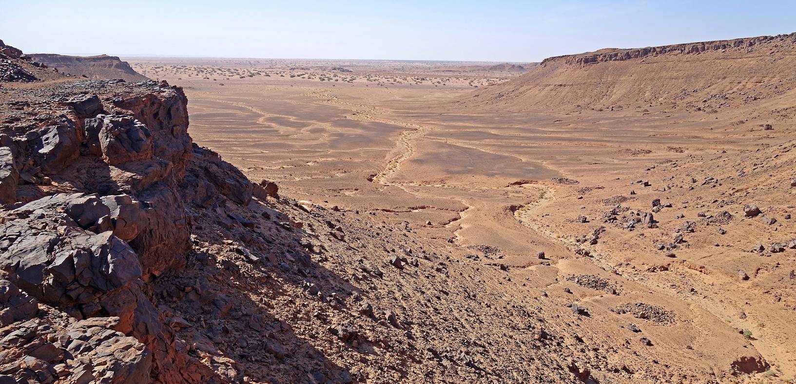
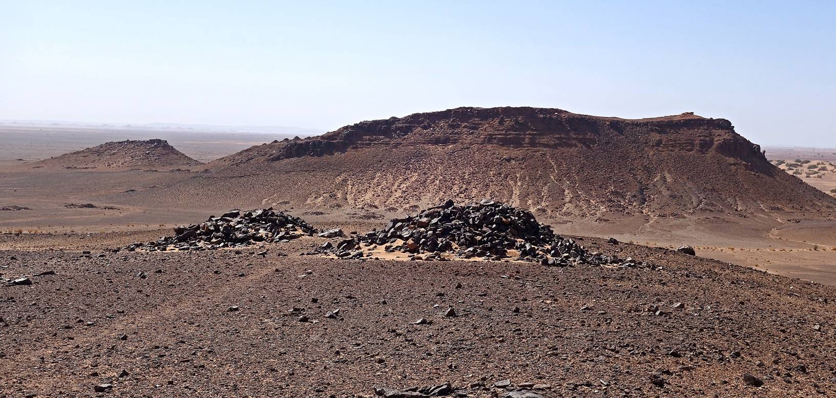
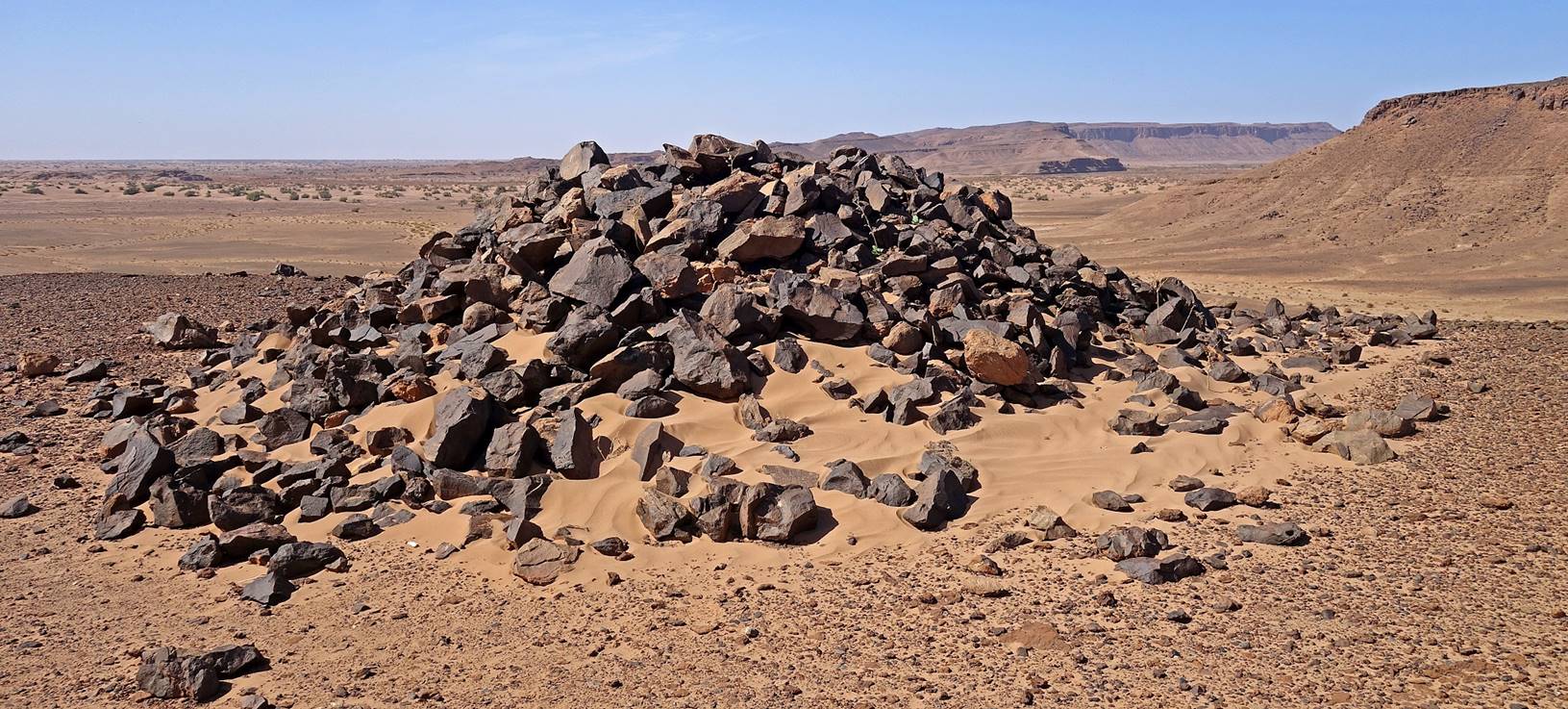
of the desert (toward the west) from a location between waypoints 009 and 010.
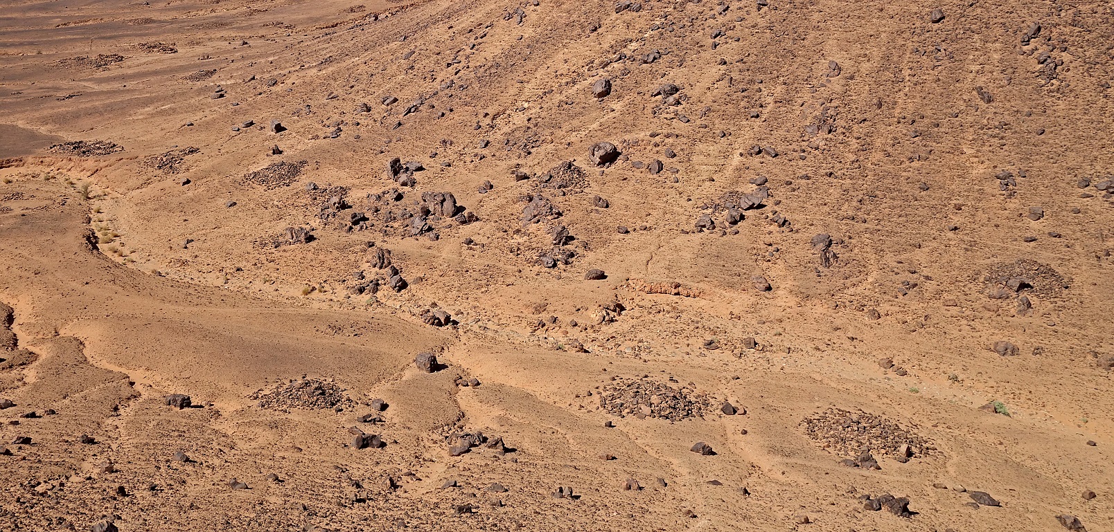
Tumuli
(burial stone mounds) below us.
View
toward the south from a ridge.
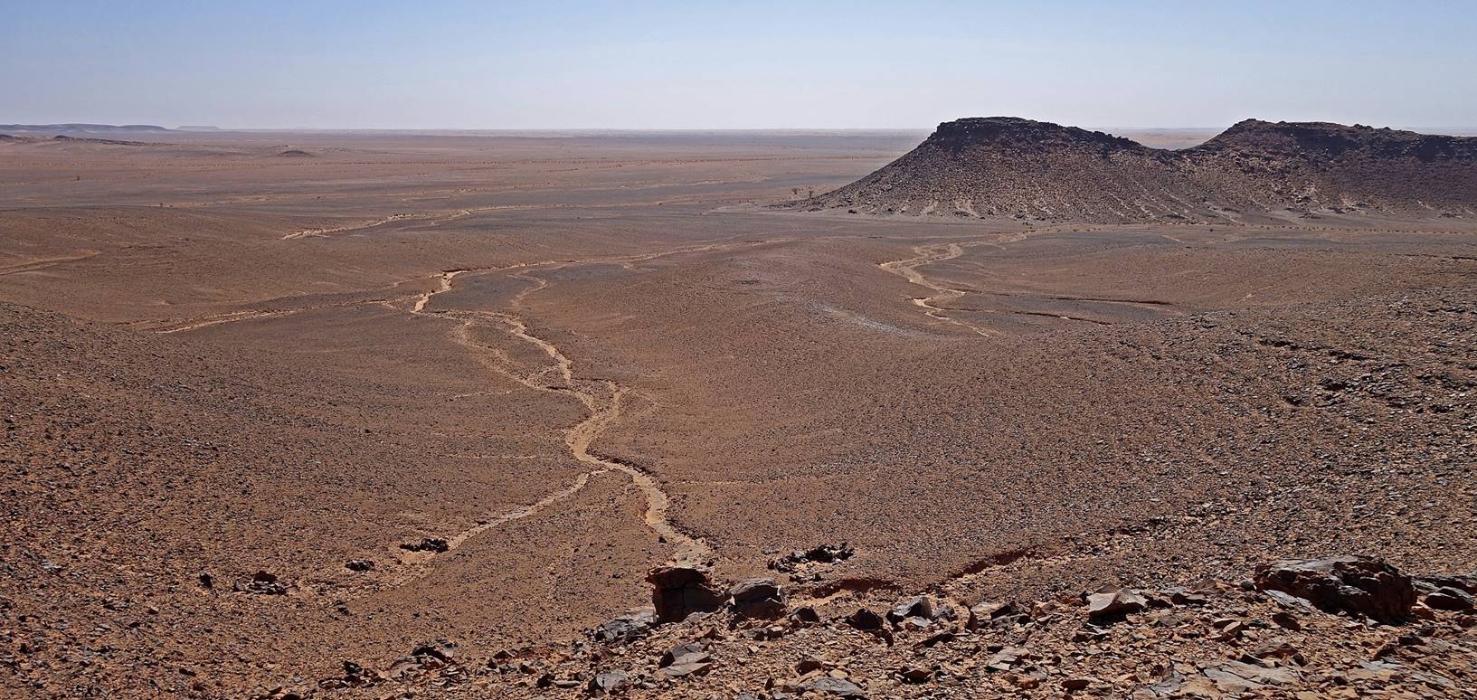
Closer views of
tumuli. Each one, typically 1.5m high, may be the burial place of several dead
from different families and of different rank or wealth status. A dead person
used to be buried quickly after his/her death. The body was laid down on top of
an existing tumulus (or a new tumulus was created) and covered with new stones.
In the desert the graves must be covered with stones to resist wind and
occasional heavy rains.
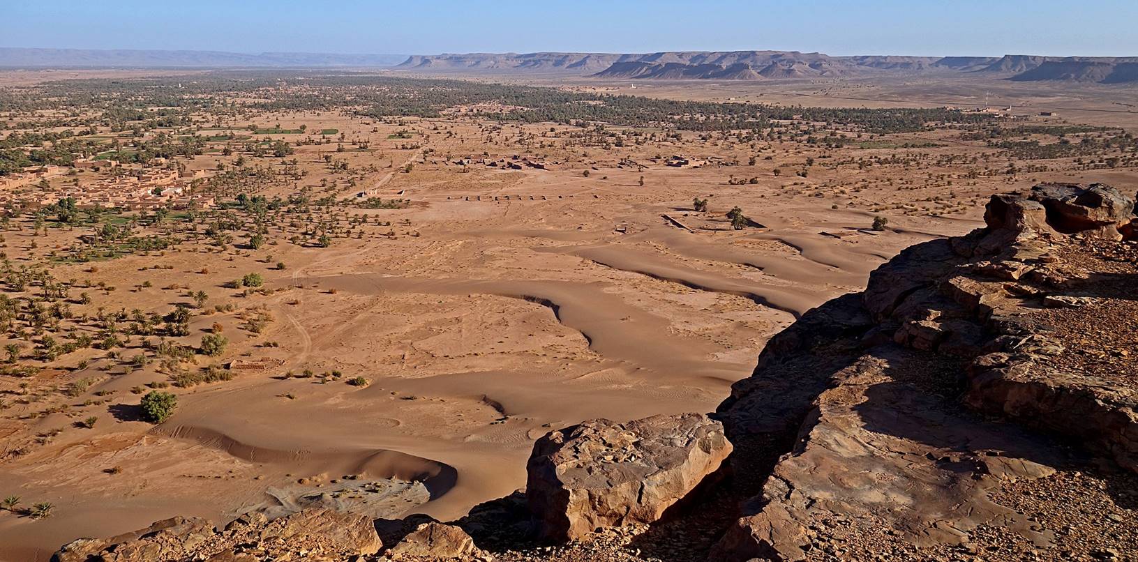
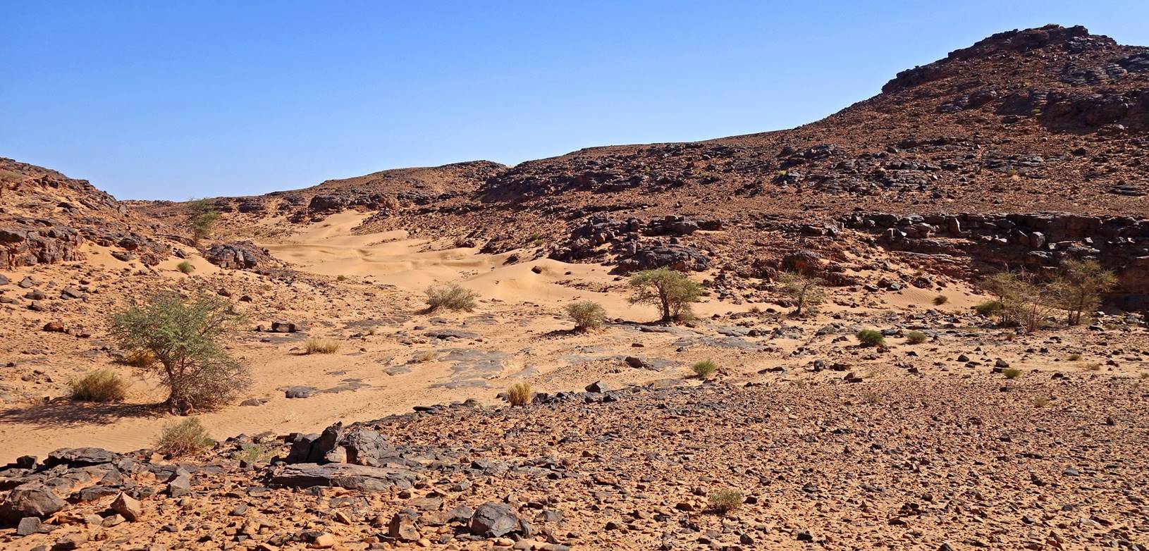
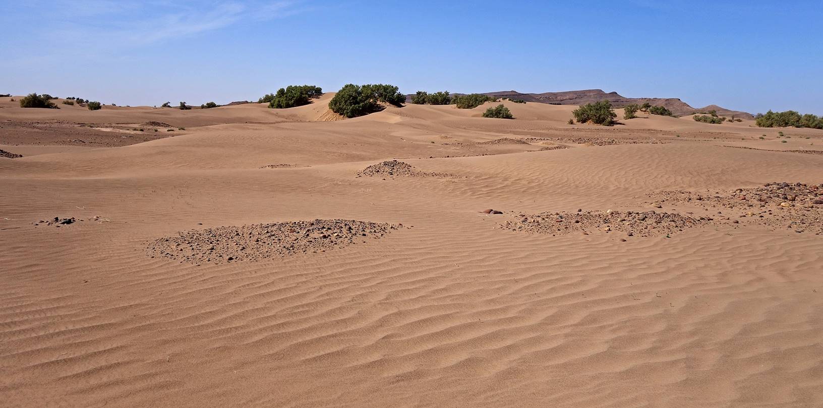
Sand dune area around waypoint 012. Due
to the proximity of Oued Draa
there is some underground water that allows small tamarind trees to grow and
survive.
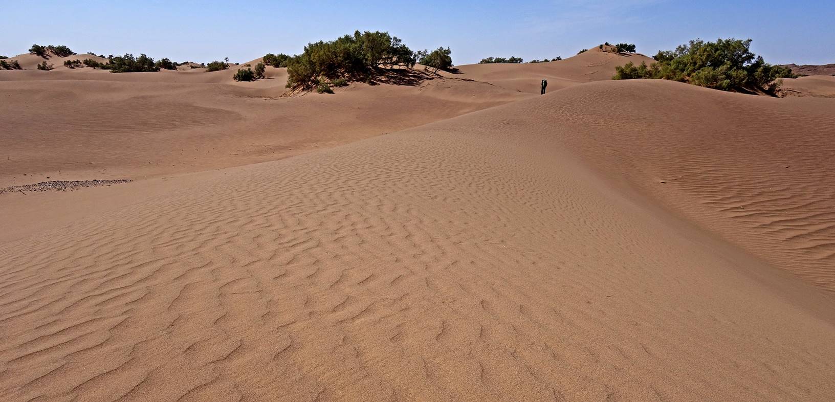
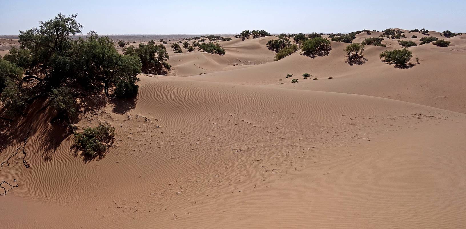
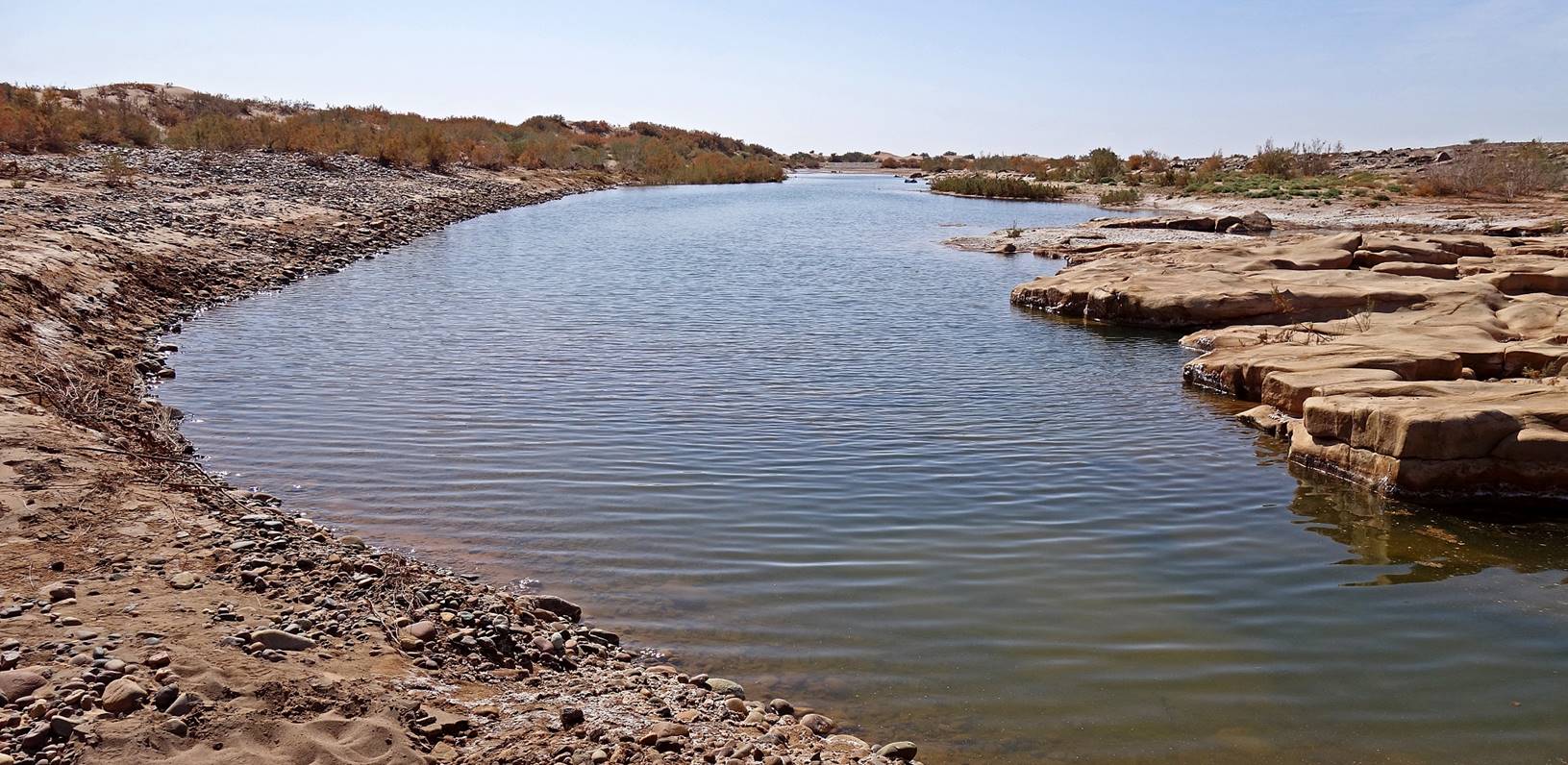
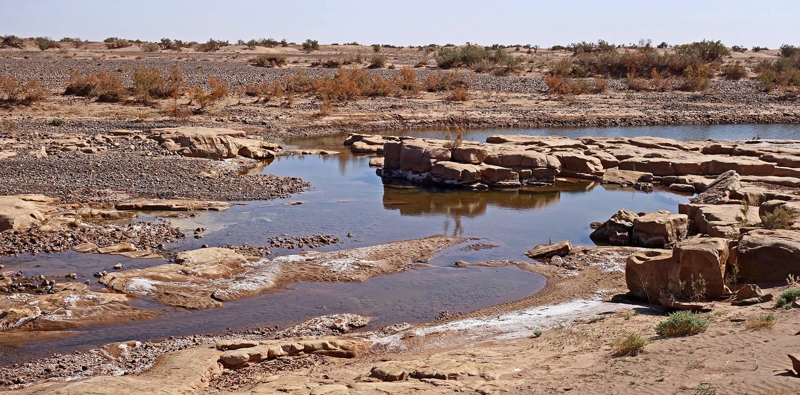
Stagnant
water (with high salt content) in the riverbed of the Oued
Draa, crossed before reaching our camp 1 at waypoint
013, close to the ″elbow″ of Oued Draa.]
[Oued Draa is the longest Moroccan river (~1,100km). It flows
from the El Mansour Eddahbi reservoir near Ouarzazate, which is fed by rivers descending from the High
Atlas. From the reservoir′s dam it first goes south-eastward to Tagounite, then southward from Tagounite
to the ″elbow″ south of Tiraf, finally
westward to the Atlantic ocean. Over most of its length it is dry most of the
year, but its riverbed and the surrounding areas are subject to floods during
major rainstorms in the mountains.]
Later in the
afternoon, Oumar and I ascended the small mountain
south of our camp 1 (waypoints 014 through 019). We had heard that there were
petroglyphs near the ″elbow″ of Oued Draa and our initial goal had been to find them. We only
found a few damaged ones, but we saw several places were rock slabs had been
cut, probably by petroglyph looters. So, we decided to continue our hike up to
the northern edge of the mountain, where we found yet another set of mysterious
ruins.
[This mountain is the southeastern tip
of Jbel Bani, which Oumar and I will visit on the last day of trek. The ruins
seem to be the Irherm n′Irhir
n′Tidri mentioned in https://www.prehistoire-du-maroc.com/foum-errjam.html,
where the mountain is called Jbel Beni
Salmane. See the main
Morocco 2020 webpage for a note about the name ″Jbel
Bani″.]
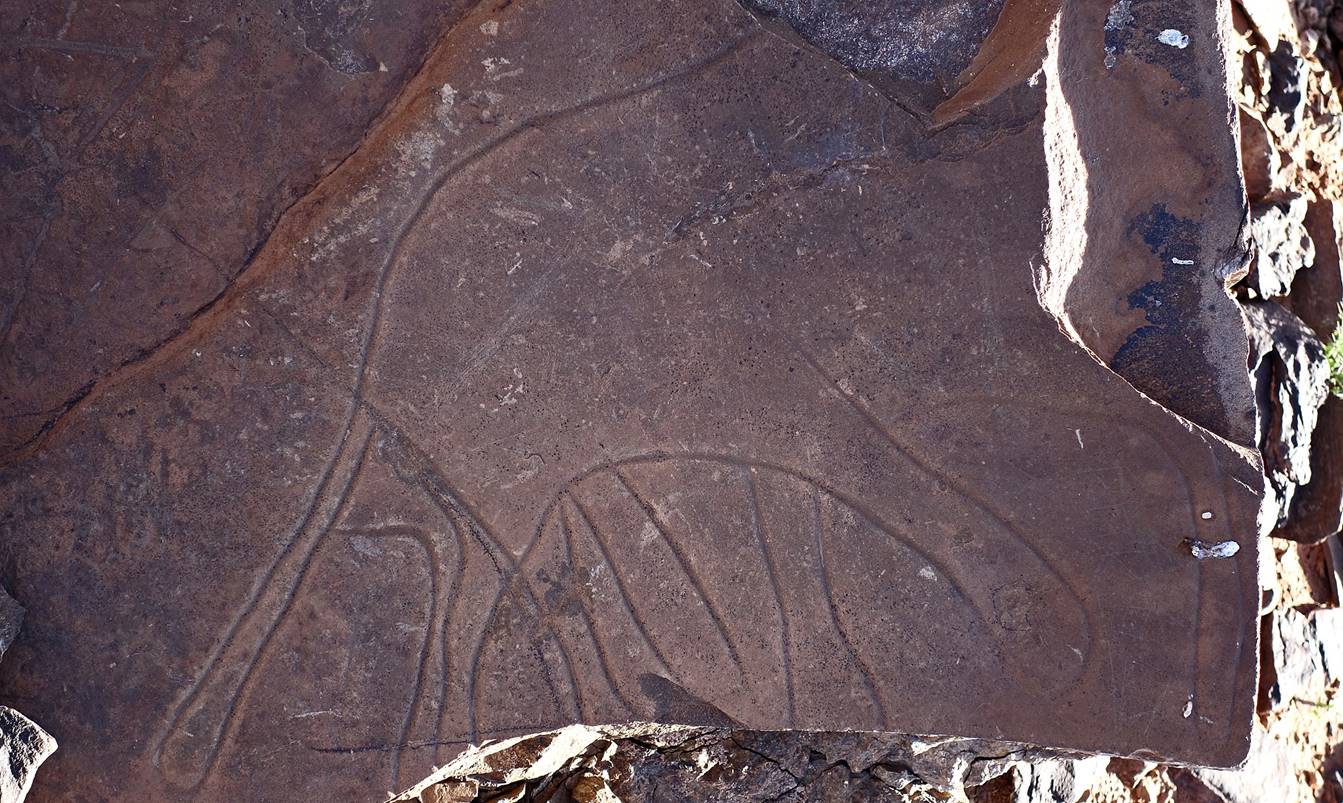
Damaged petroglyph,
which may depict an animal.
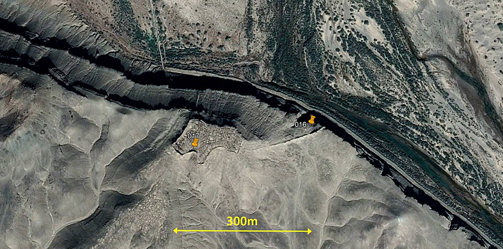
Aerial view of the
ruins located between waypoints 016 and 017, overlooking the Oued Draa on their northern and
western edges.
The ruins seen from
inside the ground.
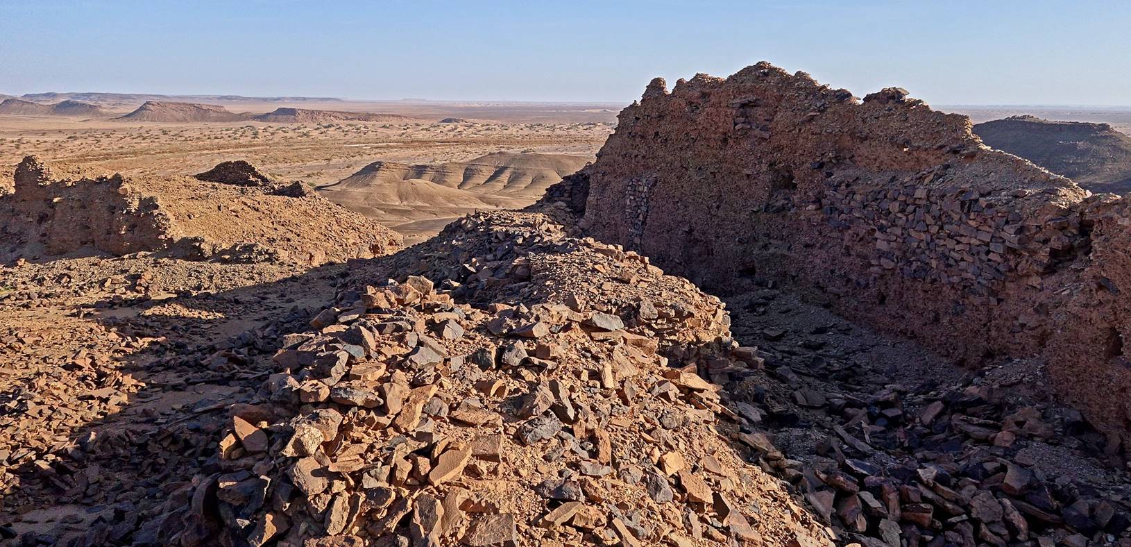
Northern
wall. (The valley of Oued Draa
is visible on the left of the second photo below.)
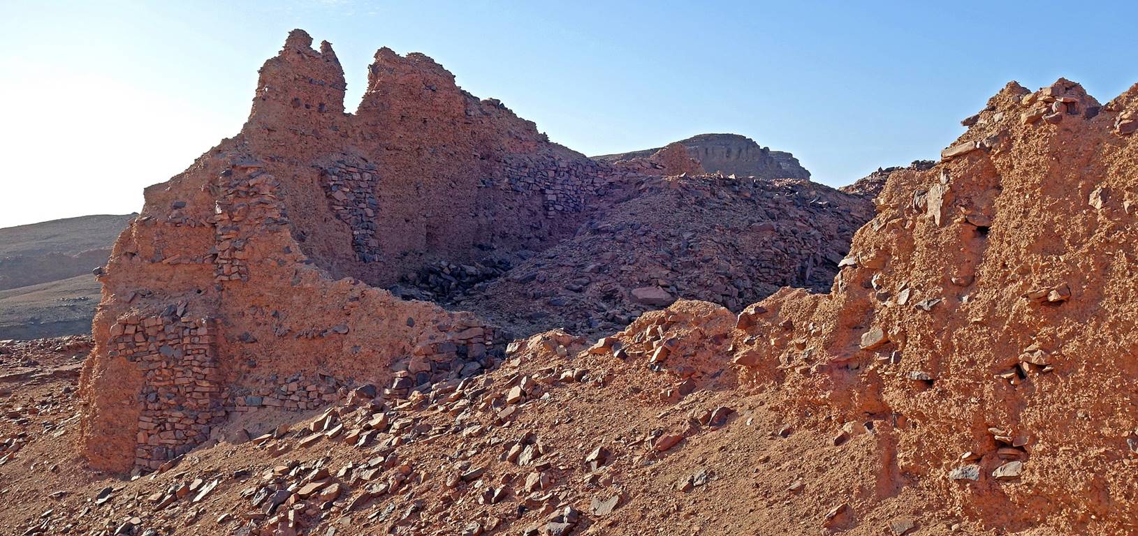
View
toward the south from the ruins. Our camp 1 is located at the tip of the yellow
arrow.

![]()