A Tour of Northern Humla, Nepal (September-October 2014)
|
|
|

Back to my mountaineering/travel webpage
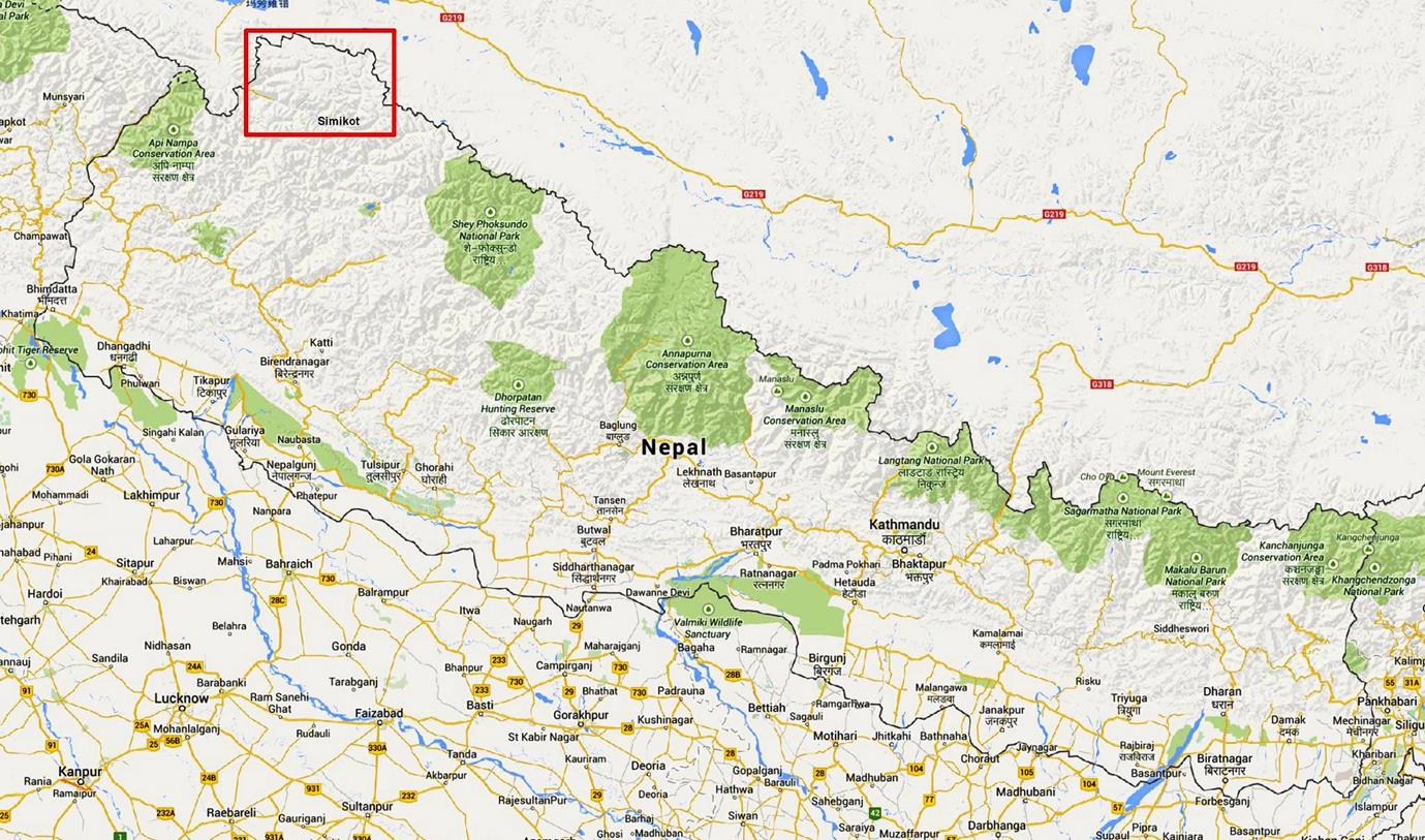
Location of northern Humla in Nepal (rectangle in red).
The map below shows the itinerary of the trek. The main loop (red dotted line) starts and ends in Simikot. It follows the Chuwa Khola, crosses the Nying La (5448m), follows the Nyalu Khola(*) to Thakchhe, then the Limi Khola and the upper part of the Karnali Humla to the border village of Hilsa, and finally returns to Simikot mostly along the Humla Karnali. There are four side trips (blue dotted lines): along the Lacham Khola (a tributary of the Chuwa Khola), to the Tibetan plateau, to Yansi Gompa, and to Raling Gompa.
(*) I could not find the name of this river in any map. Since it has its source in the Nyalu Lek mountain I named it Nyalu Khola.
I had initially planned to go to Chang La (pass on the border with Tibet, upper right in the map), but concerns with the weather led us to cancel this sidetrip to cross Nying La as soon as possible (since this pass becomes impassable after a big snow fall). I then decided to go to the Tibetan plateau (from Thakchhe) to see Mount Kailash from the border with Tibet. However, the area was extremely cold (my thermometer measured -20C in my tent at 5am during the night spent on the plateau). We were not equipped for such low temperature and we decided to return to Thakchhe (800m lower) the next morning. Two days later (on October 14th) a group of trekkers were caught in a memorable snowstorm at the same location on the plateau and had to be evacuated by helicopter.
When the snowstorm hit we had set up our camp at the hot spring located above the village of Dzang along Limi Khola. The storm had two positive impacts on my trek: it was the cause for several pujas (Buddhist religious ceremonies) in the villages of the Limi valley and it made the surrounding mountains even more beautiful. Despite the storm the trek turned out slightly shorter (in days) than I had planned. So, I used the extra days to do sidetrips to interesting gompas: Yansi and Raling gompas.
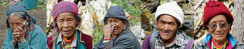
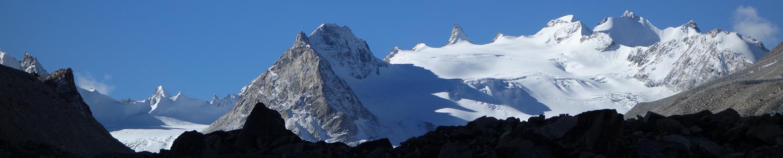
Overall, this was a great trek, with a rare diversity of scenery and very interesting people, villages and gompas.

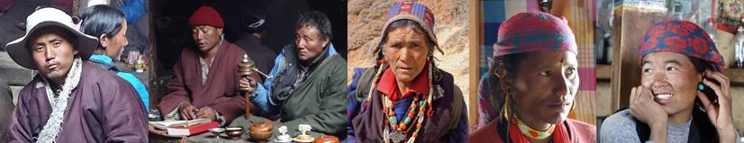
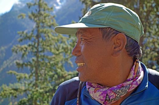
As for all my previous trips to Nepal during the past 15 years, the logistics for this trek was arranged by Windhorse Trekking. My support team consisted of Dawa (#1), Dawa (#2), and Kalu. Dawa (#1), whom I have known for many years, was the leader of this team. Dawa (#2) was the cook and Kalou was the muleteer (we used 3 mules to carry food, stoves, kerosene, tents, and other loads). Both Dawa′s are Sherpas from Solu. (The Sherpa name Dawa is often given to children born on a Monday. So, there are many Sherpas called Dawa!) Neither of them knew northern Humla before this trip. Kalu is a local Chhetri from the village of Dojam (near Simikot). He was an excellent member of the team.
|
|
|
|
|
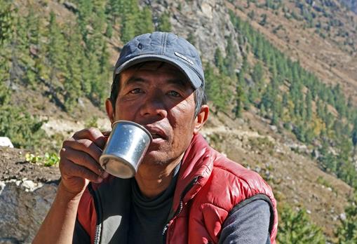
Dawa (#1) |
Dawa (#2) |
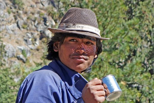
Kalu |
Click on the following links to see pictures of this trip:
- Stage 1: Nepalgunj to Simikot
- Stage 2: Simikot to Karching Kharka along Chuwa Khola
- Stage 3: Karching Kharka to Takchhe and Tibetan Plateau through Nying La (5448m)
- Stage 4: Takchhe to Dzang and Halji
- Stage 6: Halji to Hilsa (Tibetan border) via Til
- Stage 7: Hilsa to Simikot with sidetrip to Yansi Gompa
- Stage 8: Sidetrip to Raling Gompa
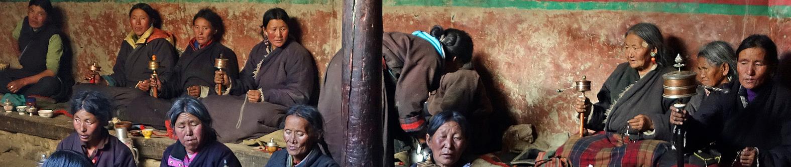
(This site is dedicated to the wonderful and welcoming people of Humla.)
|
|
|