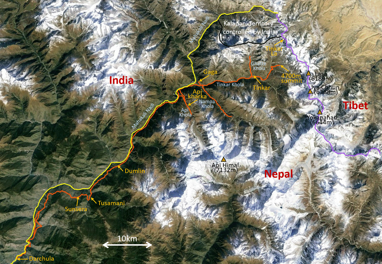
Nepal (April 2016): Valleys of Nepal‛s Northwestern Corner
3. Dumlin to Gaga
![]()
Return to main Nepal 2016 webpage
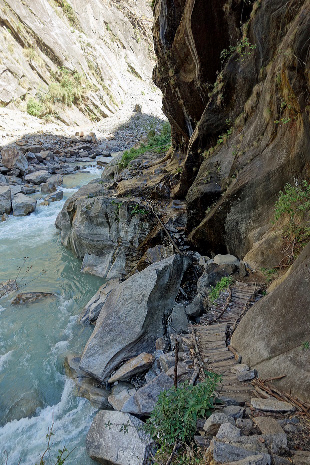
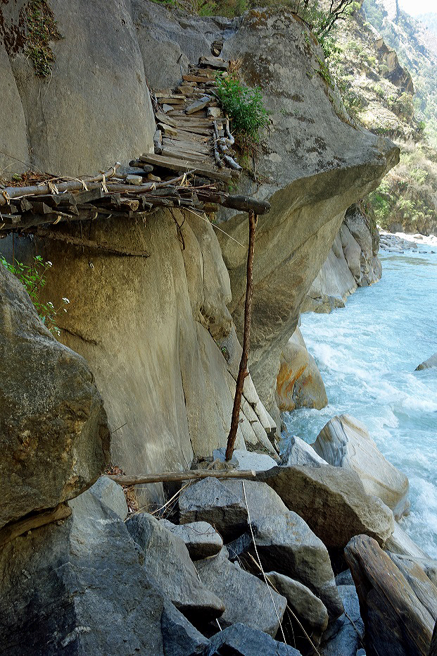
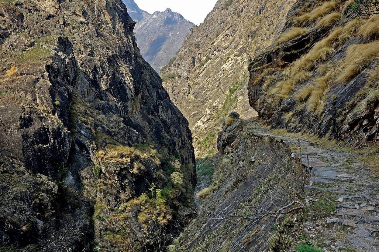
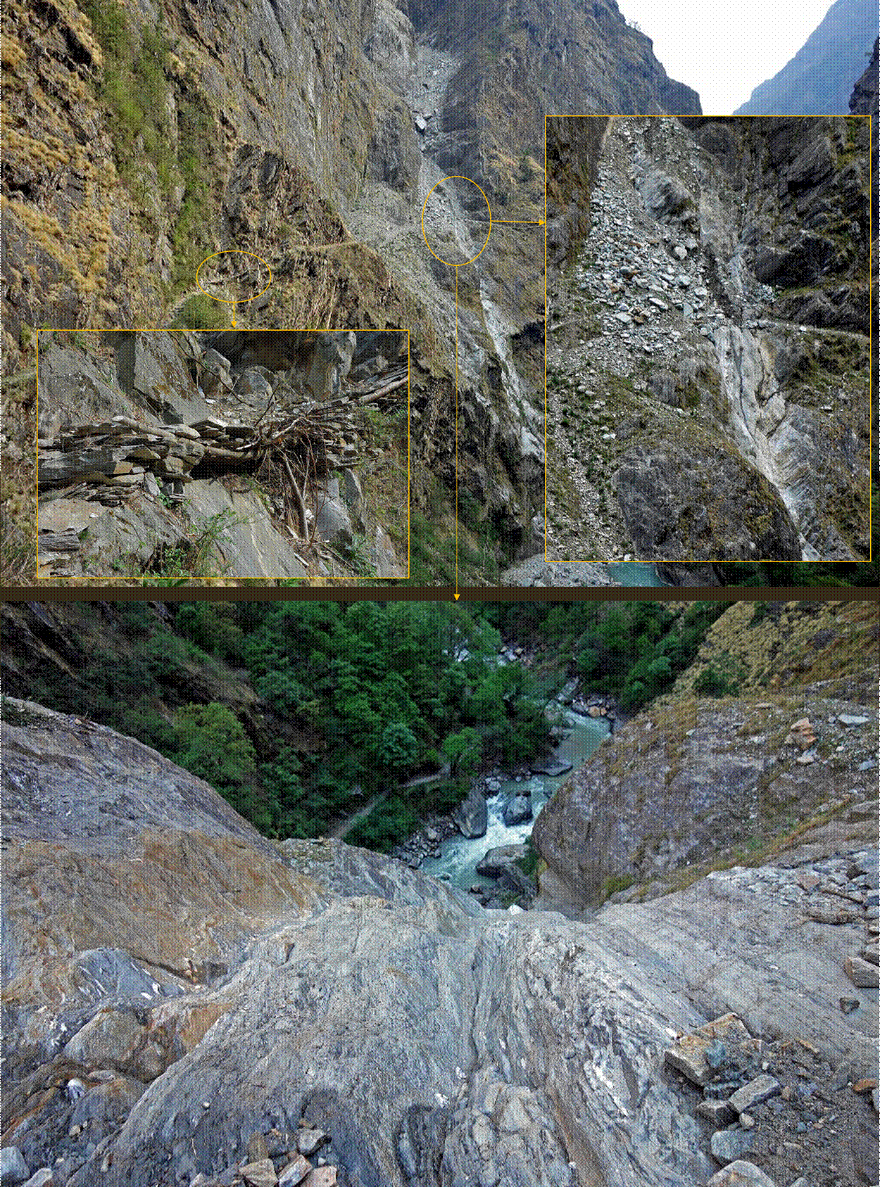
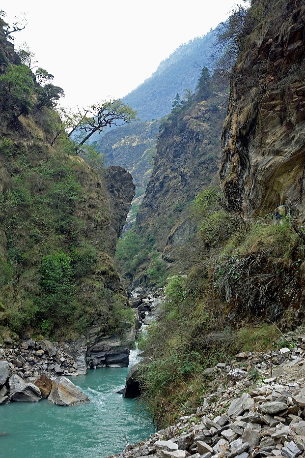
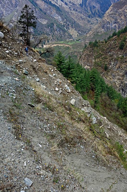
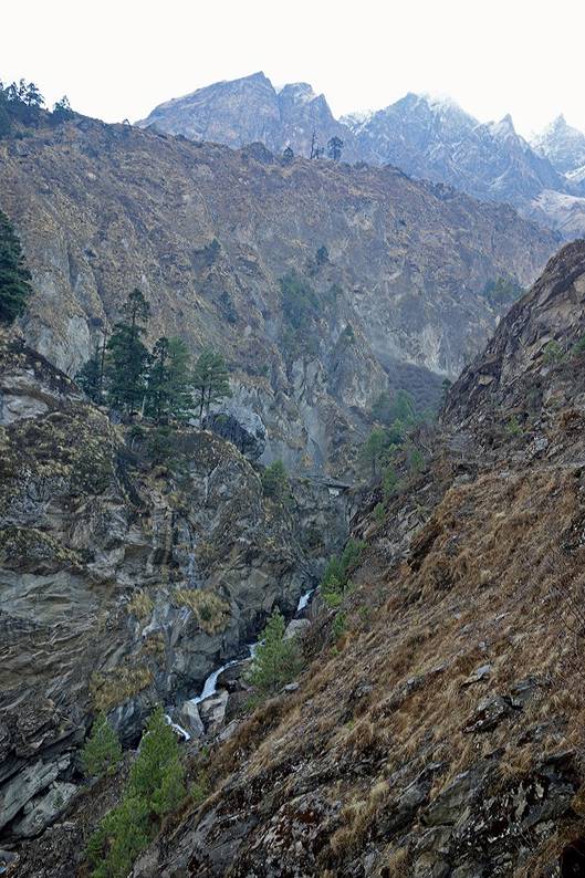
The region north of Dumlin is loosely populated and its trails are barely maintained. This hazardously engineered passage above Mahakali Nadi encountered soon after leaving Dumlin was a preview.
|
|
|
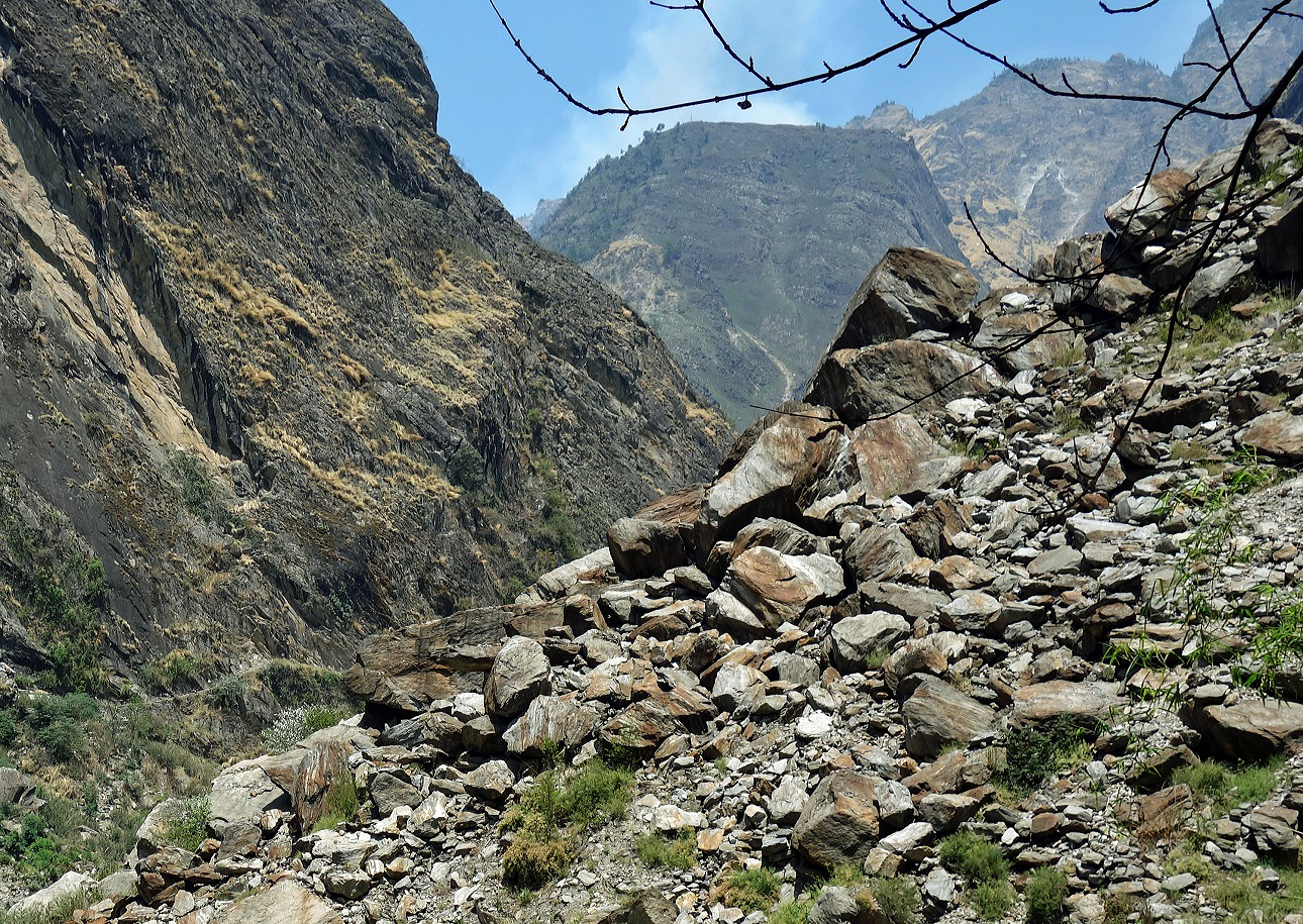
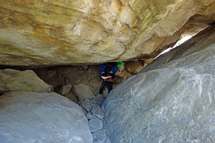
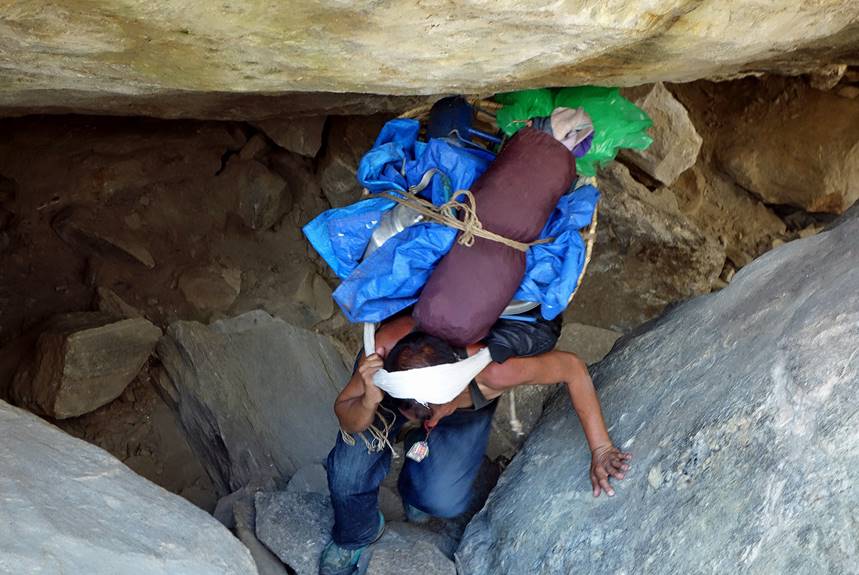
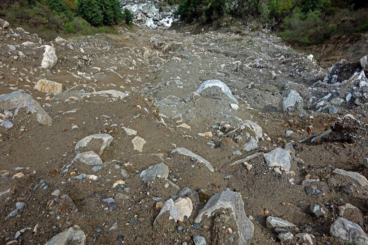
Further up, boulders from a former landslide were so big that we had to go below them, rather than above.
|
|
|
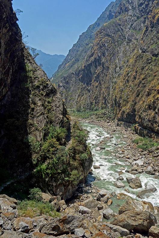
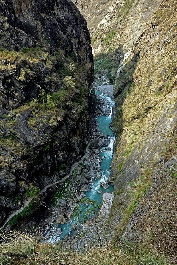
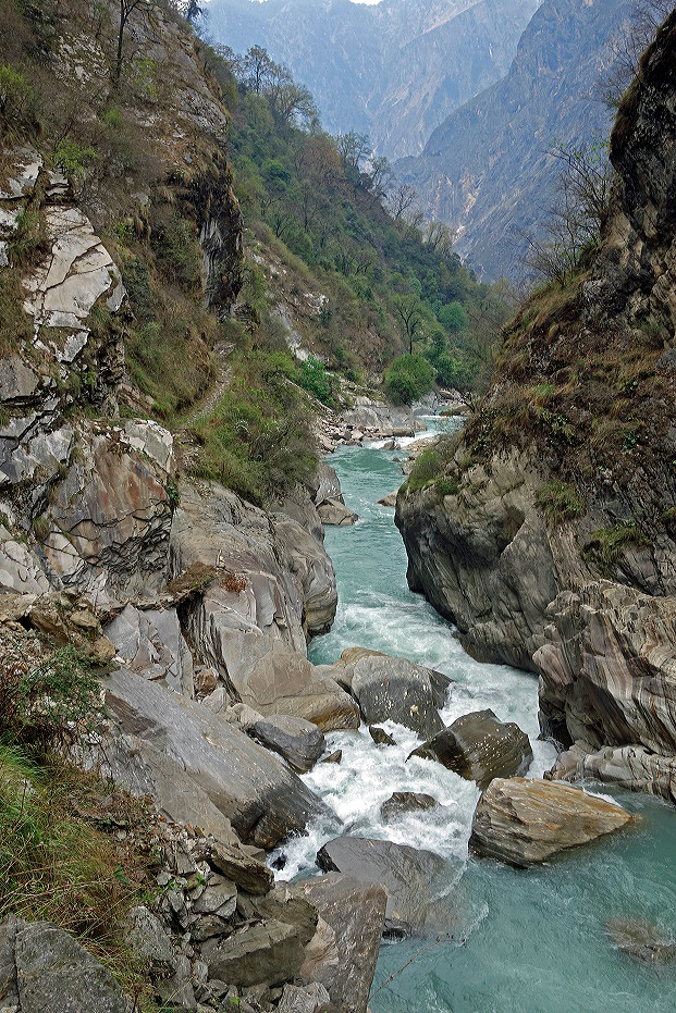
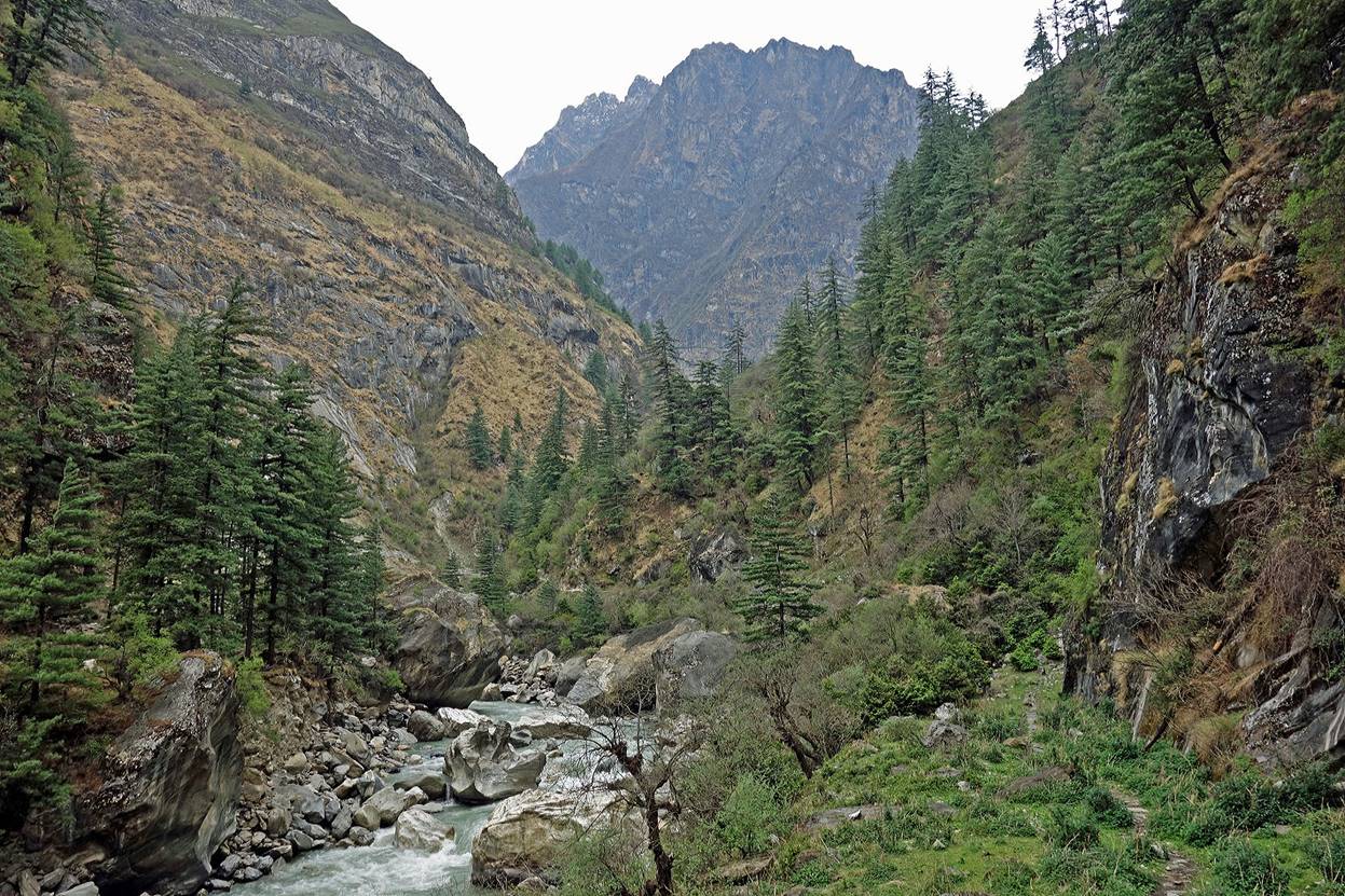
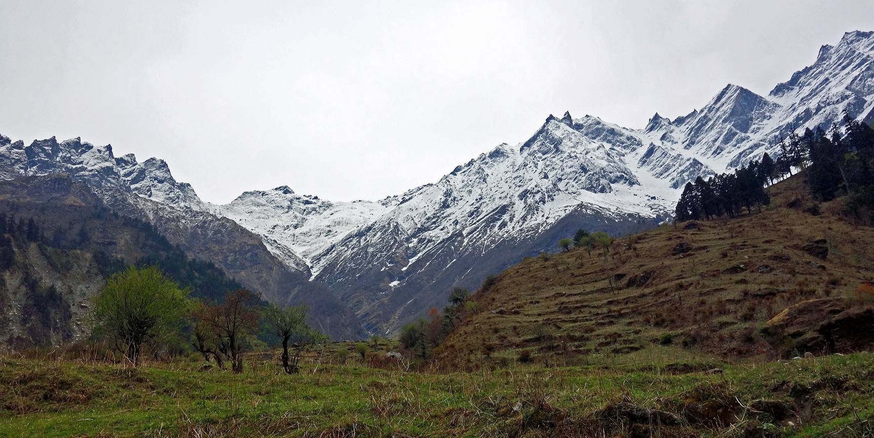
A bit later the Mahakali valley became increasingly narrower (with India on the left and Nepal on the right).
|
|
|
|
|
|
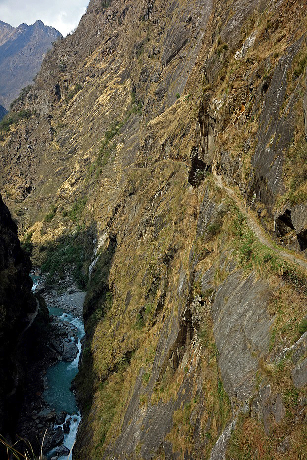
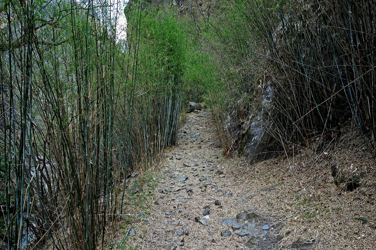
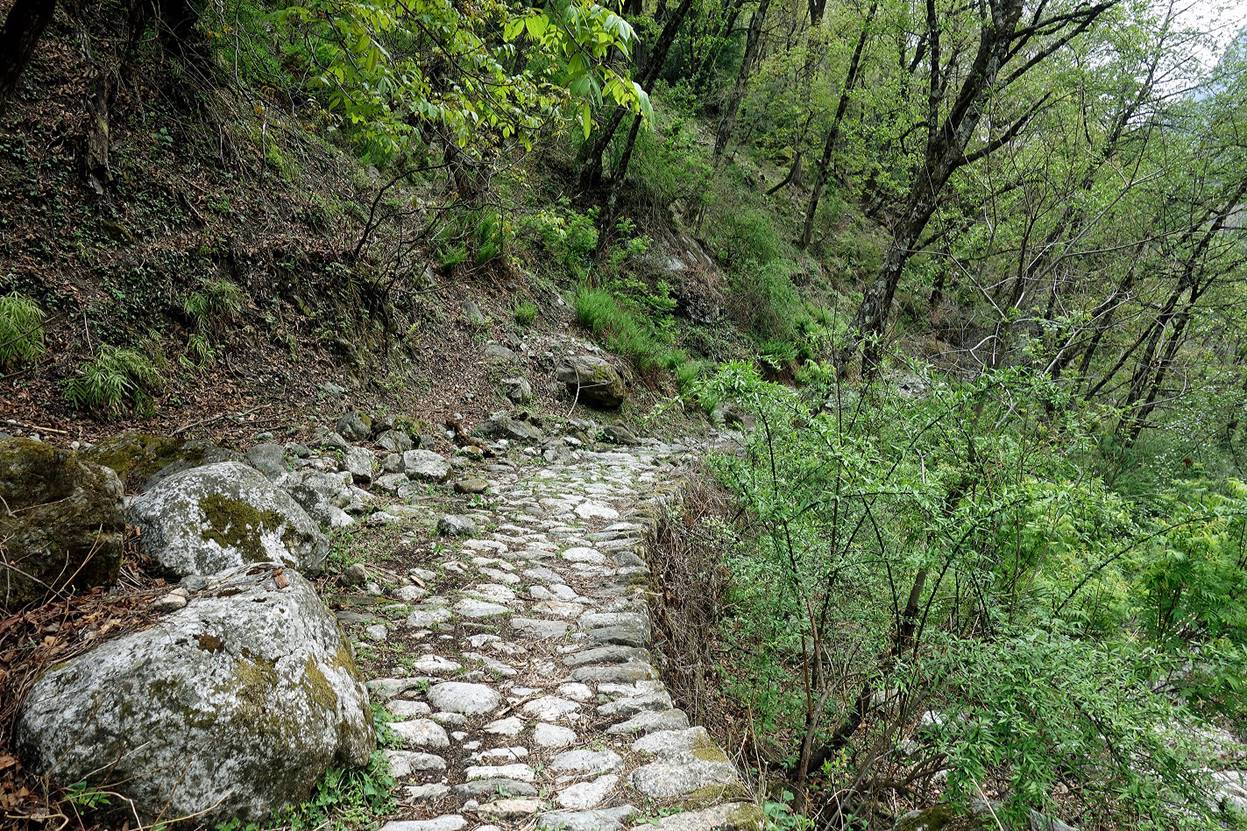
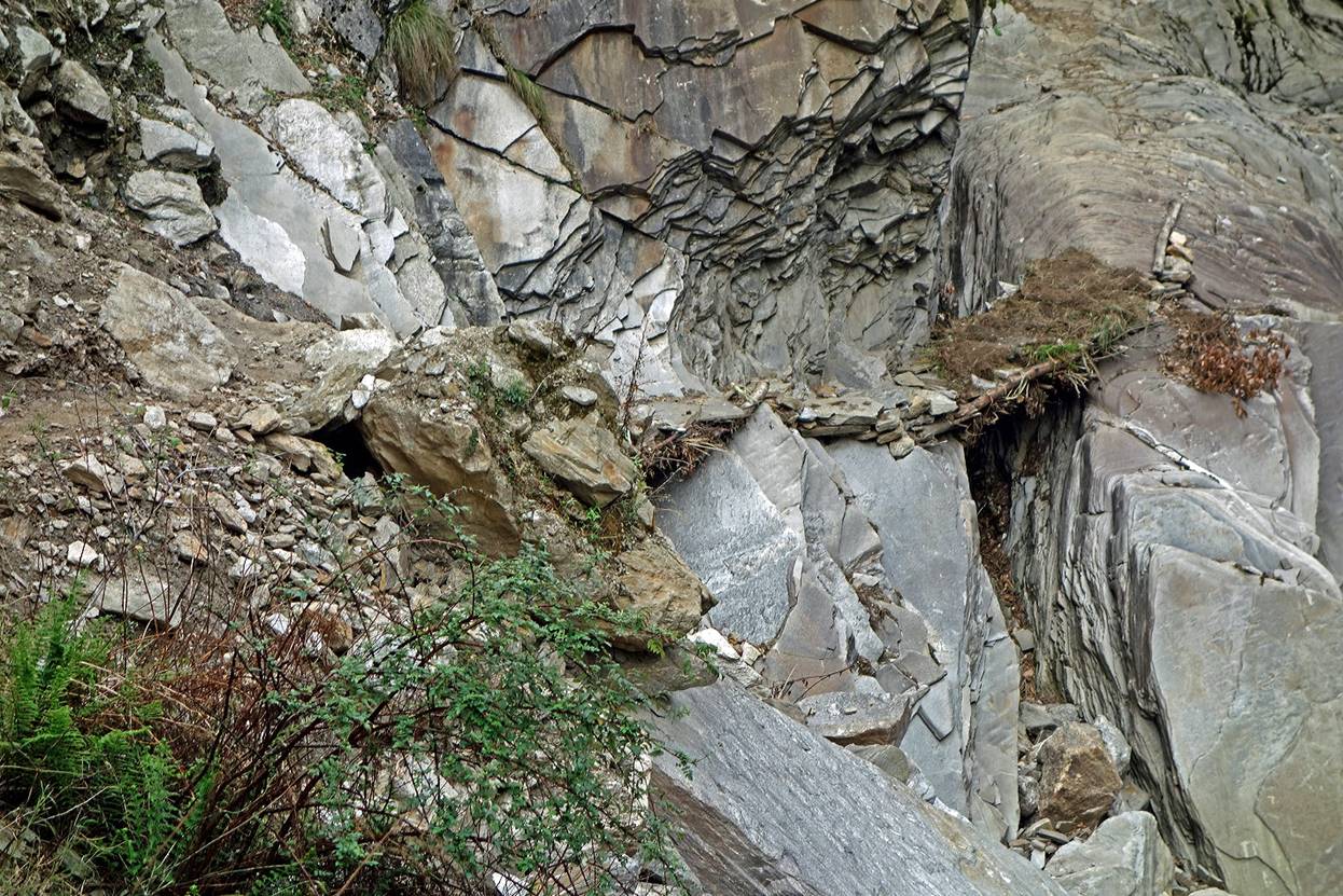
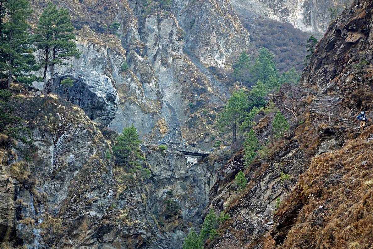
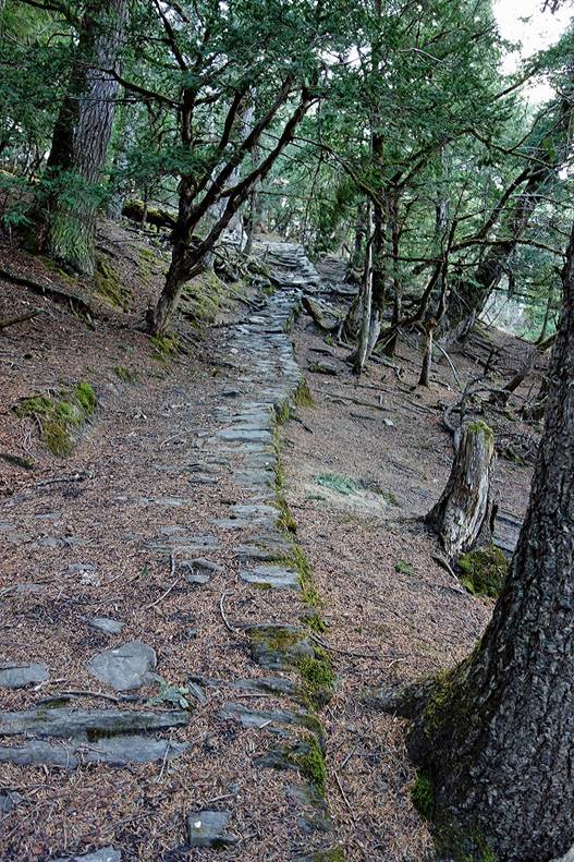
The ancient, well-constructed trading trail was still there, but with some broken sections as shown below. (This photo faces south, so India is on the right.)
Some good sections of the trail.
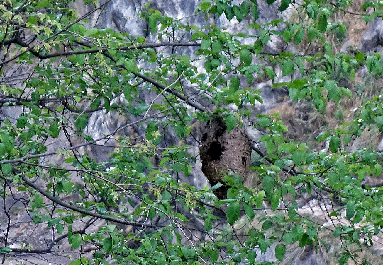
An abandoned beehive. Locals say that those bees are so powerful that their stings can kill cows.
Narrow sections and hazardous passage again.
|
|
|
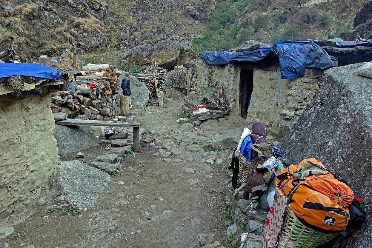
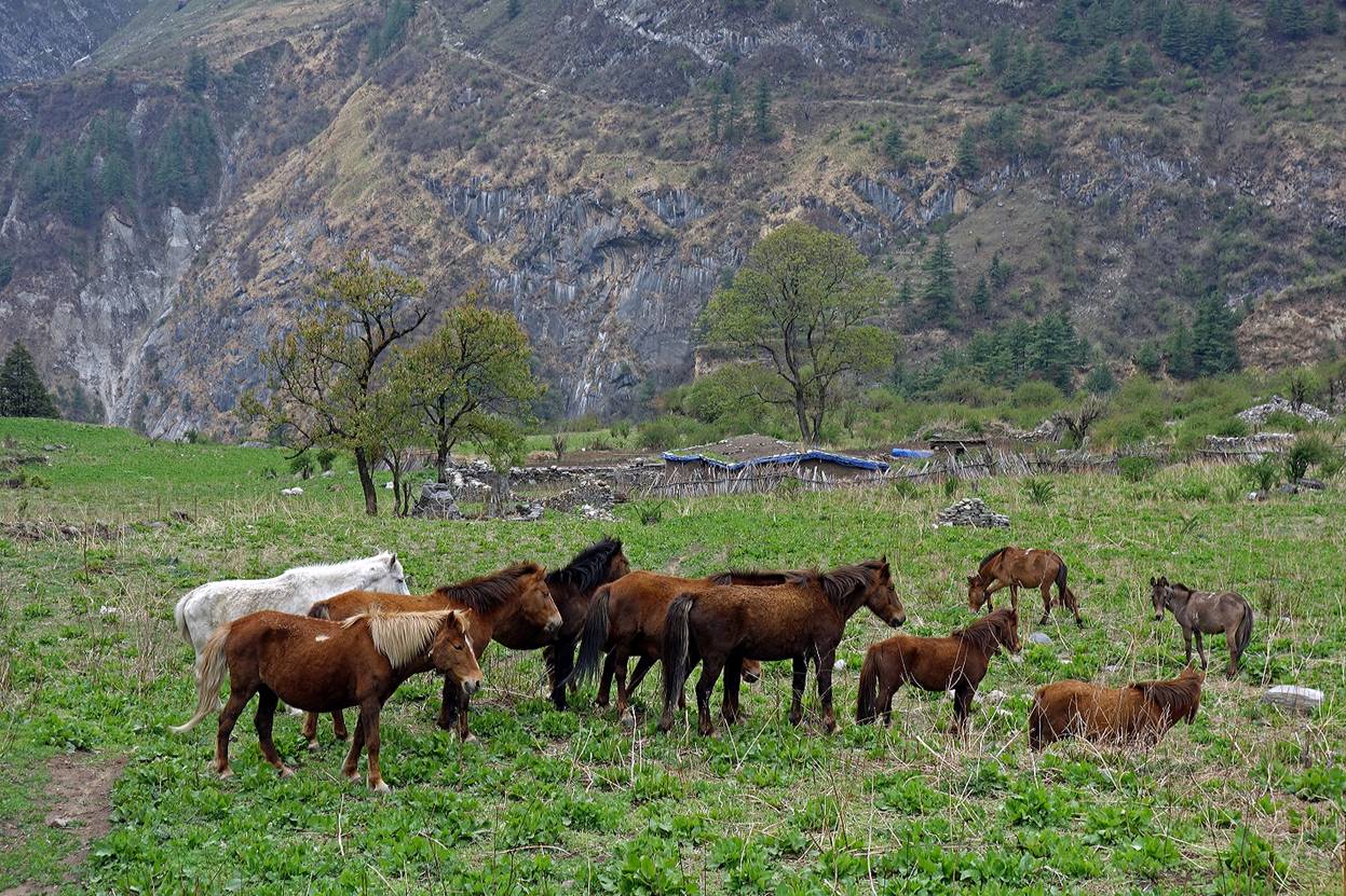
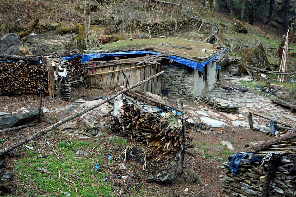
A small settlement along the way.
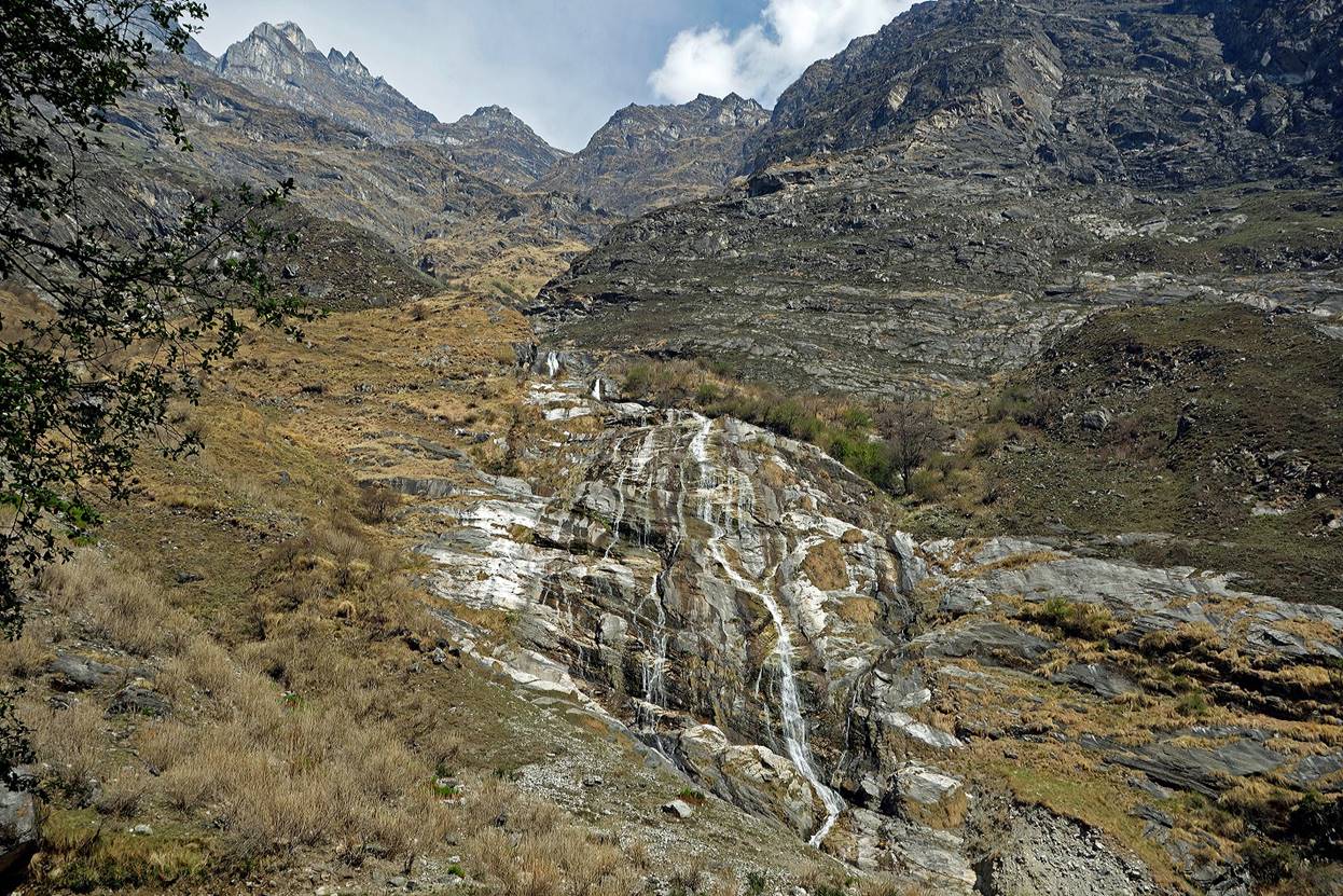
Waterfall on the Indian side of Mahakali Nadi.
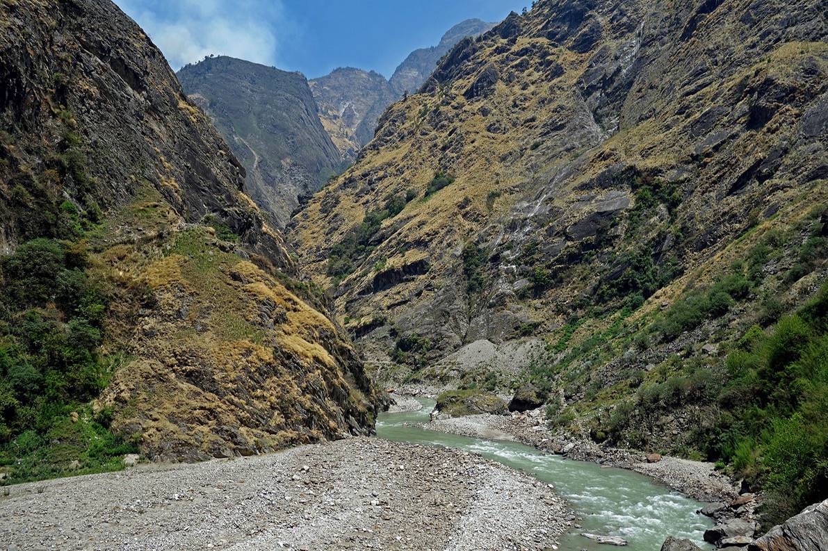
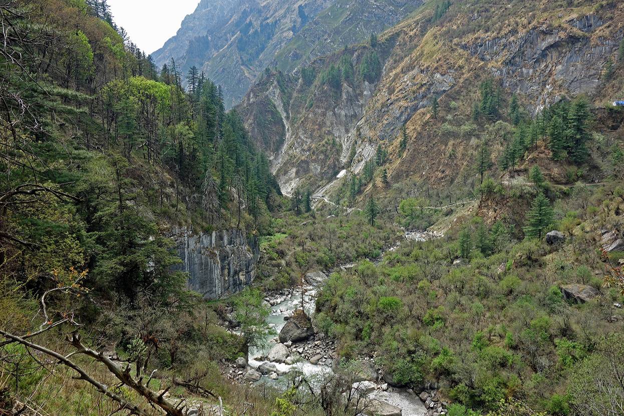
Further up the valley widens somewhat.
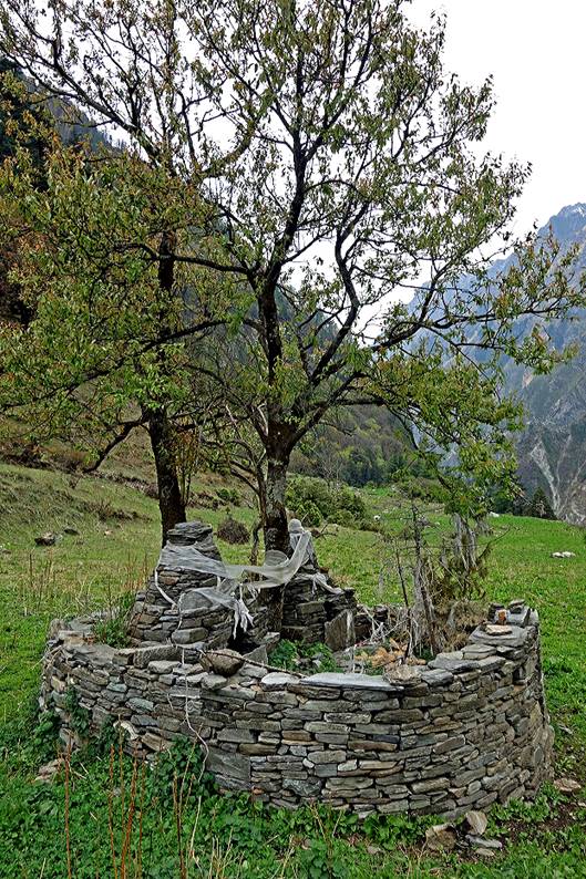
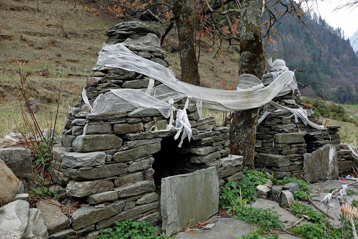
Another small settlement and its shrine.
|
|
|
The short valley of Buddhi Khola located slightly south of Api valley.
|
|
|
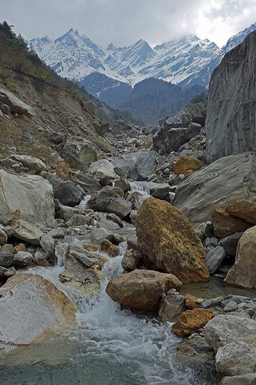
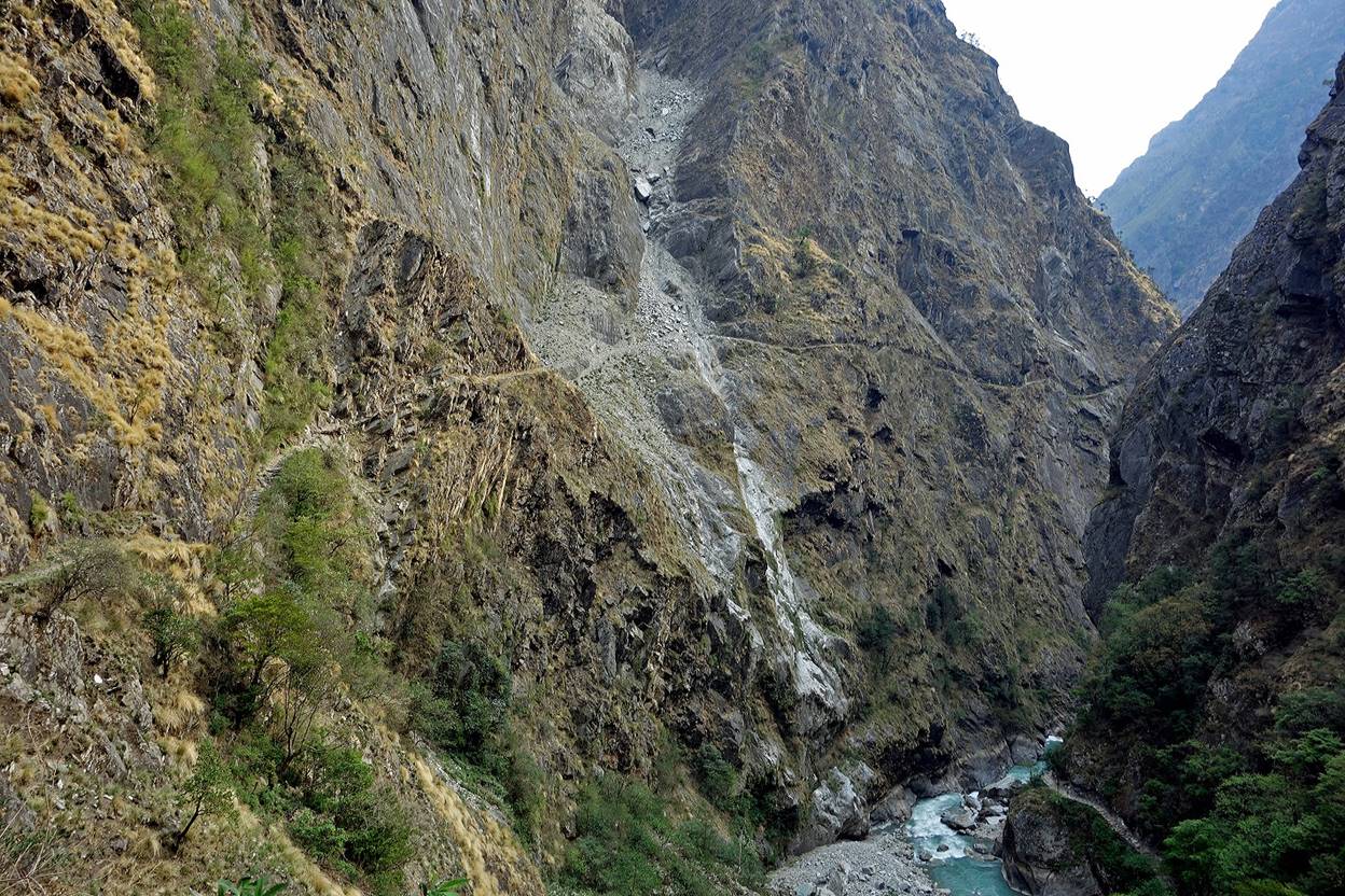
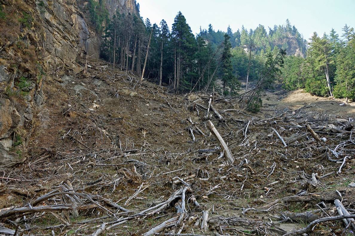
Landslide further up.
|
|
|
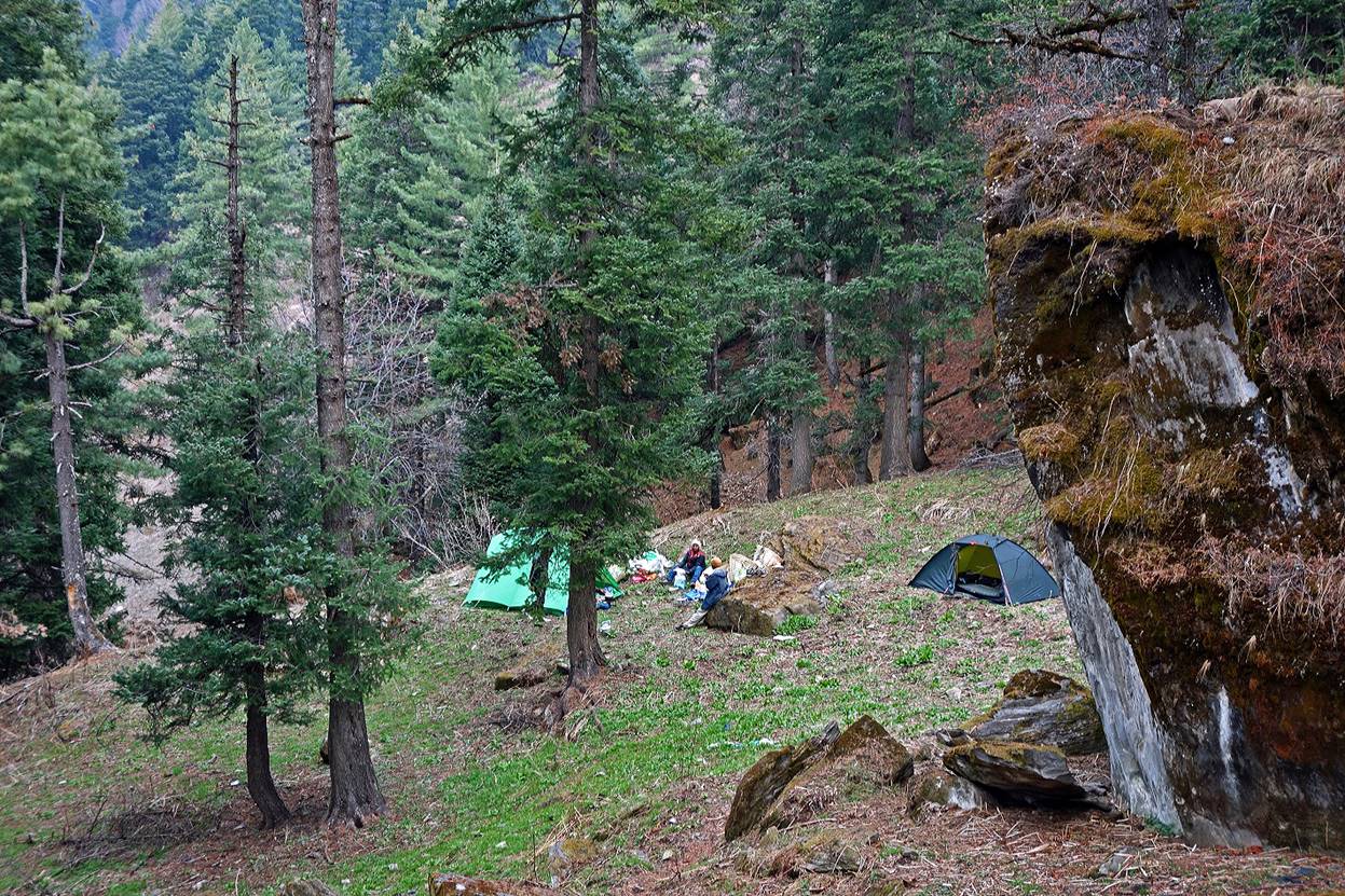
A summer settlement (no one was there), near which we put one of our camps.
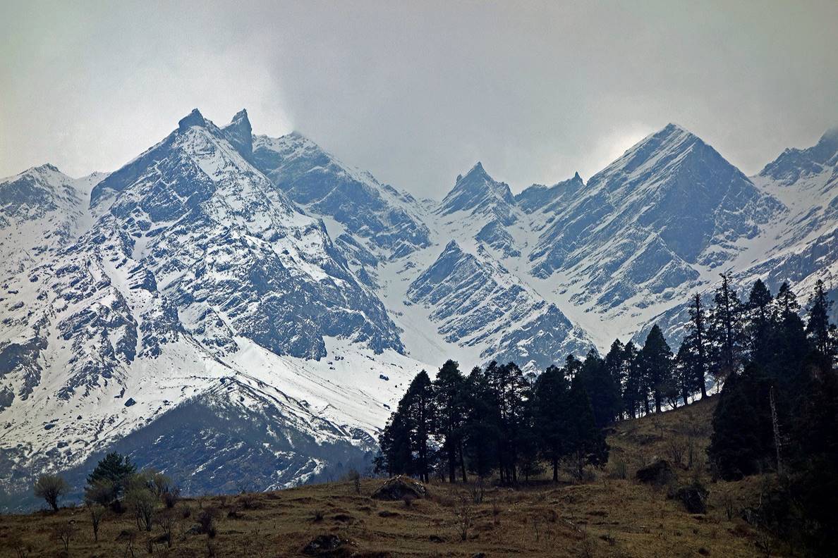
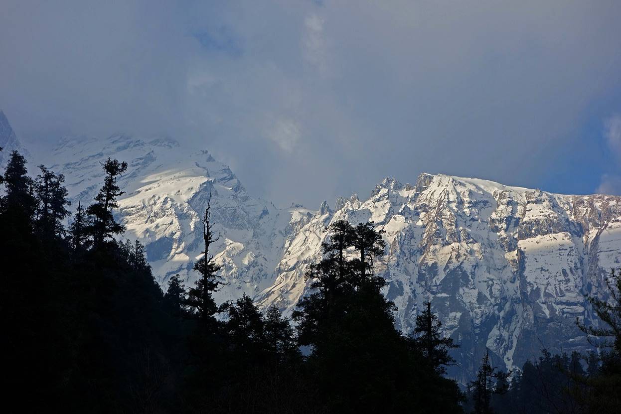
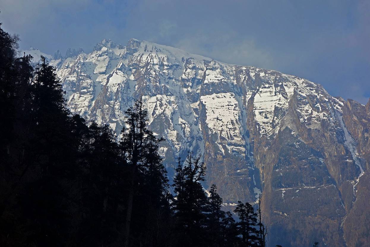
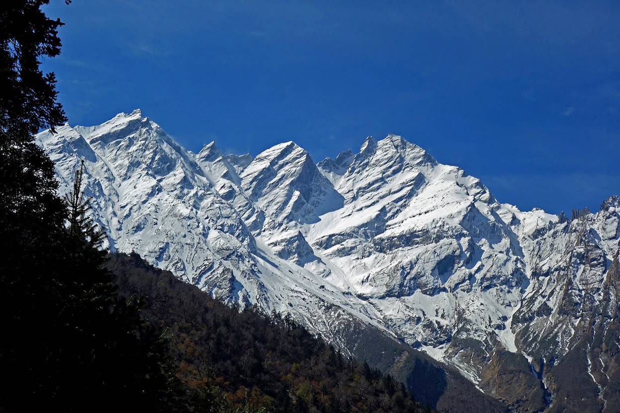
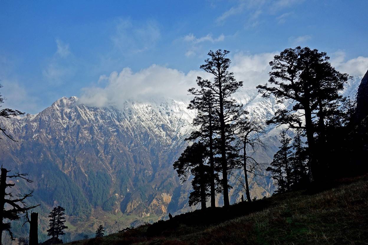
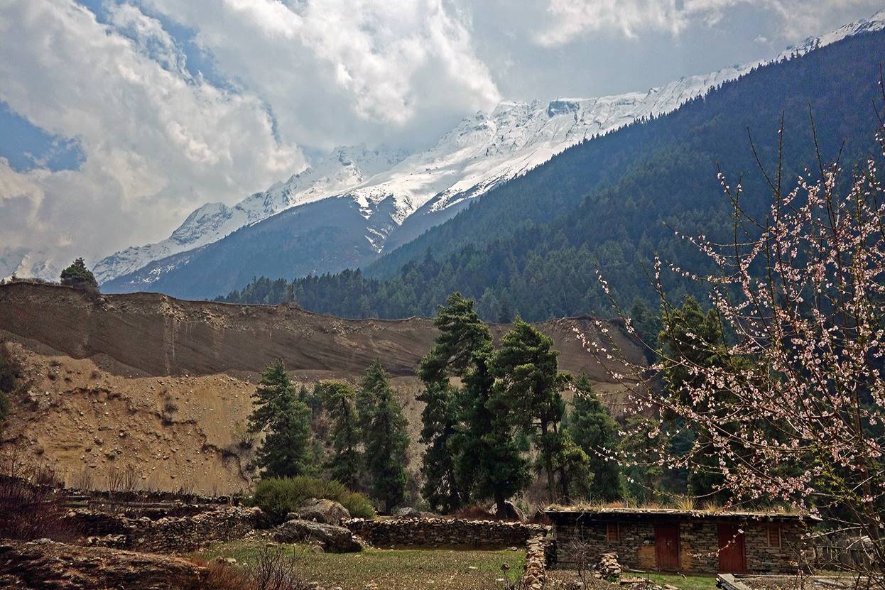
Mountain range (with peaks rising up to about 5500m) seen from this location.
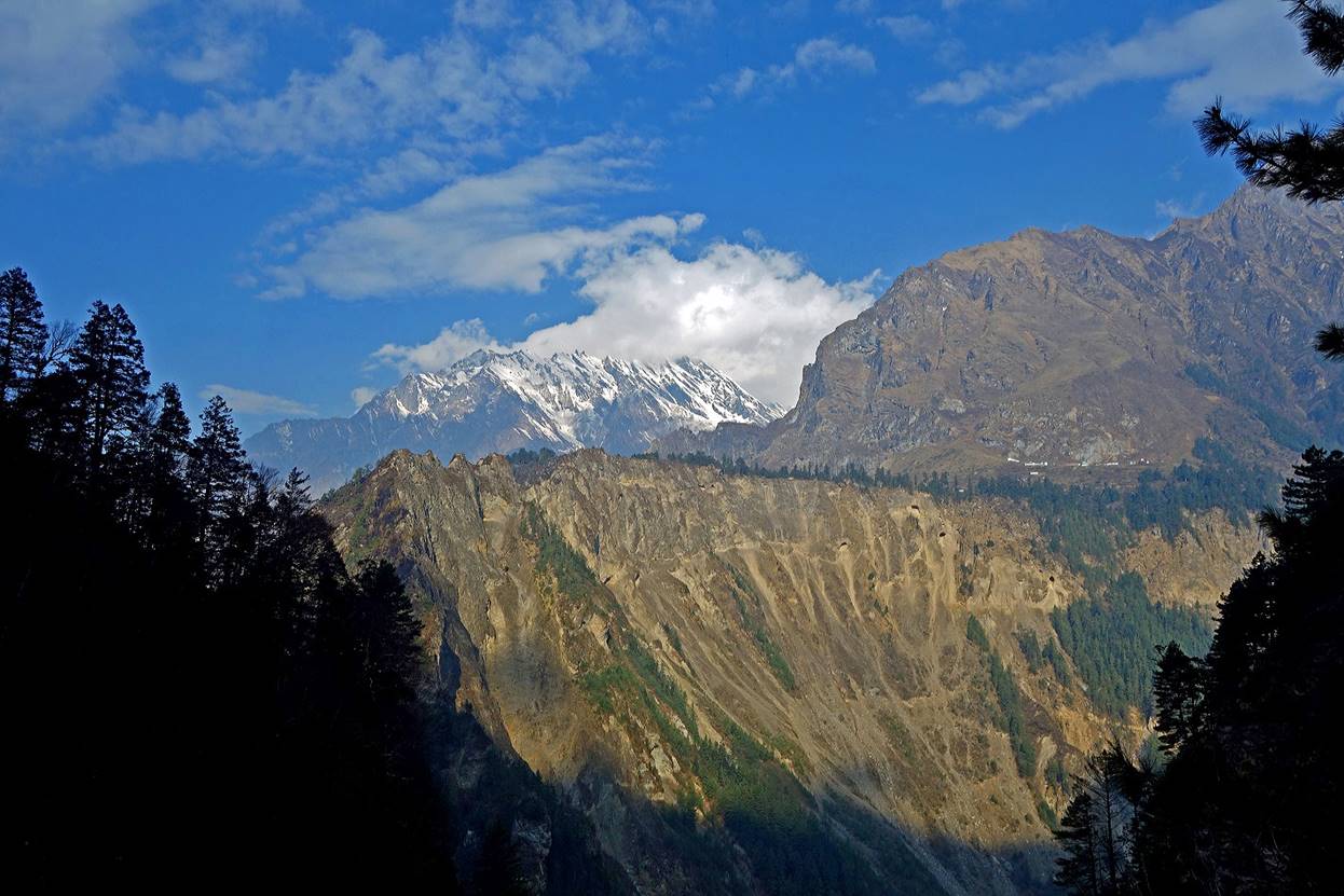
Views across Mahakali Nadi toward India.
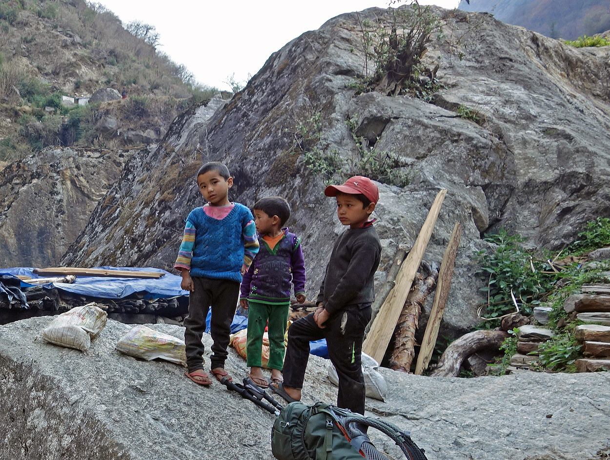
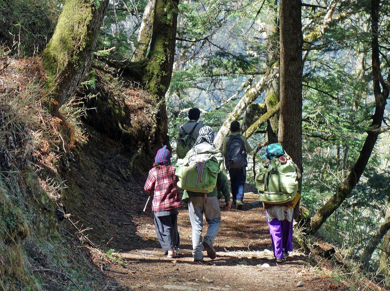
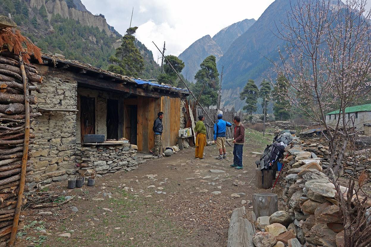
A local family on the trail. (This sight was unusual, as there was very little traffic along the trail.)
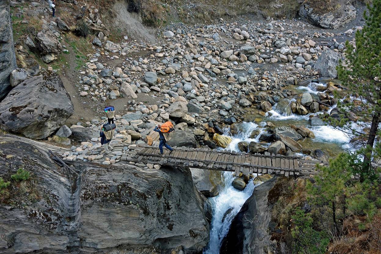
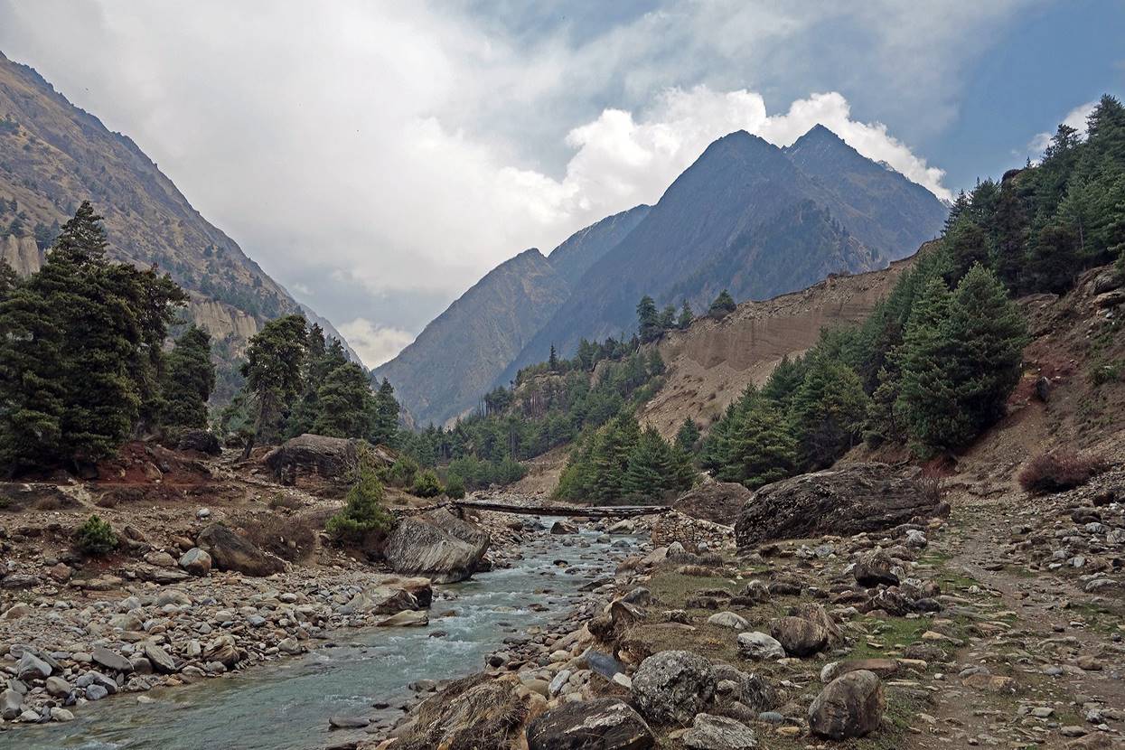
Reaching the bridge over Api Khola.
|
|
|
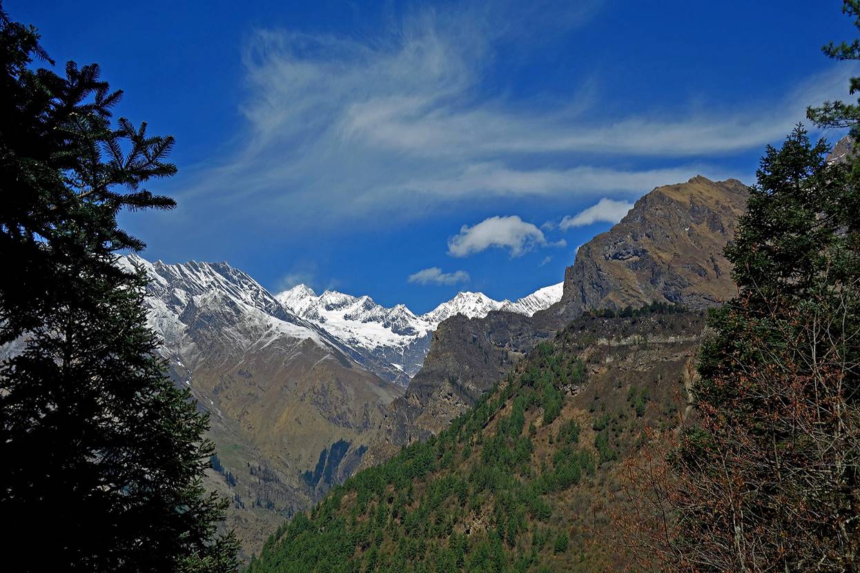
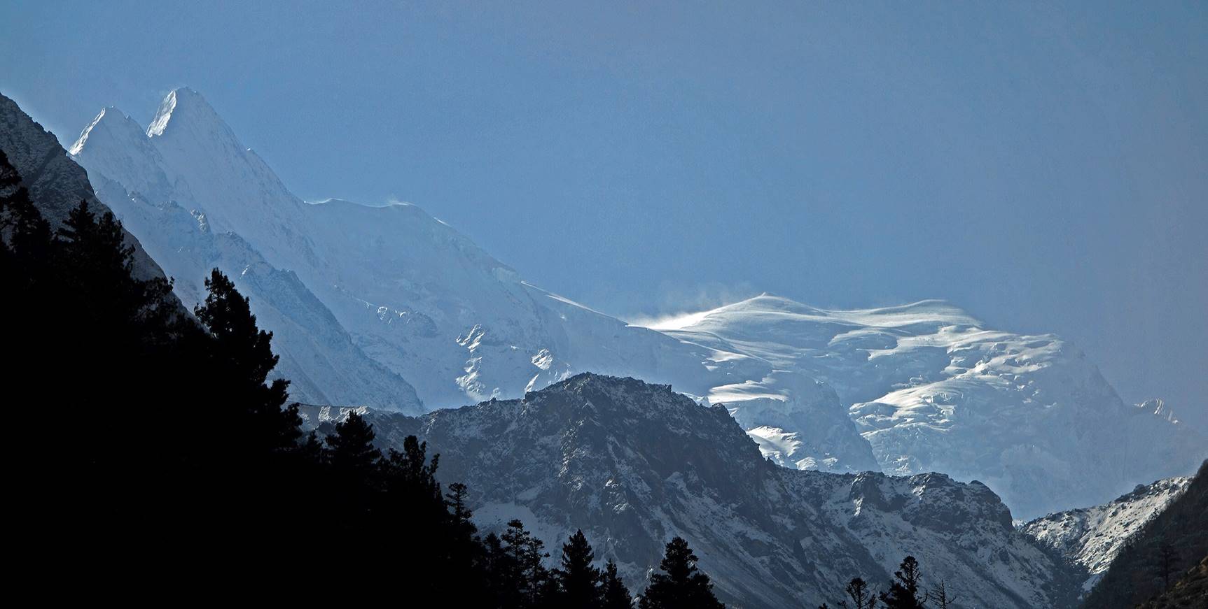
View of Api Himal (on the left side of the photo) taken from a location near the bridge across Api Khola.
View toward India from about the same location.
Two sections of the trail. One is good and is a testimony of how well the ancient trail was built. The other has been destroyed and buried under avalanche debris.
|
|
|
Bridge across Tinkar Khola, just before reaching Gaga. The valley forward (center left) is the valley of Tinkar Khola, while the occluded valley on the right is the valley of Nampa Khola.
The village of Gaga (this is the name used by locals, although maps often carry different names) consists of two parts. Down in the valley, near Tinkar Khola, is a small settlement with apple orchards. The main part of the village lies about 100m higher, on a small plateau.
Dawa and Pasang with local people in the lower part Gaga.
View from the lower part of Gaga.
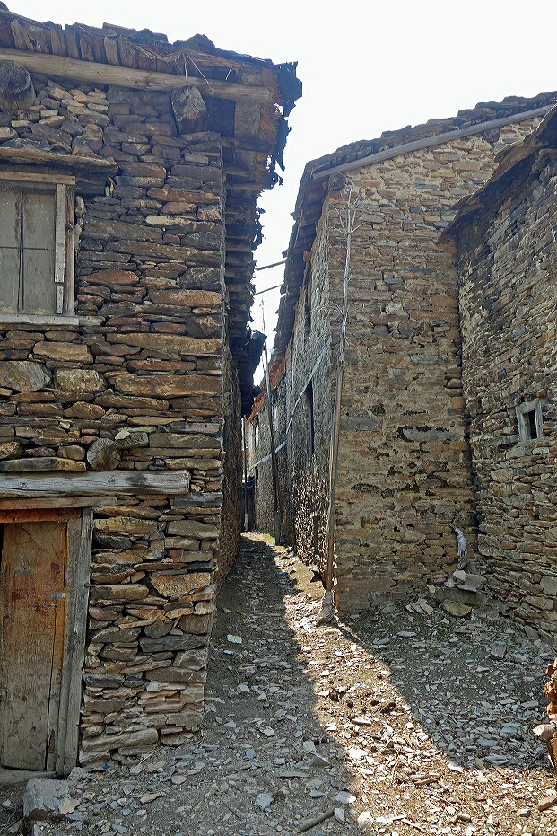
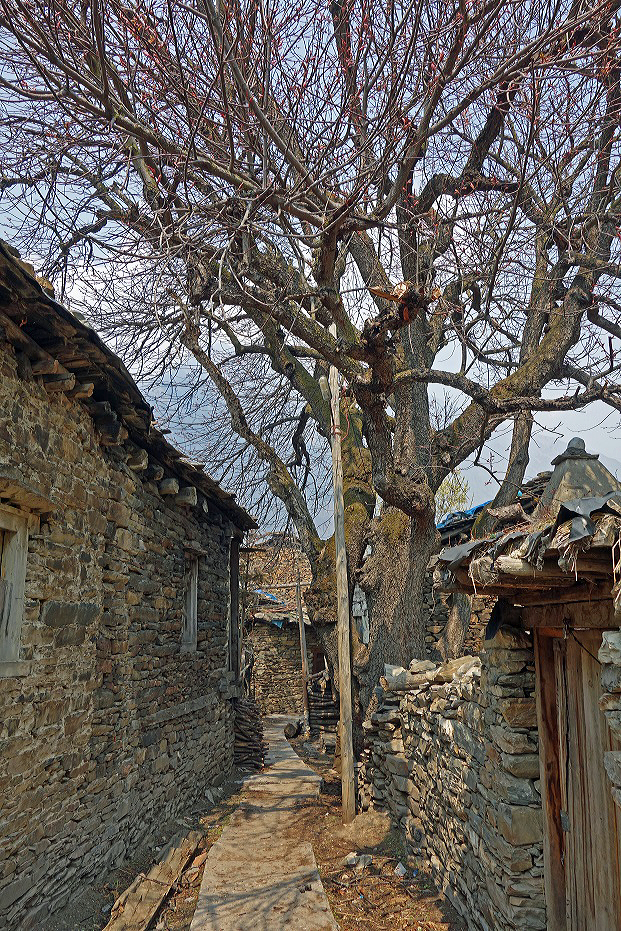
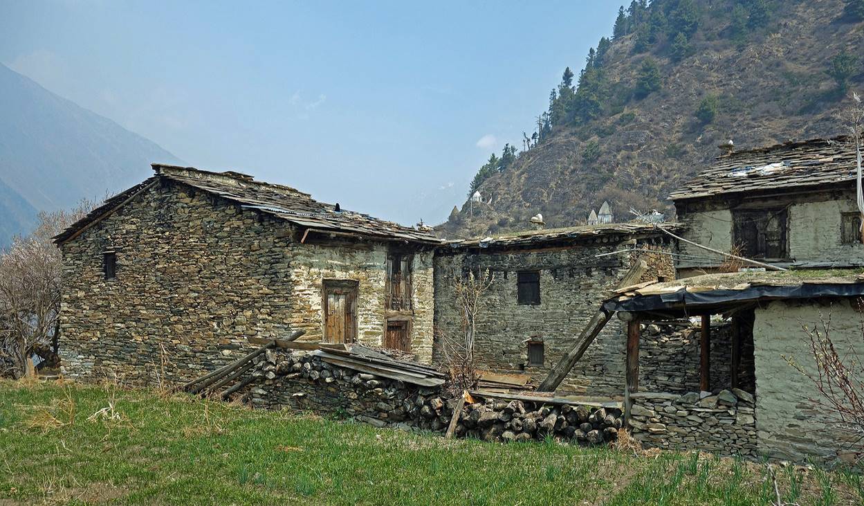
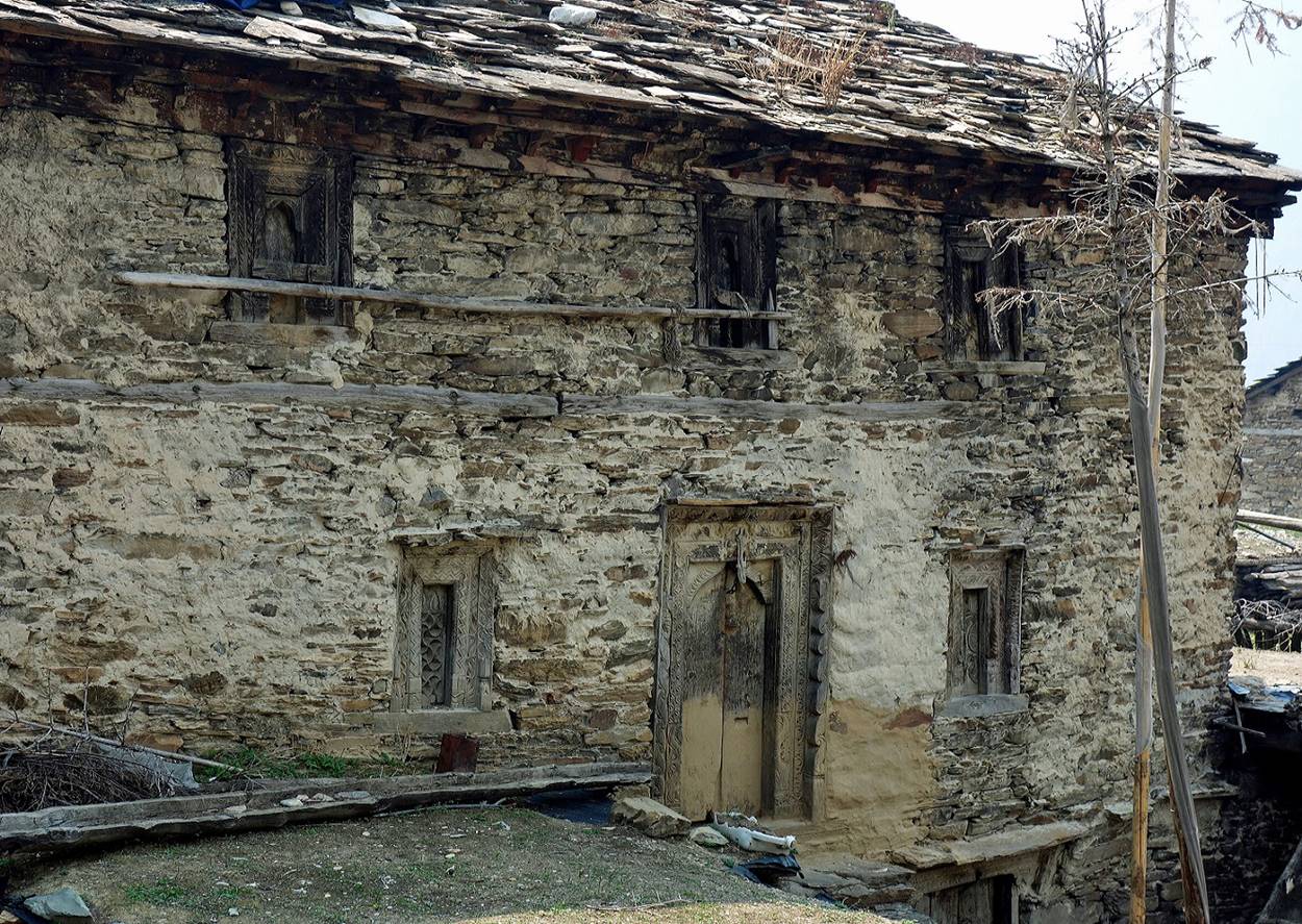
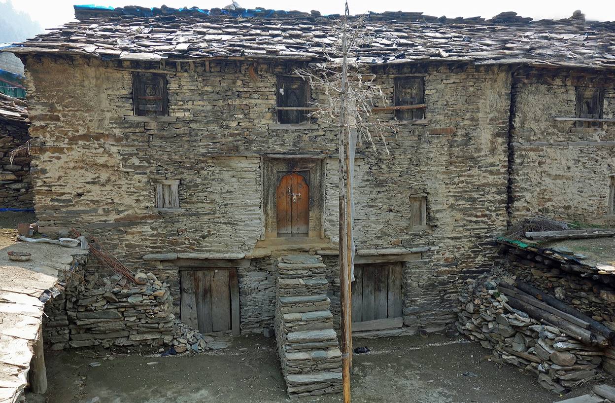
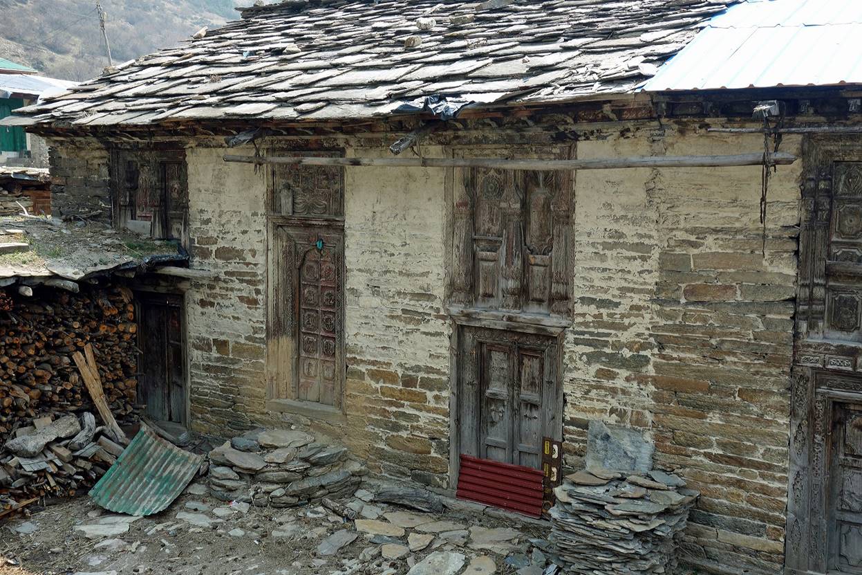
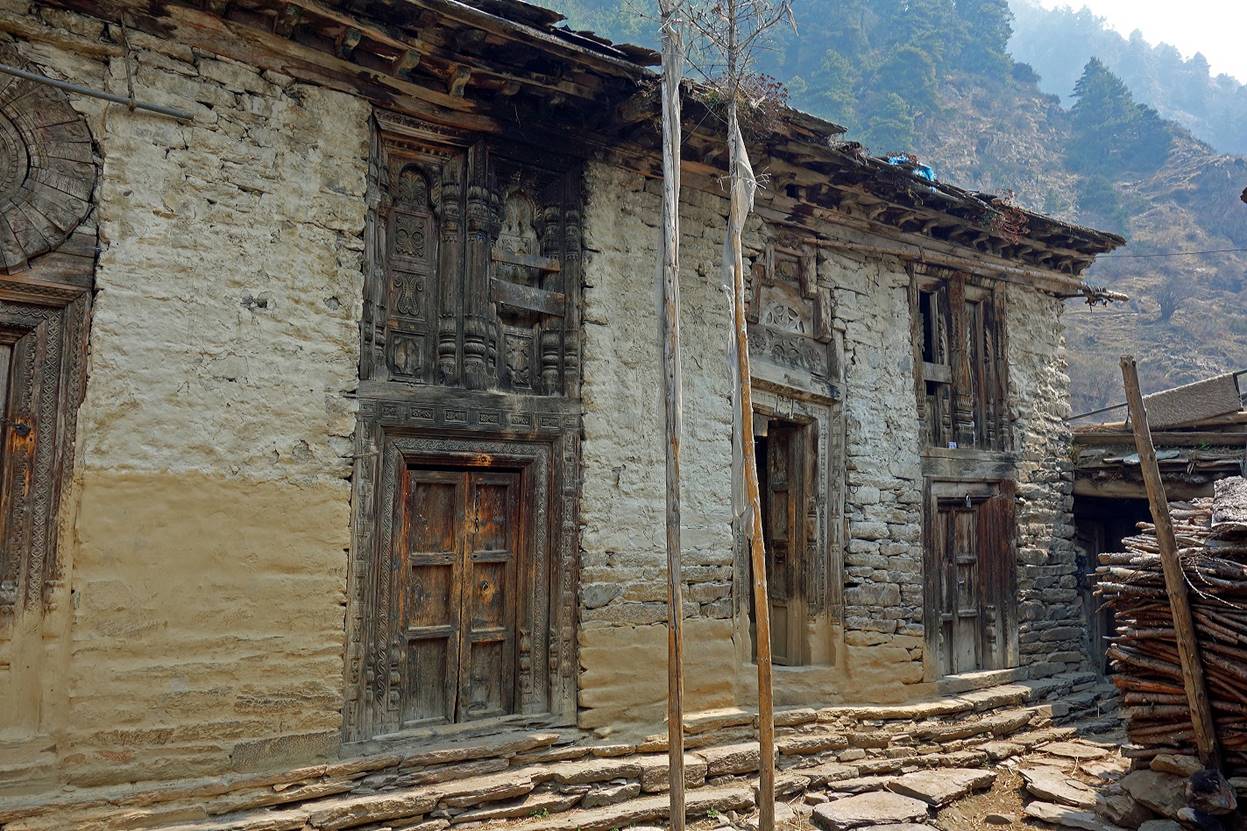
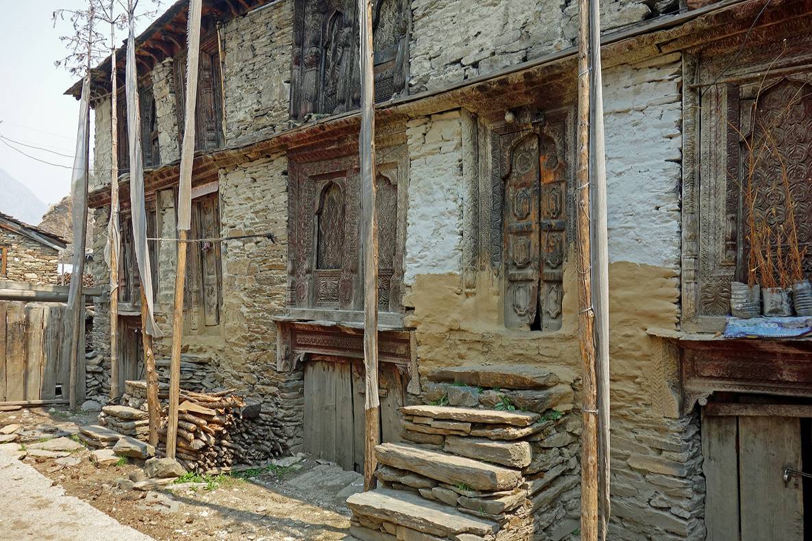
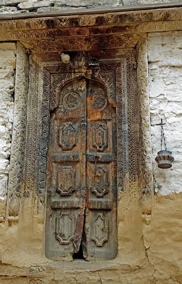
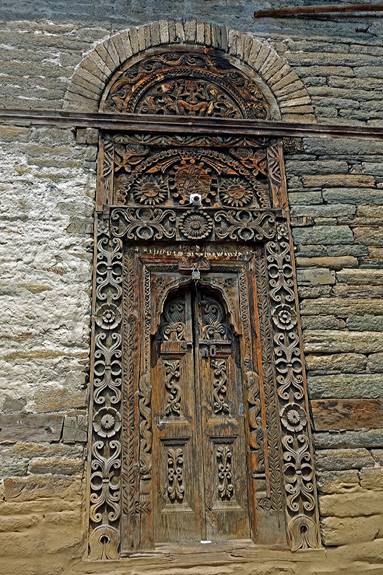
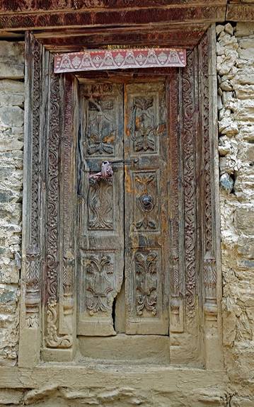
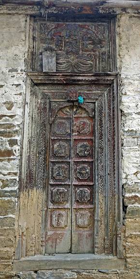
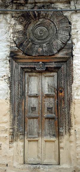
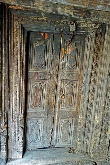
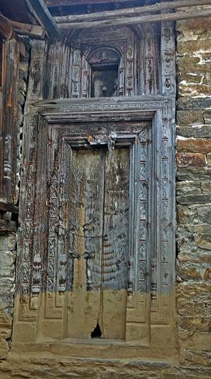
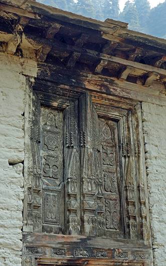
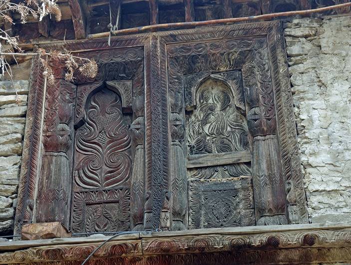
Based on how the lower part of Gaga looked, I did not expect that the main part of the village could be interesting and I hesitated to go there. This would have been a big mistake! The old houses of Gaga are stunningly beautiful and provide evidence of a thriving ancient trade that has now disappeared.
Streets of Gaga.
|
|
|
Houses of Gaga.
|
|
|
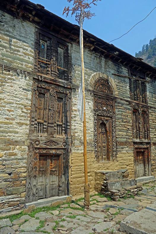
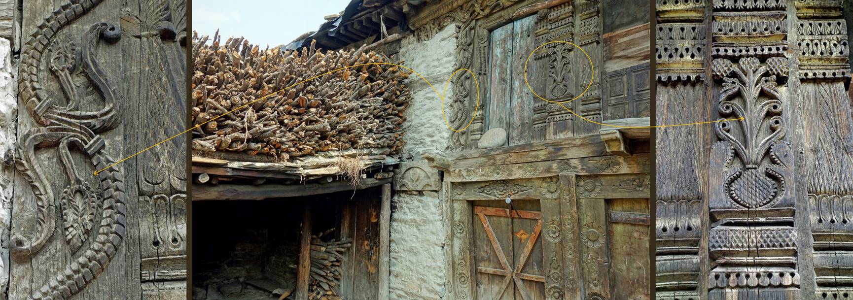
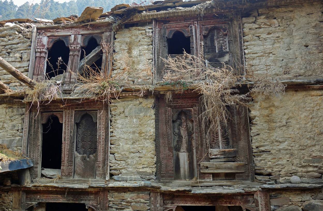
Doors and windows in Gaga.
|
|
|
|
|
|
|
|
|
|
|
![]()