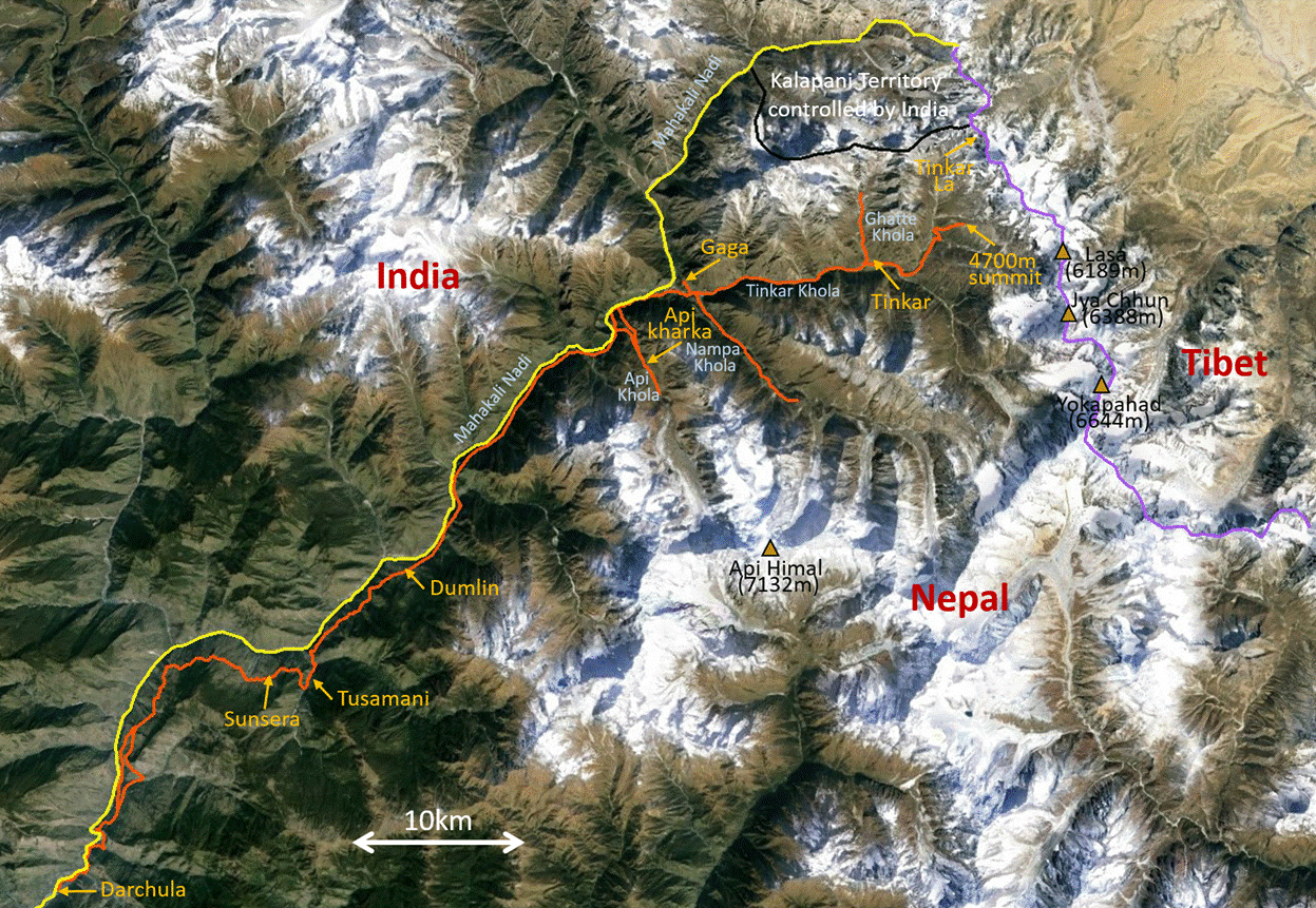
Nepal (April 2016): Valleys of Nepal‛s Northwestern Corner
4. Tinkar Valley
![]()
Return to main Nepal 2016 webpage
Lower Tinkar Valley (below the village of Tinkar):
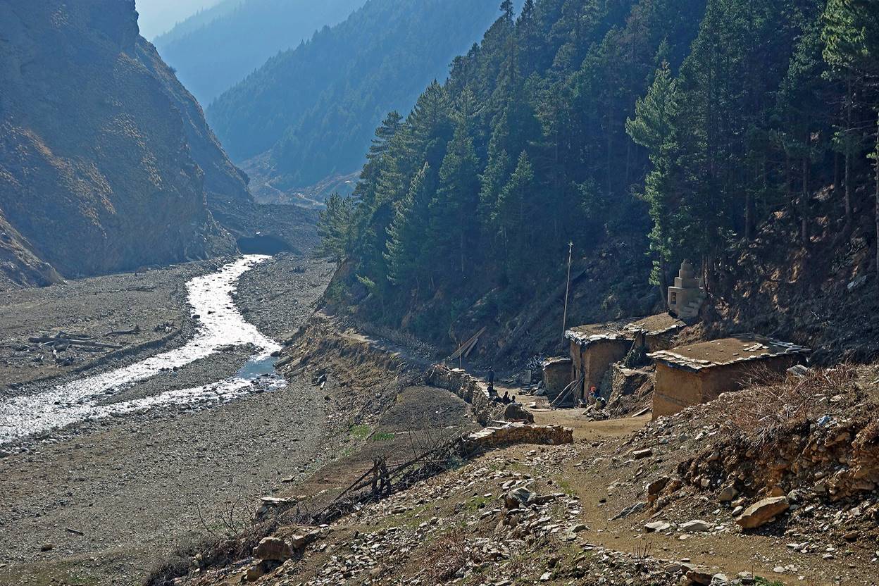
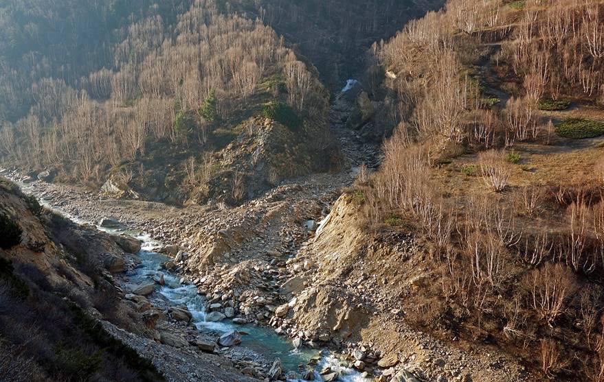
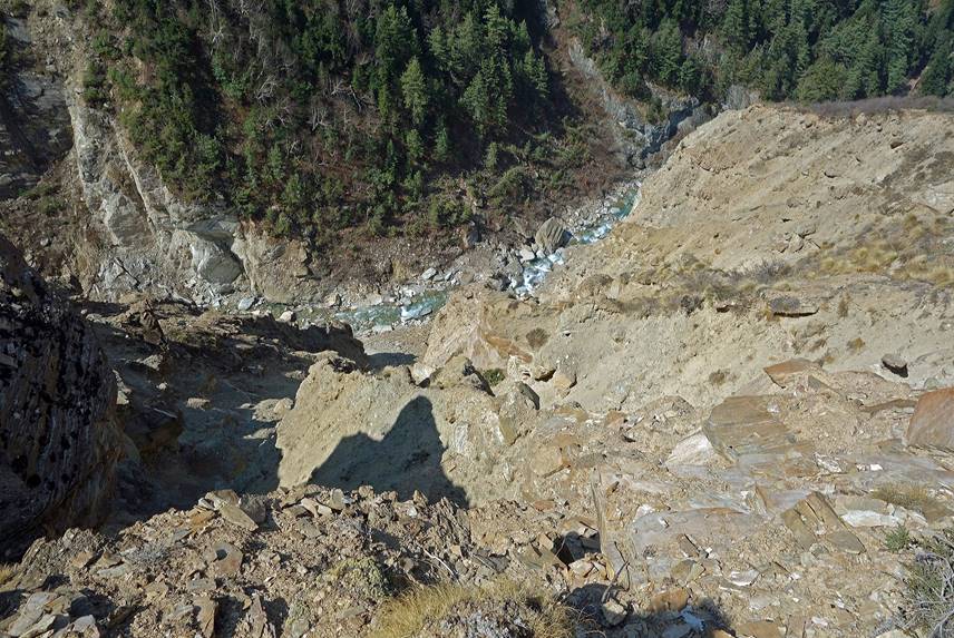
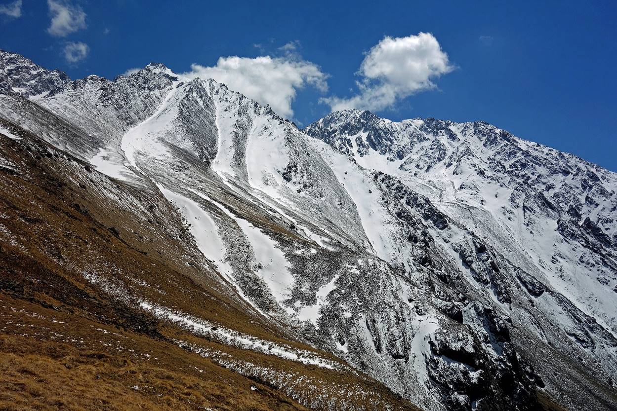
Soon after leaving Gaga the old trail of the Tinkar valley had been destroyed by numerous landslides and avalanches.
|
|
|
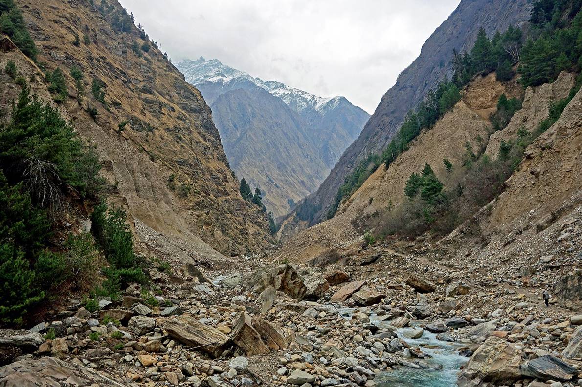
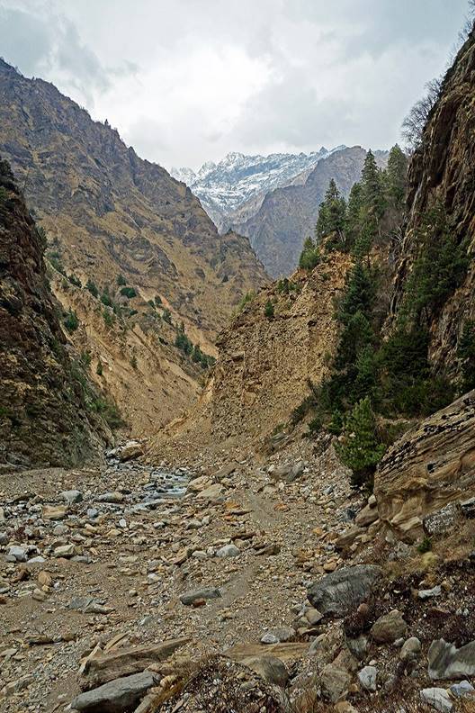
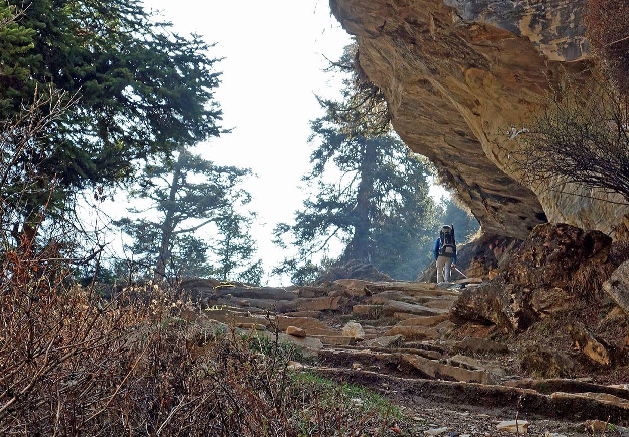
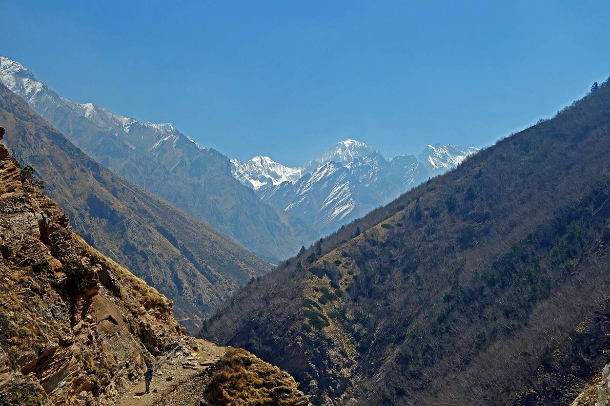
But higher up some good sections of the trail remained.
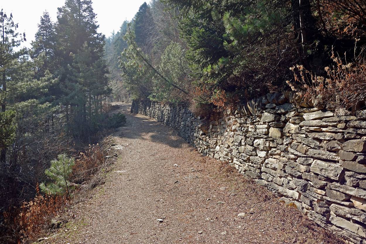
Views along the trail.
|
|
|
A small teahouse. It was closed and only opens during the summer season when the trail gets more traffic.
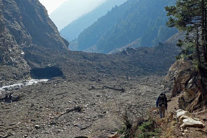
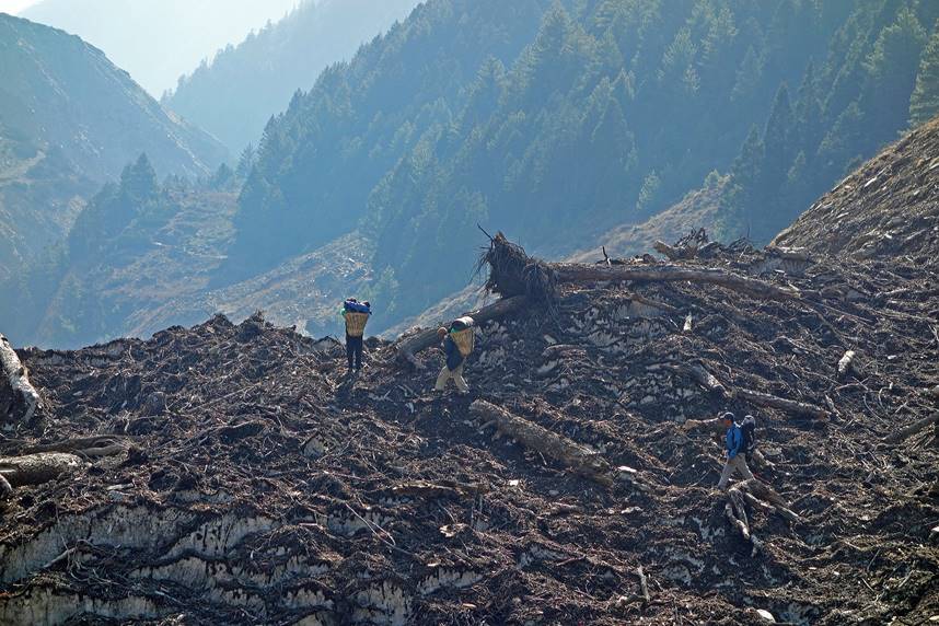
Avalanche debris burying the trail.
|
|
|
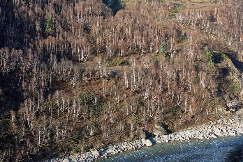
Forests of birch trees.
|
|
|
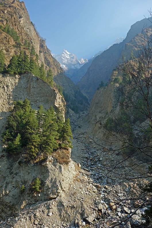
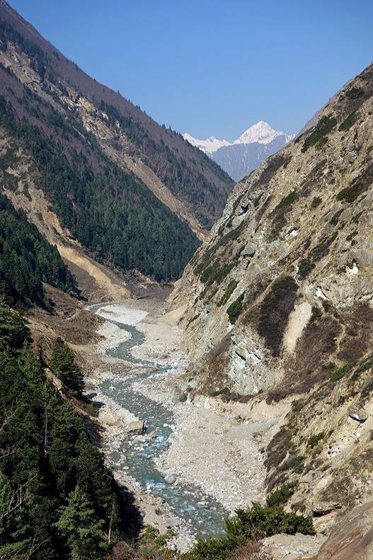
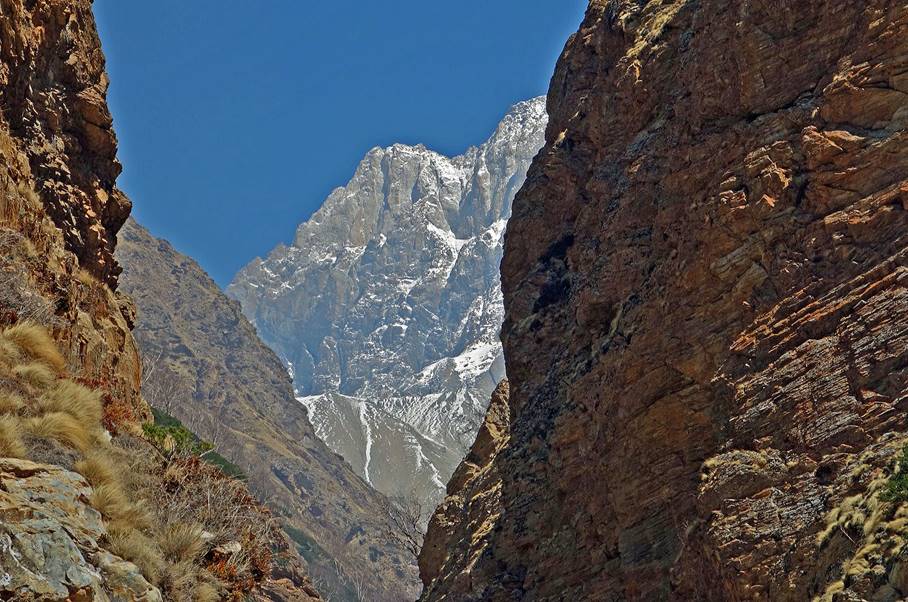
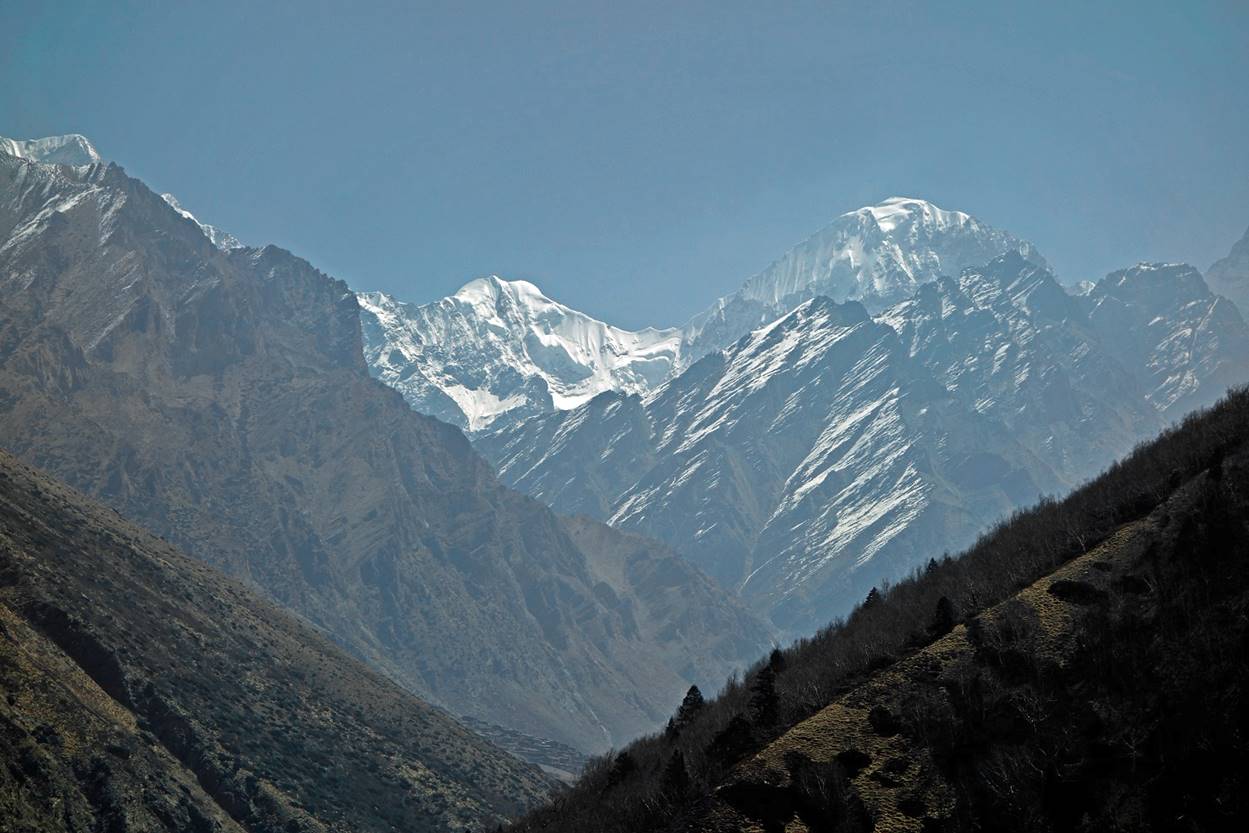
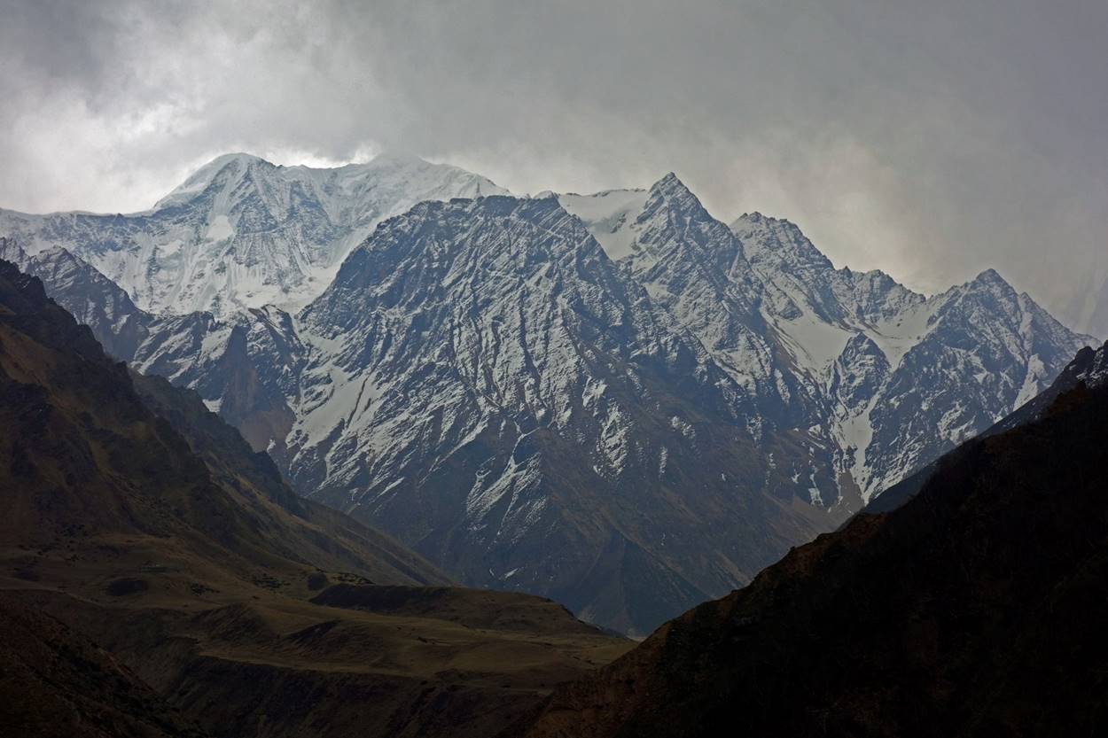
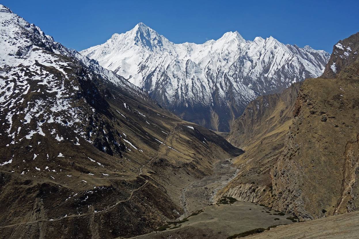
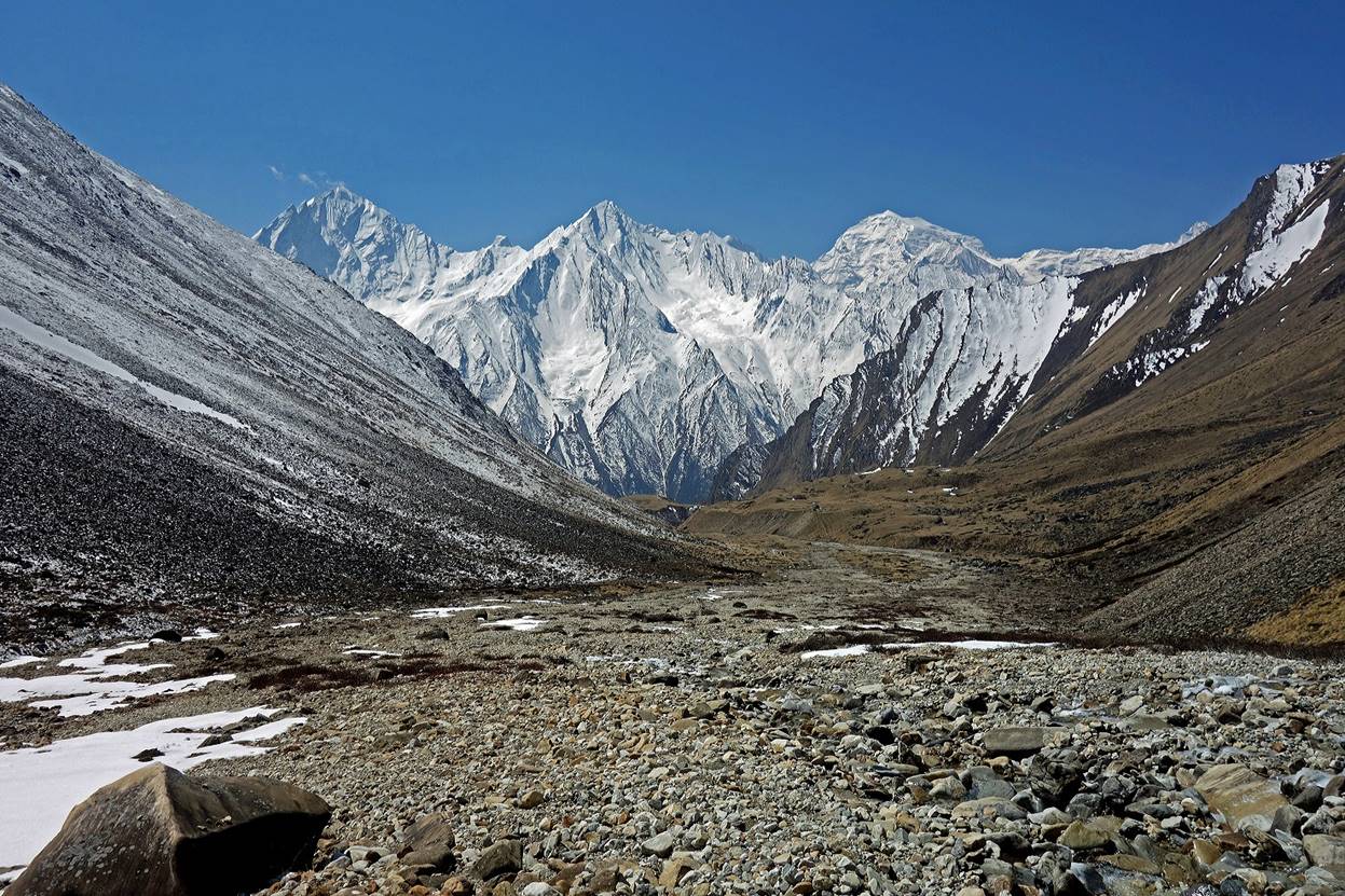
Looking down along the Tinkar valley. The high peaks in the background are located in India.
|
|
|
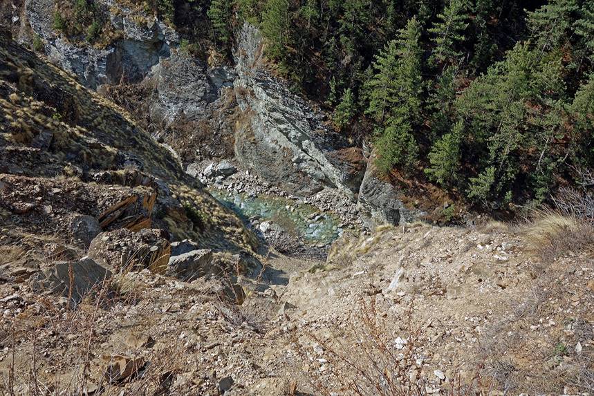
A couple of exposed sections along the trail.
|
|
|
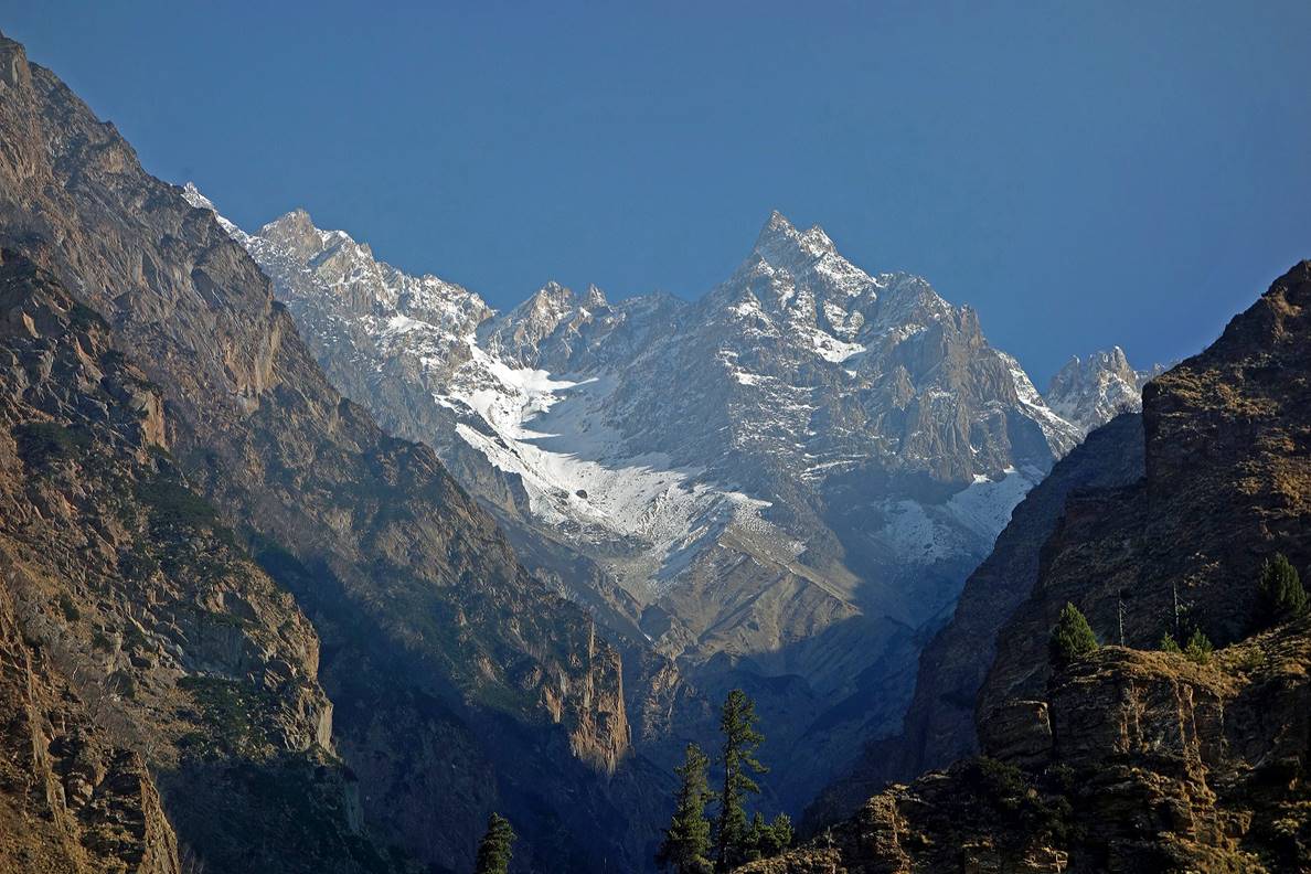
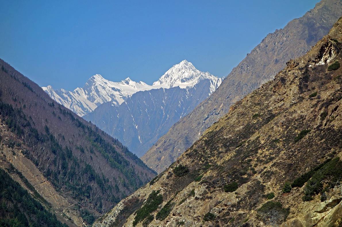
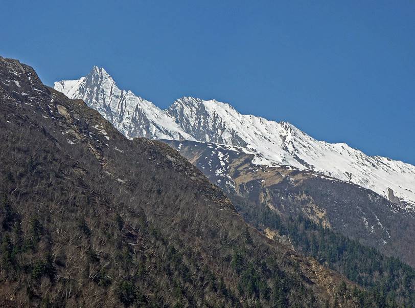
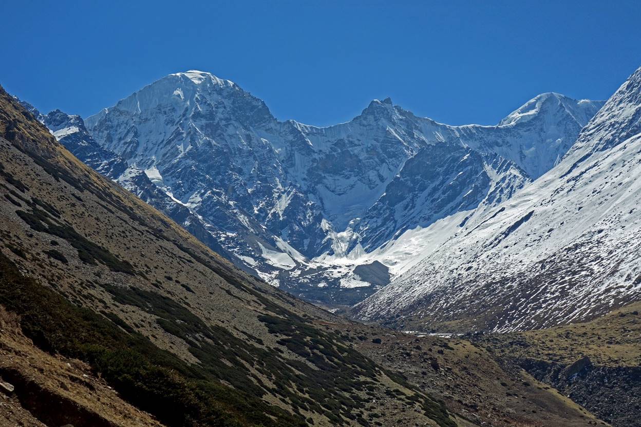
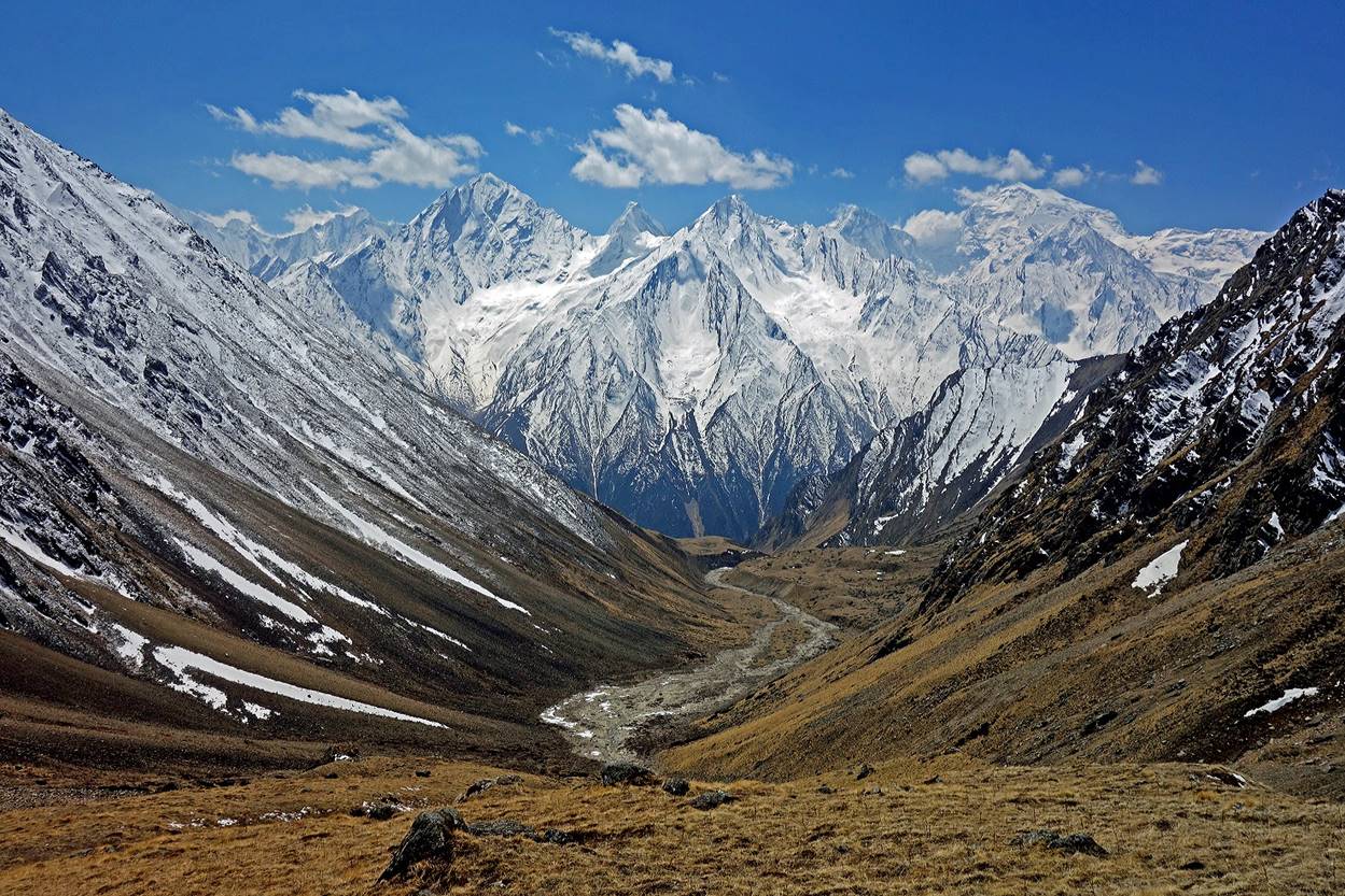
Peaks visible on each side of the Tinkar valley (left: on its northern side; right: on its southern side).
|
|
|
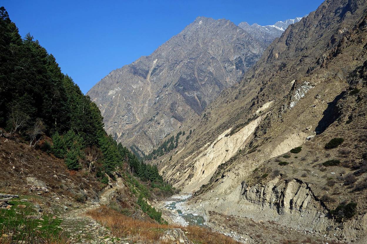
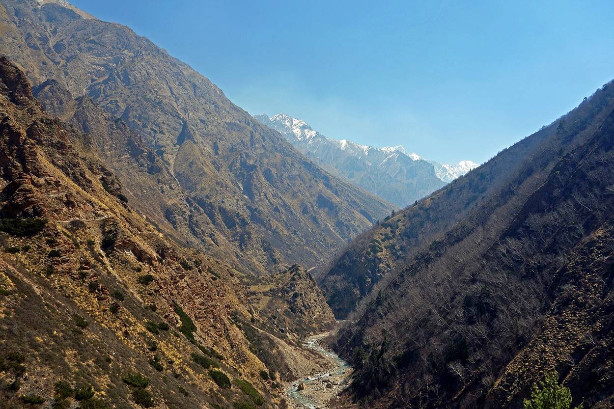
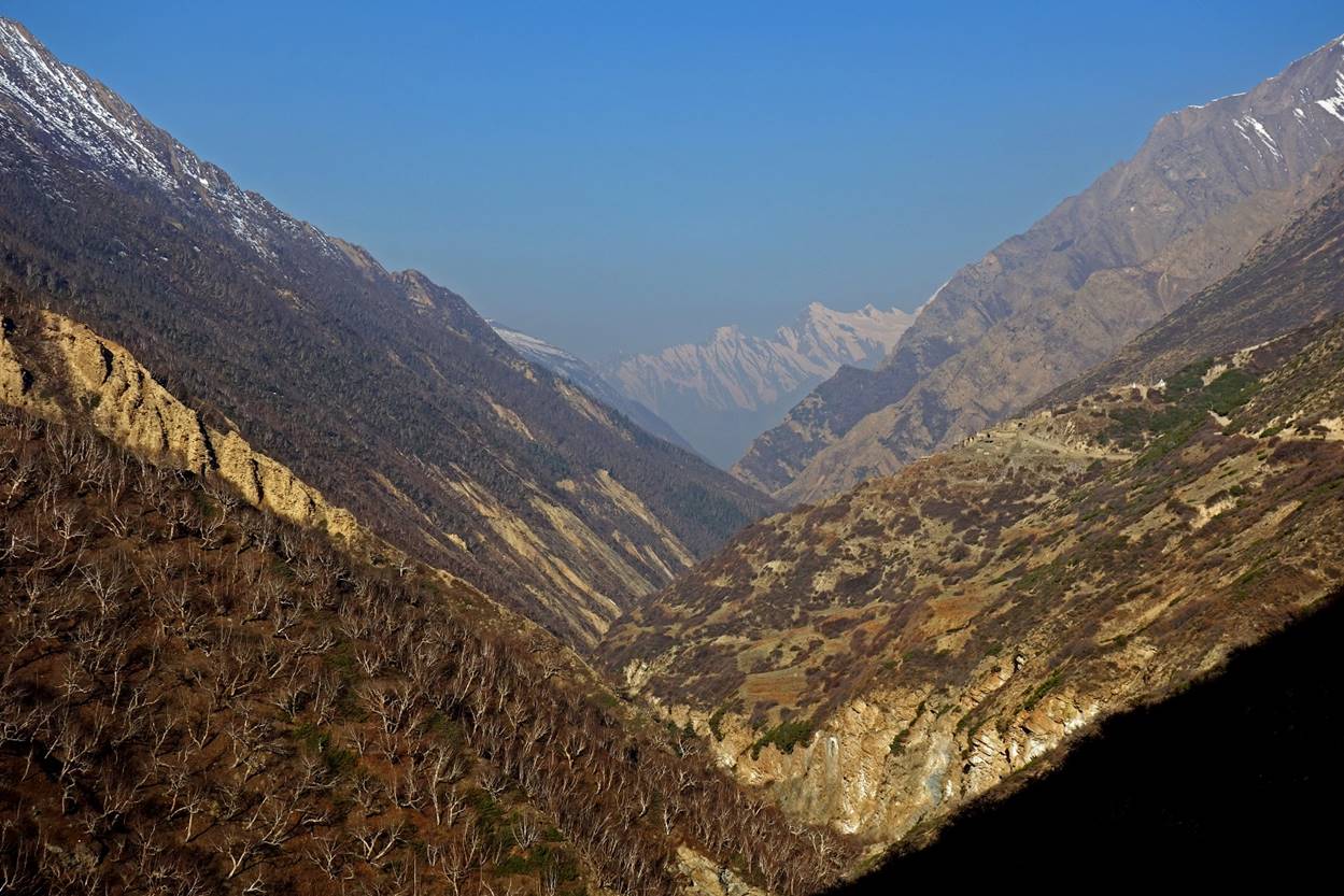
Looking upward along the valley, as we were approaching the village of Tinkar (visible in the second and third photos below).
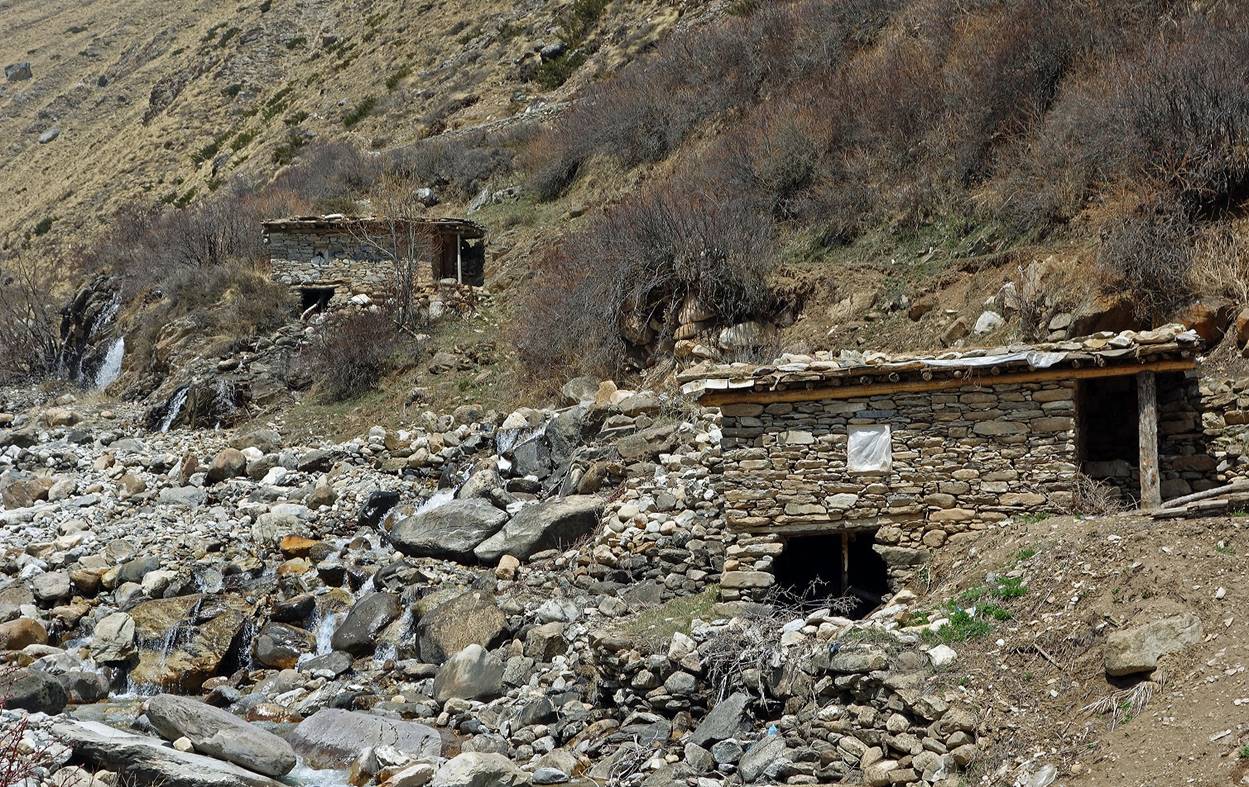
Flour mills on the Ghatte Khola before reaching Tinkar.
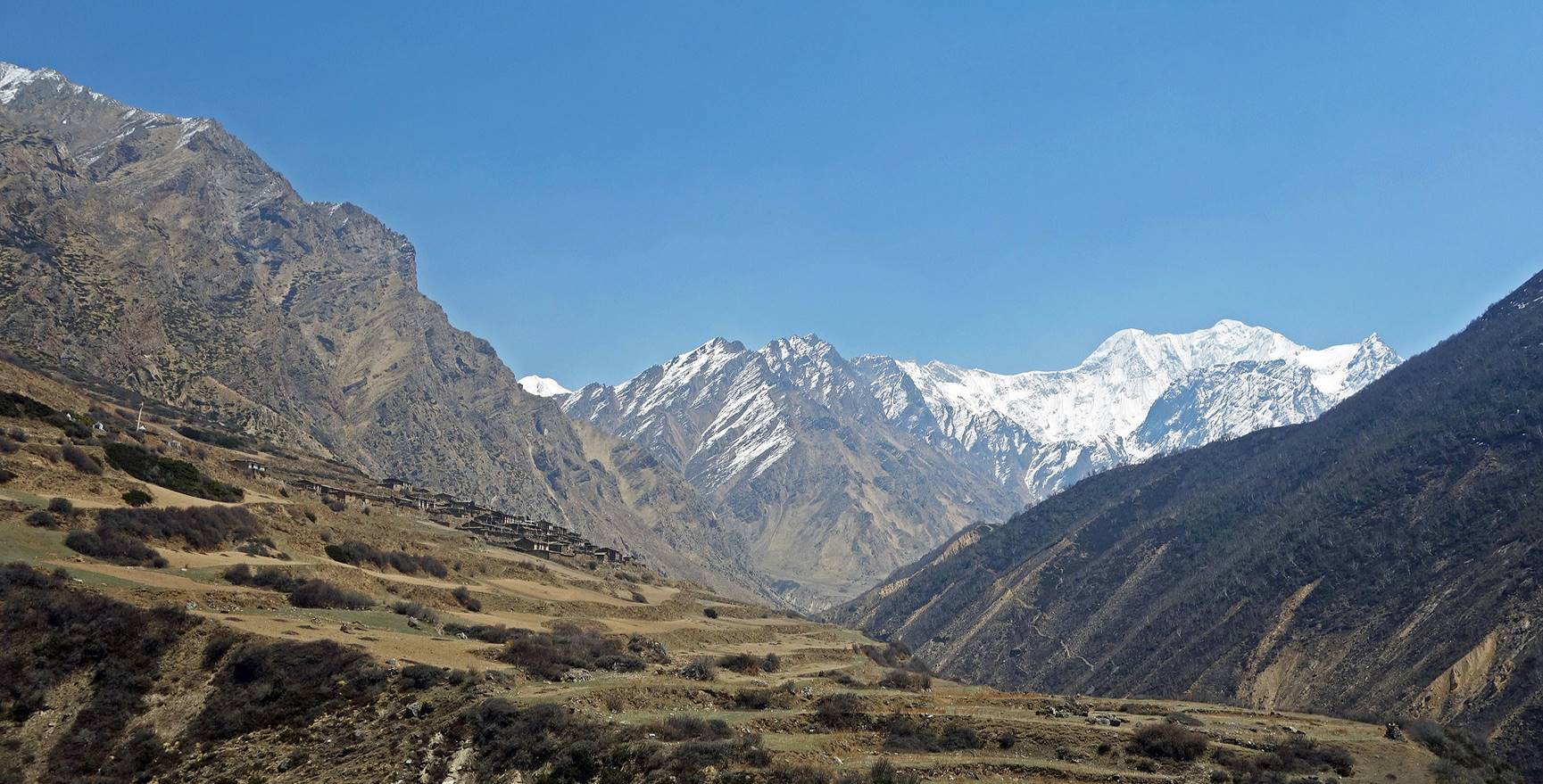
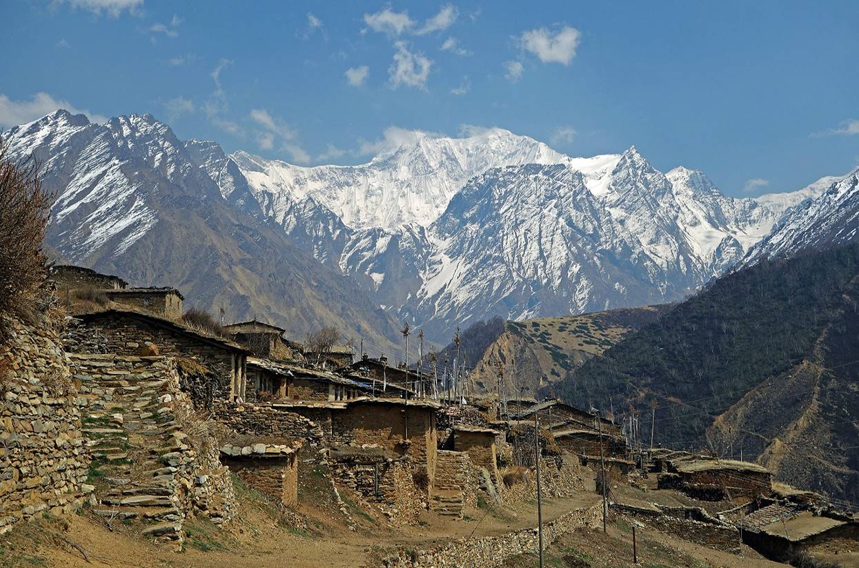
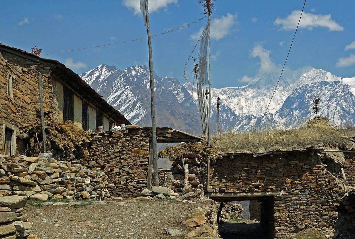
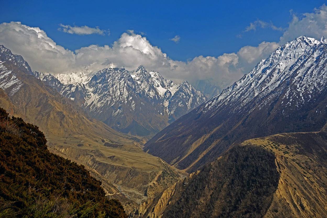
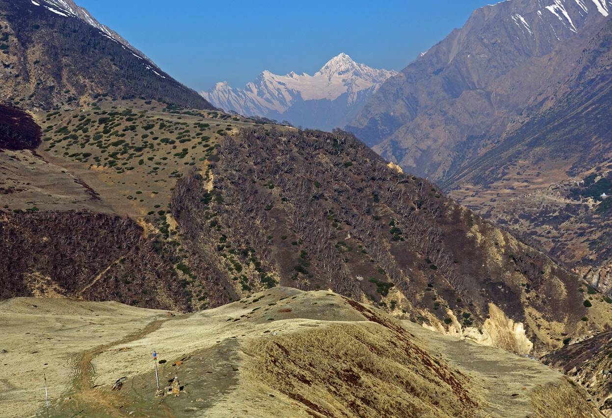
View of the village of Tinkar and its awesome surrounding. The high peak in the background lies on the border between Nepal and Tibet.
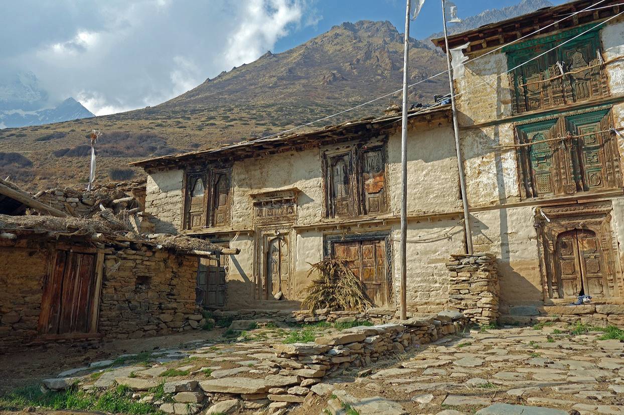
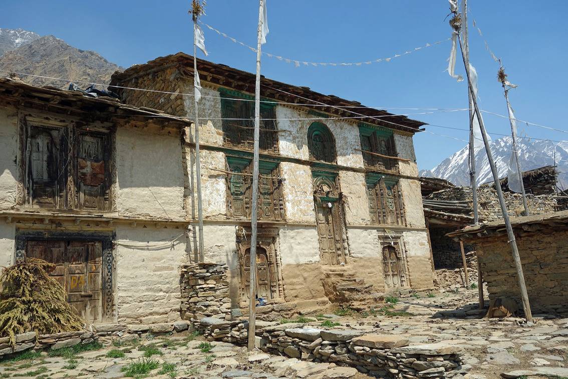
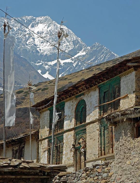
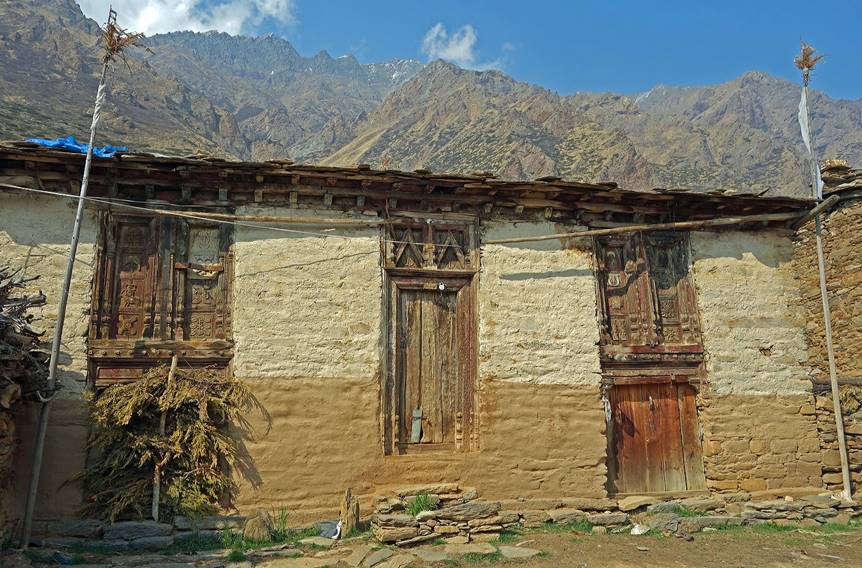
Village of Tinkar:
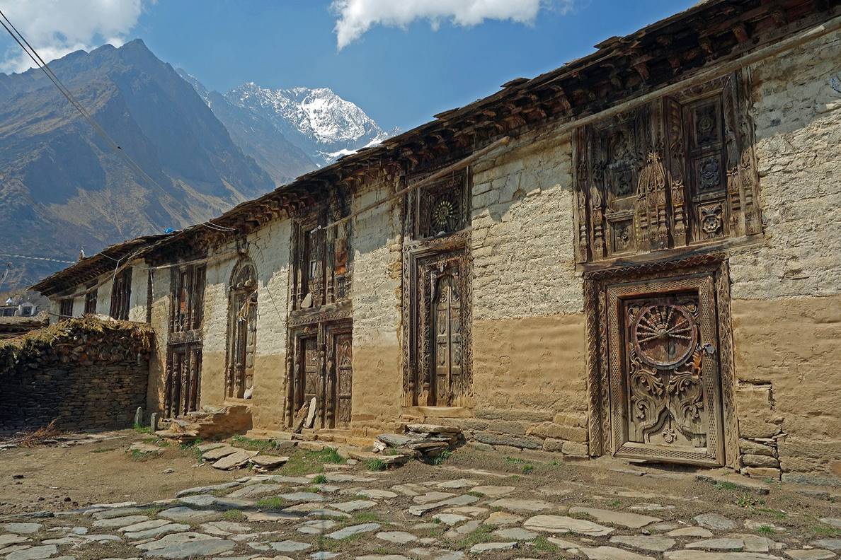
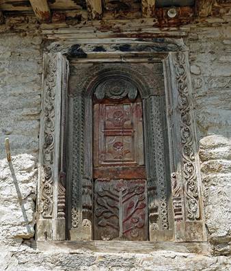
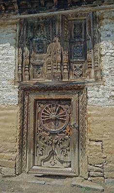
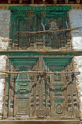
We set our camp for 3 nights near Tinkar. The village was totally empty, as it is populated only during the monsoon season. Like Gaga, Tinkar boasts beautiful old merchant houses. Unfortunately, many badly need some repair.
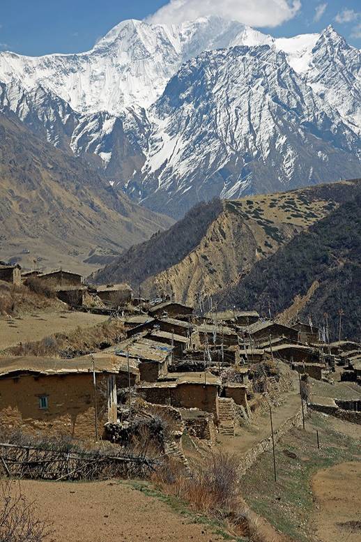
Views of the village and its setting among high peaks.
|
|
|
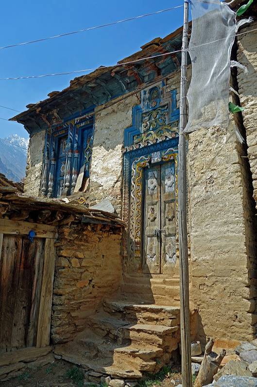
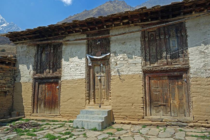
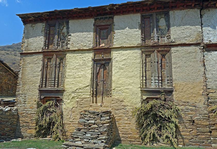
Houses.
|
|
|
|
|
|
|
|
|
|
|
|

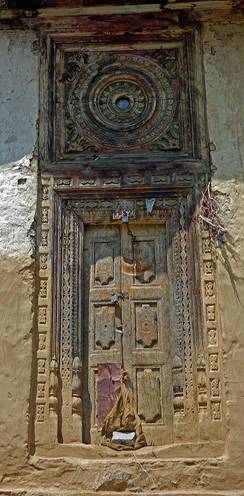
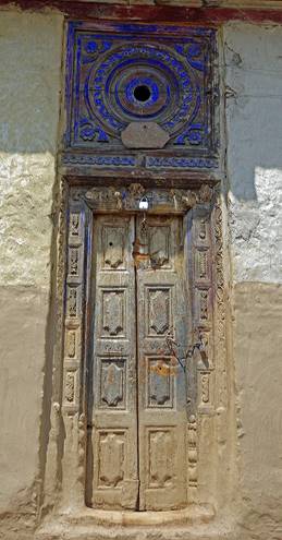
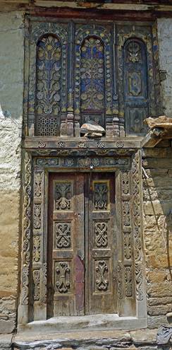
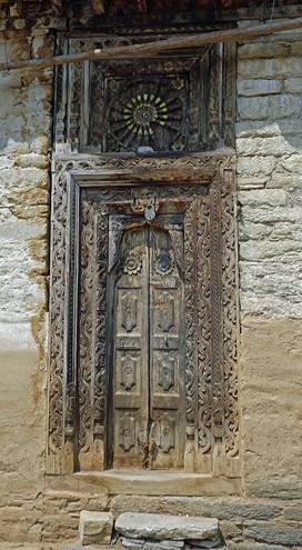
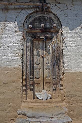
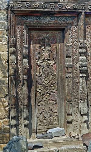
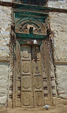
Doors and windows.
|
|
|
|
|
|
|
`
|
|
|
|
|
|

Upper Tinkar Valley (above the village of Tinkar):
On one day, Dawa and I went hiking along the upper Tinkar valley, while Pasang, Tsiring, Rupak, and Uday were resting at our camp. The Tibetan border at Tinkar La was too far away to be reached in a single day, so we chose to climb a 4700m peak instead (see map at the top of the page).
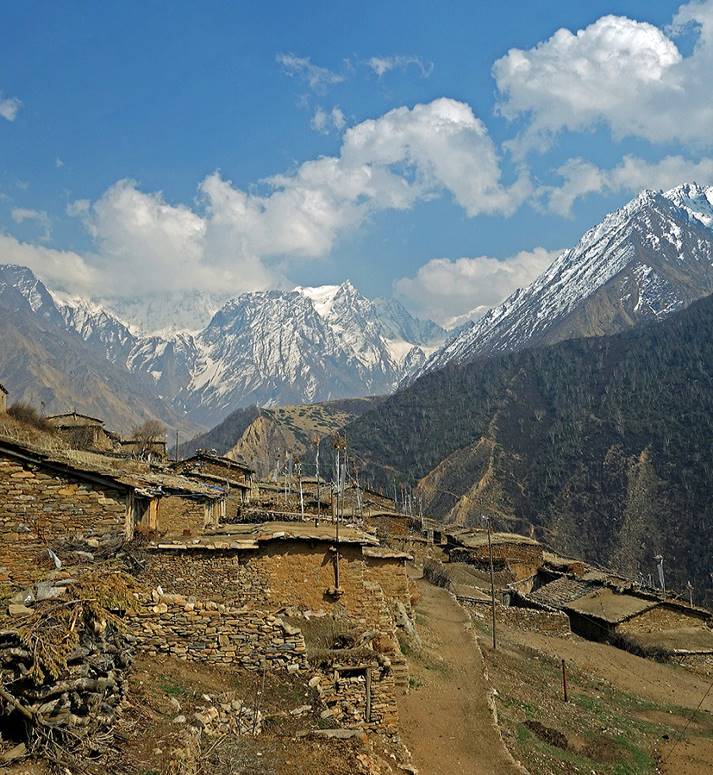
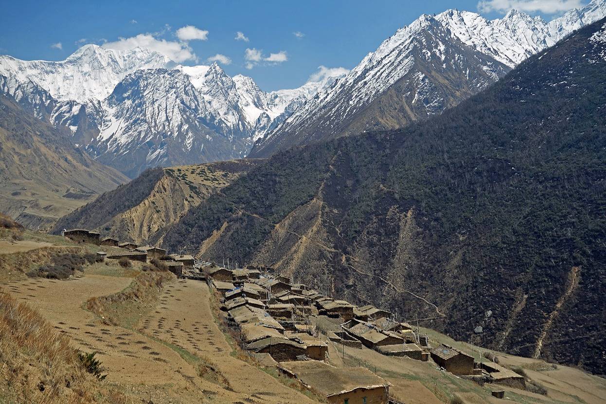
Views of the valley from Tinkar (I took these two photos at very different times). Further east the valley divides into two. The Tinkar valley turns left toward the north-northeast.
Looking back toward the village of Tinkar (visible on the right side of the two photos below). The snowy peaks in the background are located in India.
The Tinkar valley just after it turns toward the north-northeast.
Looking down at the Tinkar valley while ascending the 4700m peak.
Peaks on the eastern border with Tibet seen during the climb.
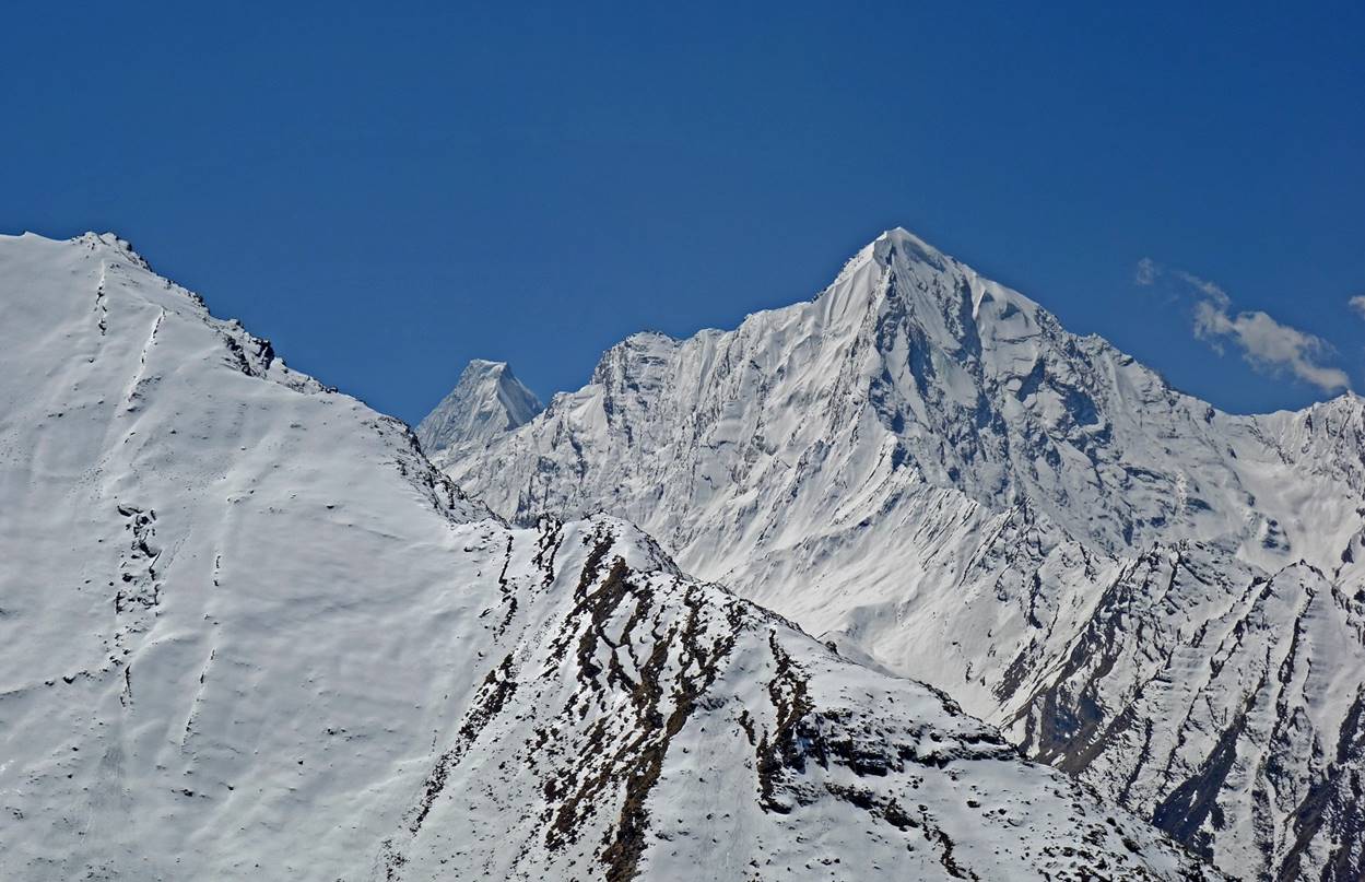
View toward the north from the 4700m summit.
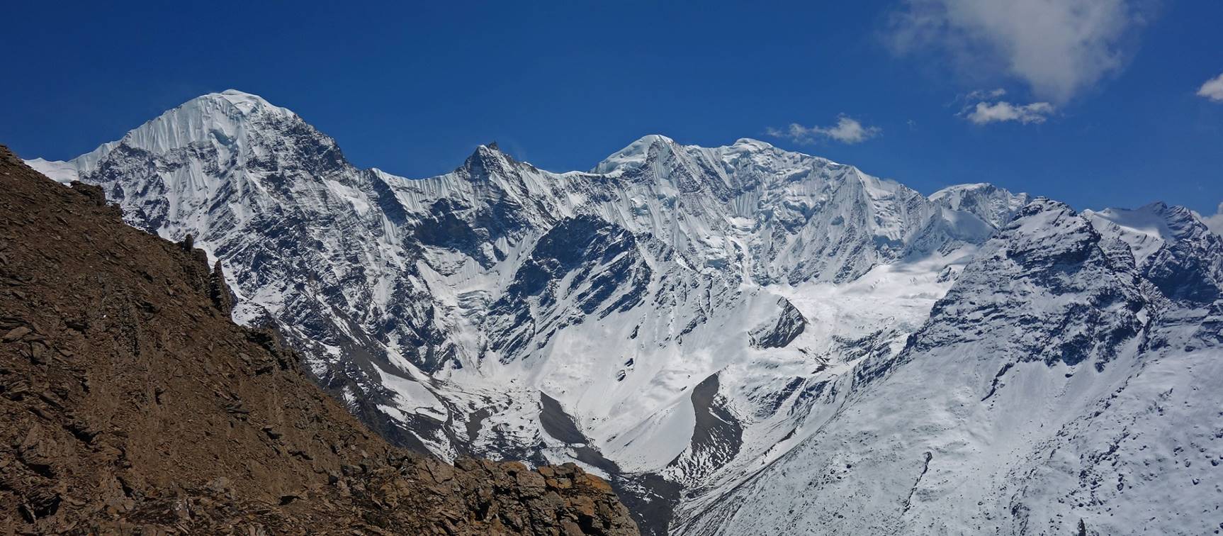
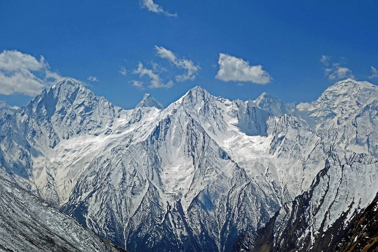
Views toward the south, with Api Himal visible in the background.
Side-valley of Ghatte Khola (north of the village of Tinkar):
On another day, Dawa and I went climbing the side-valley of Ghatte Khola (see map at the top of this page), a small tributary of Tinkar Khola.
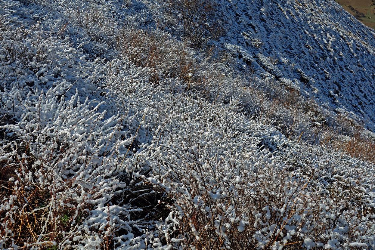
There had been a small snowfall during the night and in the morning the terrain was dusted by a thin layer of snow.
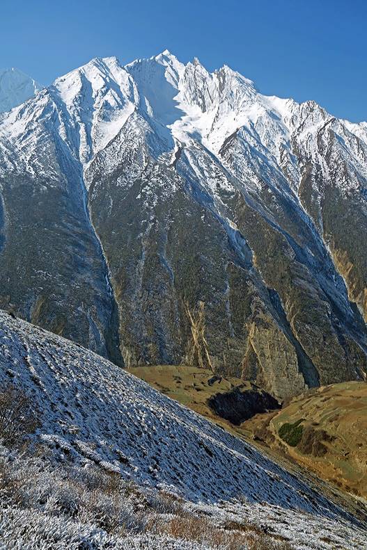
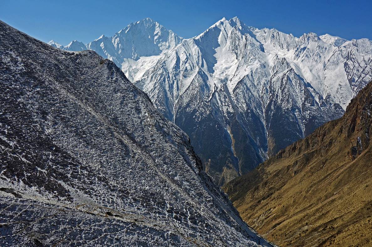
Initially the climb along Ghatte Khola is rather steep, but provides beautiful views over the mountain range on the southern side of Tinkar Khola.
|
|
|
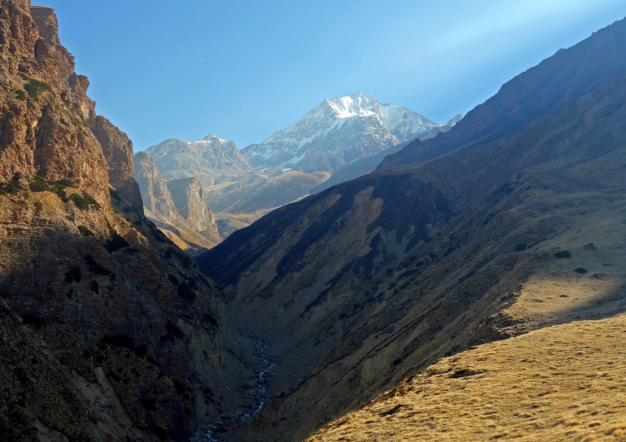
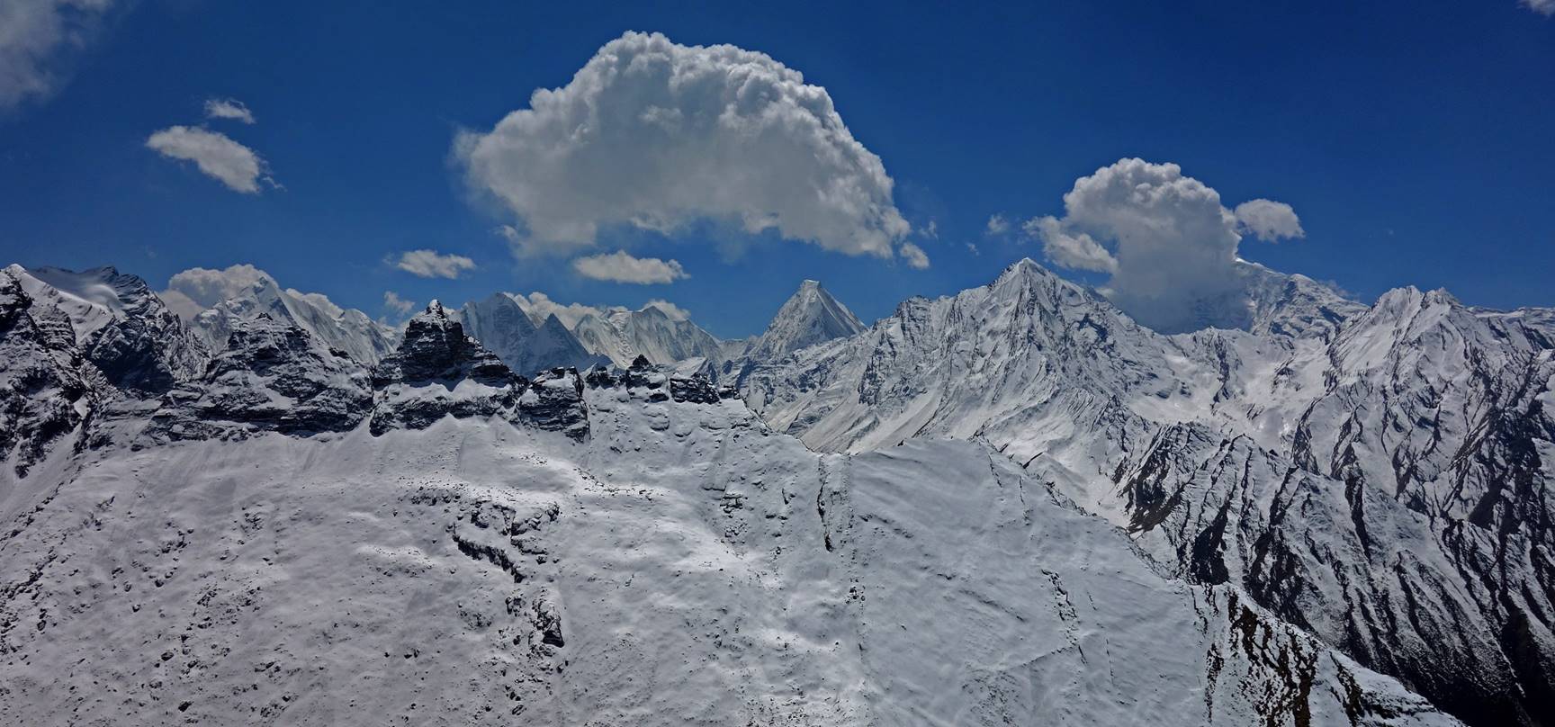
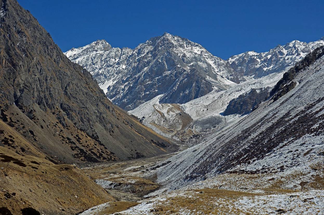
The climb eventually reaches a flatter section of the valley that is used as a pasture during the summer months. The photo below points north, with the peaks in the background lying on the boundary of the disputed Kalipani Territory currently controlled by India.
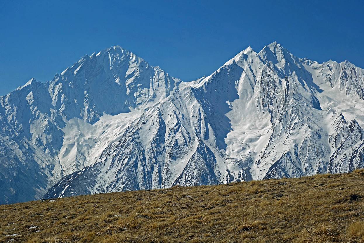
Successive views toward the south as we advanced further into the Ghatte Khola valley. Api Himal is visible in the second, third, and fourth photos.
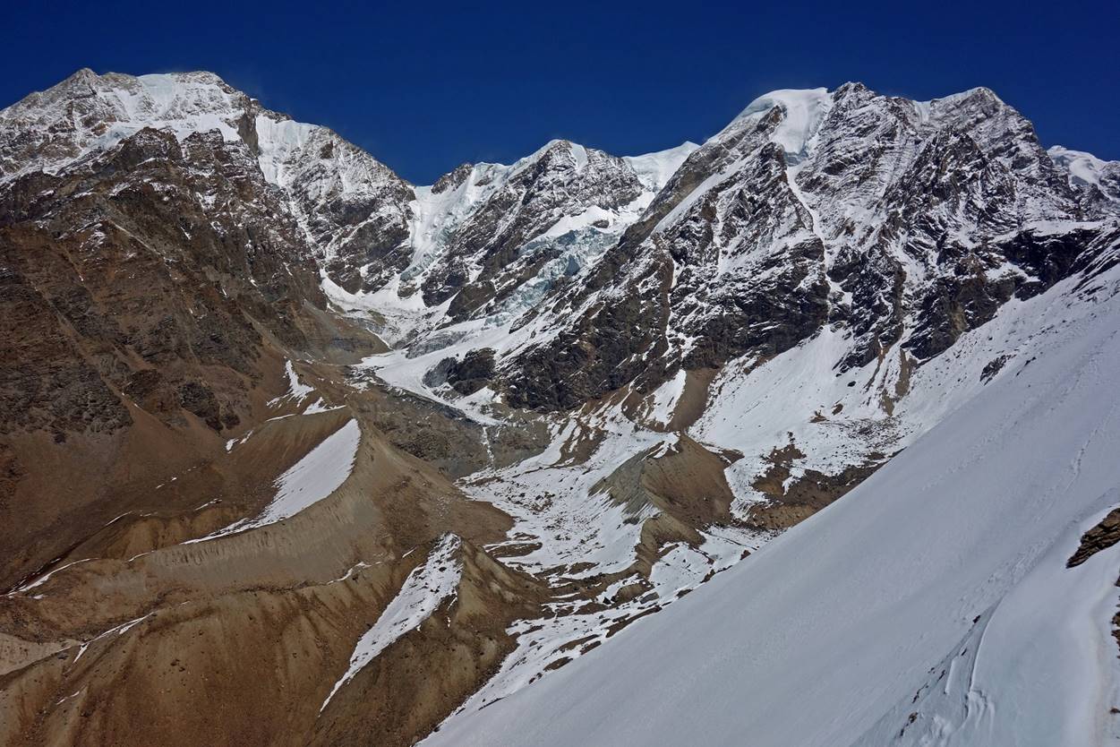
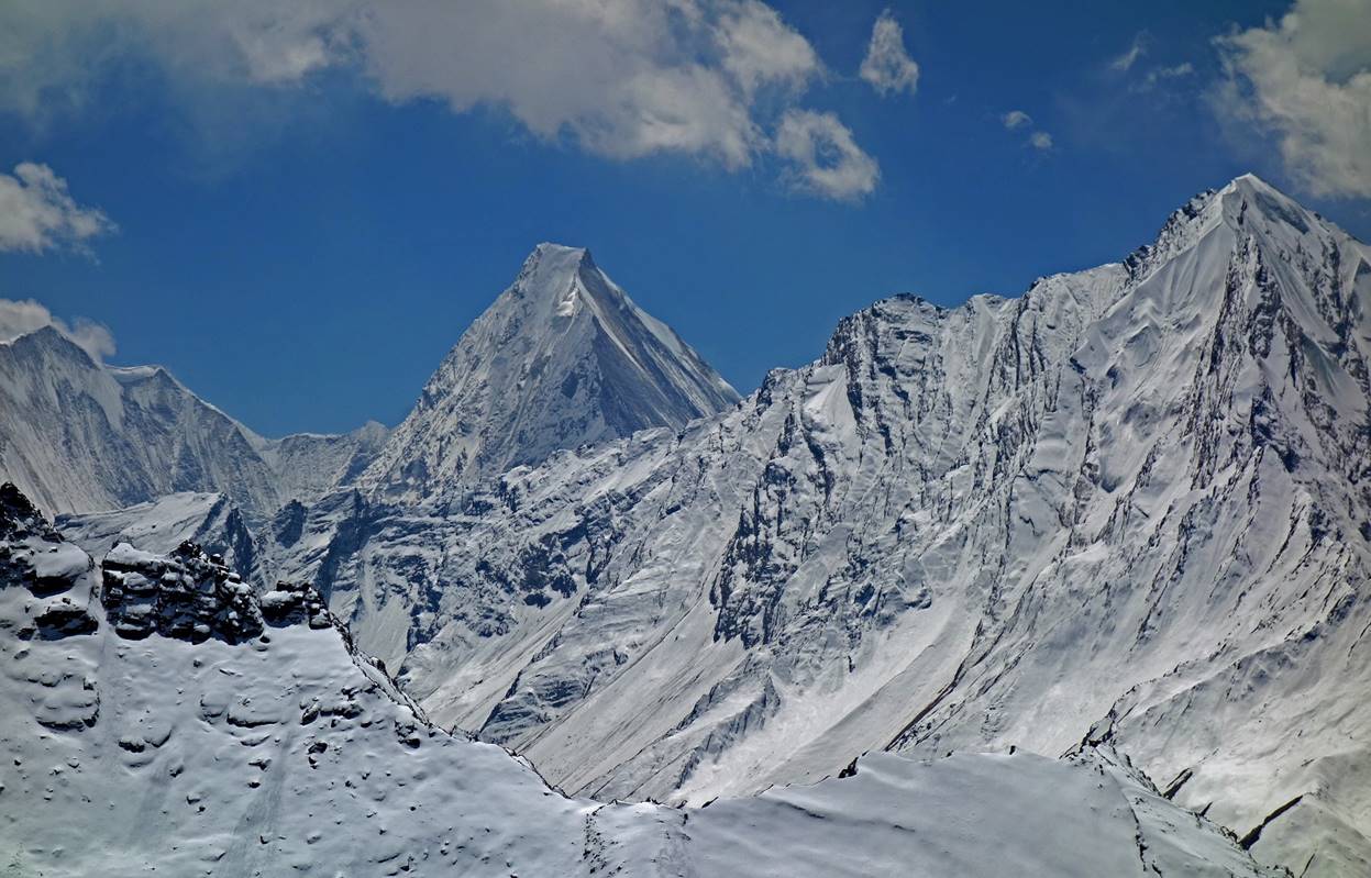
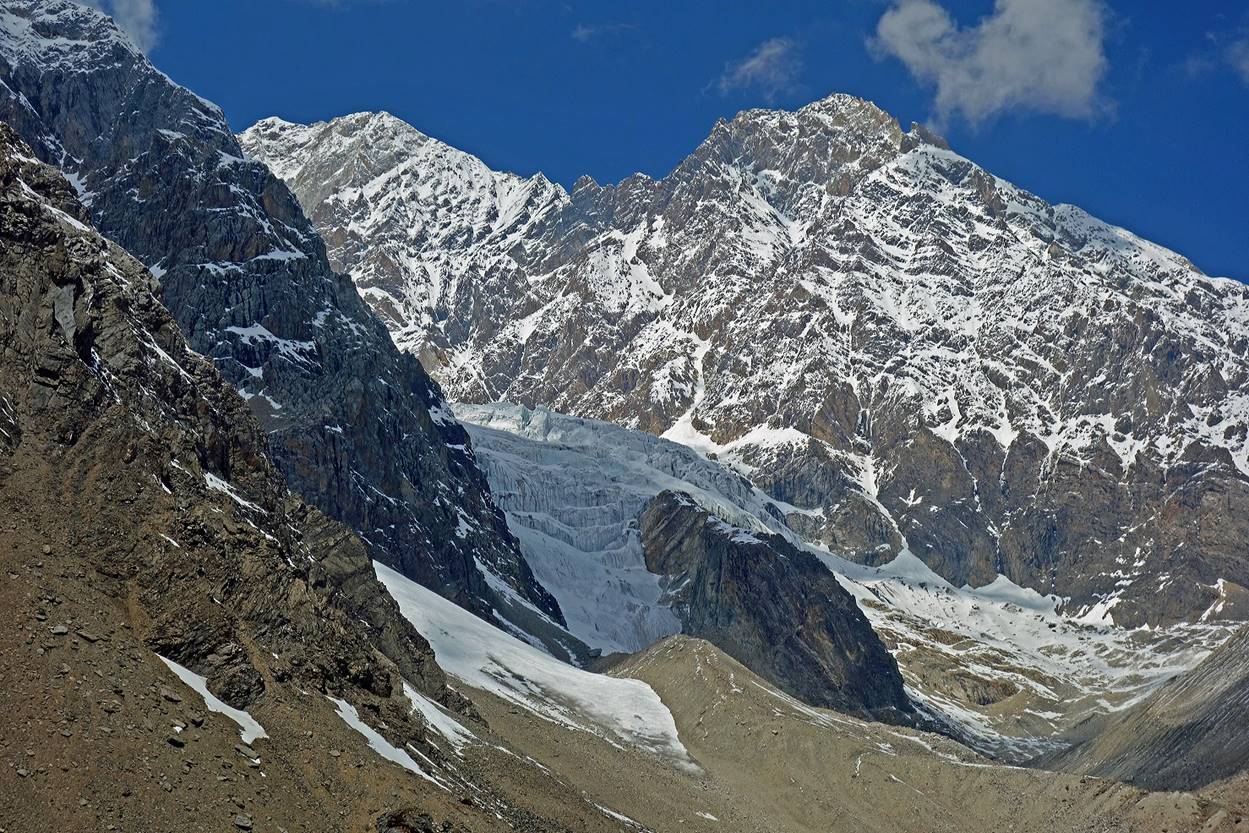
The Ghatte Khola valley ends into a cirque bounded by high peaks and some hanging glaciers. First photo below: view toward the west. Second photo: view toward the north.
![]()