Taiwan: Island of Lanyu (April 2017)
![]()
|
|
|
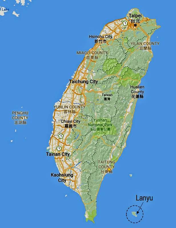
Lanyu (Orchid
Island) is a small island located 63km east of the southern tip of Taiwan′s
mainland (91km southeast of Taitung). Within a perimeter of 63km and an area of
25sq.km, it is made of craggy volcanic peaks (culminating at Hongtou-shan, 552m) surrounded by a coral reef coastline.
The island is mainly populated by the Tao (or Dawu),
who migrated here 800 years ago from the Batan
Archipelago in northern Philippines. They are mostly fishermen and farmers.
Flying fish, omnipresent in Tao′s culture and diet, are the main catch,
but only for a short period of time in each year.
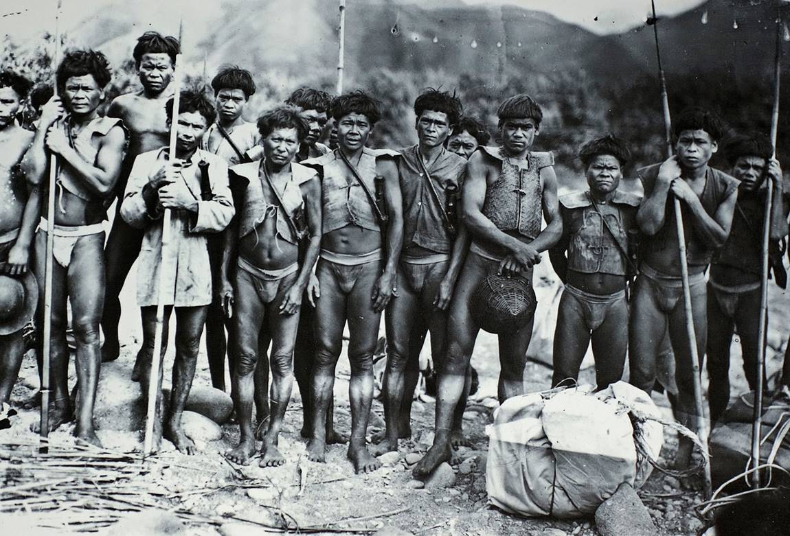
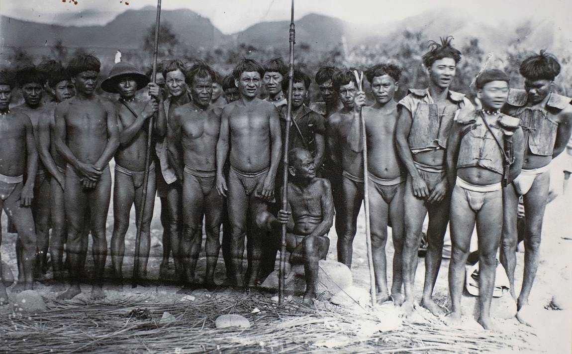
Photos of Tao
fishermen (circa late 1940s?) posted at Lanyu′s
airport. Note the vests on the 3rd and 4th fishermen in the first photo and the
3 rightmost fishermen in the second photo: these vests are supposed to protect
them against malevolent spirits when at sea.
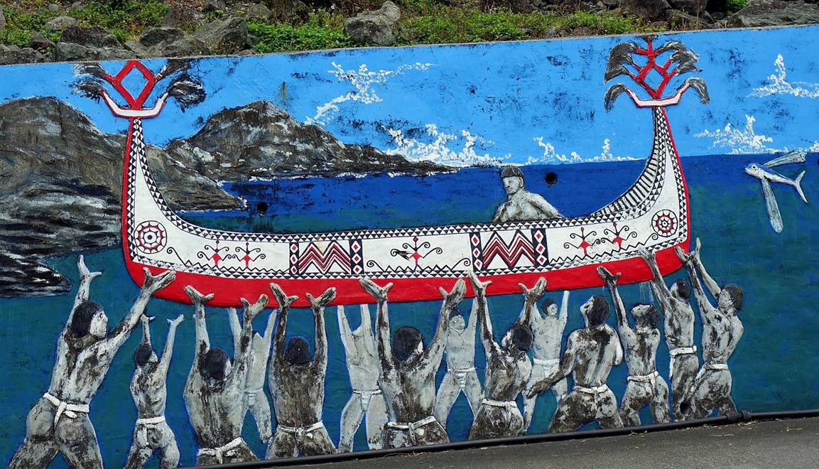
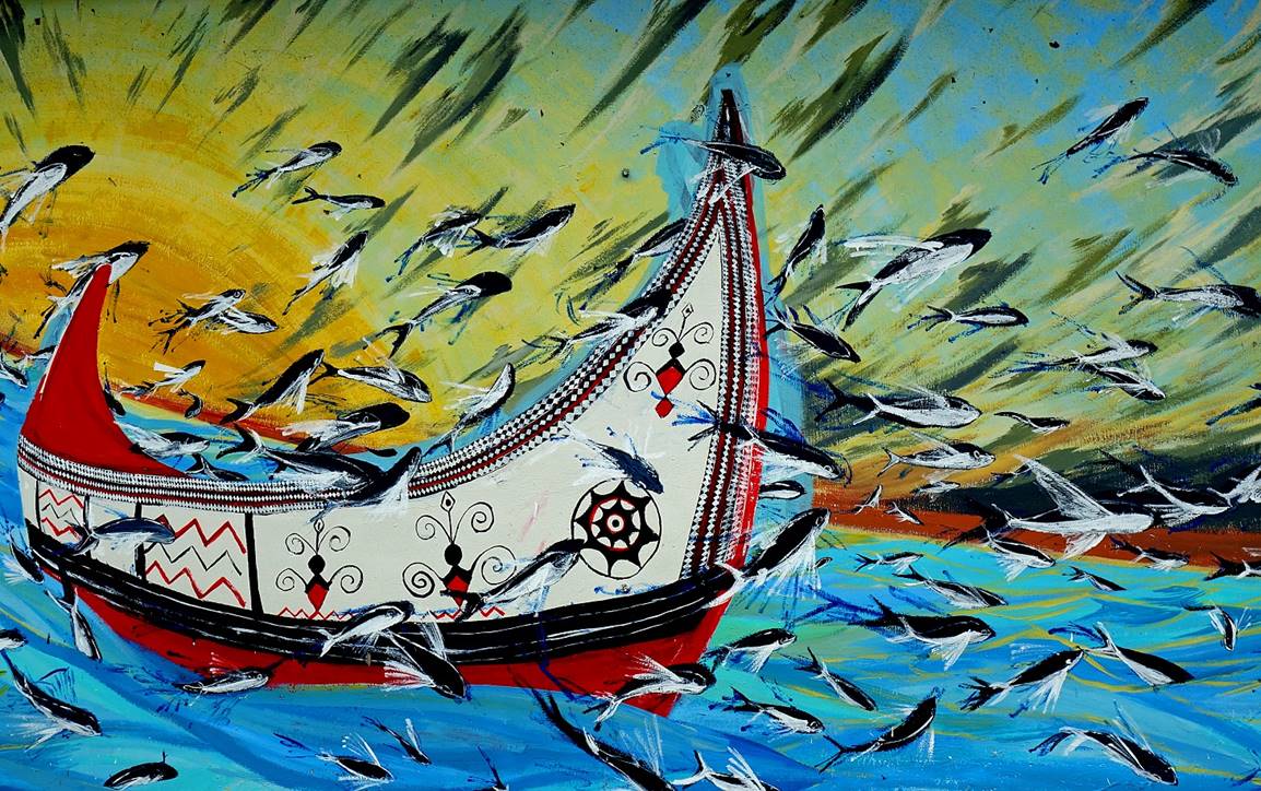
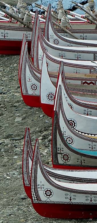
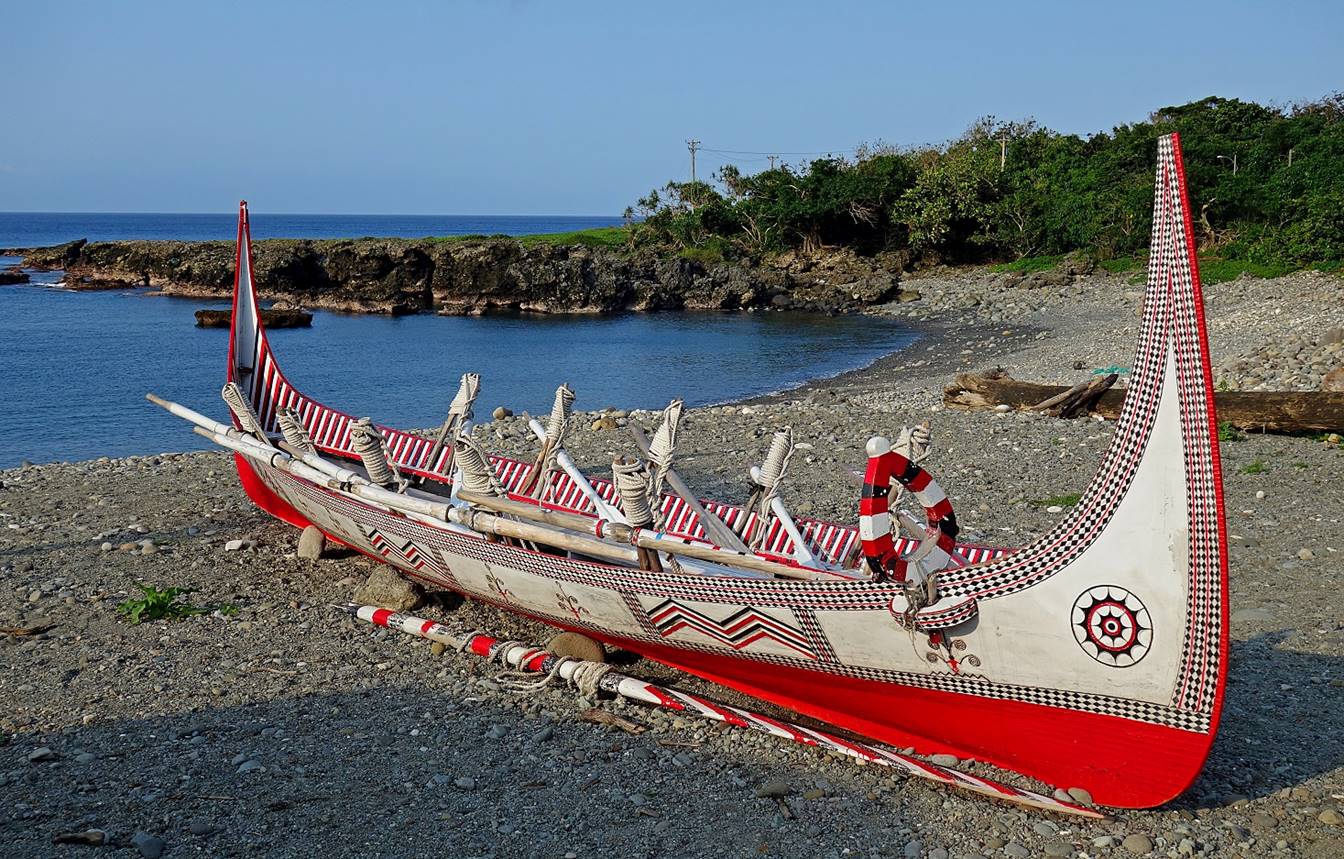
Mural
paintings celebrating the fishing culture of the Tao people, with flying fishes
and tataras (locally made canoes used to catch fish).
The circular patterns at both extremities of the canoe are the boat′s
eyes. They guide and protect the fishermen. The jagged patterns on the sides of
the boat represent the waves and the intermediate patterns represent human
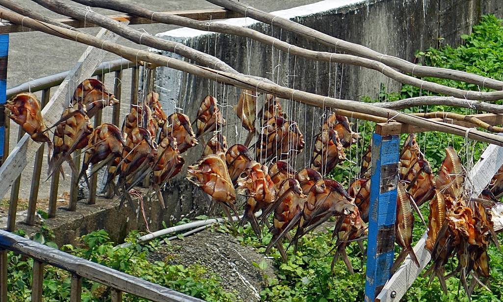
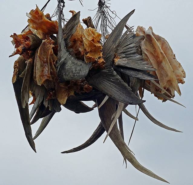
figures. Tao have many taboos regarding their tataras
and flying fish. Outsiders should not touch tataras
or take photos of fish (including drying ones) at a close distance.
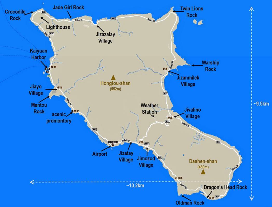
There are 6
villages on the island (see map at the top of this page), each with a Tao and a
Chinese name. In counter-clockwise order they are (the Chinese names are in
parenthesis): Jiayo (Yeyou),
Jizatay (Yuren), Jimozod (Hongtou), Jivalino (Yeyin), Jizanmilek (Dongqing), and Jizazalay (Langdao). The total
population is approximately 4000. One road goes around the island and a smaller
one cuts across the narrowest part of the island between Jimozod
and Jivalino. The main port served by the ferries
from mainland Taiwan is Kaiyuan on the west coast.
The airport is also located on the west coast, further south.
The island
was off-limits to the public until 1967. Since then it has opened up, but the
number of visitors remains relatively small. Thanks to a collective management
of land property by the Tao, there are no big hotels or large restaurants on
the island. The only odd shop is the 7-Eleven of Kaiyuan
harbor, unique in Lanyu, which opened in September 2014. The islanders are
friendly, but for good reasons wary of outsiders. After all, in 1982 the
Taiwanese government opened a nuclear waste storage facility at the southern
tip of the island with no consultation with the local people. Earlier, in the
mid-1970s, the Tao people were told that the government was going to build a
fish cannery! (See here.) This facility is still an unresolved issue.
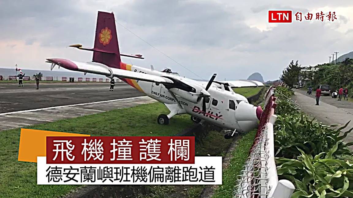
The island is
often hit by typhoons or lesser tropical storms. So, not too surprisingly, this
was my third attempt to visit Lanyu. I had previously planned to visit Lanyu in
November 2015 and again in November 2016. In each case, bad weather prevented
me from reaching the island. On the eve of this third attempt a plane from
Taitung to Lanyu skidded off the runway and crashed into a fence after landing,
due to crosswinds; the flight that I was supposed to take on the next morning
was canceled. Fortunately, I could take the ferry that connects Fugang harbor in Taitung to Kaiyuan
harbor in Lanyu.
The crashed
plane in Lanyu airport.
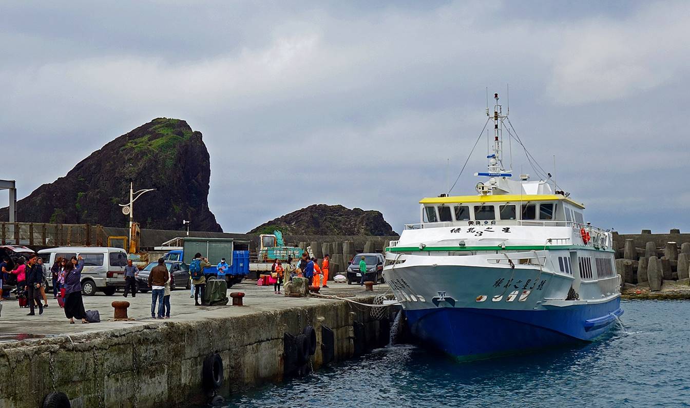
Arrival at Kaiyuan harbor.
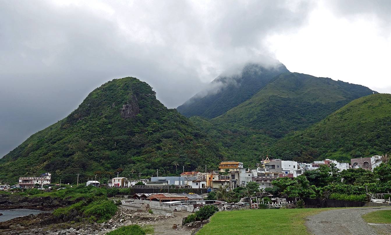
View of Jiayo village and the mountains behind it.
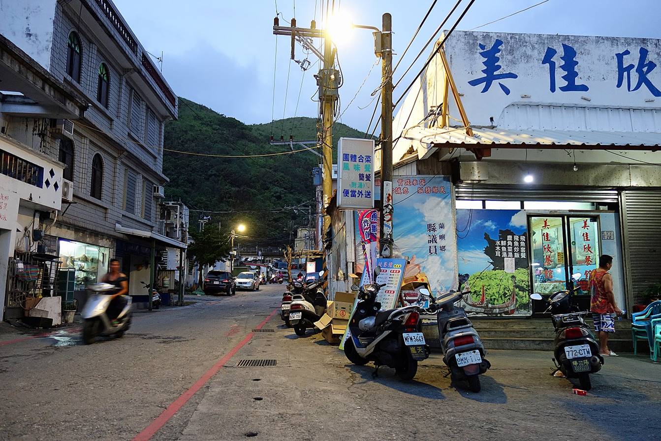
Main street of Jiayo at night.
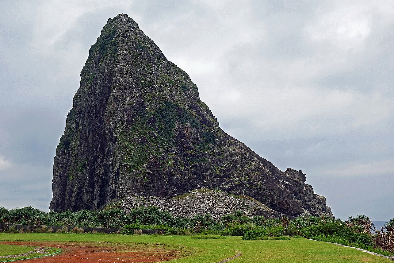
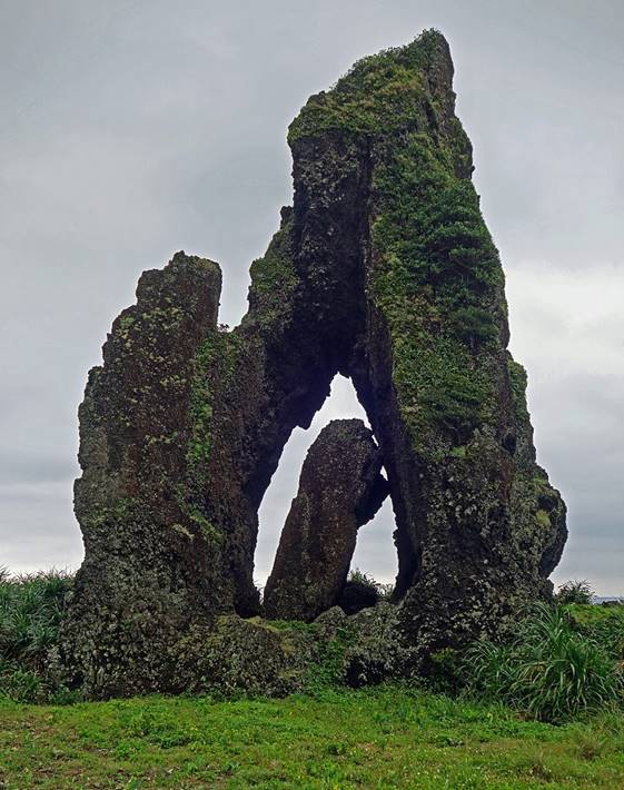
Mantou rock located behind the school of Jiayo village. It is one of the many distinctive rock
formations along the island′s coastline. Spirits of deceased Tao are believed
to reside in this rock, Outsiders must not get too close.
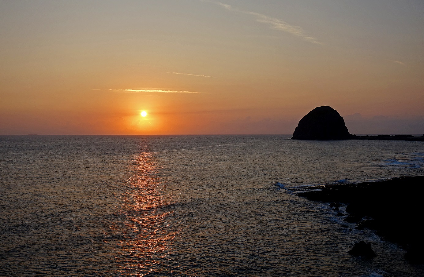
Mantou rock seen from further south.
View toward
the interior of the island from the road south of Jiayo
village.
Mixing of volcanic
and coral rocks at a promontory south of Jiayo.
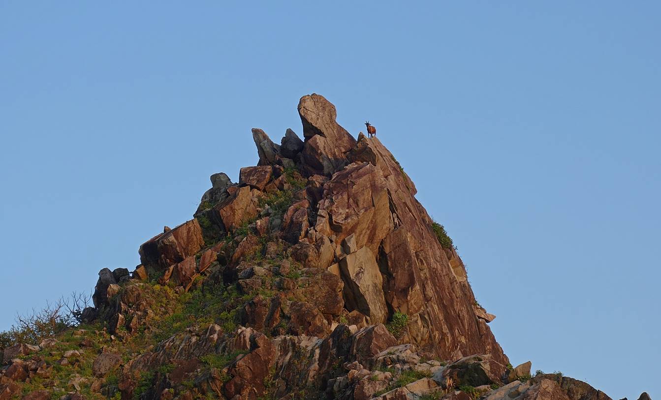
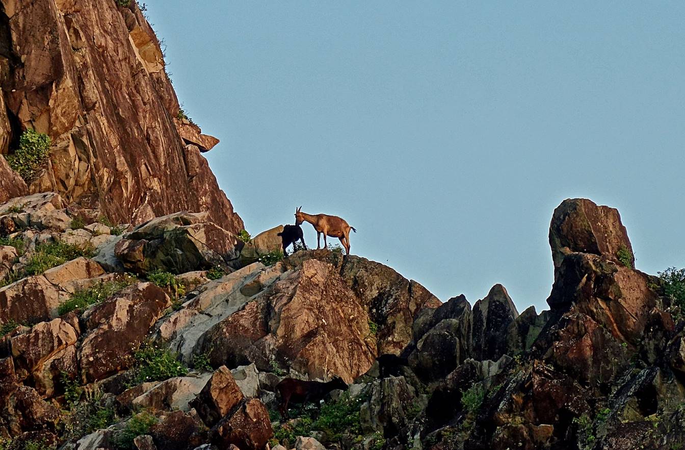
Goats at the
promontory. Goats roam freely everywhere on the island. Each of them has a owner. They are killed only for
certain important celebrations.
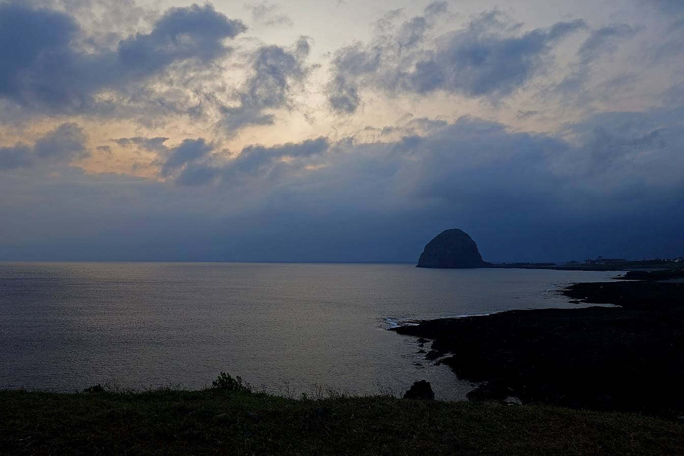
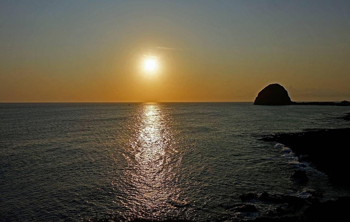
Mantou rock seen from the promontory on a cloudy and a
clear evening.
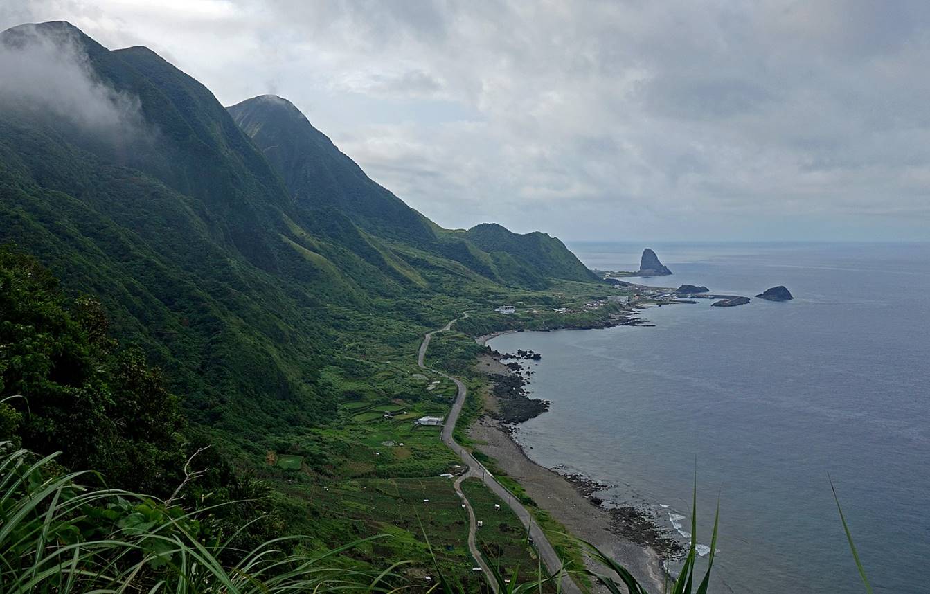
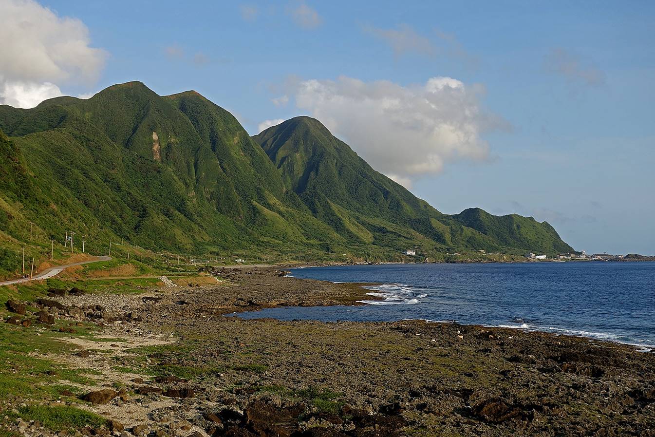
Coastline
south of the airport just before reaching Jazatay
village, with Jimozod village visible on the left.
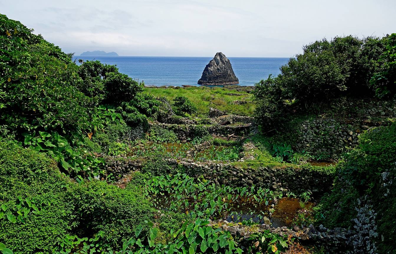
Taro
cultivated in small ponds bordered by walls made of coral rocks in Jazatay village.
Flying fishes
drying in Jazatay village.
|
|
|
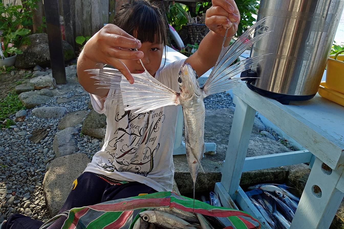
Young girl
holding a freshly fished flying fish in Jimozod
village.
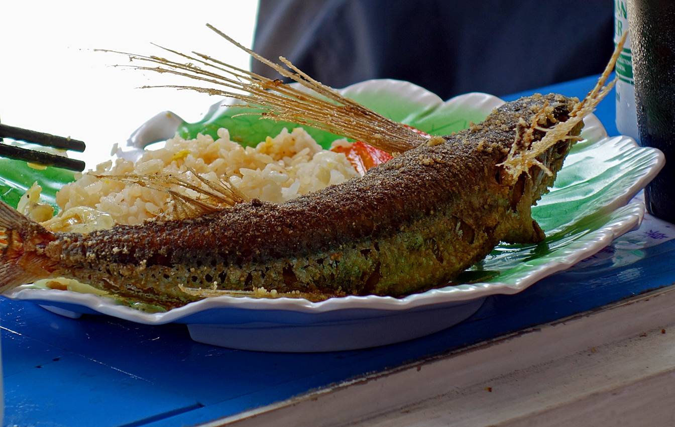
Flying fish
served for lunch in a restaurant in Jimozod village.
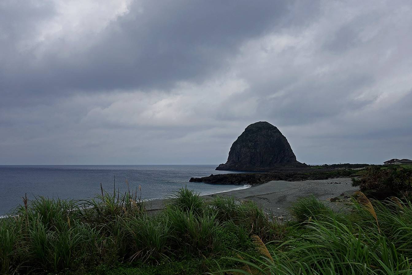
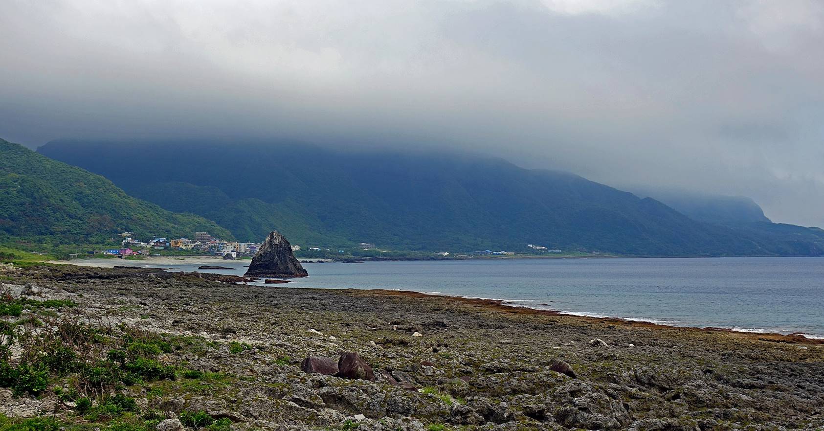
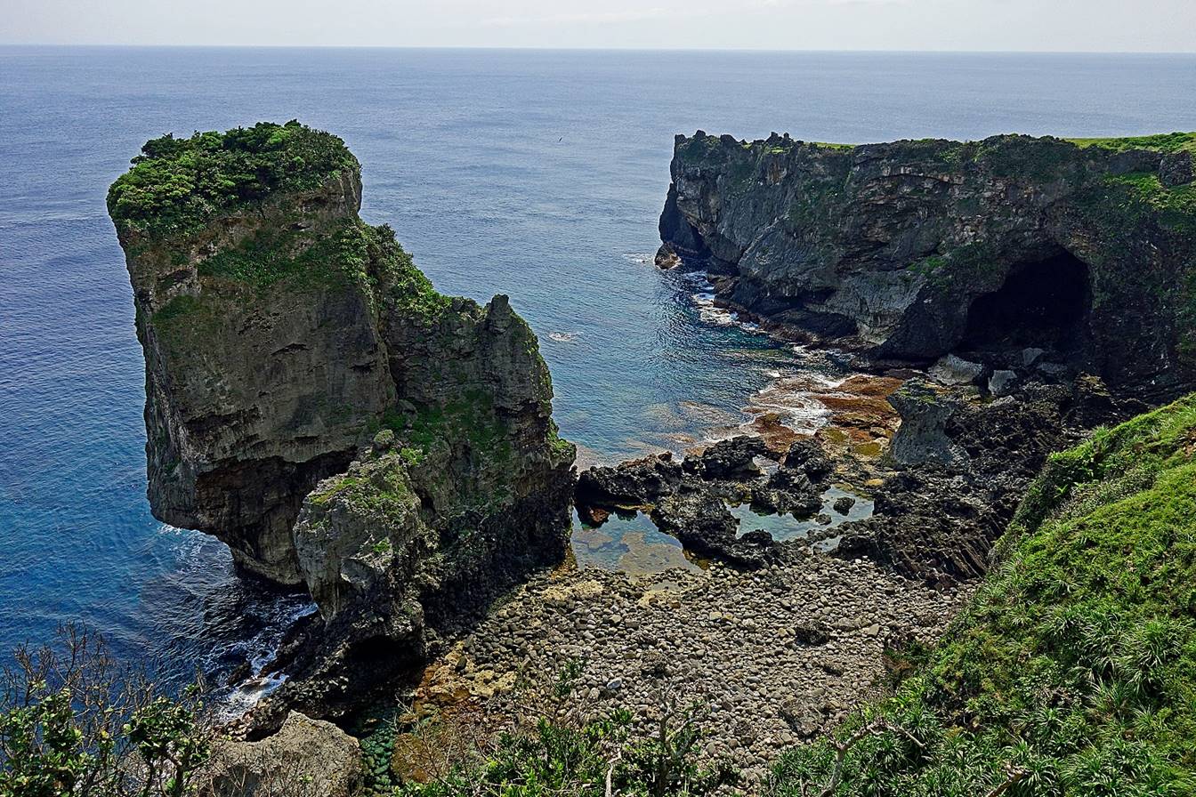
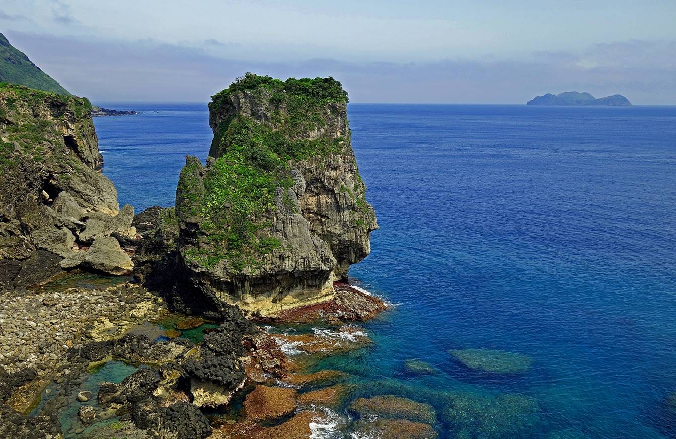
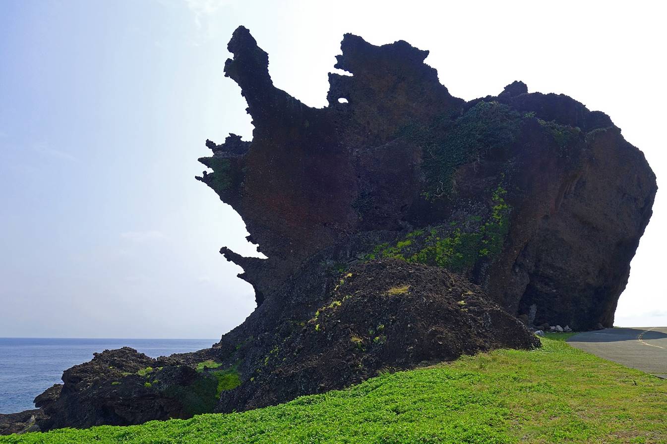
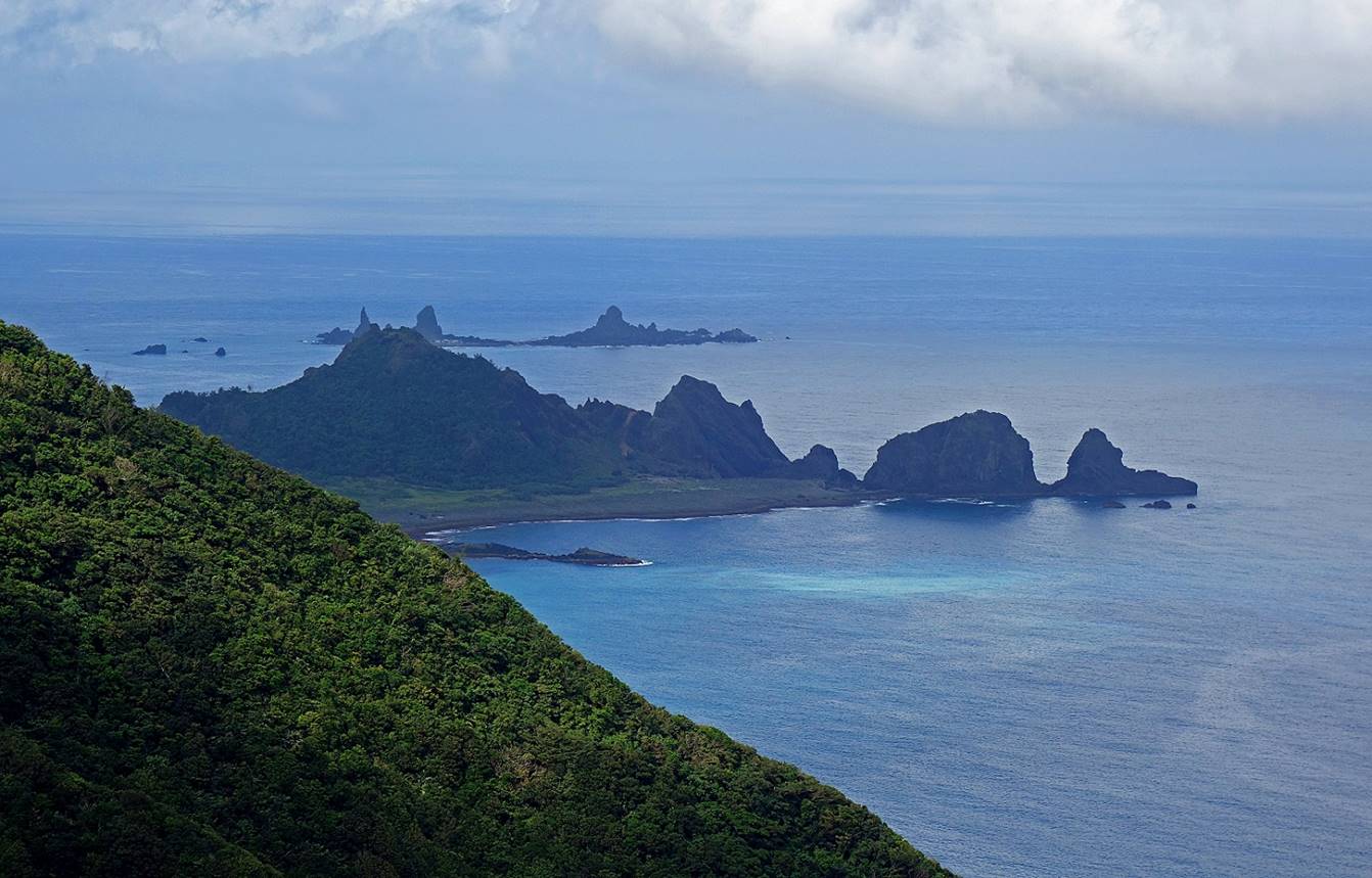
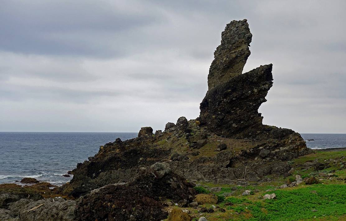
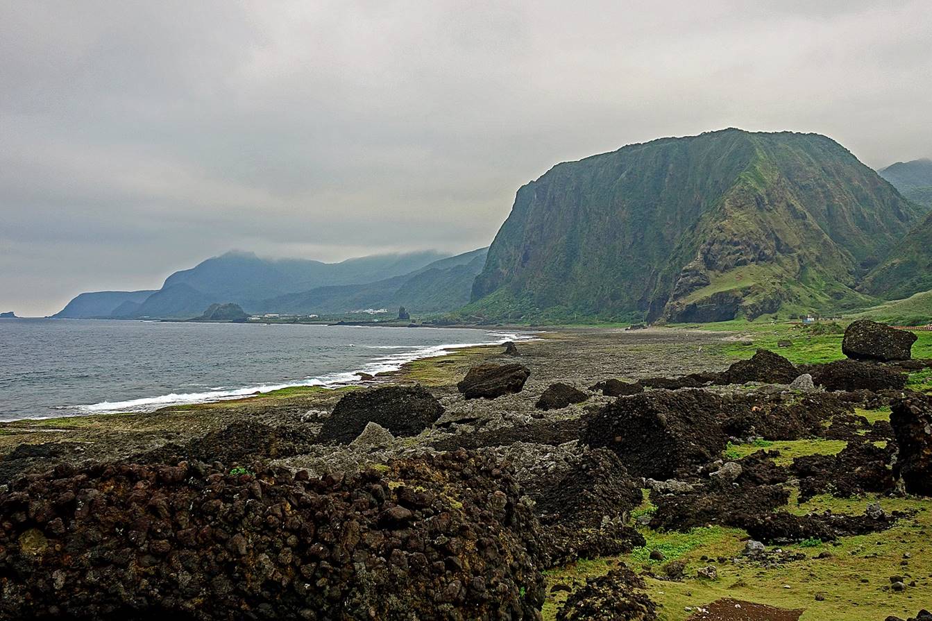
Oldman rock, one of the most beautiful sites in Lanyu. The
small island on the right side of the second photo below is an uninhabited
islet (also part of Taiwan) called Hsiao Lanyu.
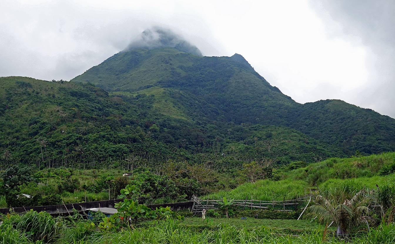
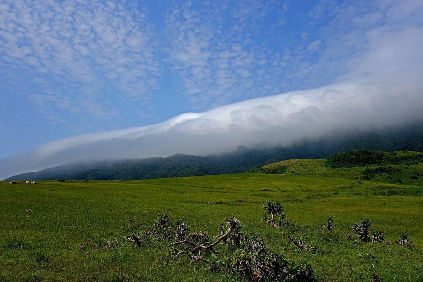
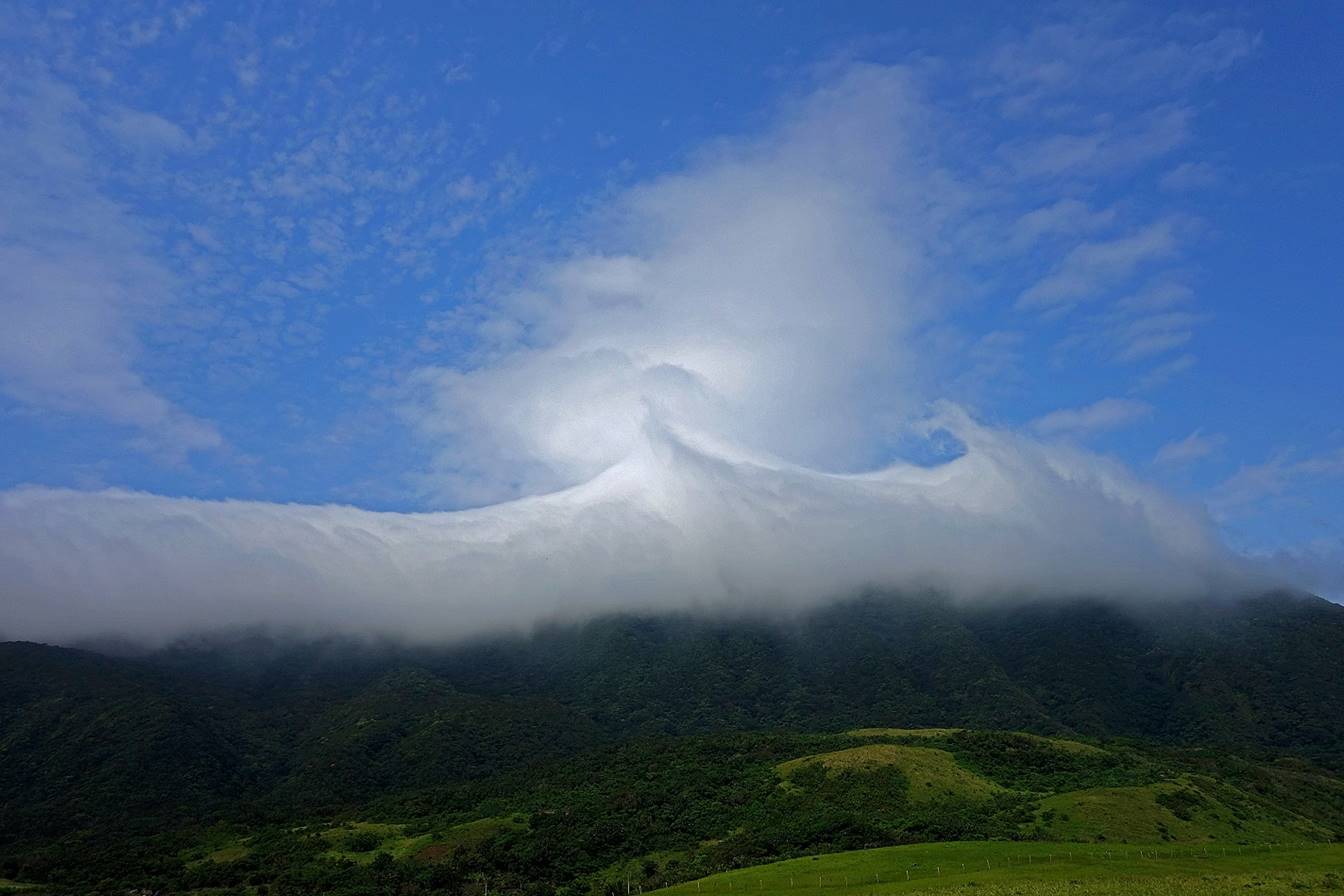
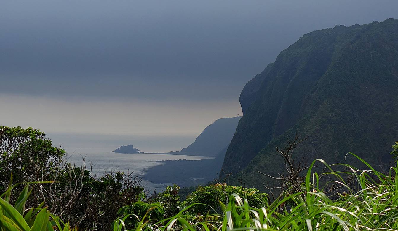
Cloud
formations on Dashen-shan seen from the grassland
above Oldman rock.
Dragon′s
Head rock located near the nuclear waste storage facility. Most of the names of
the distinctive rock formations on the island have been given by people from
mainland Taiwan in the hope to develop tourism. These names are not related to
the Tao culture and the islanders often find them ludicrous.
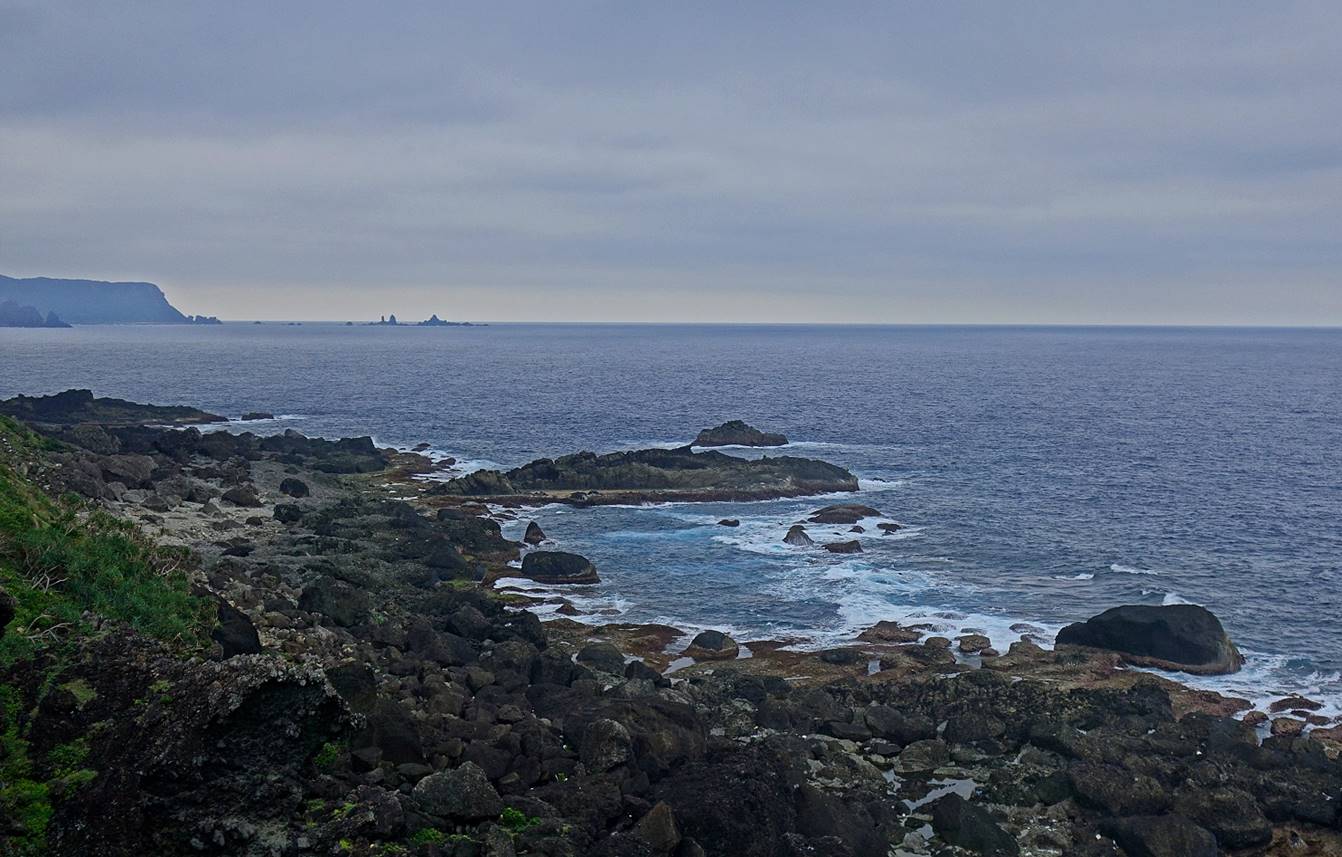
Views from
the weather station:
- Of the
southeastern coast of the island.
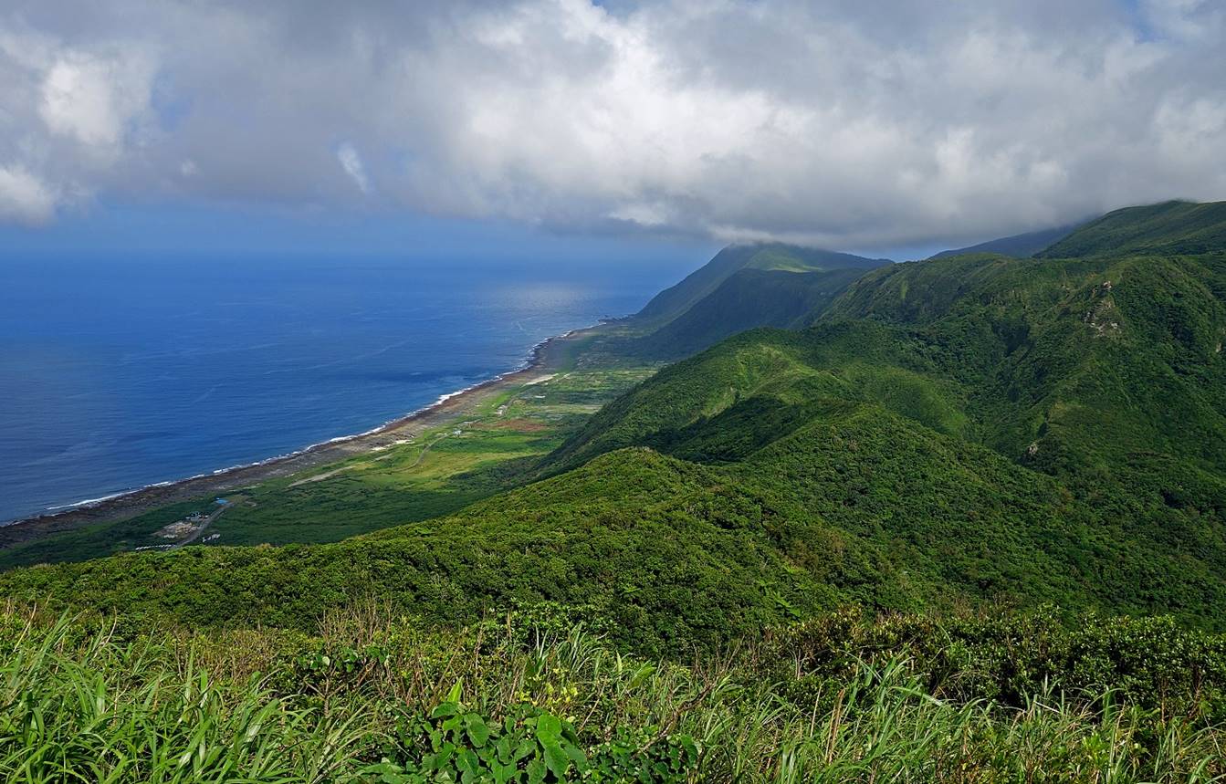
- Toward the
north. The second line of rocks in the back is called the Warship rock. It is
said that during World War II the US Air Force mistook this rock for a Japanese
warship and started bombing it, hence its name.
Coastline
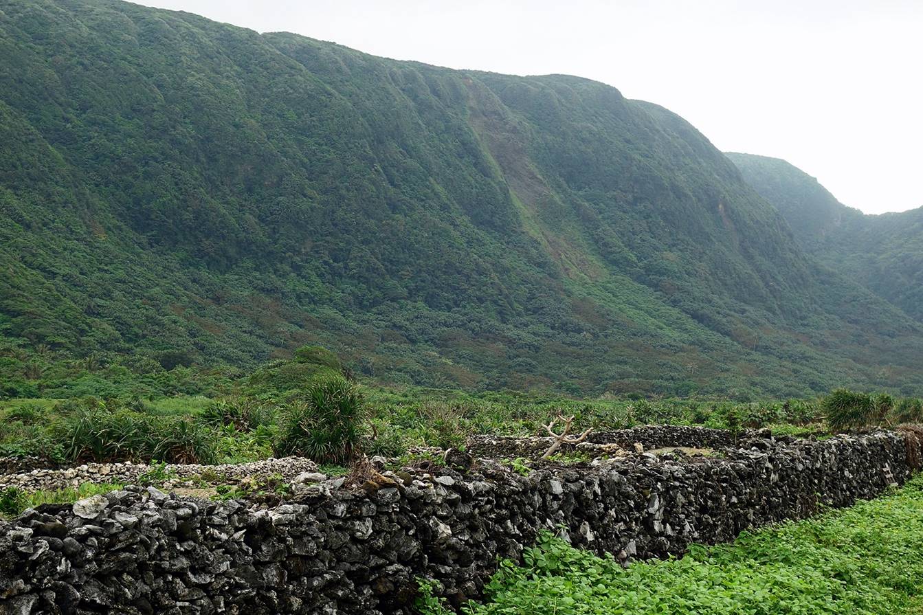
between the villages of Ivalino and Jizanmilek. The Warship rock is visible on the horizon.
Traditional
walls made of coral rocks between the villages of Ivalino
and Jizanmilek.
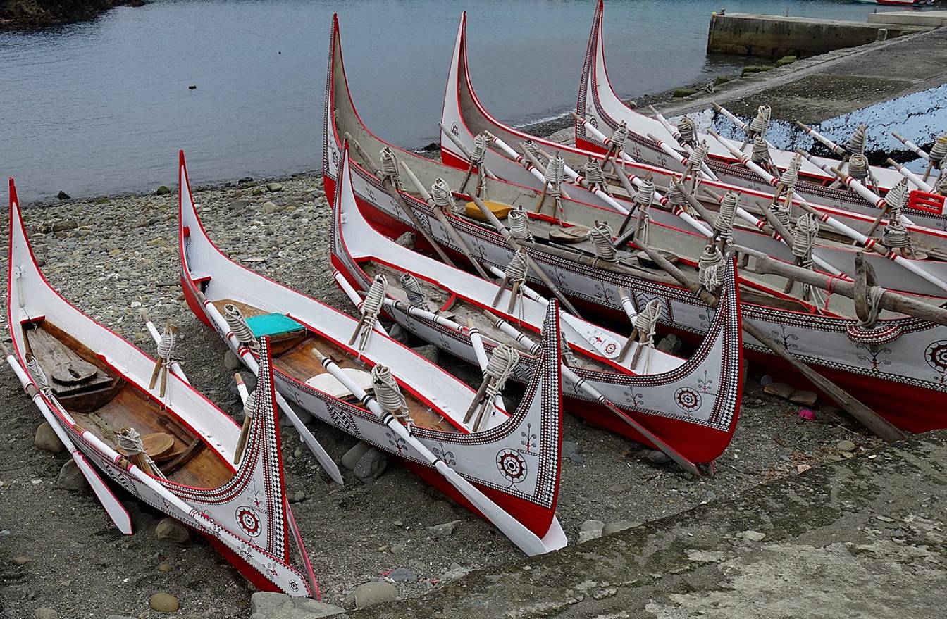
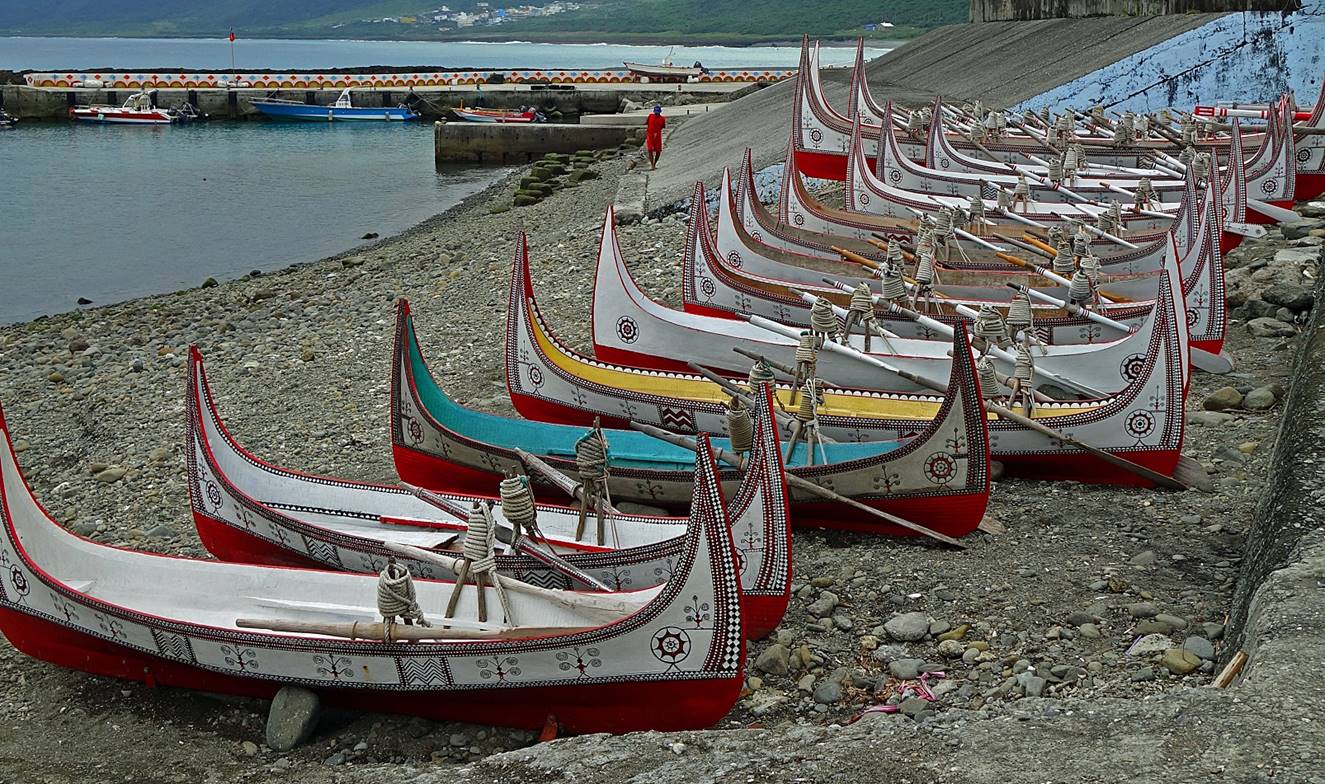
Tataras, traditional Tao boats, in Jizanmilek.
The decorations of the boats are chip carved in the wooden hulls, before being
painted.

|
|
|
Beach and
rocks in Jizanmilek:
- View toward
the south. The village of Jivalino is visible on the
right.
- View toward the north.
Twin Lions
rock.
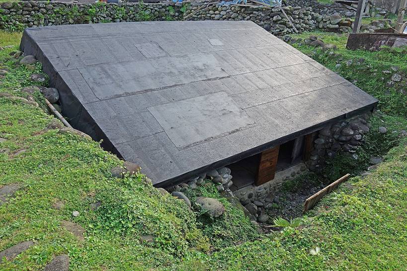
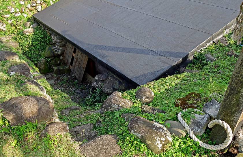
Underground
house in the village of Jizazalay. This type of
traditional Tao houses was built in the past to sustain typhoons, at a time
when typhoons arrived unannounced. In the 1960s the Taiwanese government
decided that they should be torn down and replaced by concrete structures.
Today, few such houses remain. The largest cluster is in Jivalino.
|
|
|
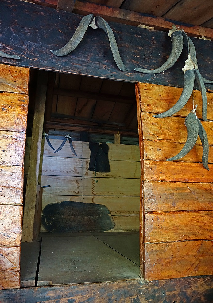
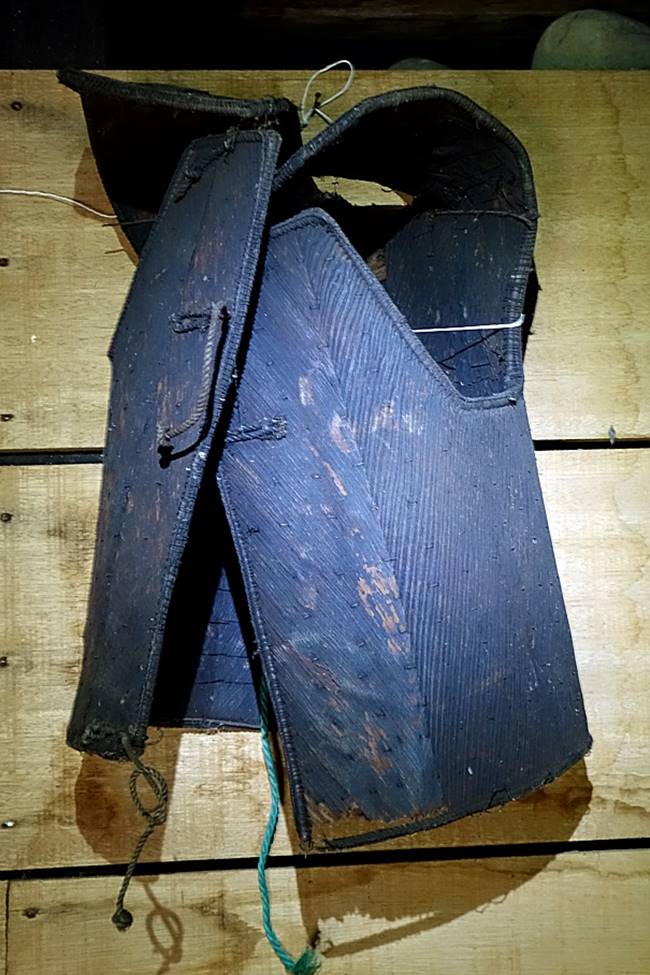
Inside the
house. The vest suspended in the inner room is the same as those worn by
fishermen in the two photos shown at the top of this page.
|
|
|
Tatara on the beach of Jizazalay.
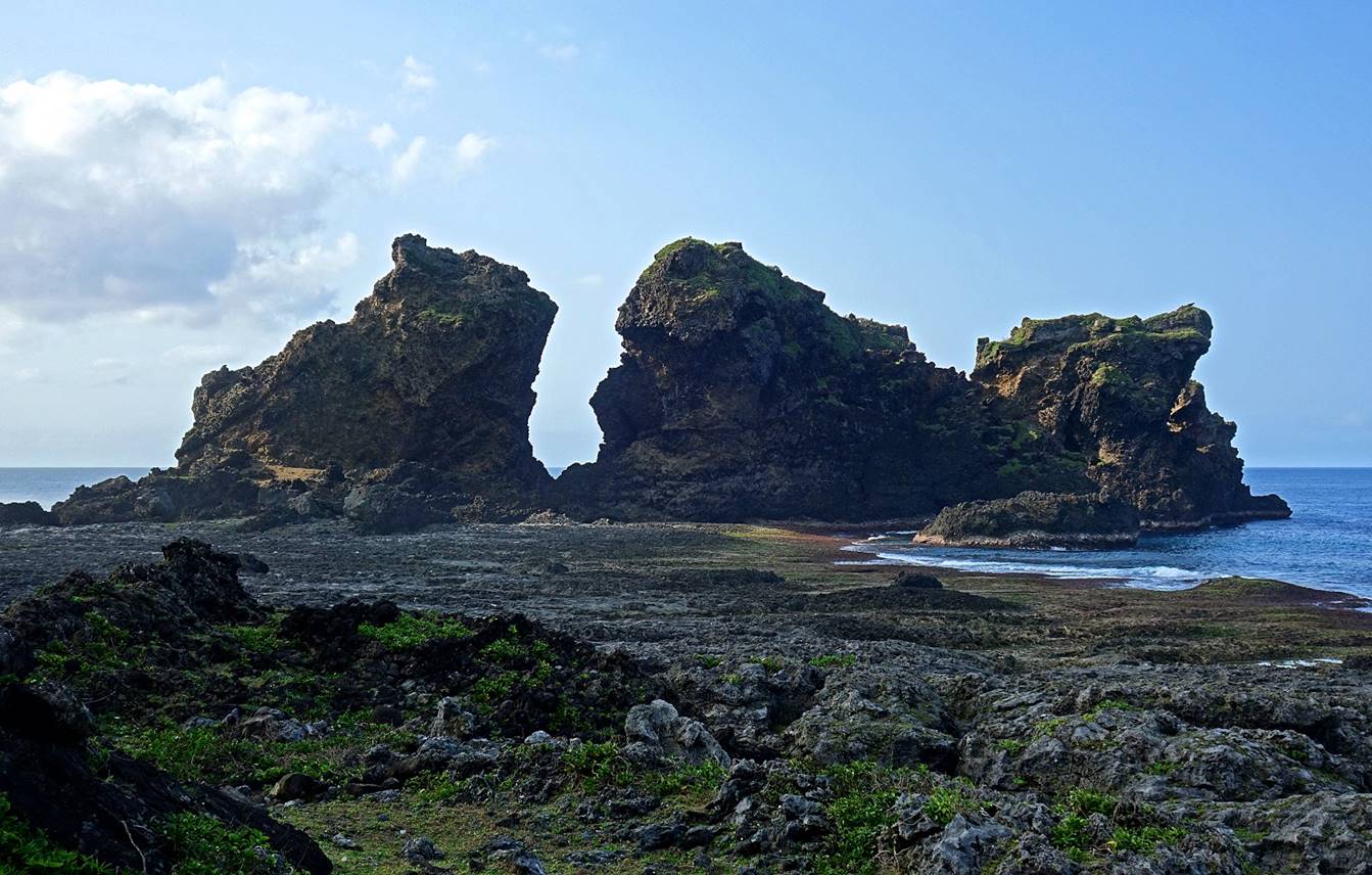
Left: Jade
Girl rock. Right: Crocodile rock.
|
|
|
Coastline
near the northwest tip of the island, below the lighthouse.
Views from the
road leading to the lighthouse:
- Of the
north coast.
- Toward Kaiyan
harbor.
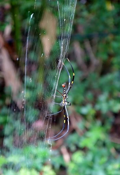
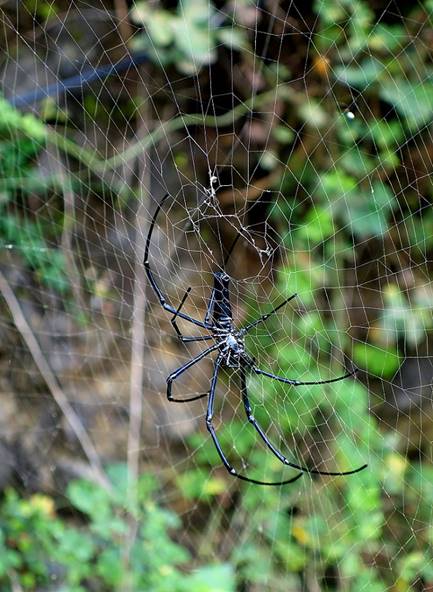
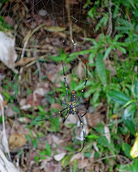
Spiders along
the road to the lighthouse.
|
|
|
|
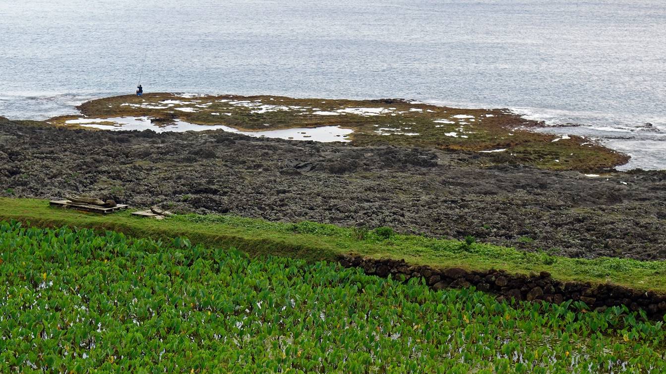
Coast north
of Kaiyuan harbor (visible on the far right).
Taro field
near Kaiyuan harbor.
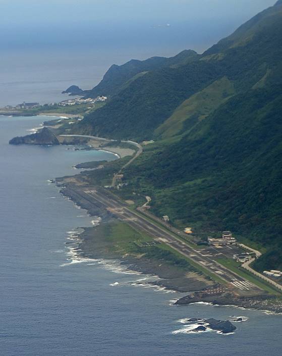
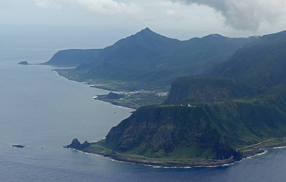
Views from
the plane on the way back to Taiwan′s mainland. Left: The narrow runway
of Lanyu′s airport. Right: The northwestern tip
of Lanyu, with the lighthouse (white) visible on top of the cliff and Jizazalay village behind at the center of the picture.
|
|
|
![]()