Turkey: Kars and around
(April 2018)
![]()
Kars is a
city (approx. pop. 80,000, elev. 1,768m) in northeast Turkey and the capital of
the Turkish province of the same name. For centuries the area had been home to
a large population of Armenians. For a brief period of time (928 to 961) Kars
was even the capital of the Bagratid Kingdom of Armenia, before this kingdom′s
capital was transferred to Ani, 45 km to the east. More recently, the Russians
occupied the region from 1878 until the end of World War I. The region then
came briefly under the administration of the Armenian Republic. But, in October
1920, Turkish forces took Kars, causing an exodus of Armenians, and the region
became officially part of the Republic of Turkey when this republic was founded
in October 1923. Today, the region includes a large minority of ethnic
Azerbaijani who strongly oppose the re-opening of the border with neighboring
Armenia.
For photos of
Ani, see here.
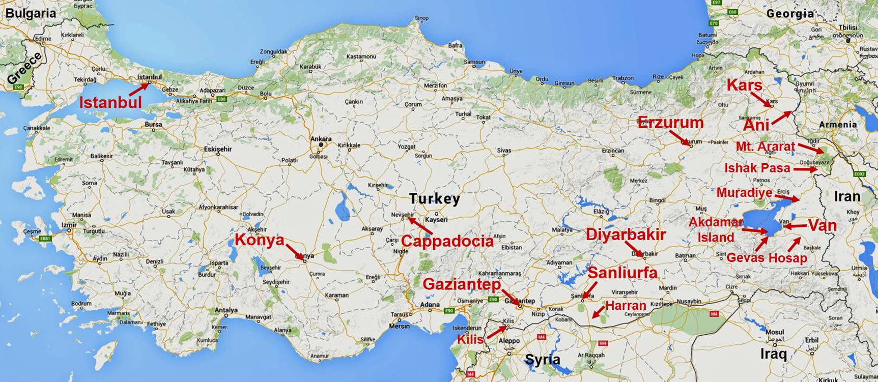
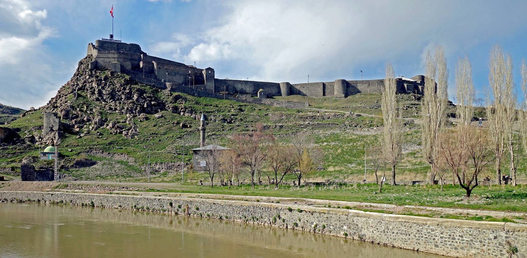
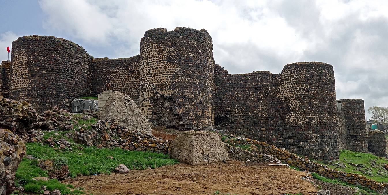
Kars:
The city is
dominated by its huge citadel (kalesi). This citadel
was initially built in 1153 under the Anatolian Seljuks,
torn down by Timur in the 14th century, and repaired
in the 16th century.
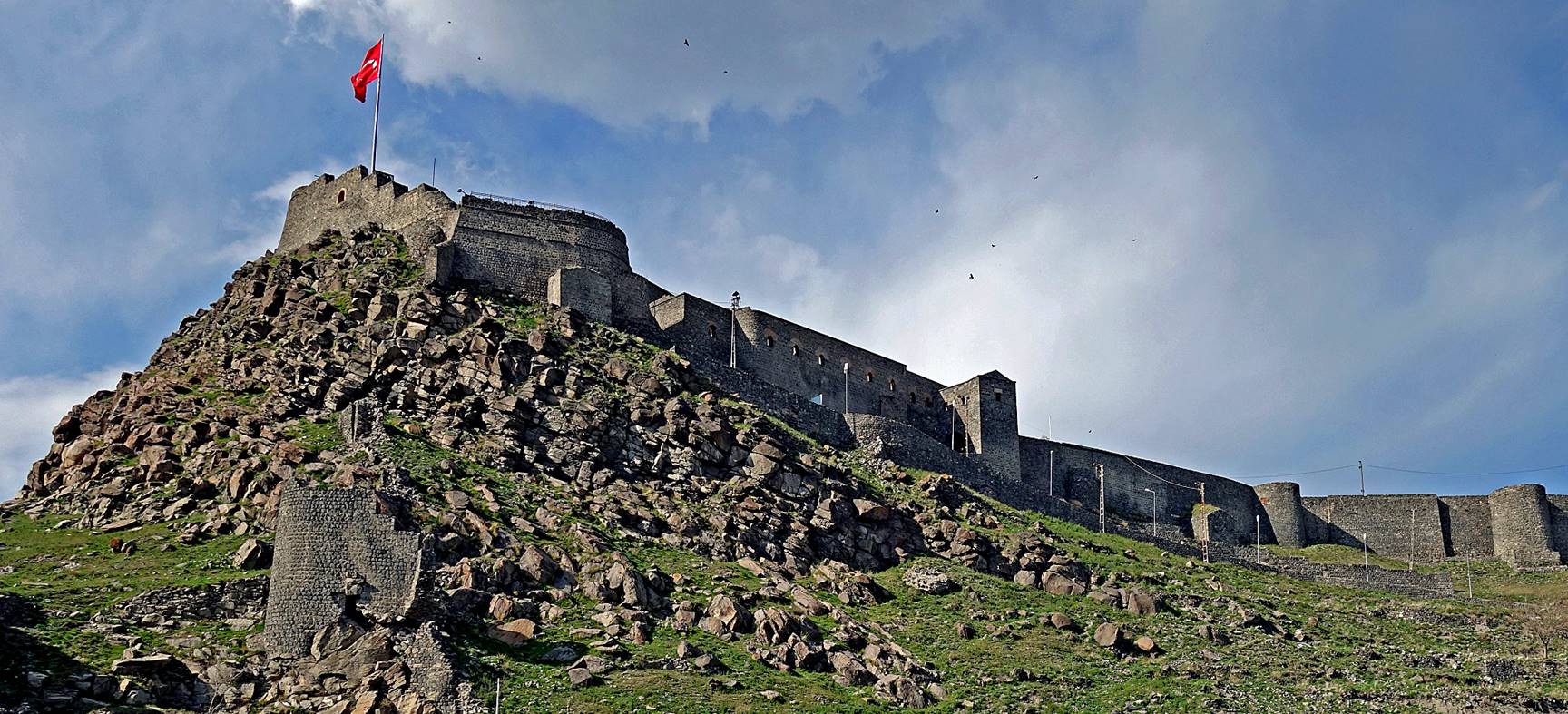
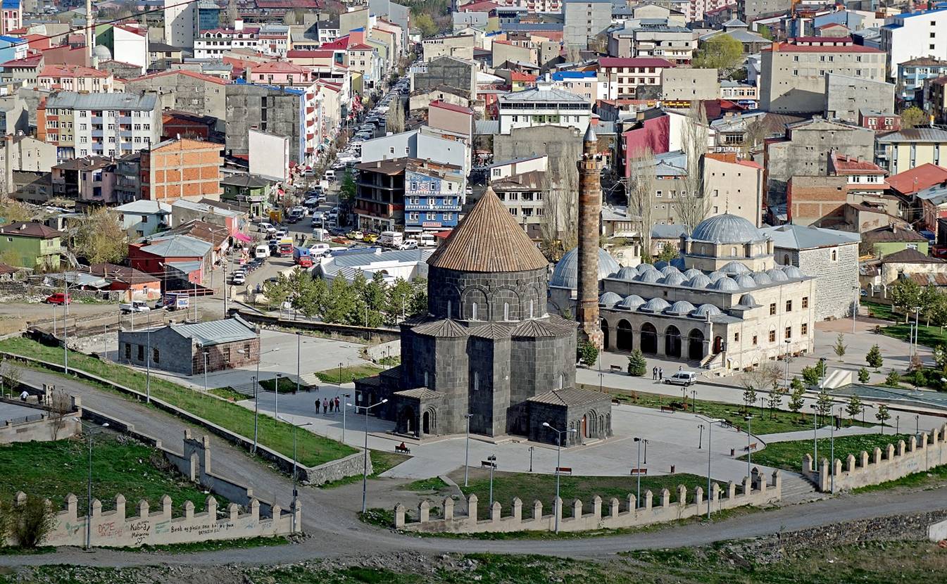
View over the city from the citadel.

|
|
|

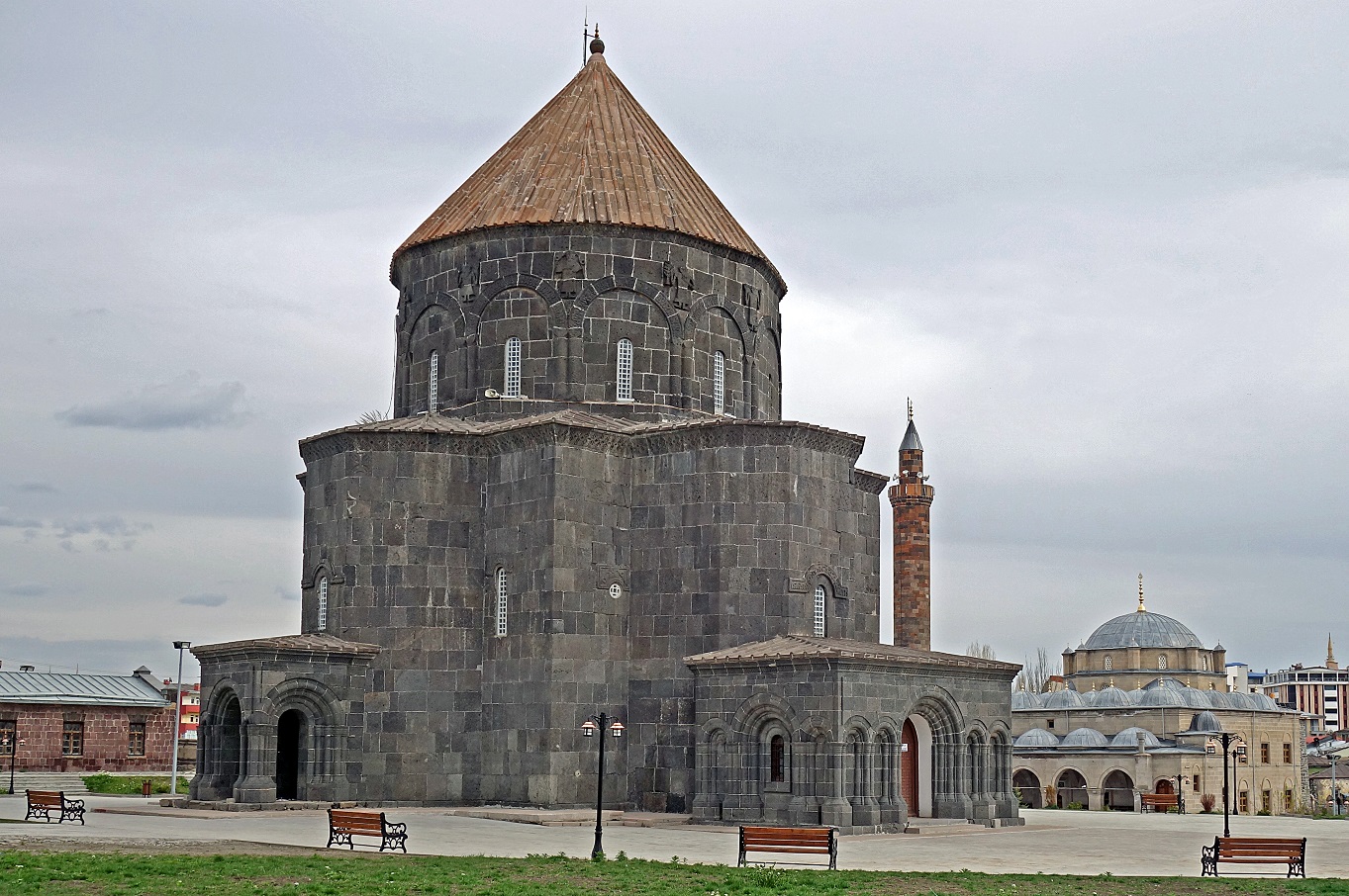
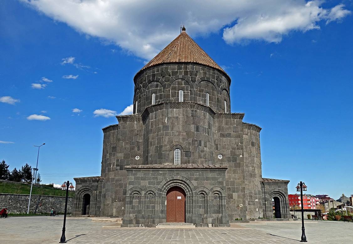
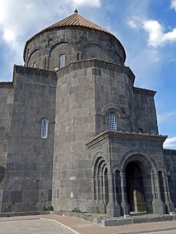
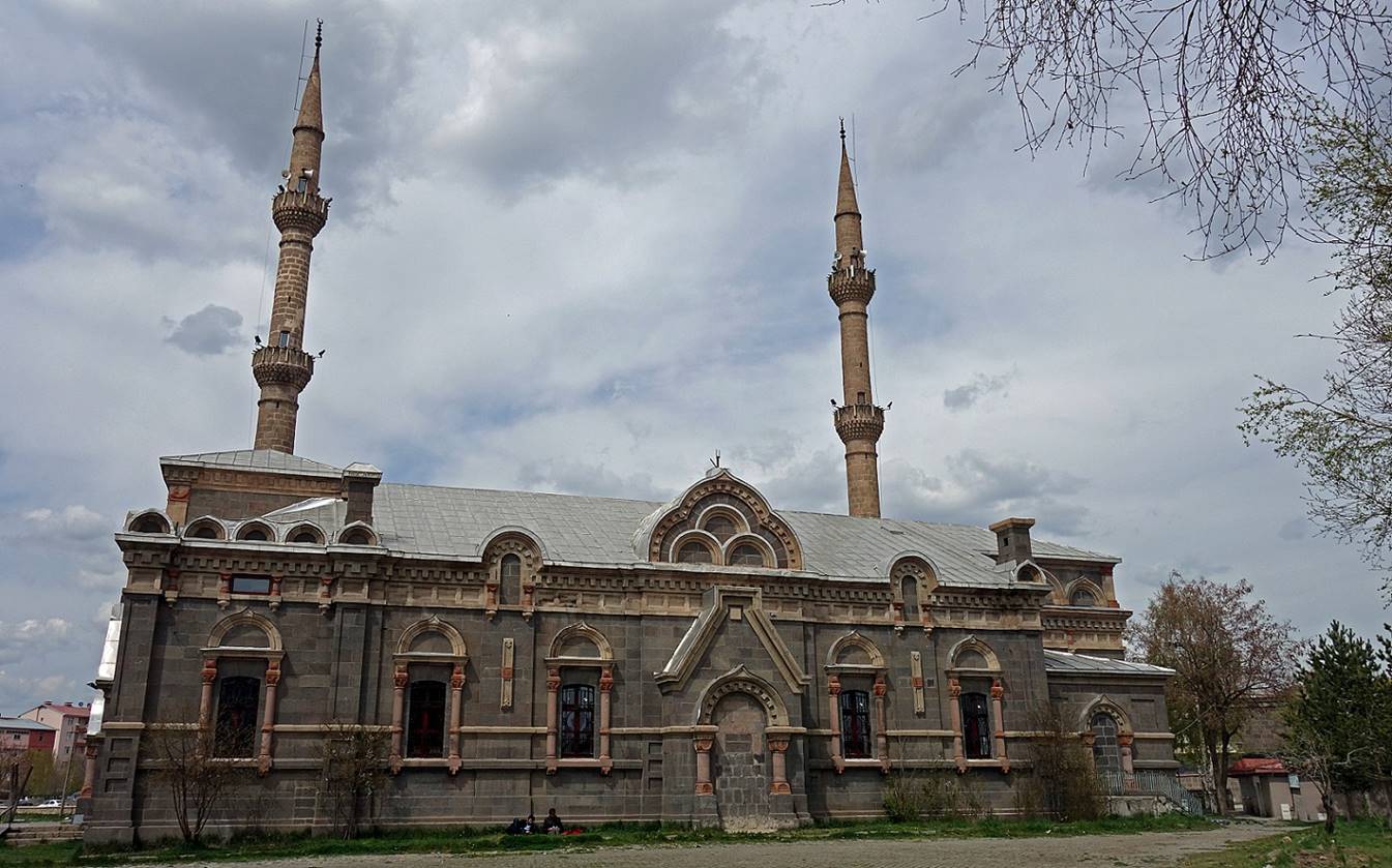
Armenian church of the Holy Apostles, built in the 930′s by
Bagratid King Abas, and the Evliya mosque (″mosque
of the Saints″) built in 1579 behind it. The church is extremely well
preserved, especially in comparison to other Armenian churches in the region.
Is it because it has officially been converted into a mosque (called Kumbet camii, for ″Domed
mosque″), though it does not look like one, or because it lies in the
heart of a province capital?
Other views
of the Armenian church.
|
|
|
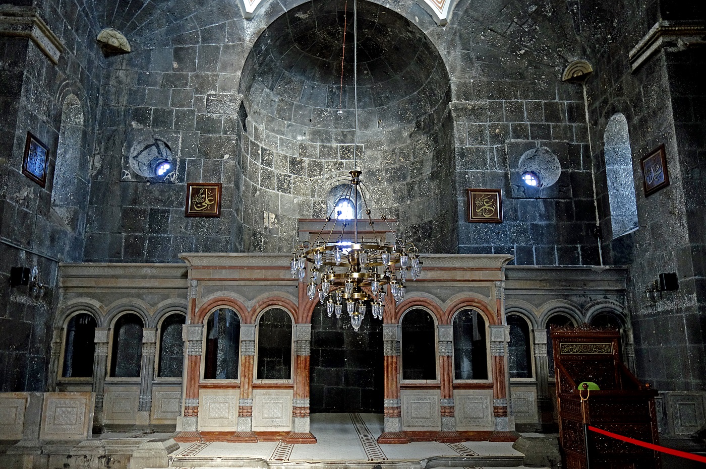
Inside the
church. The porches were added during the Russian occupation. In the
bottom-right corner of the photo one can see parts of the modest arrangements
made when the church was converted into a mosque, in addition to the four
square frames with prayer signs in Arabic script posted on the walls and the
removal of Christian objects.
Left: View of
the citadel in a painting by J. Suchodolsky showing
the 1828 Russian siege of Kars. Right: Late 19th-century photo of the Armenian
church of the Holy Apostles during some restoration work. Neither the citadel,
nor the church has changed much since then.
|
|
|
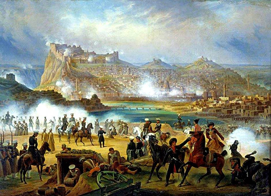
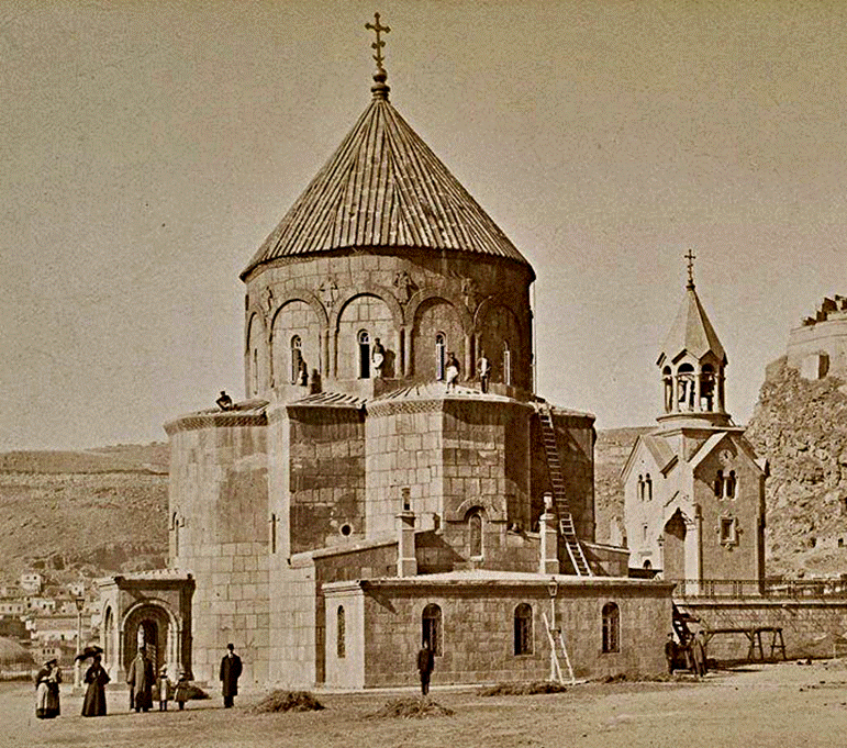
[Source of both images: https://en.wikipedia.org/wiki/Kars.]
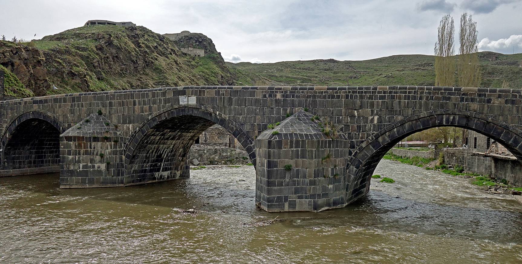
Tas Kopru, a bridge built over the Kars river in the 16th century and reconstructed in the 18th
century after an earthquake.

A
19th-century Russian Orthodox church, converted into a
mosque, the Fethiye mosque.
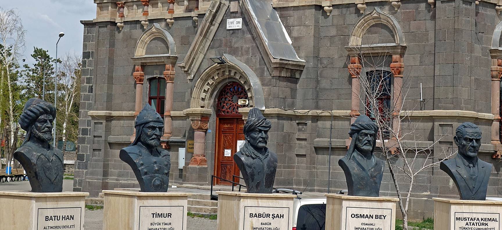
Busts of
historical figures lined up near the Fethiye mosque.
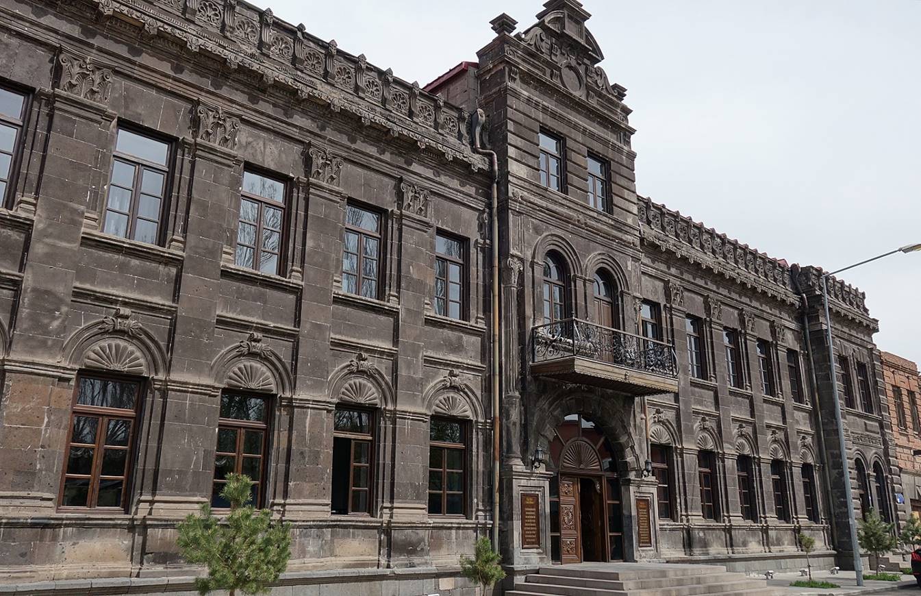
Facade of the
Hotel Cheltikov, one of the remaining 19th-century
Russian buildings in Kars.
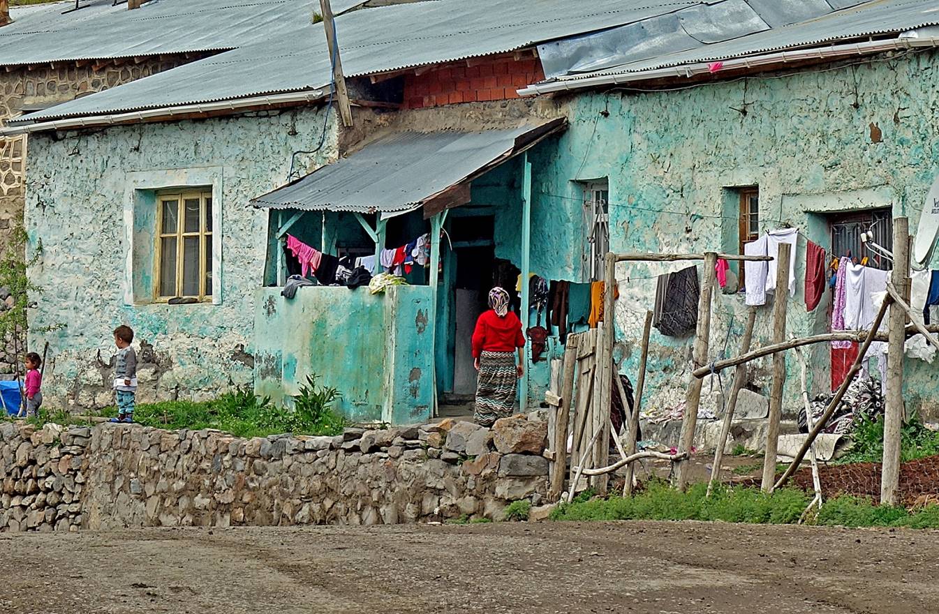
North of
Kars:
This area is
close to the borders of Turkey with modern Georgia and Armenia. In medieval
time this area was more an extension of Georgia than Armenia.

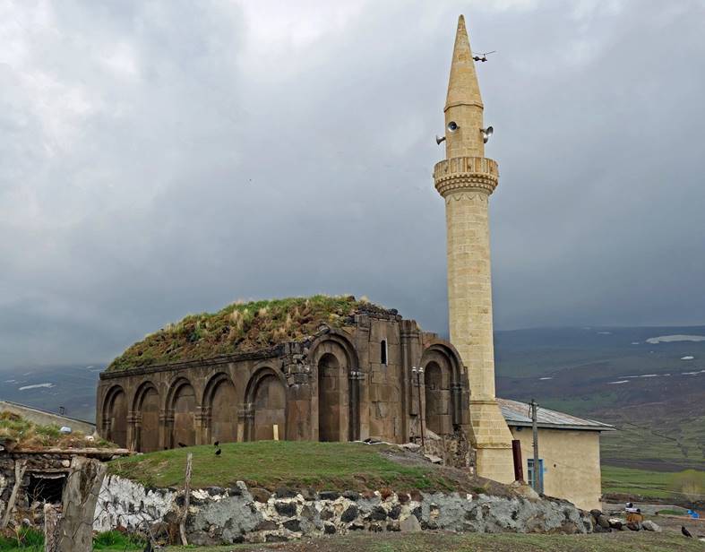
Remain of an Armenian/Georgian church
from the 10th century in the village of Dogruyol
(pop. ~1,000) on the north-east shore of lake Cildir Golu, some 55km north-east of Kars. The neglected church is
side by side with a more recently built mosque.
|
|
|
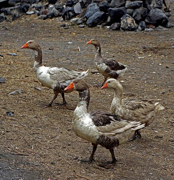
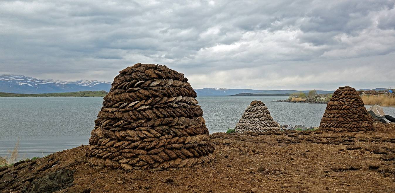
Farming scenes in the village. Villagers
use collected manure for fuel during winter and as fertilizer in spring.
|
|
|
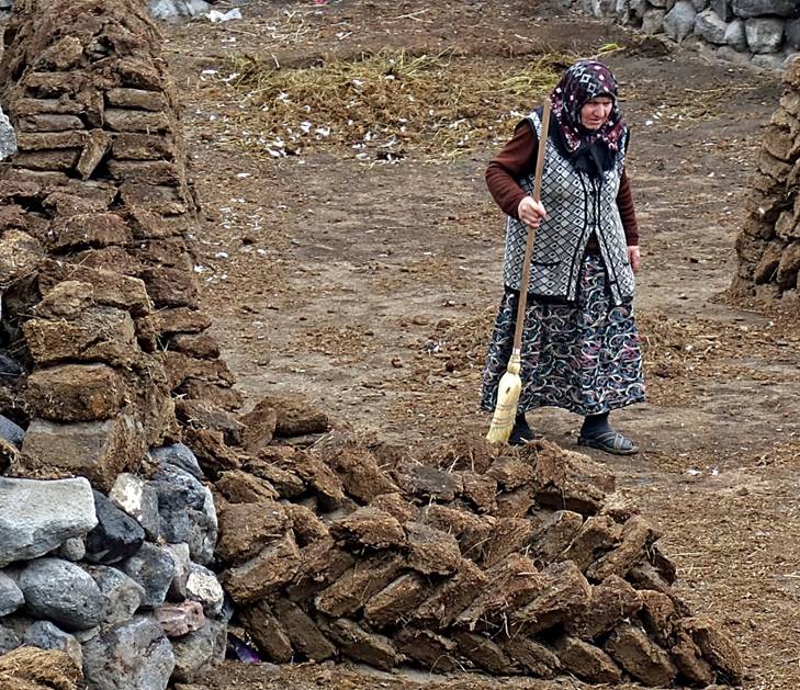
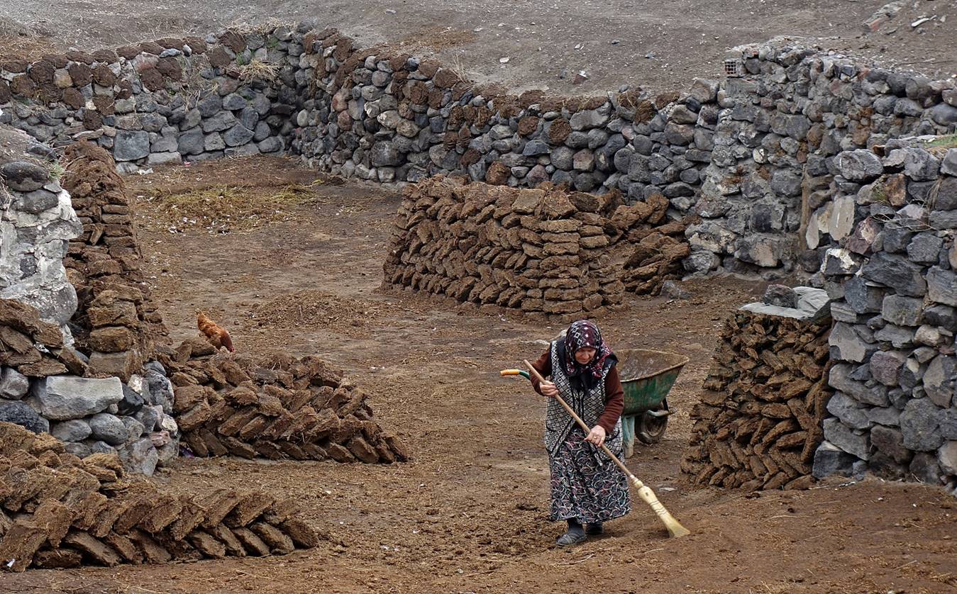
Cones of manure patties
near the shore of Cildir Golu.
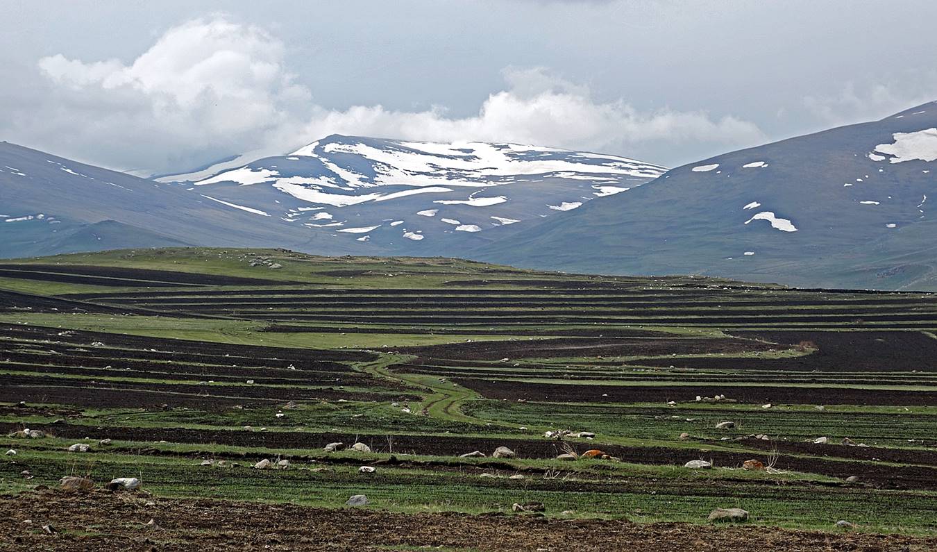
Recently plowed fields near Dogruyol.
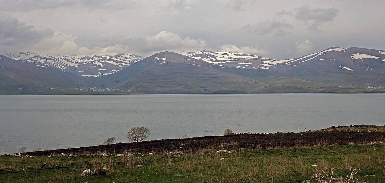
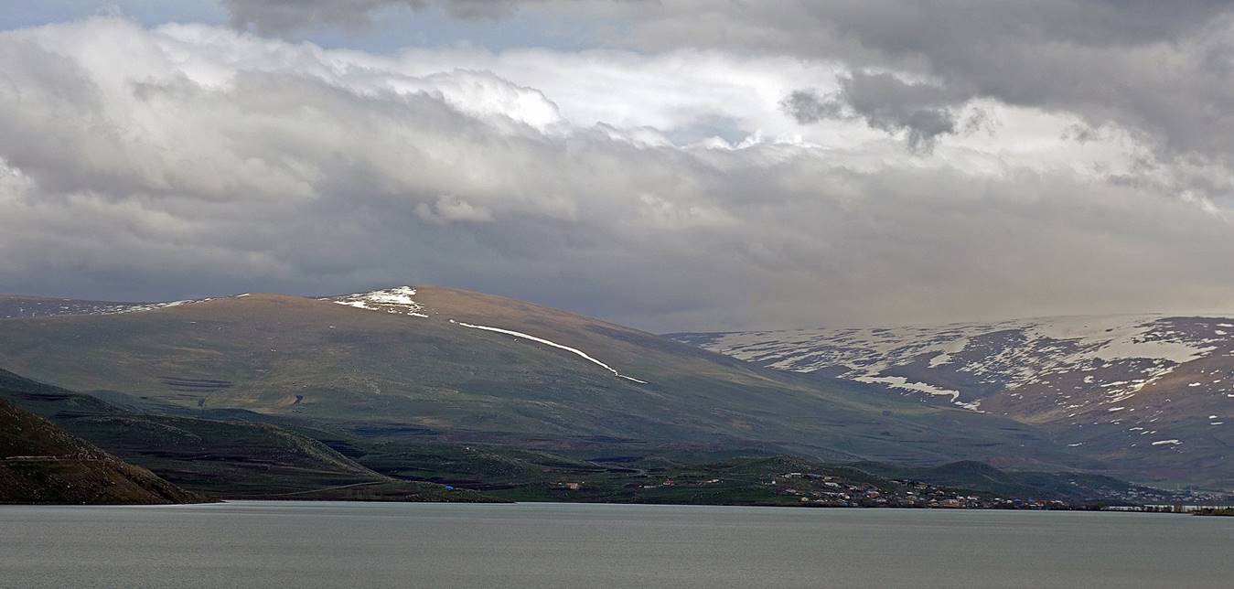
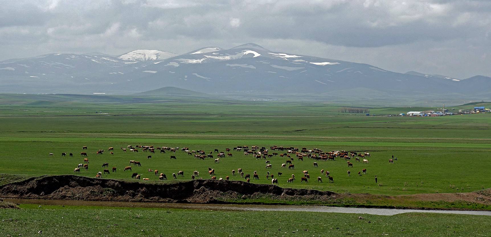
Views of Cildir
Golu (the name of which in Georgian is ჩრდილის ტბა, meaning ″Lake of Shadows″),
at an elevation of 1,900m.

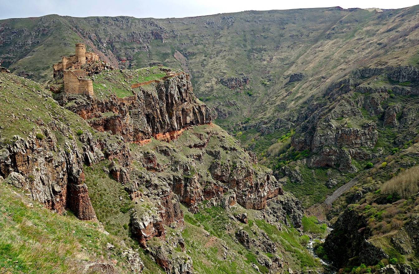
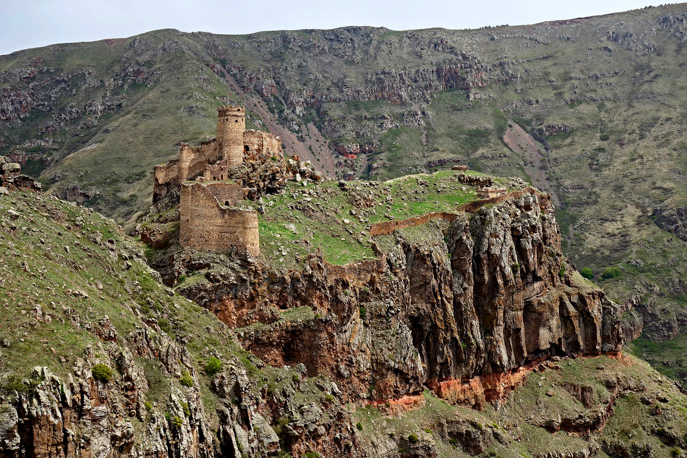
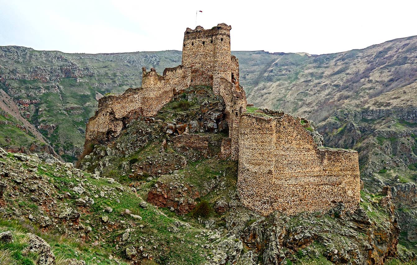
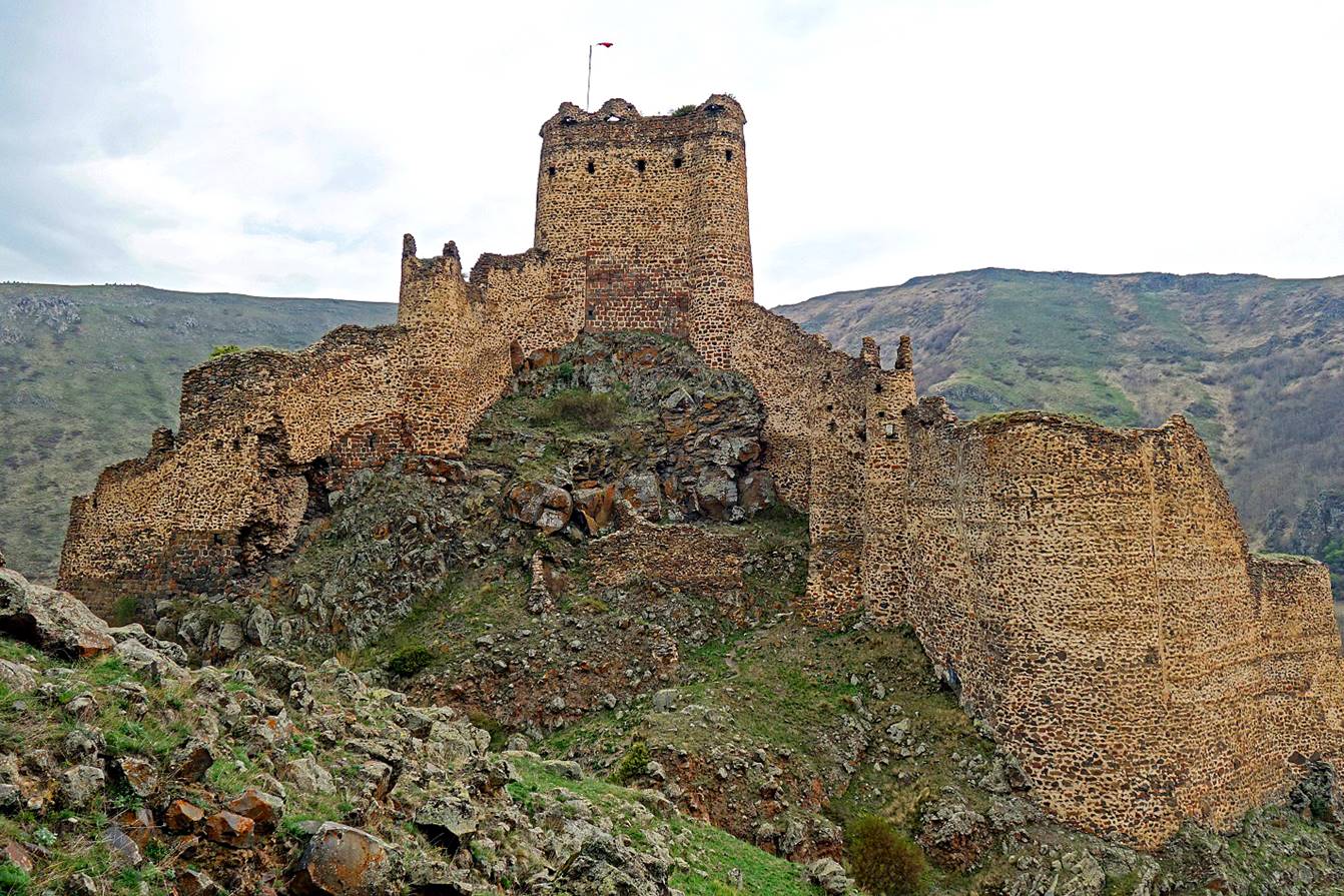
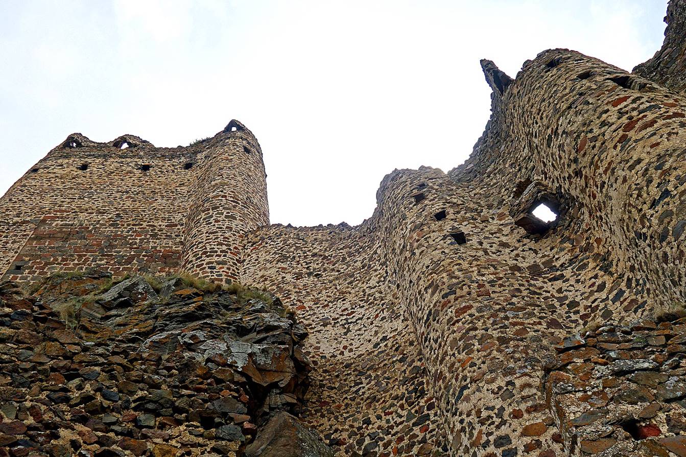
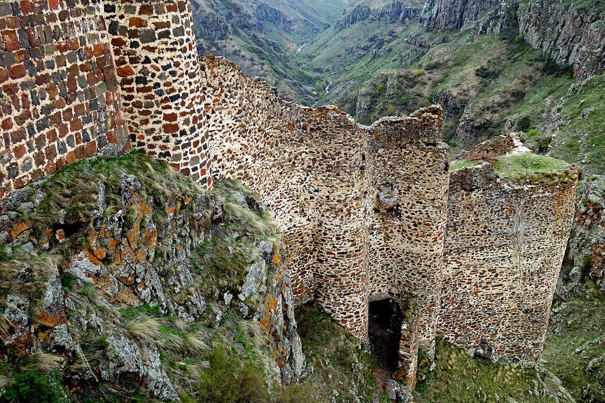
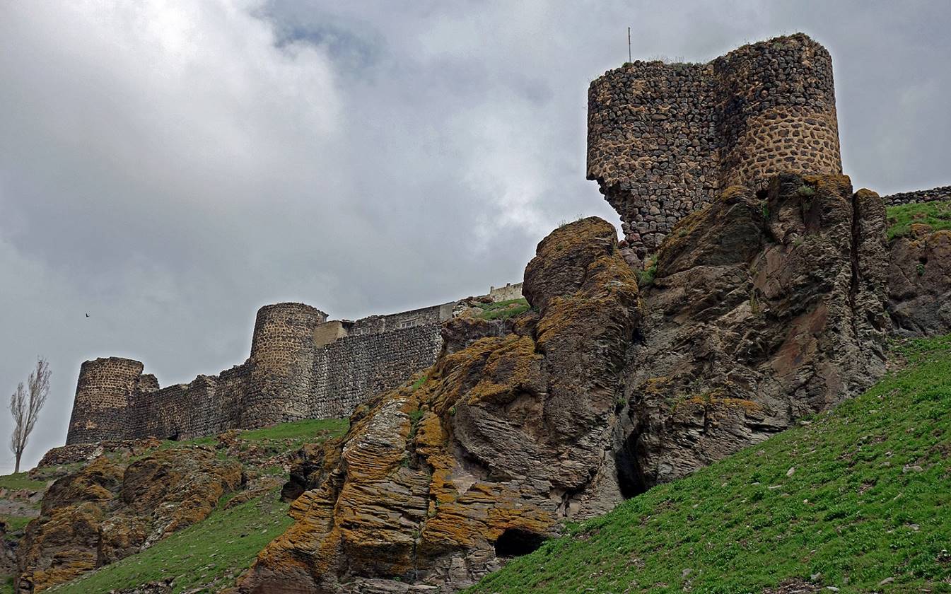
Seytan Kalesi (which
means ″Devil′s Castle″) is a well-renovated castle built on a
rock platform (elev. ~2,400m) above a deep gorge formed by the Karacay (″Black water″) some 8km north
of the shores of Cildir Golu
and 9km west of the border with Georgia. Its origins are unclear, but it was
mentioned in Seljuk chronicles as early as 1064. It offers a fantastic sight,
but its walls are plain and lack interesting ornamental details.
|
|
|

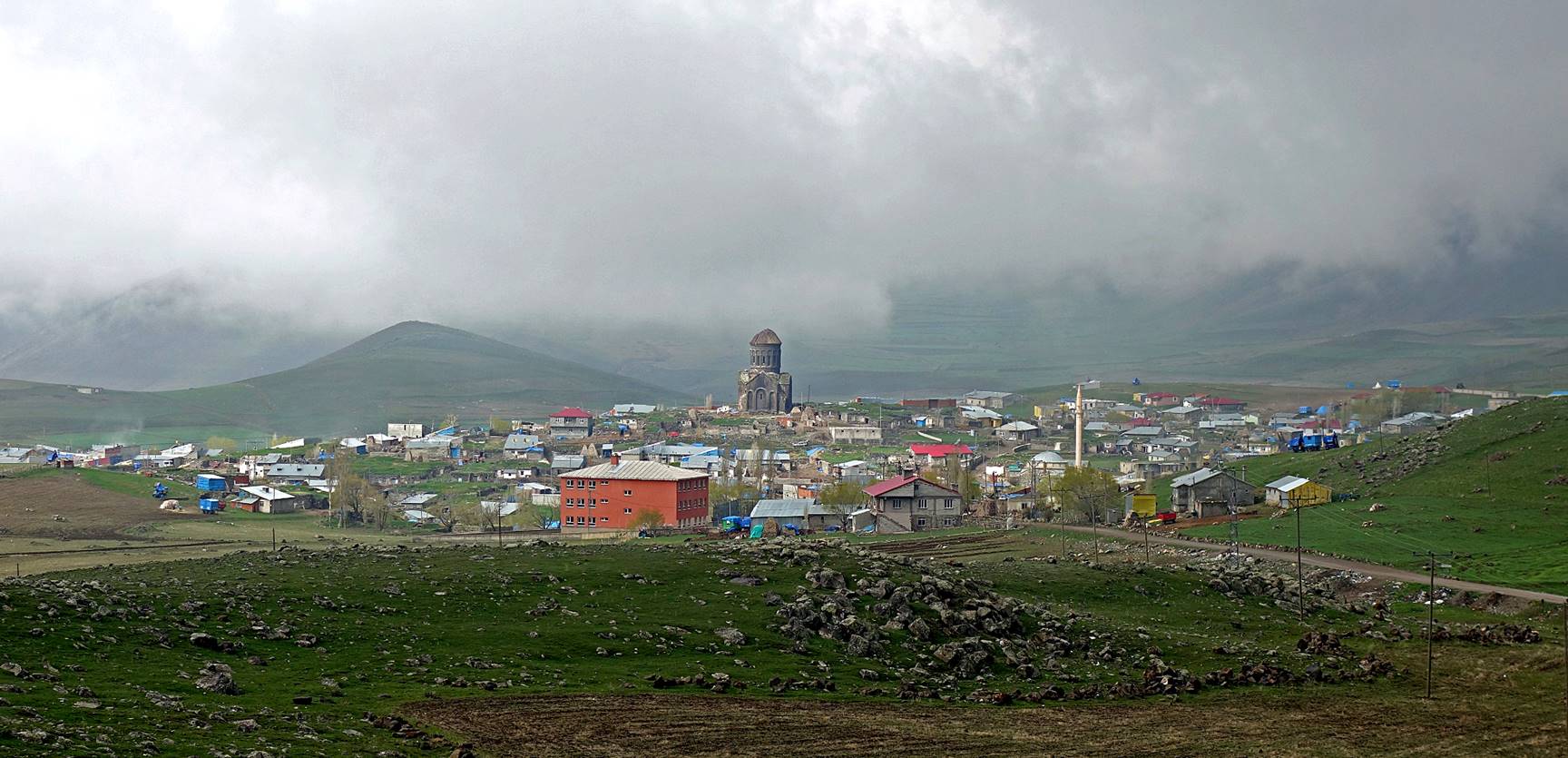
South of
Kars:
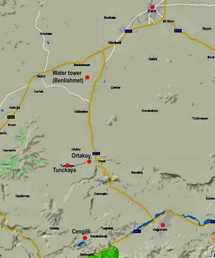
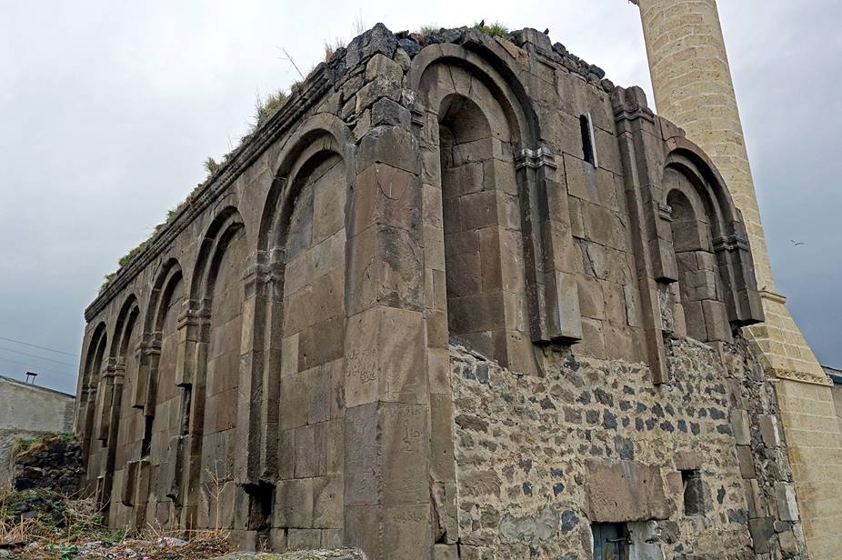
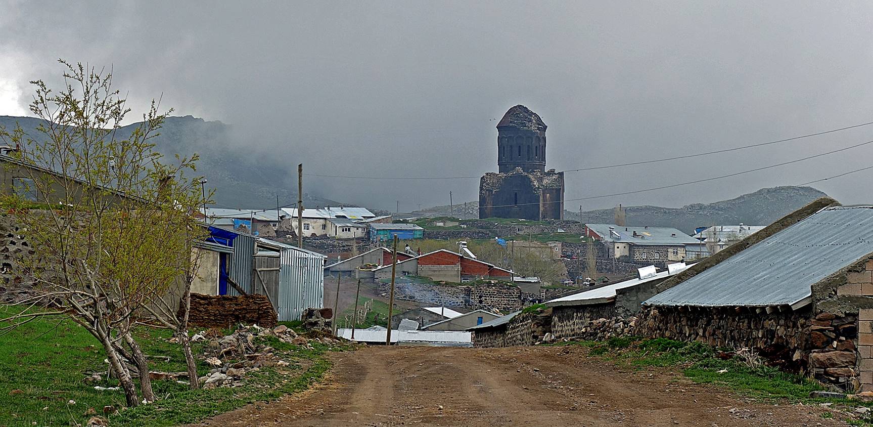
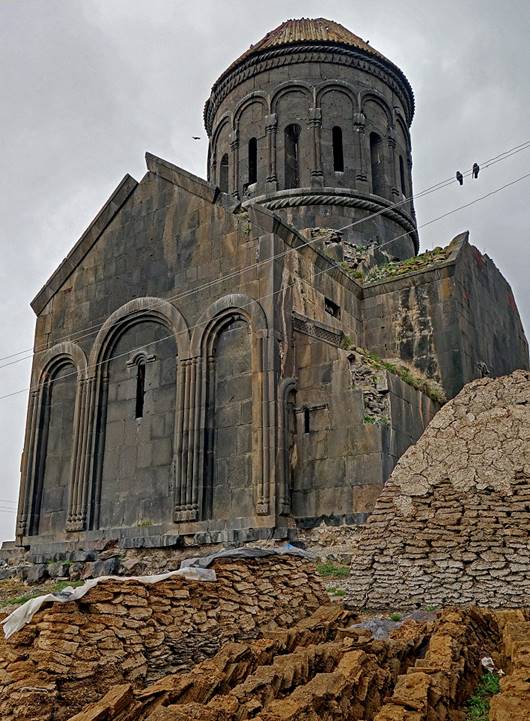
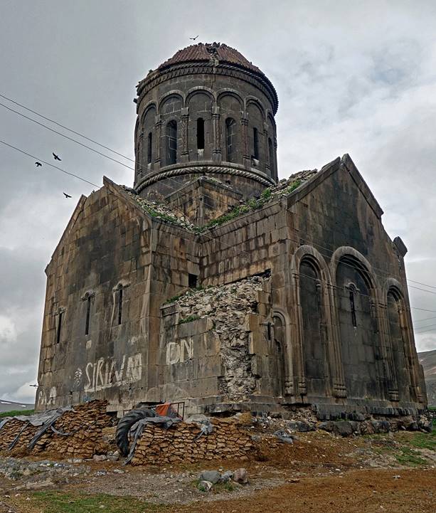
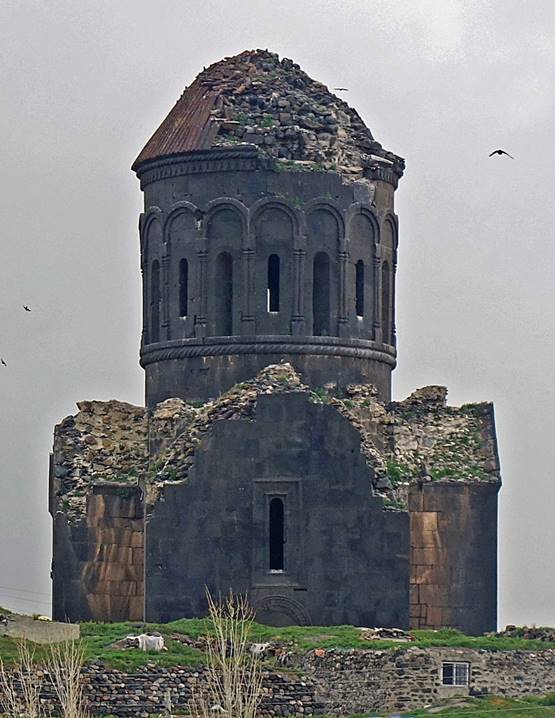
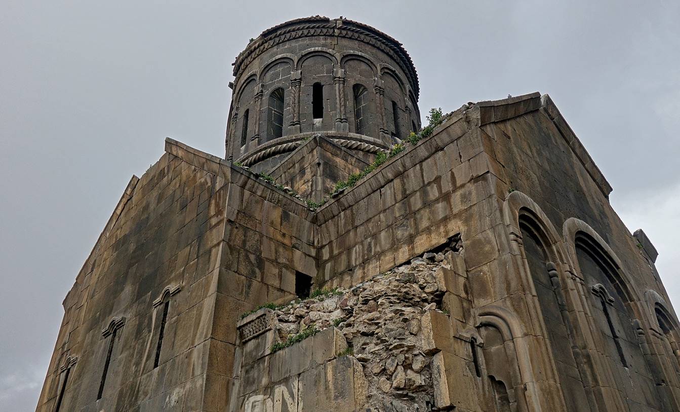
Armenian church
(former Eghegnamor monastery, 13th century) towering
above the houses of the village of Cengilli (elev.
~2,000m), 55km south of Kars, near the city of Kagizman.
By the end of the 19th century most of the villagers were ethnic Armenians.
Today most are ethnic Kurds. The views from outside the village give a good
idea of the sheer size of the church. (First photo below: view from the east.
Second photo: view from the west.)
The church seen from close-by locations.
It is now used more or less as a communal barn and warehouse. Without
protection, despite being sturdy, it will not survive so much neglect and
vandalism for long.
|
|
|
|
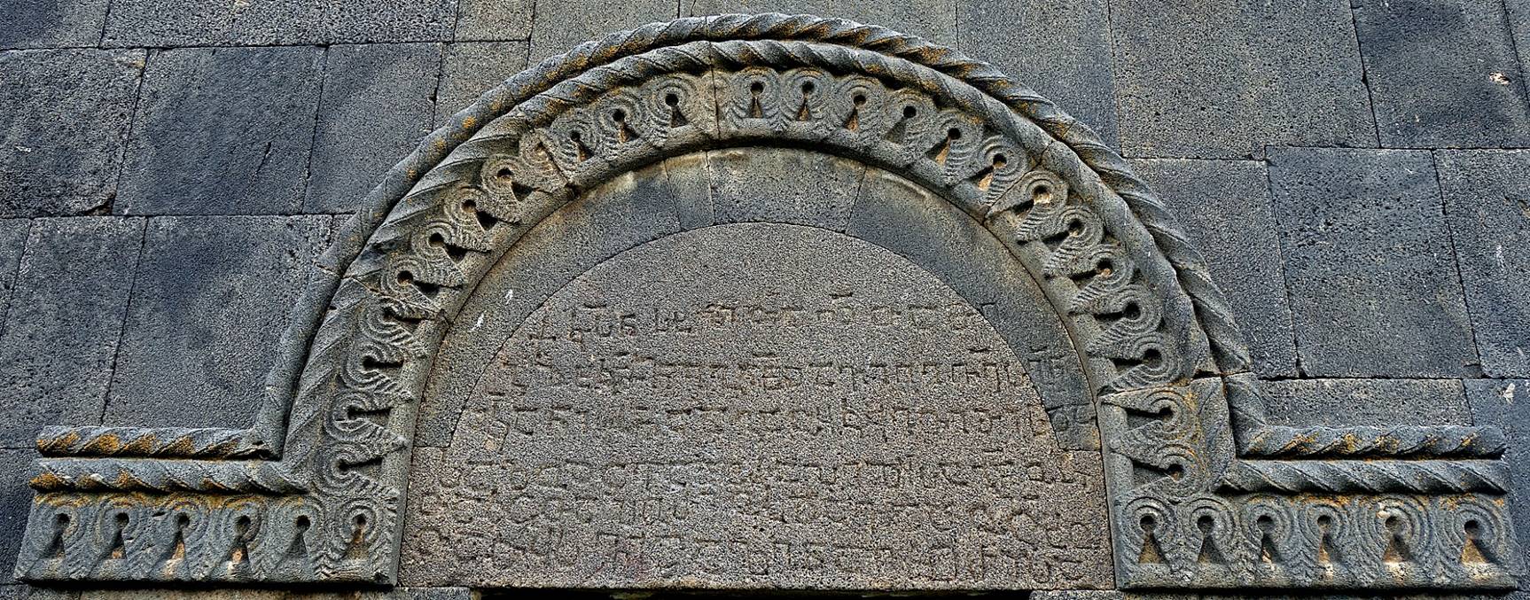
Inscription in Armenian above the
entrance of the church.
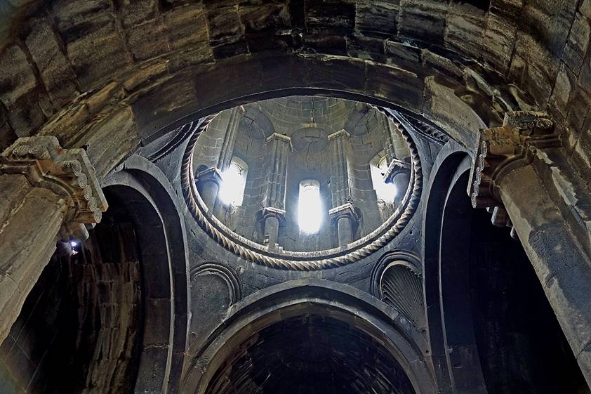
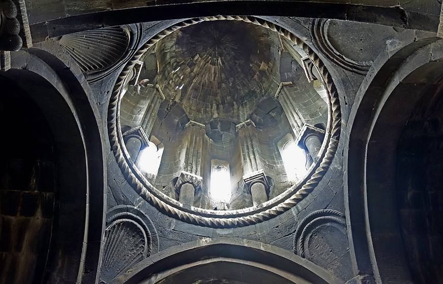
Inside the church.
|
|
|
Walls of an ancient fortress in the
village of Kercivan. The former fortress was huge,
but most of it is crumbling and/or mixed with the village houses.
In the nearby village of Ortakoy.
Water tower at the old railway station
near the village of Benliahmet, built during the
Russian occupation of the region.

Landscape near Benliahmet.
![]()
Back to
main Turkey page | Back
to my mountaineering/trekking/travel webpage