Uzbekistan (April 2018): Nukus to Aral Sea
![]()
Return to main Uzbekistan 2018 page
Both Nukus and the Uzbek part of the Aral Sea are located in the Republic of Karakalpakstan in the far west of Uzbekistan. Nukus is the capital of this republic. The trip from Nukus to the Aral Sea is a trip across one of the areas of the world that has been the most affected by poor water mismanagement and, to a lesser extent, climatic changes. Despite (or because of?) this environmental disaster, the stark beauty of the area is overwhelming.
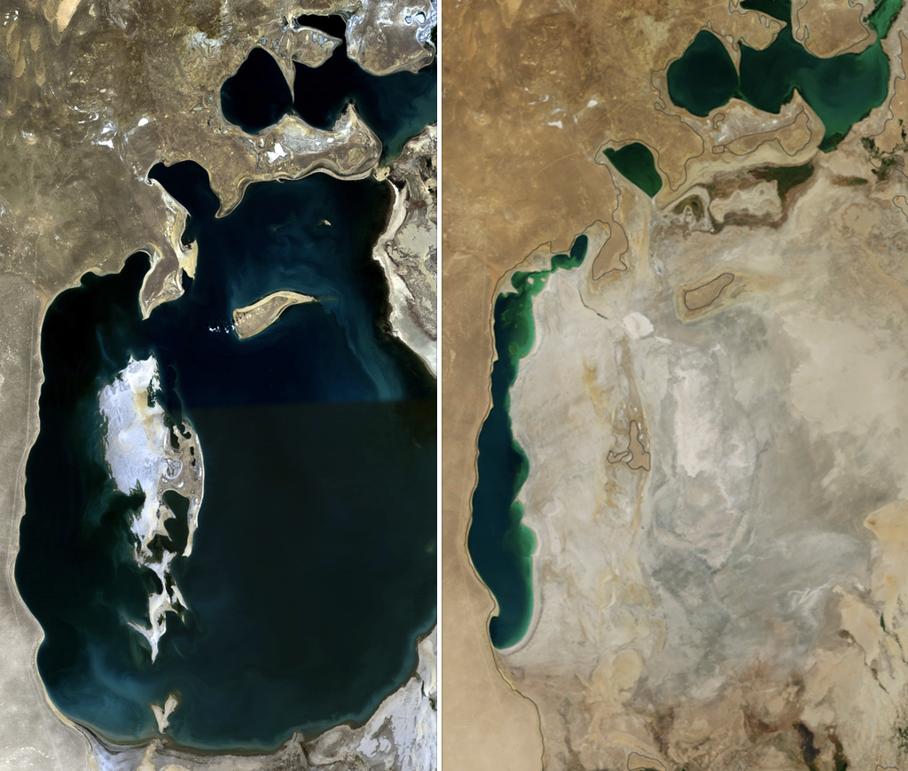
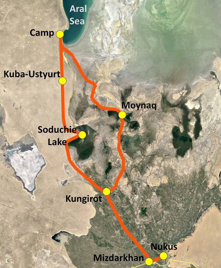
The first two pictures below (source: https://en.wikipedia.org/wiki/Aral_Sea) show aerial views of the Aral Sea in 1989 (left) and 2014 (center). The south part of the area lies in Uzbekistan and the north part in Kazakhstan. The seabed that is no longer recovered by water was relatively shallow. The much deeper western basin has receded by ″only ″ a few hundred meters in the past 50 years and is likely to survive longer. The picture on the right shows the approximate itinerary of the excursion: Nukus to Aral Sea (camp) via Soduchie lake and return via Moynaq. The trip was arranged by Advantour via a local company based in Nukus.
|
|
|
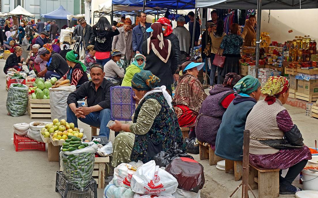
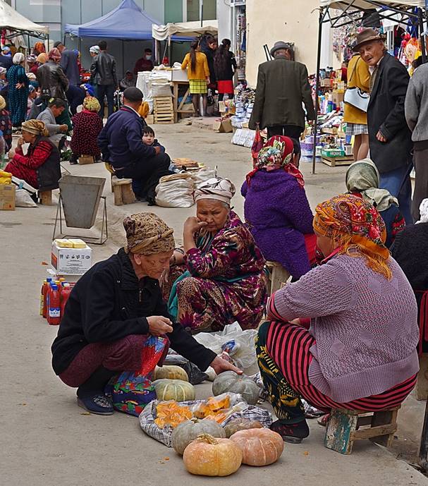
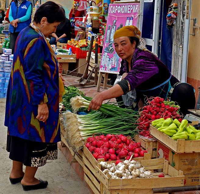
Nukus has a bad reputation in Uzbekistan: poor, backward, windy, dusty, extremely cold in winter, extremely hot in summer. Perhaps because of this reputation, I was happily surprised by the city. During my visit in April the weather was pleasant. The city is not beautiful, but it is much better than announced and also quite friendly. There is a lively bazaar and, more important, it is home of the gorgeous Igor Savitsky Museum.
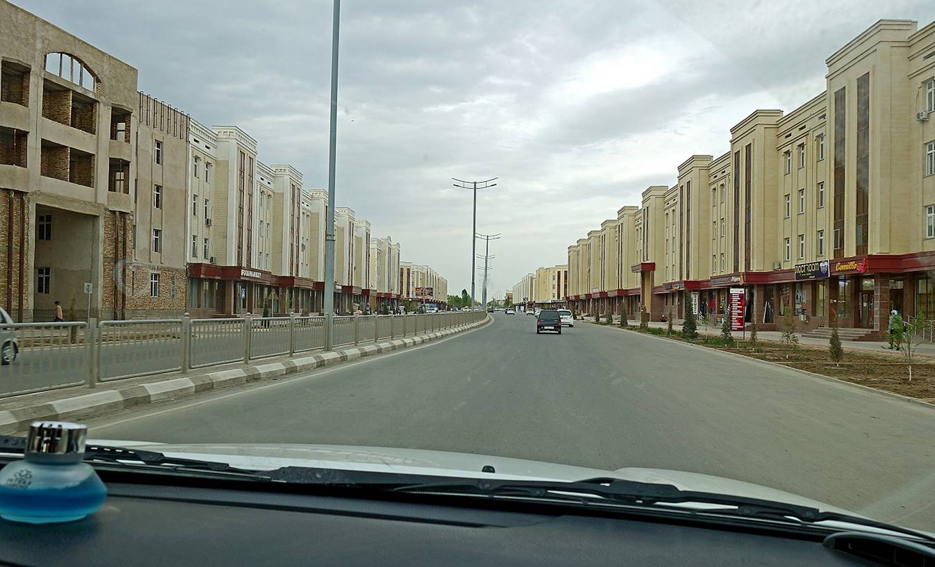
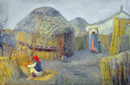
In a street of Nukus. Identical buildings are lined up on both sides with shops on the first floor. Not great, but I have seen similar streets in other cities of Uzbekistan (e.g., Karshi).
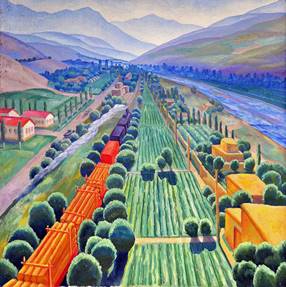
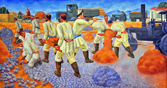
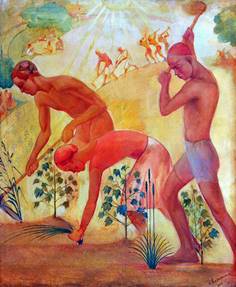
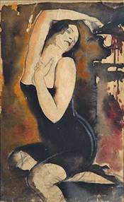
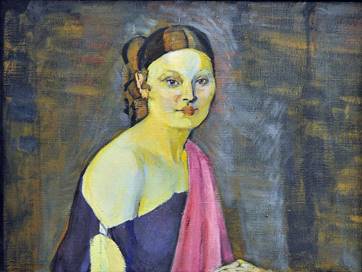
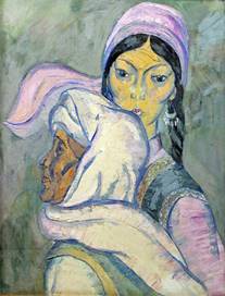
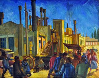
The Igor Savitsky Museum is most famous for its amazing collections of Soviet avant-garde paintings, as well as more recent paintings of the Karakalpakstan School. It also contains exhibits of archeological finds and folk art from Karakalpakstan. I spent several hours in the museum, but I could have stayed more, had I planned for more time in Nukus.
|
|
|
|
|
|
|
|
|
|
|
|
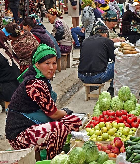
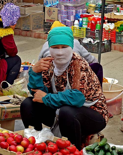
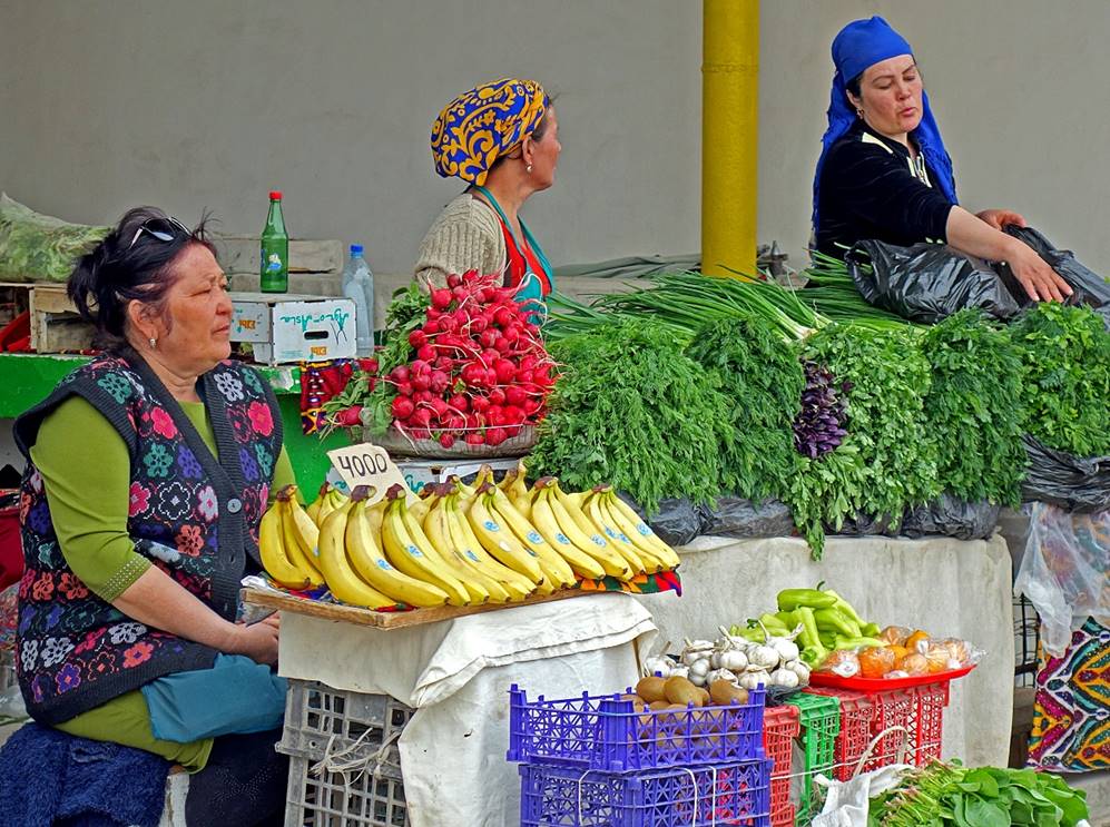
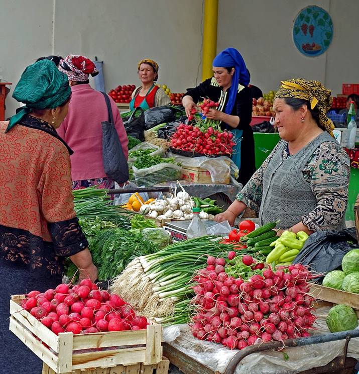
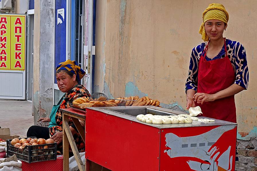
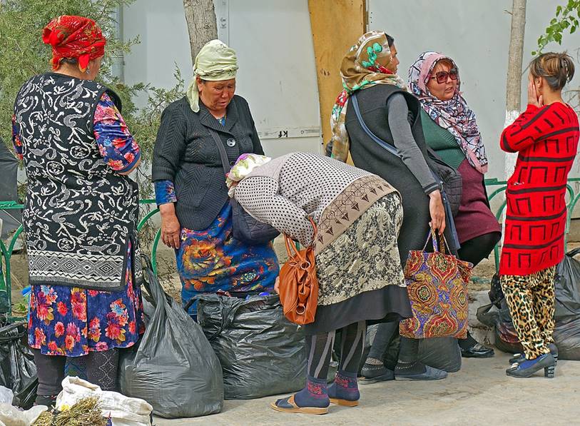
In the bazaar. Many of the women sitting outside carefully protect their faces against sun light.
|
|
|
|
|
|
|
|
|
|
|
|
|
Cemetery of Mizdarkhan located 15km west of Nukus. Mizdarkhan was an ancient city until it was destroyed by Timur in the 14th century. Local people have returned there to build mausoleums and bury their deads. The cemetery is huge, peaceful, and slightly eerie.
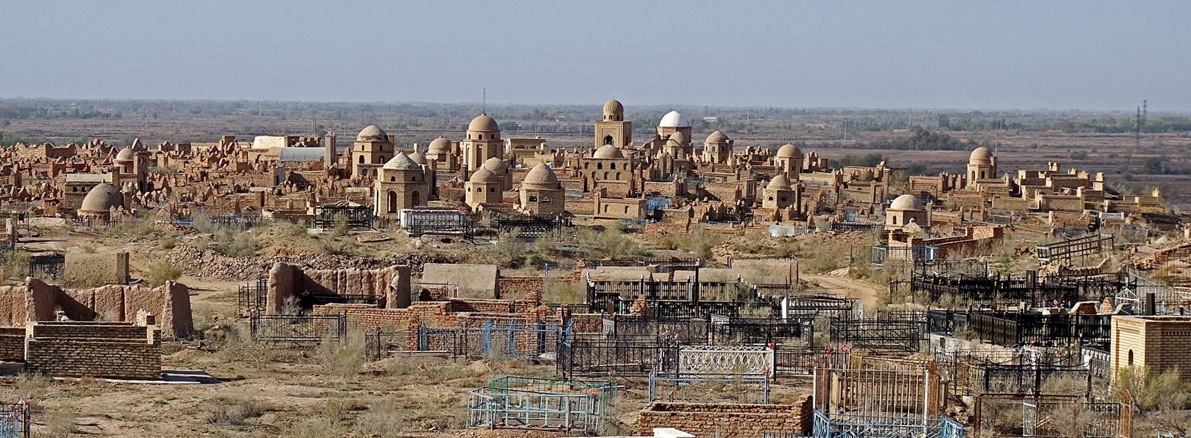
Old tomb houses in the cemetery. Note the small stacks of 7 stones. They were made by visitors believing that by doing so their wishes will be granted.

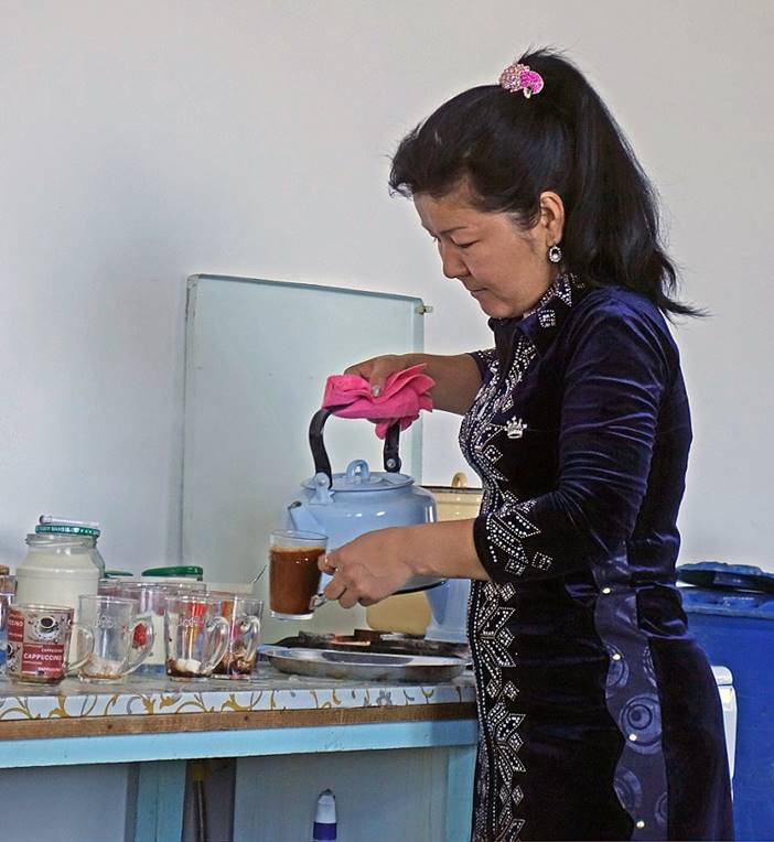
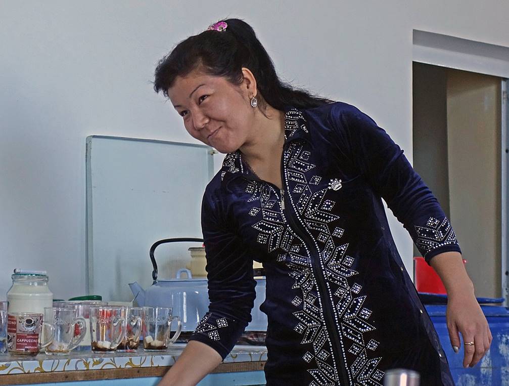
In a friendly coffee shop in the small town of Kungirot north of Mizdarkhan, soon before entering the desert land south of the Aral Sea.
|
|
|
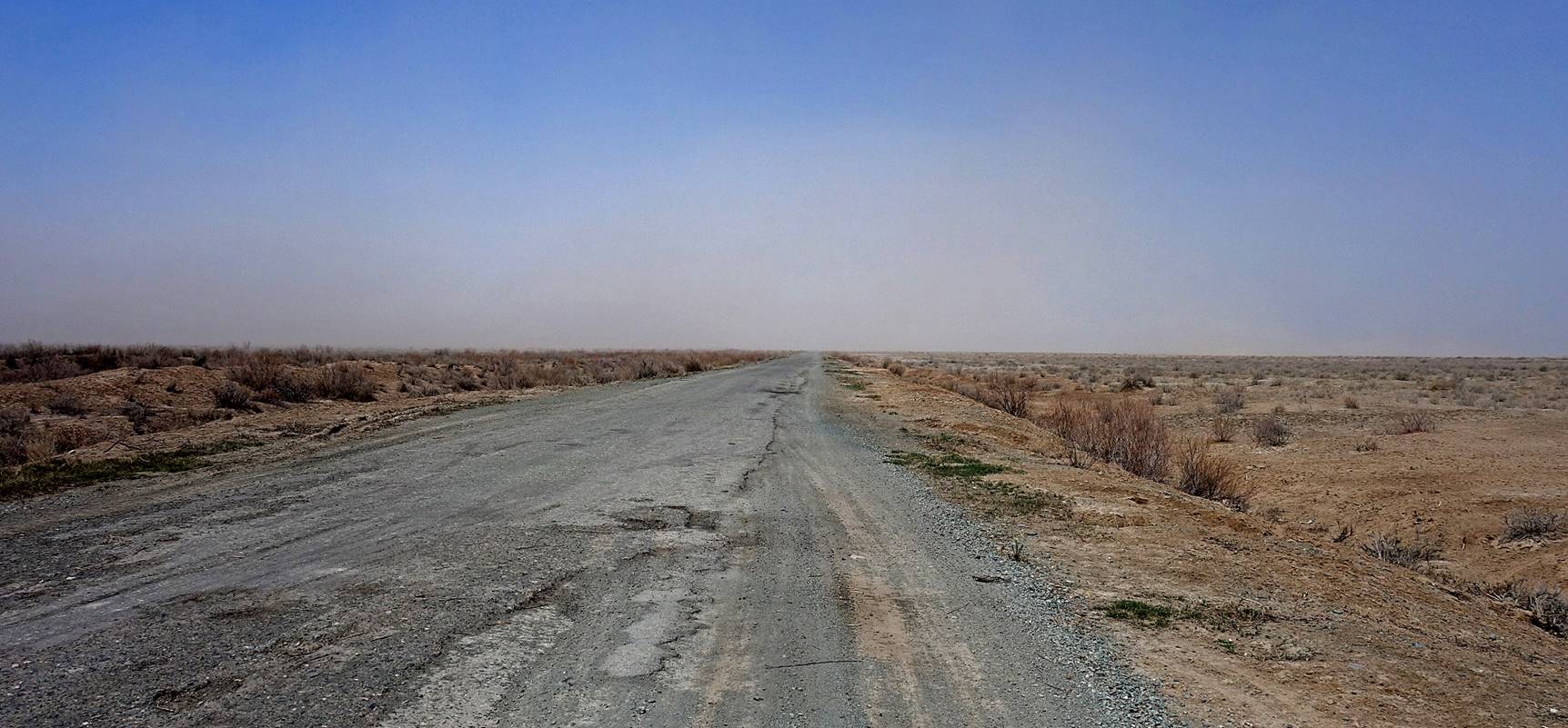
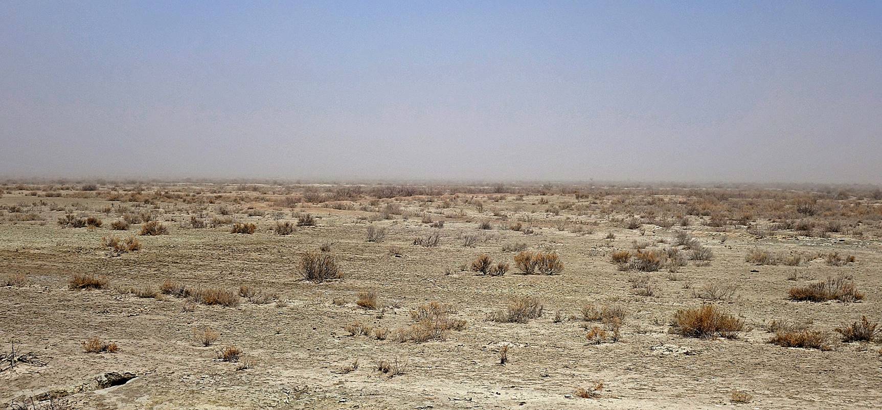
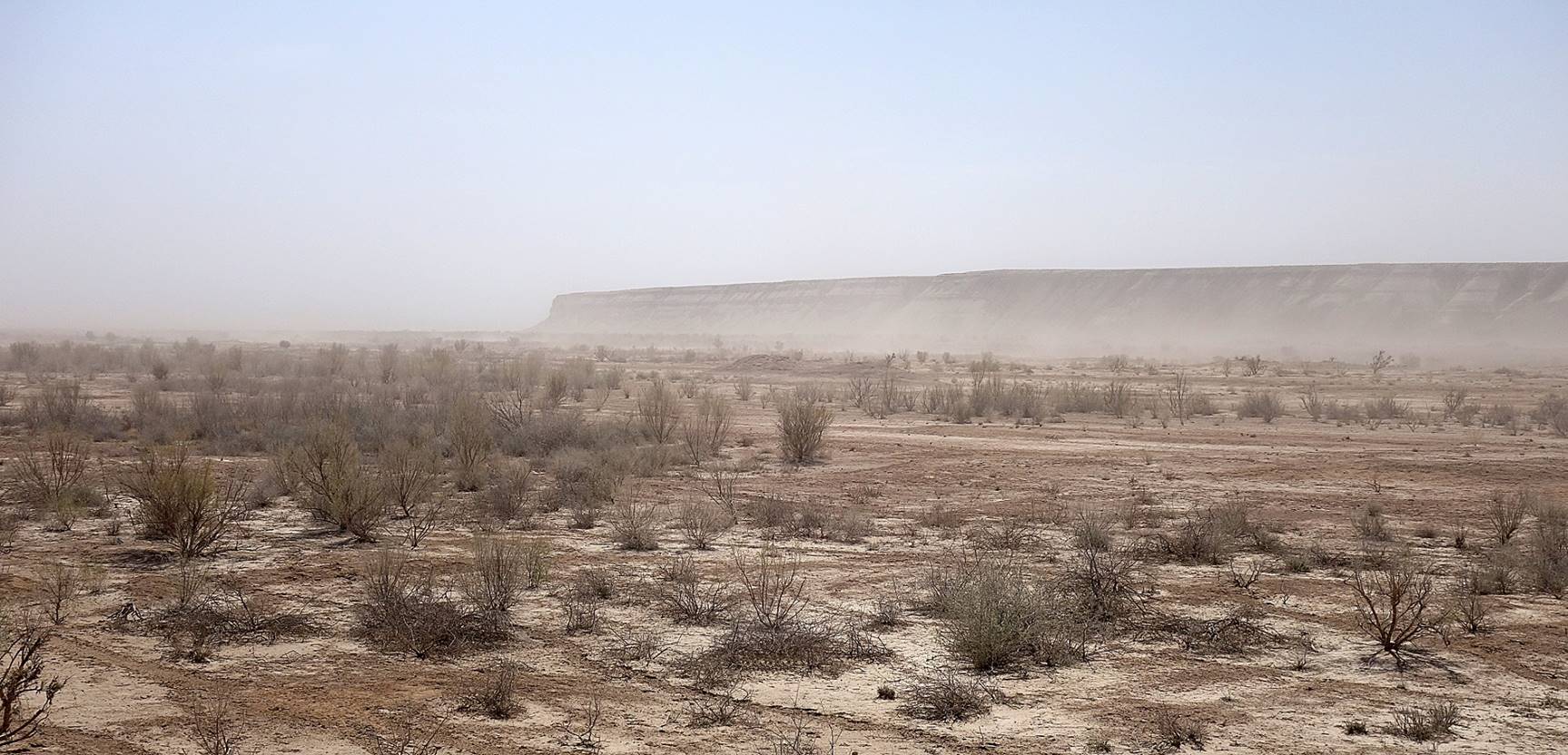
Entering the flat desert area south of the Aral Sea. Wind fills the air with considerable amount of salty dust, despite some government-supported plantations of drought-resistant shrubs (called saxauls).
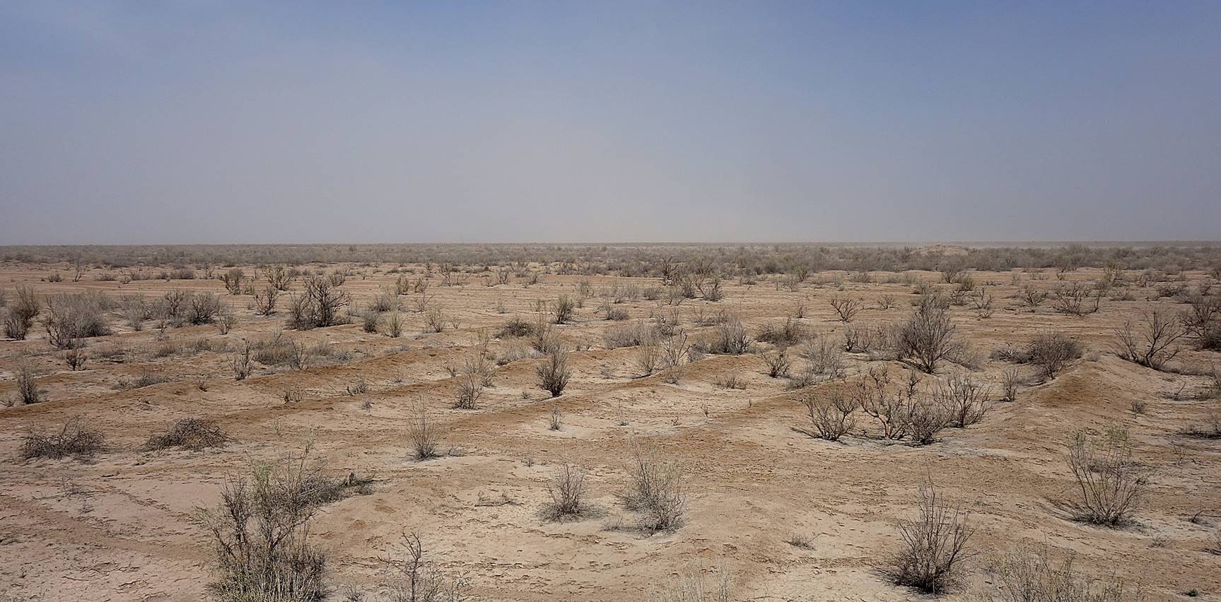
[Plantation of saxauls.]
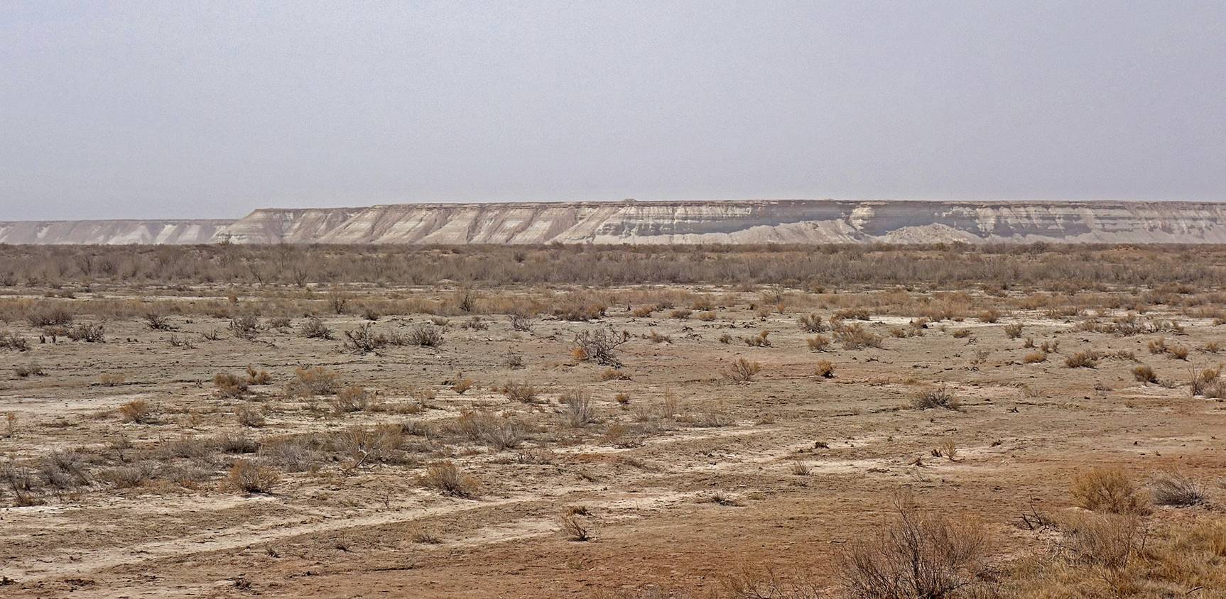
Reaching the huge Ustyurt plateau that lies on the west of the Aral Sea. The plateau stretches 800km from north to south.
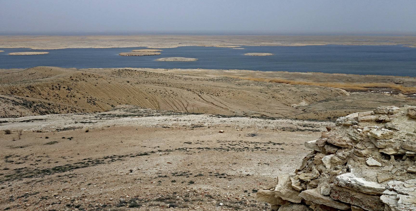
Remains of a former lighthouse above what is now the Soduchie lake.
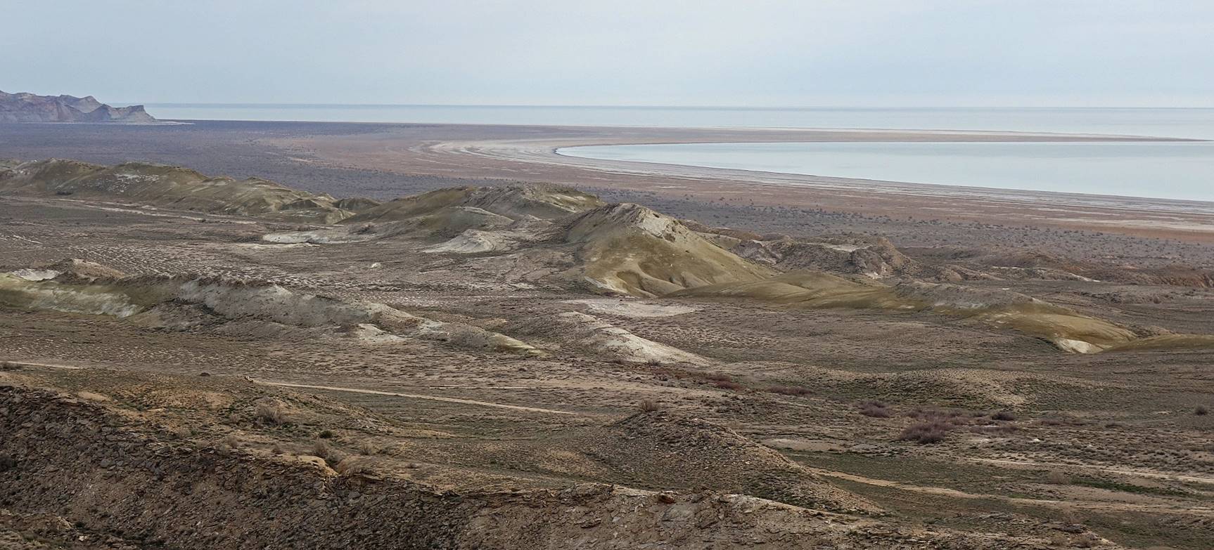
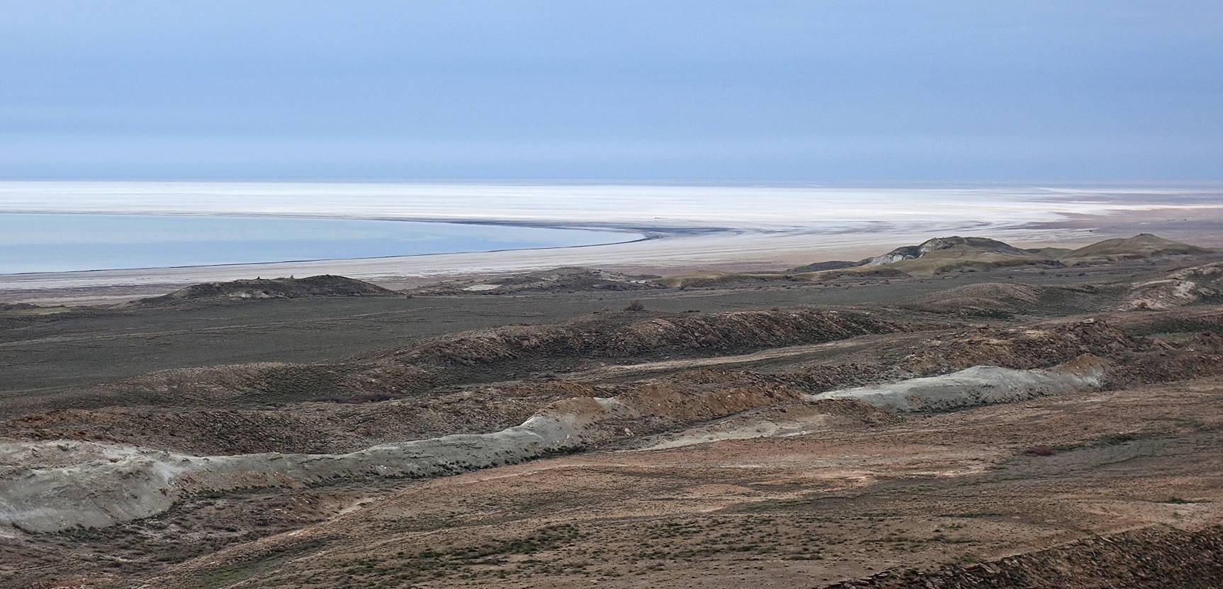
View over a portion of the Soduchie lake from the lighthouse. The recession of the Aral Sea has left several lakes behind its new shores. Soduchie lake is one of the largest.
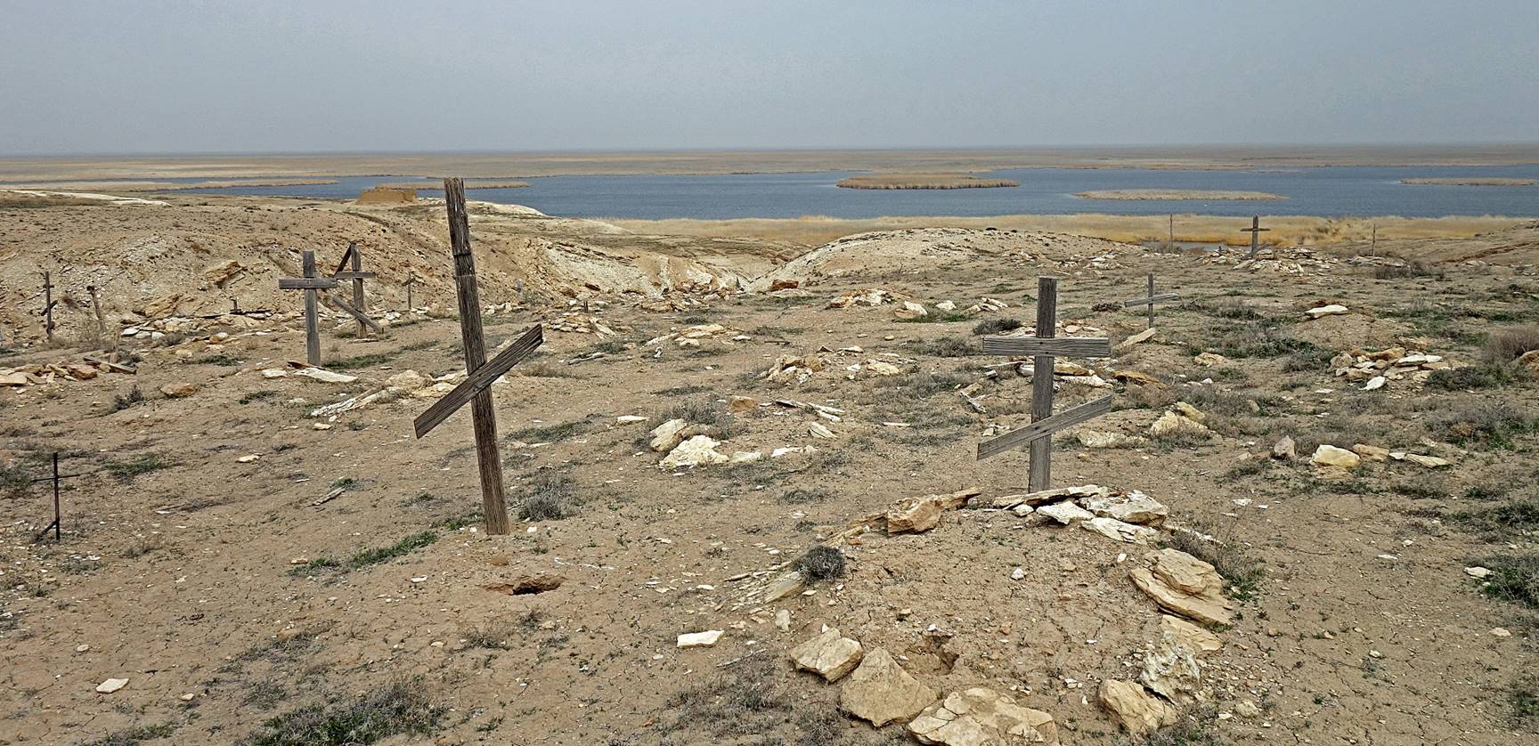
Abandoned Russian cemetery near the lake.
Ruined fish cannery on the shore of the Soduchie lake.
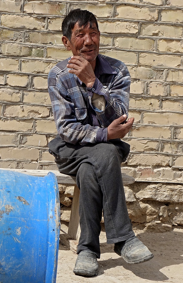
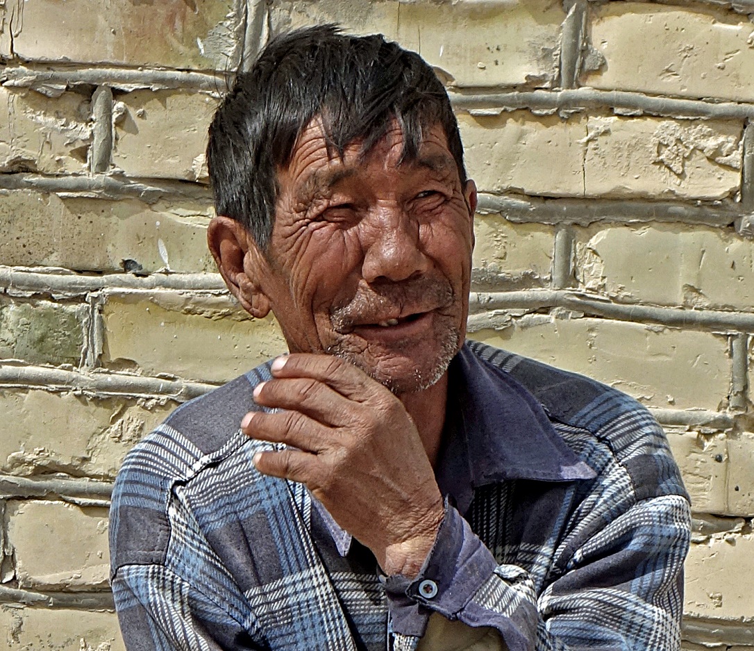
Due to its increasing salinity, most life has disappeared from the Aral Sea, except for artemia (also known as brine shrimp), which is now harvested in large quantity. However, some of the lakes south of the sea, in particular Soduchie lake, still receive fresh water from the Amu Daria and host significant fish populations. There were a handful of fishermen near the above cannery, whose catches are sold in cities like Nukus.
One of the fishermen.
|
|
|
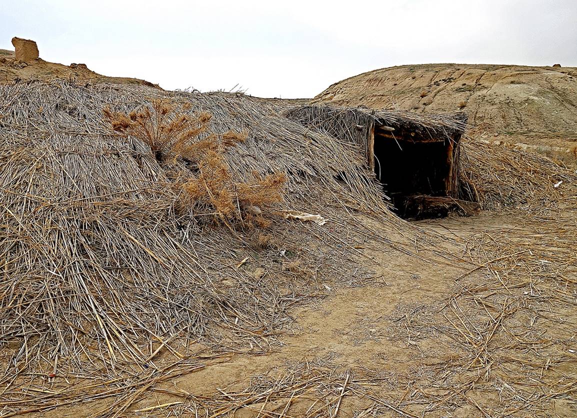
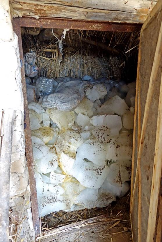
To preserve their catches between two pickups, the fishermen have created a large refrigerator in the form of a cave isolated with reed stems collected for the shores of the lake (photo on the left below). At the end of the winter they fill the cave with ice from the lake (photo on the right). Despite very high summer temperatures, the cave retains enough ice until late summer.
|
|
|
Canal created by the fishermen to access the main body of water of the lake.
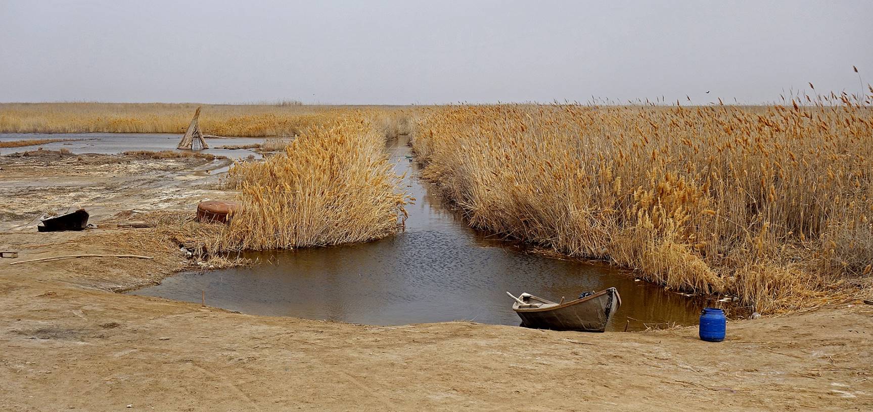
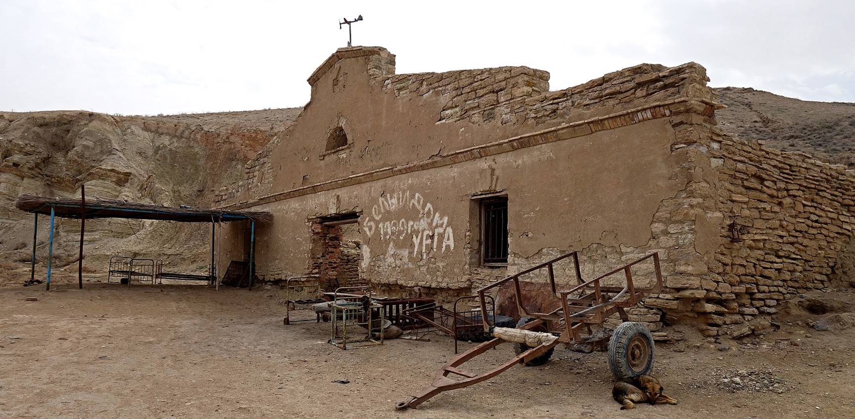
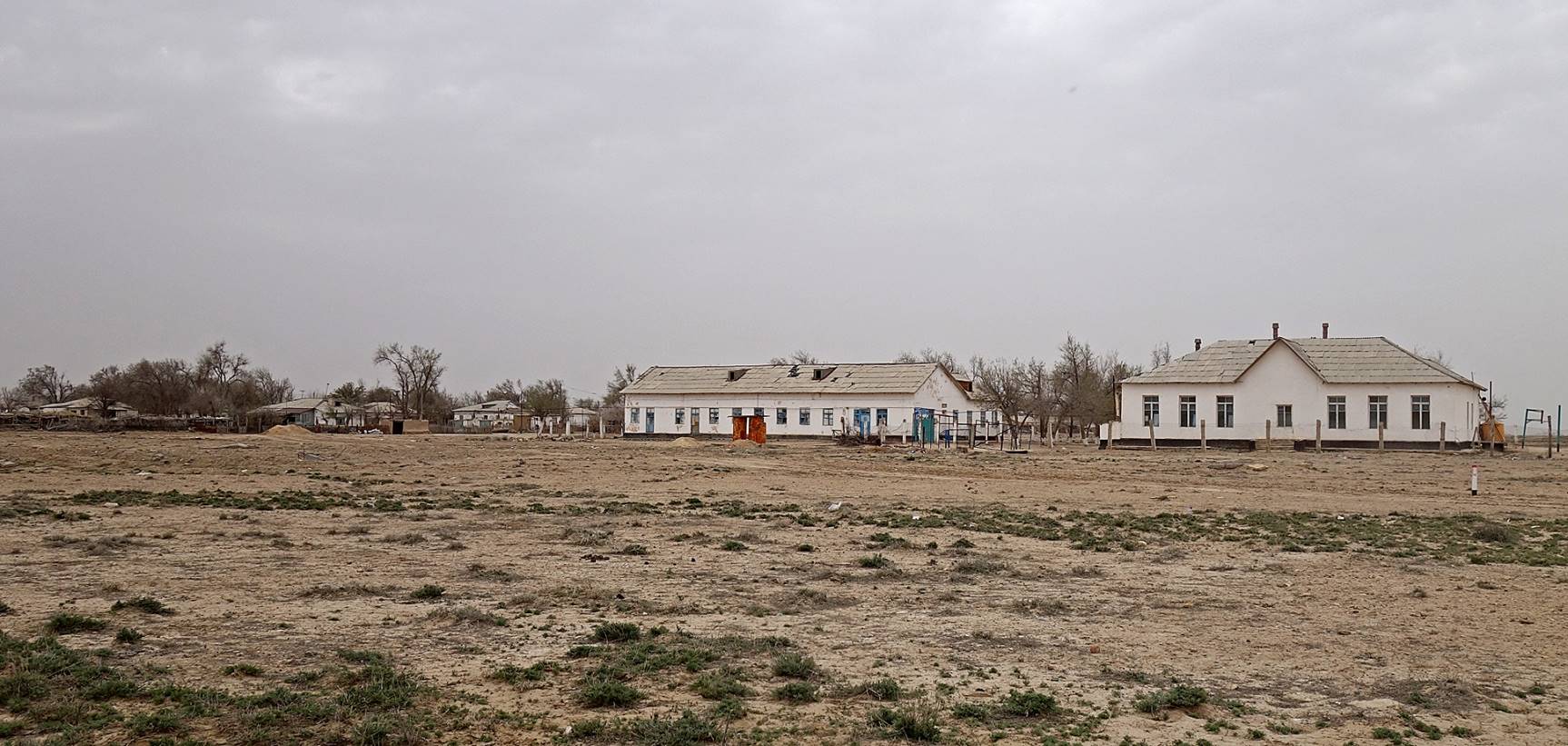
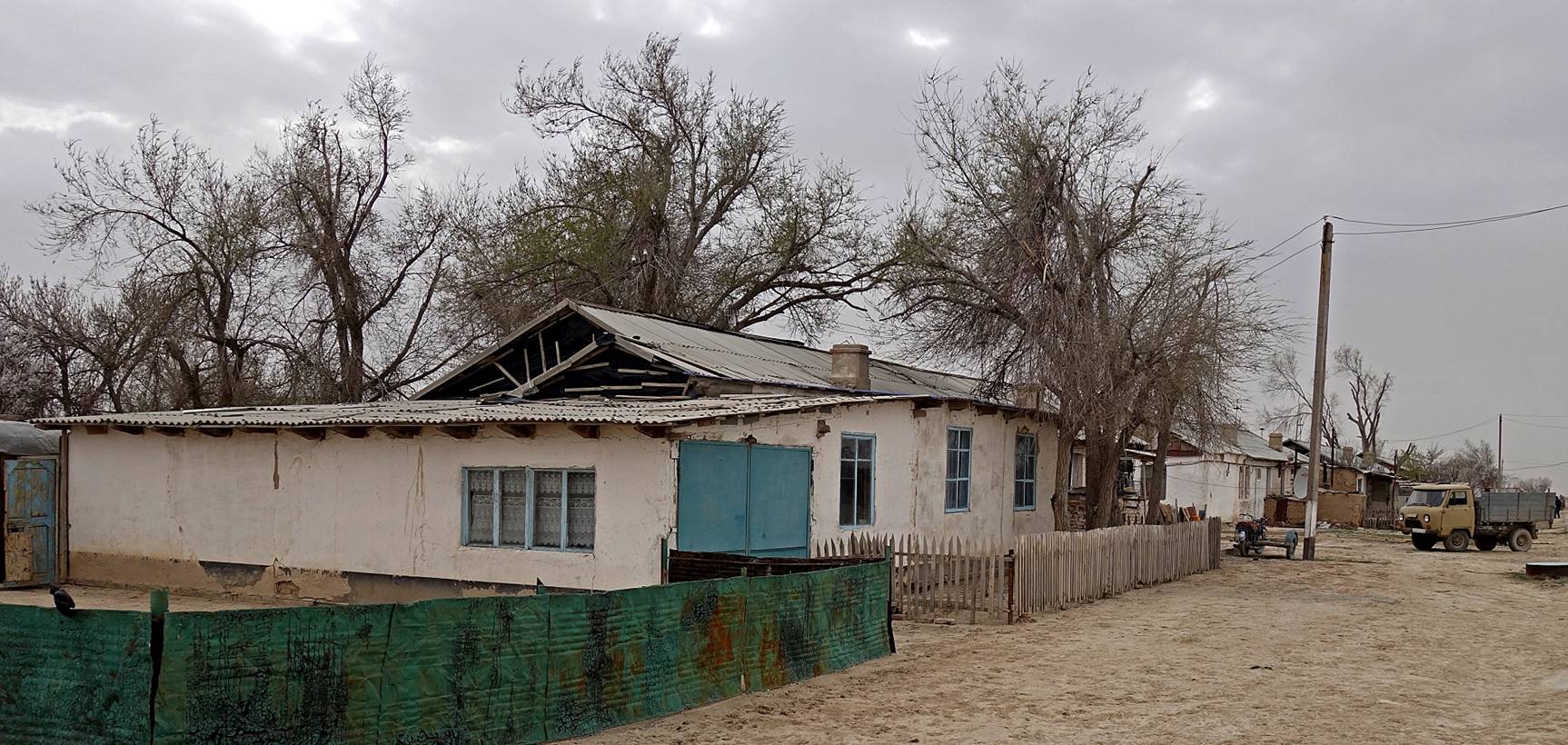
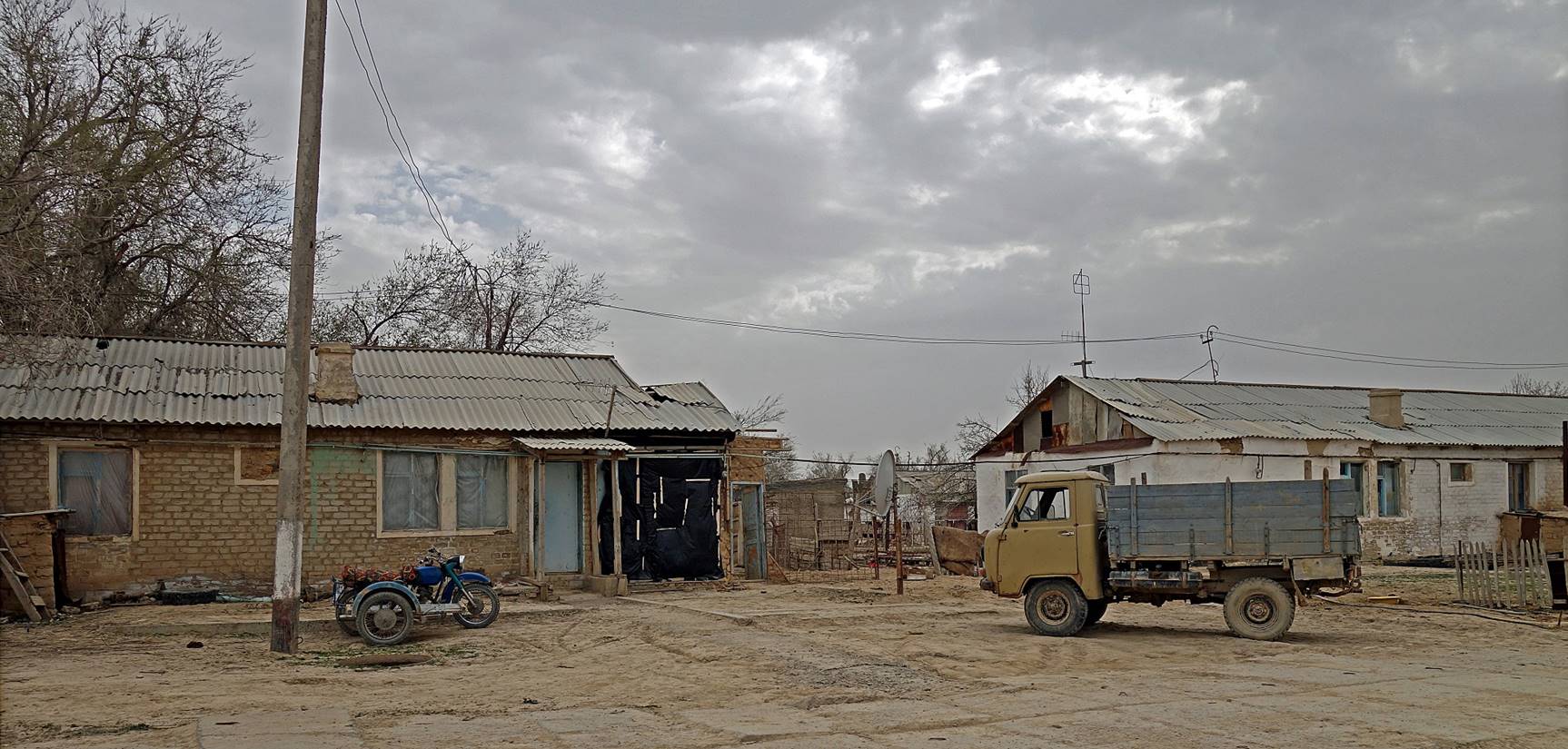
Village of Kuba-Ustyurt, north of Soduchie lake. In Soviet time, this village was much bigger and even had a functional airport.
|
|
|
|
|
|
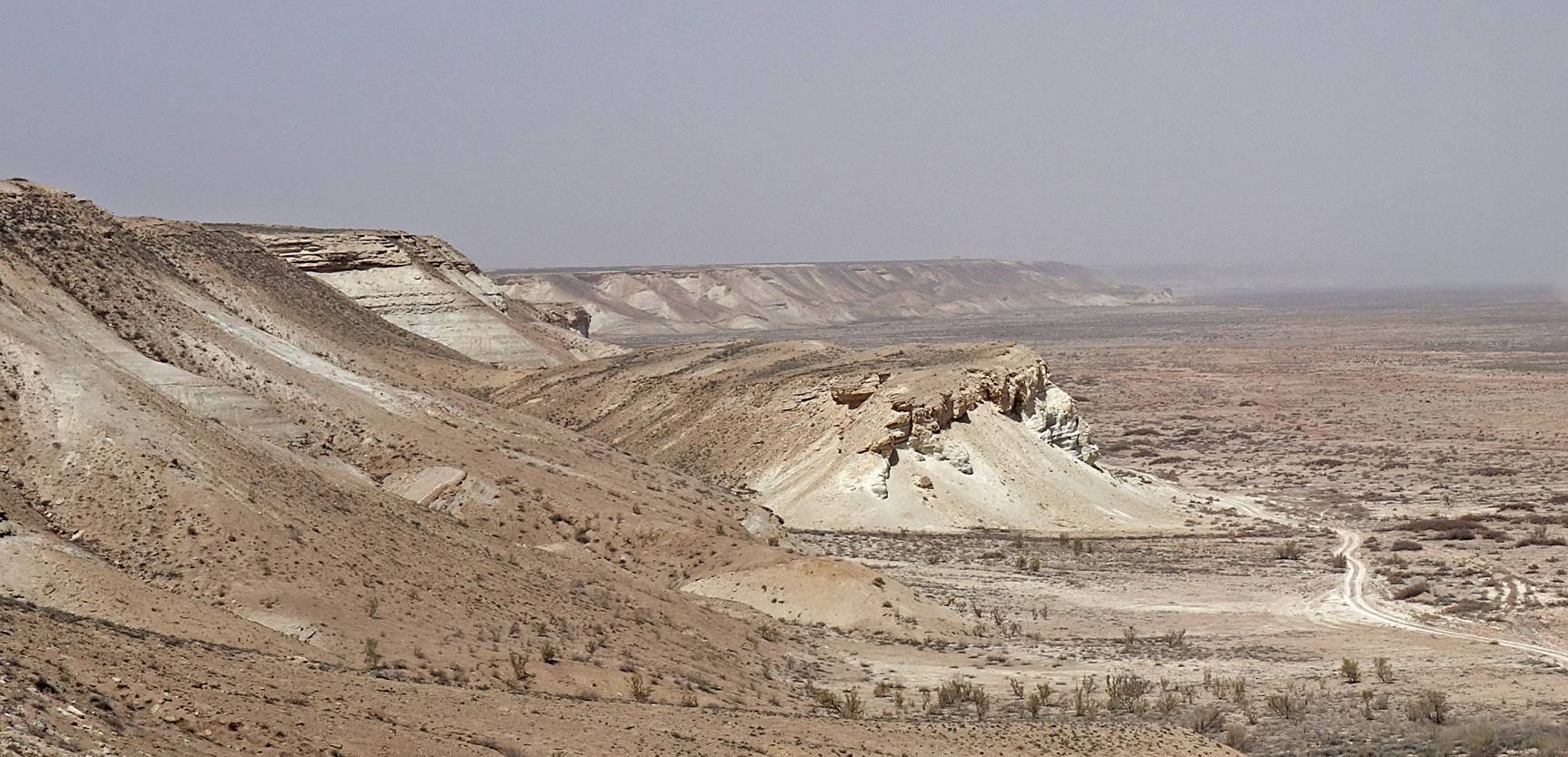
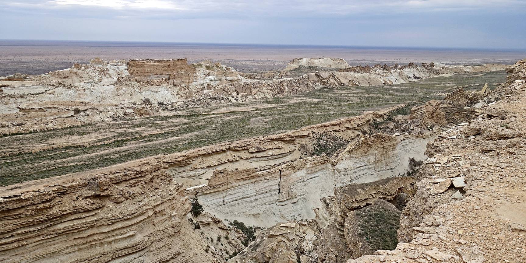
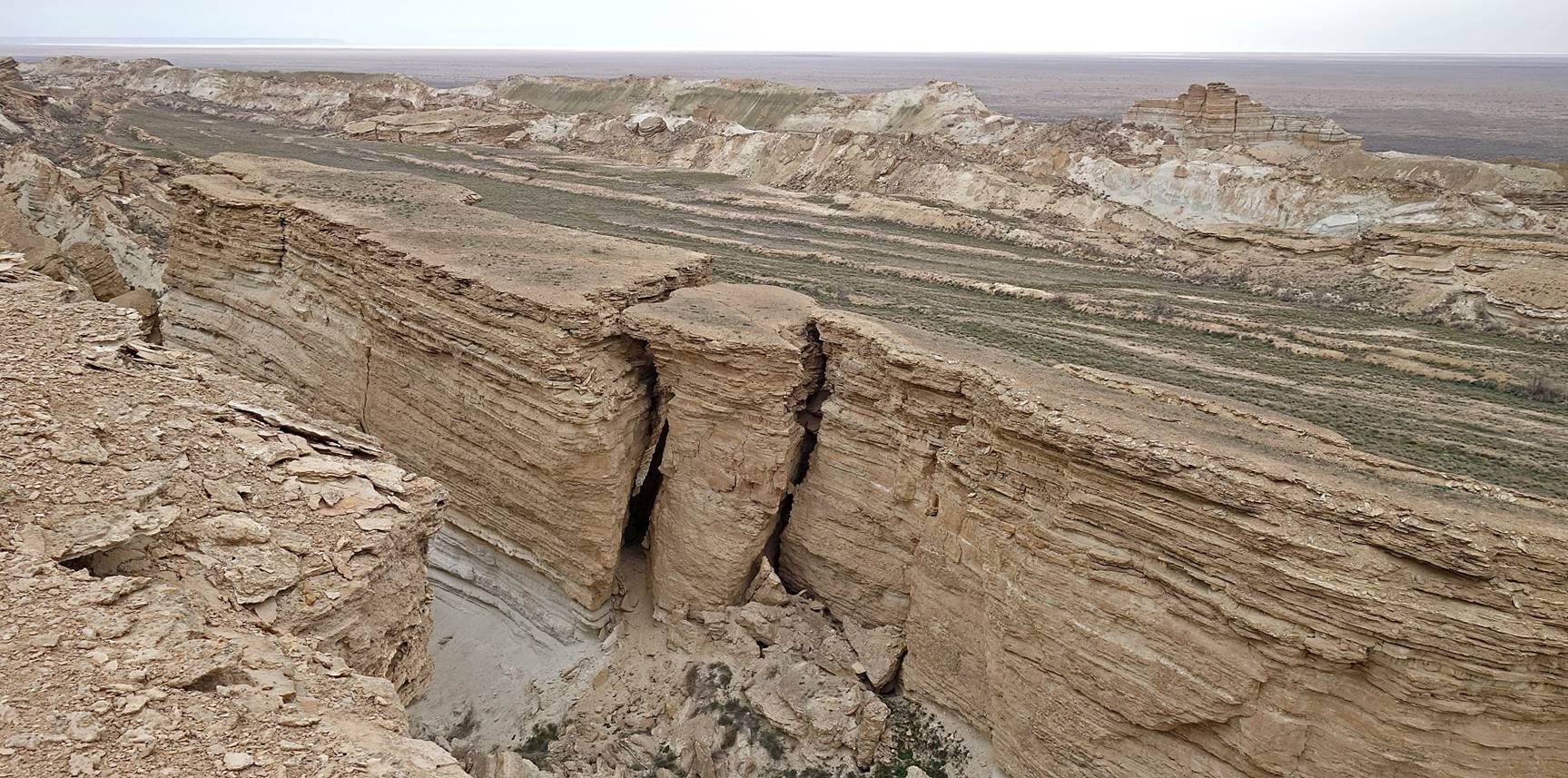
Large fractures on the eastern edge of the Ustyurt plateau near the current southern shore of Aral Sea.
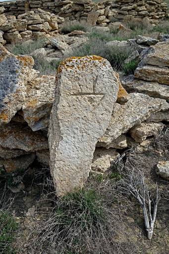
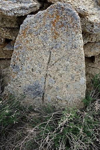
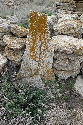
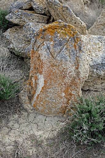
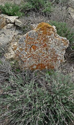
Tomb markers in an old Kazakh cemetery along the way. The marks (tamg′a) on the stone identify the clan/family of the buried person.
|
|
|
|
|
|
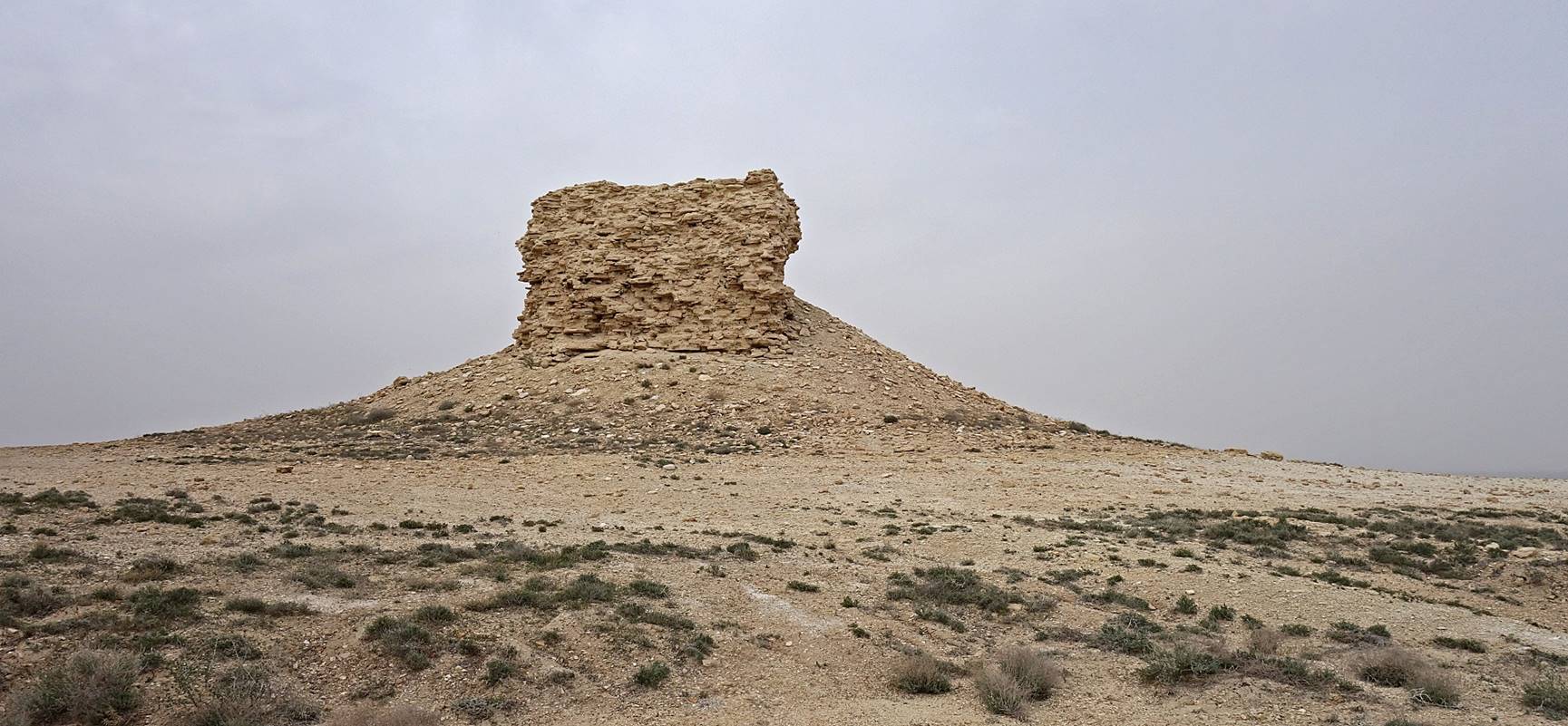
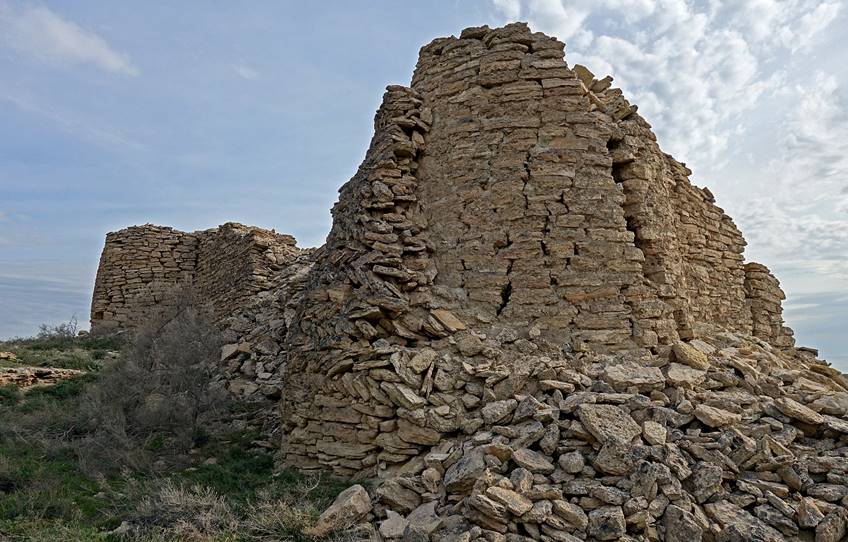
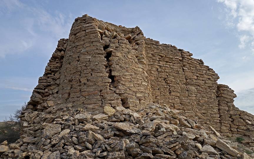
Remains of a century-old building. Some say that it was a caravanserai, others that it was a fortress. Perhaps no one really knows.
|
|
|
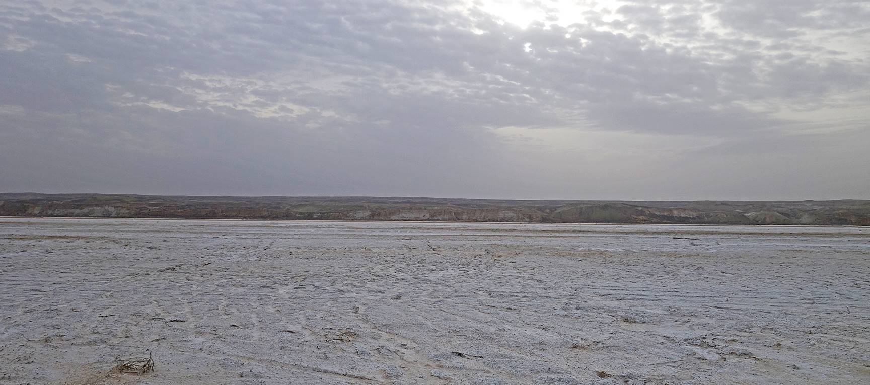
Reaching Aral Sea.
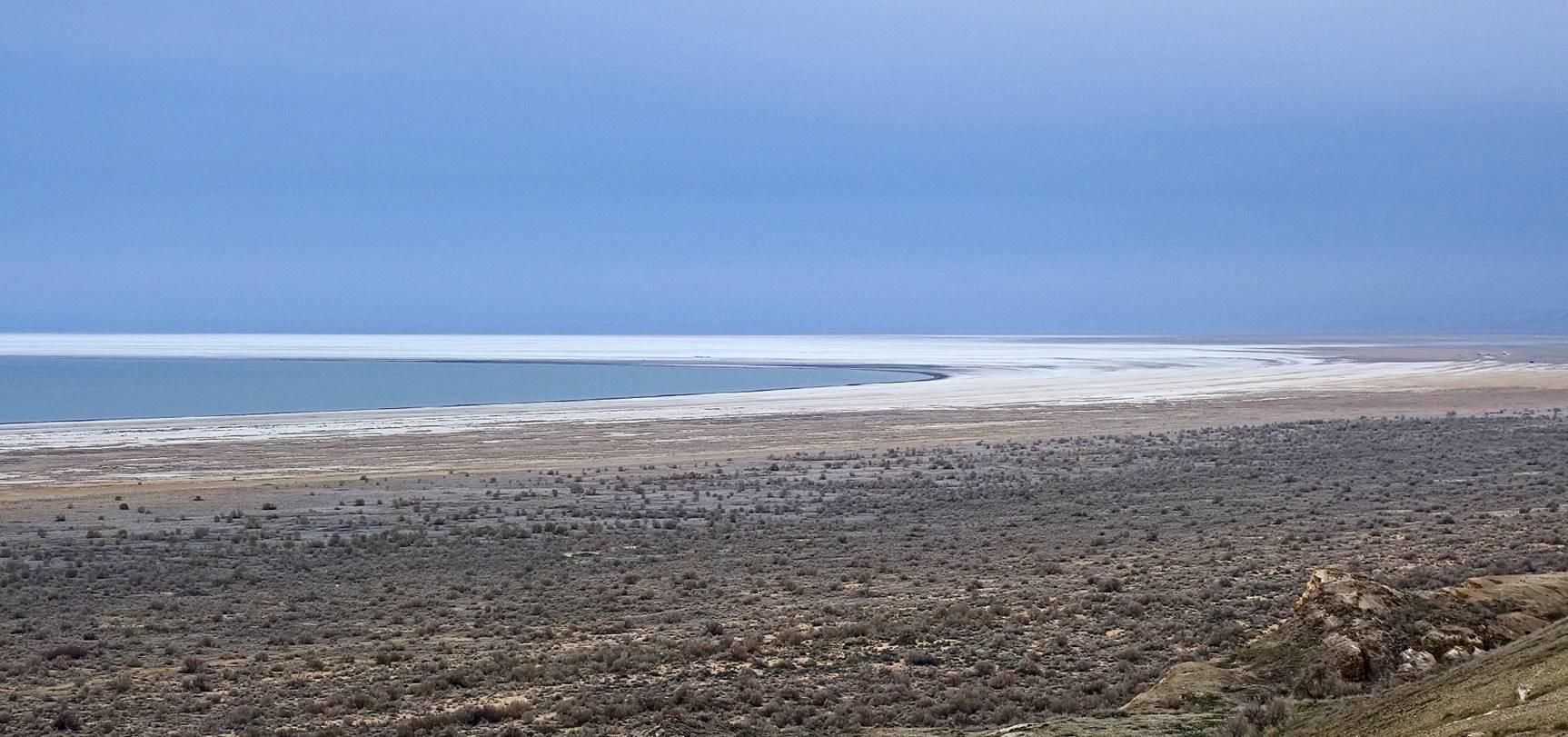
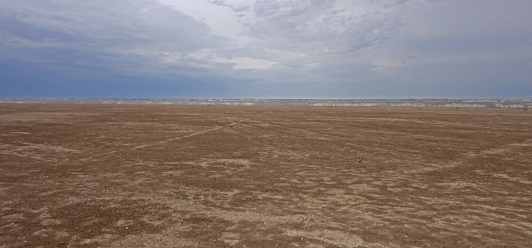
Looking toward the west from the shore of the sea, with the edge of the Ustyurt plateau visible in the background.
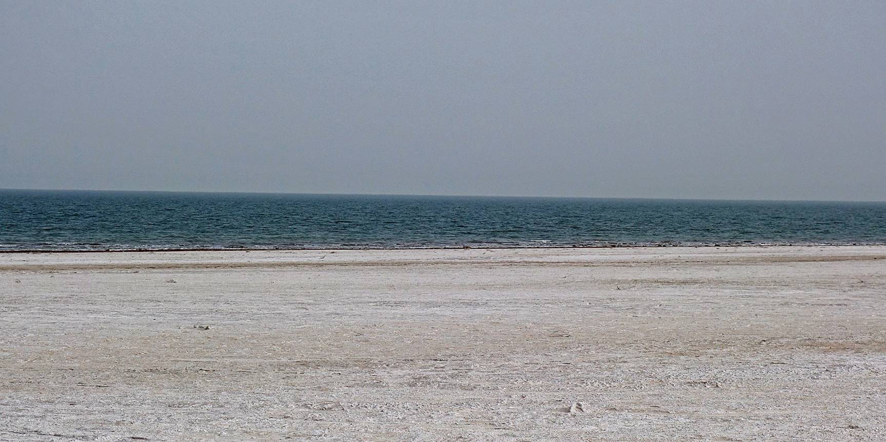
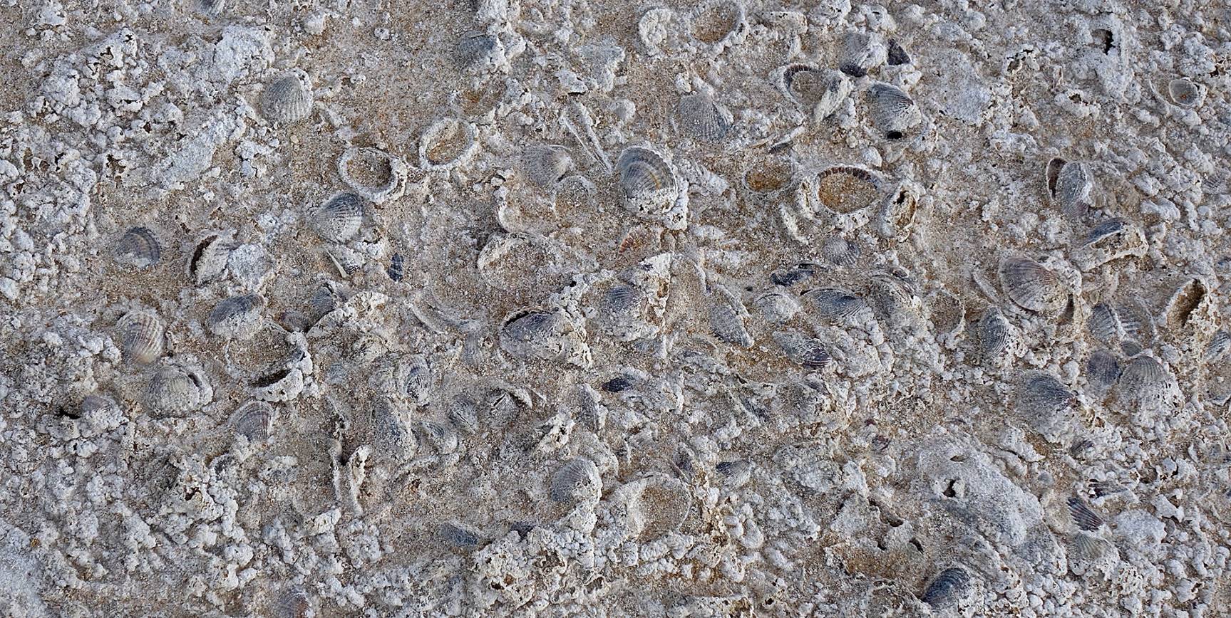
Sea shells embedded in the ground, the remains of the abundant life that existed in the Aral Sea.
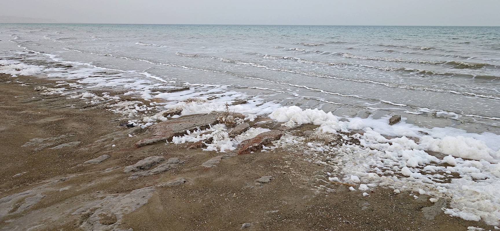
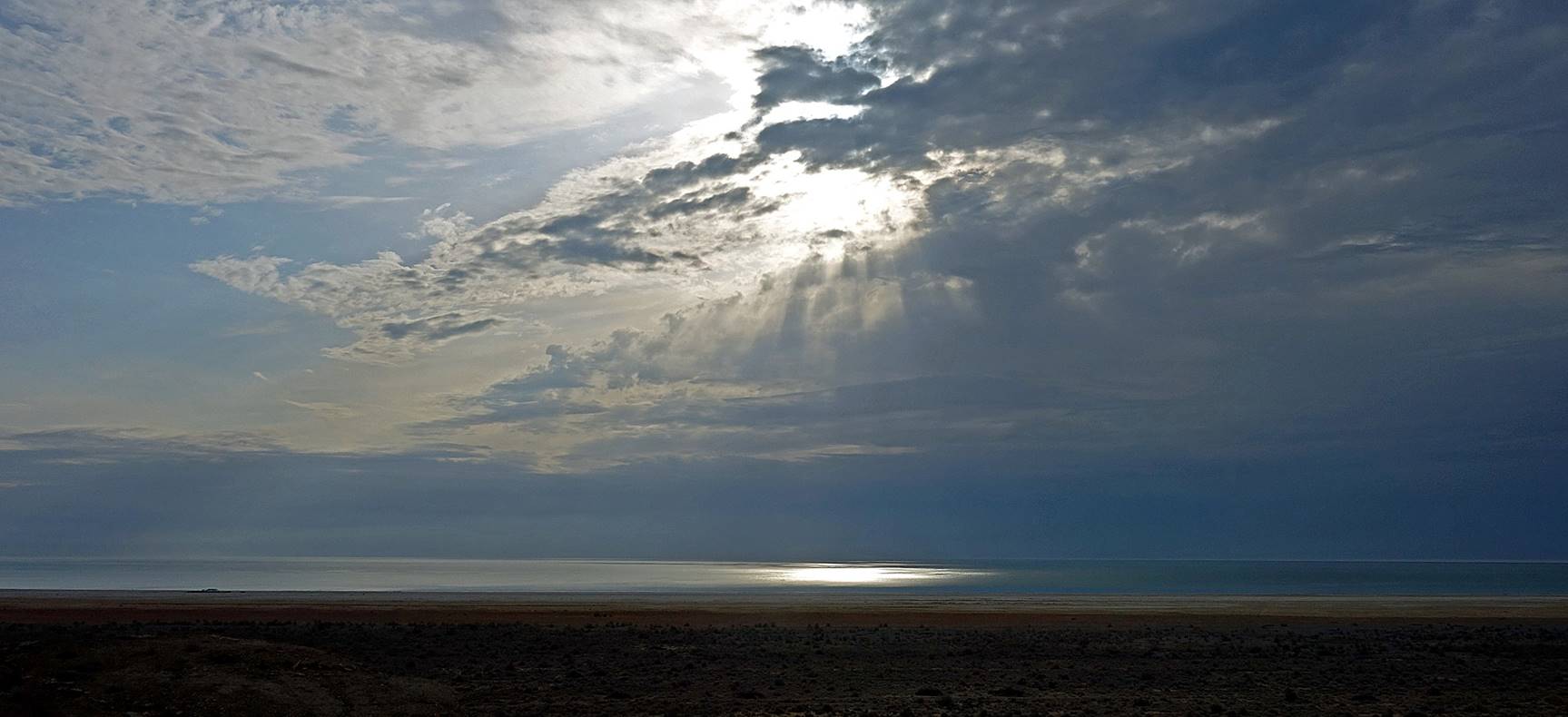
Morning reflection of sunlight on the sea.
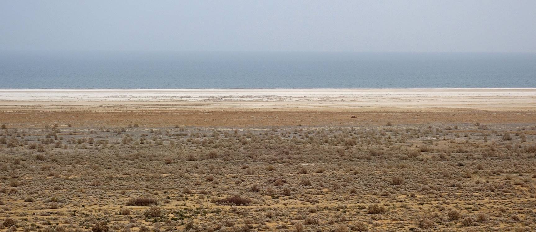
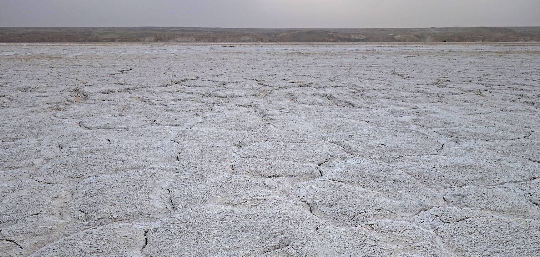
On the way to Moynaq, crossing flat land that was still covered by the Aral Sea some 20 years ago. The Ustyurt plateau is visible in the background. The tiny white dots on the ground are shells.
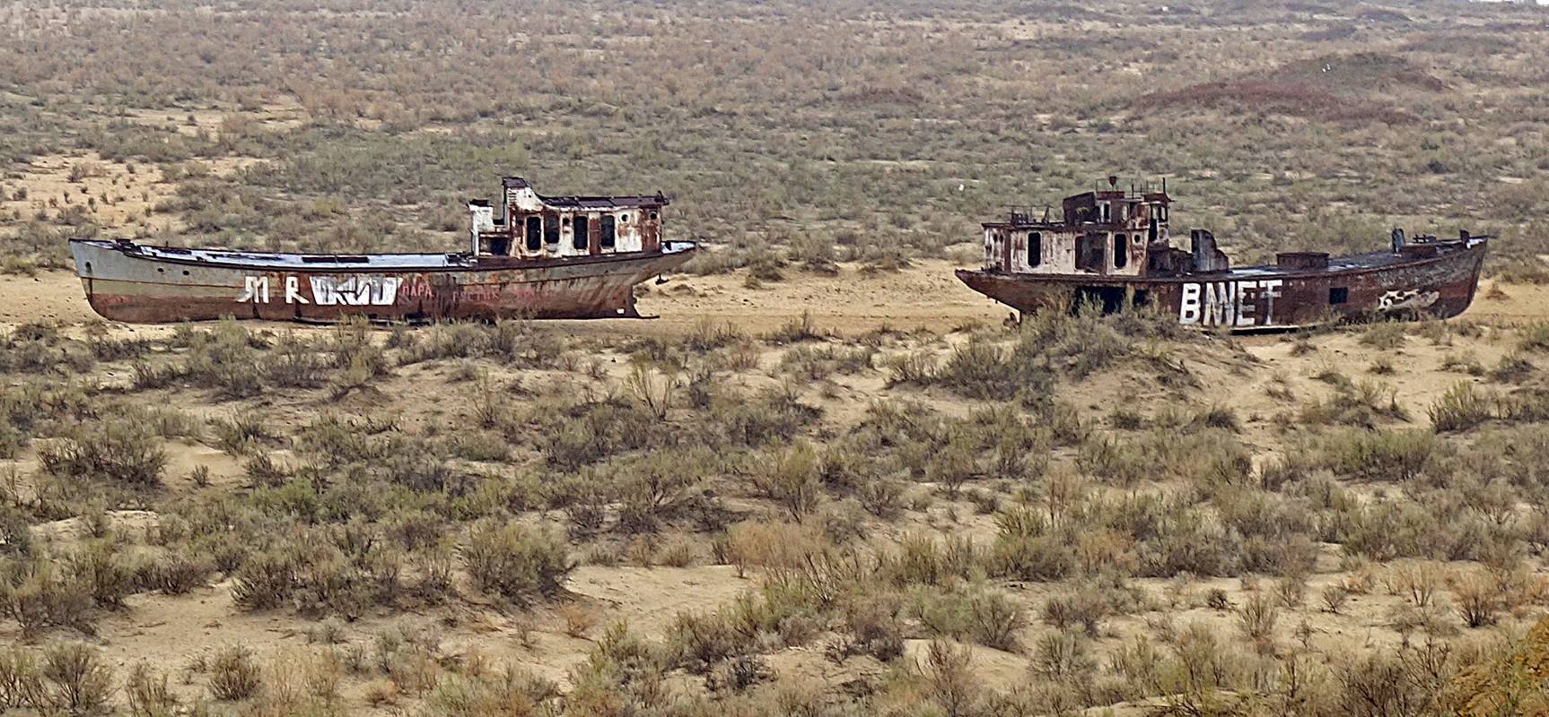
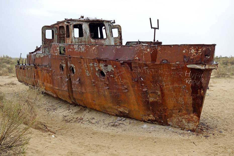
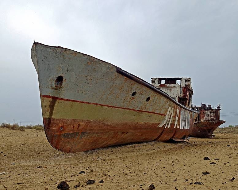
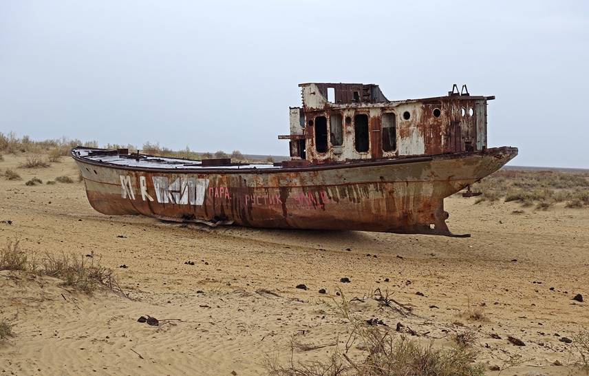
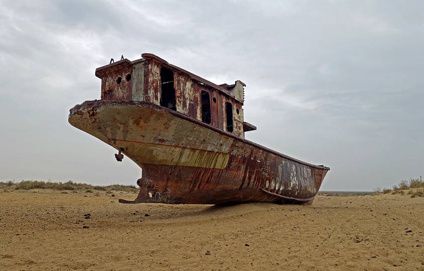
Views of the infamous ships′ graveyard of Moynaq.
|
|
|
|
|
|
![]()