Uzbekistan (April 2018): Qalas of Karakalpakstan
![]()
Return to main Uzbekistan 2018 page
The country of Uzbekistan is politically divided into 12 provinces (Andijan, Bukhara, Fergana...), one capital city (Tashkent), and...one ″autonomous republic″. The latter is the rather mysterious Karakalpakstan (sometimes called the ″forgotten stan″), located in the far west of Uzbekistan. While Karakalpakstan (160,000 sq.km) is much larger than any of the 12 Uzbek provinces, most of it is a barren flat desert. But on its south-east this desert is dotted with a number of old ruined fortresses (qalas). How can that be?
Thousands of years ago the Amu Darya river did not flow into the Aral Sea, but into the Caspian Sea. During the second millennium BC it changed direction and, instead, flowed into the Aral Sea. It then watered a region that became fertile and increasingly populated, well into the first millennium AD. Most of the qalas have been built during this period to control the region and protect the agricultural settlements from nomad raids. Some may have been fortified residences, others pure military barracks. However, by the end of the 9th century AD, the Amu Daria changed course again (still flowing into the Aral Sea), forcing the population to leave some areas for lack of irrigation water. Numerous qalas had to be abandoned and the land around them became a desert.
An excellent reference to Karakalpakstan, its people, and the qalas, by David and Sue Richardson, can be found here. Much of the information given below was drawn from this reference.
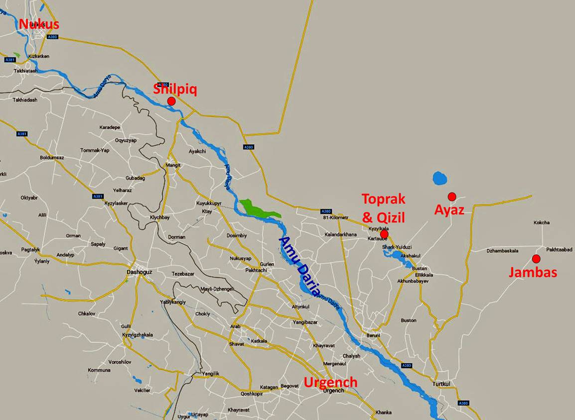
Map showing the approximate locations of the sites I visited (red dots). Their precise coordinates can be downloaded by clicking here (.kmz file) and opening the downloaded .kmz file in Google Earth.
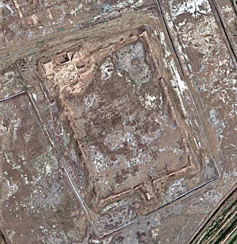
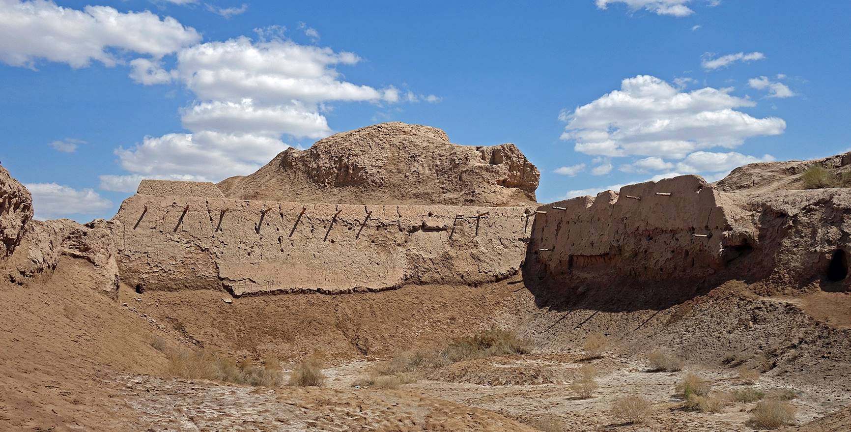
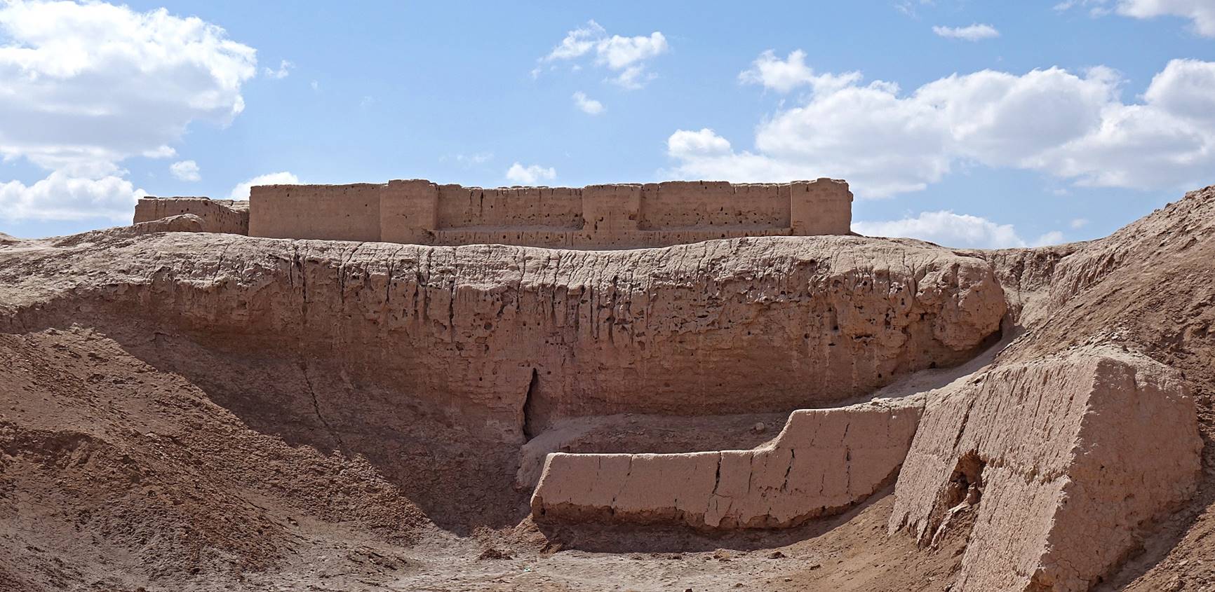
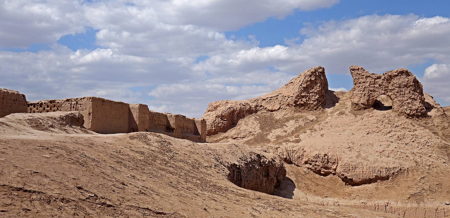
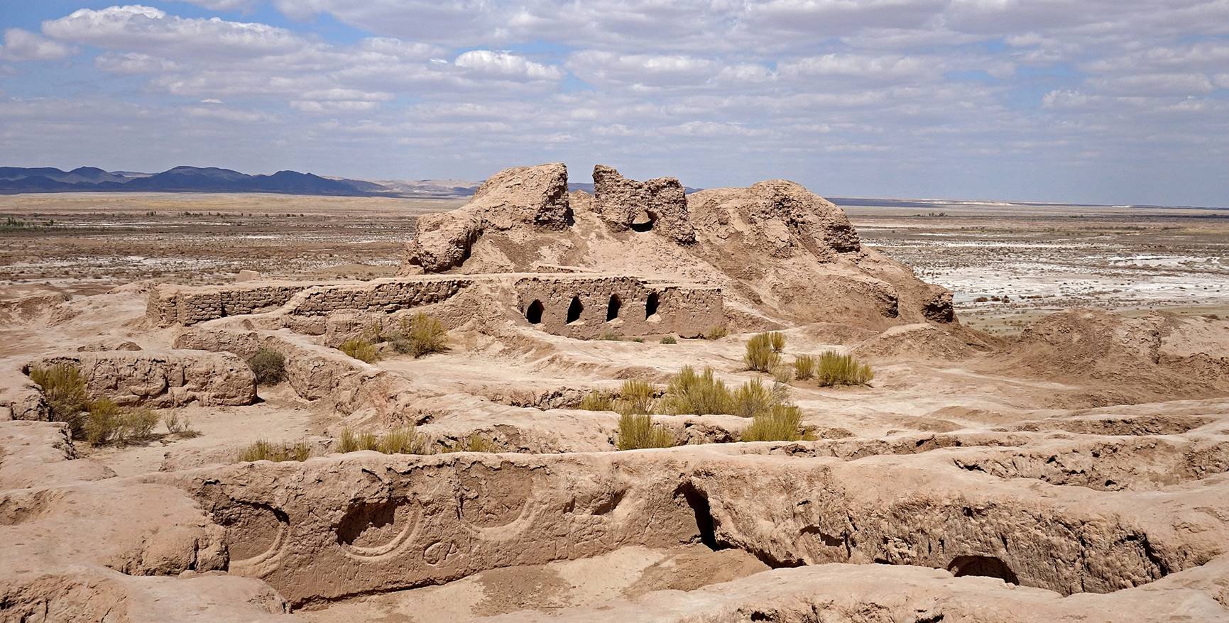
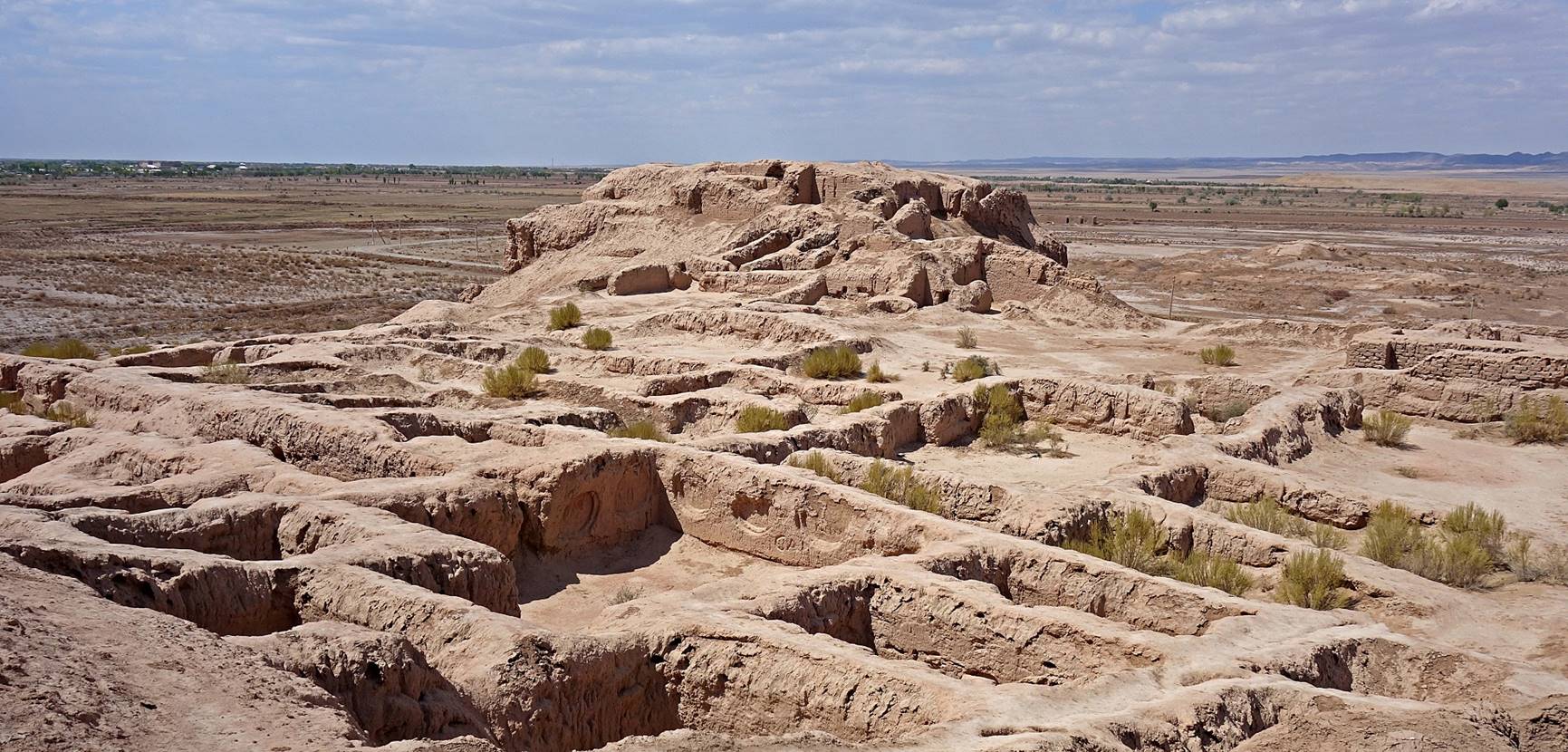
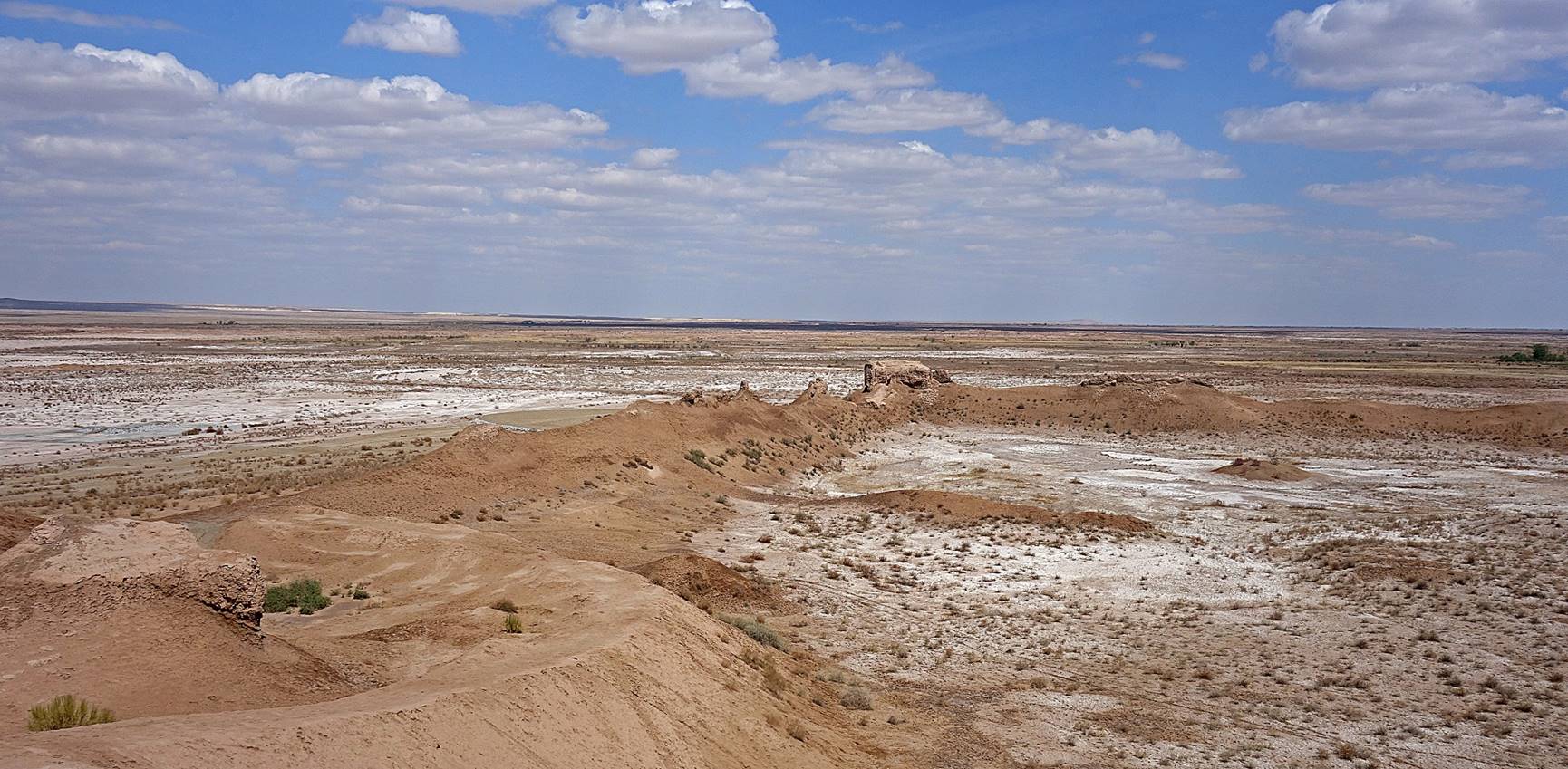
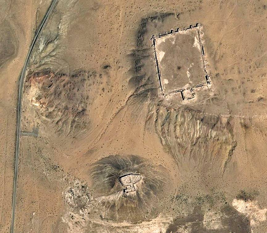
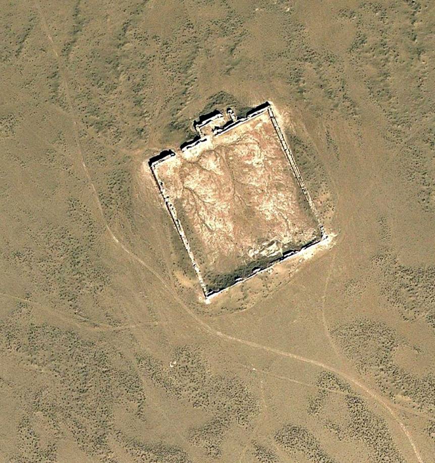
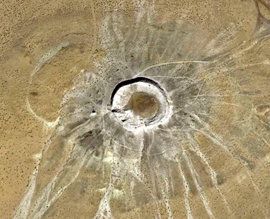
Topraq qala:
Topraq qala means ″clay fort″, which seems quite appropriate today. It was built sometime between the 1st and 2nd century AD. It forms a 500mx350m rectangle enclosed by high walls, with the High Palace in its north-west corner.
Aerial view.
Entrance of the High Palace from the nort-west.
Views of the High Palace from the east.
View from the High Palace toward the north-east, with the north-east tower in the middle of the photo. The white areas in the surrounding desert are salt deposit.
View toward the north-west tower (at the center of the photo).
View from the High Palace toward the north-east corner of the enclosing high wall. Note again the salt deposits.
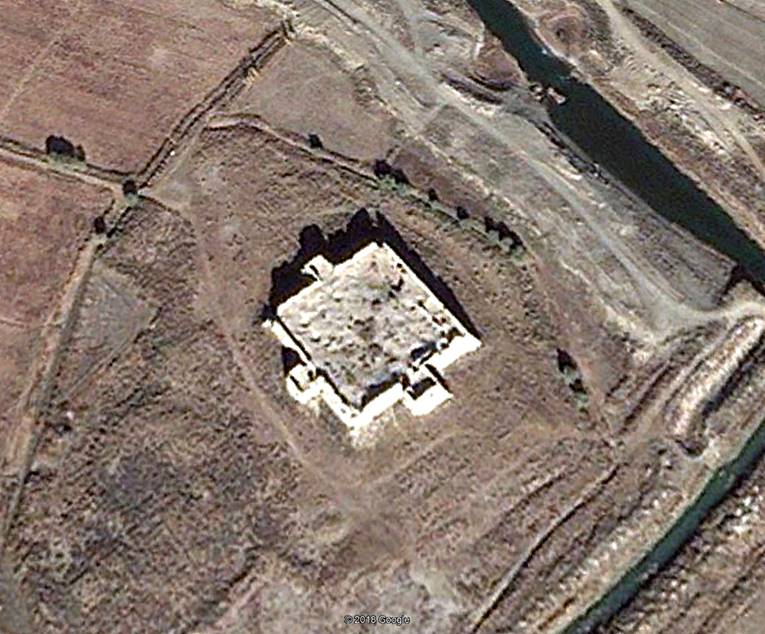
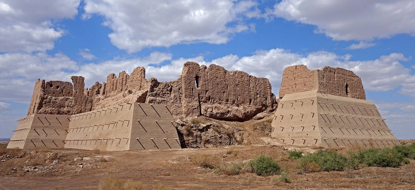
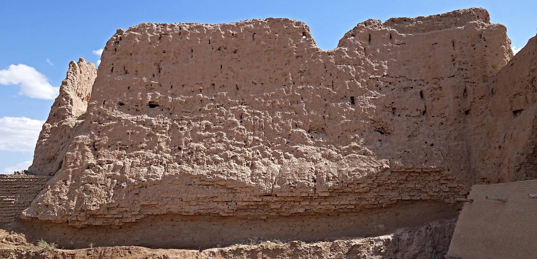
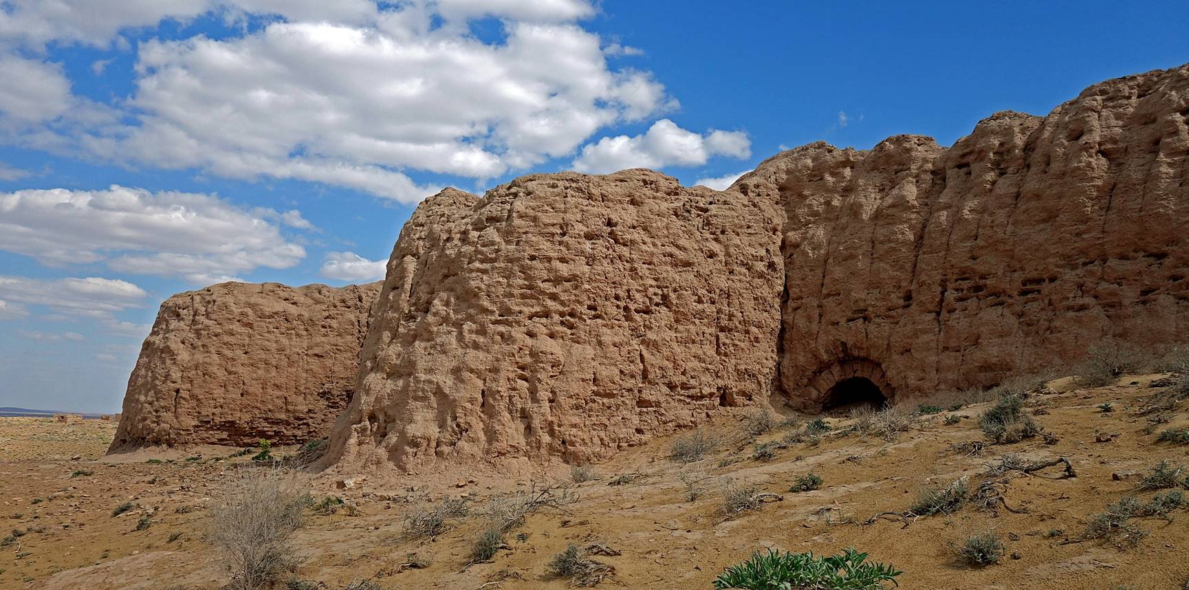
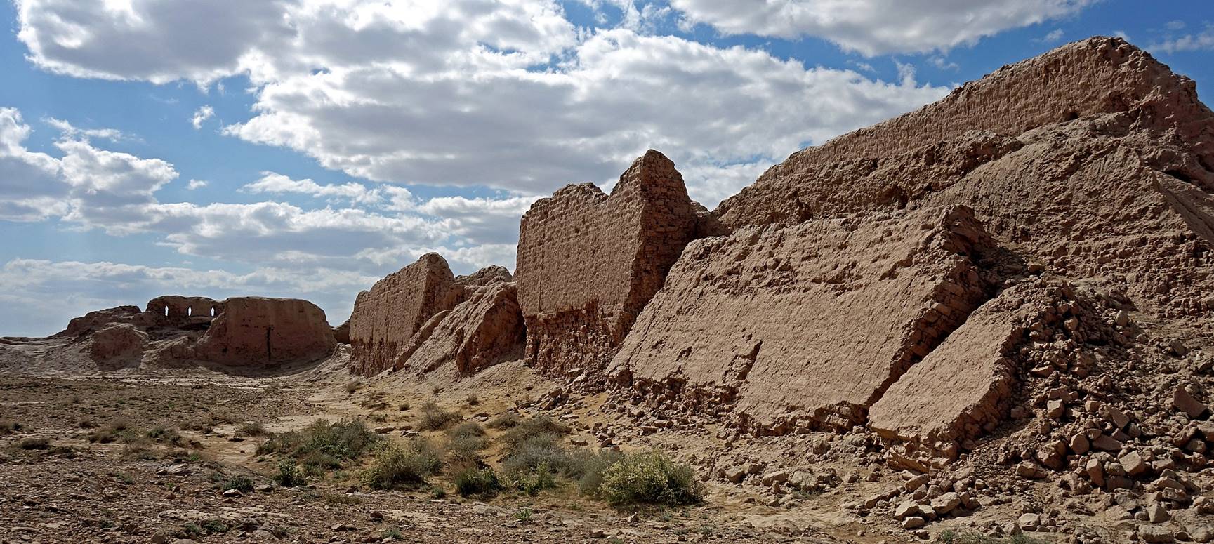
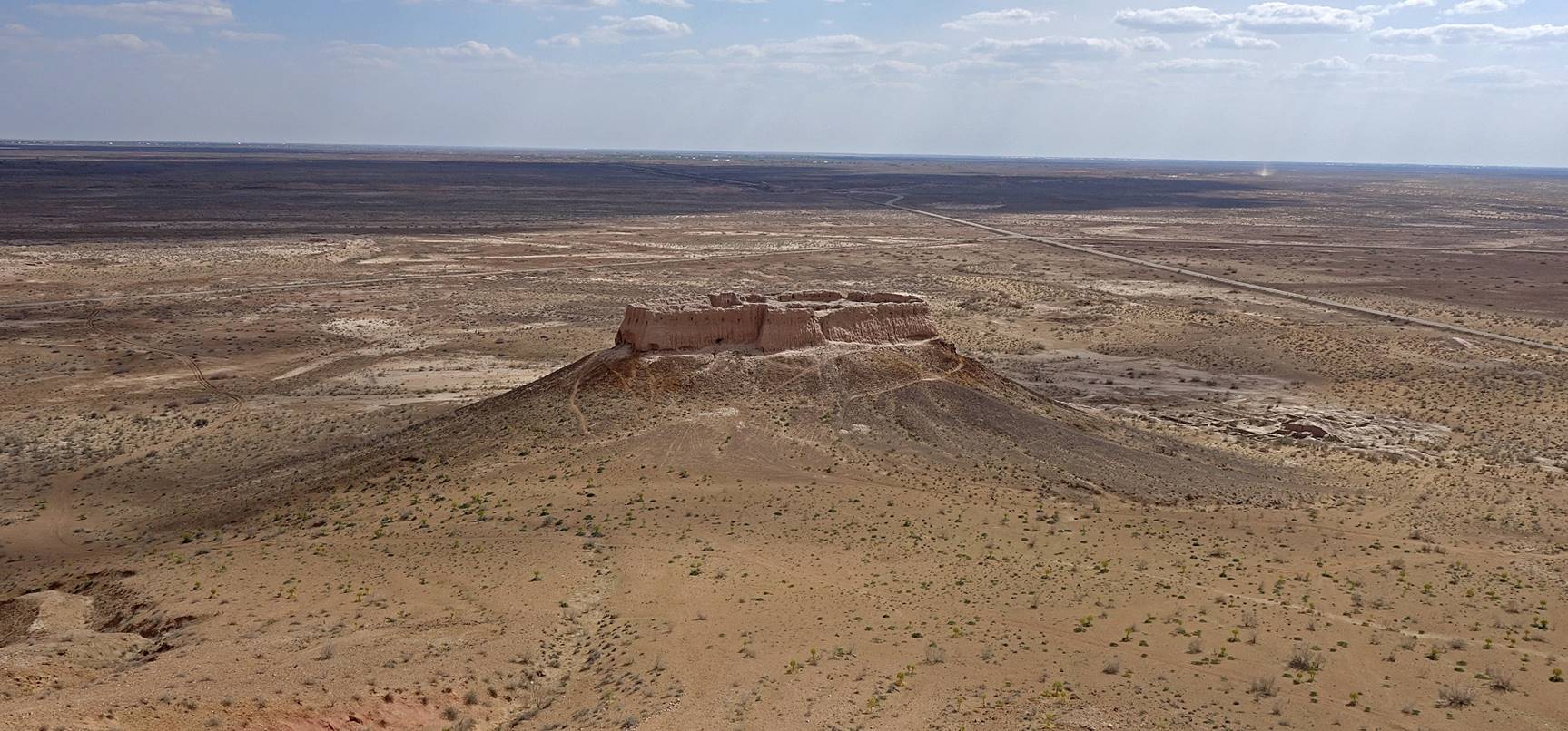
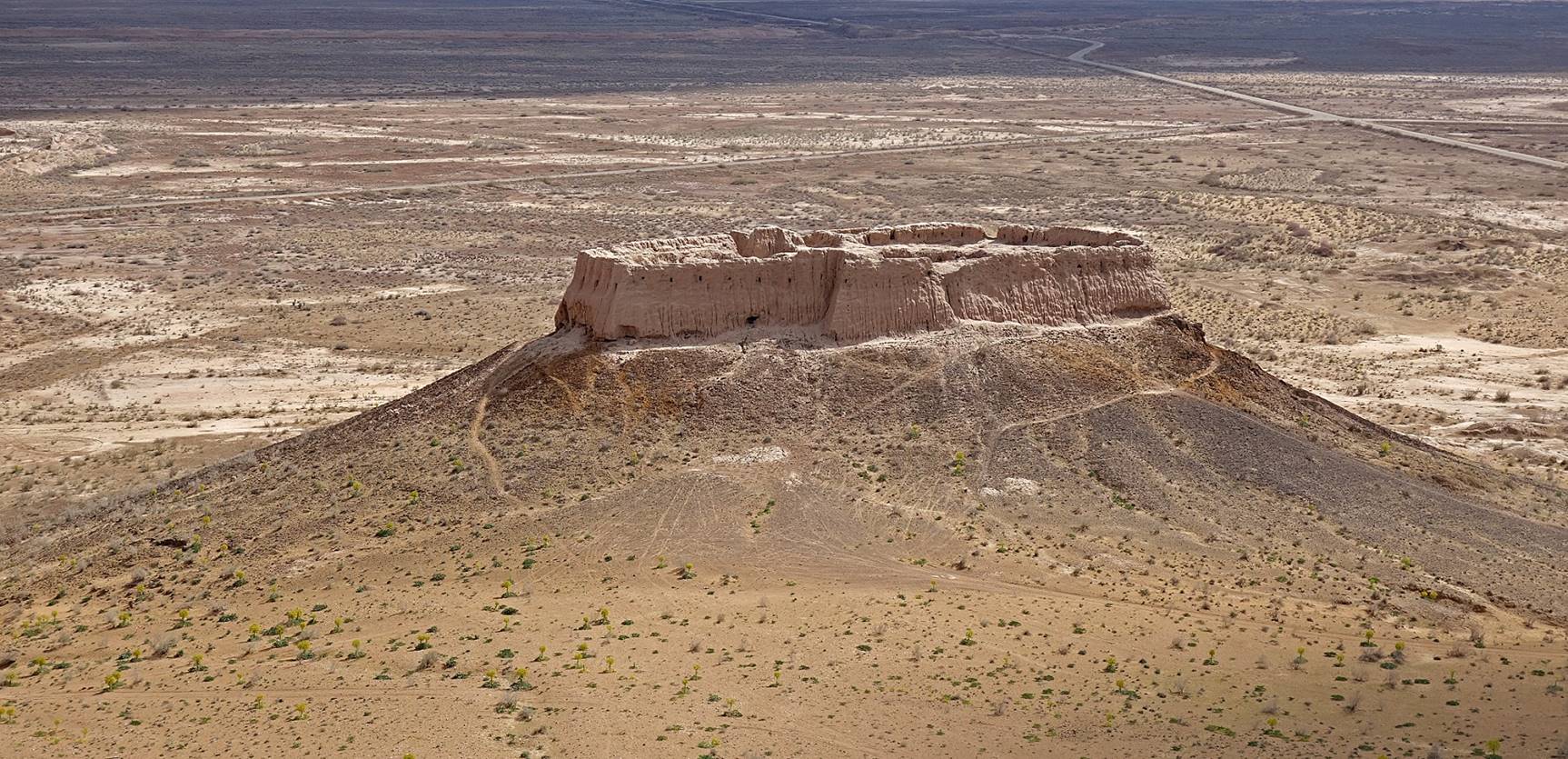
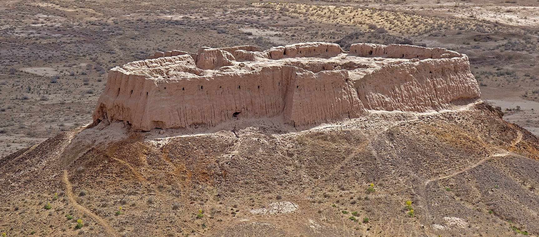
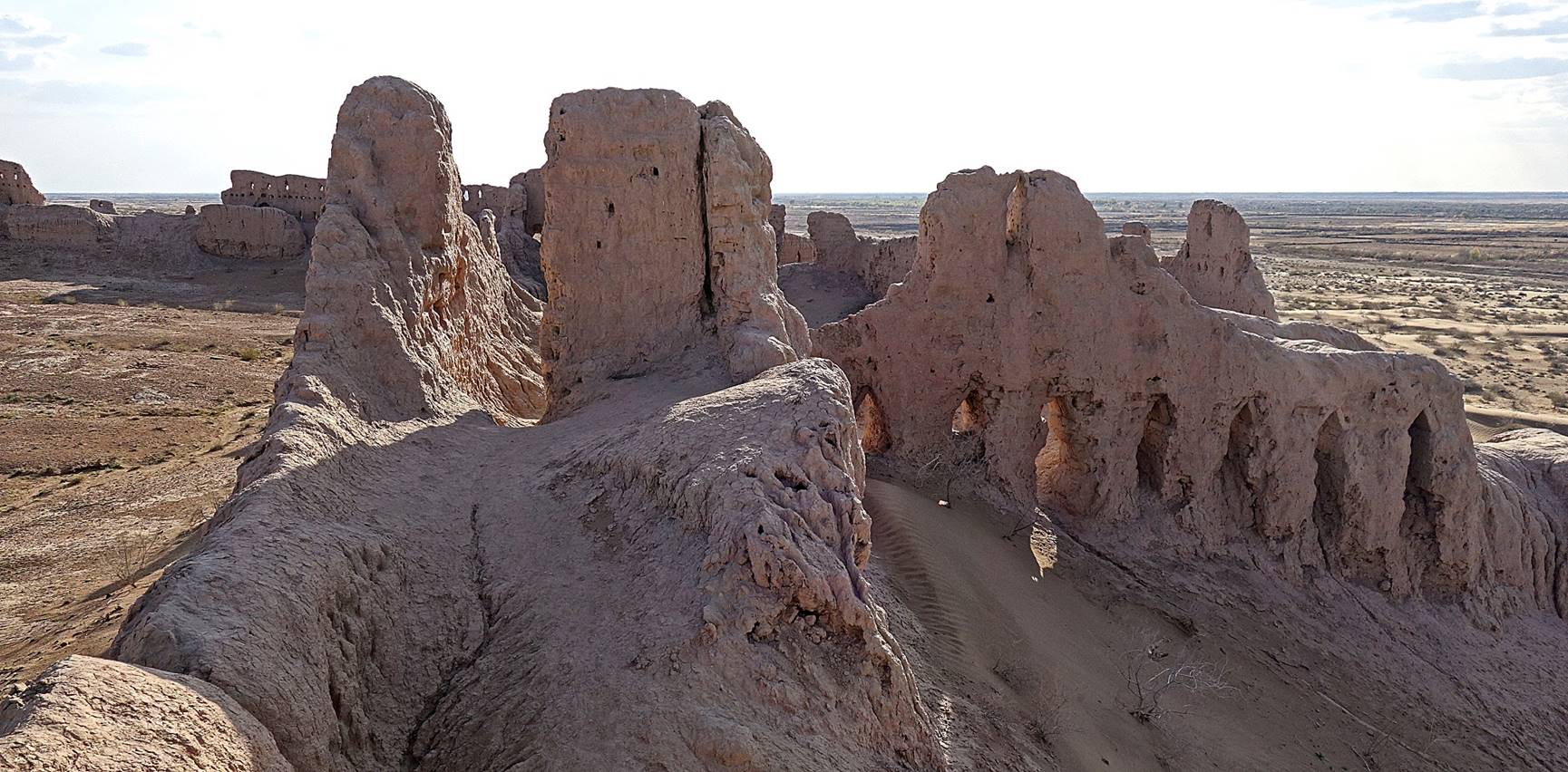
Qizil (Kyzyl) qala.
This qala was also built between the 1st and 2nd centuries AD. It may have been restored during the 12th century prior to the Mongol invasion. Its horizontal size is 65x63m, with walls measuring up to 16m.
Aerial view.
View of the south-east wall, which has been partially restored recently. One may not like the appearance of the rebuilt sections, but they protect the wall from crumbling further down. It also gives a better sense of the former majesty of the fortress.
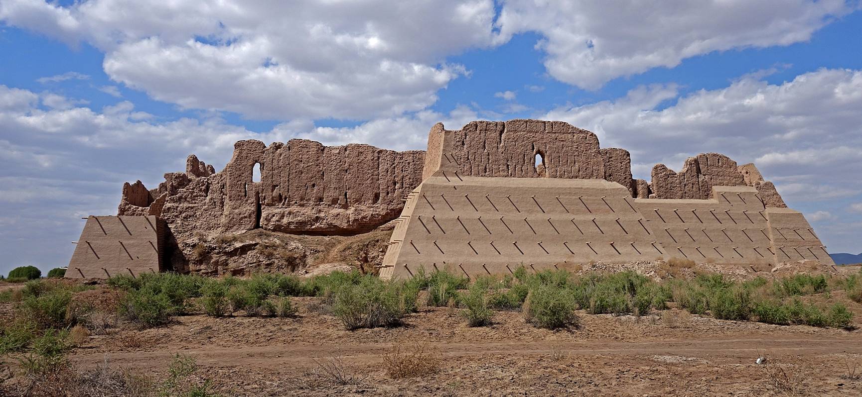
View of the south corner of the qala, with the south-west wall on the left and the south-east wall on the right.
Non-restored portion of the north-west wall.
Views of the interior of the qala with its surrounding walls.
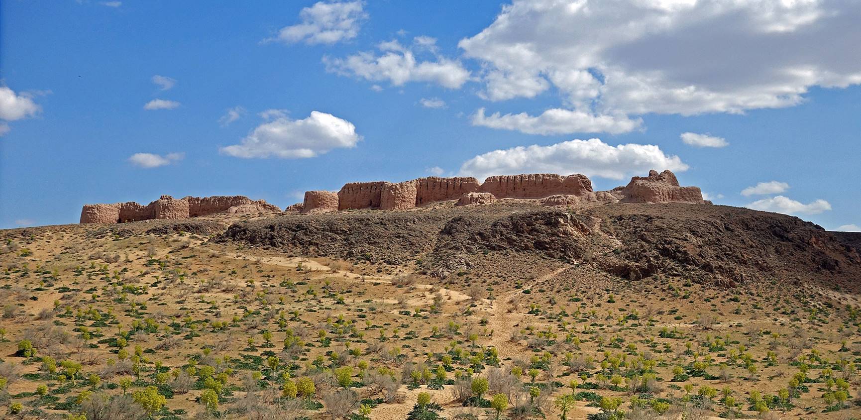
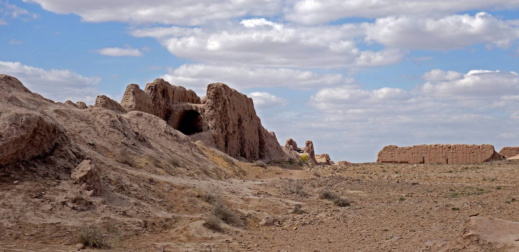
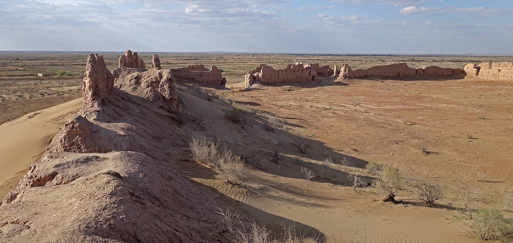
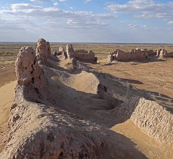
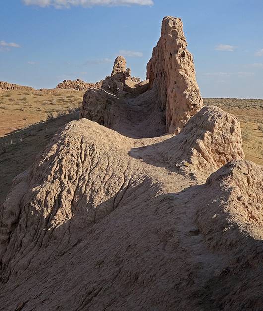
Ayaz qala:
This site consists of two main structures:
- a large defensive refuge referred to as Ayaz qala 1, dating from the 4th or early 3rd century BC, on top of a flat hill that provides views over the surrounding plain,
- a much smaller feudal fort referred to as Ayaz qala 2 built between the 6th and 8th century AD standing on a smaller hill south of Ayaz qala 1.
Ayaz qala 1 has a 180mx150m rectangular layout.
Aerial view.
Views of the north wall of Ayaz qala 1, with its watch towers.
A closer view of two watch towers.
Views of the walls from the inside.
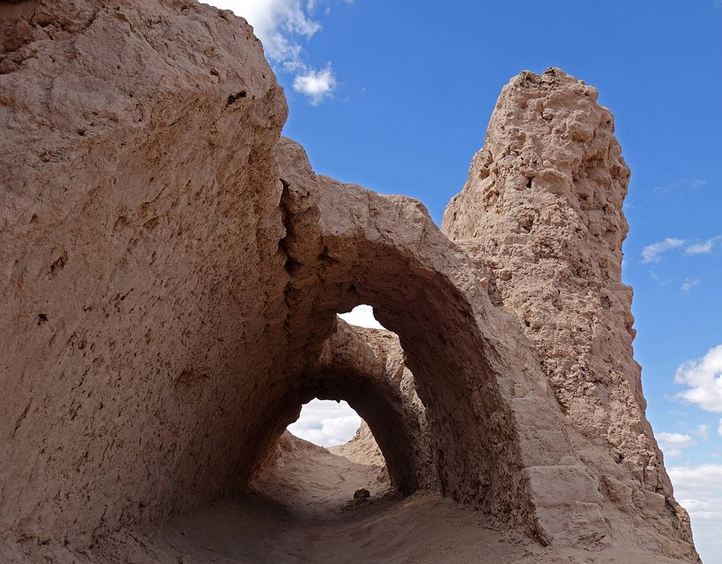
The walls around Ayaz qala 1 used to be double walls, with an inner and an outer walls separated by a vaulted archer gallery, as shown by the three pictures below.
|
|
|
Views over Ayaz qala 2 from the south-west corner of Ayaz qala 1.
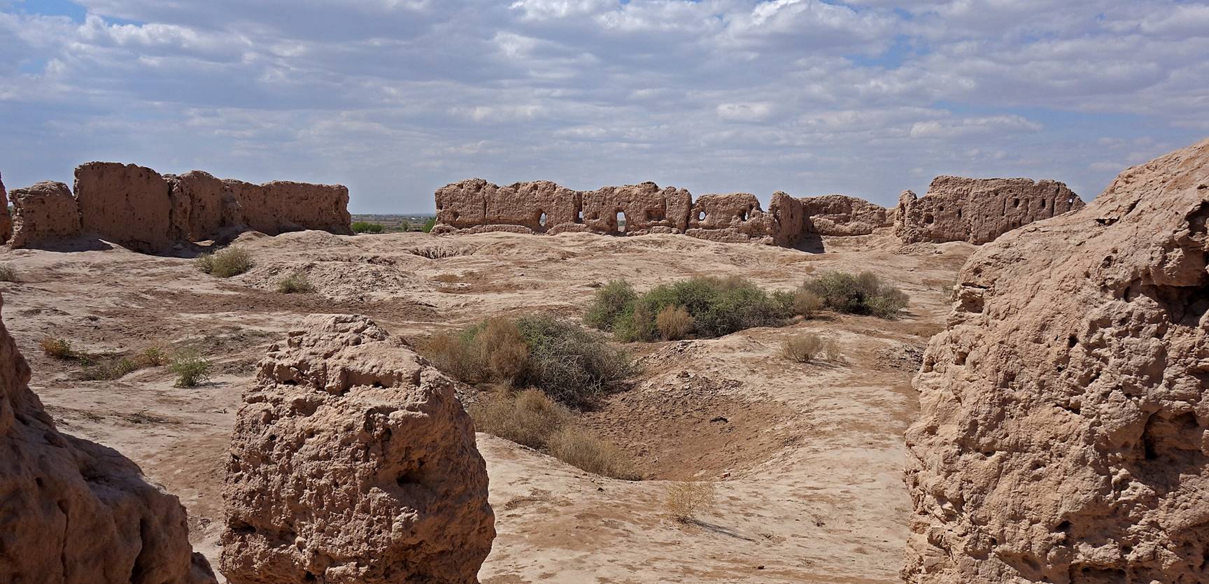
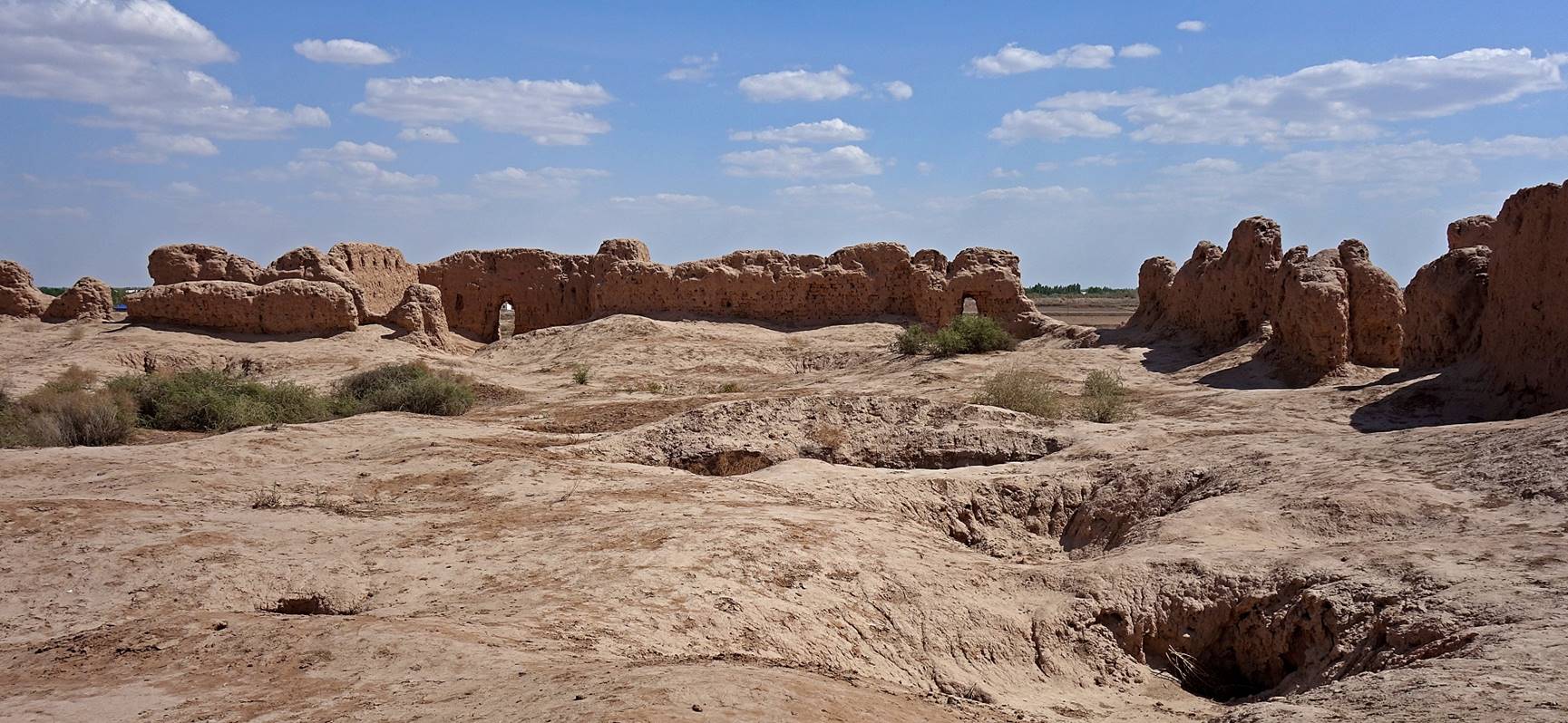
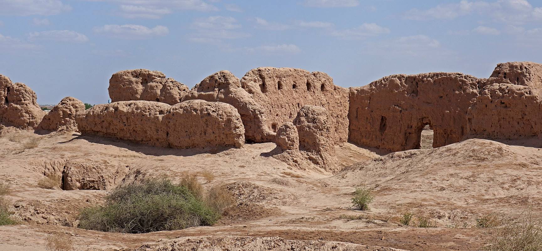
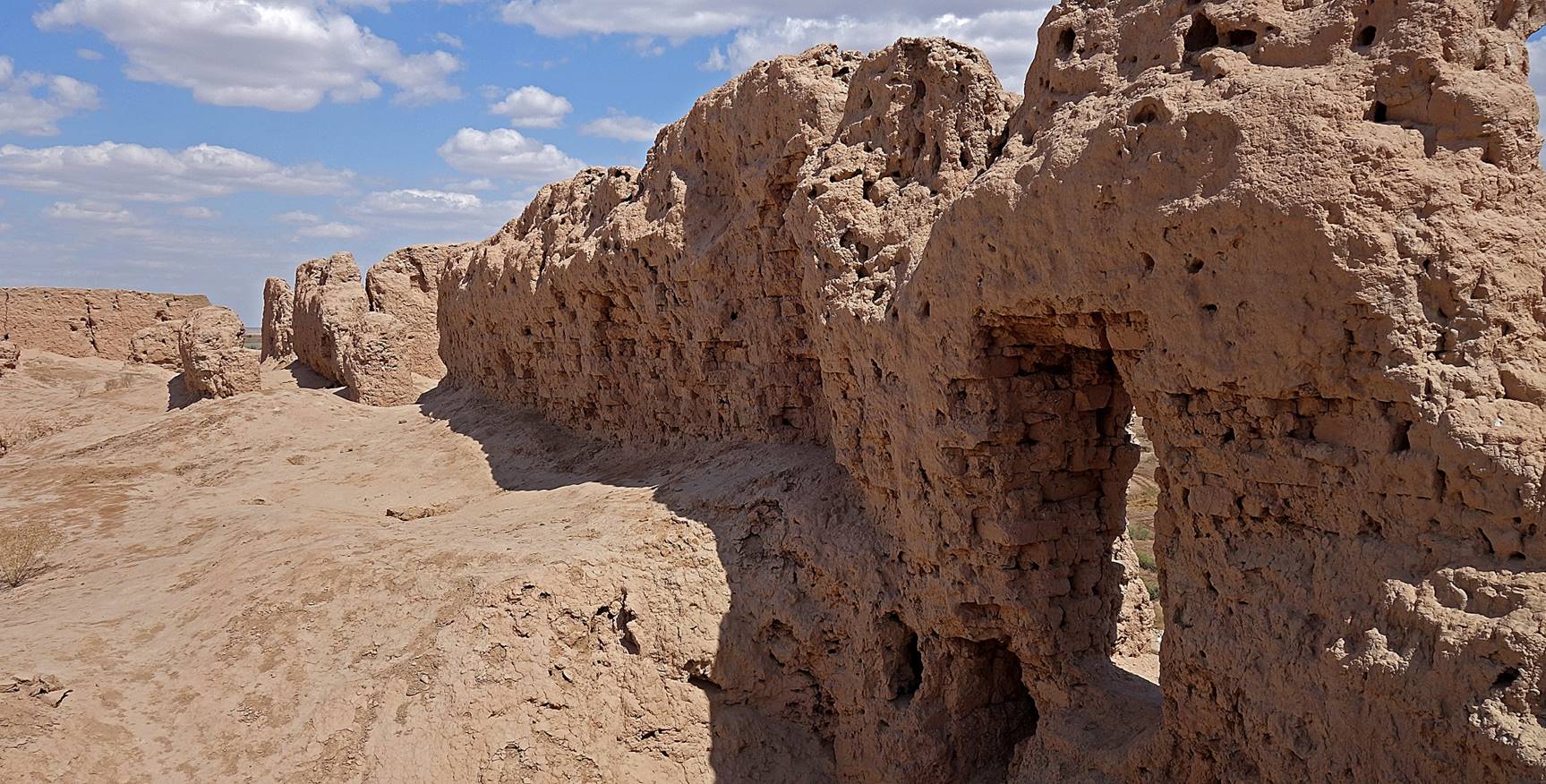
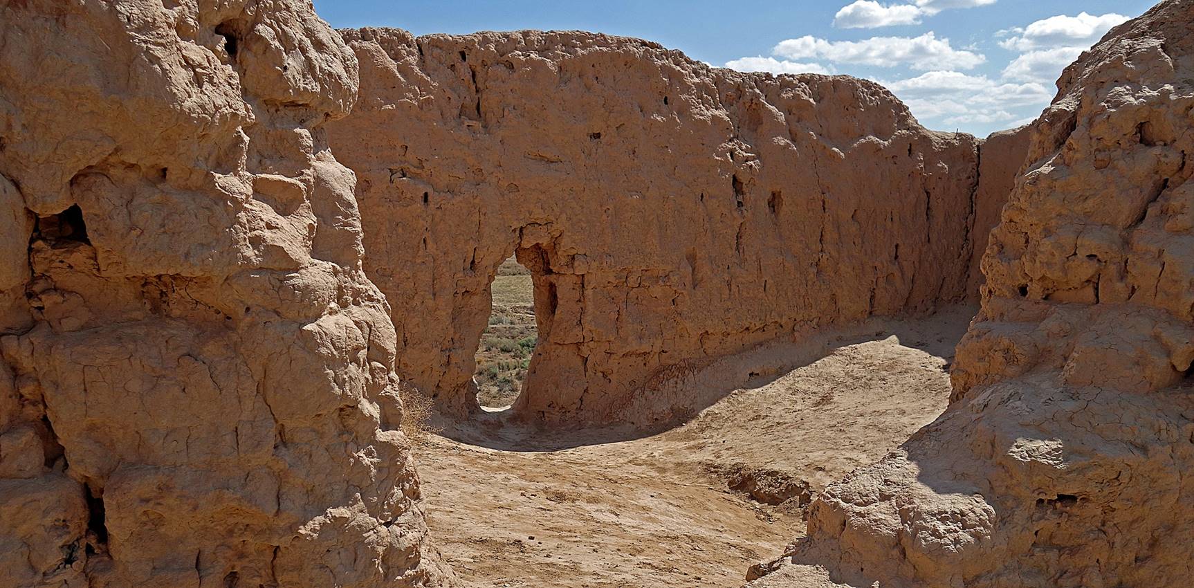
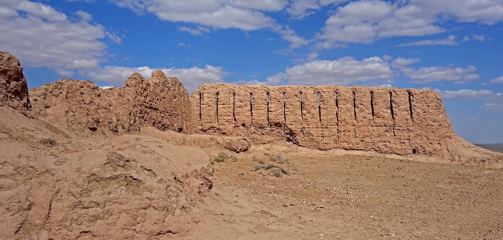
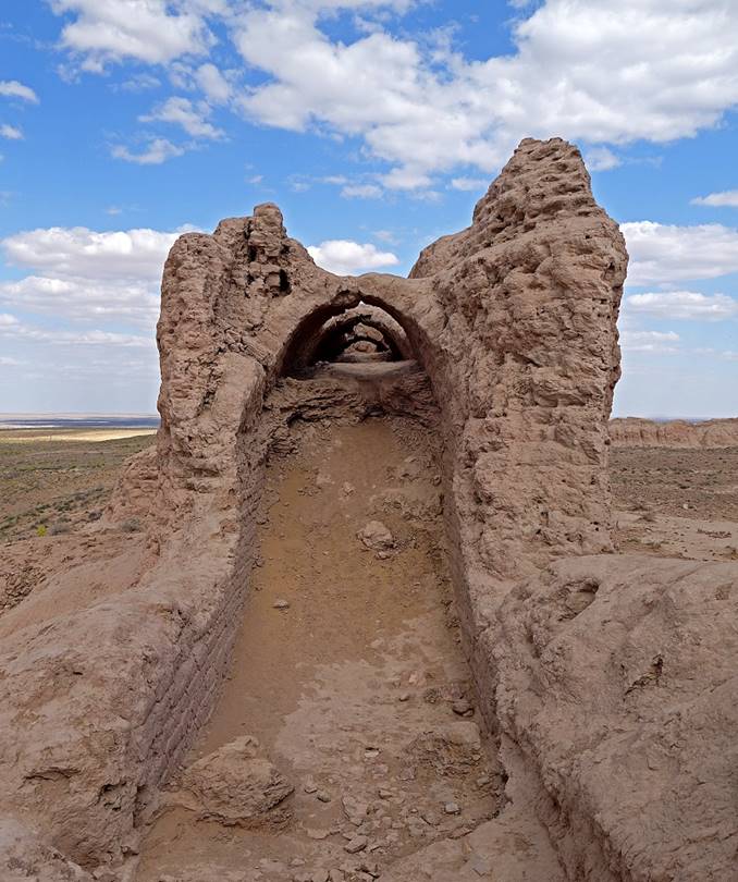
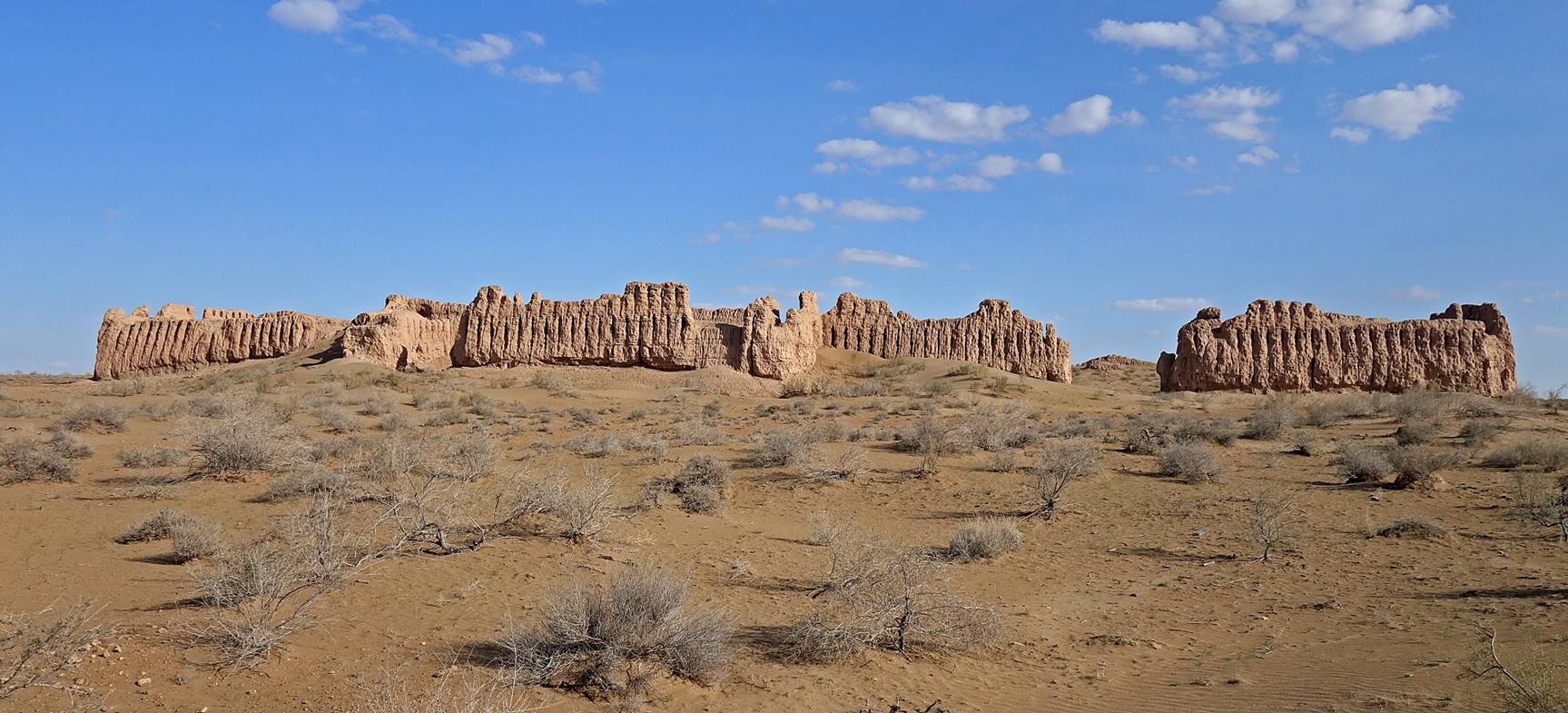
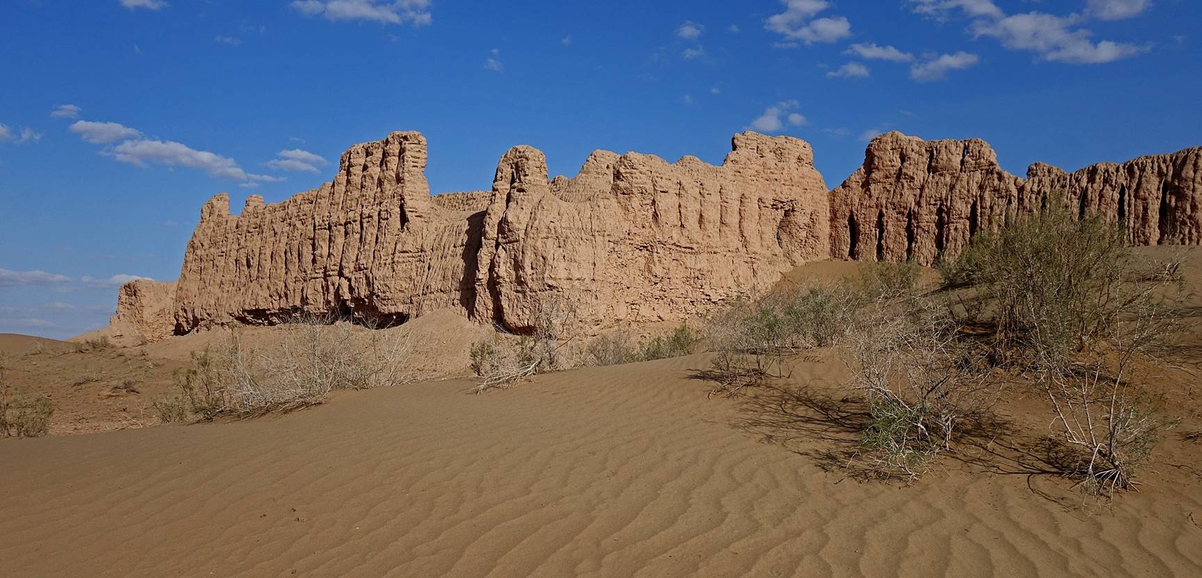
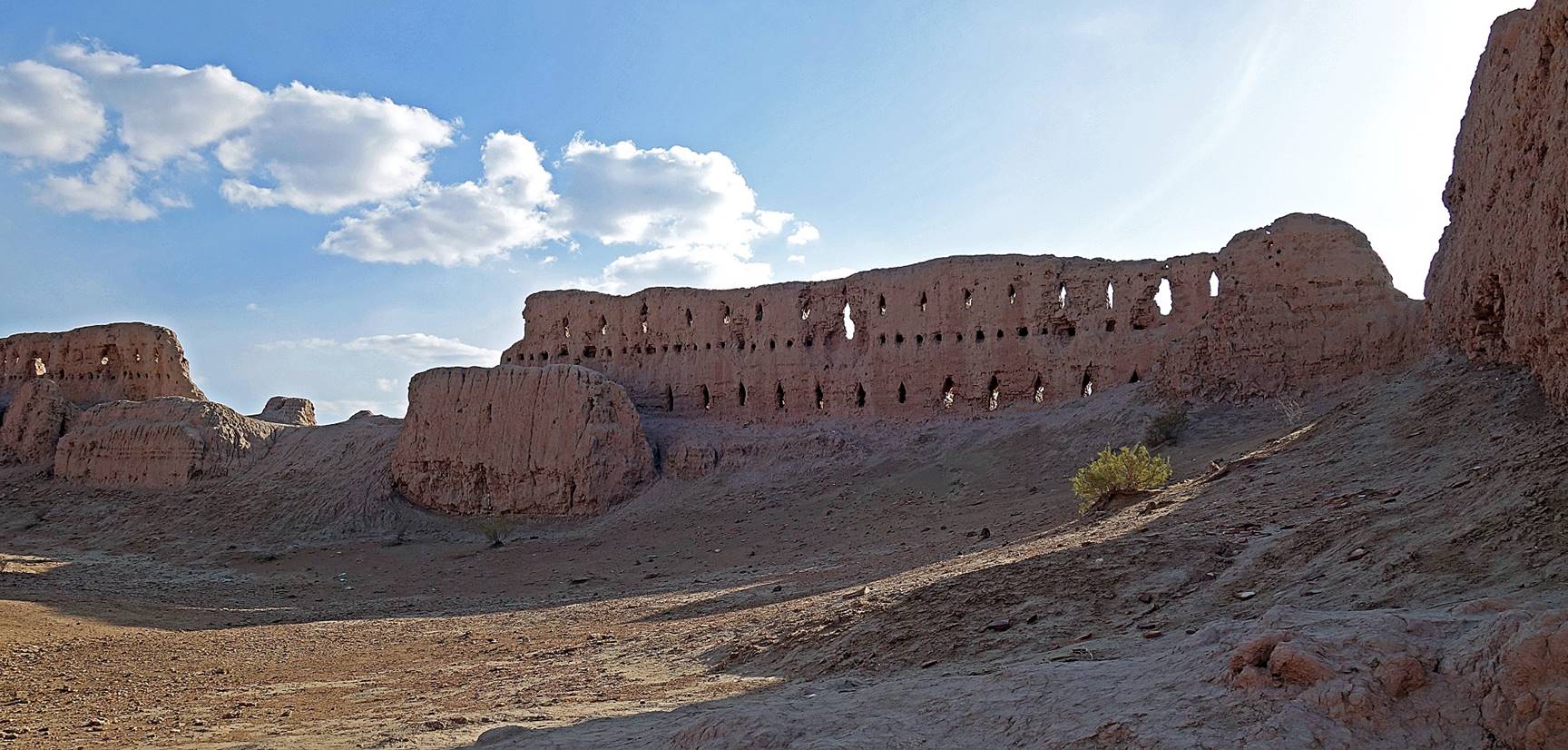
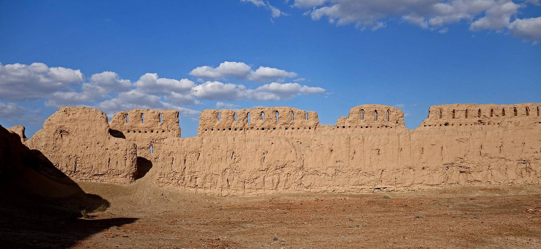
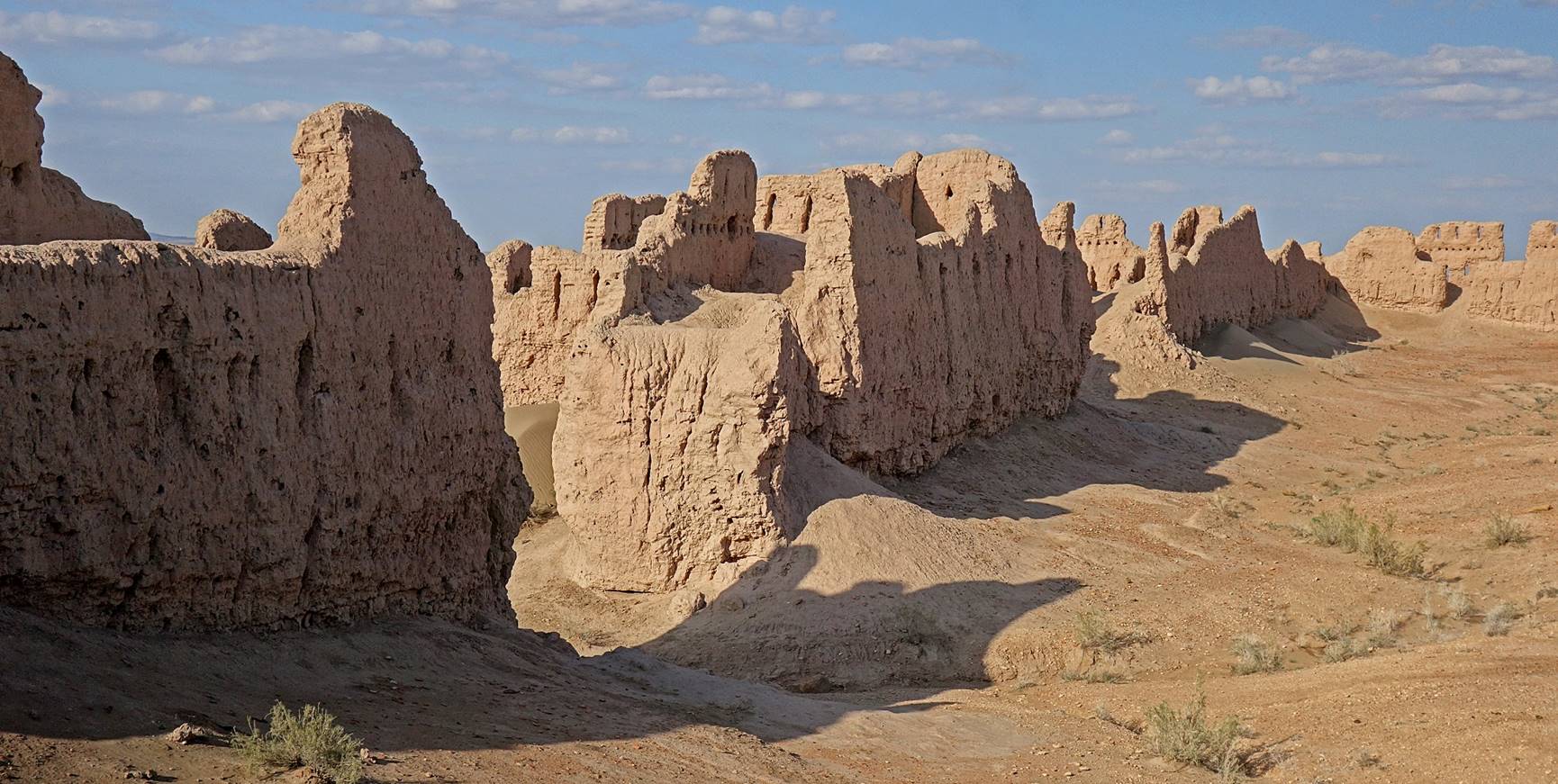
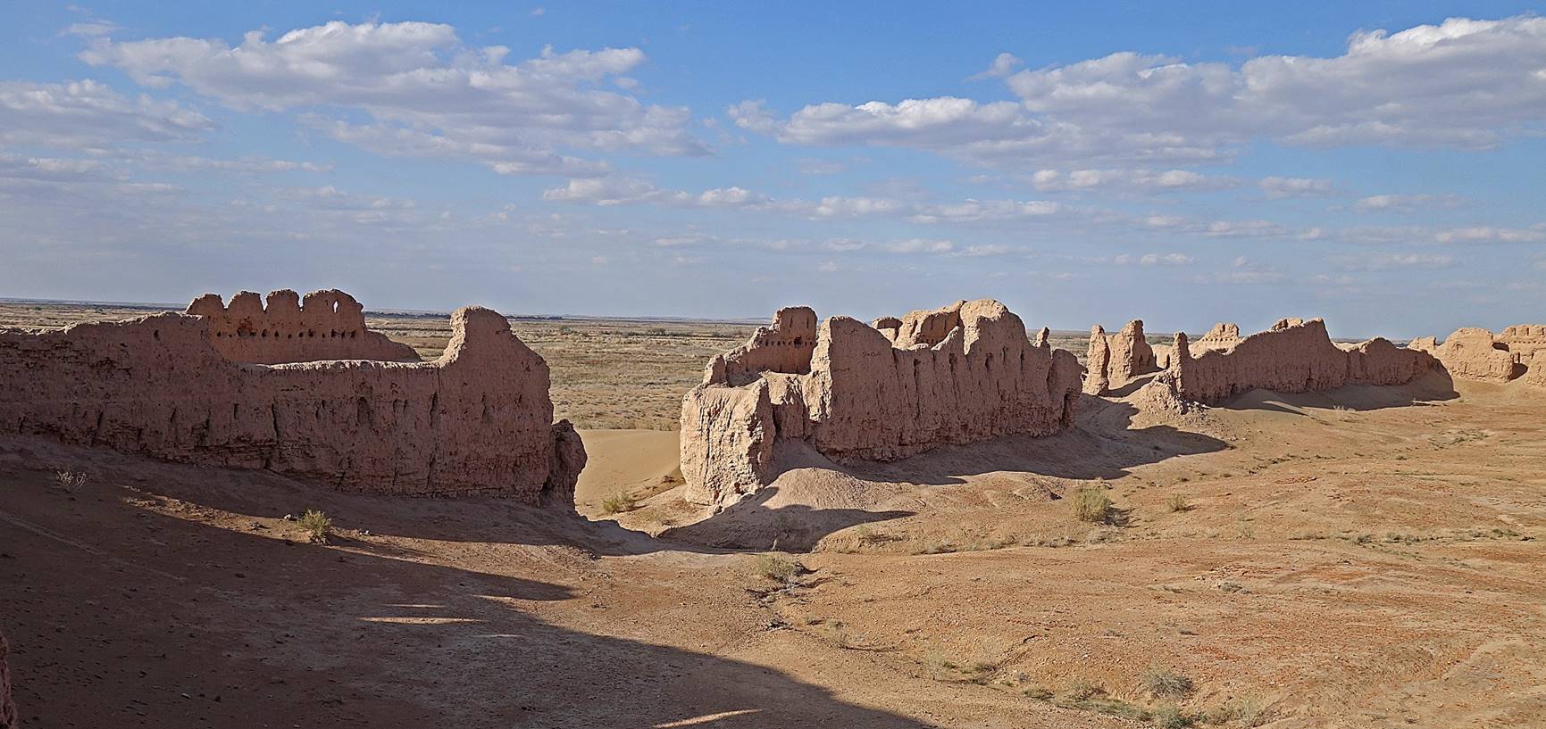
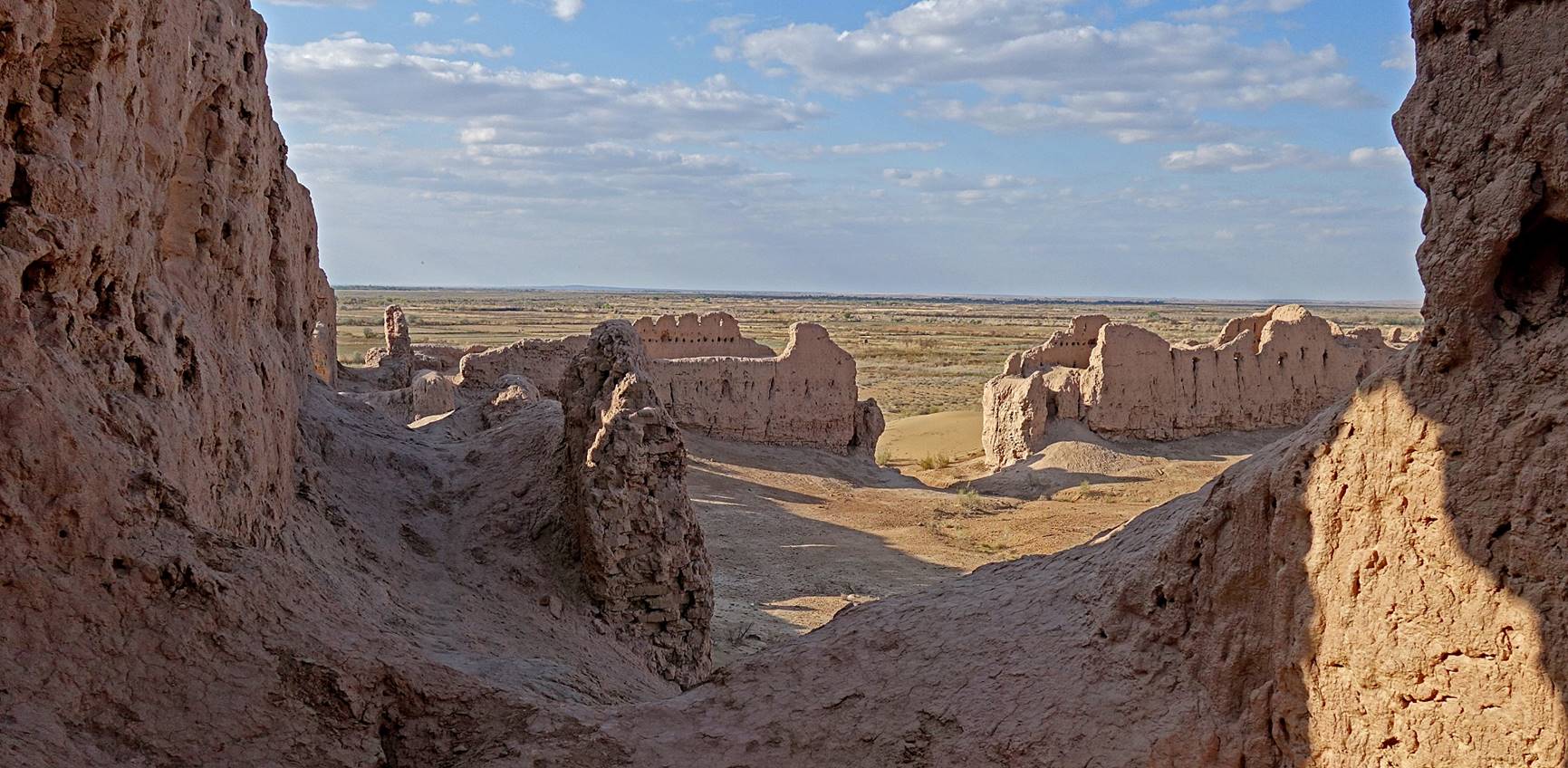
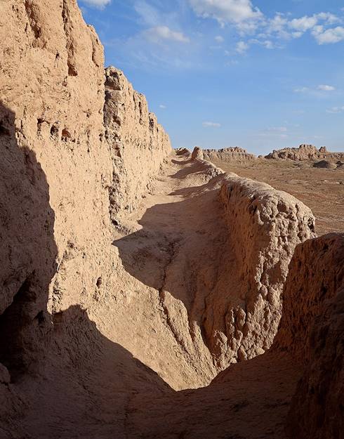
Janbas qala:
Janbas qala is the most impressive qala I visited. As I arrived at the site quite late in the afternoon, the lighting was much better than for the previously visited qalas. It has a slightly twisted 200mx170m rectangular layout and its walls measure up to 20m.
Aerial view.
View of the north-west wall. The current entrance into the enclosure is the opening on the right, but the former entrance was actually further to the left through an intermediate courtyard visible in the aerial photo.
Wall of the entrance courtyard.
View of the entrance courtyard.
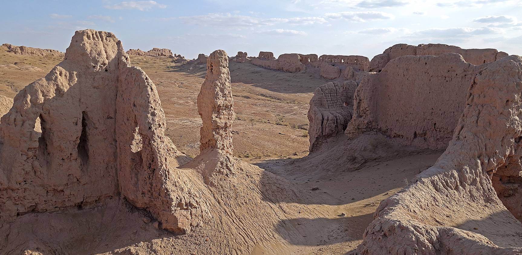
Views of the walls from the inside. The double walls contained at least two, probably three, levels of archer galleries.
|
|
|
|
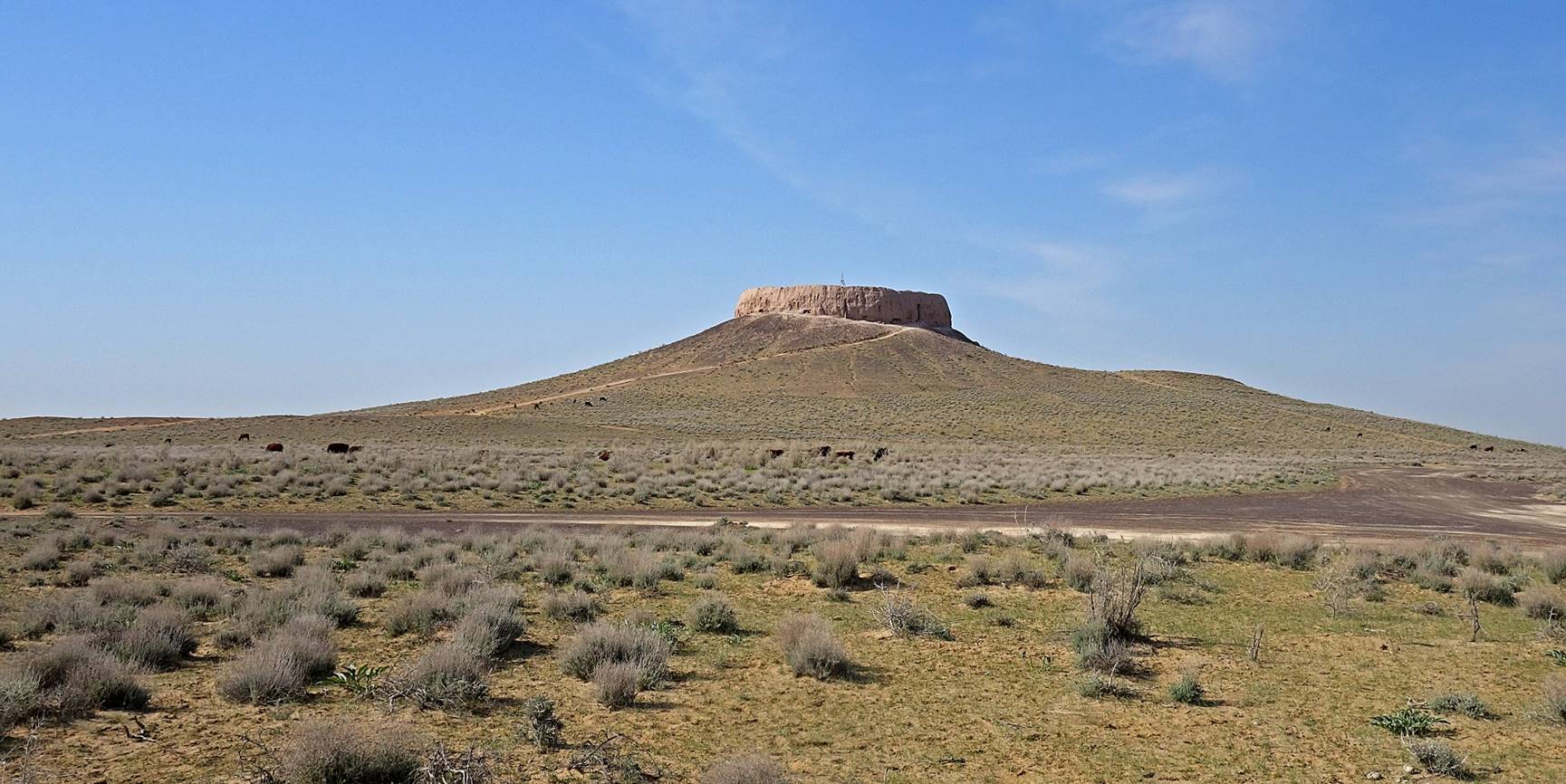
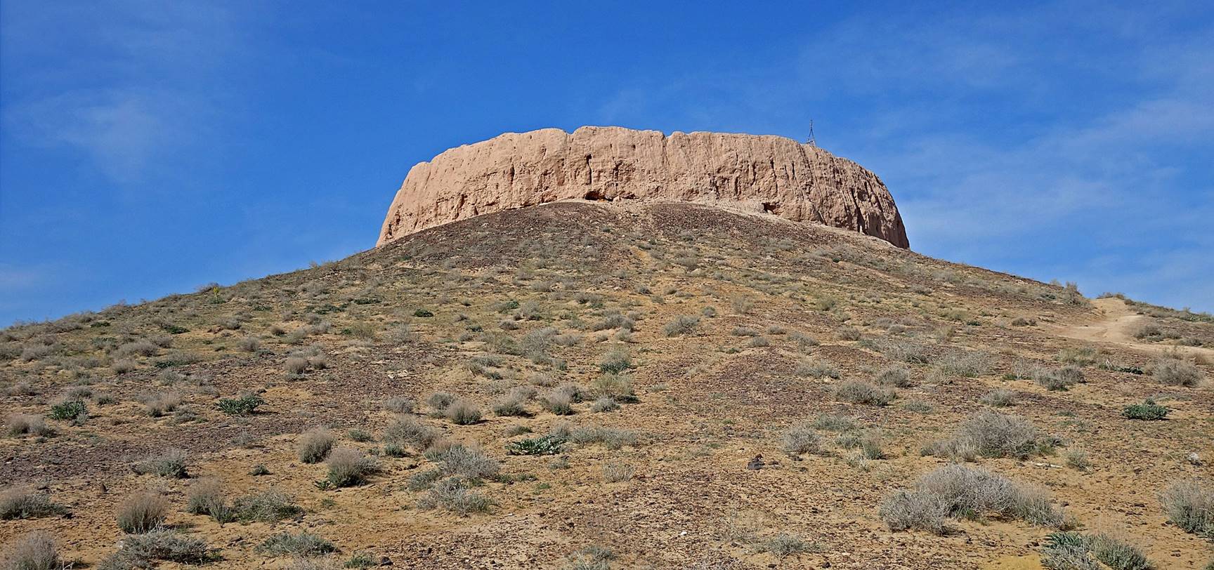
Shilpiq (Chilpik):
For lack of a better place, I included this monument in this page despite the fact that it probably never served as a fortress, although it may look like one. Instead, it is believed to be a tower of silence (a ″dakhma″) built by Zoroastrians for exposing dead bodies to vultures (excarnation). Excavations suggest that it has been used up to the time of the Arab invasion in the 7th century, as Zoroastrianism was the official religion of the region prior to Islam. The approximately circular top of the tower has a diameter of 65 to 70m.
Aerial View.
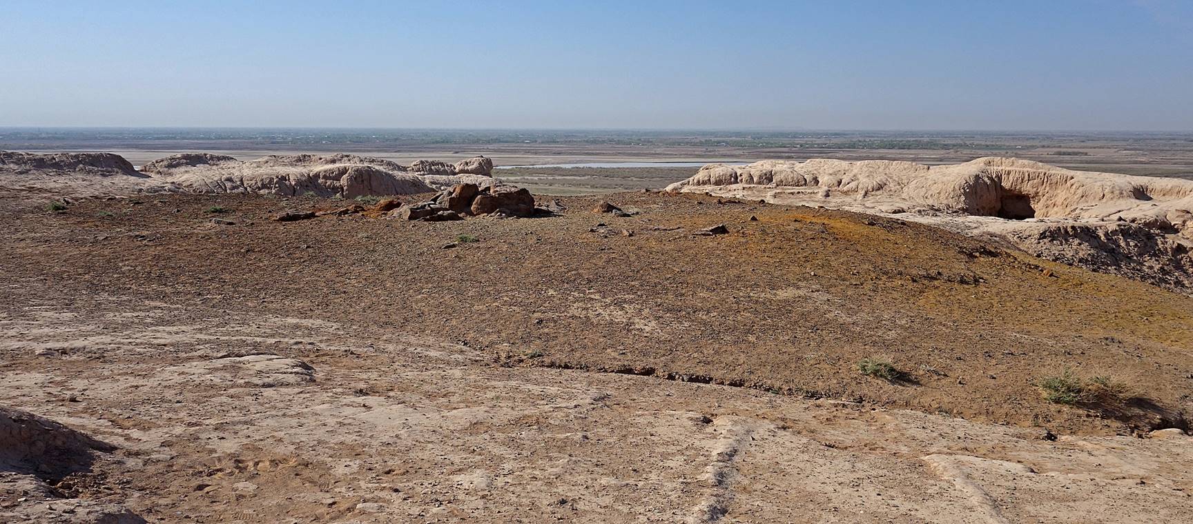
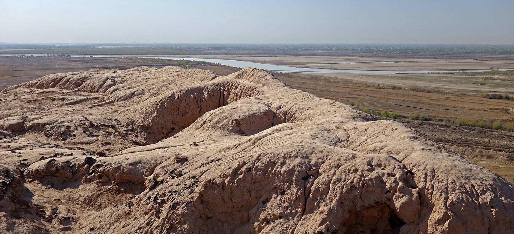
The tower seen from the base.
Platform at the top, with the Amu Daria river and Turkmenistan in the background.
![]()