France, October 2025
(Part 2/2)
![]()
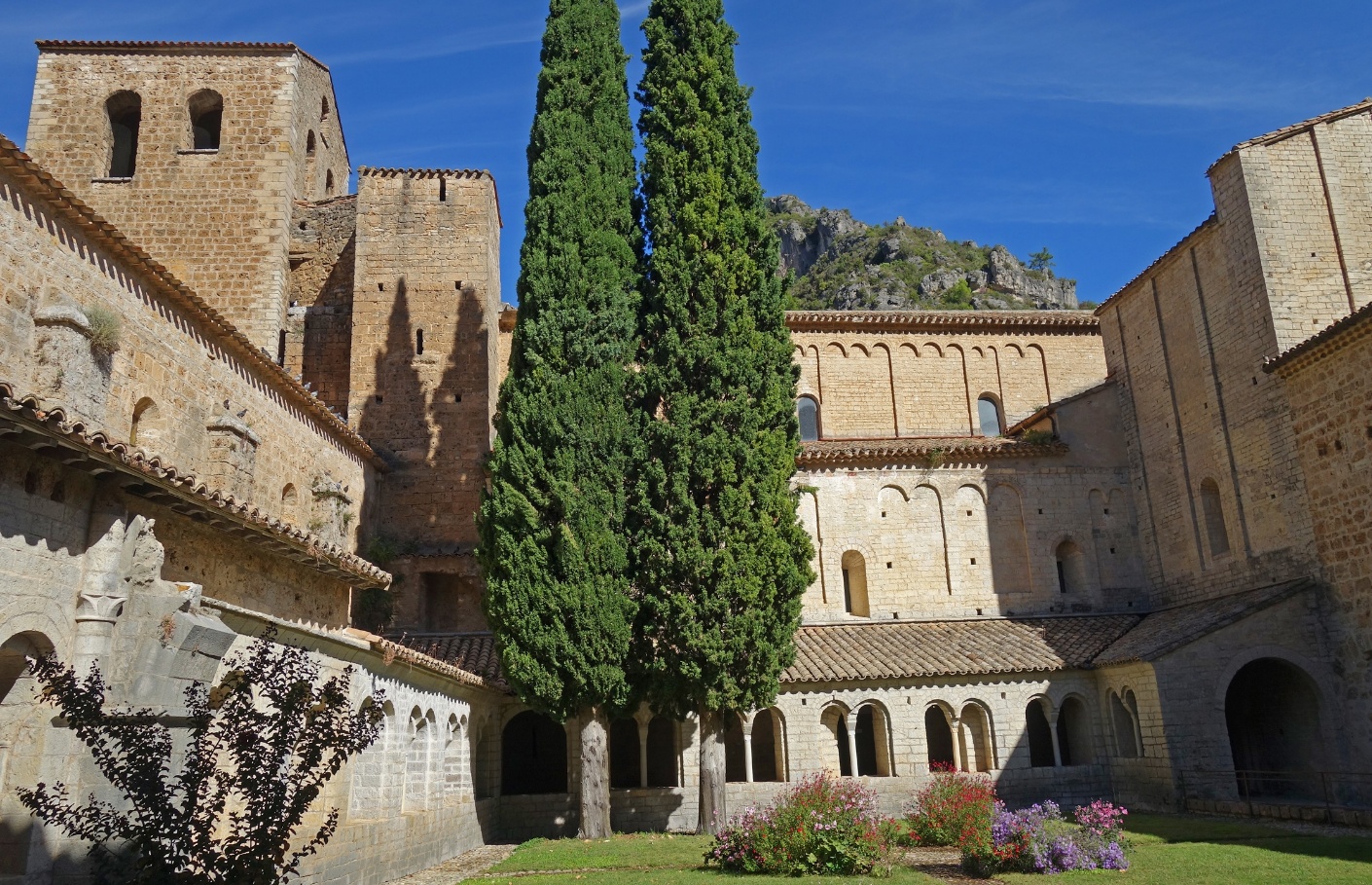
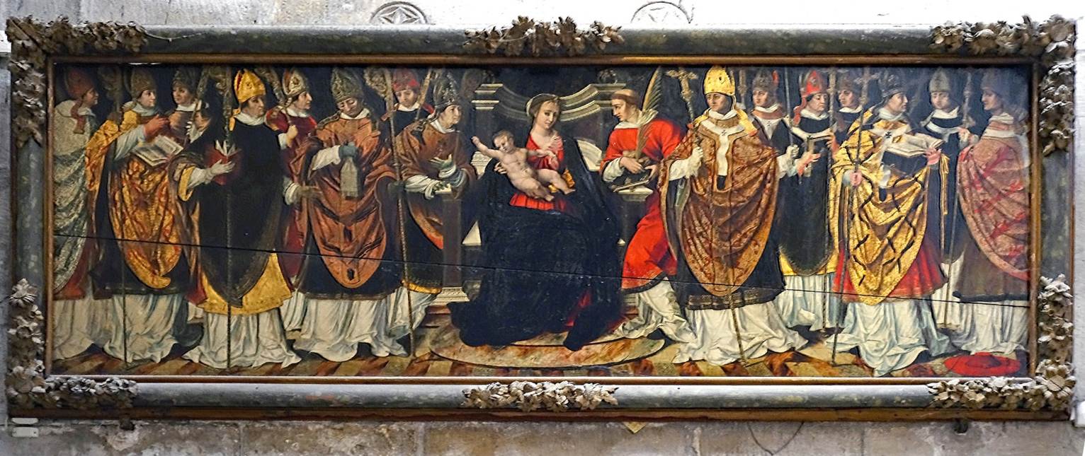
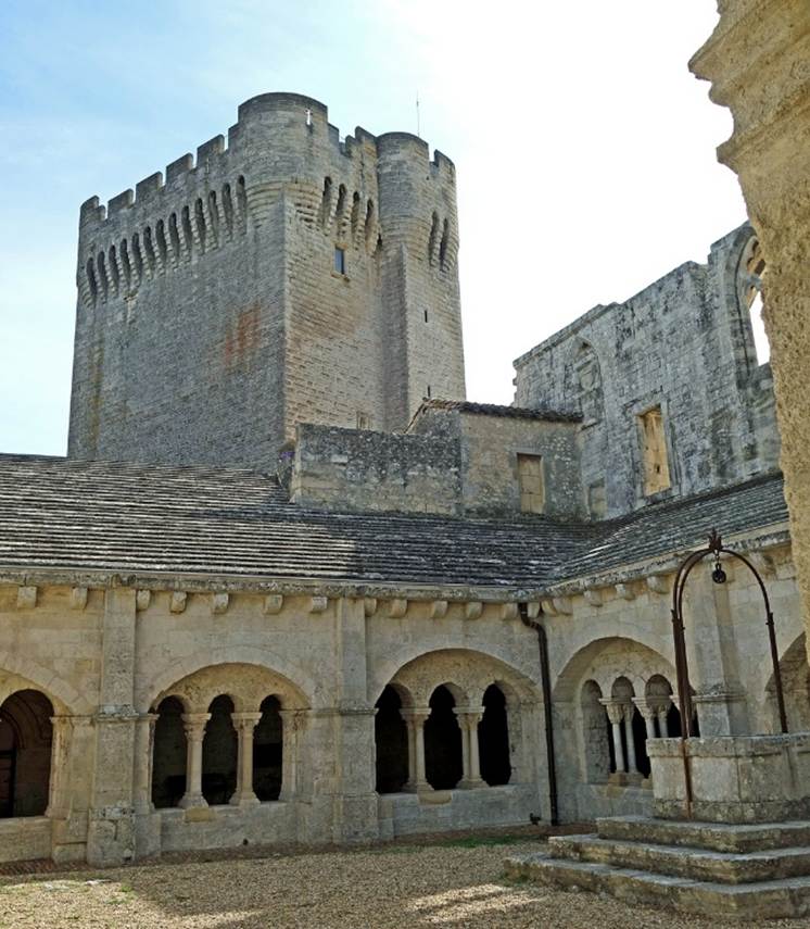
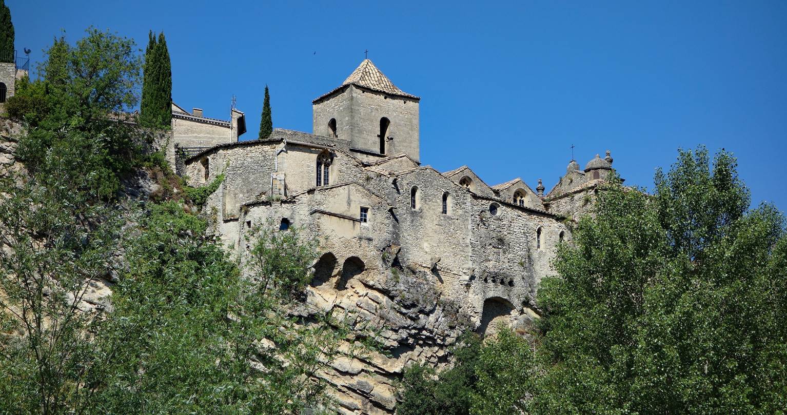
Abbey of Gellone,
Saint-Guilhem-le-Desert (Department of Herault)
The Abbey of Gellone is located in the
heart of Saint-Guilhem-le-Desert, a small medieval village. It was founded in
the early 9th century by Guillaume (Guilhem in Occitan) de Gellone,
cousin of Charlemagne and former Count of Toulouse, who had retired there. From
the late 11th century, it became an important pilgrimage place thanks to its
precious relics (including the remains of Guilhem). By the end of the 12th
century, the abbey is said to have housed up to a hundred monks. In 1568, it
was captured and damaged by Protestants. Later, in 1644, a group of Benedictine
monks took possession of the abbey and restored it. After the French
Revolution, a cotton mill and tannery were established in the abbey, the
cloister was used as a stone quarry, and sculptures were sold to antique
dealers. It was not until 1840 that the abbey obtained state protection. Since
then, successive restorations have been undertaken.
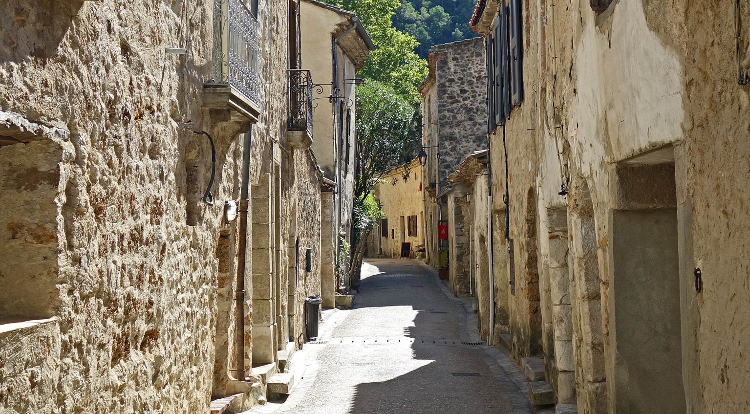
In the street named ″Chemin du Bout du Monde″ (″Path
to the End of the World″) leading, despite its name, to the small square
(Place de la Liberte) where the entrance of the abbey is located.
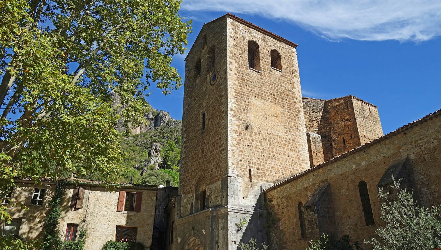
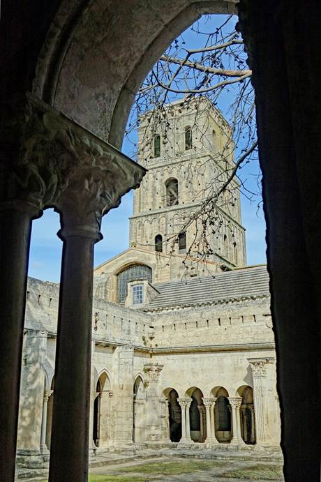
Bell tower of the abbey church, overlooking the Place de la
Liberte.
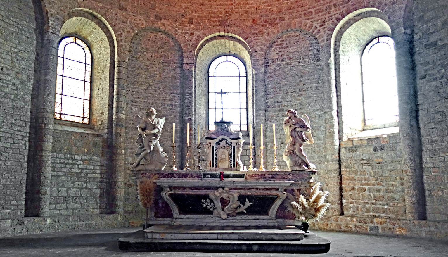
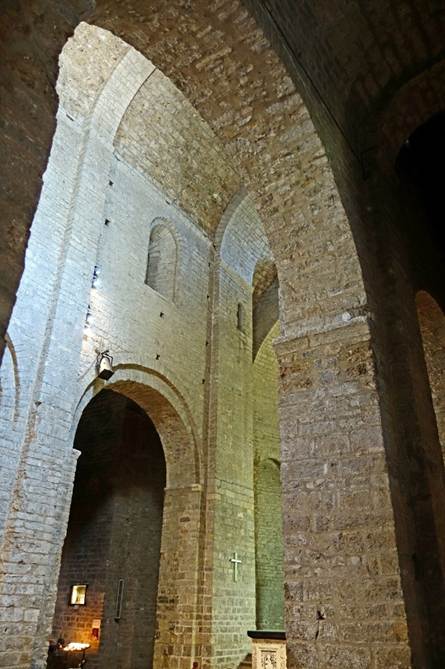
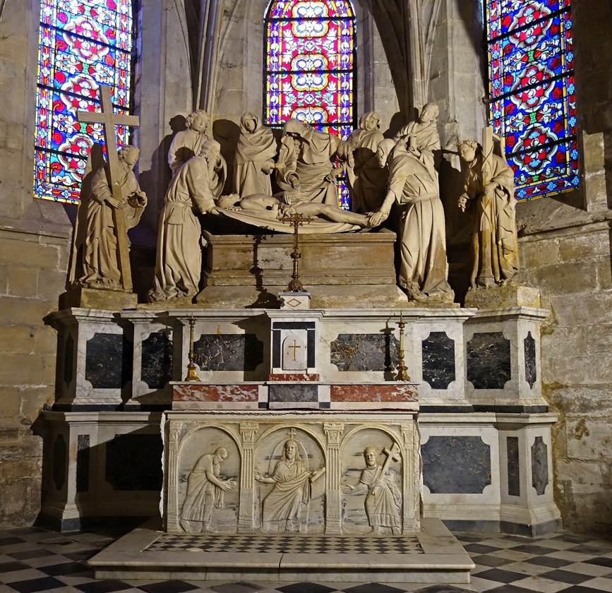
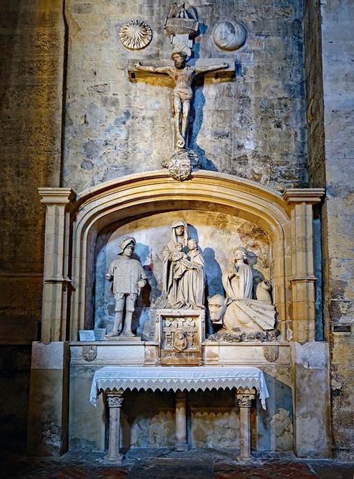
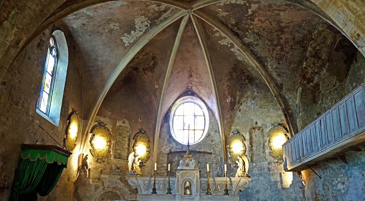
Altar in the apse of the abbey church.
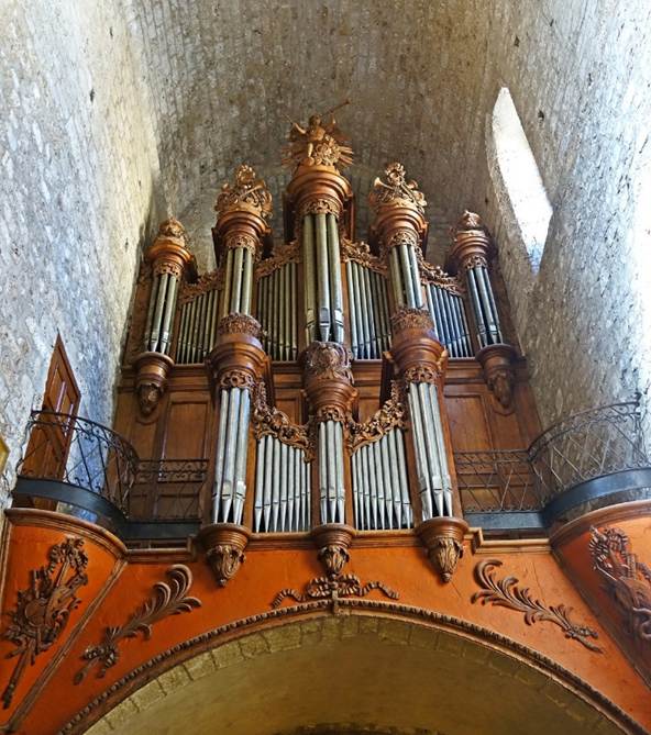
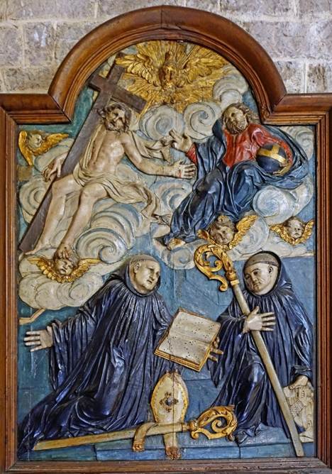
Other views inside the abbey church, from left to right: pipe
organ, nave, and framed bas-relief.
|
|
|
|
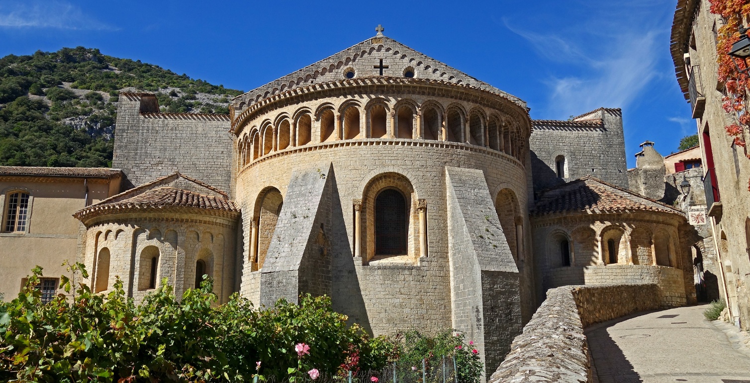
Exterior view of the apse of the abbey church.
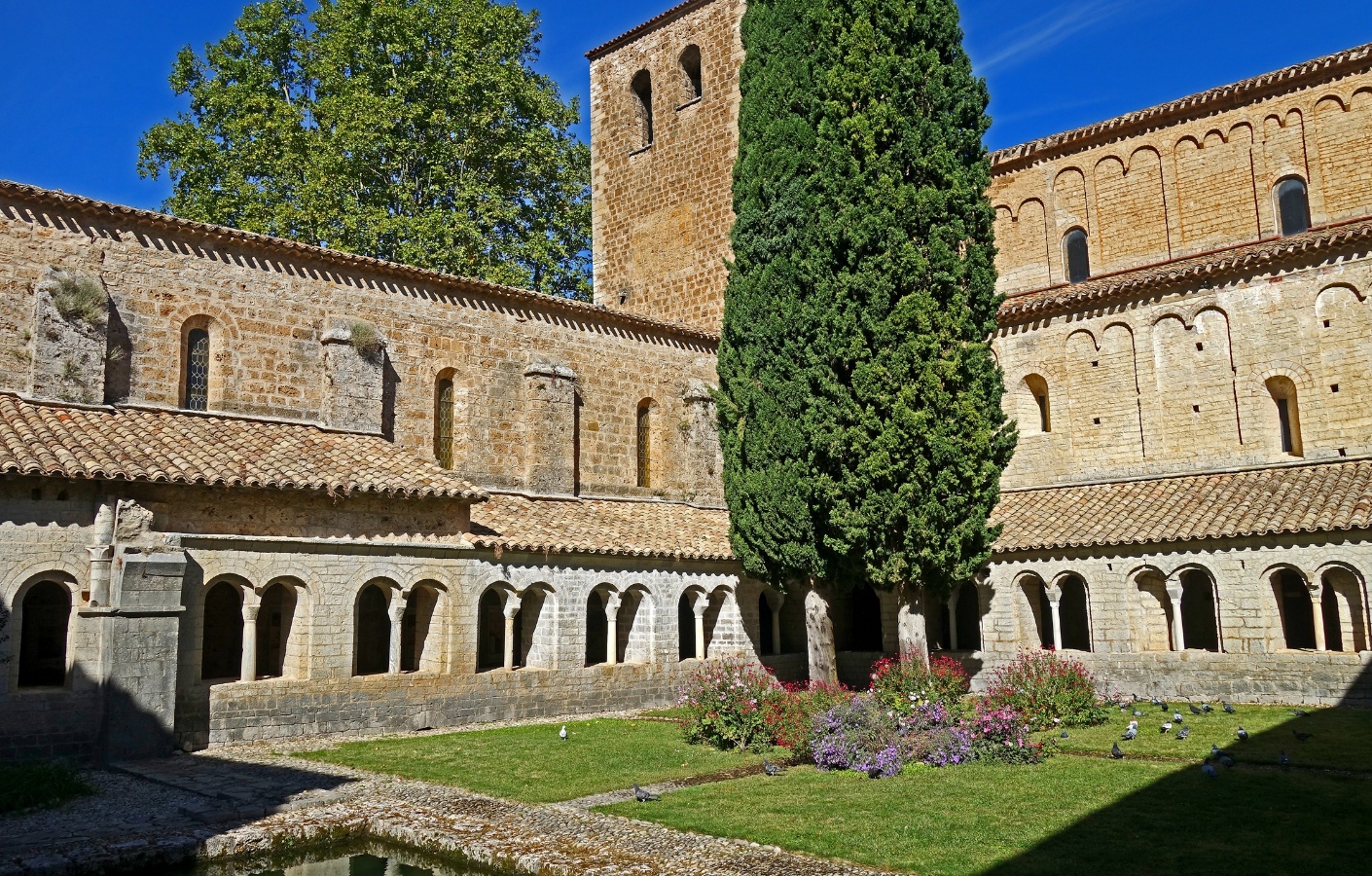
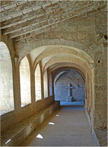
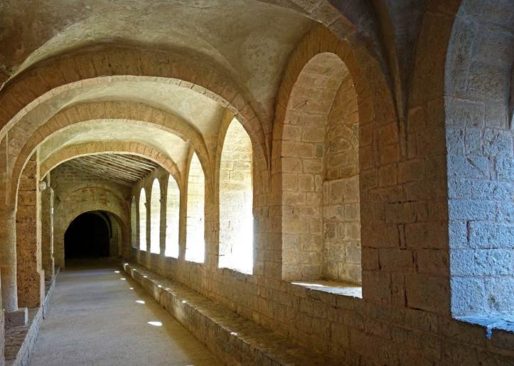
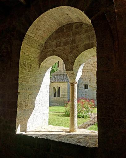
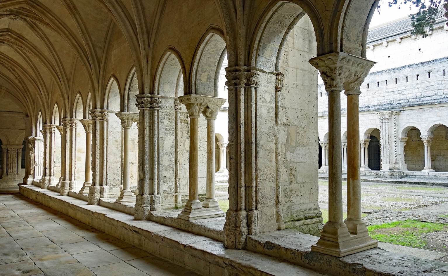
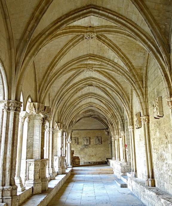
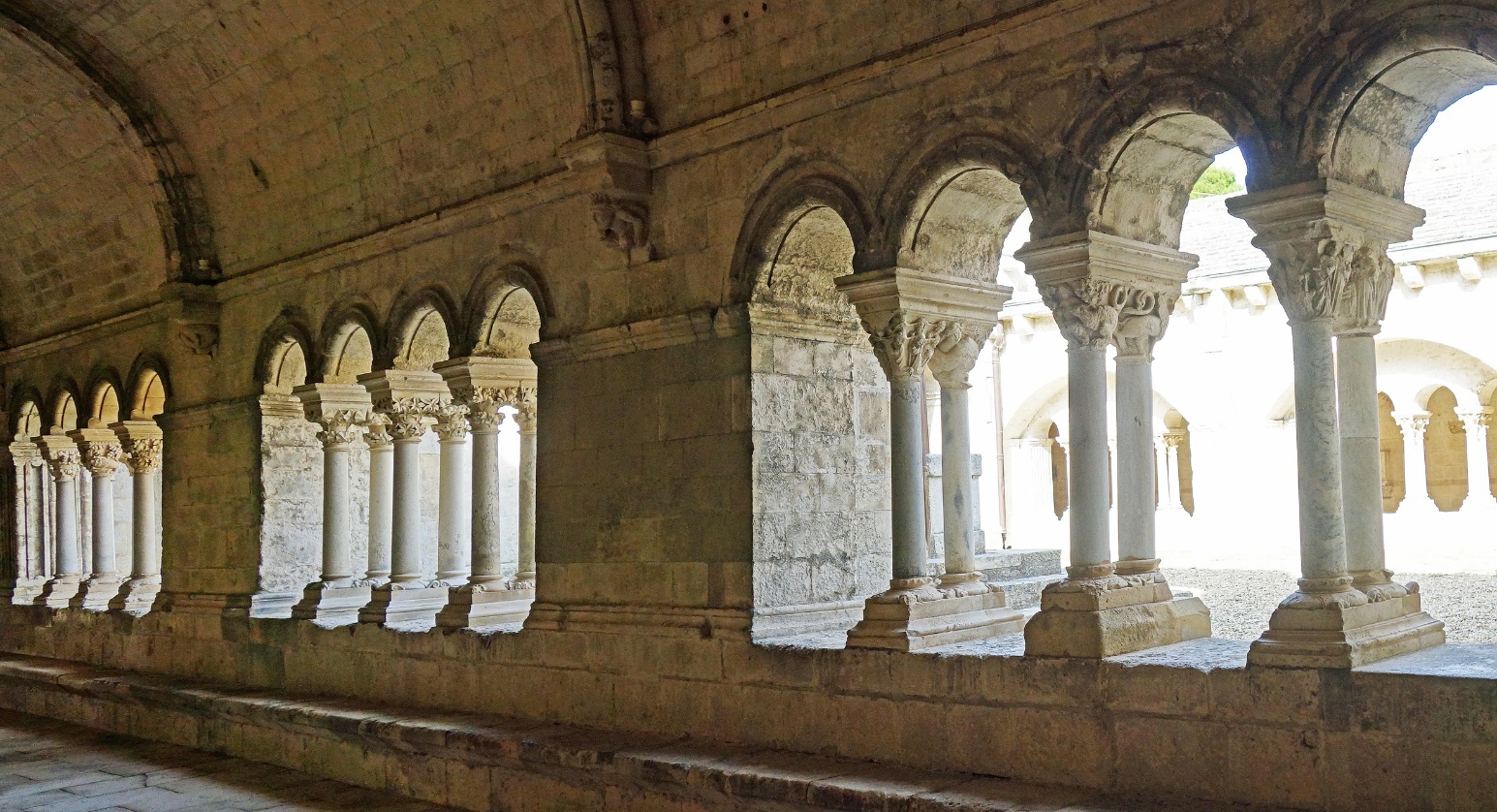
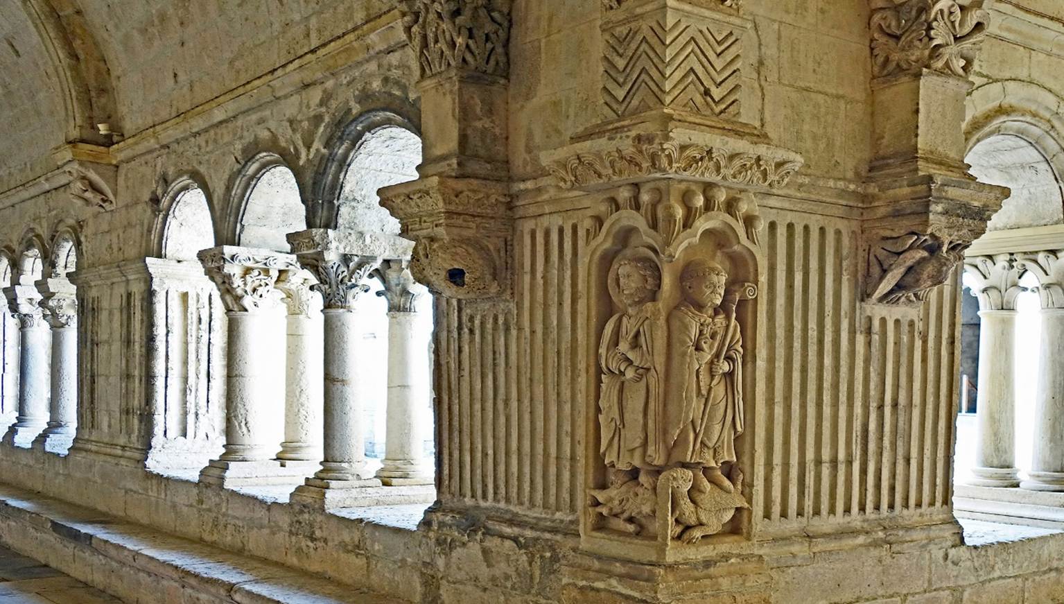
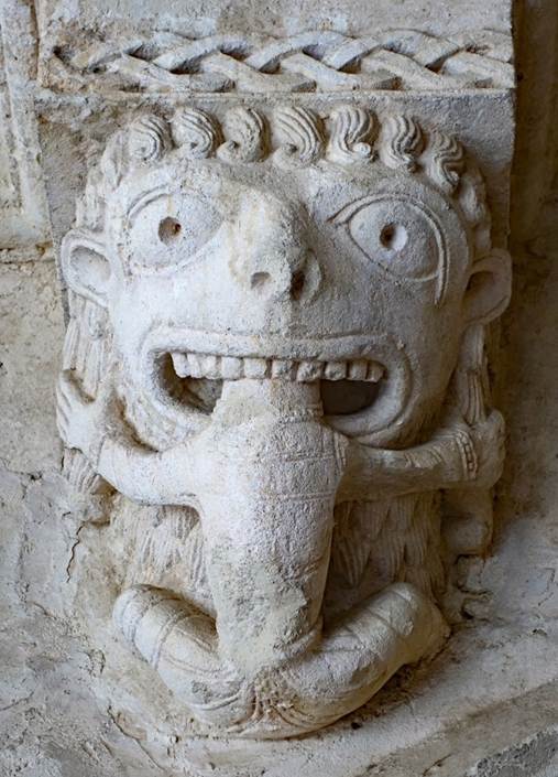
Cloister of the abbey.
|
|
|
|
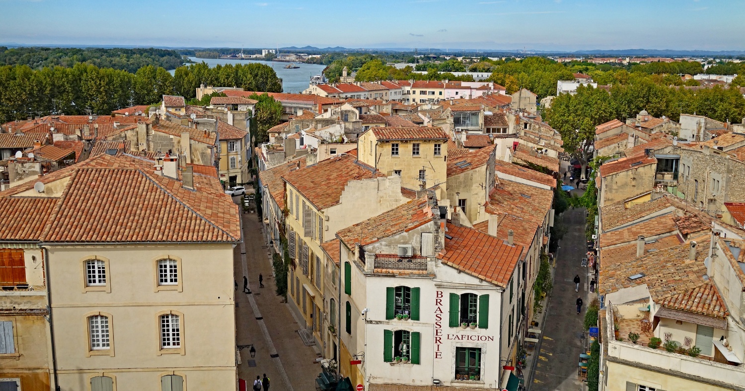
Arles (Department of Bouches-du-Rhone)
View over old houses of Arles from the upper level of the Roman
amphitheater, with the Rhone visible in the background.
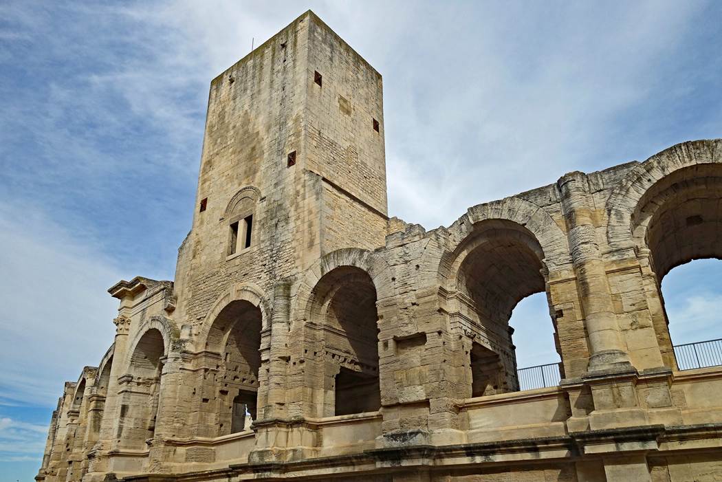
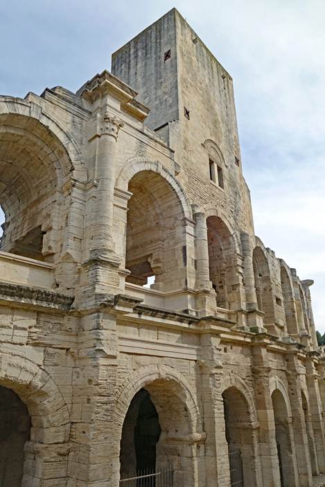
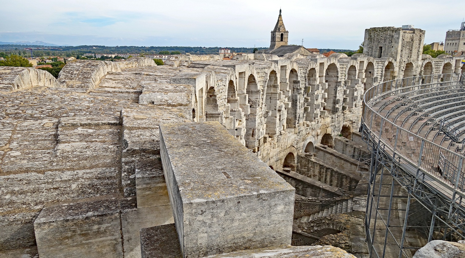
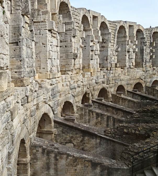
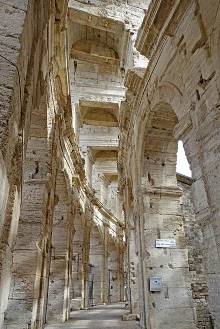
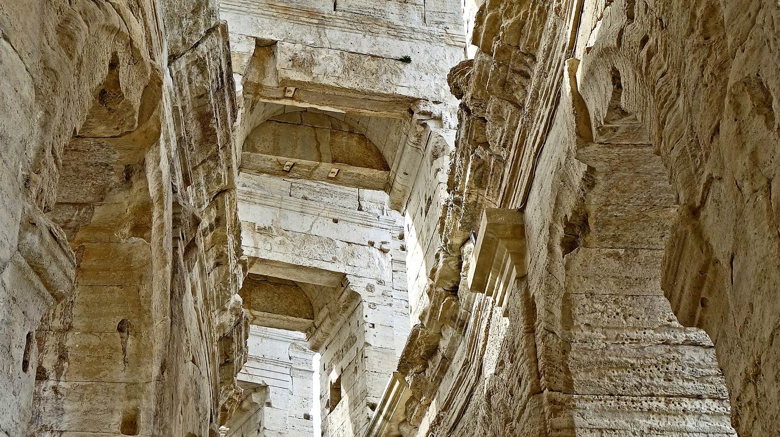
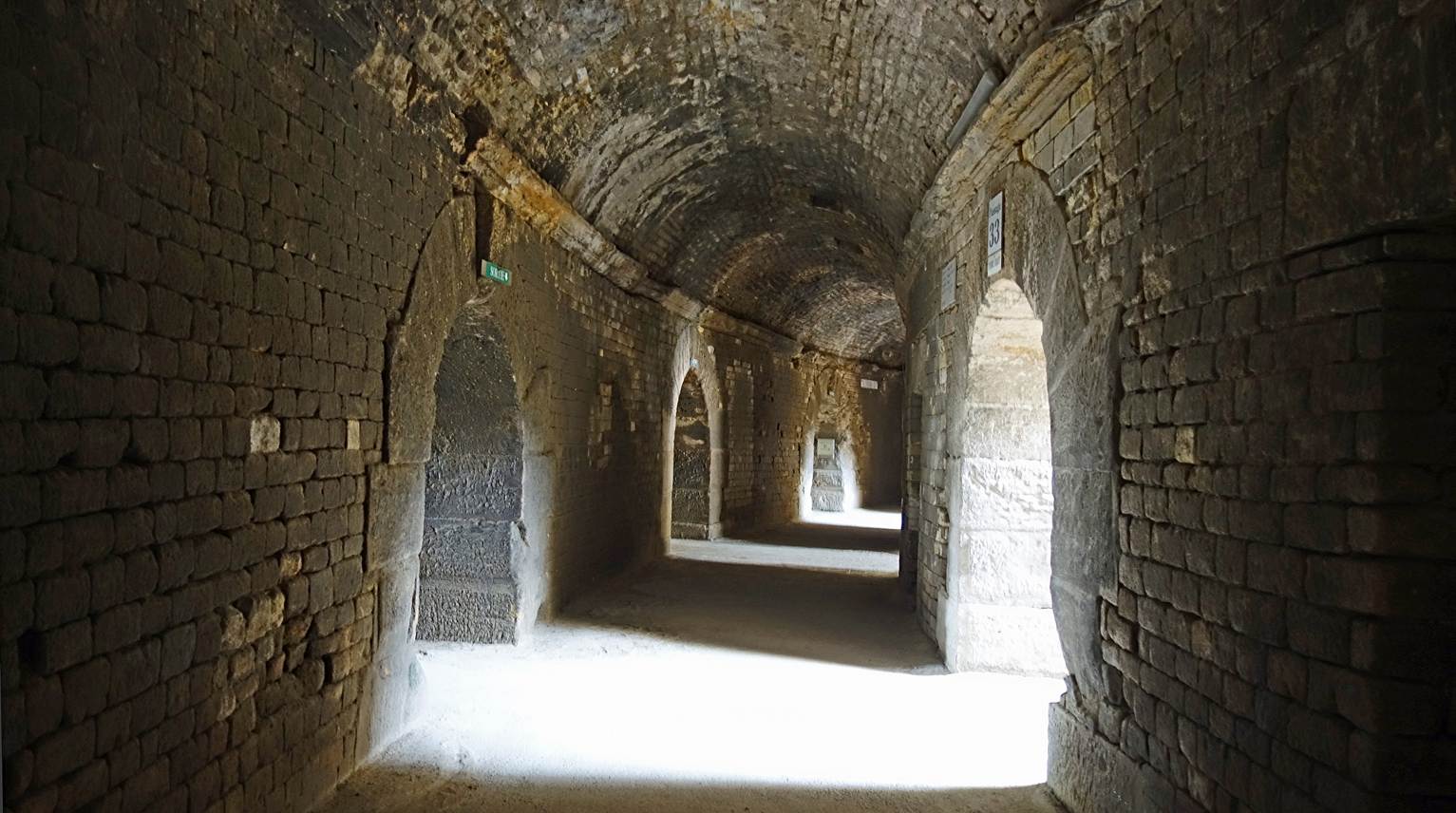
Views of the Roman amphitheater built around 90CE. Its oval-shaped
arena is surrounded by two levels of galleries bordered by arcades above a
ground-level passage. The entire building measures 136mx109m and could
accommodate 20,000 spectators in Roman times. After the fall of the Western
Roman empire, it was transformed into a fortress by adding four towers. Houses
were built inside this fortress, eventually forming a real small town. These
houses were removed between 1826 and 1830, and in 1830 a bullfight took place
in the arena to celebrate the capture of Algiers.
- Views of the arcades, their galleries, and some of the added
towers.
|
|
|
|
|
|
|
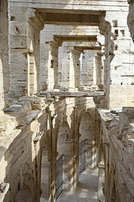
- Ground-level passage giving access to the arena.
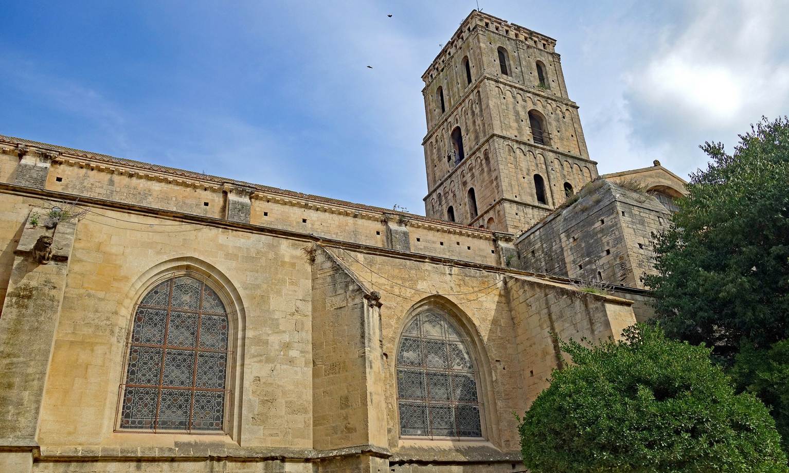
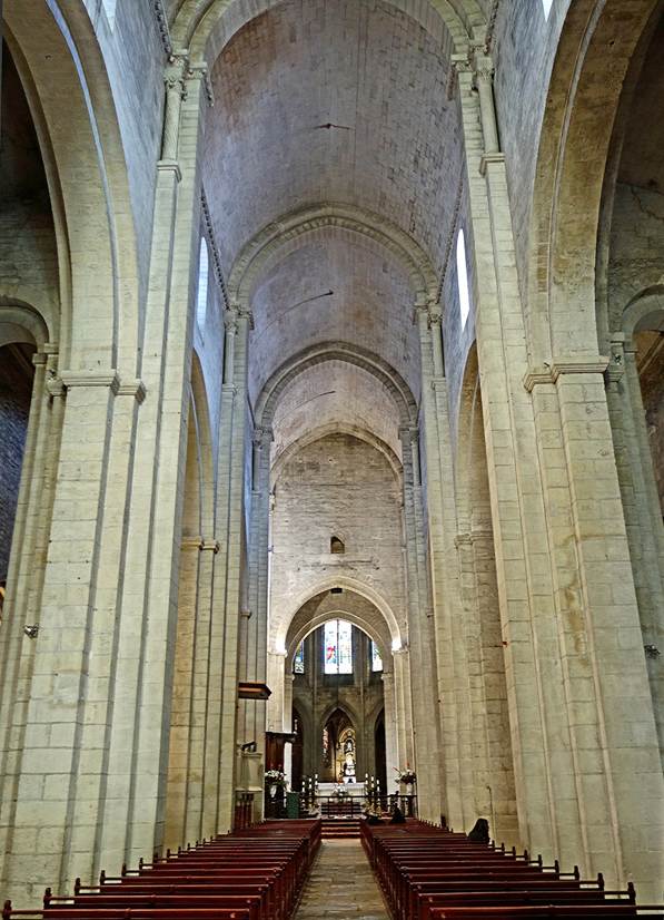
Church of Saint Trophime, built between the 12th
and 15th centuries in the Romanesque architectural style.
- Partial view of the church and its bell tower.
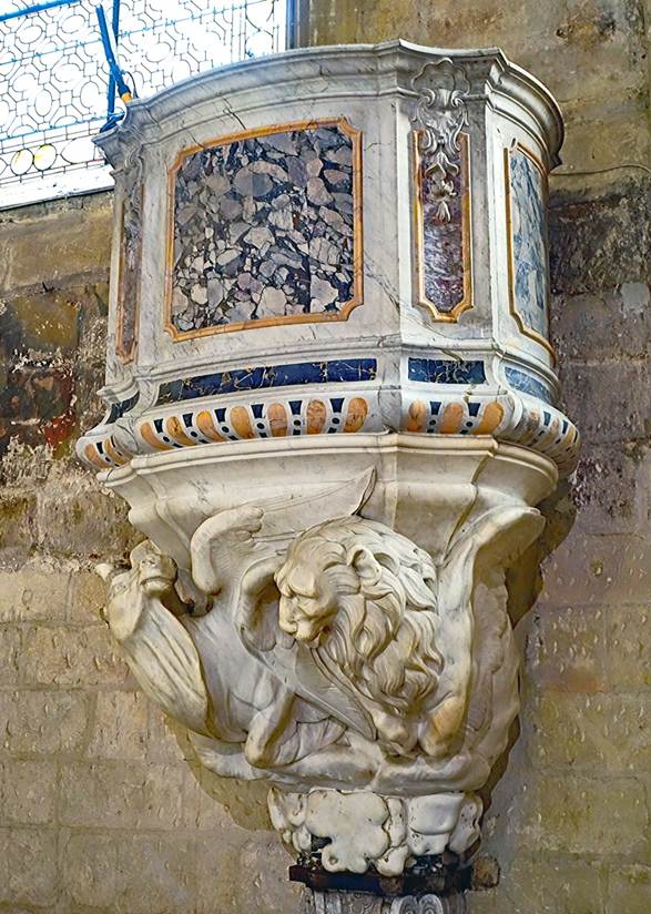
- Nave and pulpit.
|
|
|
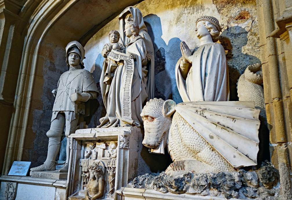
- Left: Chapel of the Holy Sepulcher with statues above the altar
depicting the Entombment of Christ. Right: Chapel of Saint Genes (see next
photo).
|
|
|
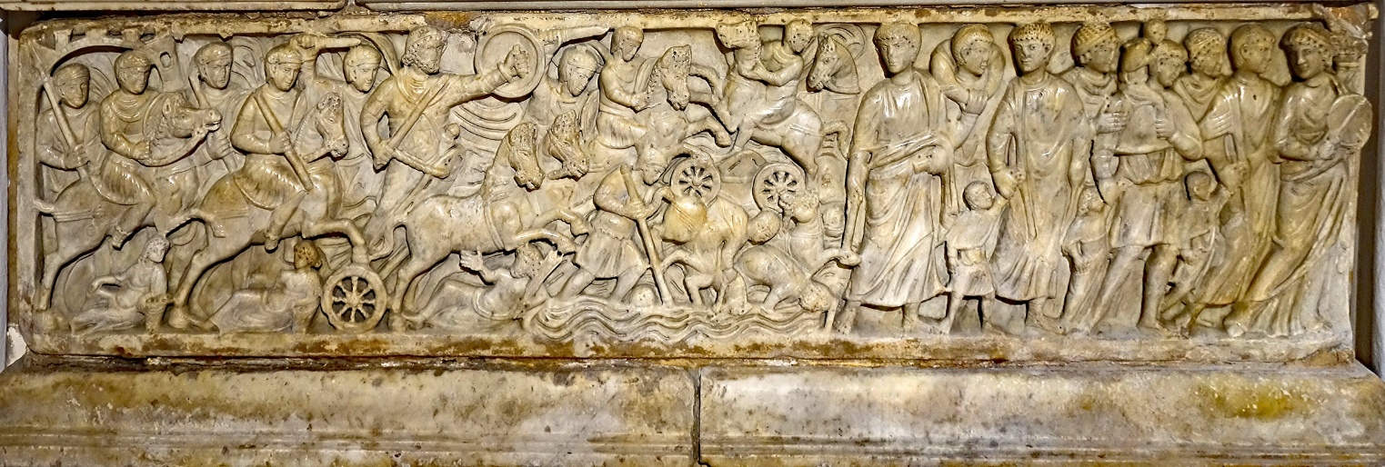
- The altar of the chapel of Saint Genes (pictured above, on the
right) is a 4th-century sarcophagus decorated with a finely carved bas-relief
depicting the crossing of the Red Sea by the Hebrew people led by Moses. On the
left, the Egyptian army is shown struggling against the rising sea level. On
the right, the Hebrew people are shown crossing on dry land. In between, Moses
is depicted with a staff, ordering the waters to close again.
- Another finely carved 4th-century sarcophagus.
- Painting on wood executed at the end of the 16th century. It is
believed to represent the Council of Marseille, placed under the patronage of
the Virgin Mary to judge the Bishop of Riez, the sixth figure from the left,
accused of having diverted Church property for his own benefit. He is depicted
holding a purse.
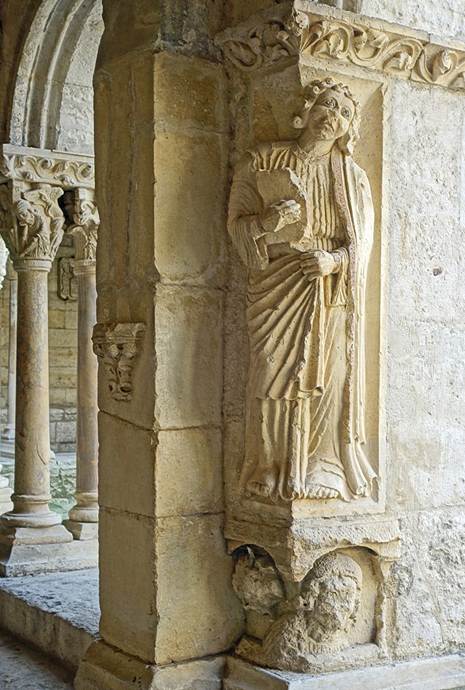
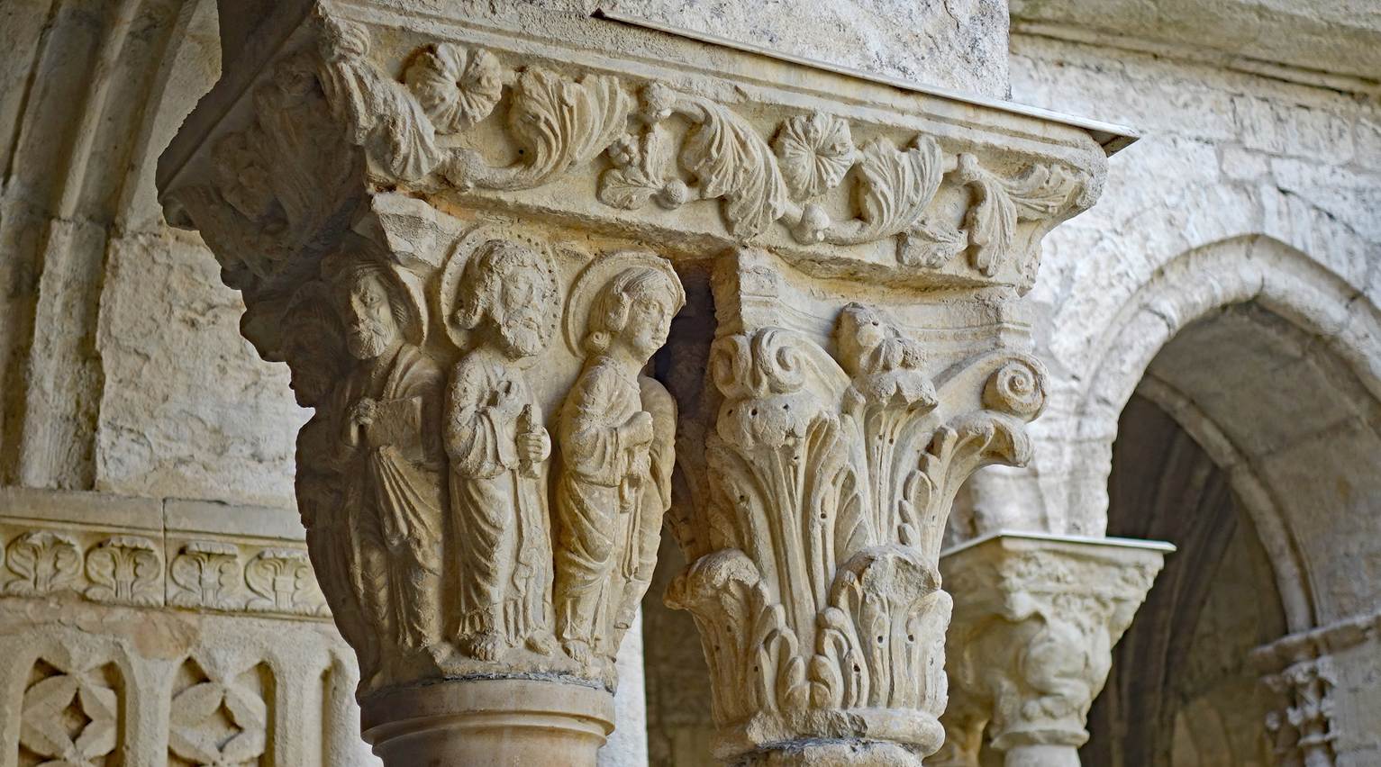
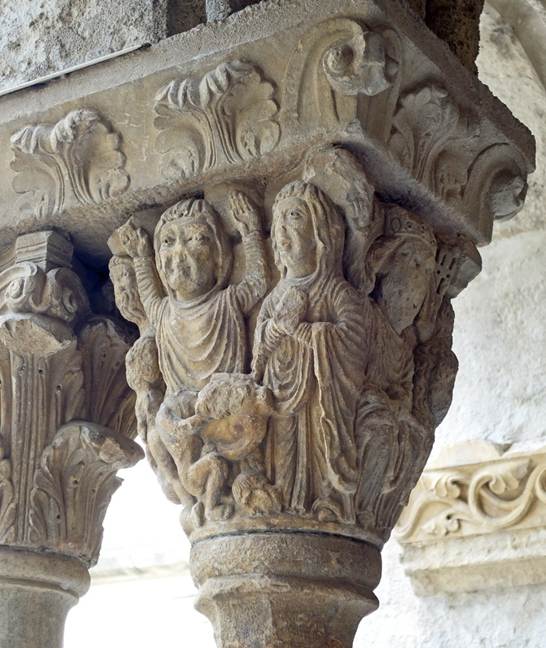
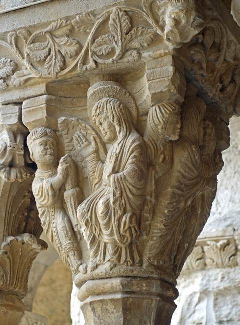
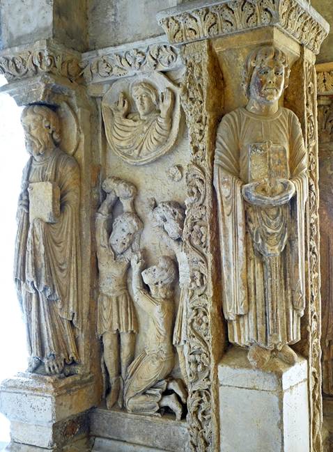
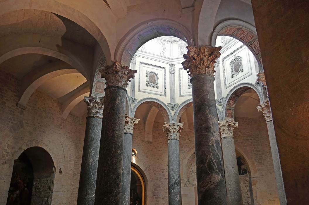
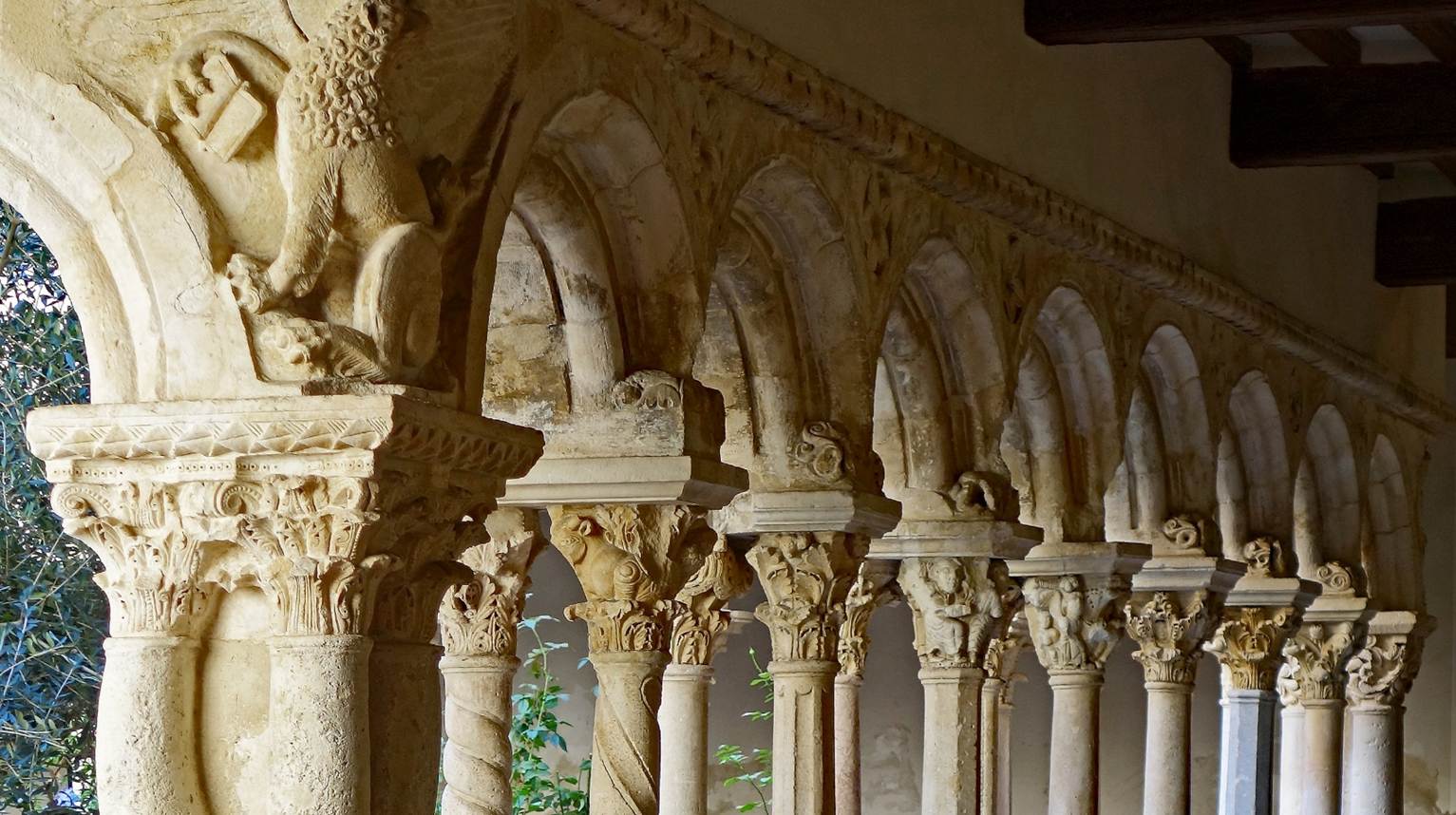
Saint-Trophime cloister. It was built at
about the same time as the church and is located next to it. It is remarkable
for the high quality of its sculpted decorations.
|
|
|
|
|
|
|
|
Abbaye de Montmajour
(Department of Bouches-du-Rhone)
This abbey stands on a rocky outcrop emerging from
surrounding wetlands, 2.5km northeast of the historic center of Arles. Founded
in 948 by Benedictine monks, it began as a small abbey, but its influence grew
in the 11th century as it became the necropolis of the Counts of Provence and
established a large network of priories. In the 12th century it had become a
major pilgrimage destination, with large groups of pilgrims coming by boats on
the Rhone. New buildings, including a larger church, were erected. In the 13th
and 14th centuries, famine, plague, wars, and roving ″companies″ of
unemployed soldiers during periods of peace prompted the fortification of
existing buildings and the construction of the Pons-de-l'Orme, a tall defensive keep. In the 15th
century, disputes over relics with other local communities and with the
hierarchy of the Catholic Church led to the decline of the abbey's influence.
It lost its independence and the abbots became appointed by powerful figures,
rather than elected by monks. In the 17th century a new congregation of Maurist monks took over the abbey. They built a large new
building, the ″Saint-Maur monastery″, the most recent construction
on the site. In 1786, the abbey was secularized after the deposition of its
last abbot, Cardinal de Rohan, who was implicated in a famous fraud known as
the ″Affair of the Queen's Necklace″ that took place in 1784-1786.
During the French Revolution, the abbey buildings were severely damaged, but
were partially restored in the 19th century. The abbey became state property in
1945.
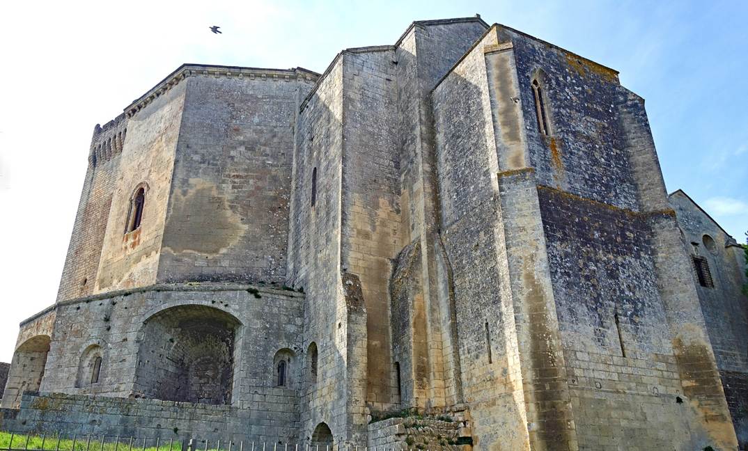
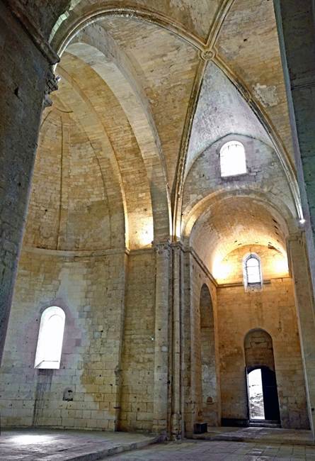
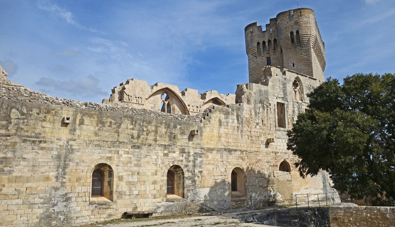
Left: One of the largest fortified buildings of Montmajour, which includes the large abbey church built in
the 12th century. Right: Interior of this abbey church.
|
|
|
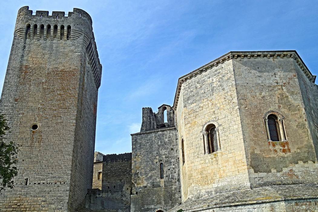
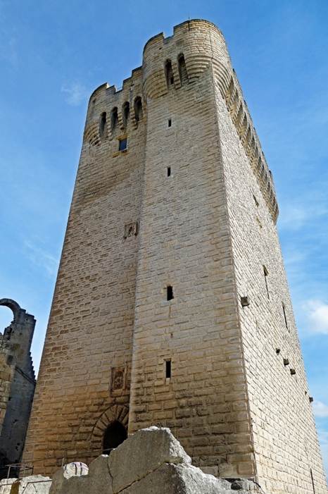
Left photo: The Pons-de-l'Orme, the 26m-high
defensive keep built in the 14th century, and the apse of the abbey church.
Right photo: Another view of the Pons-de-l'Orme.
|
|
|
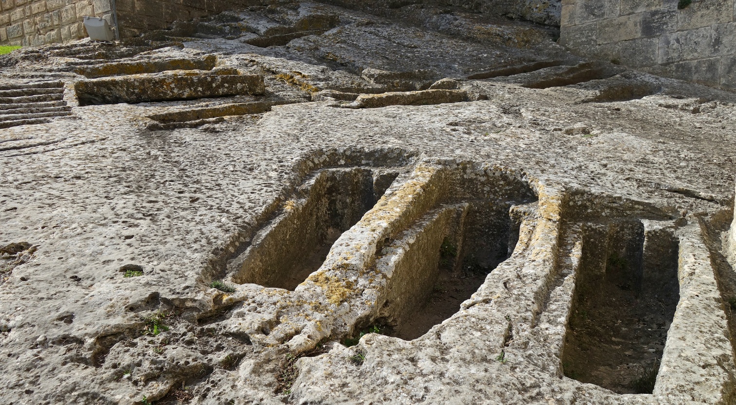
Rock-hewn tombs located at the base of the church apse and the
keep. Most of them predate the founding of the abbey and were used by hermits
living there. Others were dug later and used by monks.
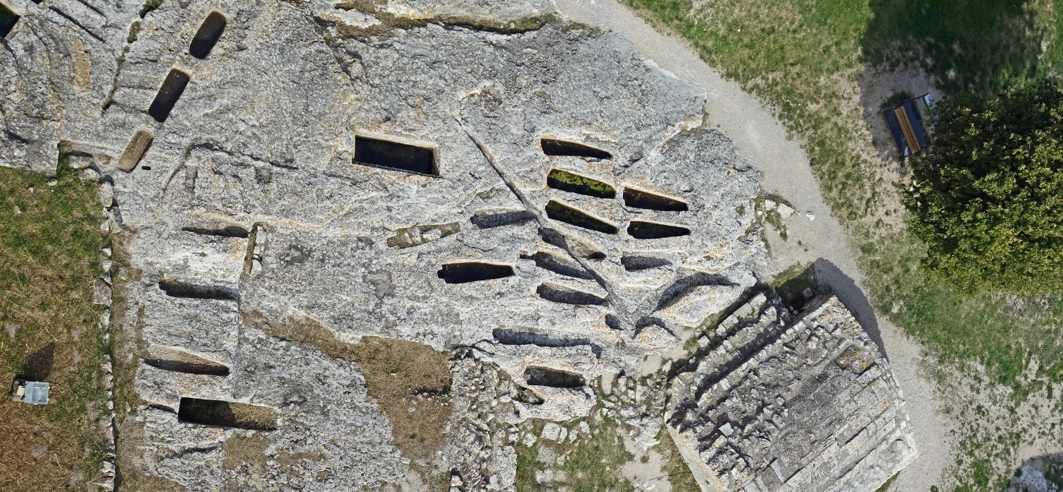
The rock-hewn tombs seen from the top of the keep.
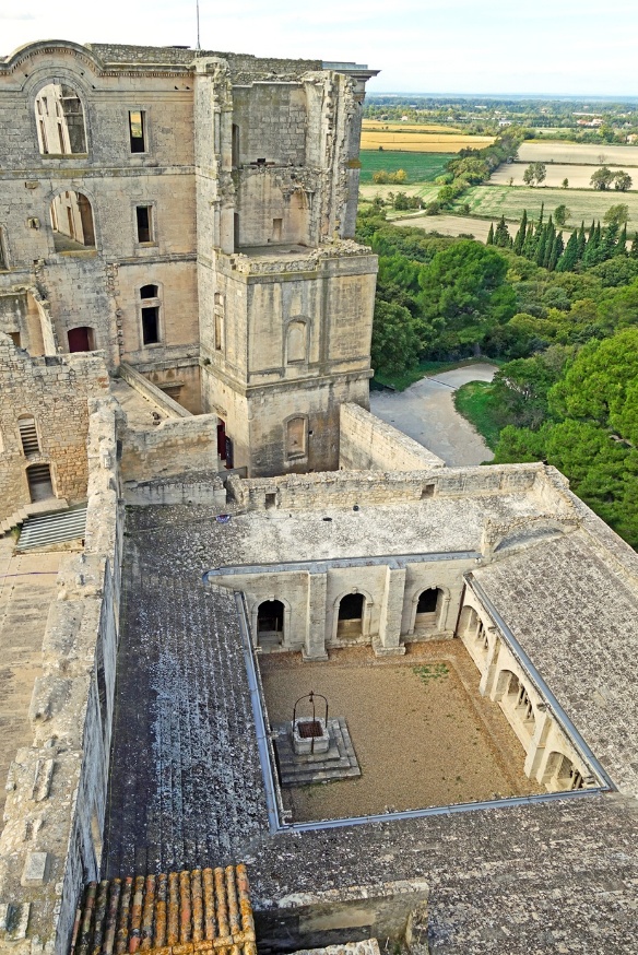
Left: The cloister and the Saint-Maur monastery seen from the top
of the keep. Right: The cloister's courtyard, with the keep in the background.
|
|
|
In the cloister's covered walkway.
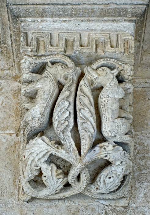
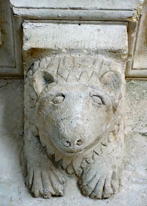
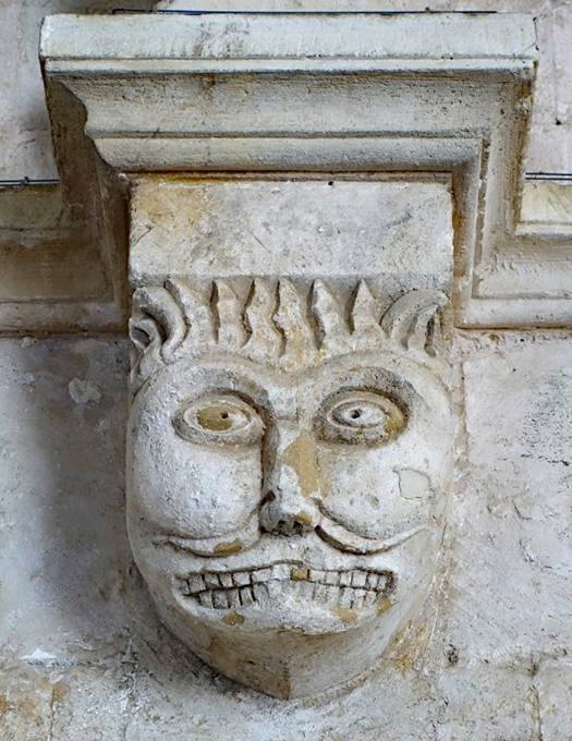
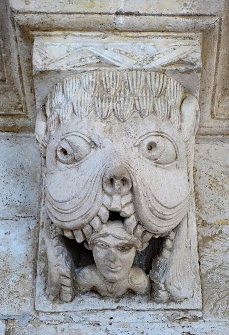
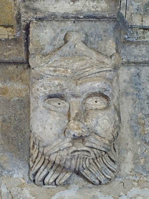
A fantastic bestiary: here are some photos of the sculpted
consoles that adorn the bases of the arches in the cloister's walkway.
|
|
|
|
|
|
|
|
Remains of the wall of the monks' refectory, with the upper arches
of the cloister visible behind.
Aqueduct of Barbegal
(Department of Bouches-du-Rhone)
Located 8km northeast of the center of Arles, this
Roman aqueduct bridge was built in the late 1st century CE. It is part of a
longer canal supplying Arles with water. This aqueduct is unusual: it consists
of two adjacent bridges running north to south. Initially, both bridges ended
at the same basin from which a single conduit supplied Arles. But in the 2nd
century, the eastern branch of the aqueduct was diverted to feed flour mills
located on a steep slope below. It is estimated that these mills could produce
4.5 tons of flour per day, partly to feed the people of Arles, partly to
produce bread for the Roman navy.
View of two arches of the western branch of the aqueduct. Fallen
parts of the eastern branch are visible behind.
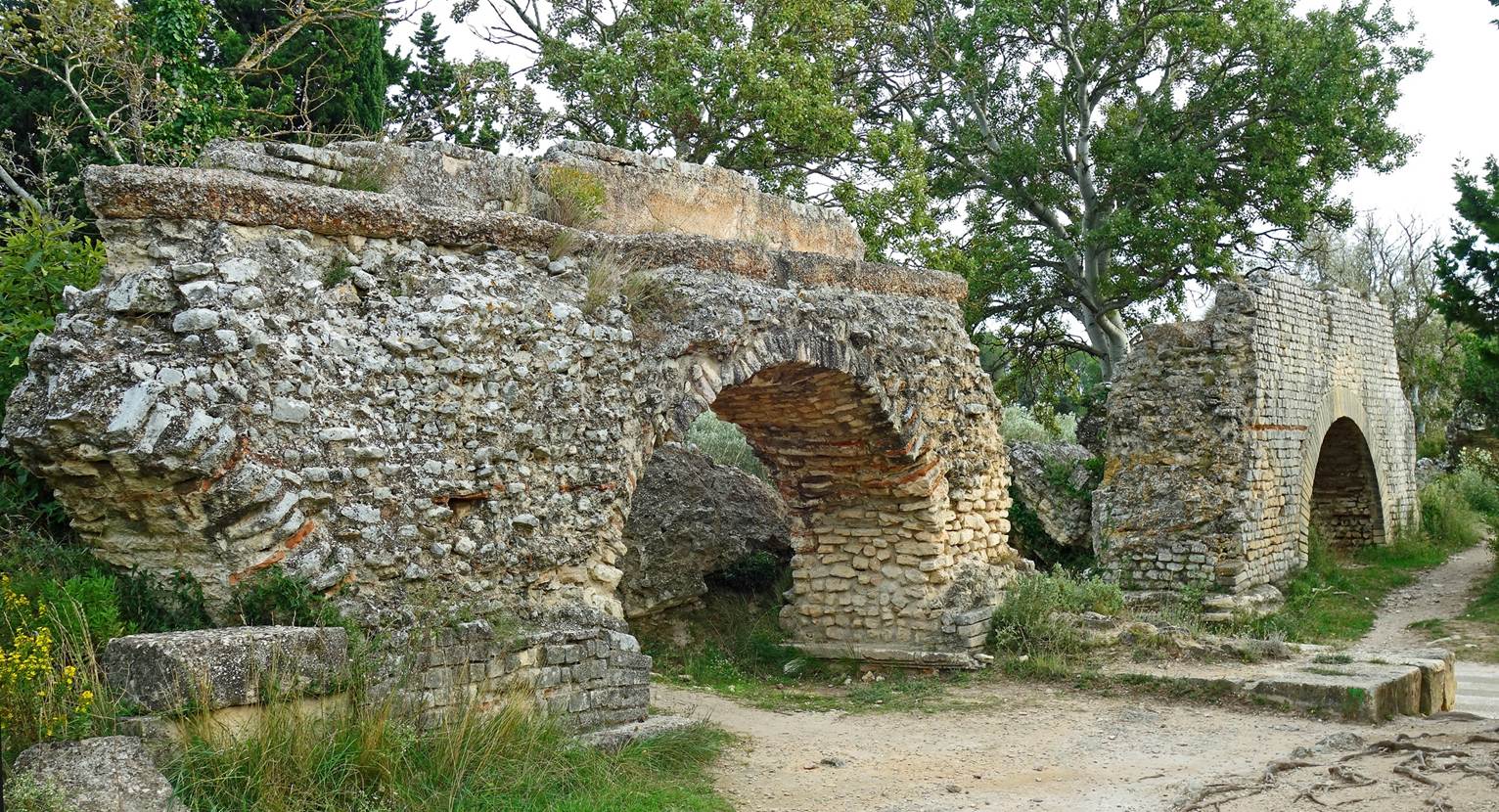
Another section of the aqueduct.
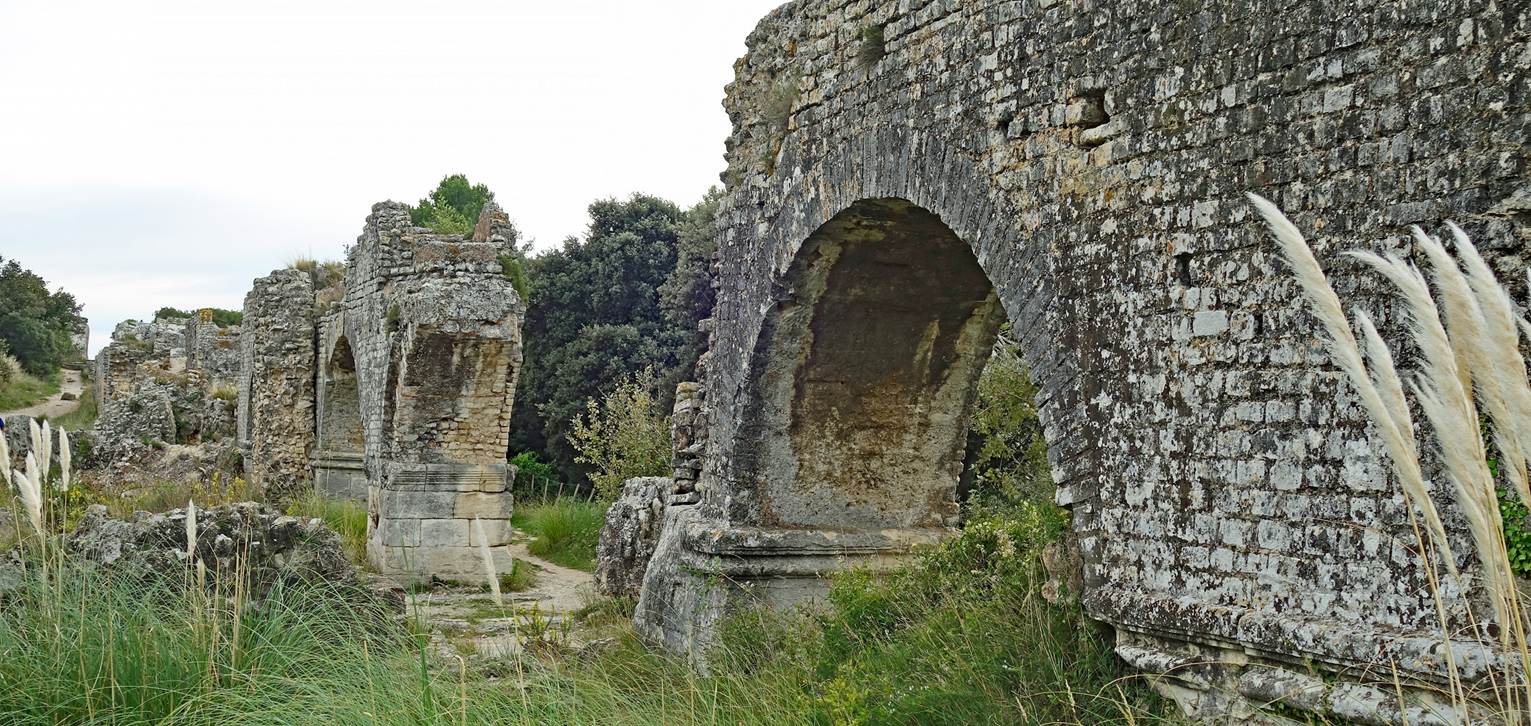
Trench cut into the rock to divert water from the eastern branch
to the mills below.
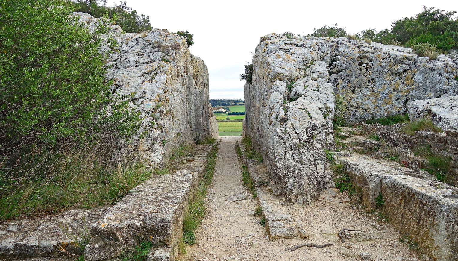
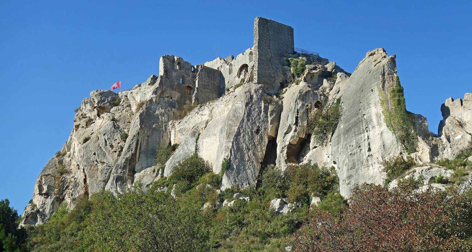
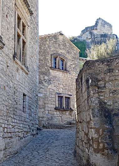
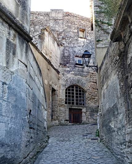
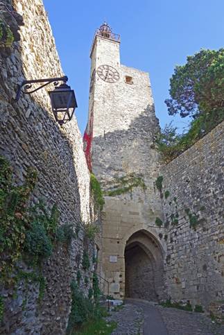
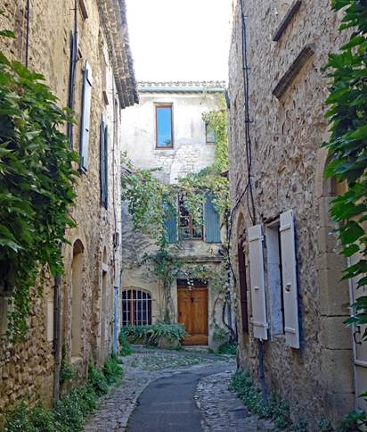
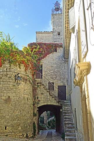
Les Baux-de-Provence (Department of Bouches-du-Rhone)
Located in the small Alpilles massif,
this medieval village is built on an impressive rocky spur. From their fortress
built in the 11th-13th centuries, the princes of Les Baux controlled a large
part of Provence for many years.
View of the fortress on top of the rocky spur.
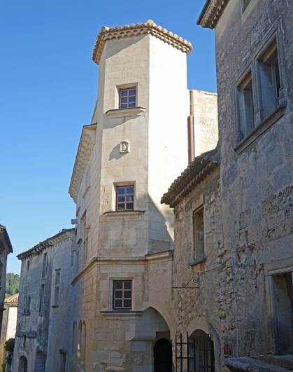
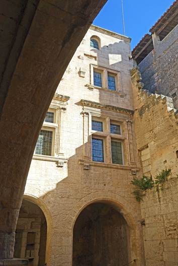
In the cobbled streets of the village.
|
|
|
|
|
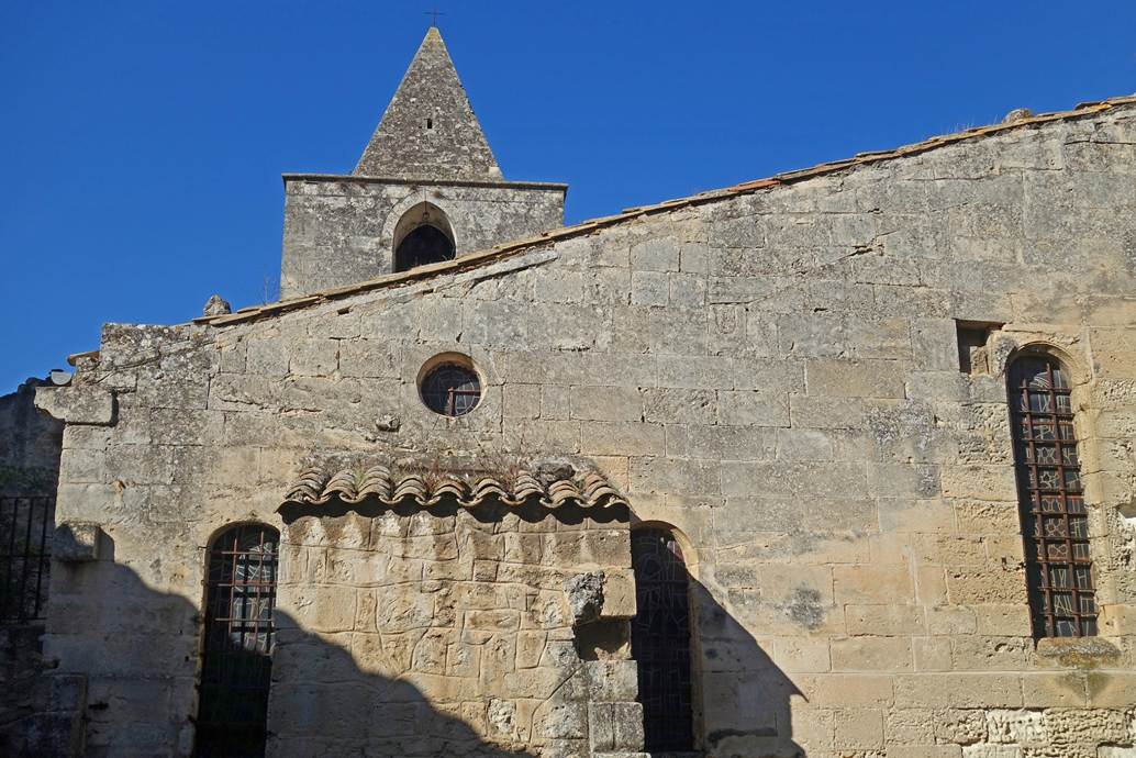
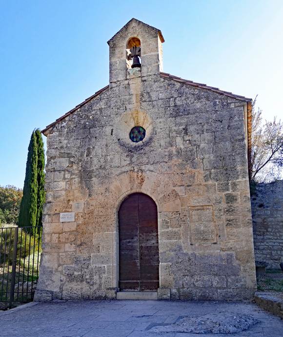
Simple church and chapel in the village.
|
|
|
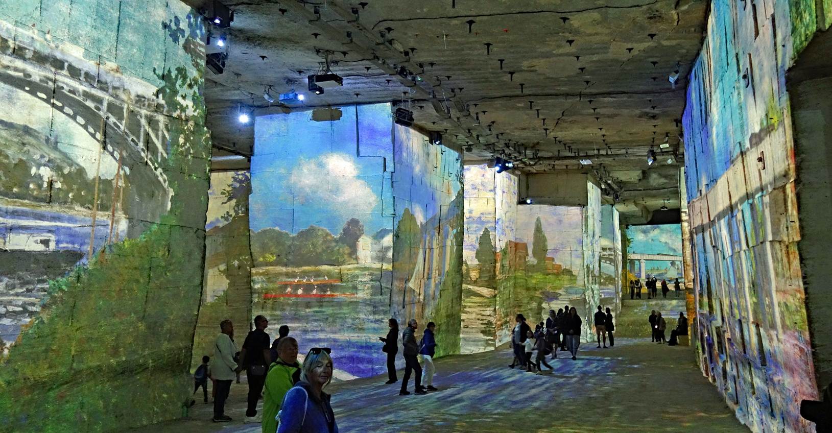
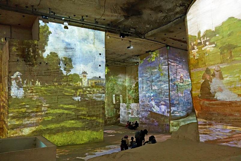
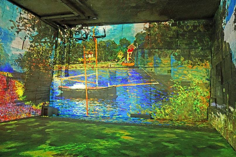
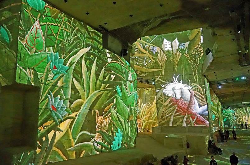
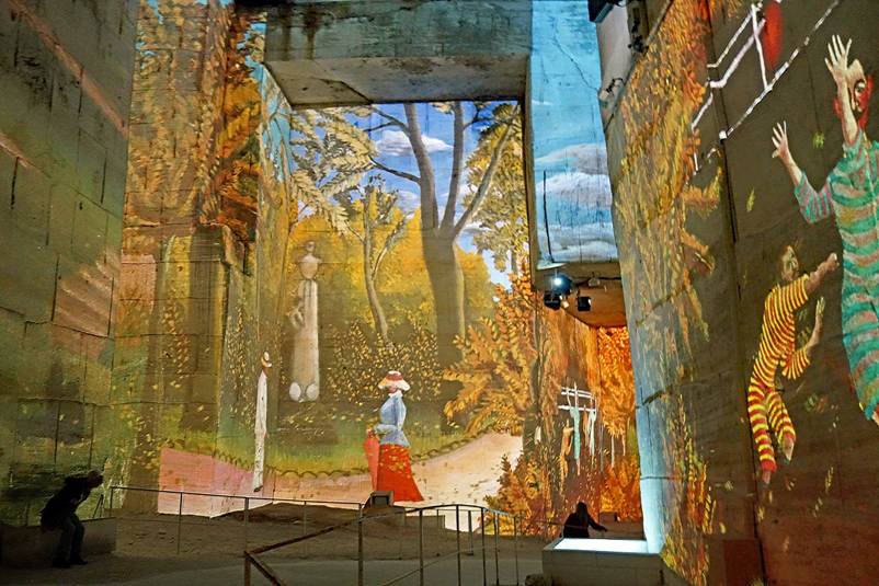
Quarries of Light (Carrieres des Lumieres). This is a visual spectacle presented in the
galleries of the former limestone quarries of Les Baux. These quarries were
originally dug for the construction of the castle and houses of Les Baux, and
later for other purposes, until their closure in 1935. The spectacle consists
of dynamically projecting large images onto the flat, immaculate walls of the
galleries. Successive sessions have distinct themes. Below are photos taken
during sessions dedicated to the painters Claude Monet and Henri Rousseau.
|
|
|
|
|
|
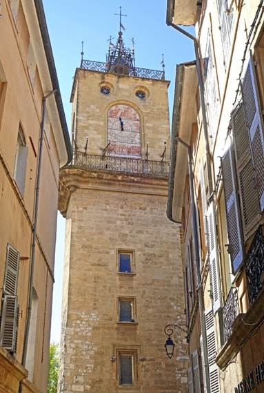
Aix-en-Provence (Department of Bouches-du-Rhone)
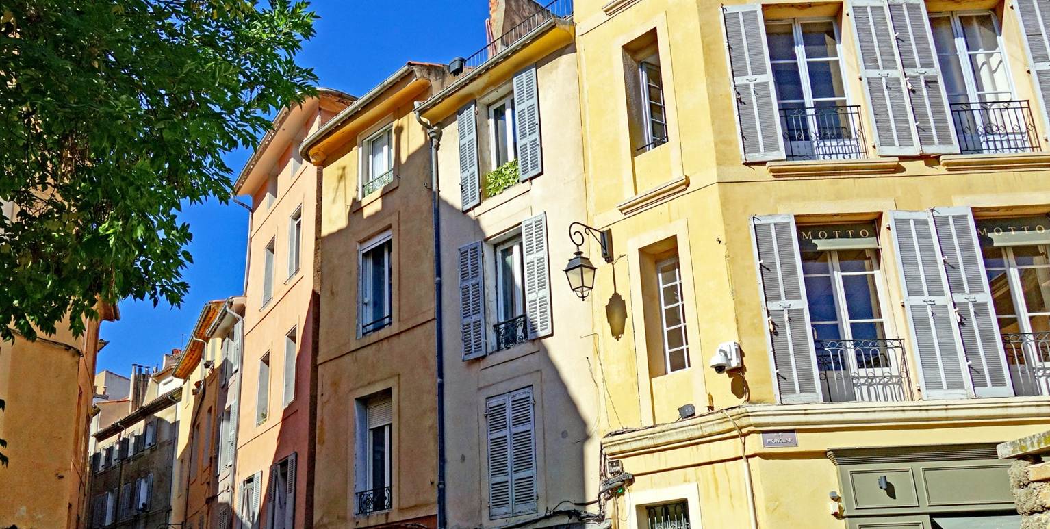
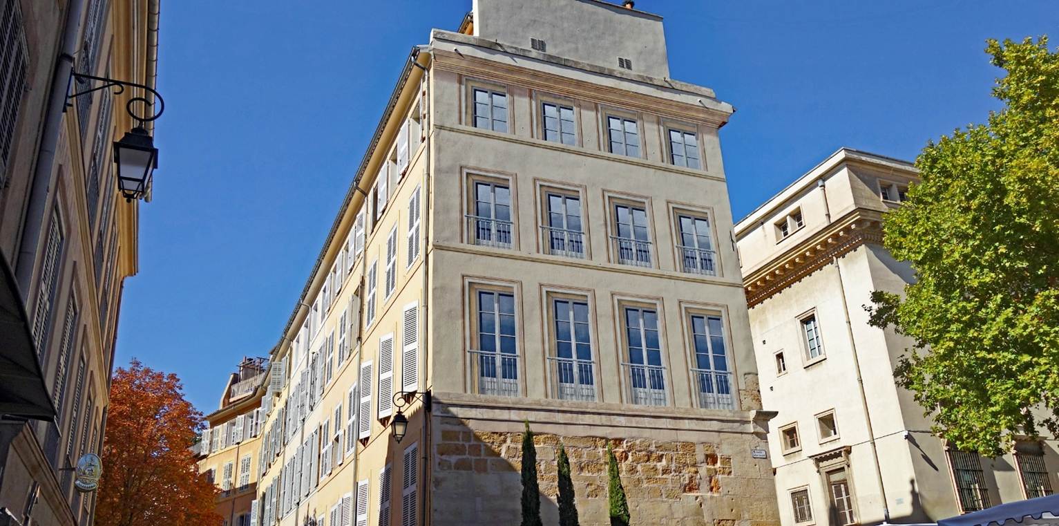
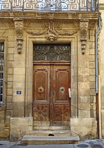
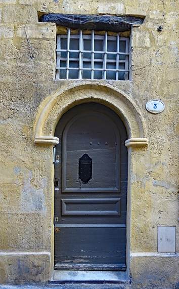
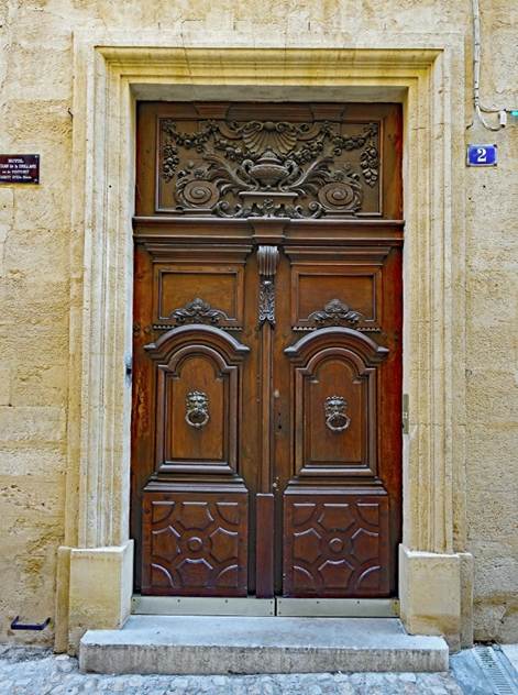
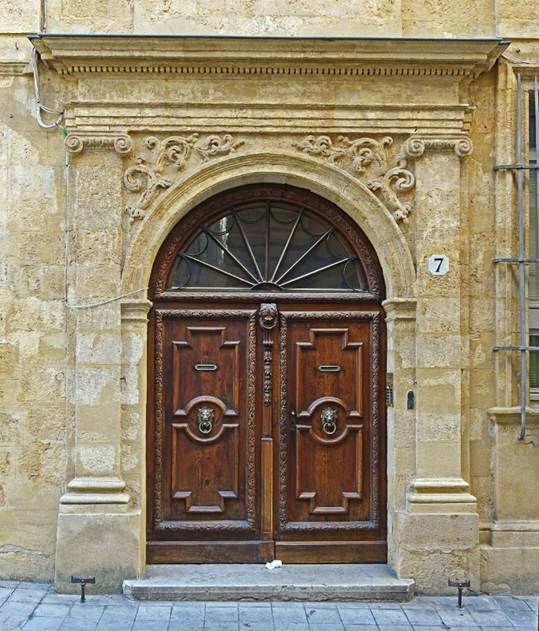
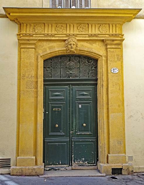
In the streets of Aix-en-Provence's historic center.
|
|
|
|
|
|
|
|
|
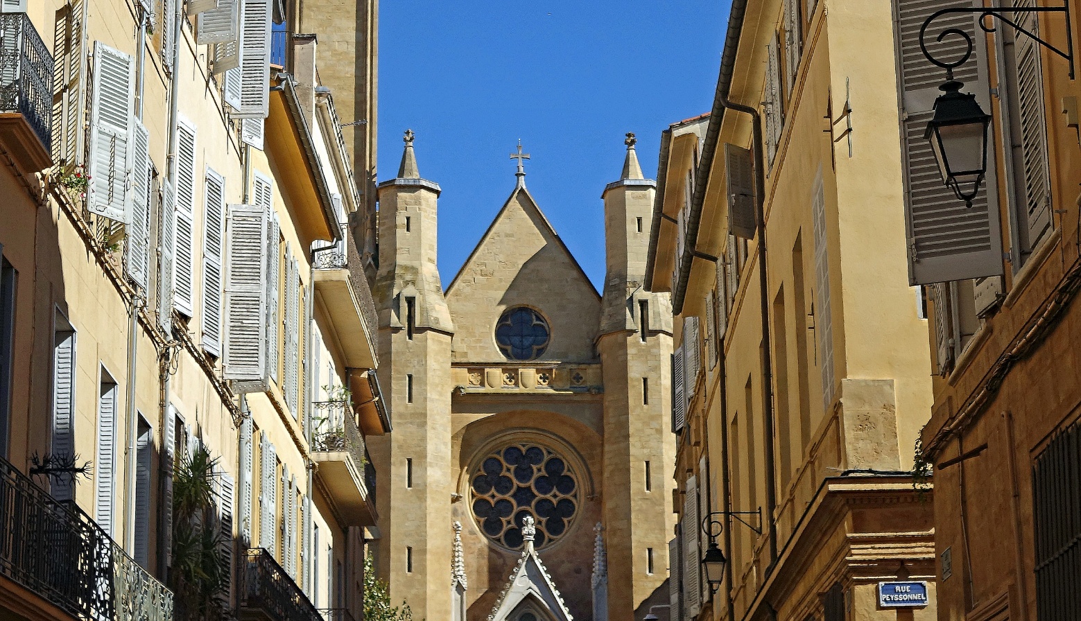
Cathedral Saint-Sauveur. Its construction spanned a long period, from
the 12th century to the 17th century. So, the resulting building combines
different architectural styles, from Romanesque to Gothic and Baroque.
- Facade of the cathedral.
|
|
|
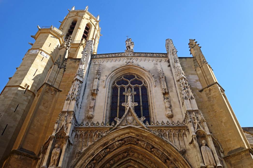
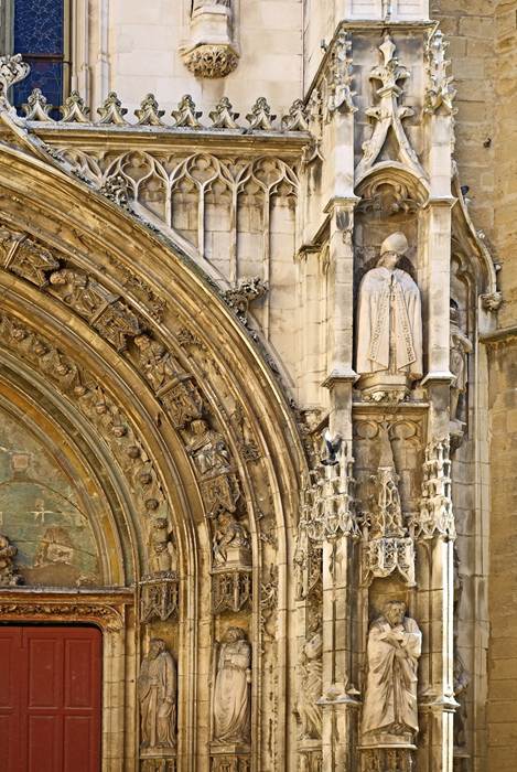
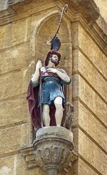
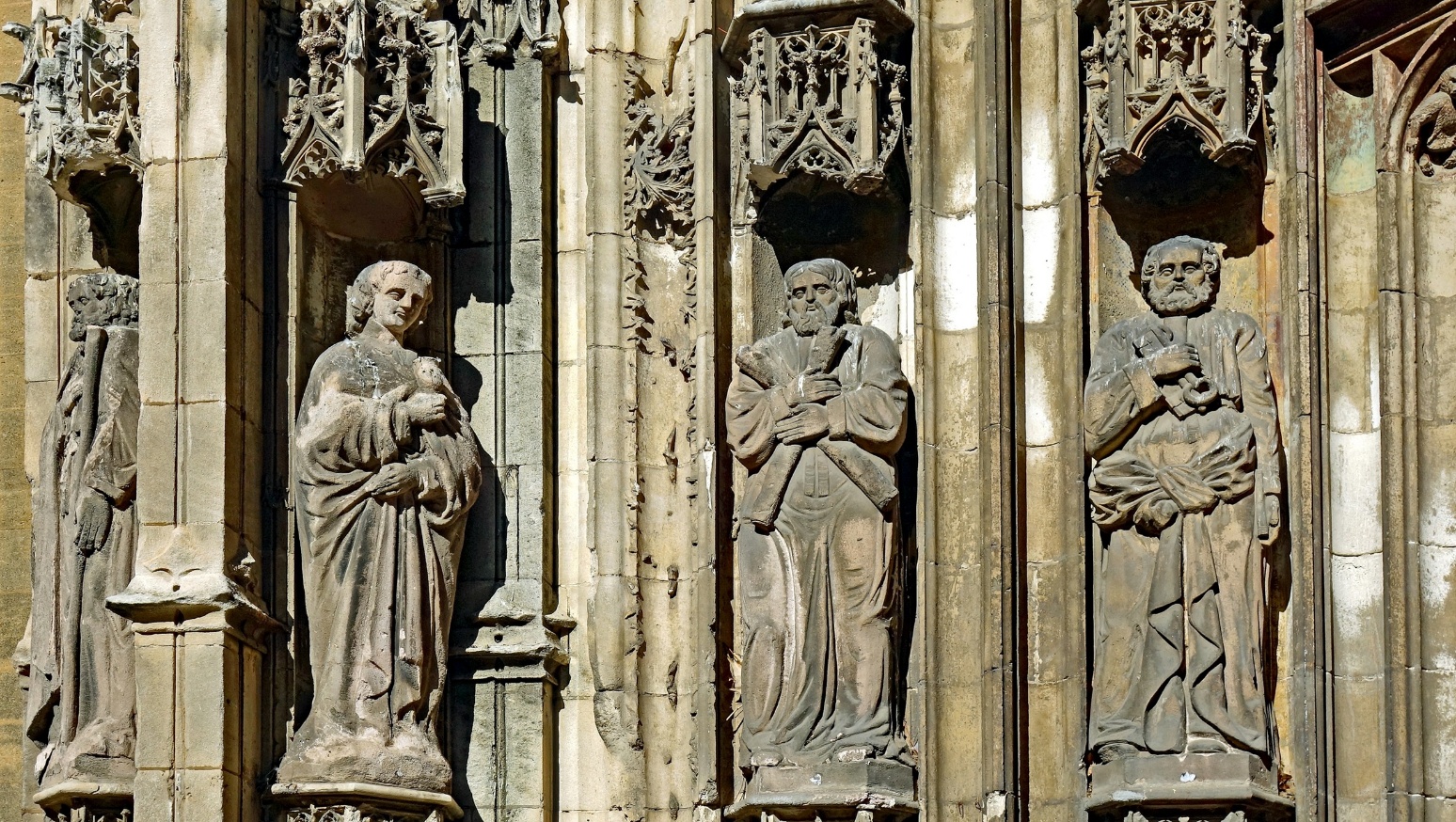
Statues on the left side of the portal.
- Main nave (Gothic).
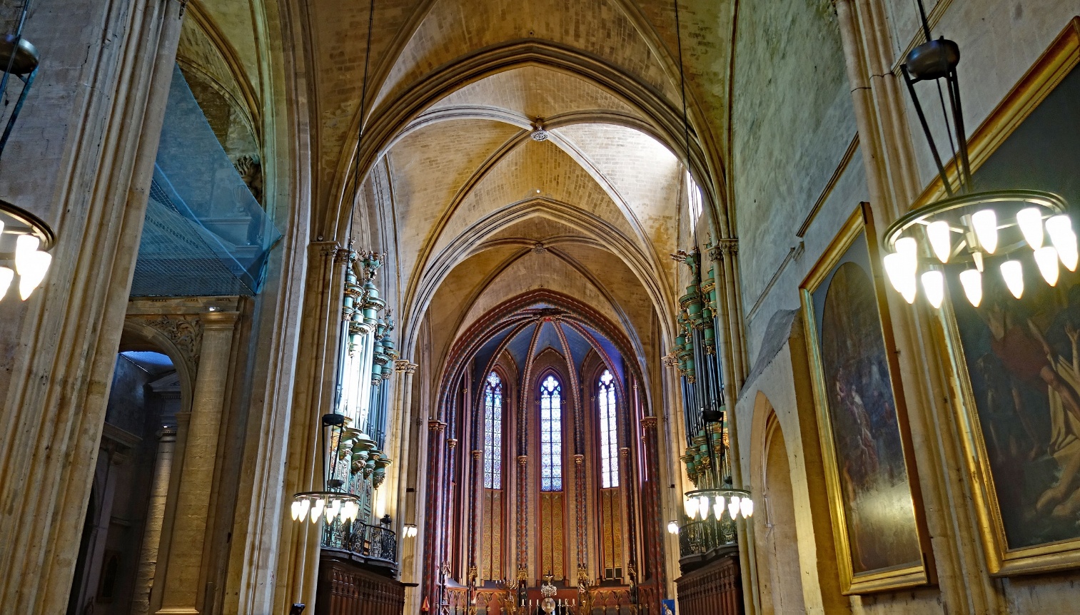
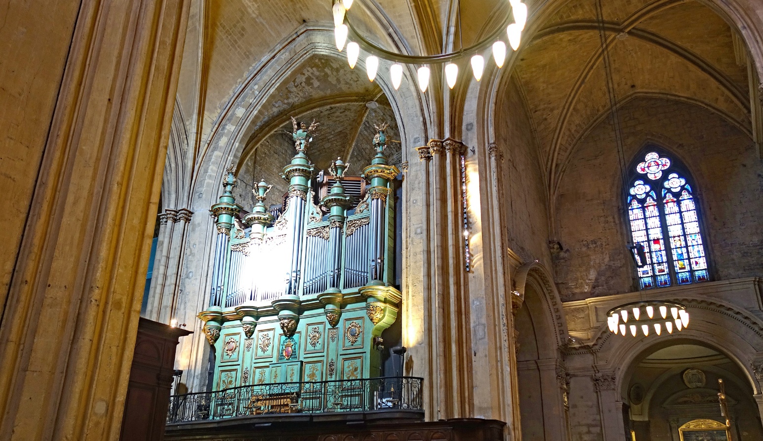
- Pipe organ and transept.
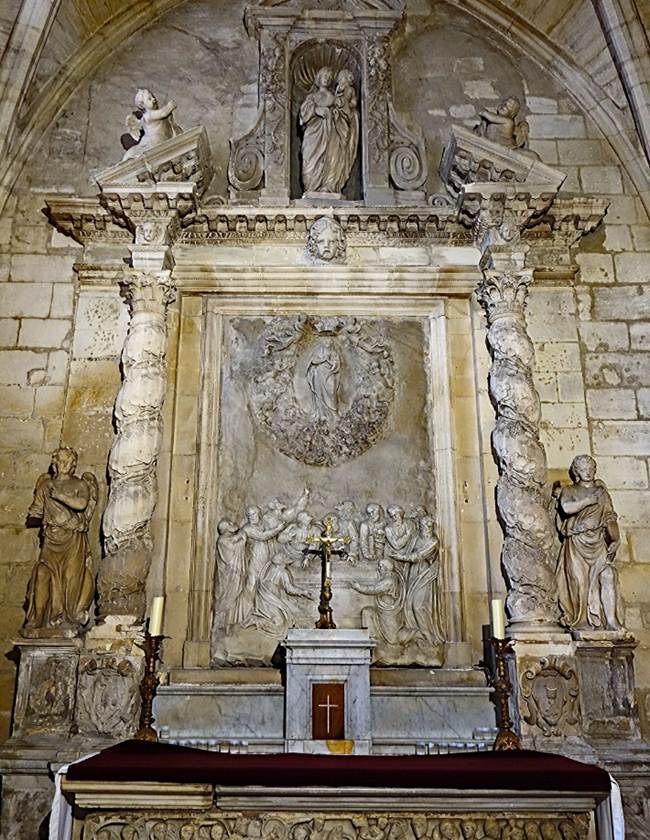
- Altar of Aygosi (1470), originally in the Carmelite church,
moved to the Saint-Sauveur cathedral in 1823.
|
|
|
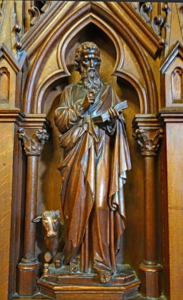
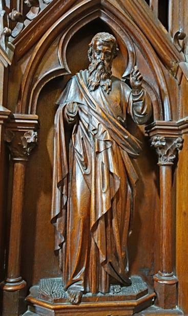
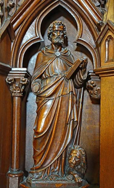
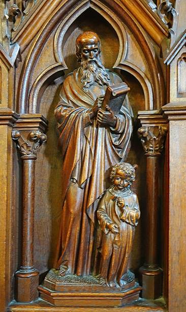
- Wood carvings adorning panels of the pulpit.
|
|
|
|
|
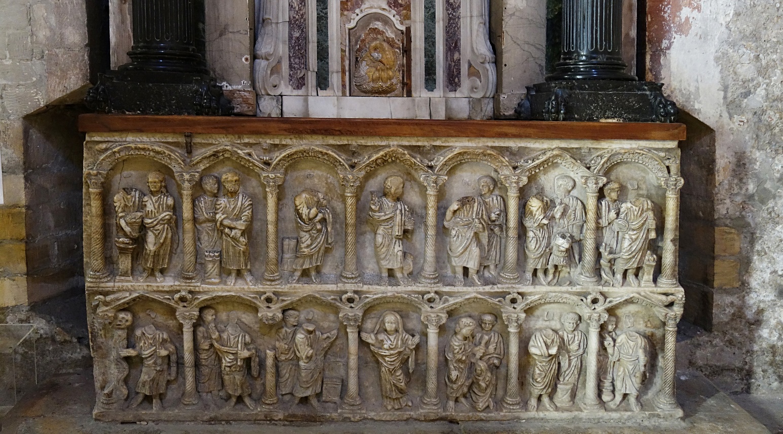
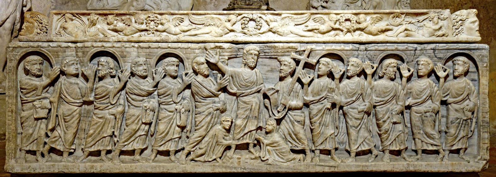
- Beautifully carved marble sarcophagus from the 6th century,
believed to be that of Saint Mitre, located the Saint
Come and Saint Damien chapel. The bas-relief depicts Christ surrounded by his
apostles. The two figures at Christ's feet are probably the dedicatees of the
tomb.
- Left: Romanesque side nave, located to the right of the main
nave, next to baptistery; it was the main nave before the construction of the
Gothic nave, which is now the main nave. Right: Columns surrounding the
octagonal pool of the baptistery.
|
|
|
- Colonnade of the cloister attached to the cathedral. The
capitals of the columns are delicately carved with biblical scenes, animals,
and plants.
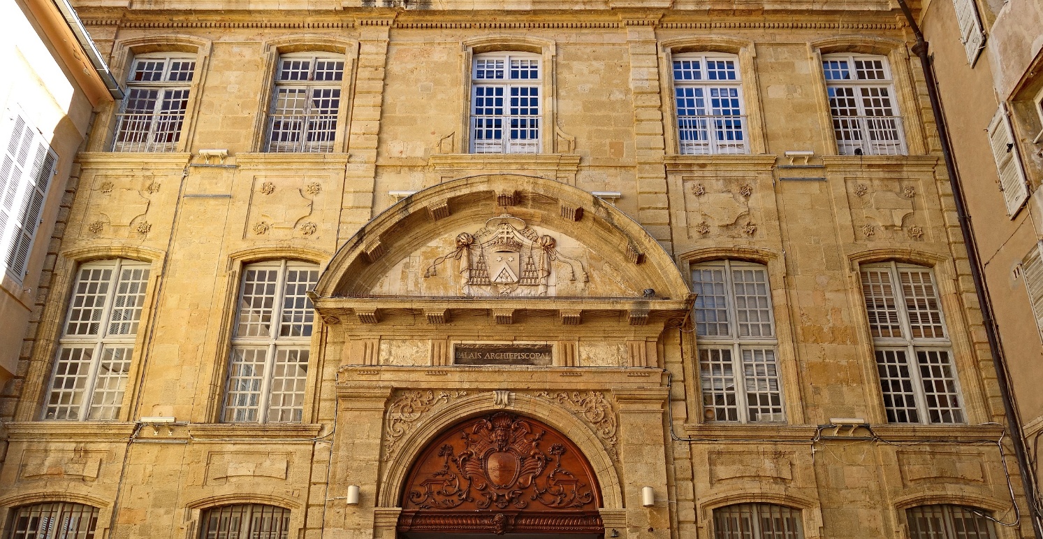
Facade of the Archbishop's Palace (18th century).
The coat of arms engraved in stone above the portal are those of
Pierre-Ferdinand de Bausset-Roquefort, archbishop of Aix between 1819 and 1829.
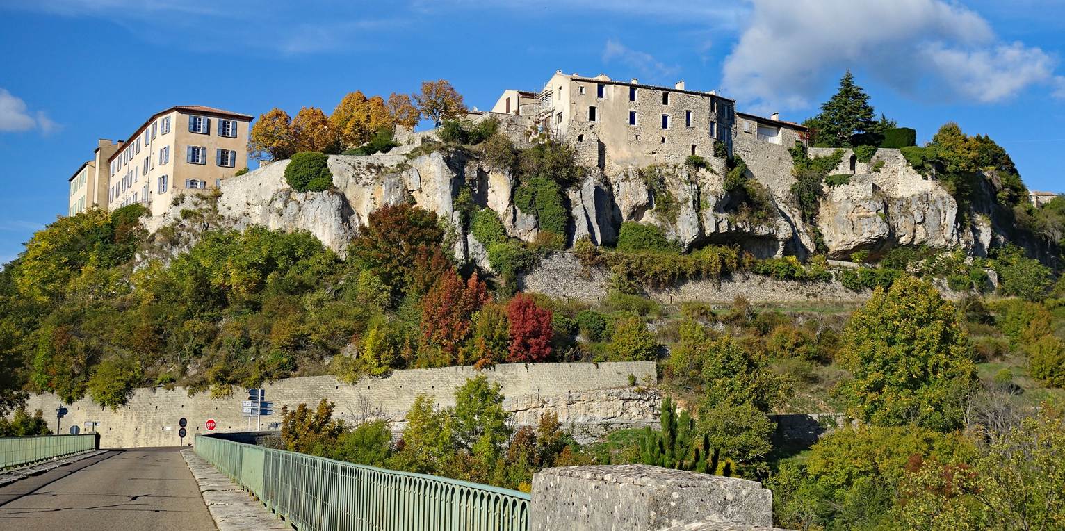
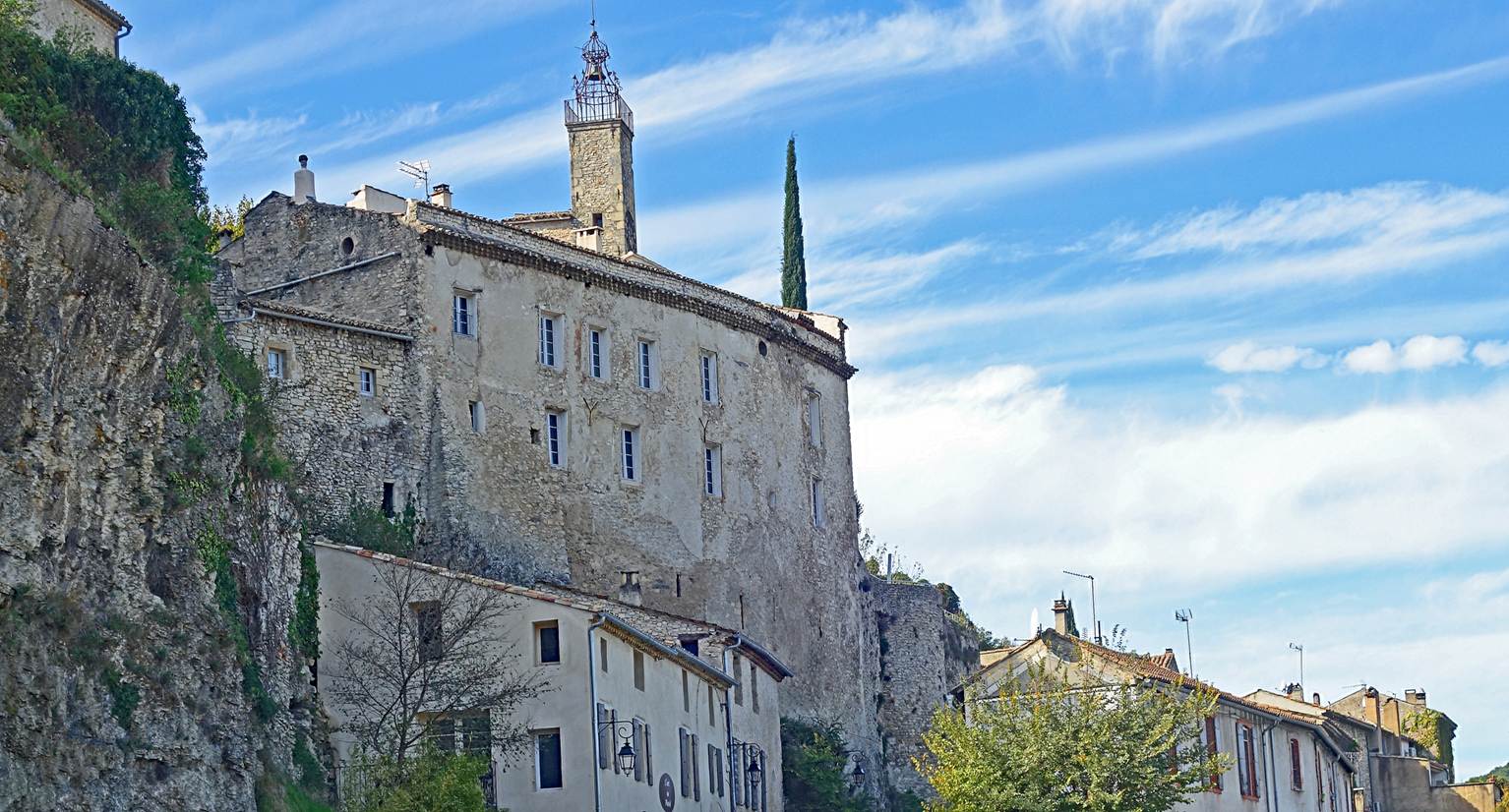
Sault (Department of Vaucluse)
Established in the 11th century, this old fortified
village was built on a rocky outcrop offering some protection against the
threat of invasion. It overlooks a large plain now famous for its lavender
fields.
View of the village from the south.
Church called Notre Dame de la Tour. First built in the 12th
century, it was partially rebuilt in the 14th century and again at the end of
the 16th century. It incorporates some elements of the village's old
fortification.
|
|
|
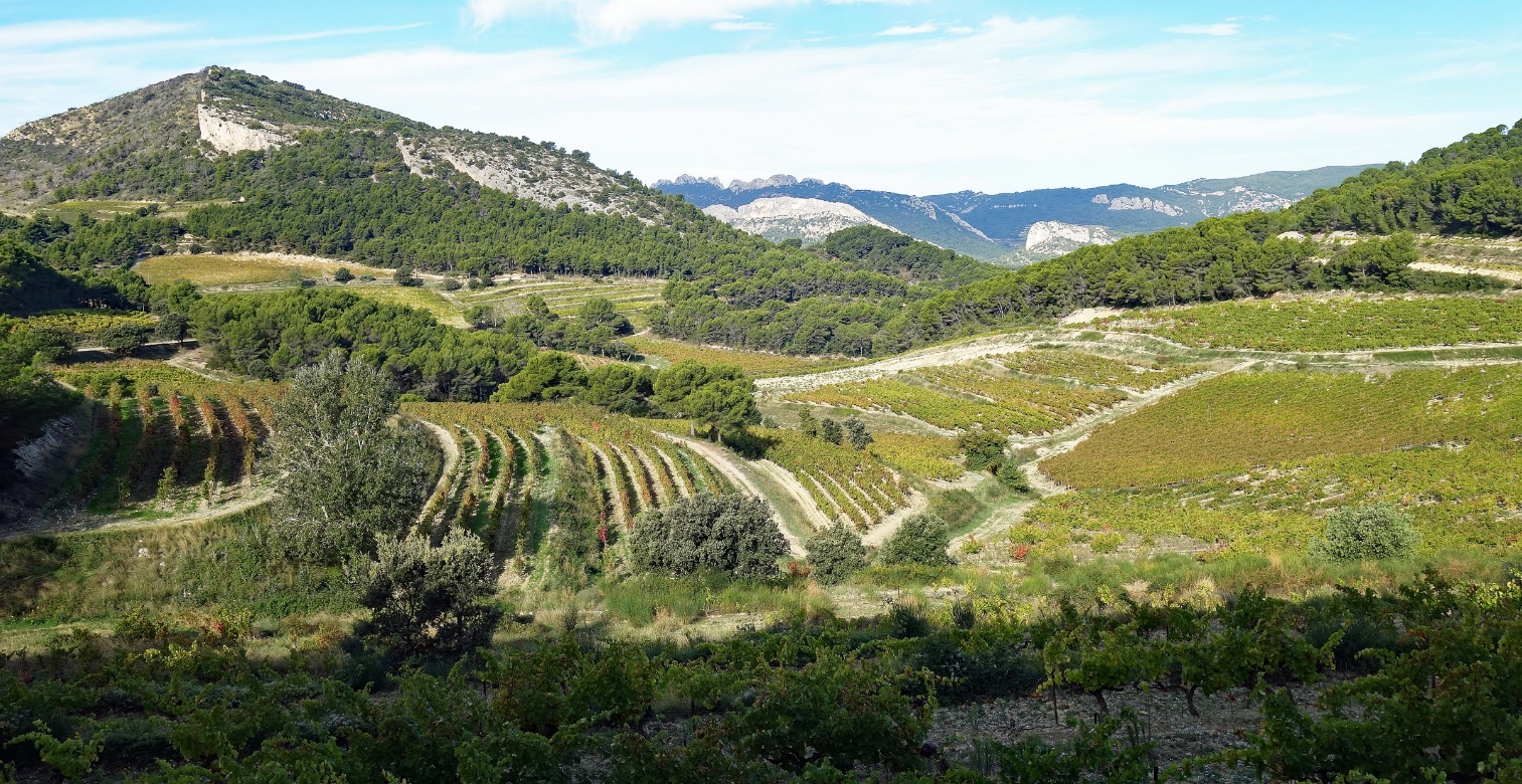
La Roque-Alric (Department of Vaucluse)
It is a small and pretty village close to the Dentelles de Montmirail.
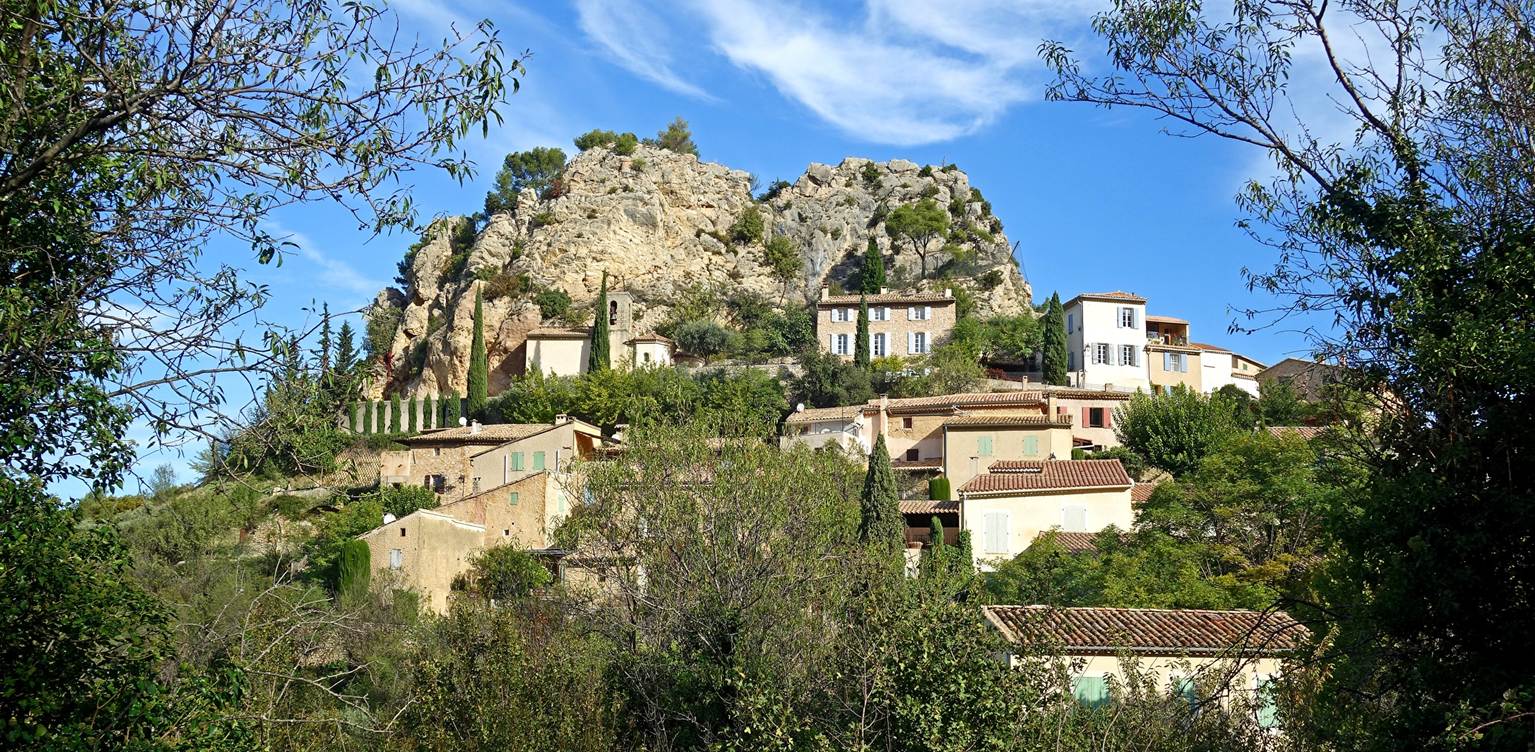
The Dentelles de Montmirail seen from a
location near the village.
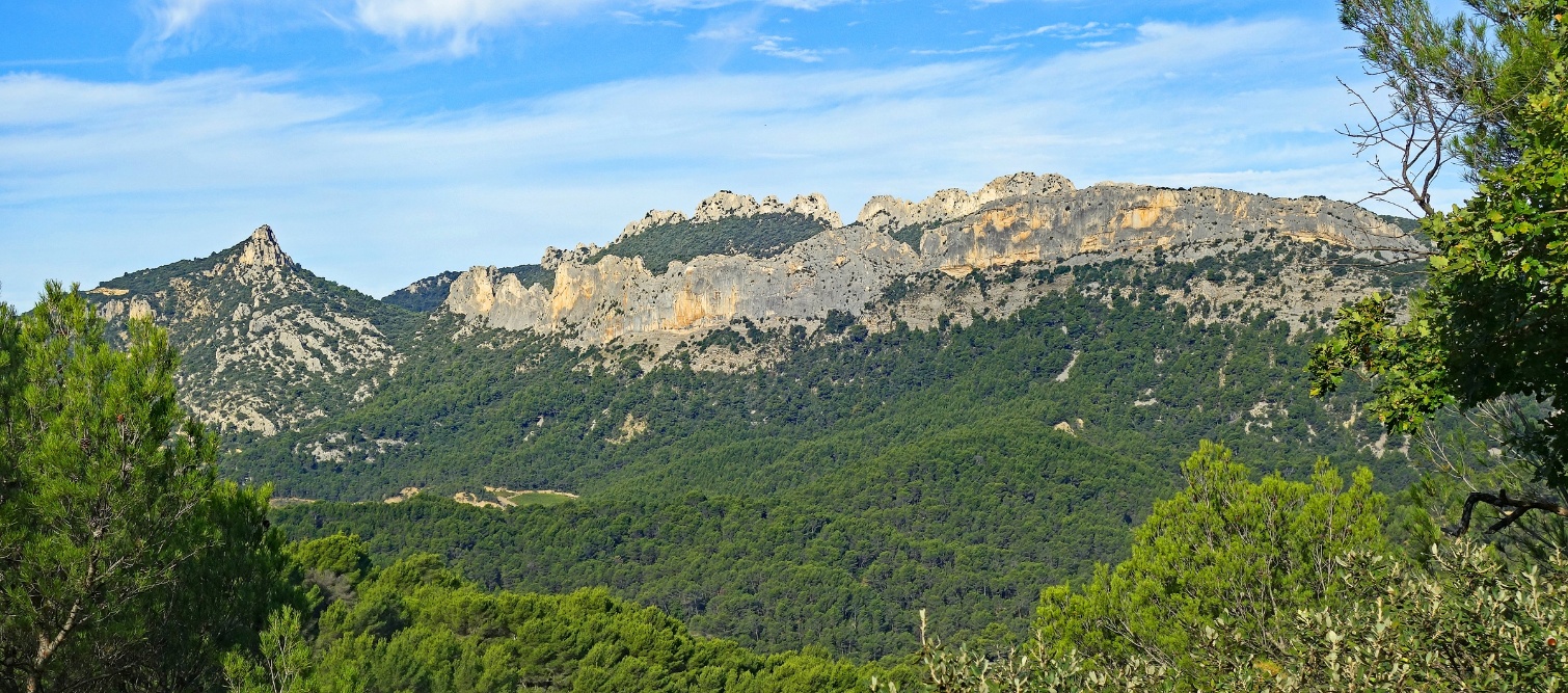
Vineyards near La Roque-Alric.
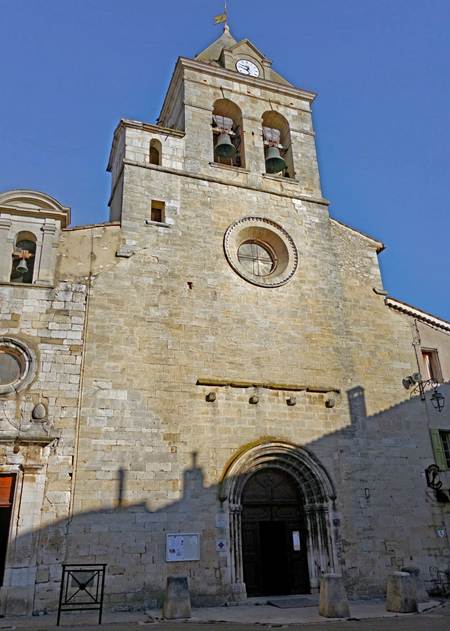
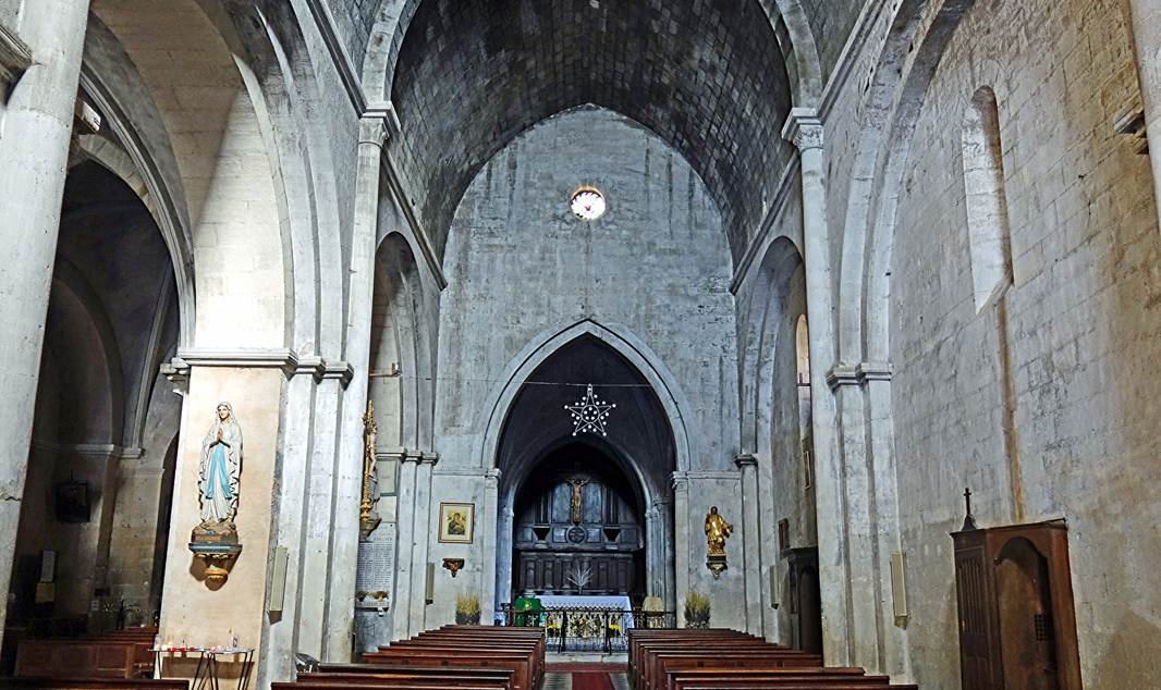
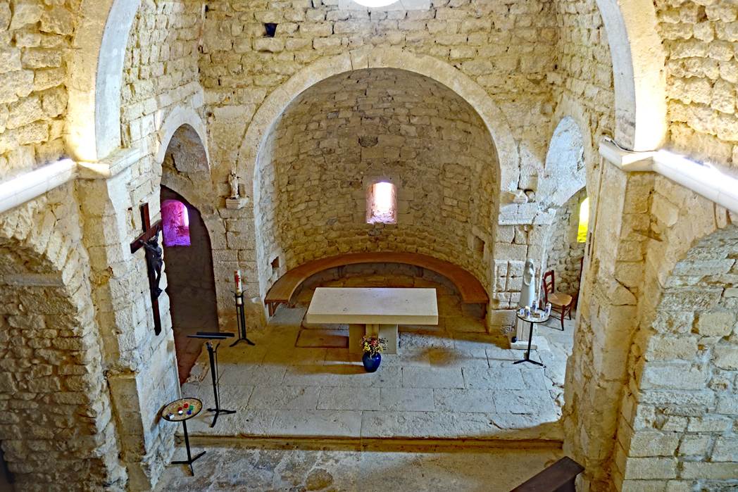
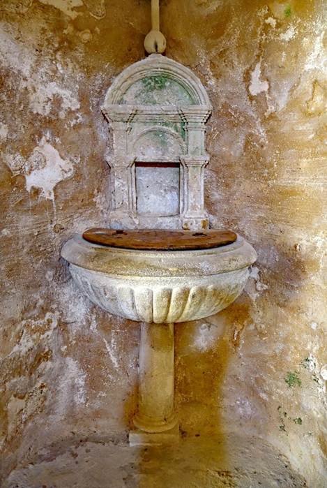
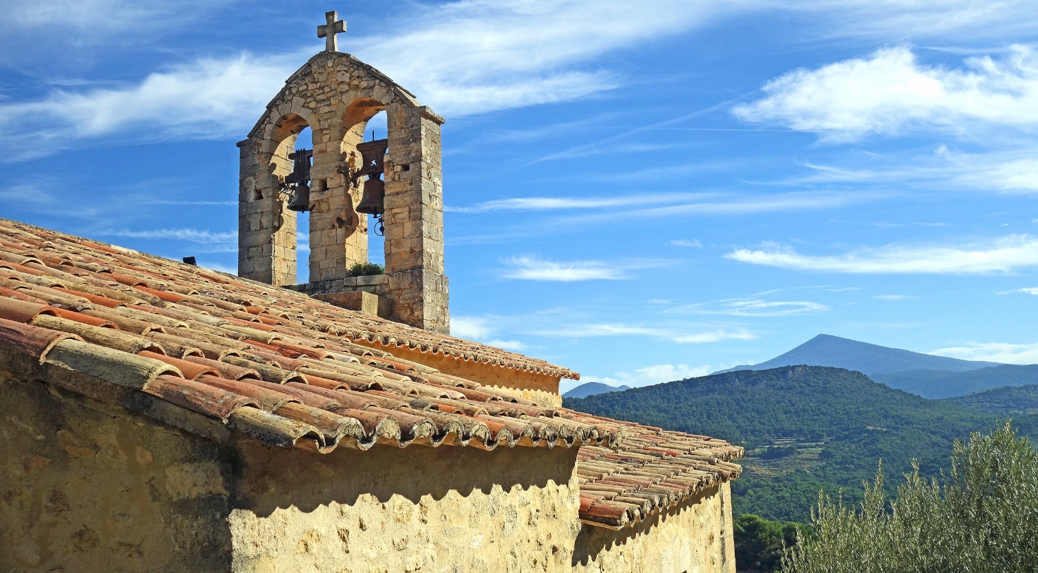
Church of Notre-Dame de Suzette, Suzette (Department
of Vaucluse)
Suzette is another small village close to the Dentelles de Montmirail, 3km north of La Roque-Alric. It is home to a
simple Romanesque chapel built at the end of the 11th century, but since then
damaged and restored several times.
Left: Interior of the chapel. The central apse is flanked by two
apsidioles (only partially visible in the photo). Right: Baptistery of the
chapel against the back wall.
|
|
|
Bell tower and roof of the chapel. The mountain in the background
on the right is Mount Ventoux.
Vaison-la-Romaine (Department
of Vaucluse)
The town of Vaison-la-Romaine is famous for its
rich Roman and medieval past. It consists of two distinct parts: the ″lower
town″, where ancient Roman remains stand alongside modern streets, and
the ″upper town″, which exudes a medieval atmosphere. The two parts
are separated by a river, the Ouveze. A Roman bridge
and a modern one connect them.
A few of the ancient Roman artefacts on display in the Theo Desplans Archeological Museum:
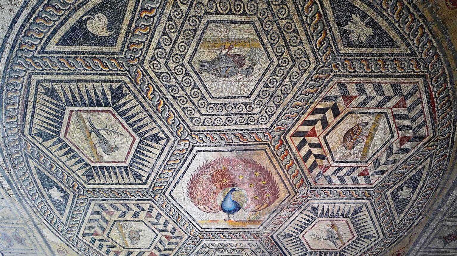
- The peacock mosaic. This large mosaic (33.35 sq.m.)
was found on the floor of a house built in the middle of the 2nd century on the
Puymin hill, where this museum is located in the ″lower
town″. It shows a peacock spreading its tail feathers in the central
hexagon. The six surrounding hexagons feature six birds: two parrots, two
ducks, and two partridges.
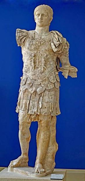
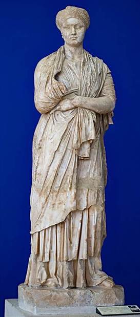
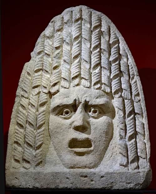
- From left to right: statue of Domitian, Roman emperor from 81 to
96; statue of Vibia Sabina (83-137), Roman empress and wife of emperor Hadrian;
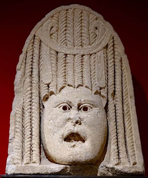
and two acroteria in the form of theater masks, found in a nearby burial area
where they probably decorated tombs.
|
|
|
|
|
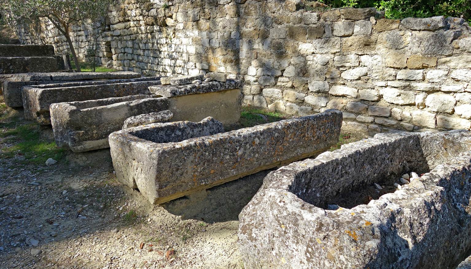
Sarcophagi of the 5th century in the archeological site of Puymin.
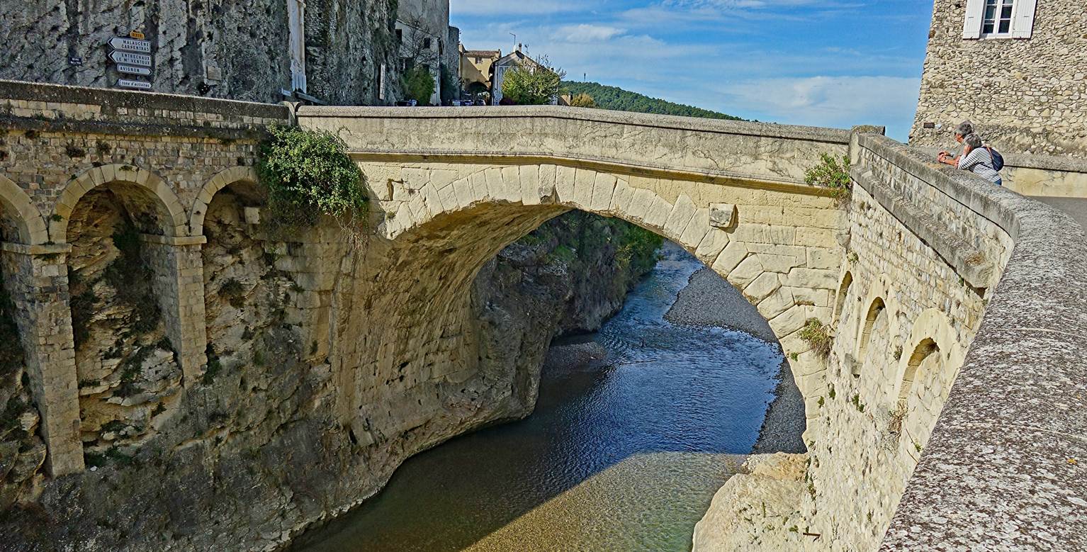
Roman bridge over the Ouveze. It
connects the lower town (on the right of the photo) and the upper town (on
the left). To this day, this nearly 2,000-year-old bridge remains open to cars.
Three views of the upper town:
- from the lower town,
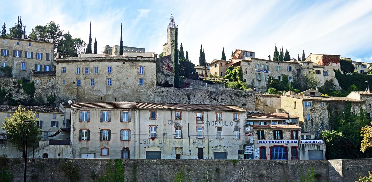
- from the bed of the Ouveze (showing
the cathedral Sainte-Marie-de-l'Assomption, which
stands on the edge of the cliff and forms part of the rampart of the upper
town),
[Note:
I took this photo in 2015.]
- and from the Roman bridge.
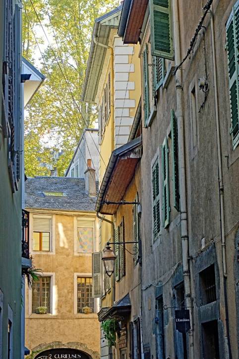
In the medieval-looking alleys of the upper town.
|
|
|
|
|
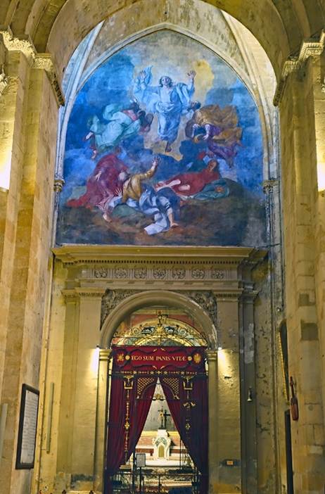
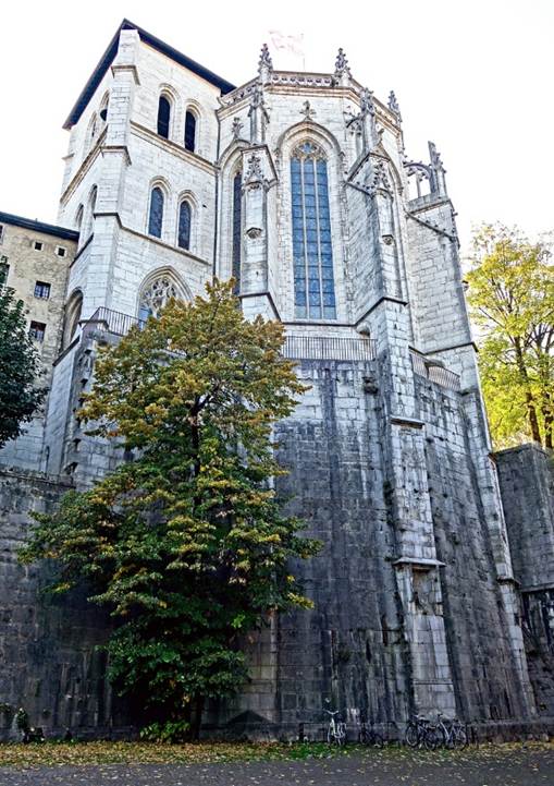
Apse of the cathedral Sainte-Marie-de-l'Assomption.
This cathedral (visible above in the photo taken from the bed of the Ouveze) was erected in the 15th century on the site of an
older church built in the 12th century.
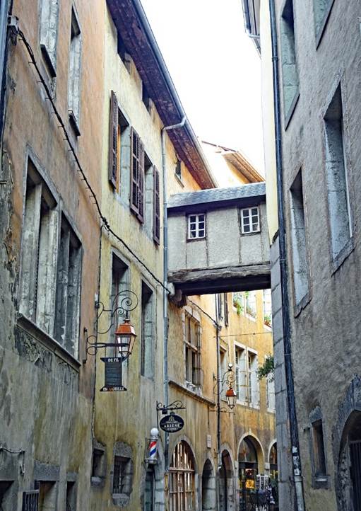
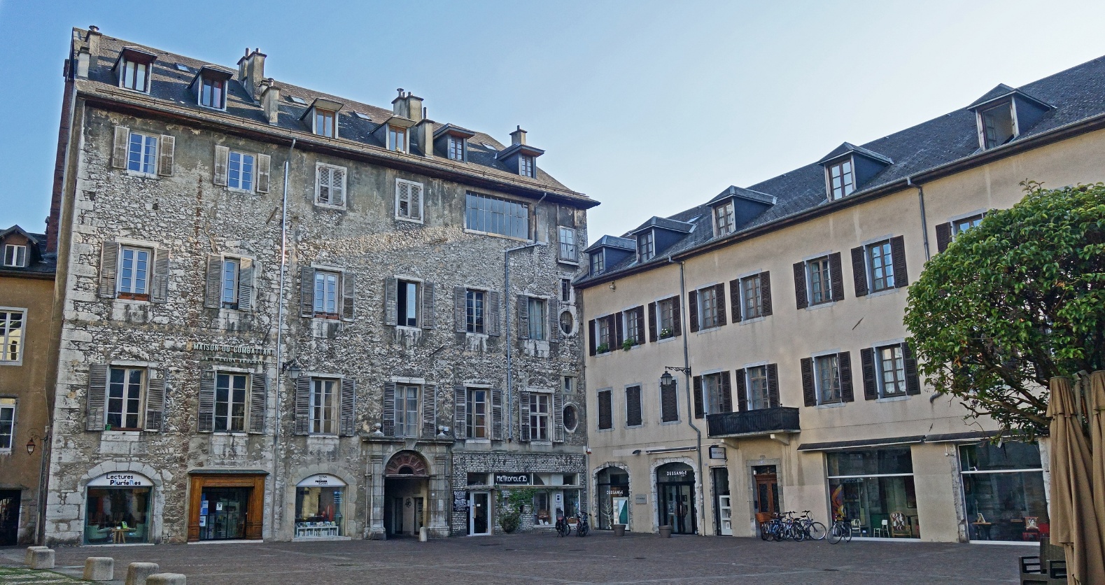
Chambery (Department of Savoie)
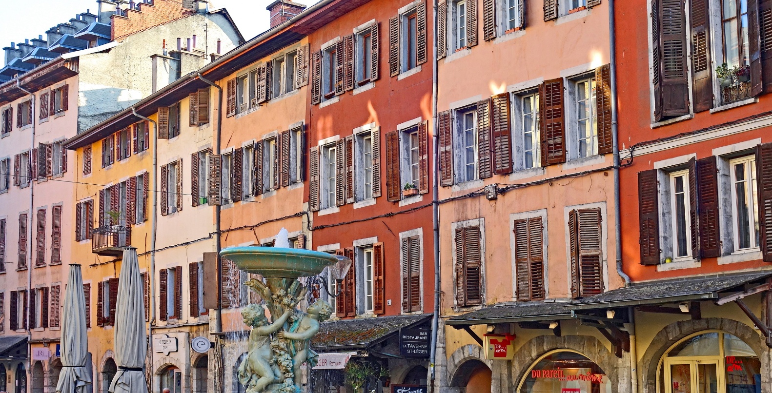
Colorful facades overlooking Place Saint-Leger, the main square in
the historic center of Chambery.
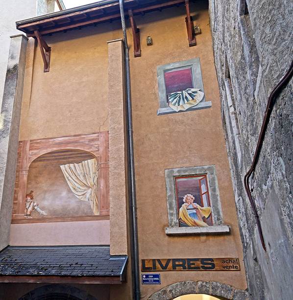
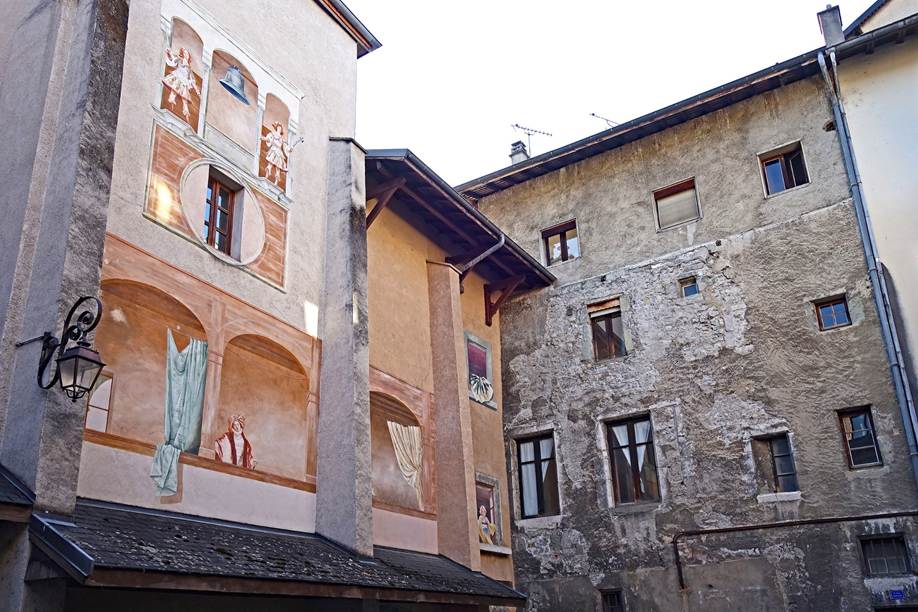
Large mural in Cour Marie-Clotilde Fardel, a small square in the
historic center.
|
|
|
Houses in the street named
Derriere-les-Murs (Behind-the-Walls). They incorporate former medieval
fortifications.
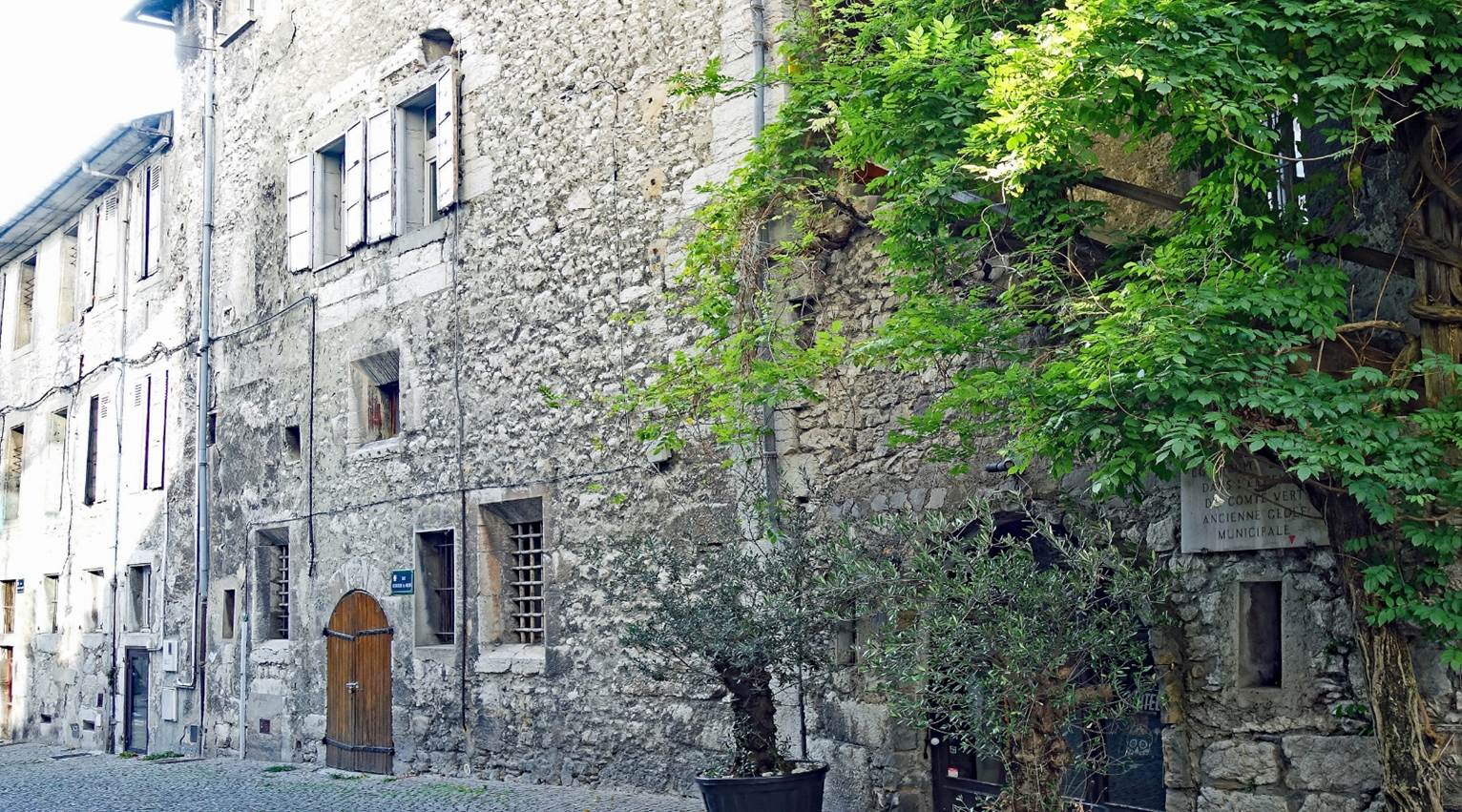
From left to right: Rue Basse du
Chateau, Rue Bonivard, and chapel of the castle of
the Dukes of Savoy.
|
|
|
|
Place Metropole, which forms the parvis
of Saint-Francois-de-Sales cathedral.
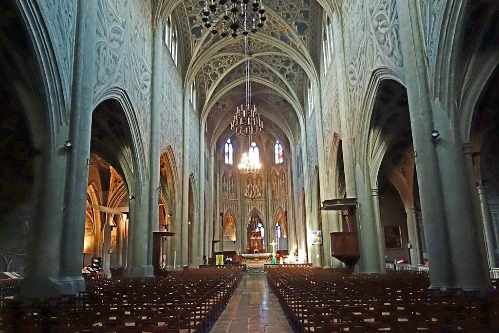
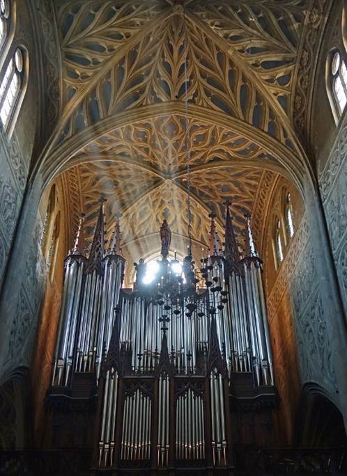
Interior of the Saint-Francois-de-Sales
cathedral.
|
|
|
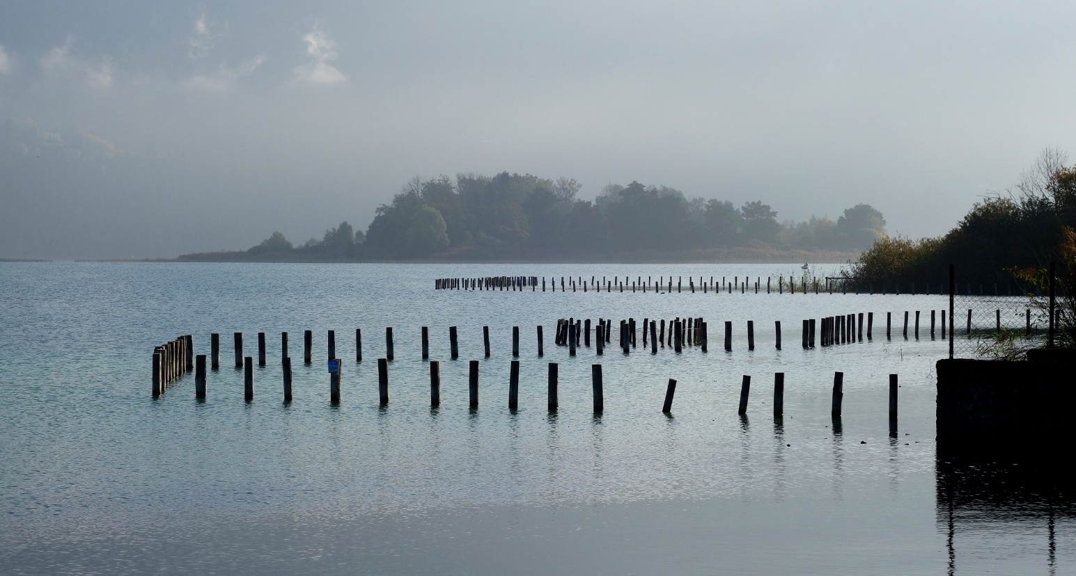
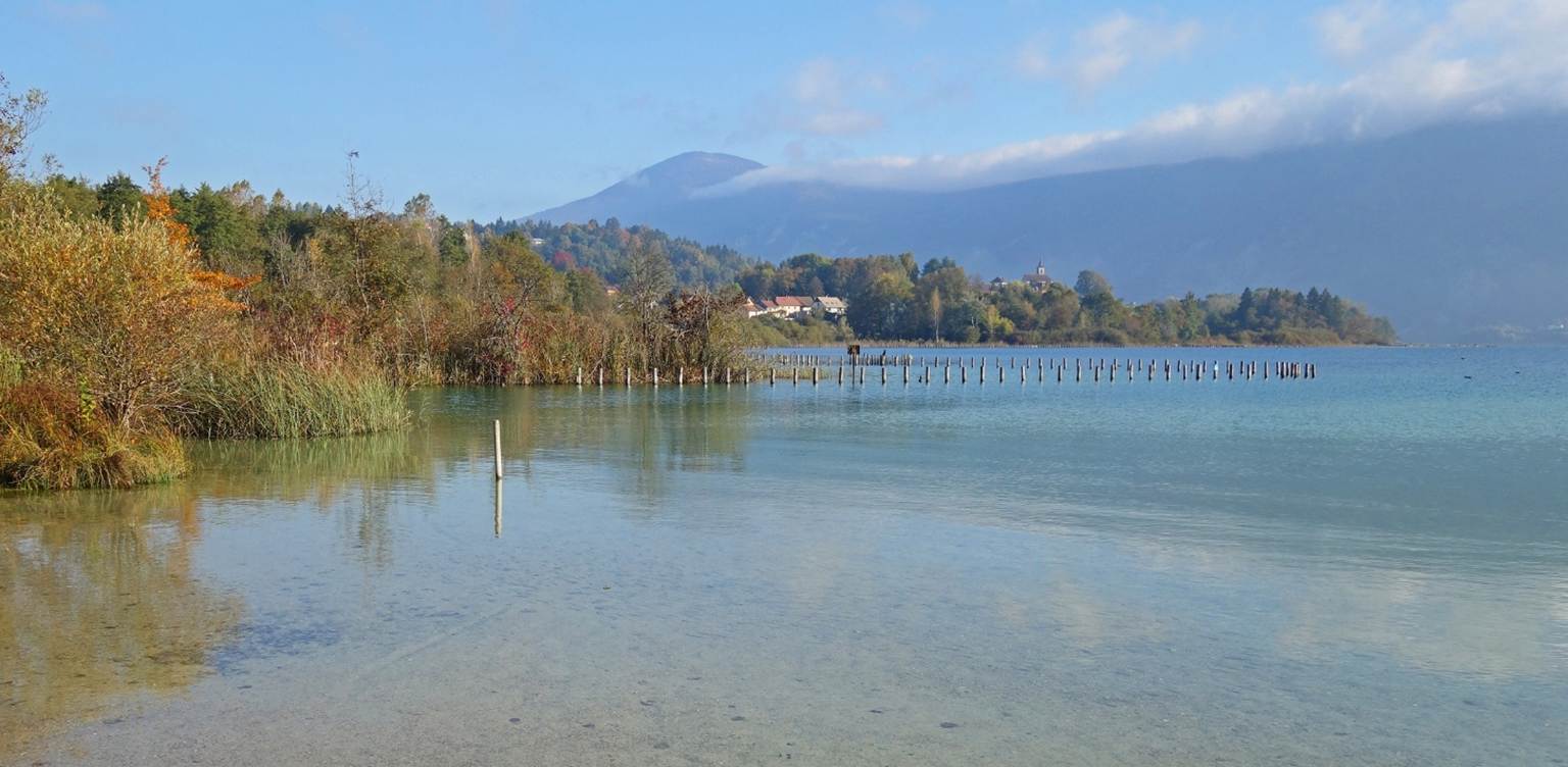
Morning views of the lake of Aiguebelette, located 10km west of Chambery's center. (The stakes
lined up near the shore of the lake are intended to protect the reed beds.)
![]()
Back to
main France page | Back to my
mountaineering/trekking/travel webpage