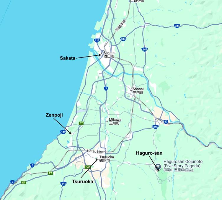
Sakata, Zenpoji,
Tsuruoka, and Haguro-san
Northwestern Honshu, Japan (October
2024)
![]()
Back to main Japan October 2024 page
|
|
|
For most of
the Edo period, these four places were part of the Shonai
domain ruled by the Sakai clan from their Tsuruoka castle. Its vast, fertile
and well-watered coastal plan, the Shonai plain, was
a major producer of high-quality rice, which ensured the prosperity of the
domain. This resulted in an unusually stable domain, both politically and
economically. In 1871, the domain was abolished and broken into two
prefectures, which later merged to form today's Yamagata prefecture.
Sakata
Sakata is a
medium-sized city located on the Sea of Japan, in the Shonai
plain. During the Edo period, thanks in part to the high quality and abundance
of rice produced in the region, it became an important trade stop on the Kitamaebune sea route linking northern Japan to Osaka via
the Sea of Japan and the Seto Inland Sea. The Honma, a local merchant family,
became dominant in the city's trade, achieved extreme wealth, and developed
ties to the local Sakai lords and the shogunate.
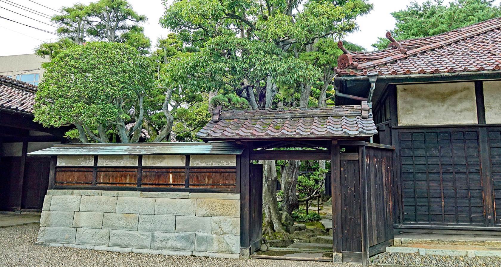
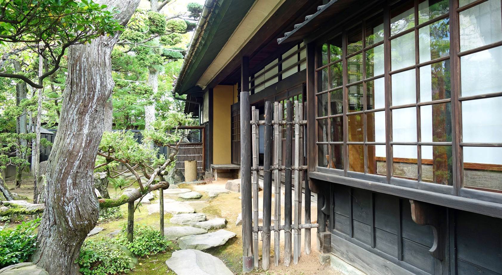
Main Honma
residence.
Built in 1768,
this house initially served as the residence for visiting high-ranking
officials of the shogunate. It later became the property of the Honma family,
who lived there until 1945.
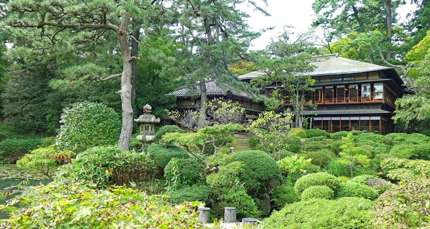
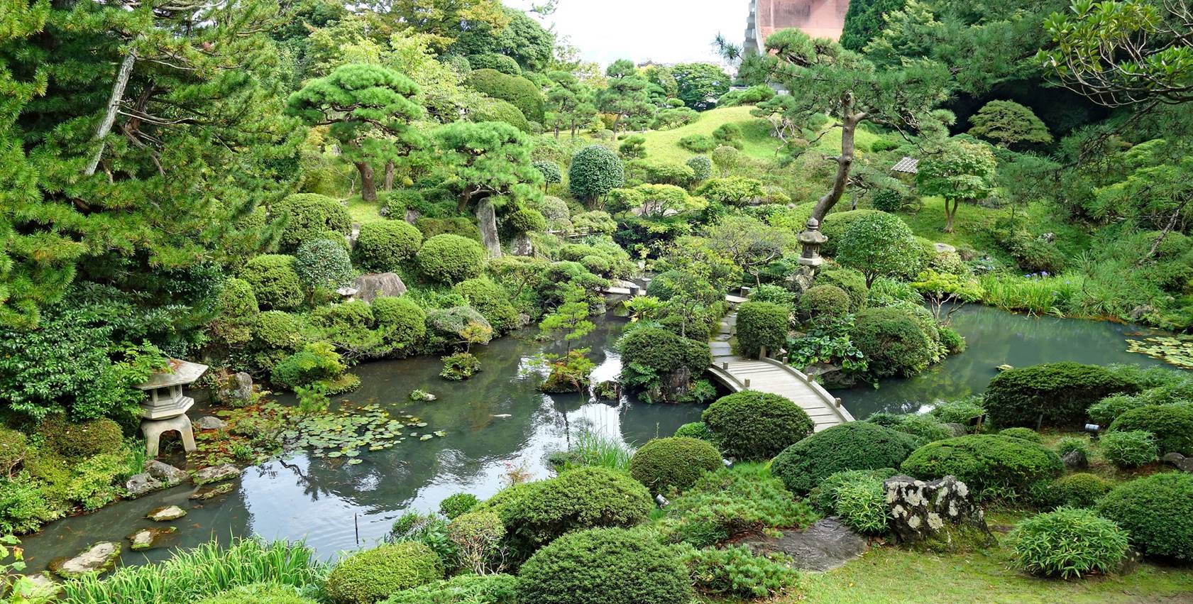
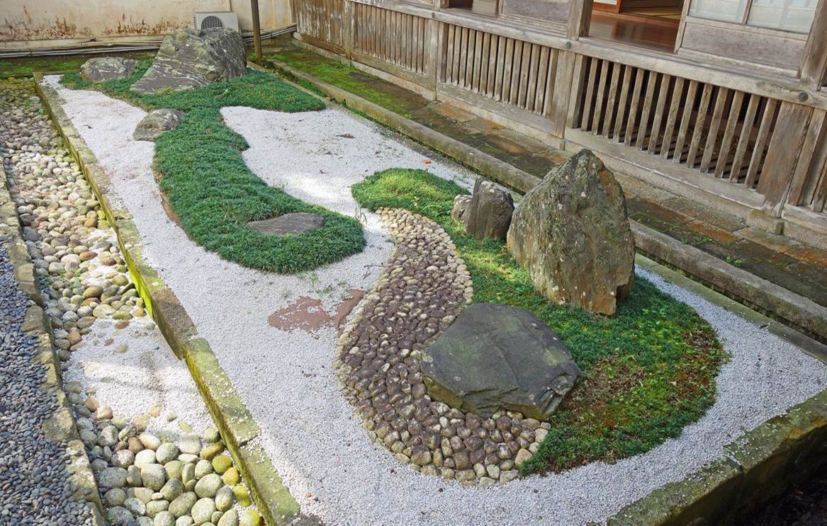
The Honma
villa.
It was built
in 1813 by Honma Kodo as a second home for the Honma
family, at a location then slightly outside the city, 1km north of the main
residence. It consists of a pavilion (the Seienkaku)
overlooking a beautiful garden (the Kakubuen). The
villa was also used by Sakai lords when they visited Sakata.
Views of the Seienkaku (first photo below) and the Kakubuen (second
photo).
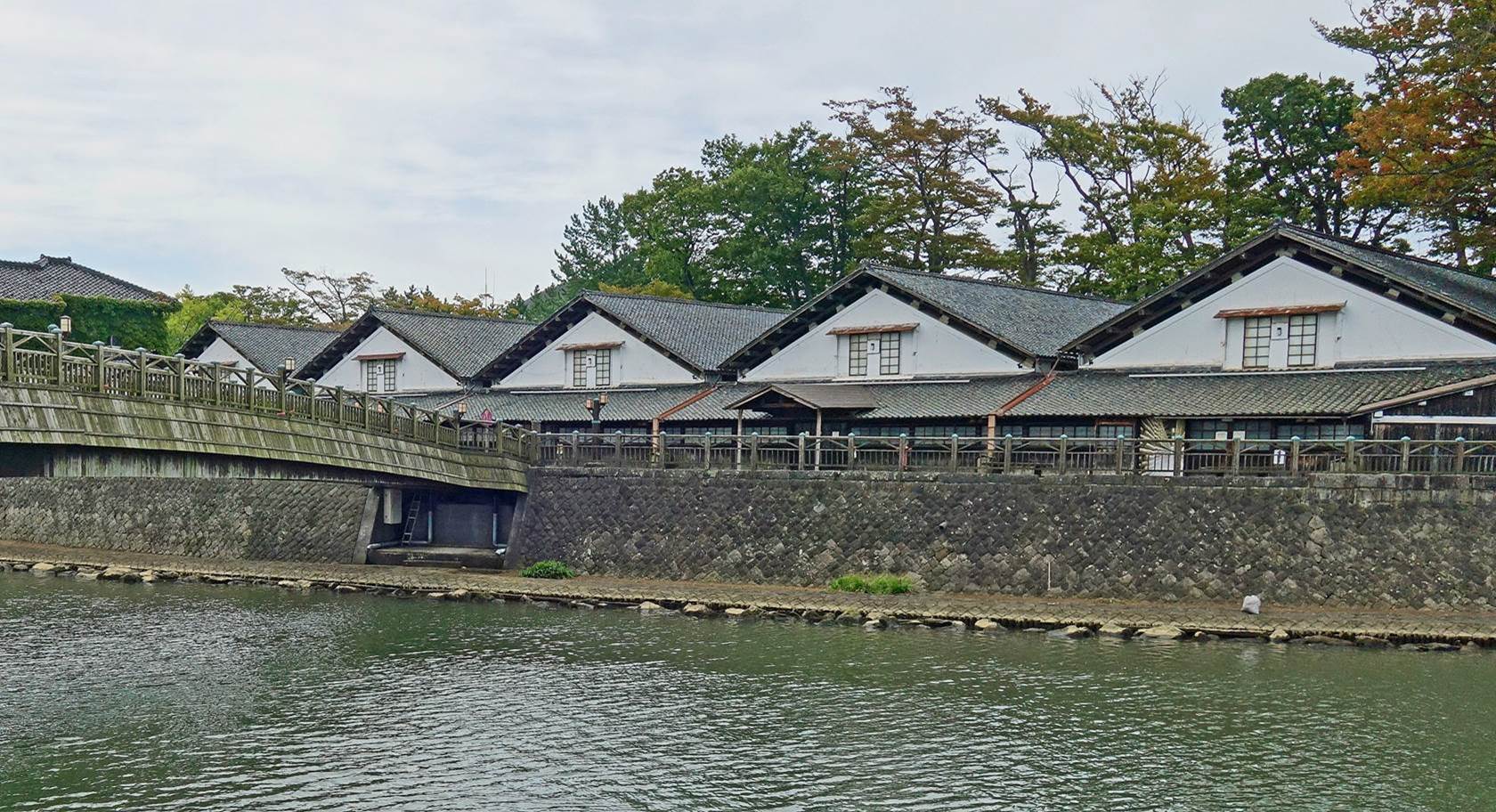
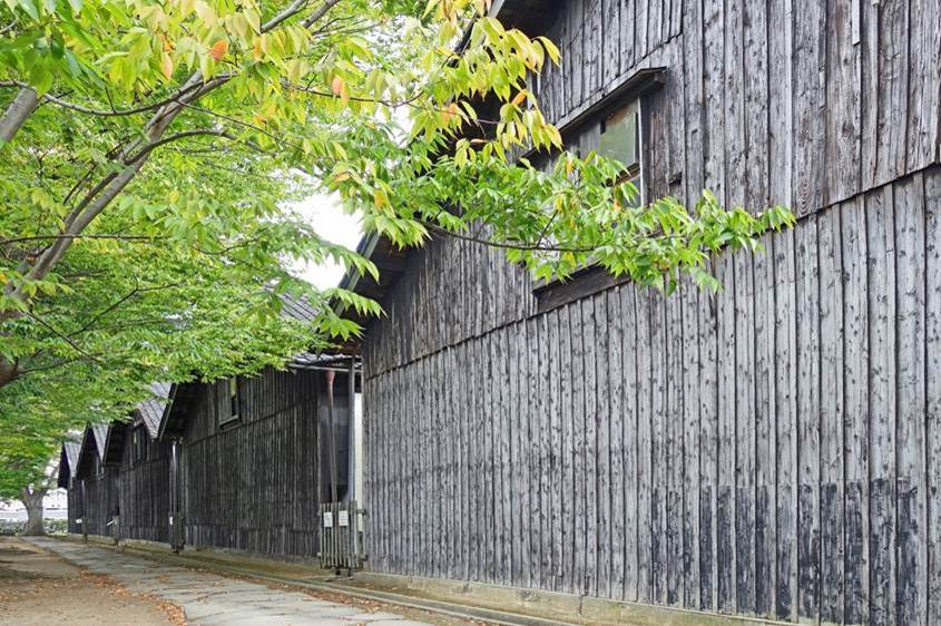
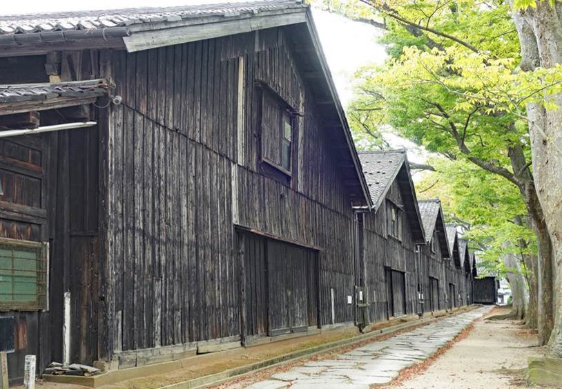
Sankyo rice
warehouses.
Rice produced
in the Shonai plain was brought and stored here,
before being shipped away. The huge size of these warehouses is an indication
of the scale of the trade.
View of the
warehouses from across the Niida river, with the
wooden Sankyo bridge visible on the left side of the photo. The warehouses are
on the left bank of the river.
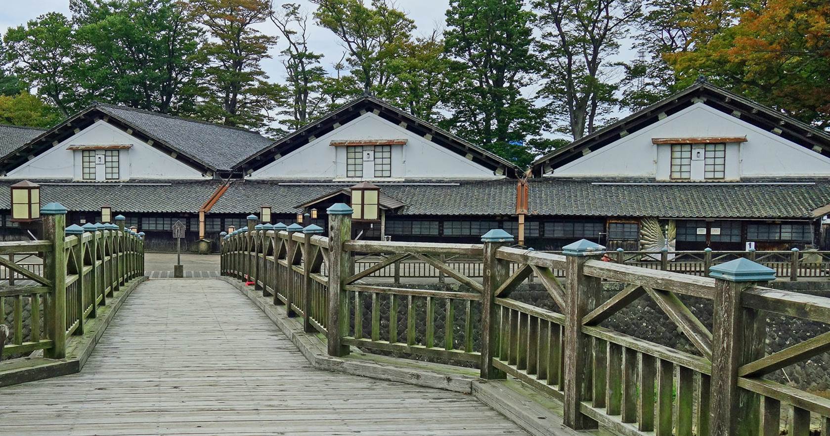
The
warehouses seen from the Sankyo bridge.
Back side of
the Sankyo warehouses. (The two photos below were taken roughly from the same
spot in opposite directions.)
|
|
|
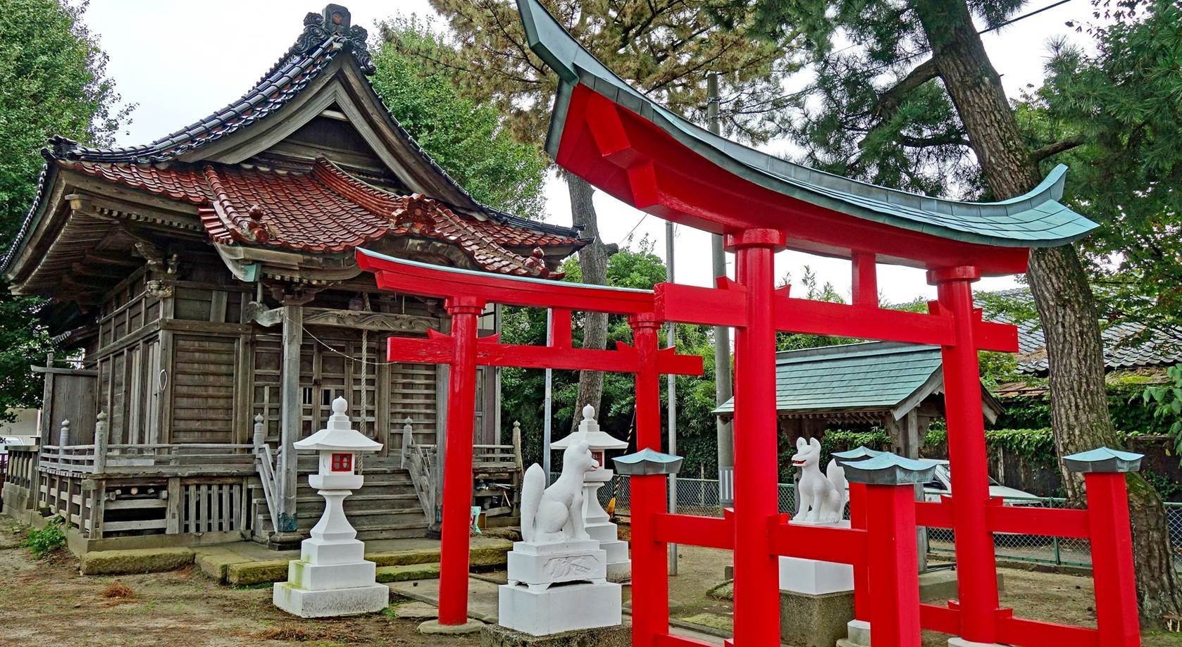
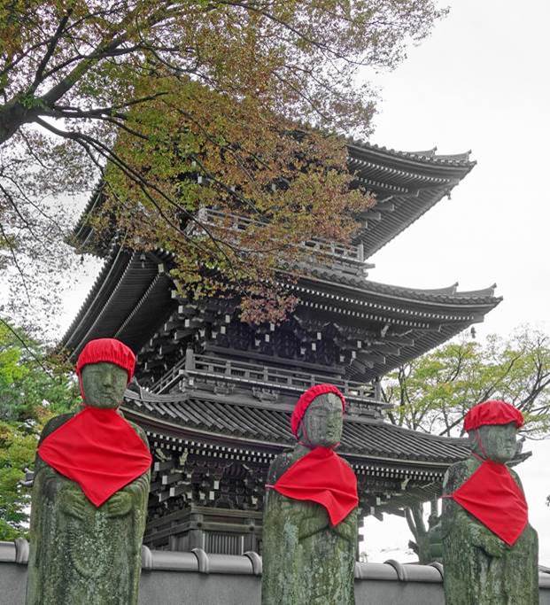
Small Inari
shrine with white foxes, 300m north of the Sankyo warehouses.
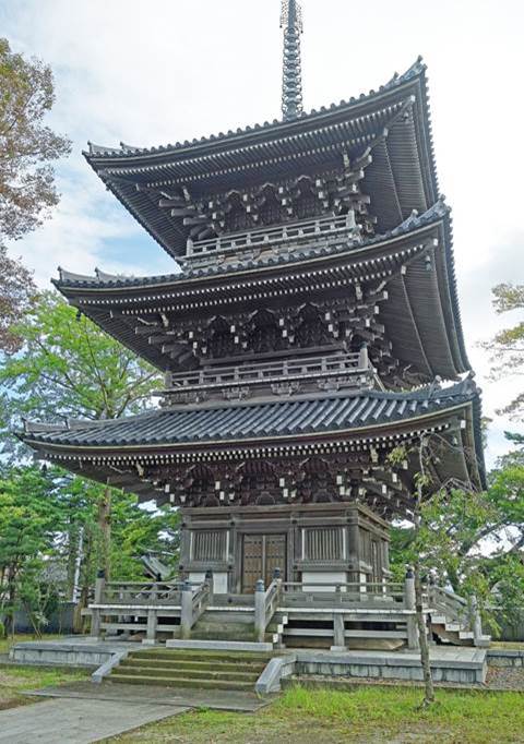
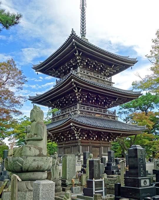
Three-storied
pagoda at the Kaianji temple.
|
|
|
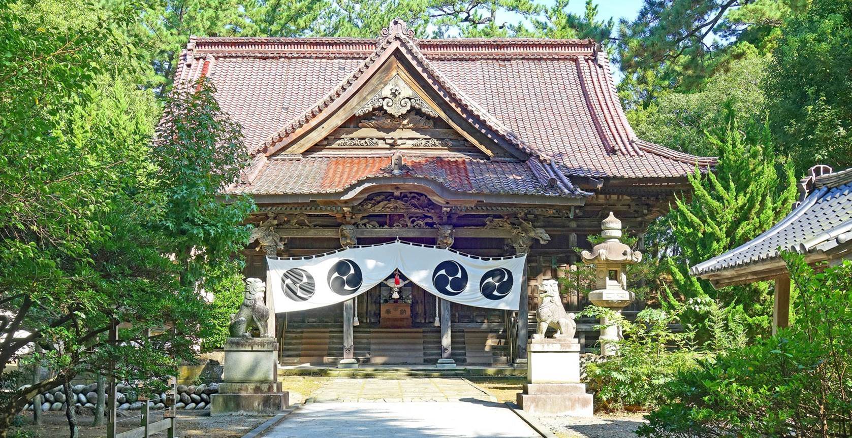
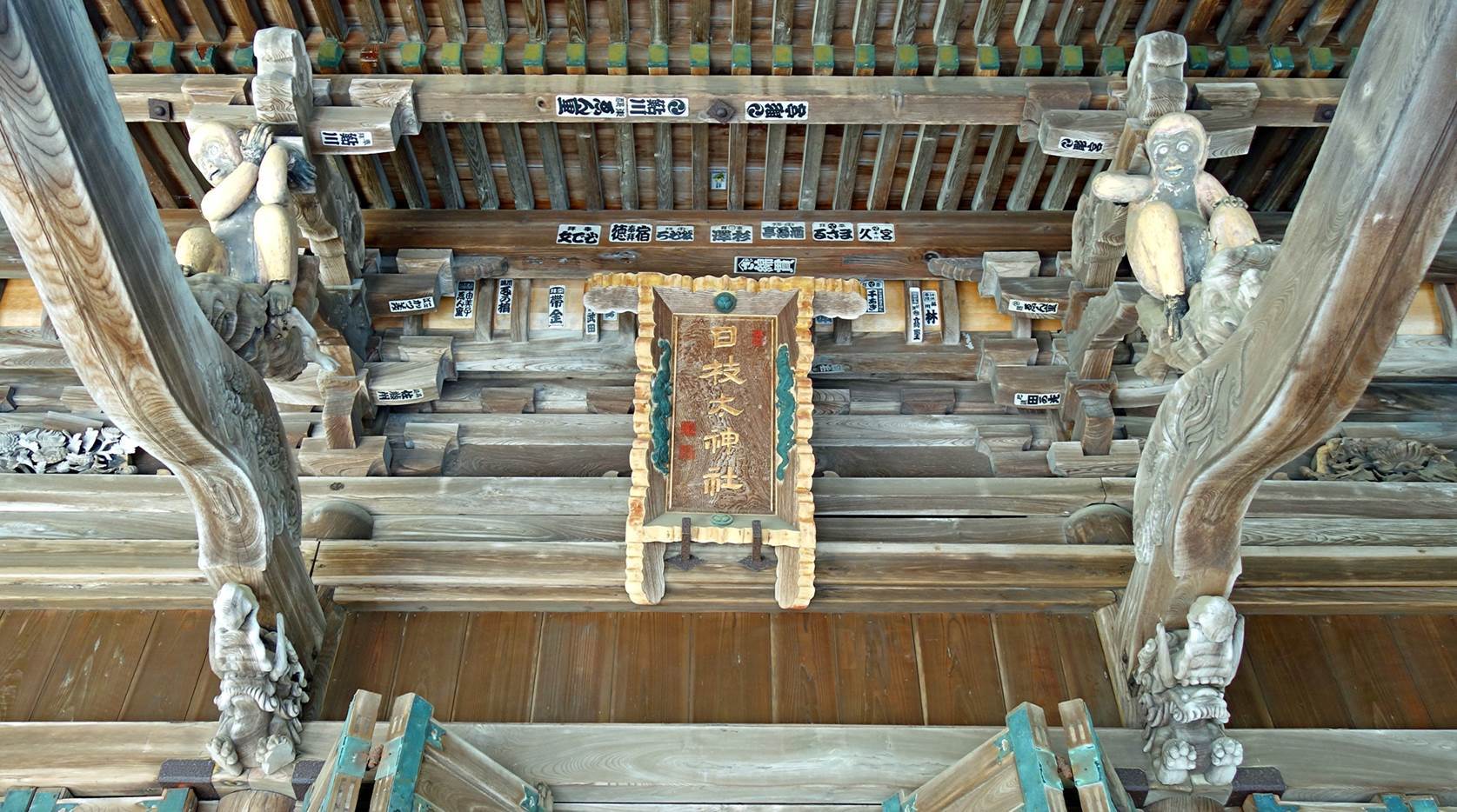
|
Shimohie-jinja (Shinto shrine), adjacent to the Hiyonuama park, home to gorgeous wood carvings (eight
photos below).
|
|
|
|
|
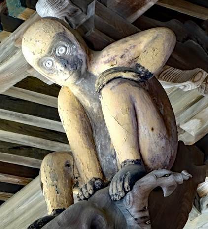
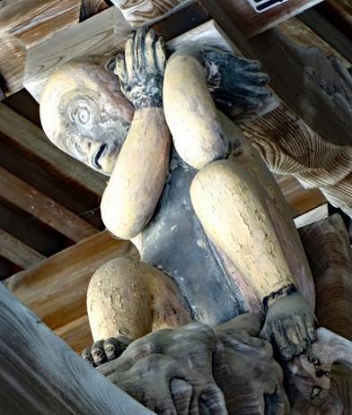
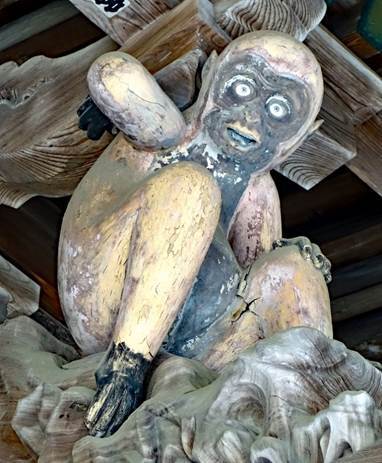
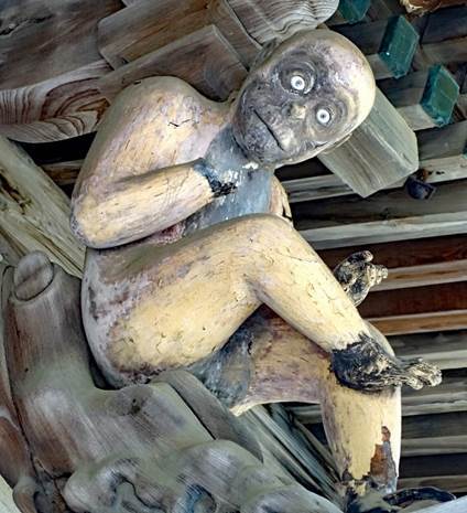
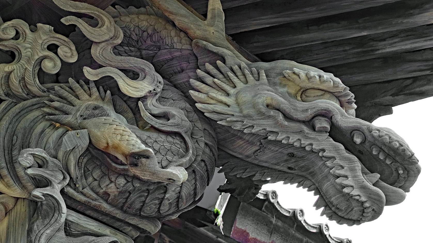
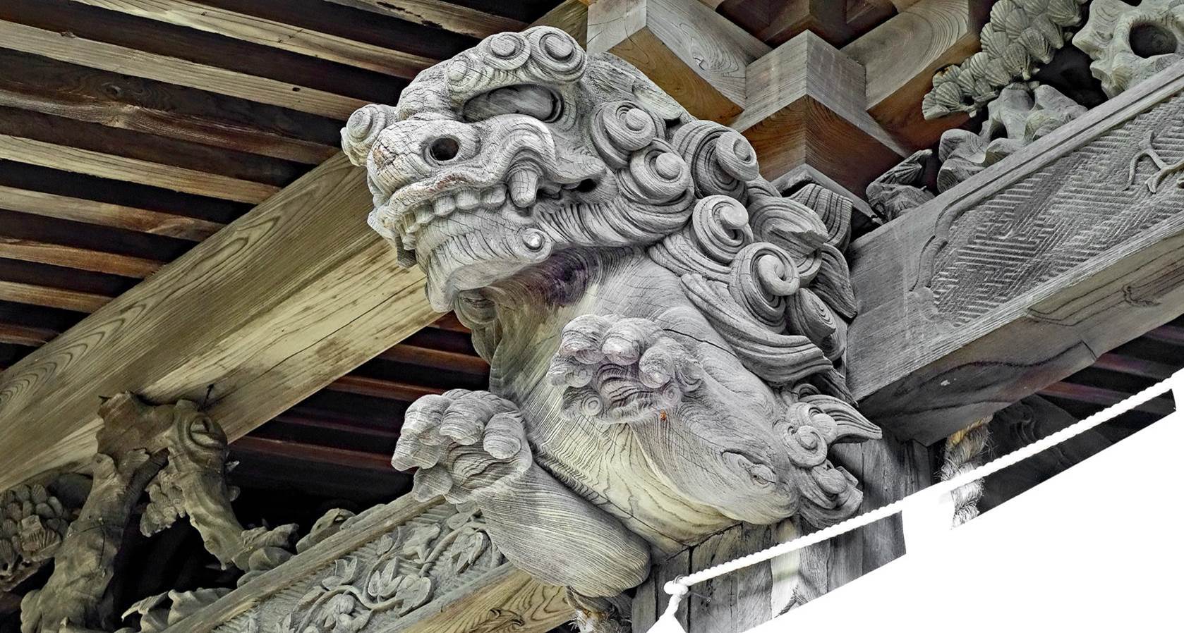
In the two
carvings above, note the remarkable use of the wood veins to accentuate the
three-dimensional rendering of the shapes.
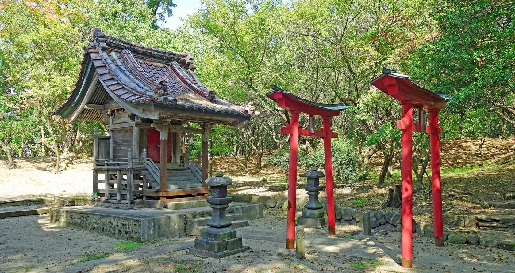
Tiny
secondary shrine in the precinct of Shimohie-jinja.
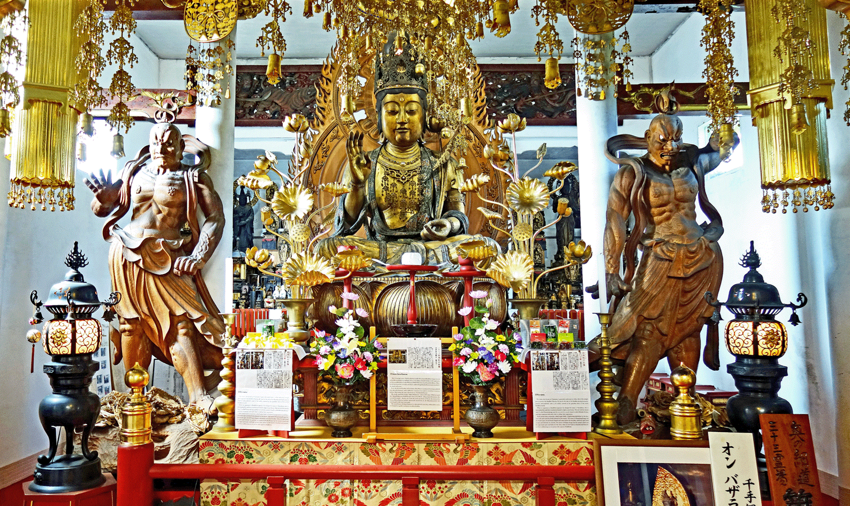
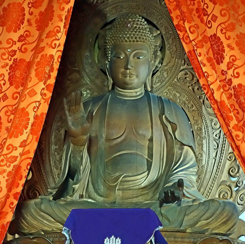
Statues of Buddha and his two guardians (Nyo) in a prayer hall of the Jichi-in temple.
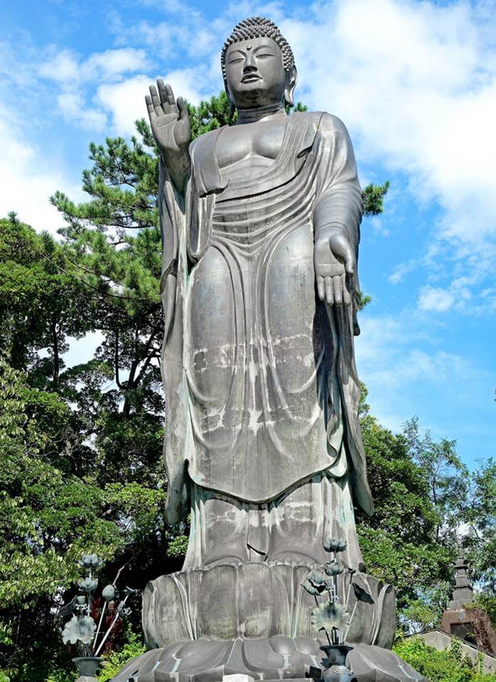
Two more Buddha statues at Jichi-in. The bronze
statue on the right, known as the Great Buddha of Sakata, is 17 meters high. It
was built in 1992 to replace the original Great Buddha of Sakata erected in
1914, which had been forcibly dismantled for its metal and used to make weapons
during WWII.
|
|
|
Zenpoji temple
Located between Sakata in the north and Tsuruoka in the south, this temple
is one of the three main Soto Zen Buddhist temples in Japan. When it was
established in 938, its name was Ryugeji. As this
name indicates, it was then a place of worship of the dragon god Ryujin,
considered the tutelary deity of the sea. It was not until the 15th century
that it became a Zen Buddhist temple called Zenpoji.
The temple nevertheless continued to attract fishermen and sailors, who
traditionally pray to the dragon god. Therefore, the presence of this temple
may have helped Sakata become a major stop on the Kitamaebune
sea route.
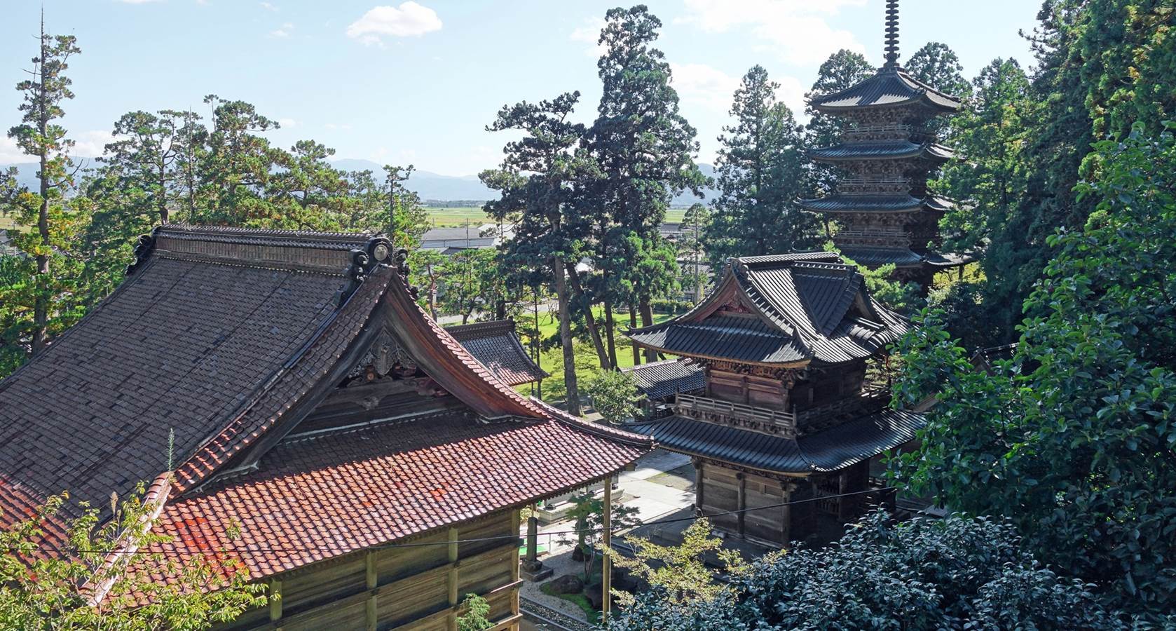
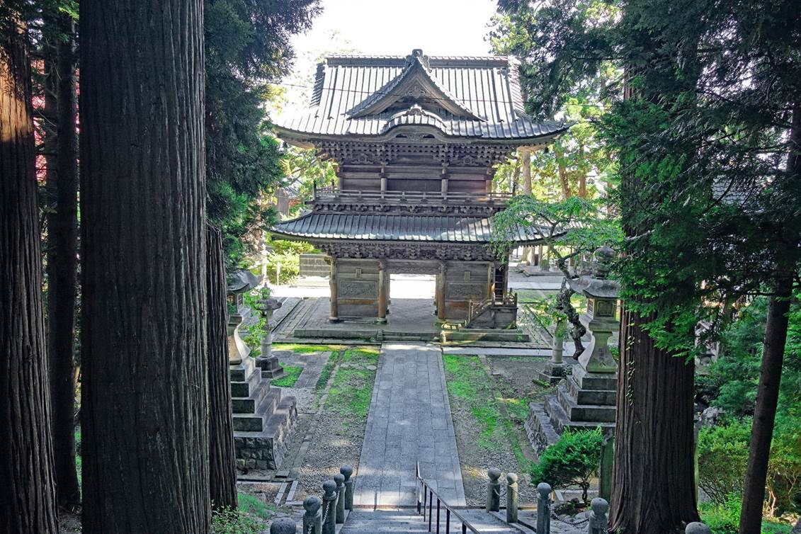
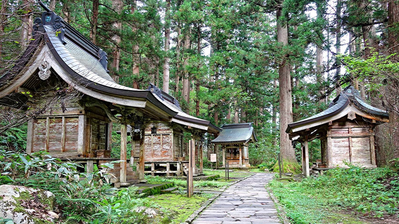
The temple is built on two levels against a forested slope. The most
interesting structures are located at the lower level.
View of the three main structures at the lower level. From right to left,
they are the five-storied pagoda, the two-storied Sanmon,
and the Gohyaku-Rakan-do.
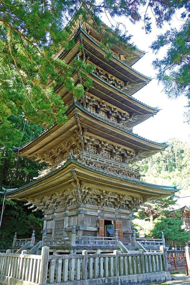
Views of the superb five-storied pagoda, said to have been built to
commemorate all the fish in the sea.
|
|
|

One of the four sides of the pagoda interior.
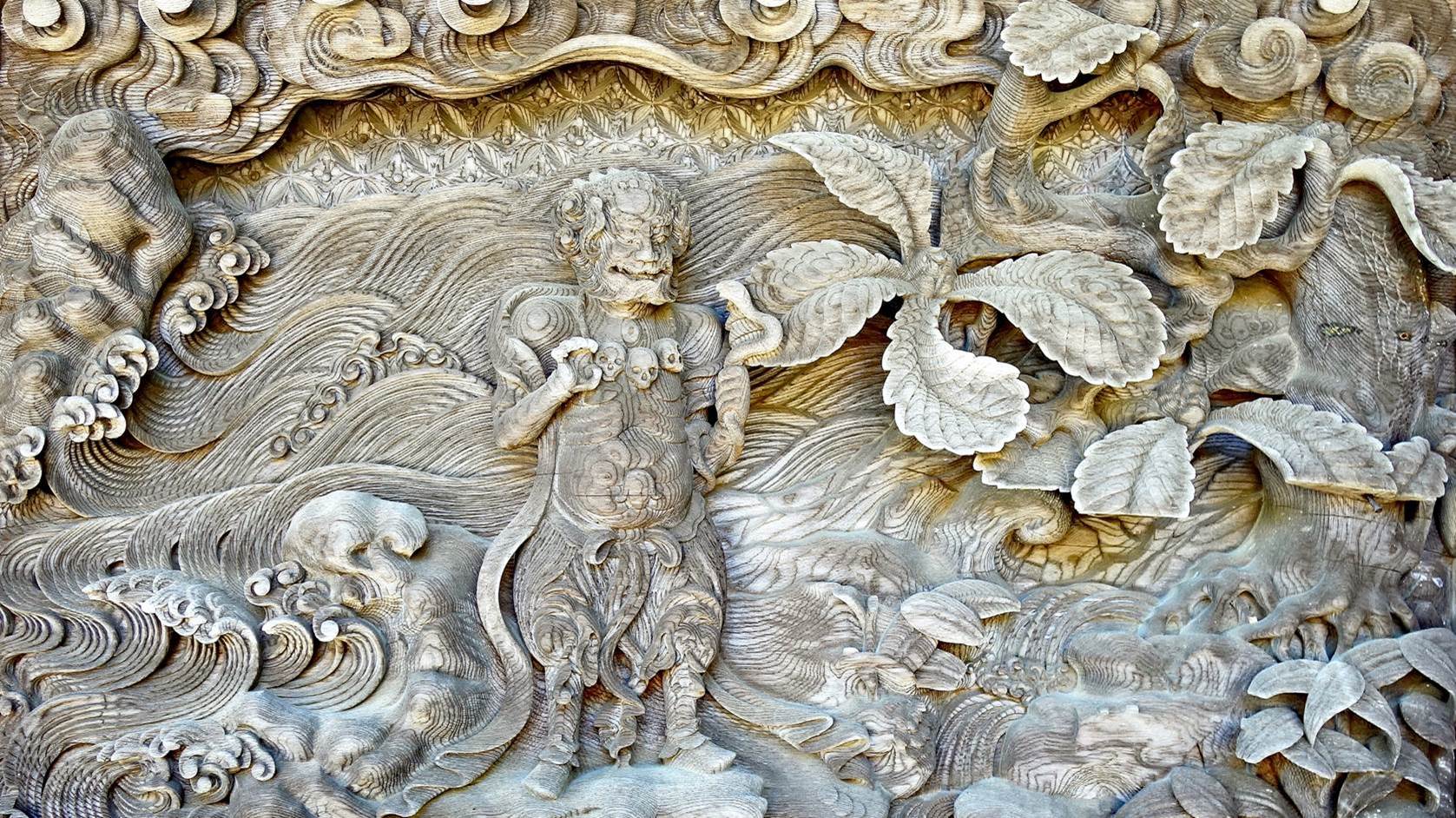
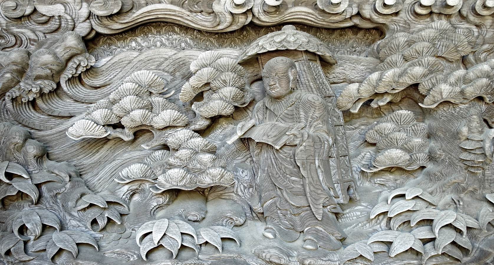
Two of the finely carved wood panels adorning the external walls of the
first level of the pagoda.
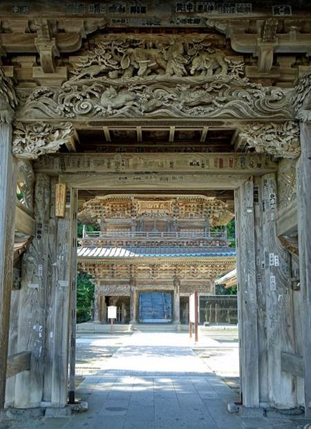
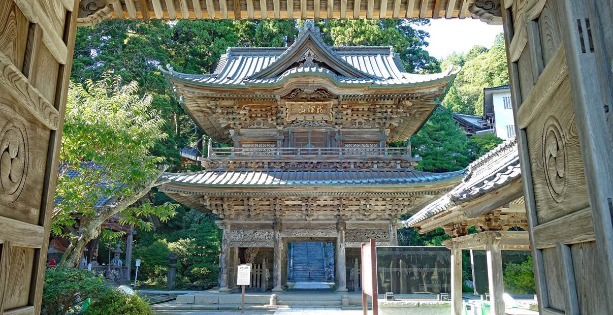
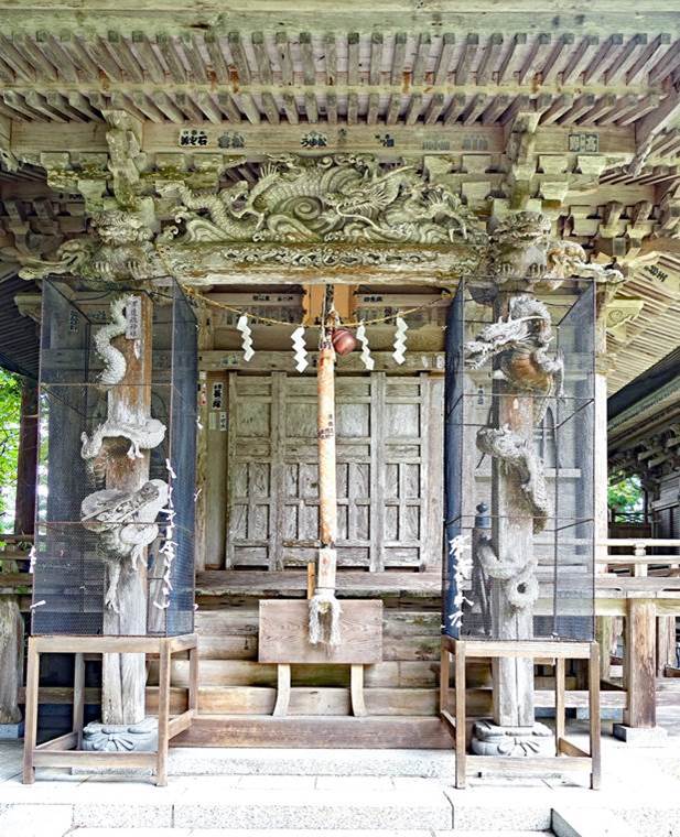
Two-storied sanmon (main gate of the temple)
seen from a smaller, finely decorated gate. The two gates are made of Japanese
elm.
|
|
|
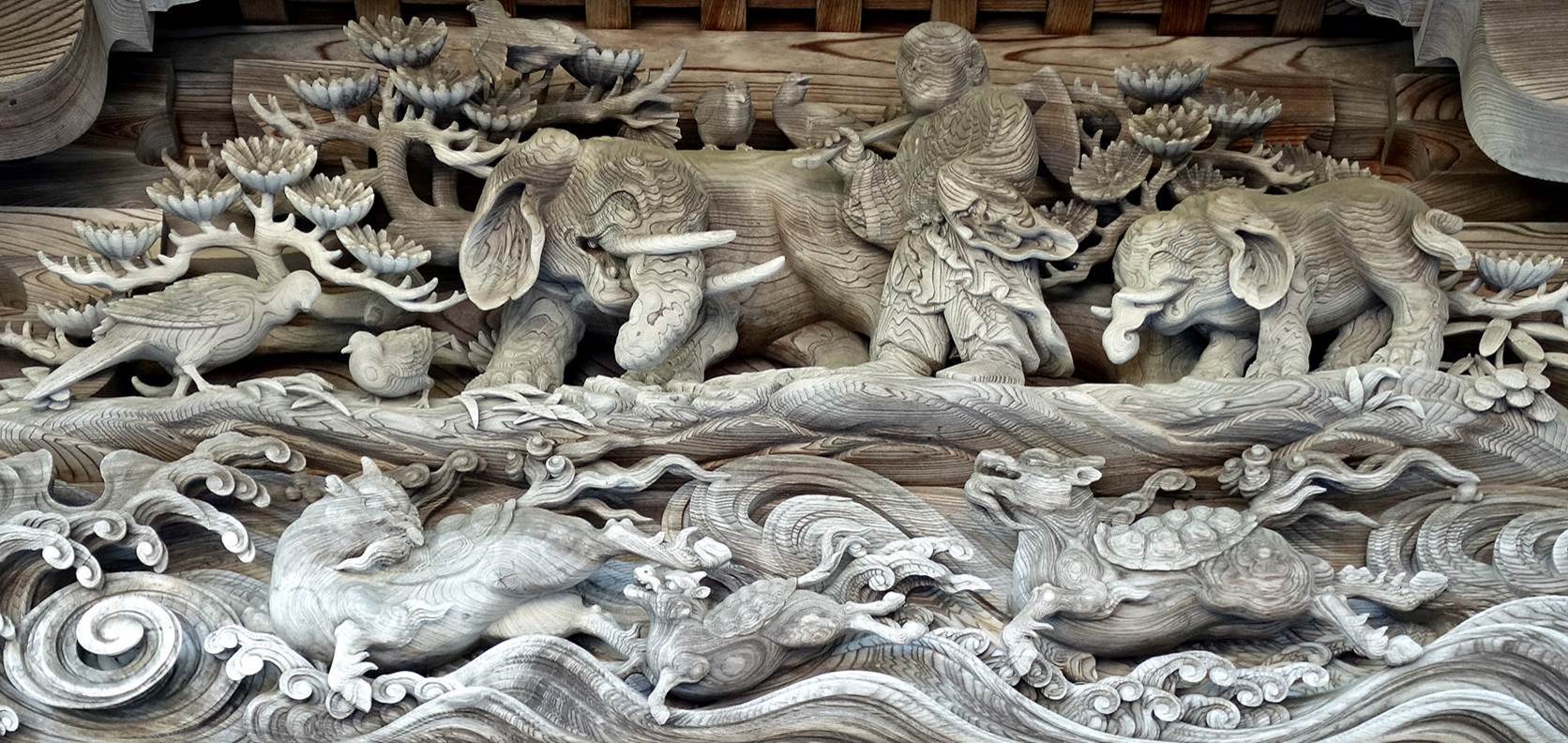
Close-up view of the carved upper panel of the smaller gate.
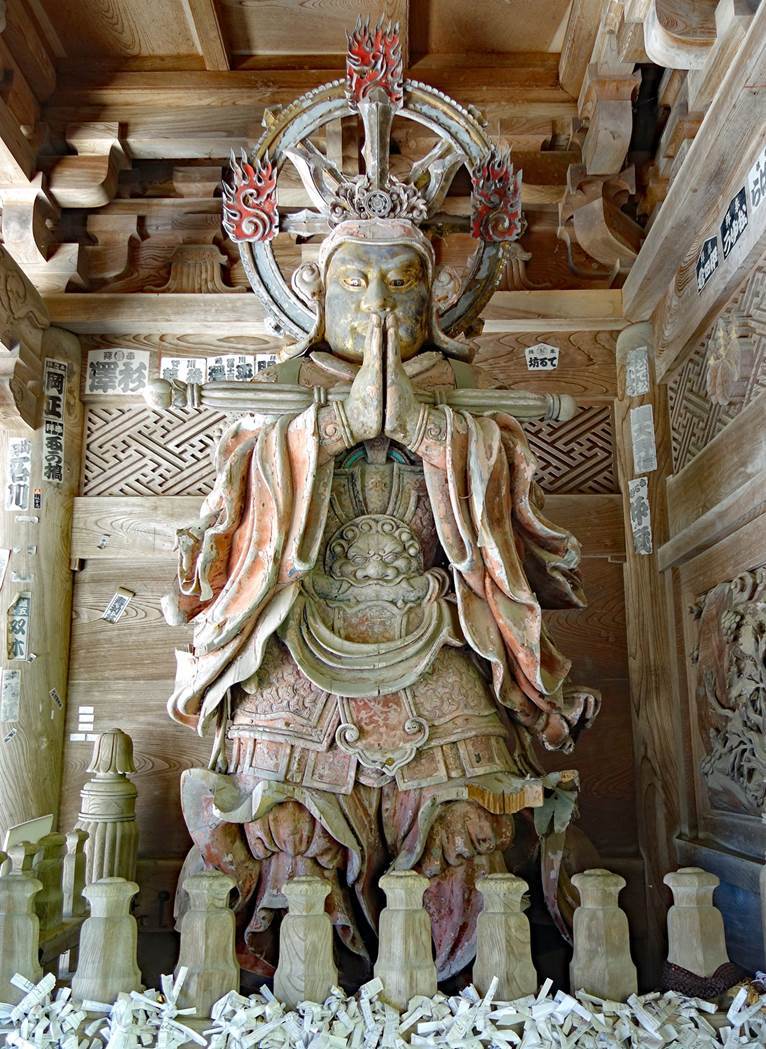
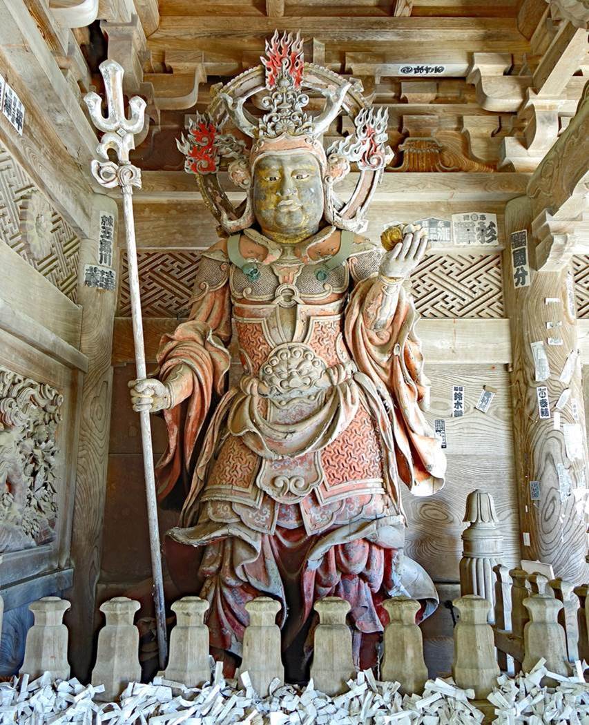
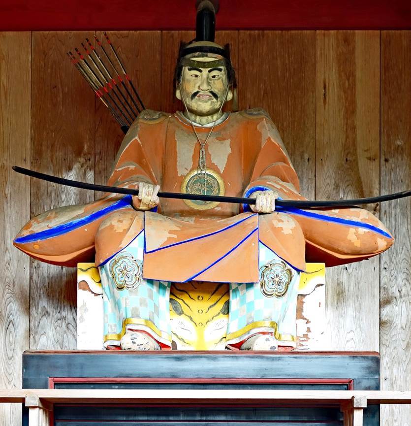
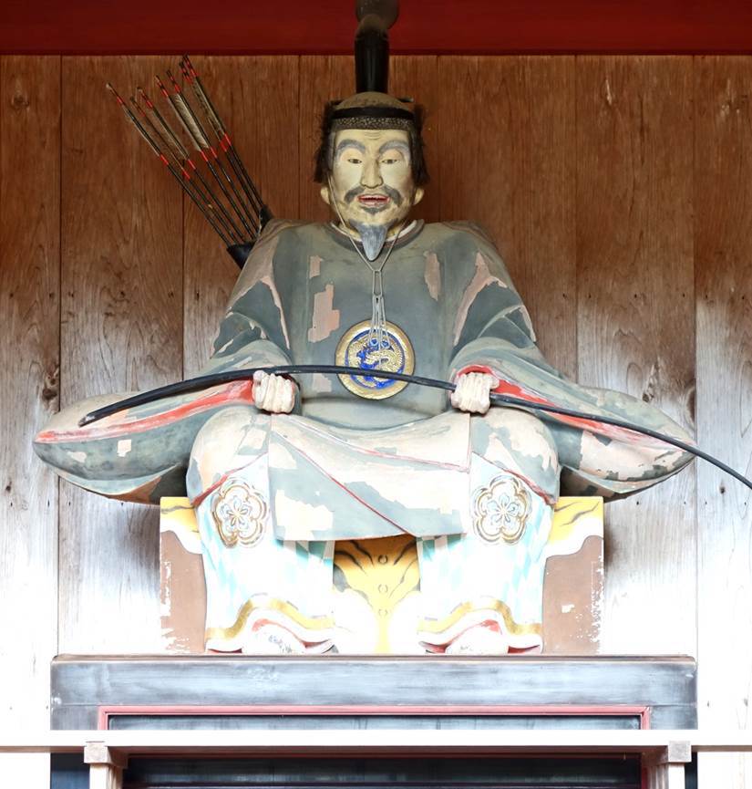
Guardians of the temple standing on each side of the sanmon.
|
|
|
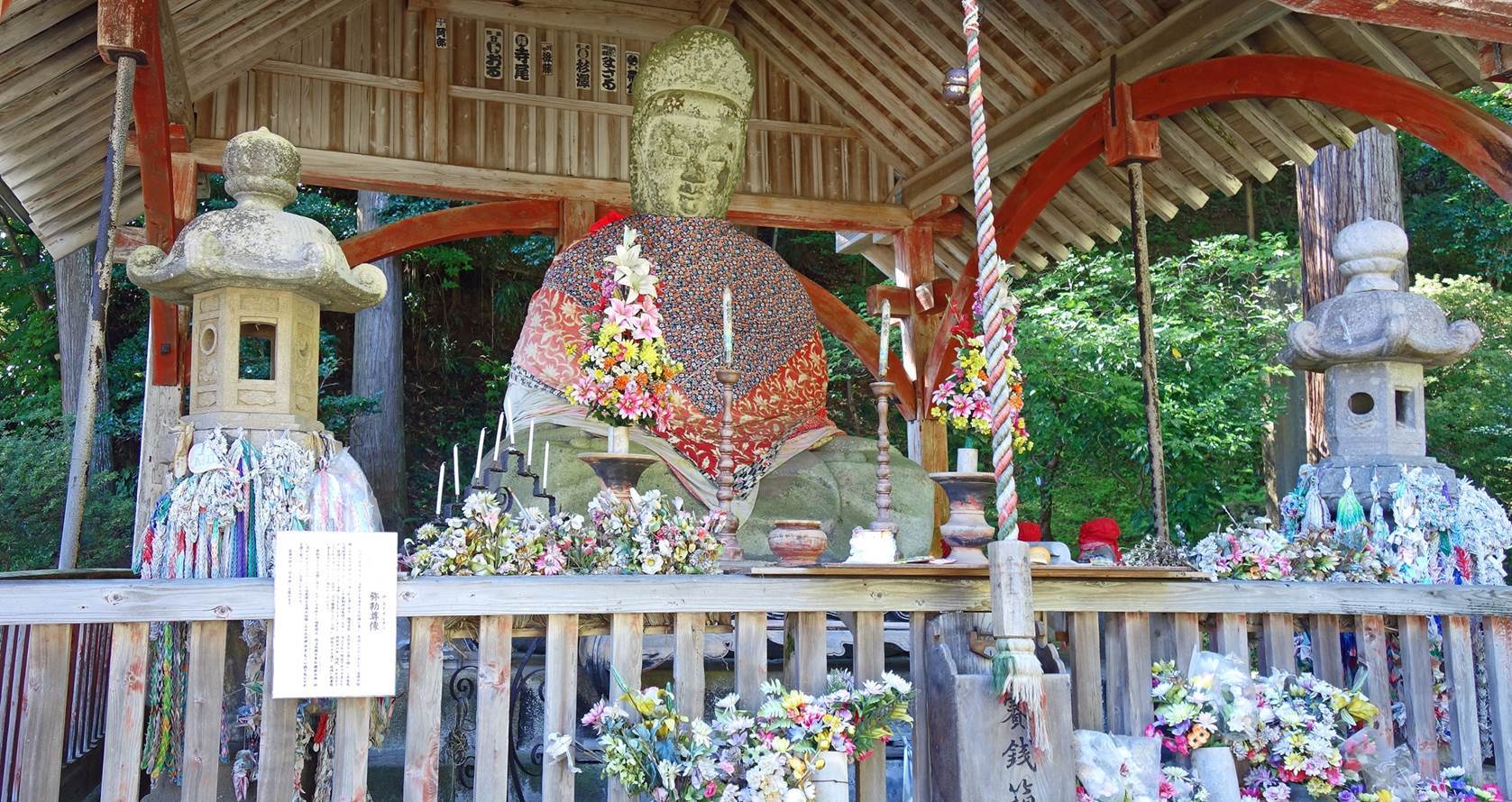
Buddha statue located behind the sanmon, to the
left of the stairs leading to the upper level of the temple.
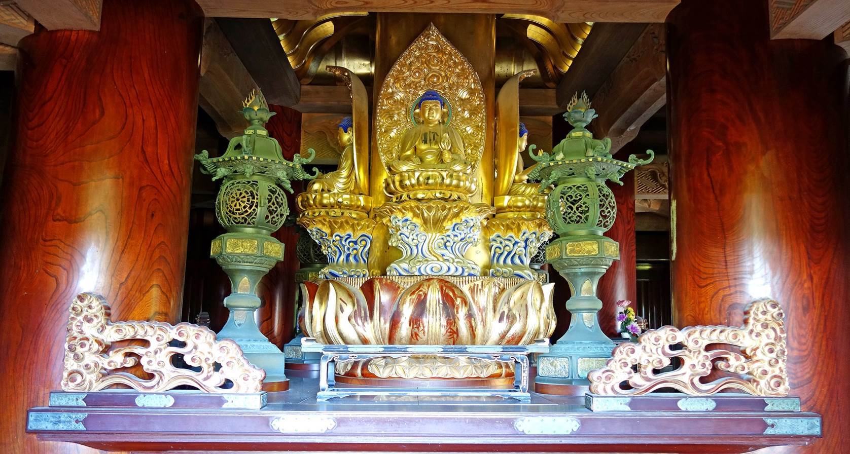
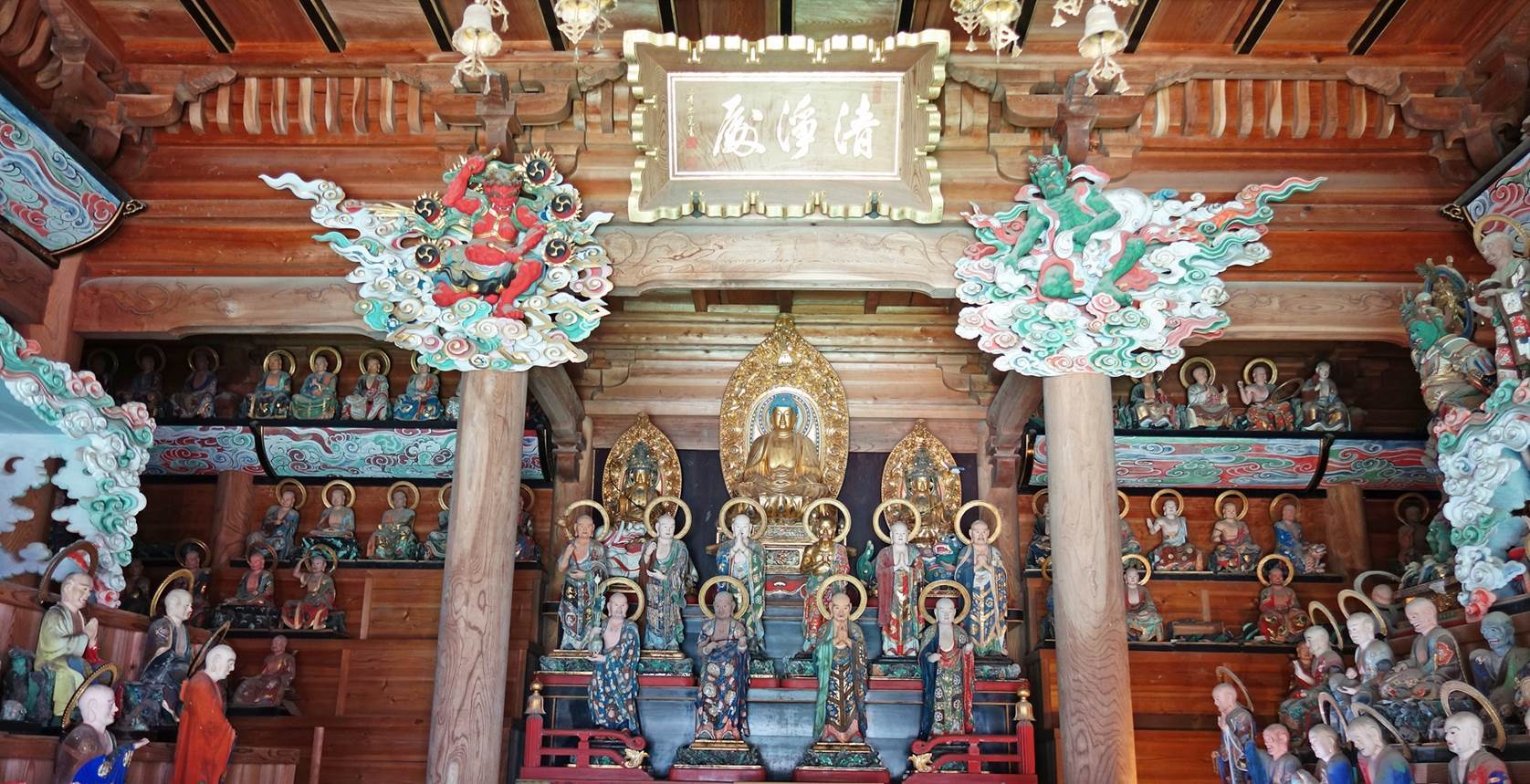
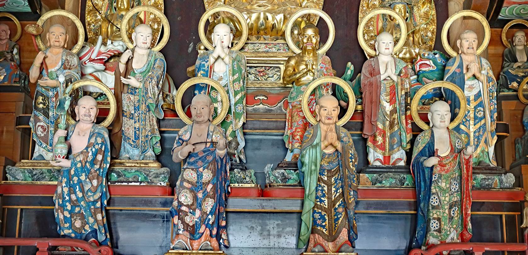
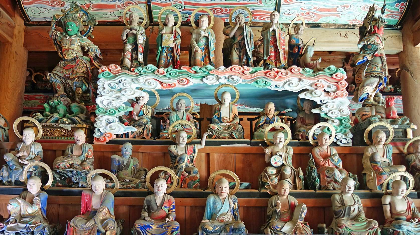
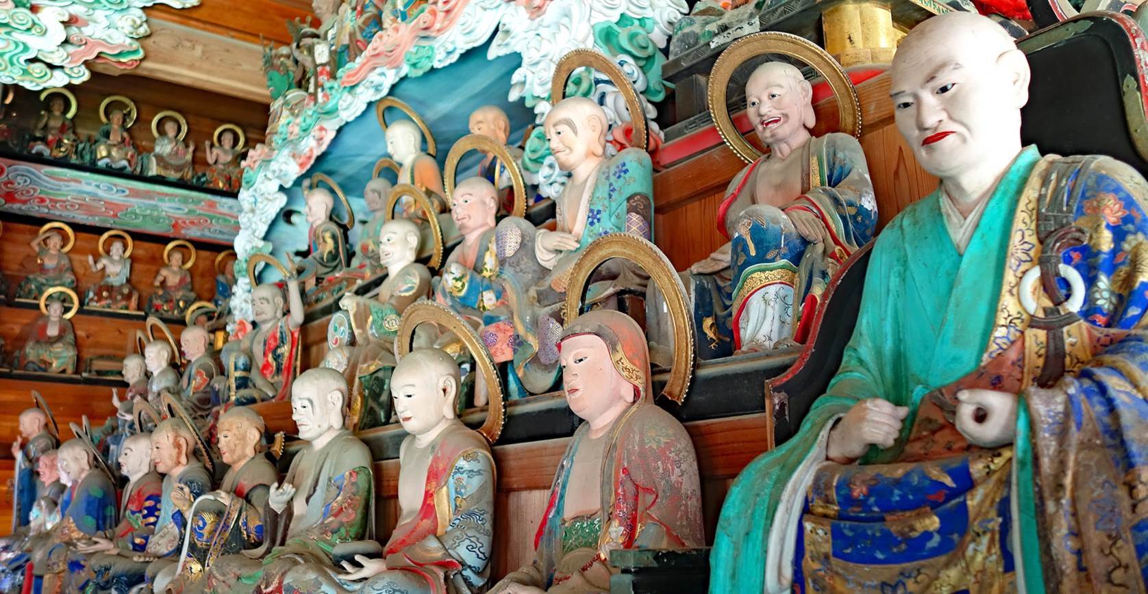
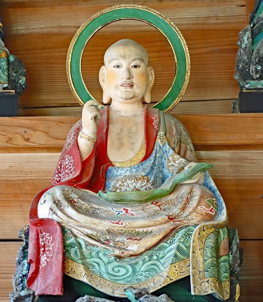
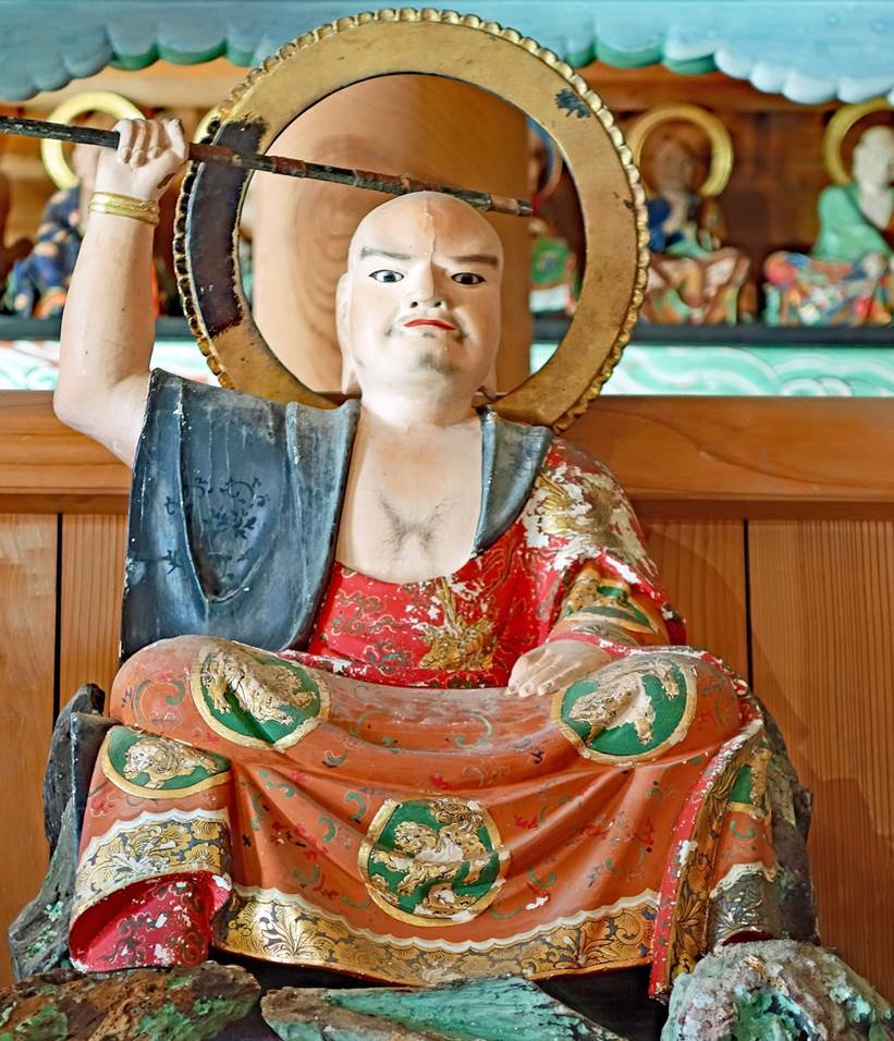
Views (6 photos below) of the spectacular interior of the Gohyaku-Rakan-do built in 1855. The three golden statues in
the center of the first photo depict Buddha flanked by two Bodhisattva. All the
other statues are rakan, the enlightened disciples of
Buddha. There are 500 of them in the room (not all visible in these photos),
each with a unique body posture and facial expression.
|
|
|
The sanmon seen from the stairs leading to the
temple's upper level.
|
|
|
Main prayer hall (on the right of the photo) at the upper level of the
temple.
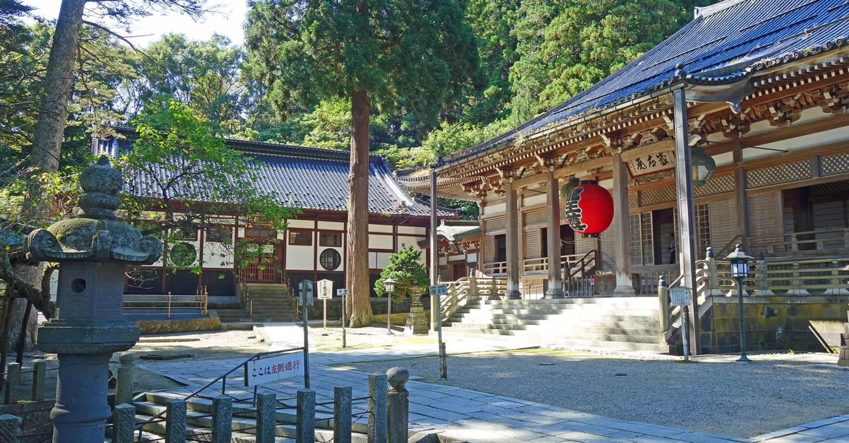
Other buildings at the upper level.
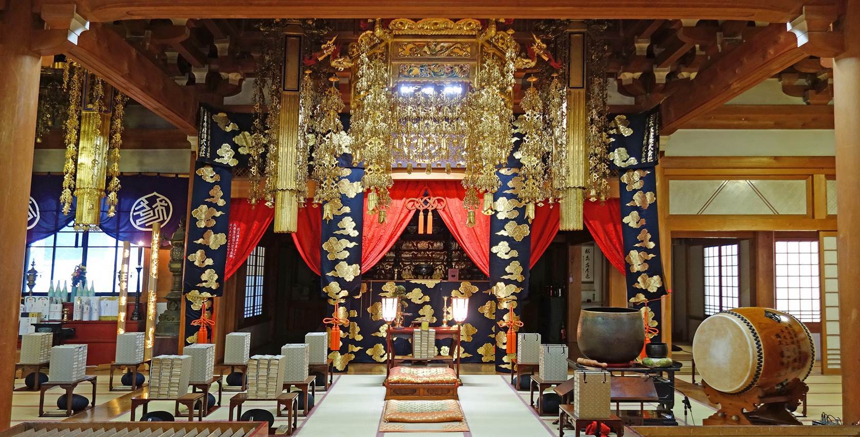
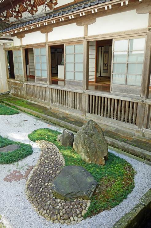
Interior
of a prayer room.
Small Japanese-style garden in a courtyard.
|
|
|
Tsuruoka
Tsuruoka was the capital of the Shonai domain.
Its castle was the seat of the Sakai clan who ruled this domain during the entire
Edo period. This castle was dismantled in the 19th century, at the end of the Boshin War (1868-1869).
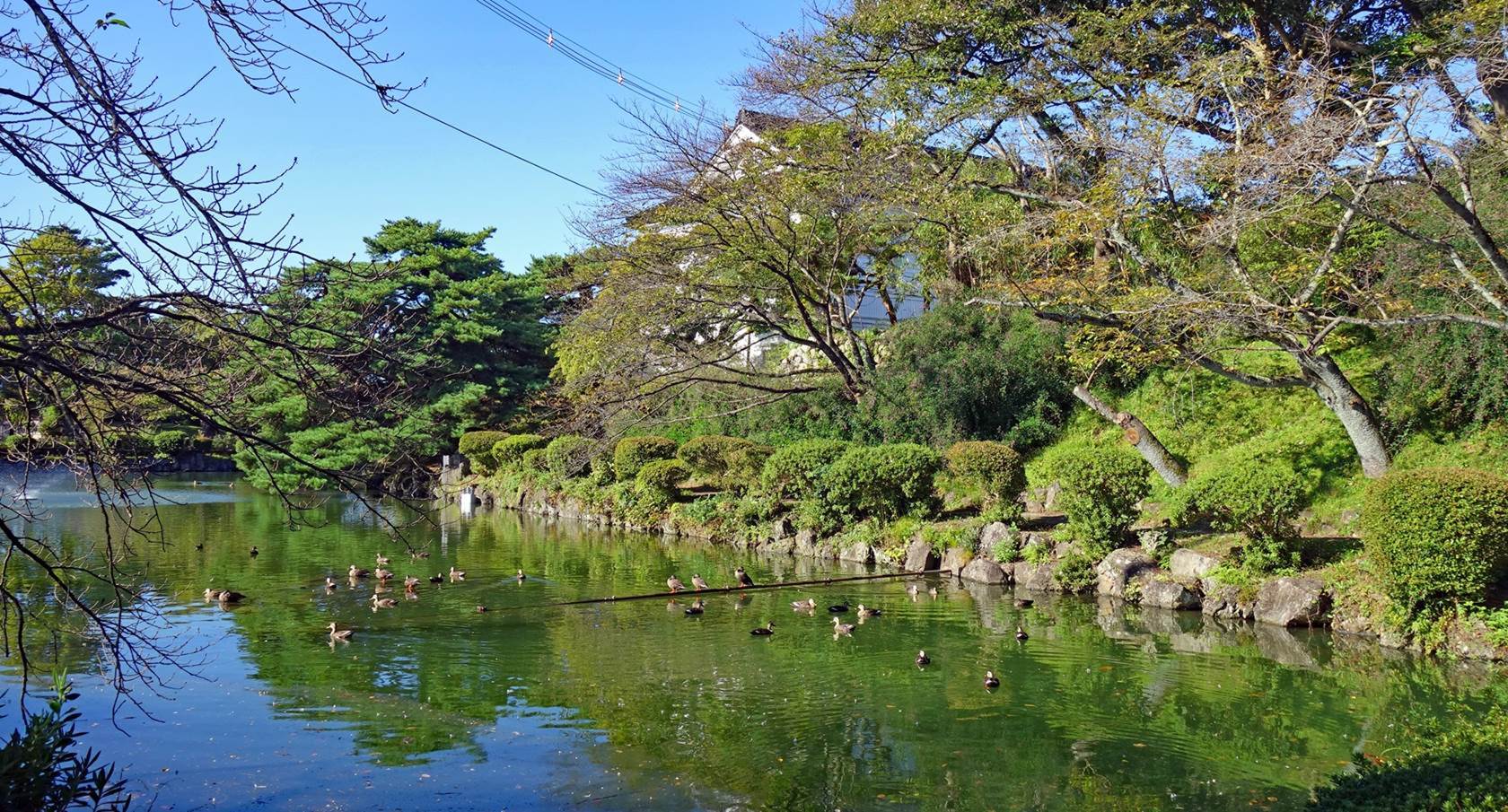
Moat of the former castle.
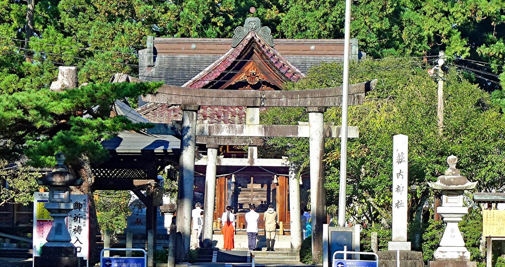
Shonai shrine.
Torii marking the entrance of the Shonai shrine
built in 1877 on the former grounds of the castle,
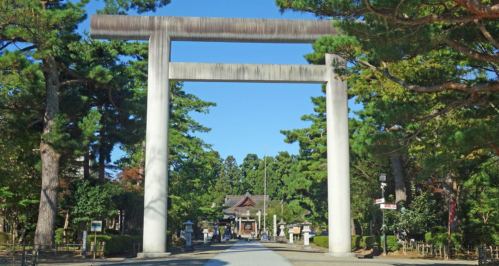
People praying at the Shonai shrine.
Chido museum.
This excellent museum was created in 1950 by descendants of the Sakai
lords. It features rich exhibits of objects (such as tools, fishing gear,
clothes...) related to the rural culture of the Shonai
region during the 19th and 20th centuries.
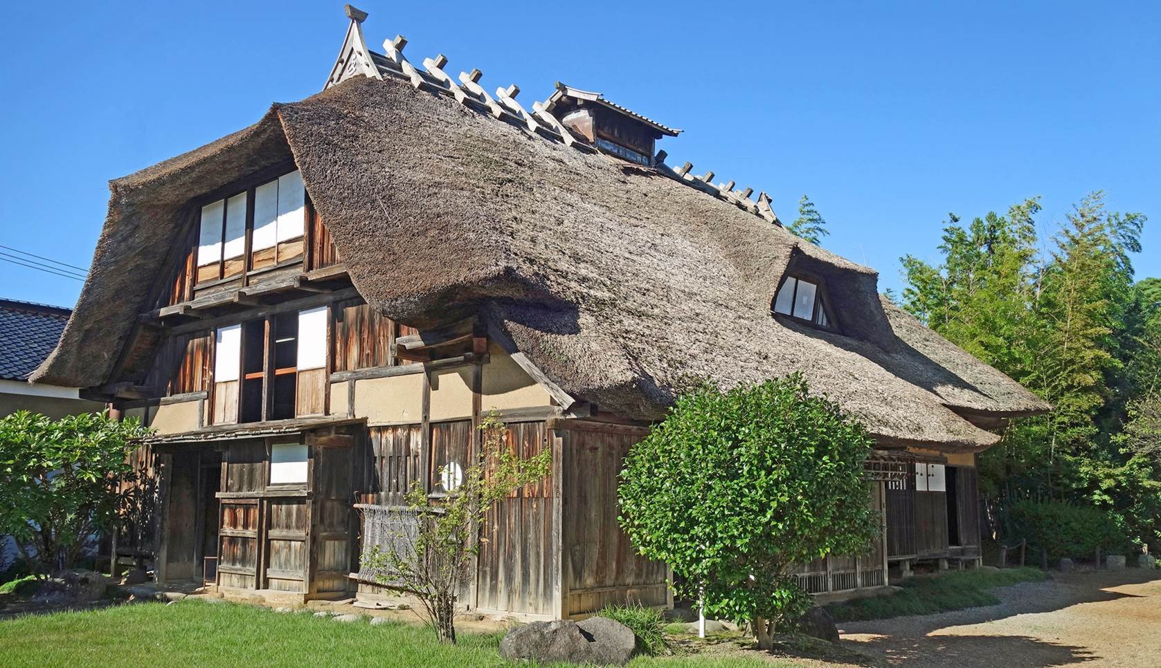
Farmhouse moved from Tamugimata, a village at
the foot of Yudono-san, and reconstructed on the
grounds of the Chido museum in 1965. Its front roof called ″kabuto zukuri″ (lit. ″helmet-shaped roof″) is
typical of that region.
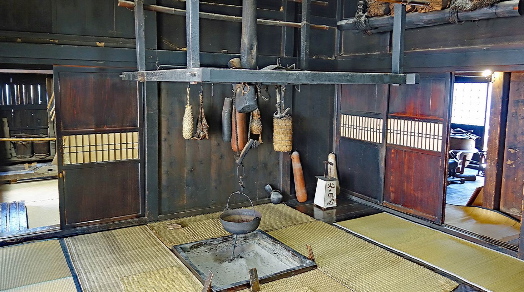
Room inside the farmhouse.
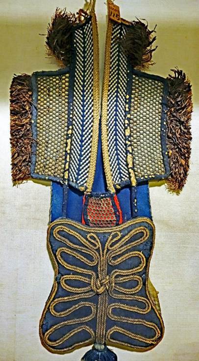
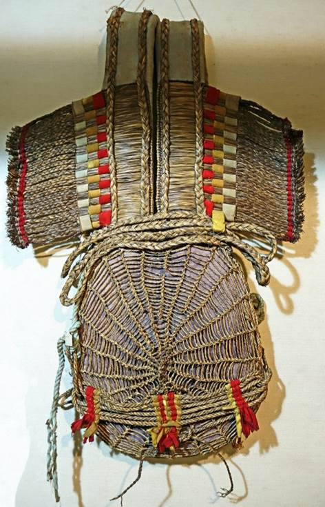
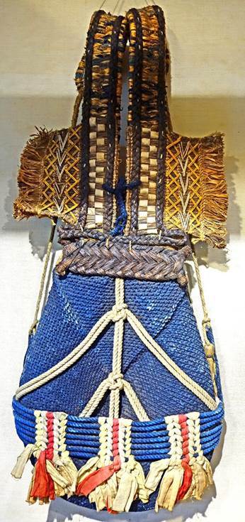
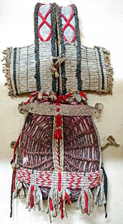
Some of the ″bandori″ shown in the
museum. These are back cushions primarily made of rice straw. They were used by
farmers to carry heavy loads, including rice, salt, fertilizer, and charcoal.
|
|
|
|
|
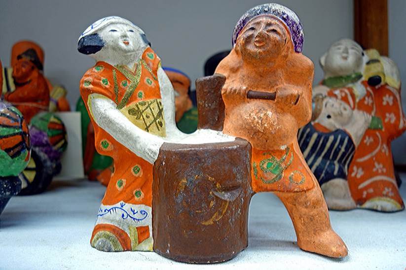
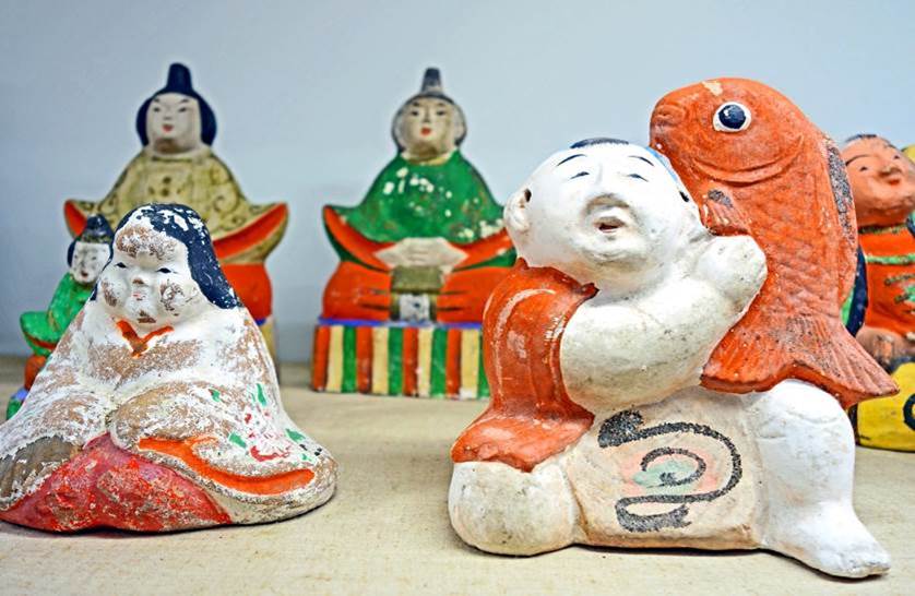
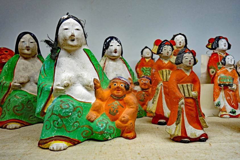
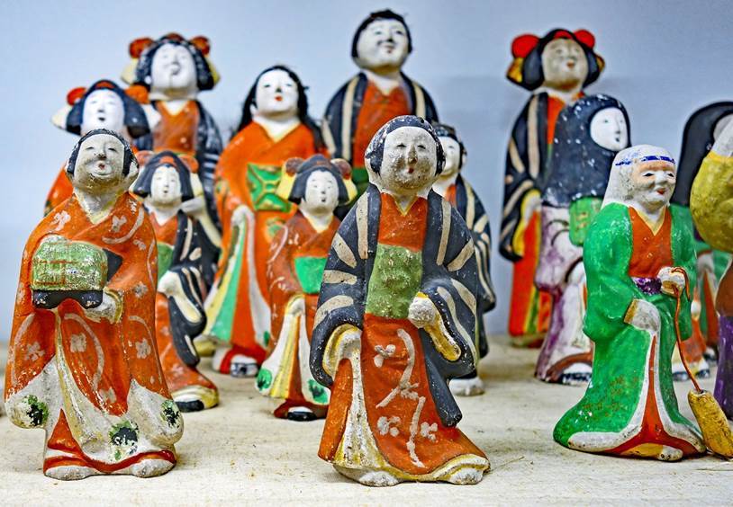
Tsuruoka dolls exposed in the museum. These
clay dolls are believed to have been made toward the end of the Edo period, as
the date marked on one of the wooden molds corresponds to the year 1821.
|
|
|
|
|
|
Haguro-san
Located 12km east of Tsuruoka, Haguro-san belongs to a cluster of three mountains,
collectively called Dewa Sanzan. The other two
mountains are Gas-san and Yudono-san.
Dewa Sanzan forms a sacred site of Shugendo, an ancient ascetic cult that draws from Buddhism,
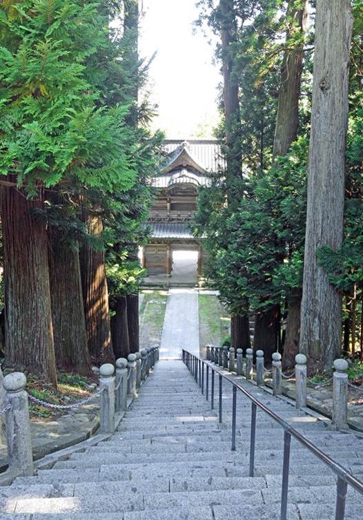
Shinto, and folk mountain worship. Practitioners are known as yamabushi (lit. ″mountain prostrator″). A
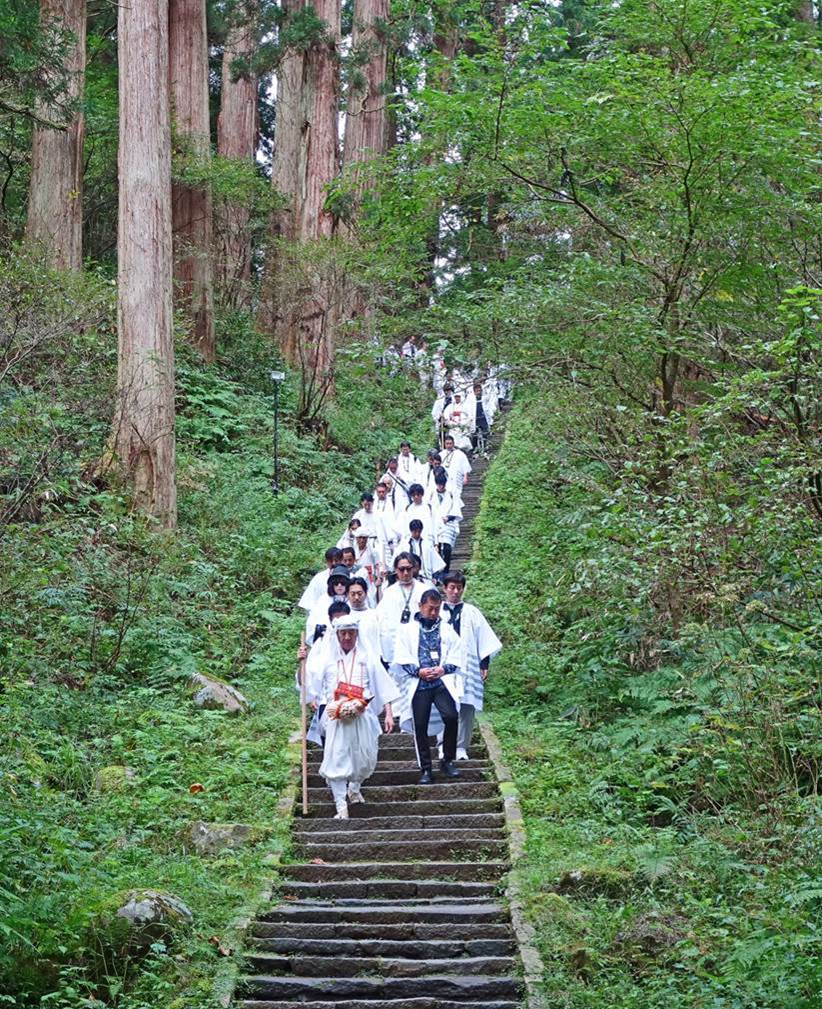
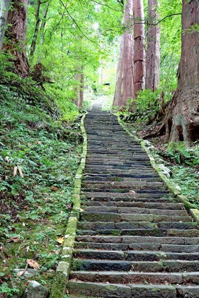
magnificent stone path comprising 2,446 steps connects the Zuishinmon
(gate) at the base of Haguro-san to the summit,
amidst Japanese cedars (sugi), many of which are
centuries old.
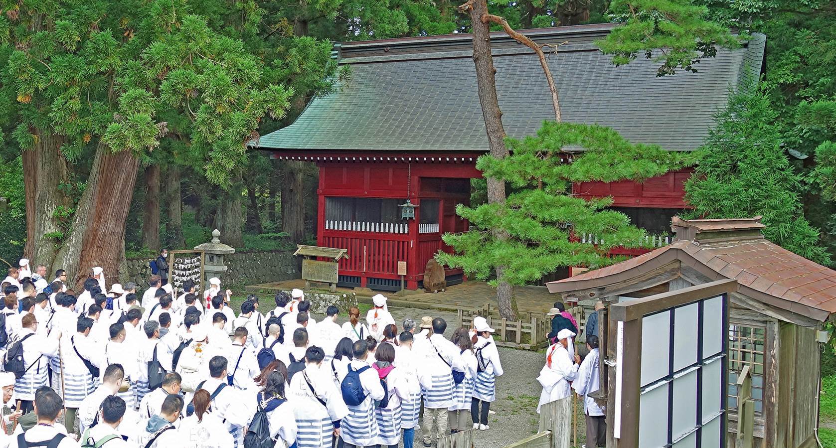
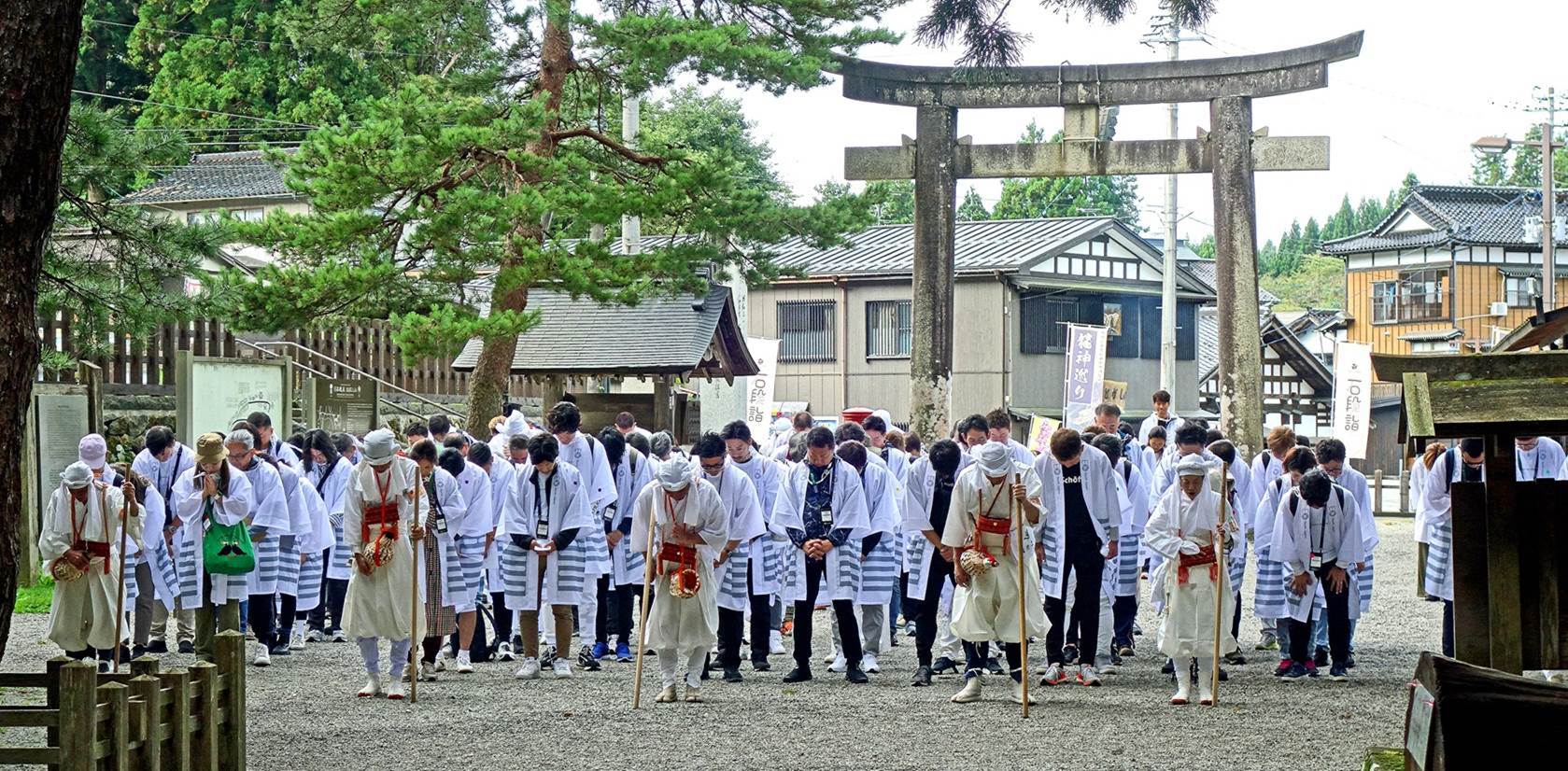
Yamabushi trainees standing
behind their leaders at the Zuishinmon, the dark vermilion gate erected at
the start of the stone path.
Statues in the Zuishinmon. They represent two
deities, Toyoiwamado no
kami and Kushiiwamado no kami, who prevent calamity and pestilence to cross the gate.
|
|
|
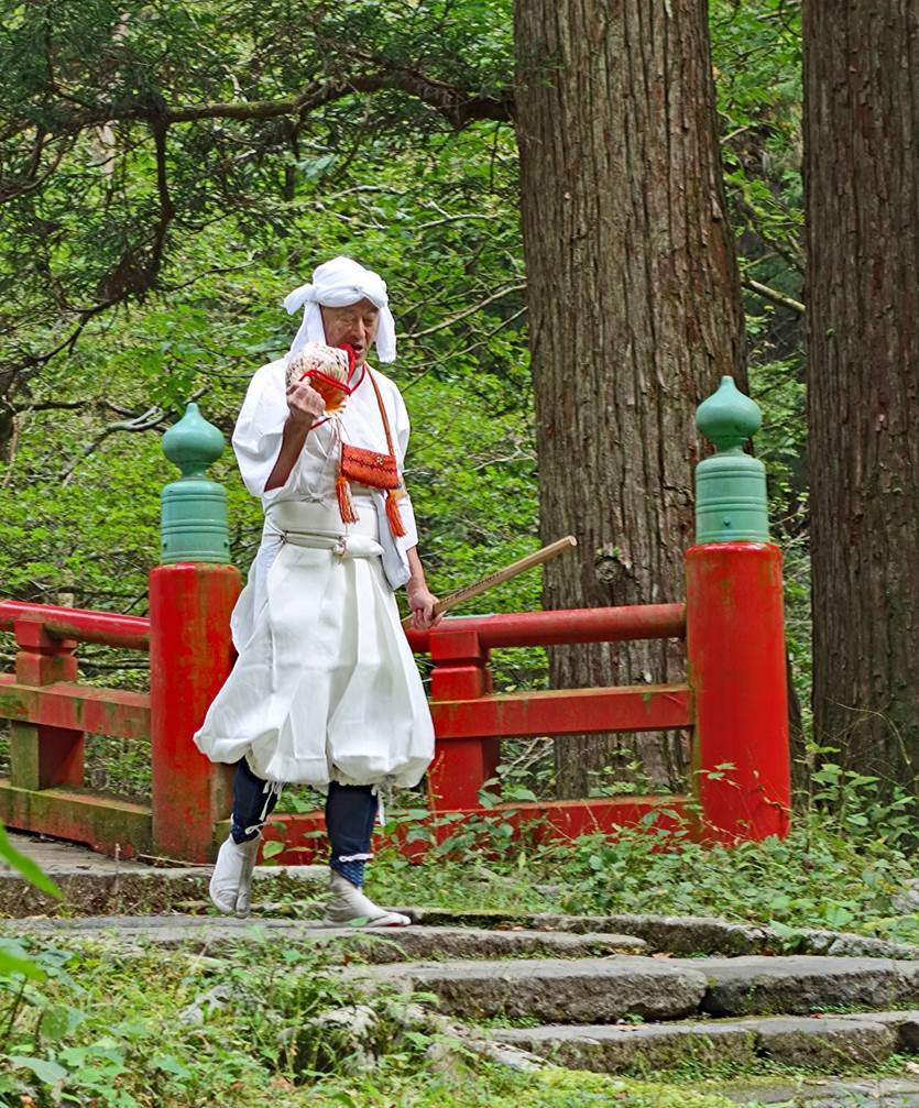
The yamabushi trainees and their 5 leaders seen
from the Zuishinmon. Each leader wears baggy pants and carries a conch shell (called an horagai),and a wooden
staff.
Left: The same group of people descending from the Zuishinmon
(the ascent of Haguro-san starts with a descent).
Right: A Yamabushi leader using his conch shell as a
trumpet to signal his presence.
|
|
|
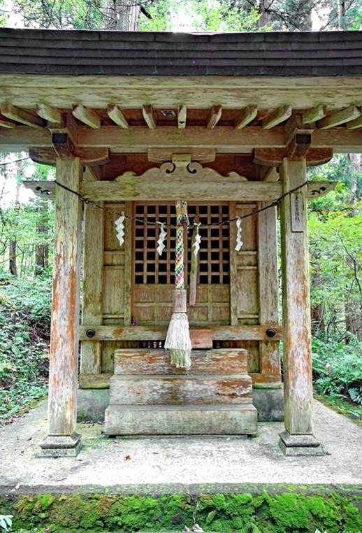
Small shrines, each dedicated to a distinct deity, at the base of the
descent.
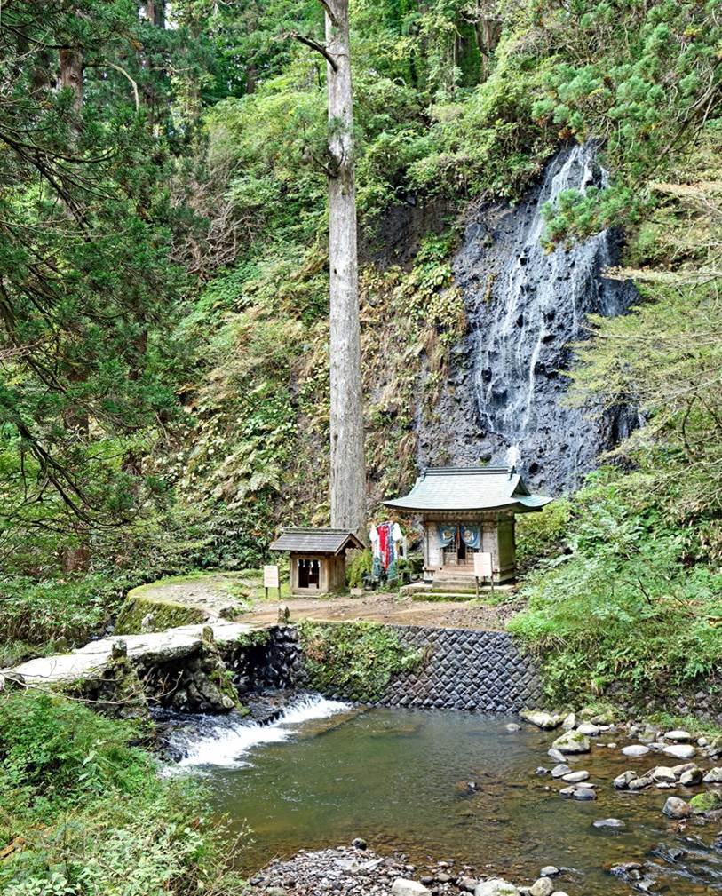
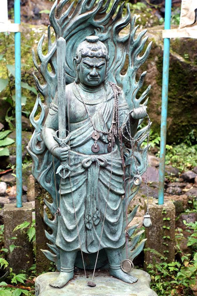
Left: Suga waterfall, the only one along the entire path. Right: Statue
of Fudo-myo-o at the base of the waterfall.
|
|
|
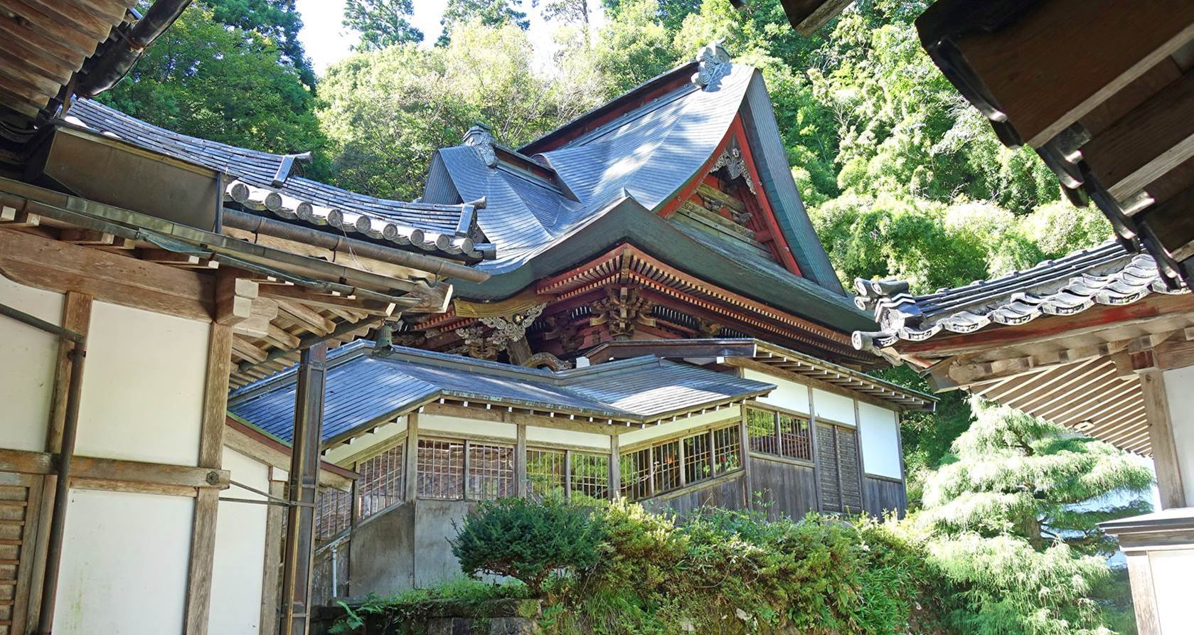
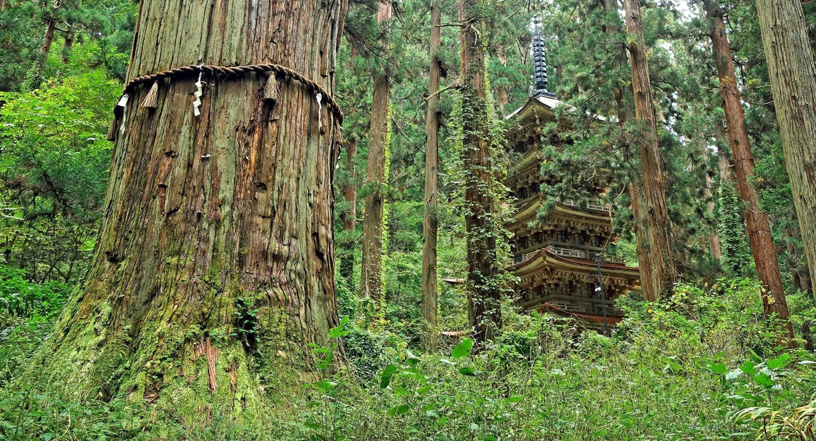
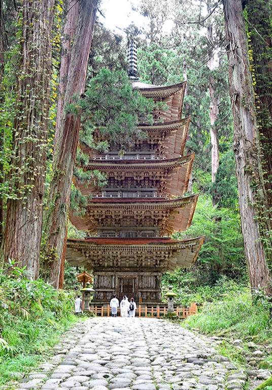
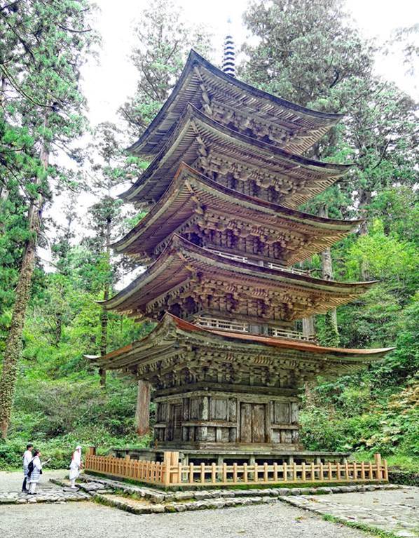
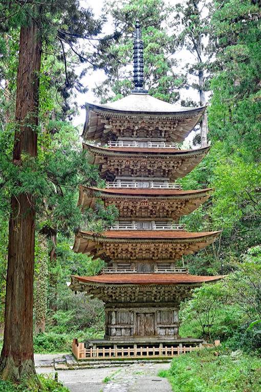
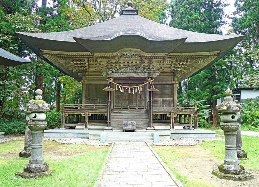
Jijisugi (meaning ″Grandpa
cedar″), the biggest and tallest cedar on Haguro-san,
estimated to be over 1000 years old, on the left of the photo, and the famous
five-storied pagoda of Hagura-san standing among
cedars, on the right.
Three more views of Haguro-san's superb 29m high
pagoda. This pagoda is a 1369 reconstruction of the original pagoda, built
around 935, but destroyed by a fire.
|
|
|
|
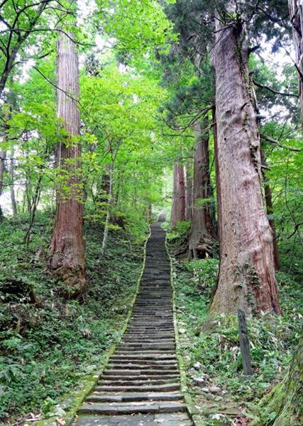
Views of the stone path at multiple locations beyond the pagoda.
|
|
|
|
|


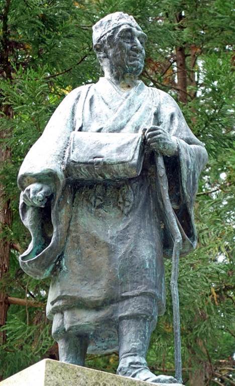
Left: Small shrine along the way. Right: Monument dedicated to haiku poet
Matsuo Basho, who traveled to Haguro-san.
|
|
|
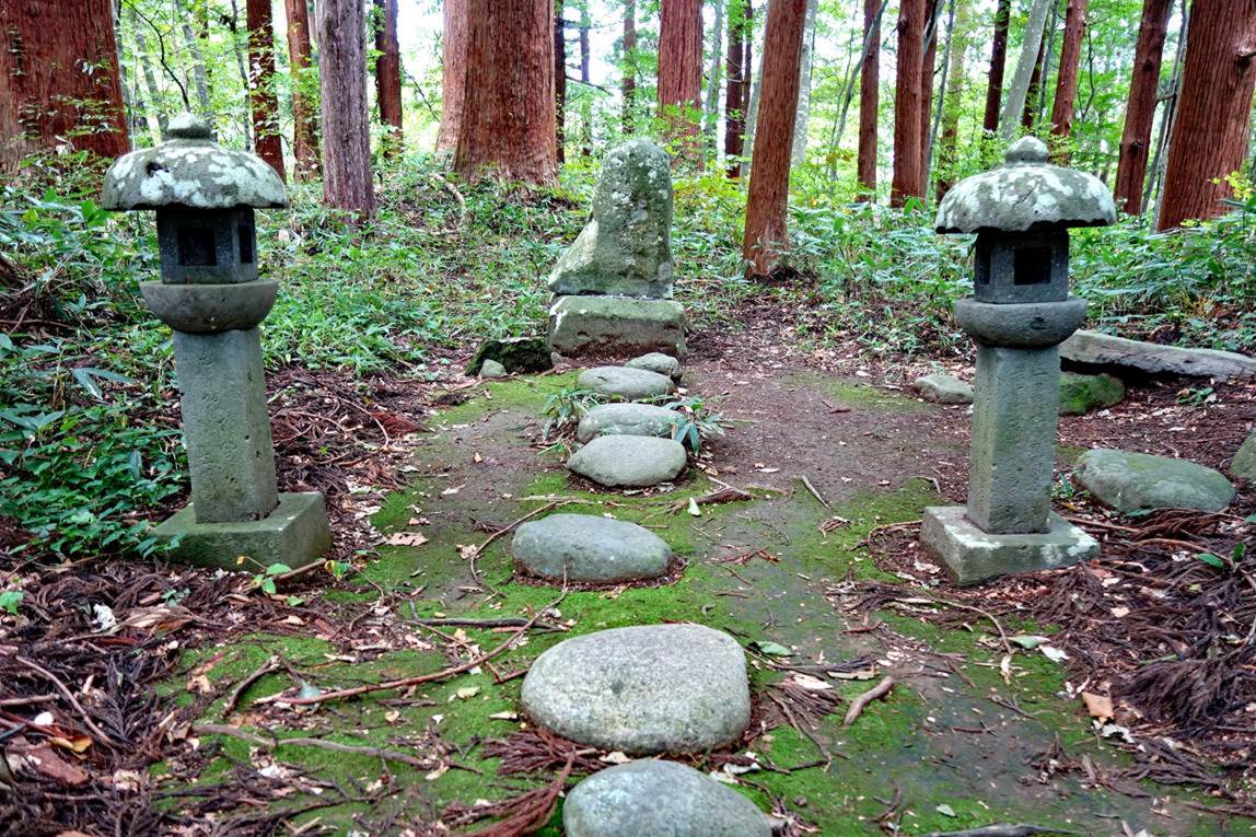
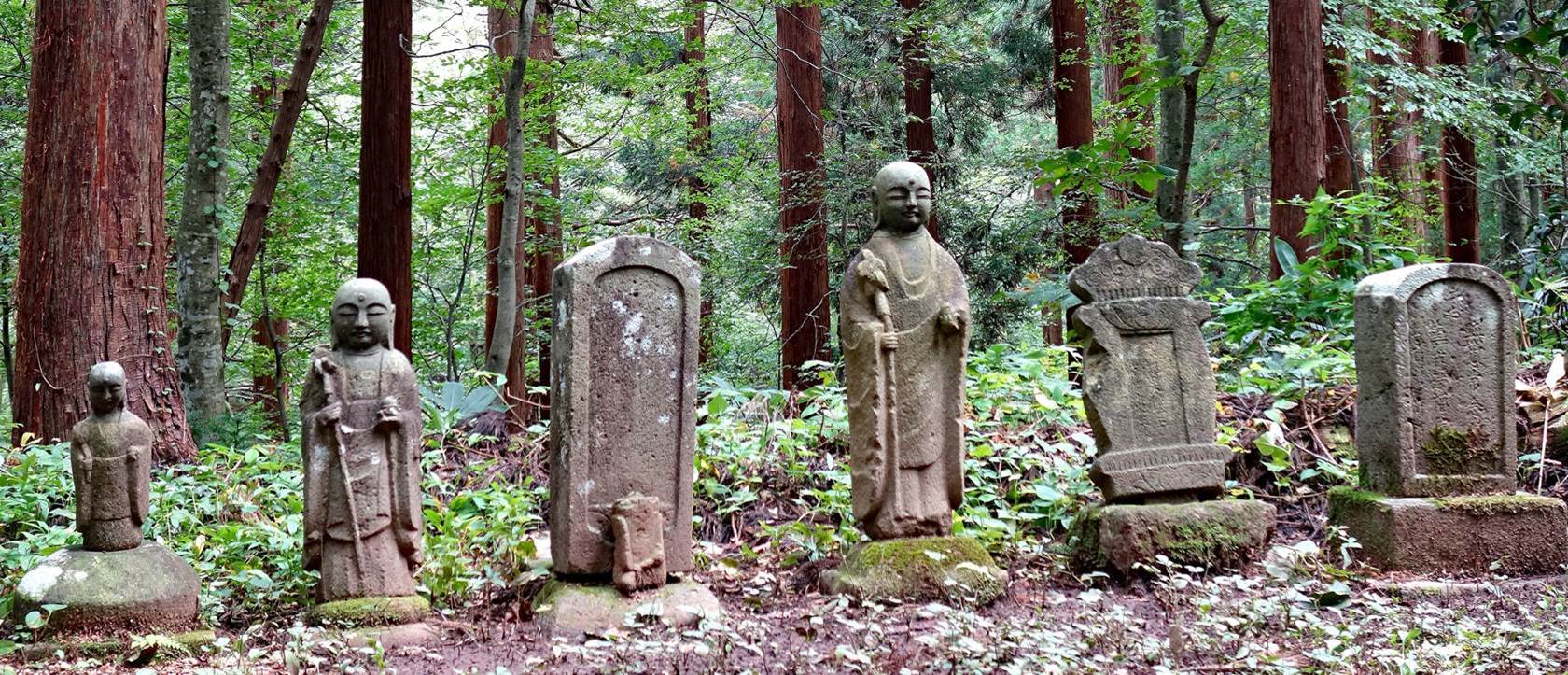
Buddhist statues and stelae (probably in a cemetery) slightly aside from
the stone path.
Left: Itsukushima shrine. Right: Prince
Hachiko shrine. These are the first two shrines seen upon arriving at the flat
summit of Haguro-san. Note the sophisticated carvings
of the Itsukushima shrine (close-up below).
|
|
|

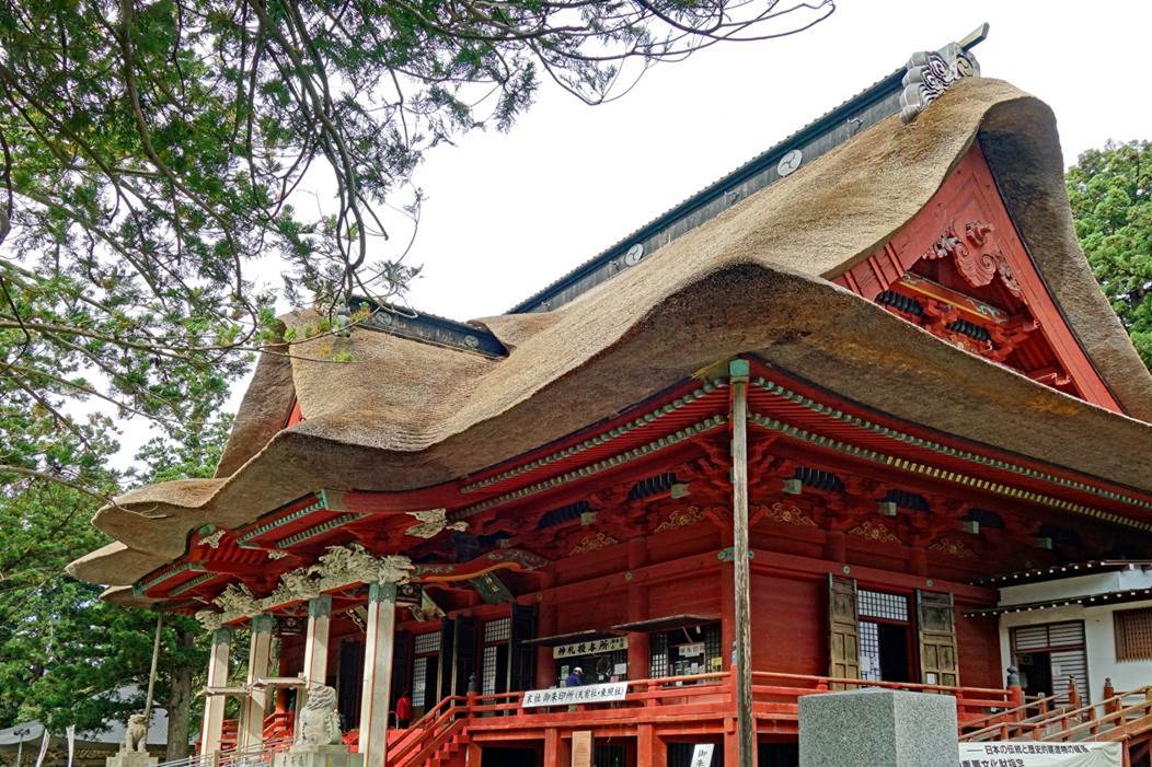
Sanjin Gosaiden shrine, seen from across the Kamami-ike (Mirror pond), at the
summit of Haguro-san. It is dedicated to the deities
of the three mountains of Dewa Sanzan. Its 2.1m thick
thatched roof is said to be the thickest in all of Japan.
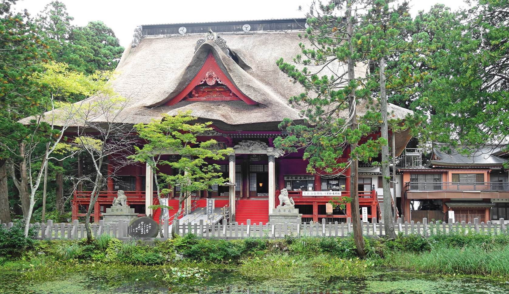
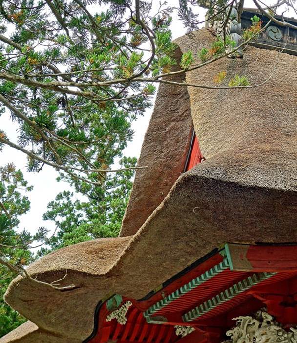
Other views of the Sanjin Gosaiden shrine and its spectacular roof.
|
|
|
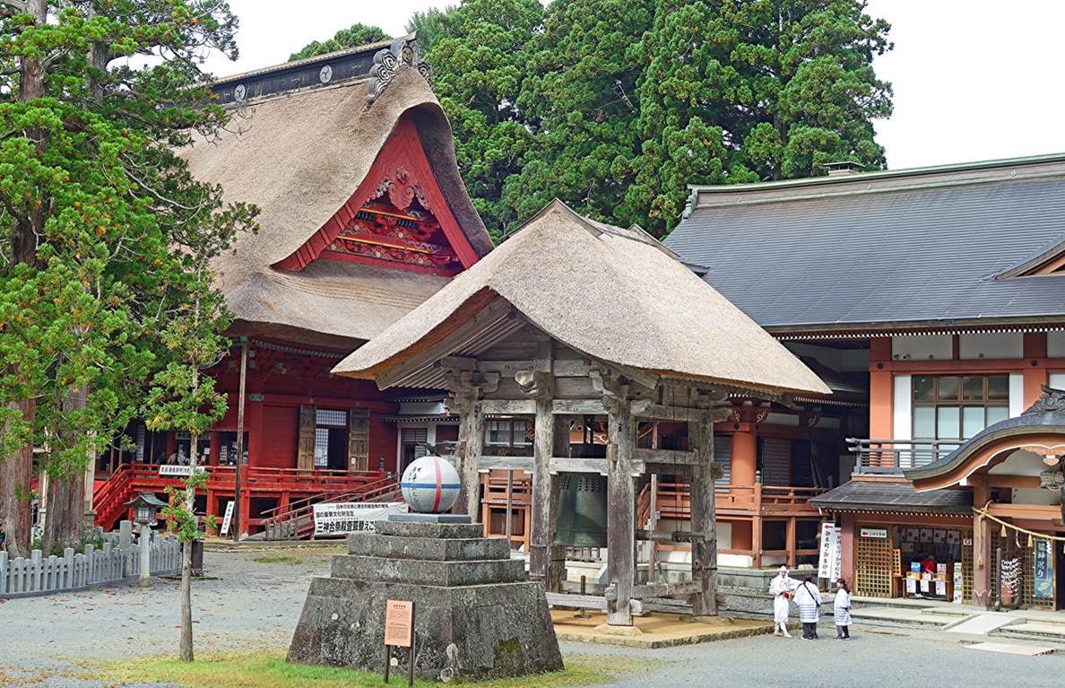
Left: Central area at the summit of Haguro-san,
with a ″world peace″ memorial in the foreground, a belfry and huge
bell behind it, the Sanjin Gosaiden shrine on the
left, and the Sanshuden hall on the right. Right:
Statue of poet Matsuo Basho located to the east of this area.
|
|
|
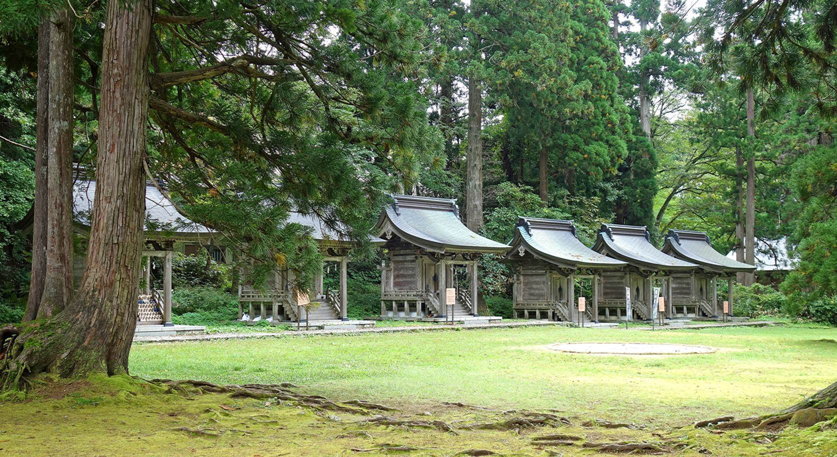
Alignment of small shrines at the summit of Haguro-san.
Each shrine is dedicated to a specific deity. In particular, the leftmost
shrine (partially hidden behind a tree), with a collection of geta on its
stairs, is dedicated to a kami providing healthy legs and safety during
travels. (A geta is a traditional Japanese footwear shaped like a flip-flop
with a raised wooden base.)
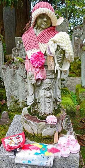
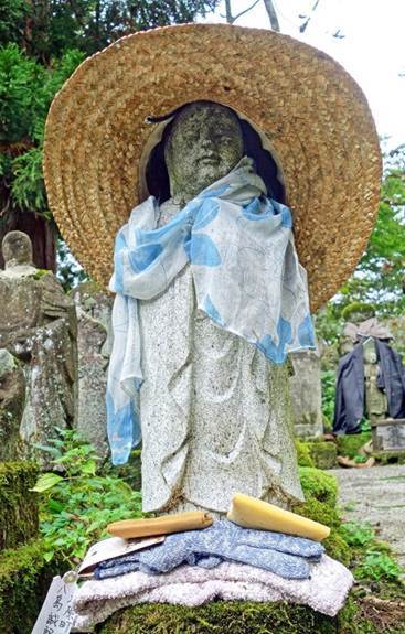
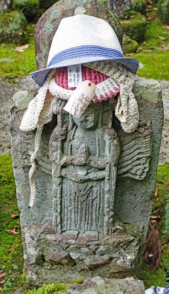
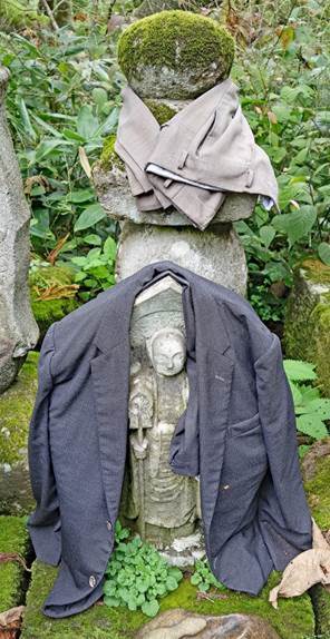
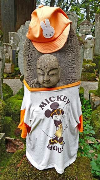
Dressed statues in a small cemetery on the northeast corner of the summit
of Haguro-san.
|
|
|
|
|
|
![]()