Mexico: State
of Oaxaca: City of Oaxaca and around (February 2024), plus Oaxaca Coast around
Zipolite and Puerto Angel (December 2024 and December 2025)
![]()
This site shows photos I took in
February 2024 during a trip to the city of Oaxaca (the capital of the state of
the same name), and various locations around this city. This was the third and
final leg of a longer trip that previously took me to Guadalaraja (link)
and the state of Guanajuato (link).
I previously visited Oaxaca in 1971 (link)
and 2013 (link).
This site also includes photos I took in December 2024 and 2025 in Zipolite and
Puerto Angel, two villages on the Oaxaca Coast.
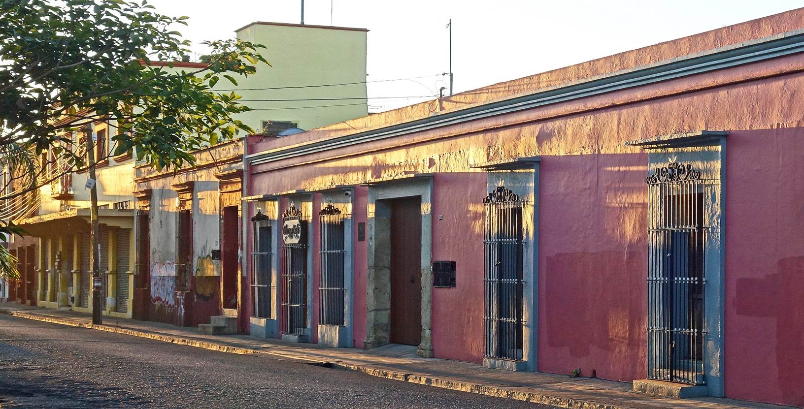
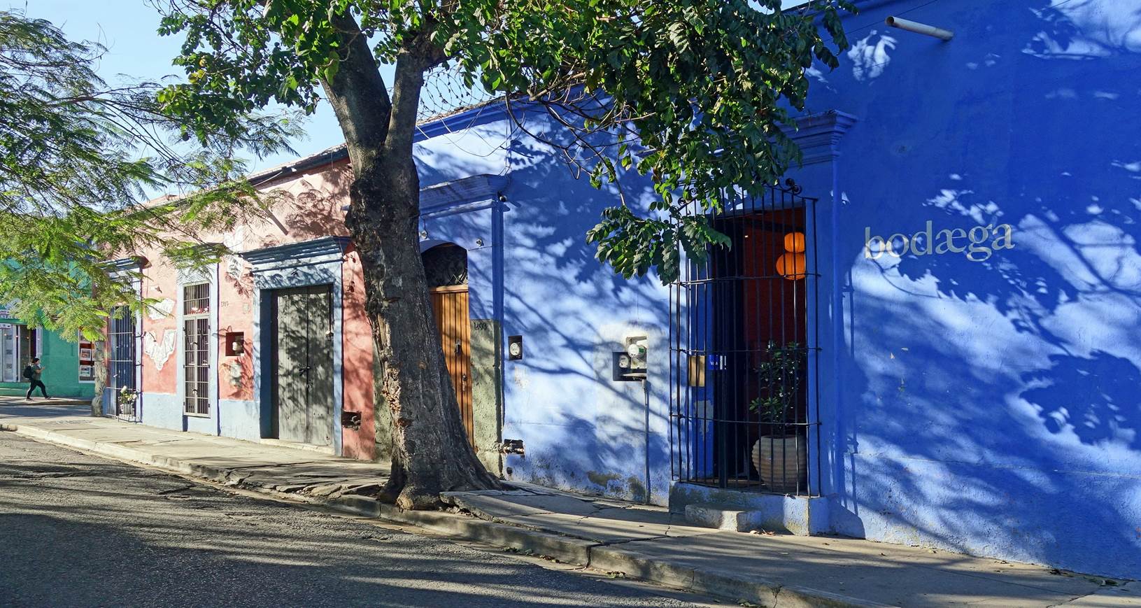
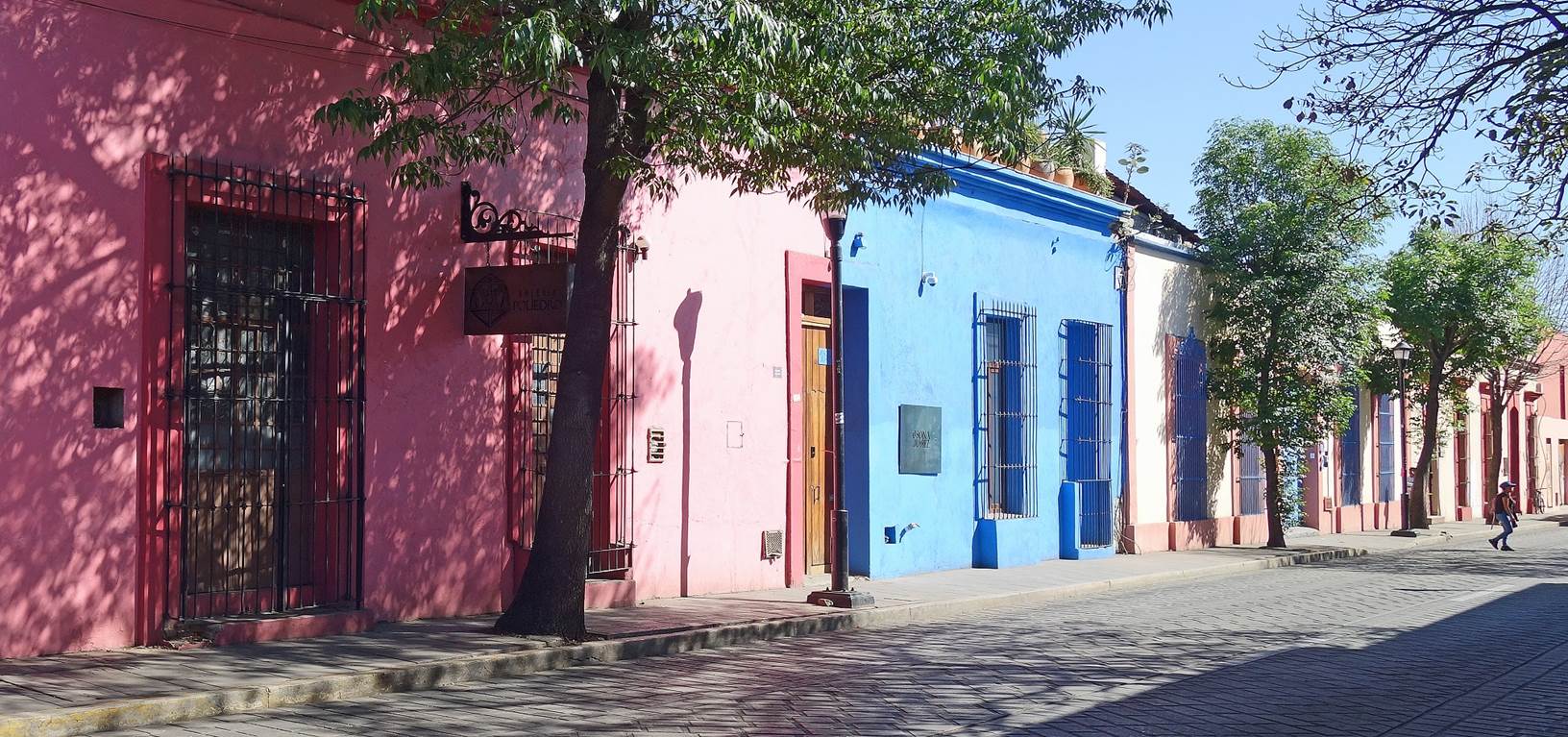
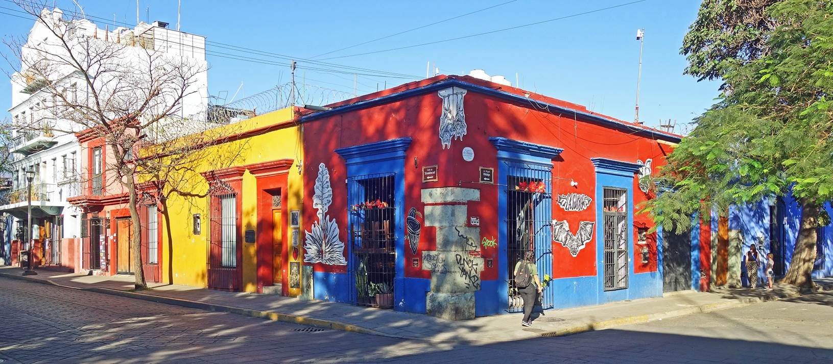
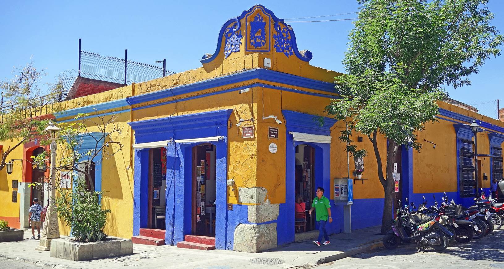
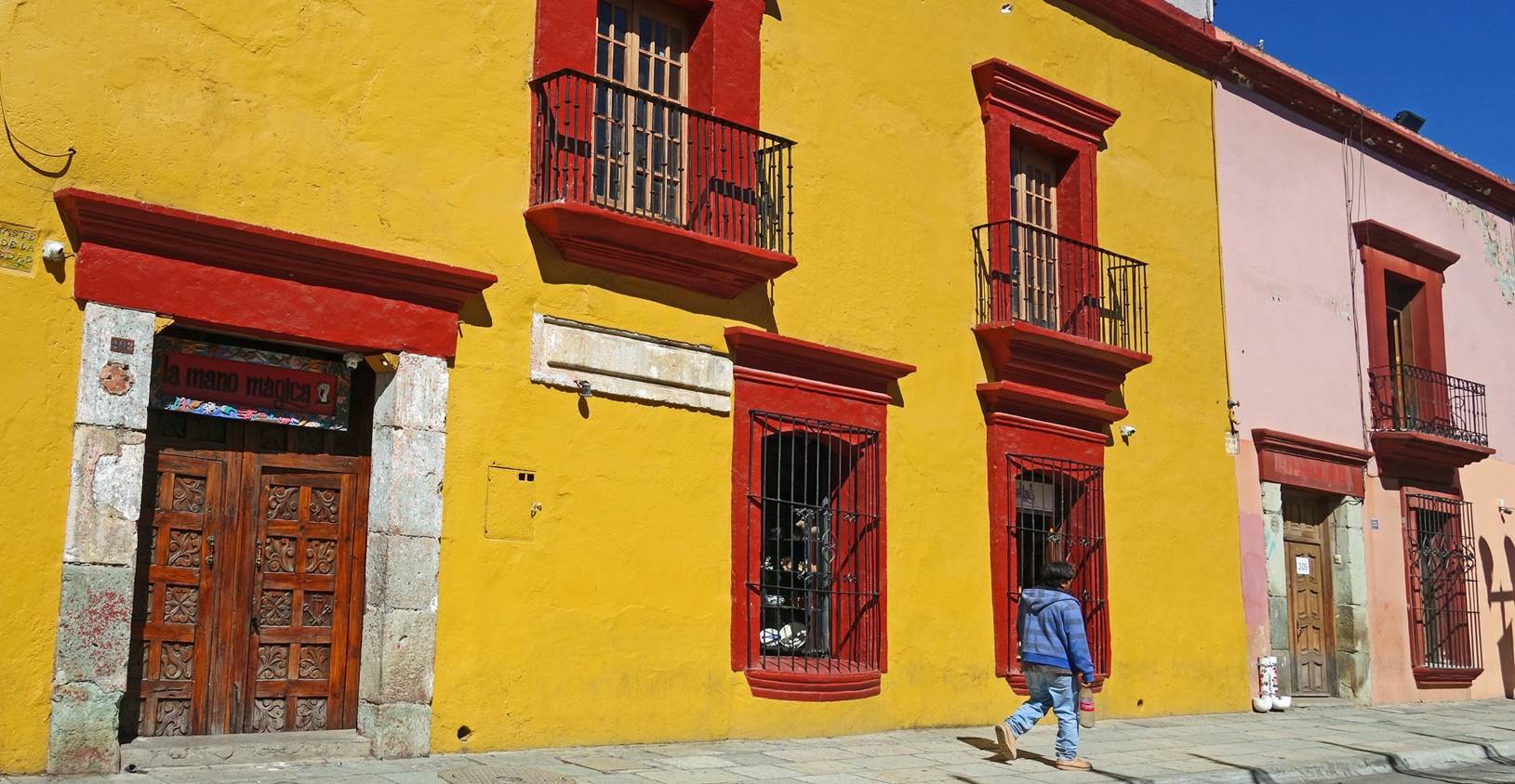
City of Oaxaca (also known as Oaxaca de Juarez)
In the streets of the colonial center:
|
|
|


|
|
|


|
|
|
|


[Mojigangas, giant papier-mache puppets, in the
street of the city.]
In the Barrio de Jalatlaco:
|
|
|


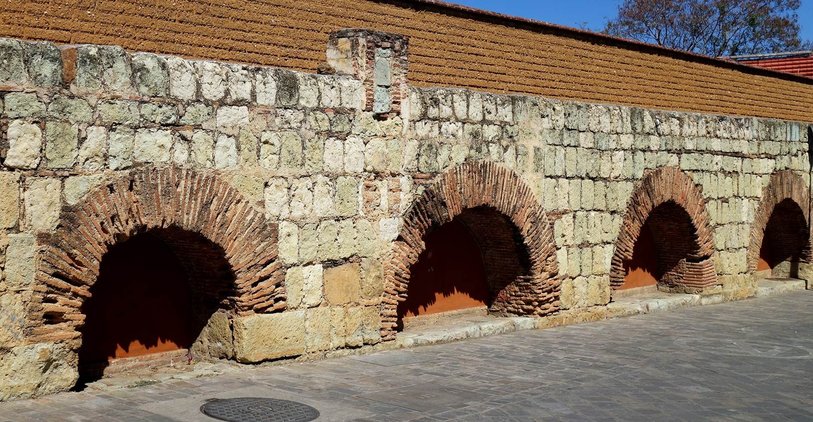
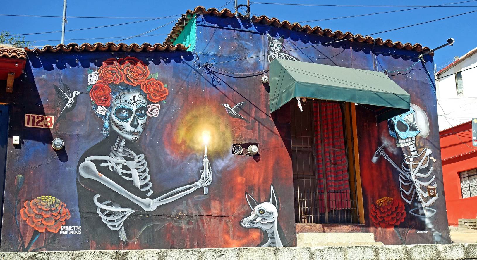
In the Barrio de Xochimilco:
Los Arcos, the remains of an arched
aqueduct built between 1727 and 1751 to bring water to the city and used for
this purpose until 1940. Homes have now been built on one side of the aqueduct
and some arches open into narrow streets, while others give access to private
homes.
|
|
|


Murals in Xochimilco.
|
|
|


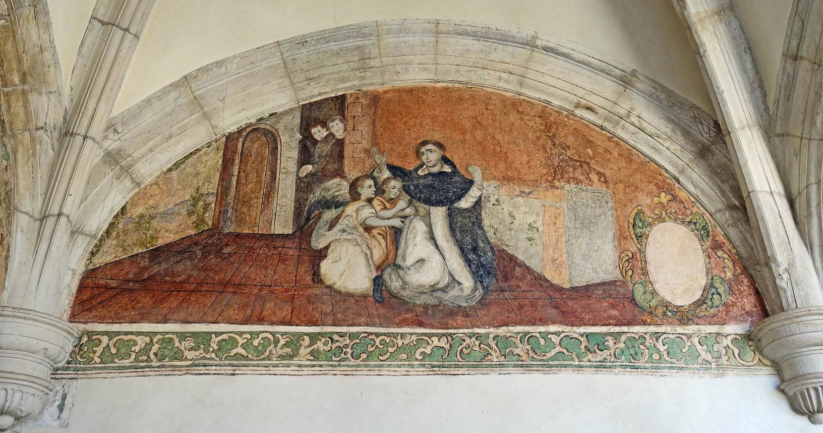
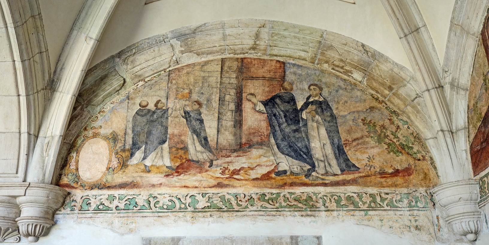
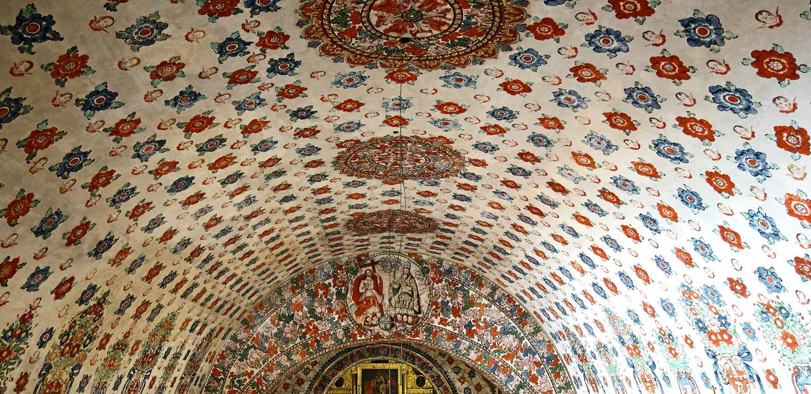
Templo de San
Domingo de Guzman:
This sumptuous Baroque church is the
most beautiful and elaborate church in the city. Its construction spans roughly
a half century before its inauguration in 1608. Highlights include the retable
behind the main altar, the ceiling decoration in the nave, and the Rosary
Chapel (Capilla de la Virgen del Rosario) on the right side of the nave.
Facade of the church.
|
|
|
|


Views of the church's interior: retable
and nave ceiling (left), retable above the main altar (center), and nave
ceiling (right).
|
|
|
|


Views toward the back of the church lit by
the late afternoon sun through the stained-glass of the facade.
|
|
|


Left: Decoration of the ceiling at the
entrance of the church representing the family tree of the father of Saint
Dominic. Right: Ceiling above the crossing of the transept of the church.
|
|
|


Capilla
de la Virgen del Rosario.
|
|
|


Catedral de la Asuncion:
Its construction began in the 16th
century but, due to several earthquakes, it was not completed until the 18th
century.
Views of the exterior of the cathedral.
|
|
|


Inside the cathedral.
|
|
|
|


|
|
|


Basilica de la Soledad:
Built in the late 17th century, it is
one of the most important religious site in Mexico, as it contains a revered
statue of the Virgen de la Soledad.
|
|
|


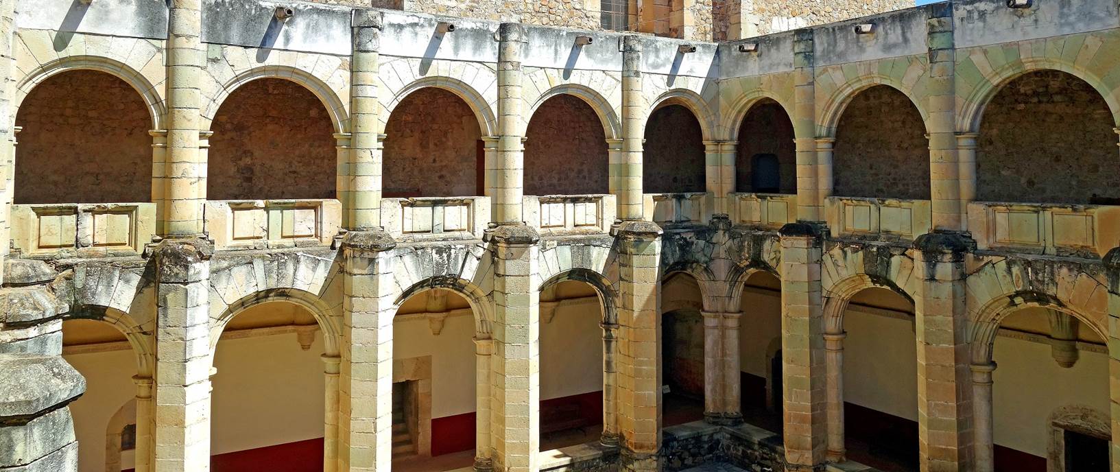
Museo de las
Culturas de Oaxaca:
This museum is housed in the former
convent attached to the Templo de San Domingo de Guzman. It contains a large
collection of pre-Columbian and colonial artefacts.
Views of the convent building and of
some paintings on its walls.
|
|
|


A few of the pre-Columbian artefacts
(mostly from Monte Alban) displayed in the museum.
|
|
|
|
|


|
|
|


Around the City of Oaxaca
Arts Center of San Agustin, in San Agustin Etla:
San Agustin Etla is a small town located
in the hills some 13km northeast from the center of Oaxaca. There, a former
textile factory (the Fabrica de Hilados y Tejidos La Soledad, founded in 1883)
has been remodeled into a center for the arts. In March 2024 this center had an
extensive display of indigenous masks.
Murals seen on the way to the arts
center
Left: Facade of the arts center. Right
and below: Some of the masks displayed in the center.
|
|
|


|
|
|
|


|
|
|


|
|
|
|


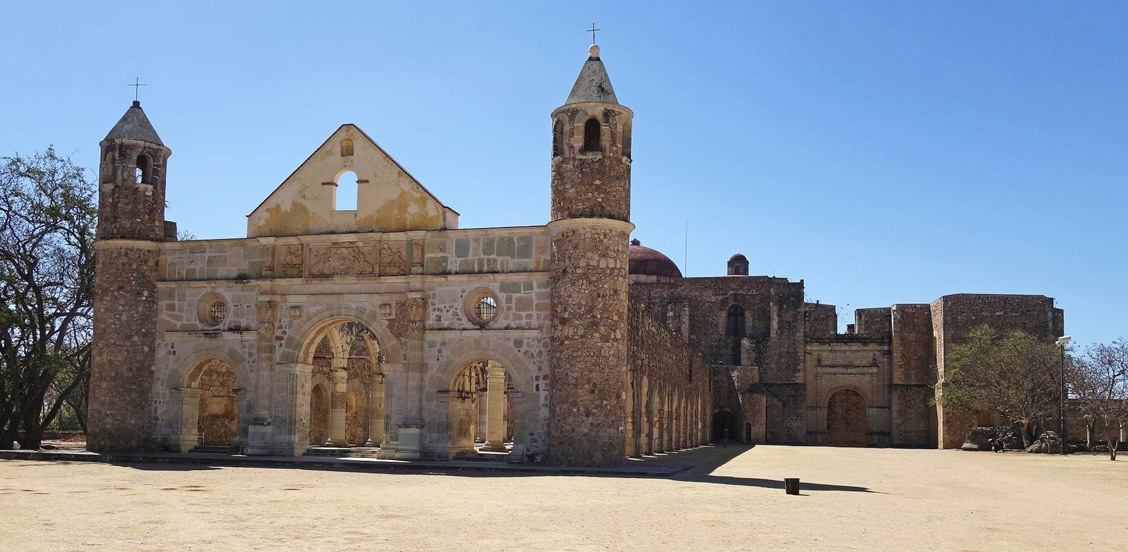
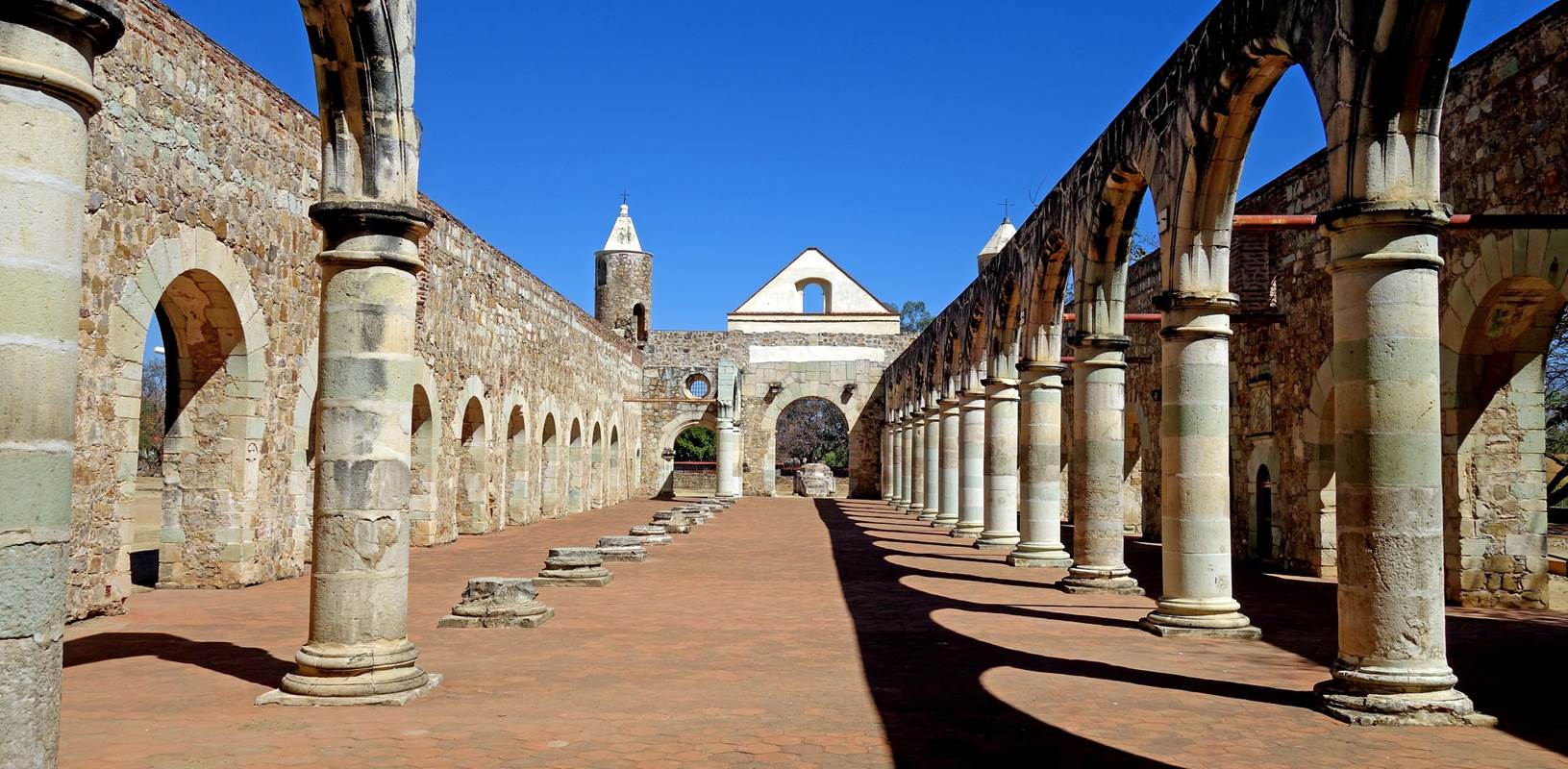
Cuilapam de Guerrero:
Cuilapam de Guerrero is a small town
located 14km southeast from Oaxaca. It is the site of a large former Dominican
convent, the ex-Convento de Santiago Apostol, where the revolutionary hero
Vincente Guerrero was executed in 1831.
Views of the former convent.
|
|
|


|
|
|


|
|
|


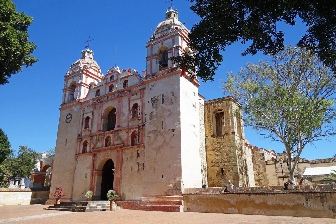
The town of San Jeronimo Tlacochahuaya
is located 25km southeast from Oaxaca. Its main church, the Templo de San
Jeronimo, was built in the late 16th century. Its outside is relatively simple.
But its interior decoration, the original work of indigenous artists, is
stunning and very unusual.
Facade of the church.
Views of the nave.
|
|
|


Decorated ceilings.
|
|
|


Left: Portion of a lateral retable. Center:
Wood statue in a niche. Right: Wall painting.
|
|
|
|


Mezcal distilleries (palenques):
Around Oaxaca, places where mezcal is
made are called palenques (they have other names in other parts of Mexico). The
following shows photos from two palenques: La Tentation del Gato, located in
the countryside 40km south from Oaxaca (near the town of Ocotlan de Morelos)
and Gracias a Dios, located outside the small town of Santiago Matatlan (which
dubs itself the world capital of mezcal), 45km southeast from Oaxaca. Both
produce excellent mezcal, with La tentation del Gato being a smaller, more
artisanal familial palenque.
Field of agave, the plant from which
mezcal is made, near Ocotlan de Morelos.
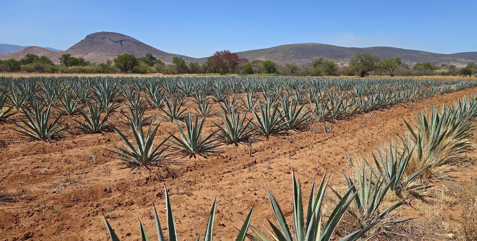
Many different varieties of agave are
used to produce mezcal of different tastes. These are just two of them.
|
|
|


After the agave plant is harvested, its
leaves are cut out. The heart of the plant, called the pina, is roasted in a
large underground pit. Left: Pile of pinas before roasting in the palenque
Gracias a Dios. Right: Pit used to cook pinas in the palenque La Tentation del
Gato.
|
|
|


Roasted pinas are then shredded into a
mash. After adding water to it, the mash is left to ferment in open-air wooden
barrels. Juice from the mash falls progressively, while dry fibers float above
it.
Fermentation barrels at Gracias a Dios (left)
and La Tentation del Gato (right).
|
|
|


At the end of the fermentation process,
the dry fibers are removed and later used as fertilizer. Left: Removal of dry
fibers at Gracias a Dios. Right: Pile of dry fibers ready to be used to
fertilize a field at La Tentation del Gato.
|
|
|


The collected juice is then distilled twice
to produce mezcal. Distillation stills at Gracias a Dios...
|
|
|


... and at La Tentation del Gato.
|
|
|


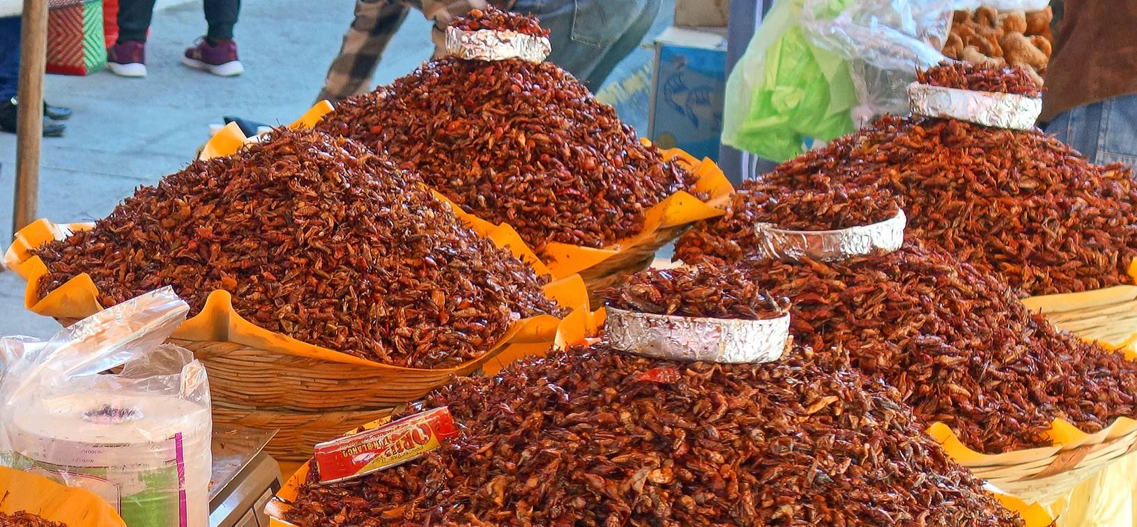
Monday market in Miahuatlan:
The town of Miahuatlan de Porfirio Diaz
is located 100km south of Oaxaca. Every Monday it hosts a large lively market
that spreads over many streets. Probably because it is relatively far from the
city of Oaxaca (compared to several other markets), very few tourists come
here.
|
|
|


|
|
|


|
|
|


Grasshoppers (chapulines). They are part
of the regular diet in Oaxaca.
|
|
|


|
|
|
|
|


|
|
|
|
|


A mojiganga (giant papier mache puppet)
maker with some of his creations.
|
|
|


|
|
|
|


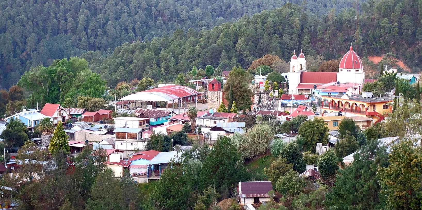
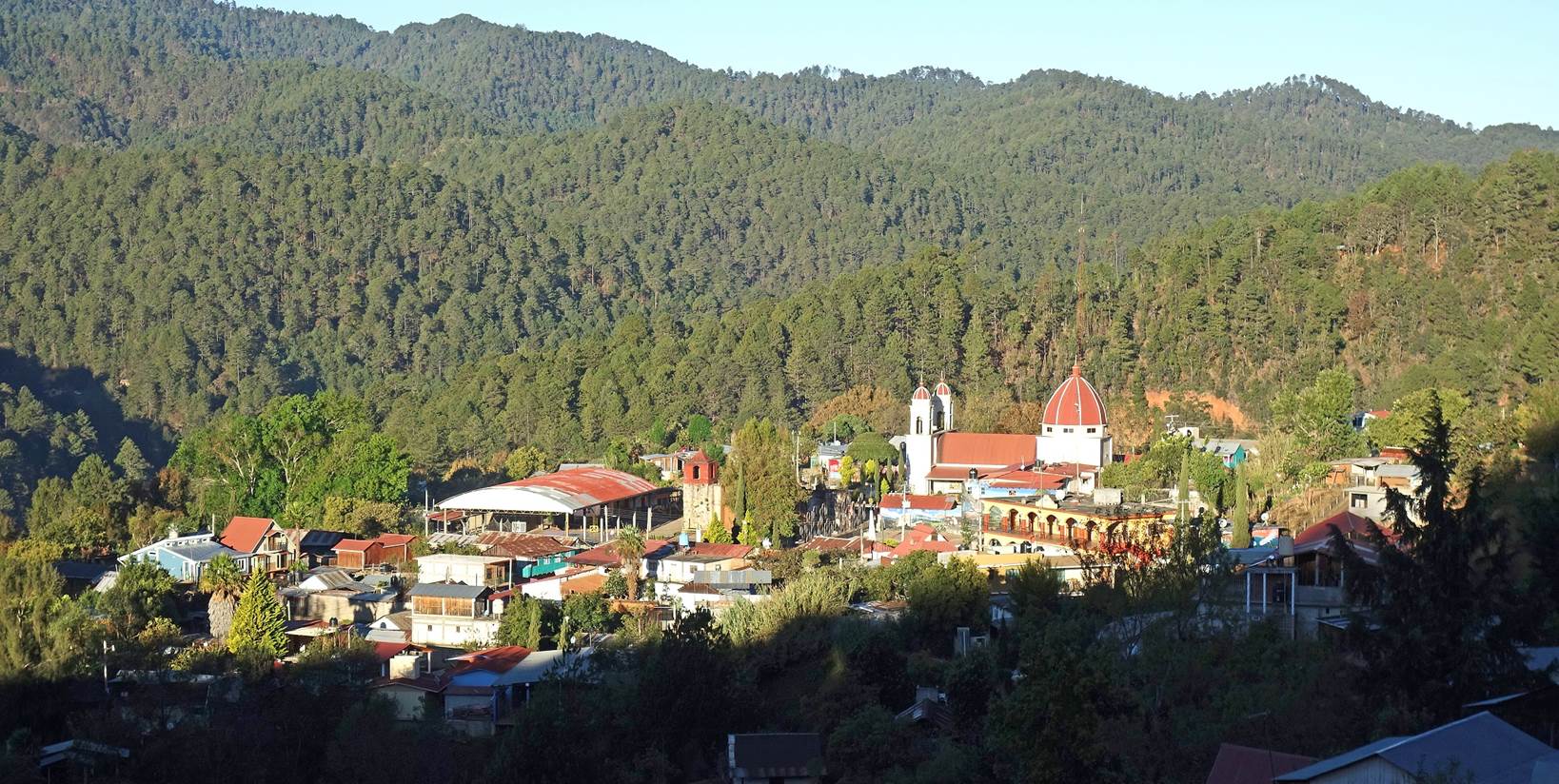
San Mateo Rio Hondo:
This village is located at 2,300m above
sea level in the Sierra Sur mountain range in the Miahuatlan District of the
state of Oaxaca, 135km south of Oaxaca City. It is a good area for hiking. It
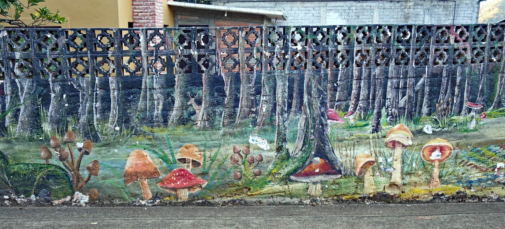
is also well known for its magic mushrooms.
Views over the village in the early
morning.
Murals depicting local mushrooms.
|
|
|


Left: Woman preparing delicious local
molotes. Right: Elegant woman in the village.
|
|
|


Views of the local church and its mural
(on the back wall of the nave) depicting Adam and Eve.
|
|
|


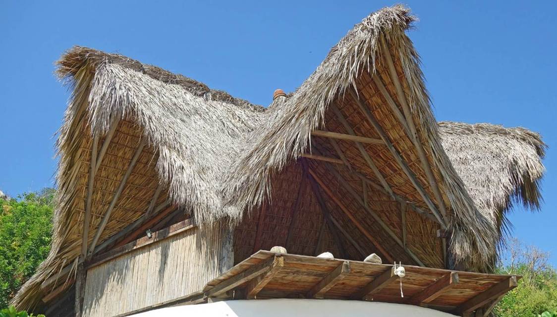
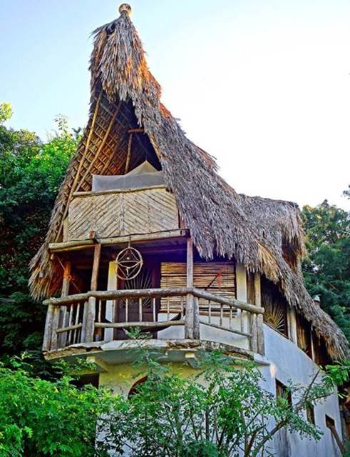
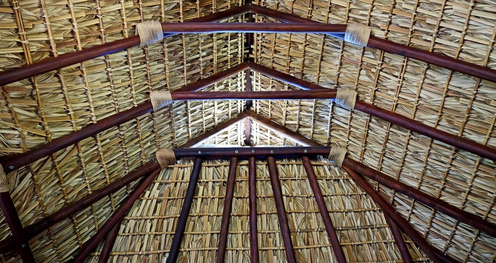
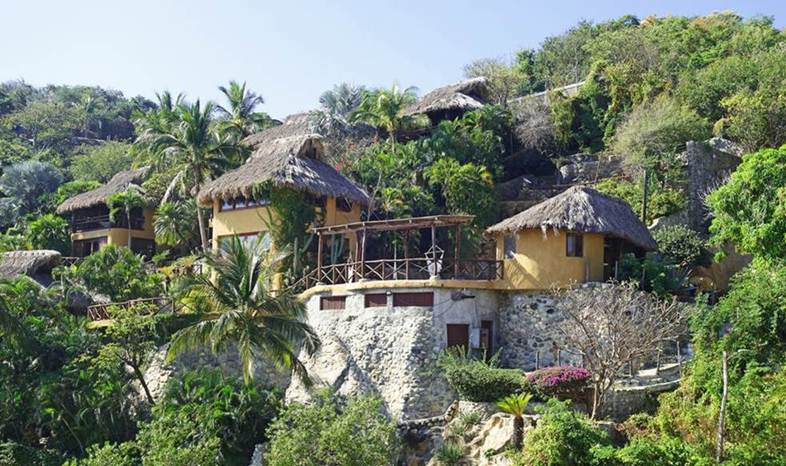
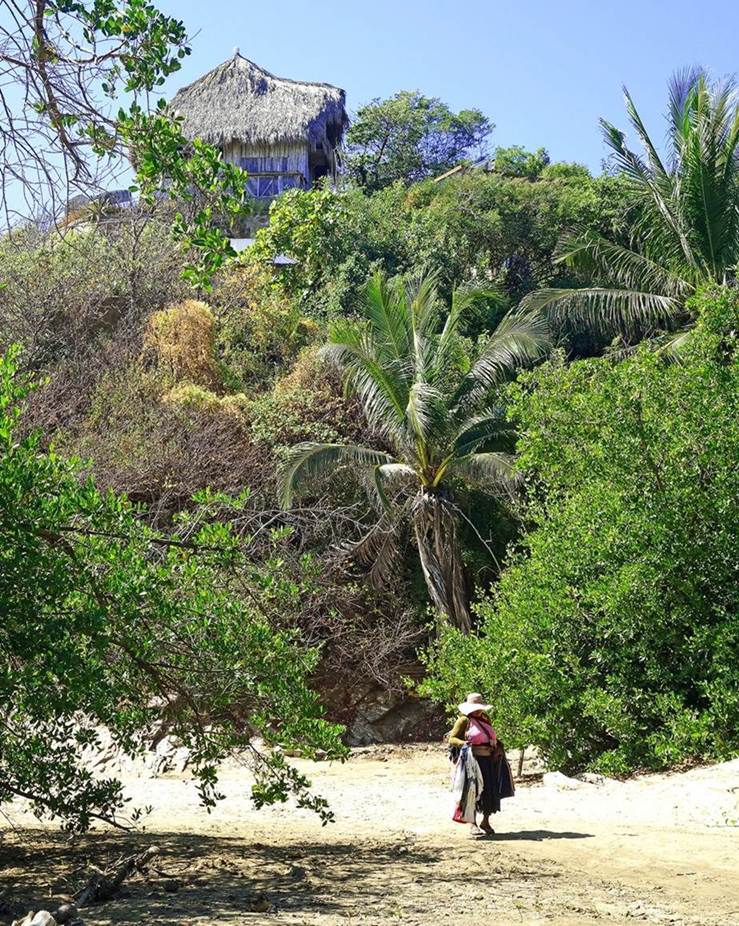
Oaxaca Coast (Zipolite and Puerto Angel)
Ubiquitous palapas, houses with thatched
roofs made of dried palm leaves.
|
|
|
|
|
|
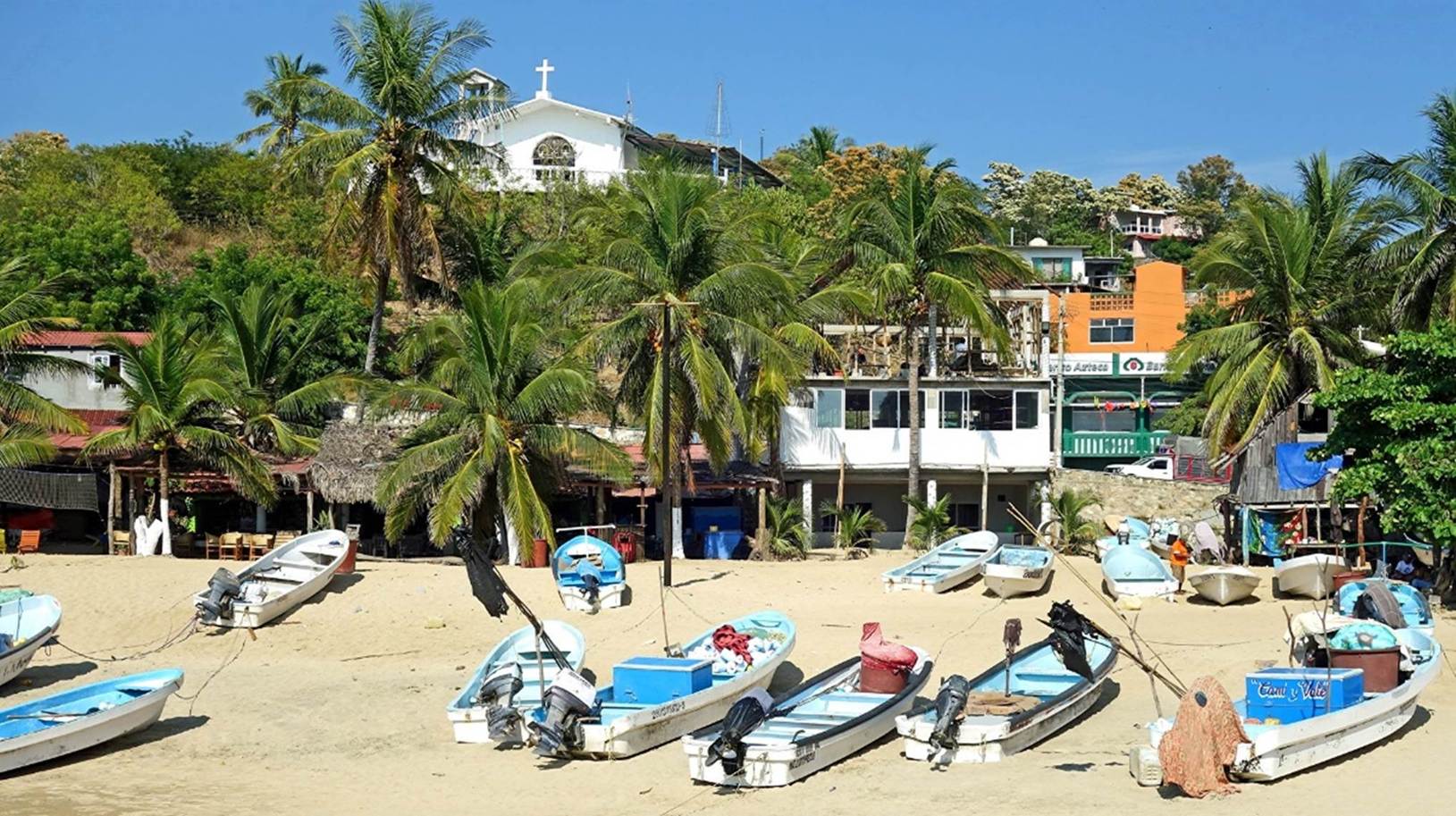
Small fishing boats on the beach of
Puerto Angel.
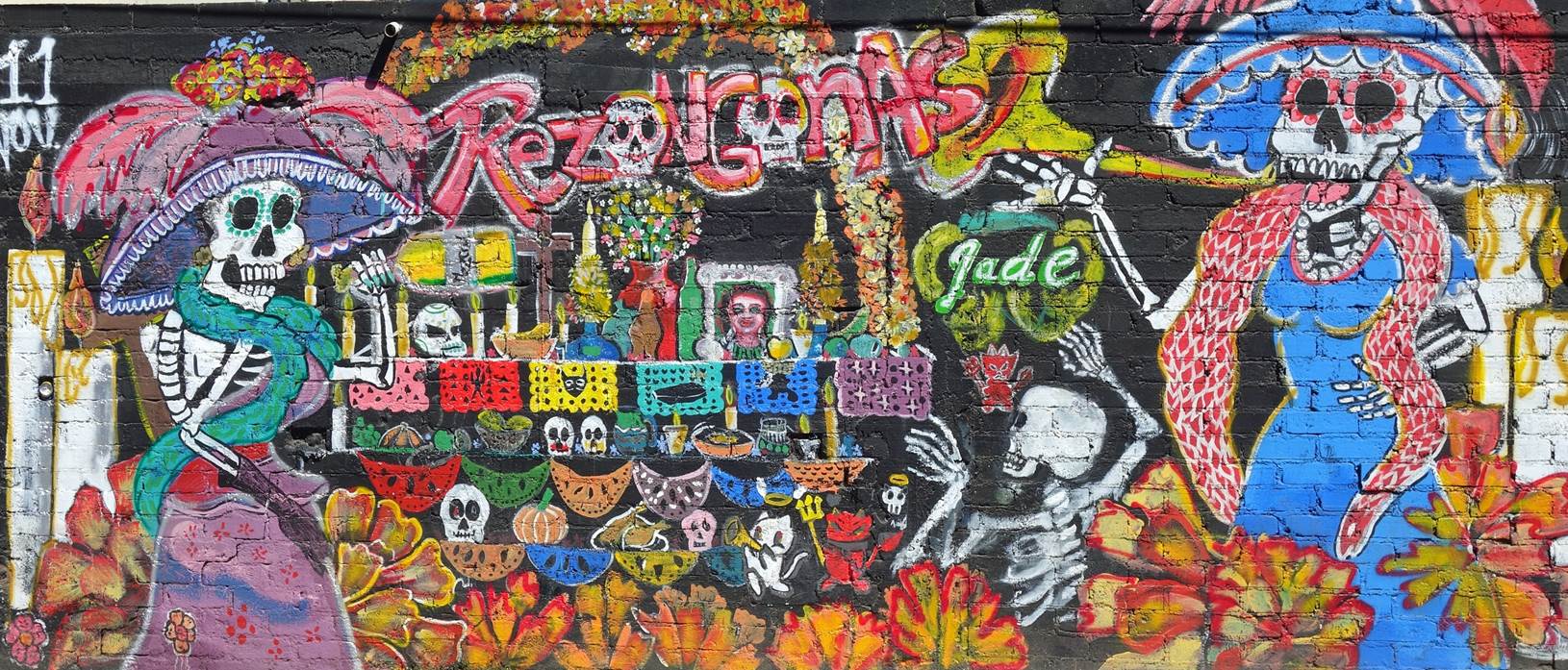
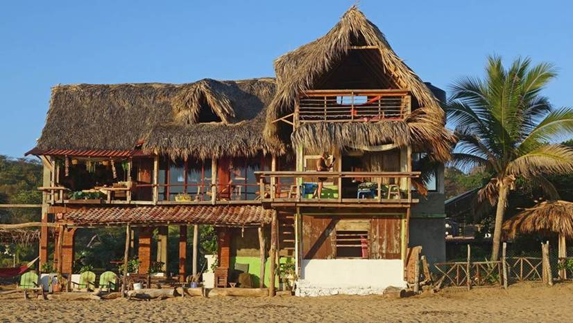
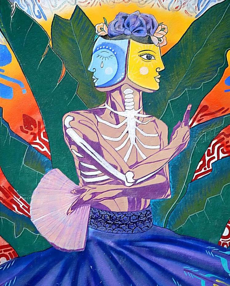
Left: House known as El Cosmico built on
an outcrop overlooking Zipolite beach. Right: Mural in Zipolite.
|
|
|
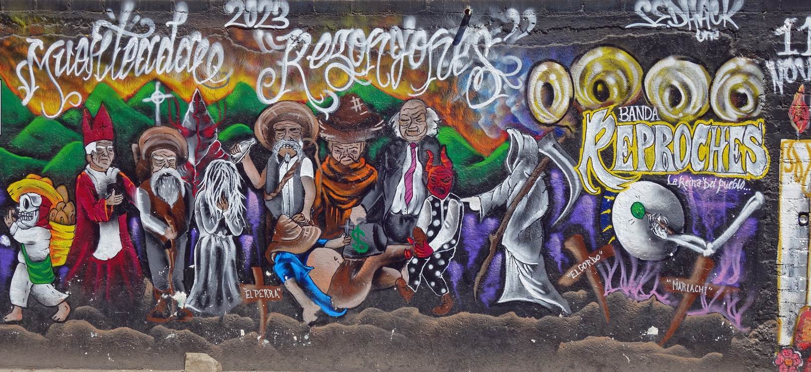
New murals in Zipolite (December 2025).
|
|
|
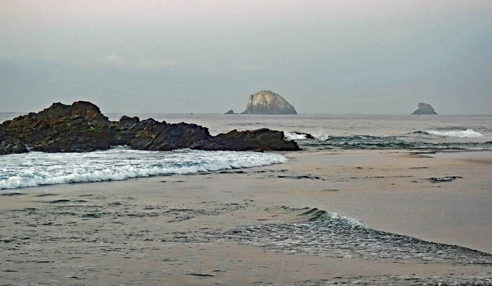

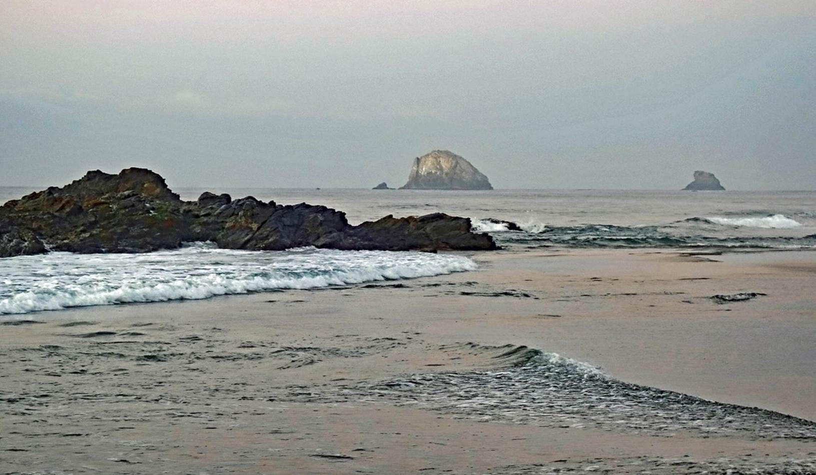
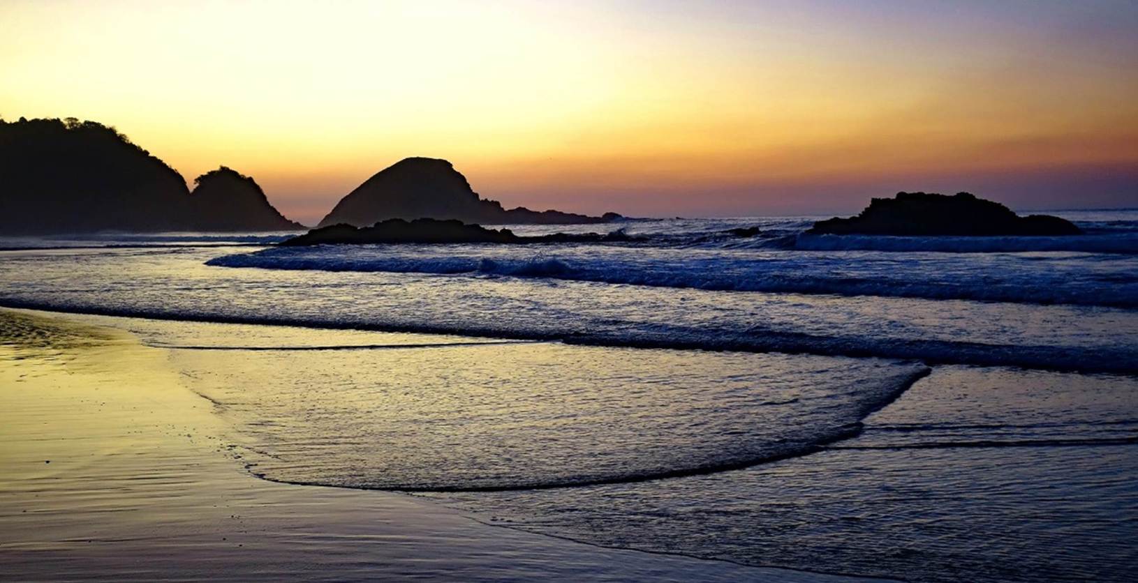
View from the beach of Zipolite before
sunrise.
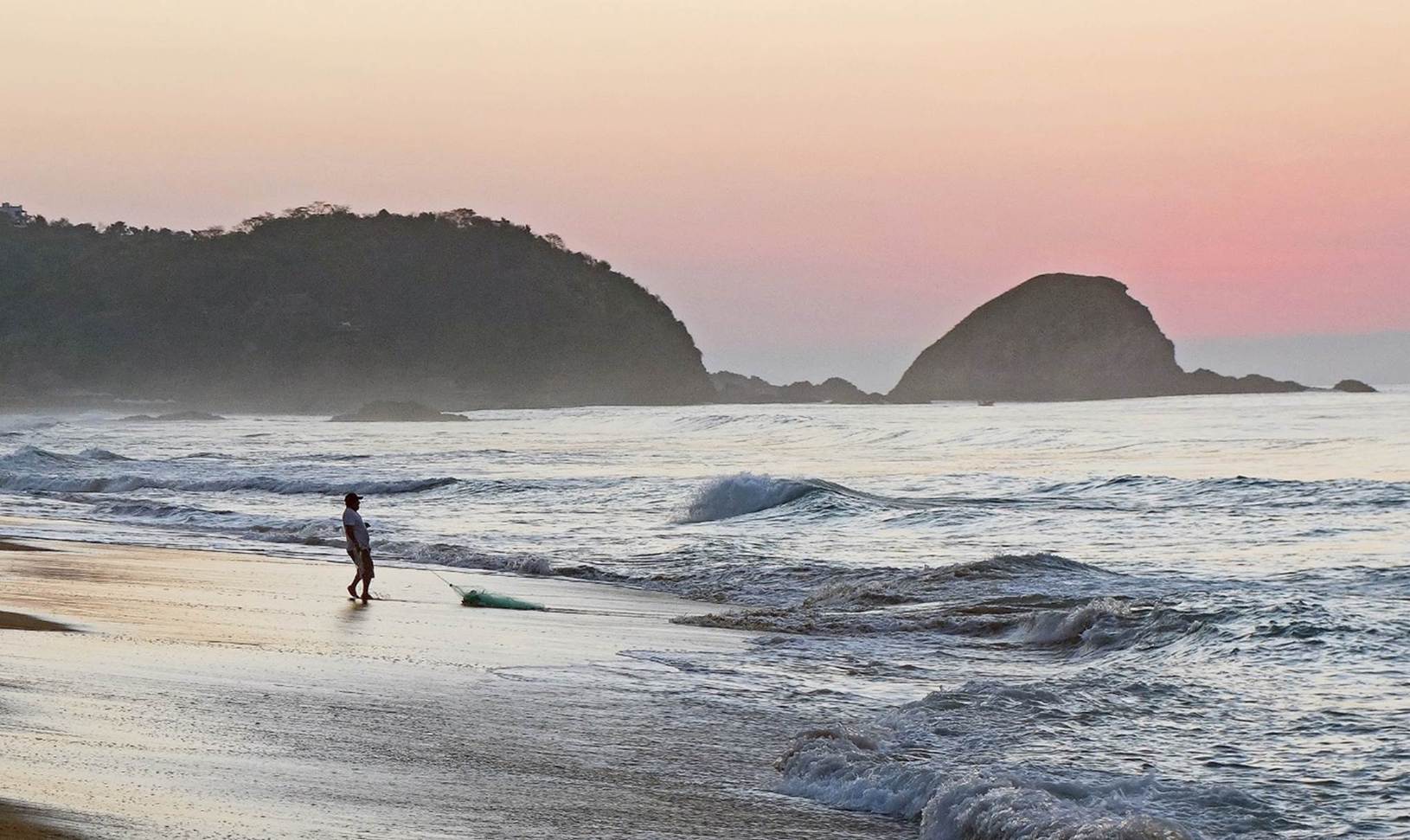
Fisherman drawing a small net on the
beach of Zipolite before sunrise.
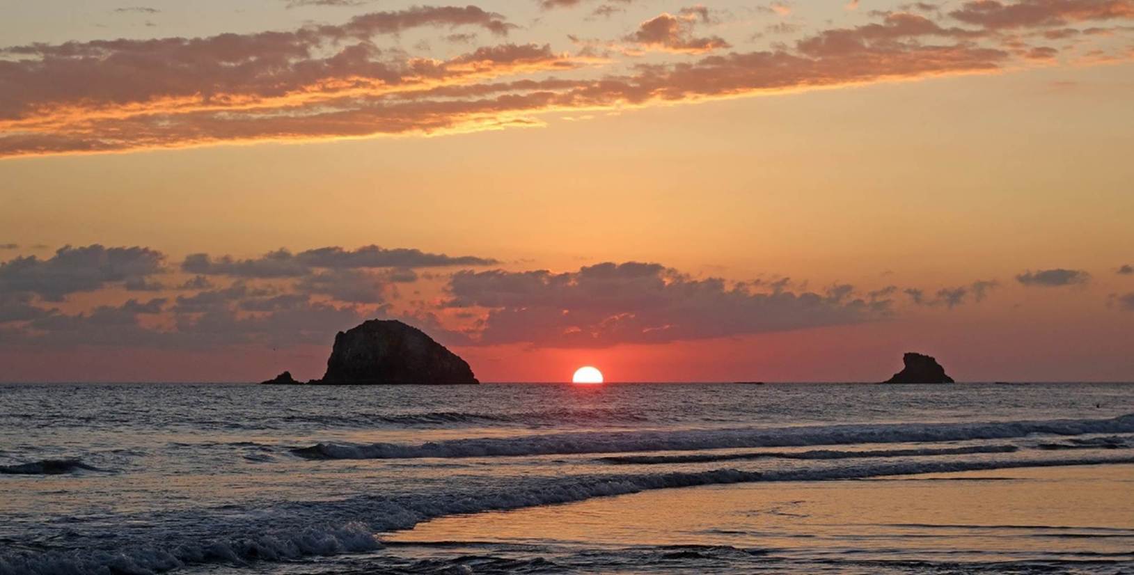
Sunrise seen from the beach of Zipolite.
Sunset seen from the beach of Zipolite.
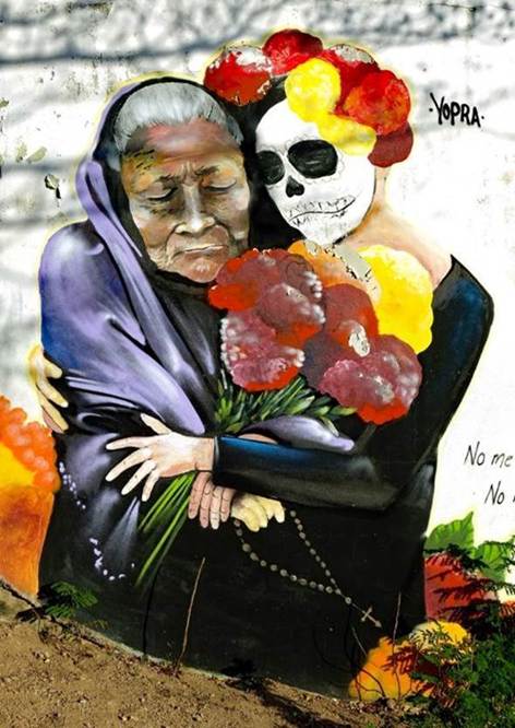
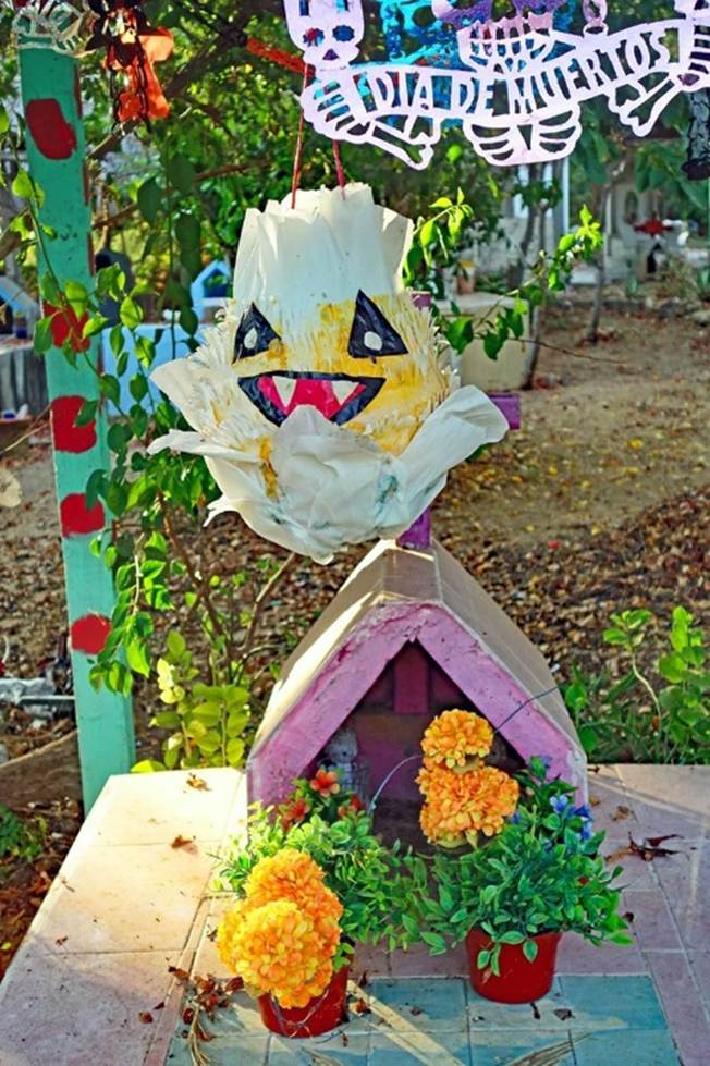
Murals at the entrance of the cemetery
of Zipolite.
|
|
|

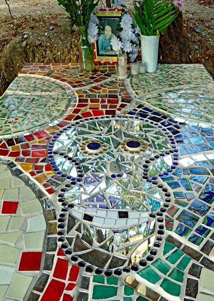
In the cemetery of Zipolite.
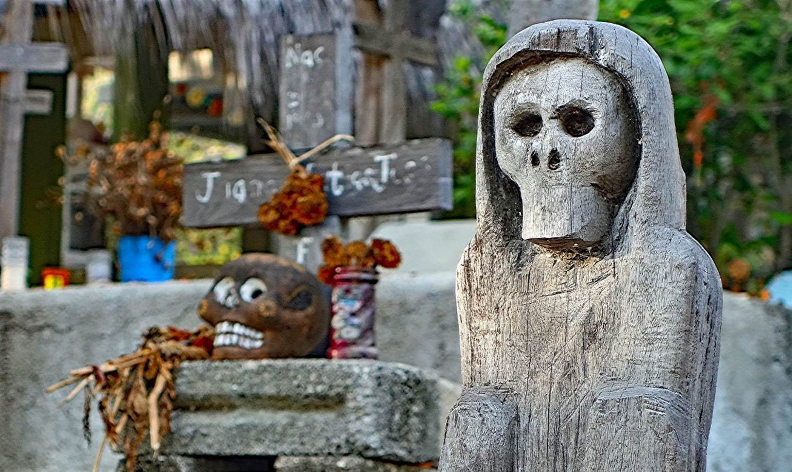
|
|
|
![]()