Turkey: Ani (April
2018)
![]()

Ani (elev. 1,340m) is a ghost Armenian
city located some 45km east of Kars on the bank of the Arpacay
(river), known as the Akhurian by the Armenians, that
marks the border between Turkey and Armenia. It became the capital of the
Armenian Bagratid Kingdom in 961 under King Ashot III
and reached its apogee under King Gagik I (990-1020),
when it was home to nearly 100,000 people. Internal conflicts led to its
decline and in 1064 it was razed by the Seljuks.
However, it recovered somewhat in the 12th century, before being sacked again
by the Mongols in the 13th century and finally ruined by an earthquake in 1319.
Because Kars lies away from the main
roads and Turkey boasts so many great historical sights, Kars receives
relatively few visitors. However, the main goal of most of these visitors is to
go to the site of Ani. Unfortunately, this site is badly neglected and
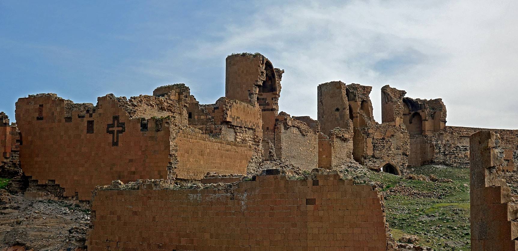
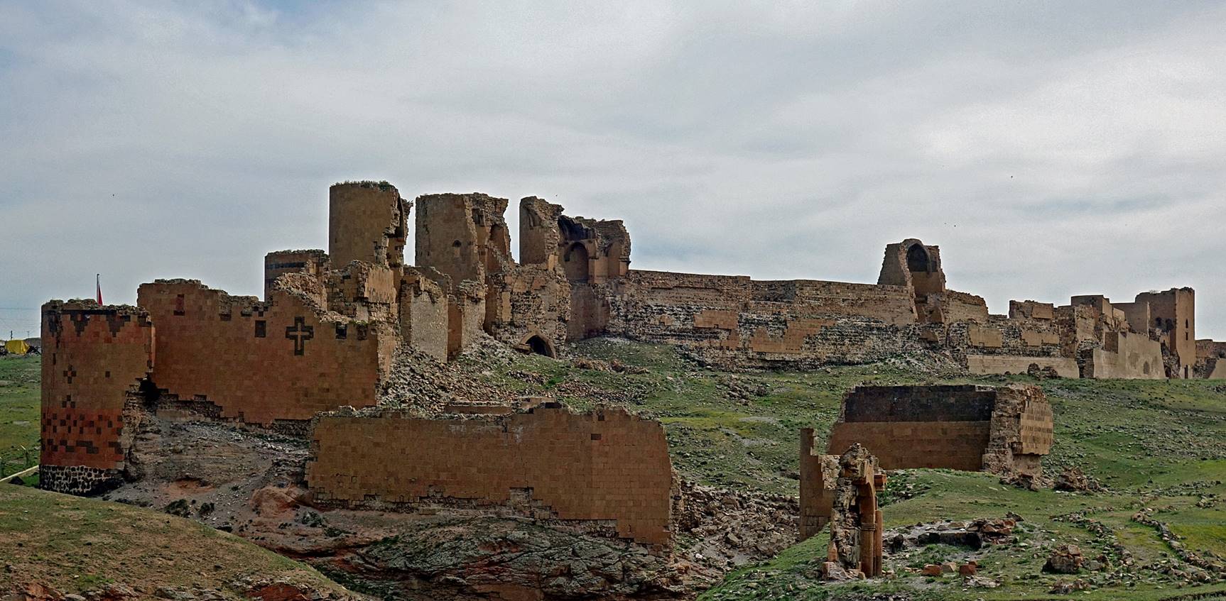
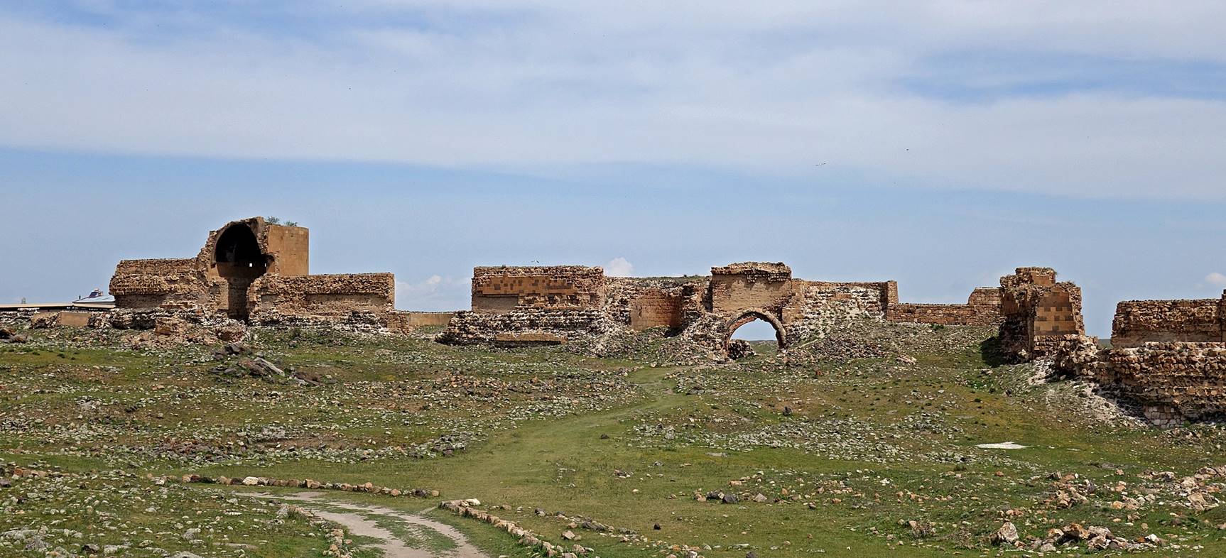
vandalized, and requires urgent protection, if this is not already too late.
Virtually all the remaining buildings are crumbling down. The World Monuments Fund (WMF) placed Ani on
its Watch Lists of 100 Most Endangered Sites since 1996. In 2011, it announced
it was beginning conservation work on two buildings, the Cathedral and the
church of the Redeemer, in partnership with the Turkish Ministry of Culture.
But, during my visit in April 2018, no serious restoration work had even
started. For some monuments, including the church of the Holy Apostles, the
church of the Redeemer, and the church of Saint Gregory of Gagik
I, damage seems irreparable, other than by reconstructing them more or less
accurately as brand new.
A visit to the site of Ani is
definitively worth it, but the sad state of its monuments does not boost one′s
morale. For a comprehensive website on Ani, the ″Deserted City of Ani″,
click here.
City walls.
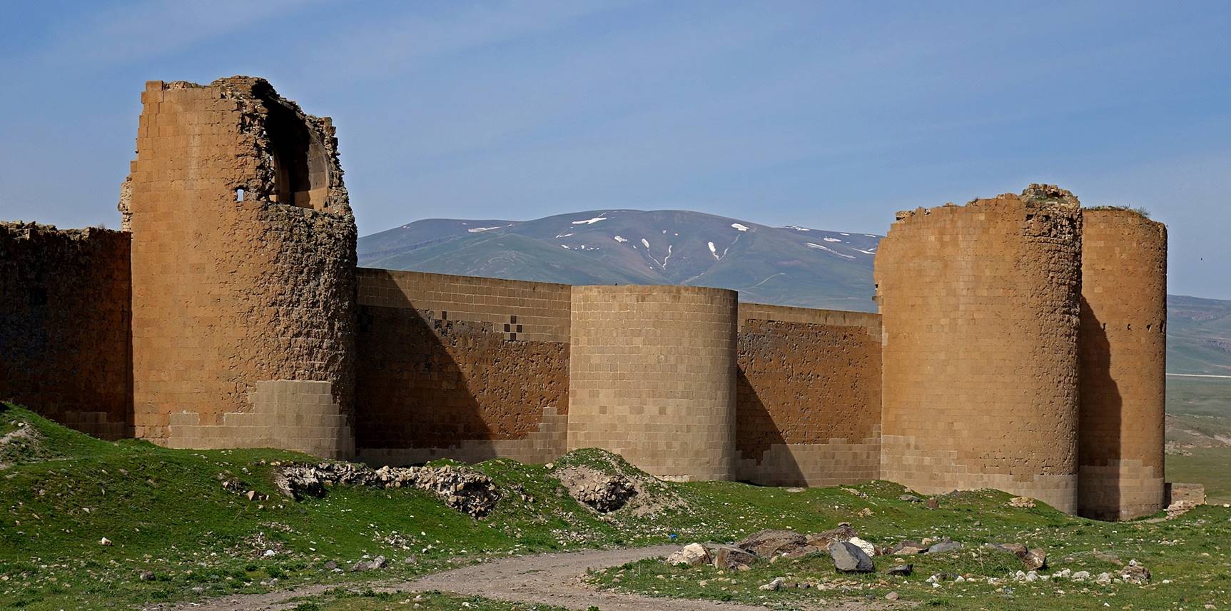

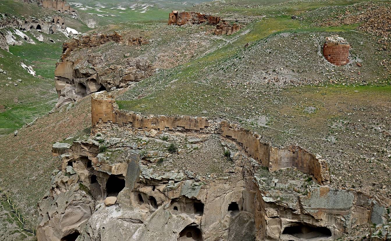
Passed the city walls, I was first struck
by the emptiness of the site. Ruins sparsely distributed, like at random, dot
an otherwise featureless plateau. Moments later I was struck by the dire state
of the remaining monuments.
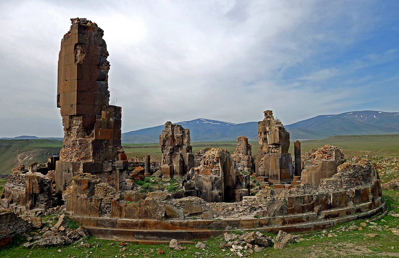
Remains of a church.
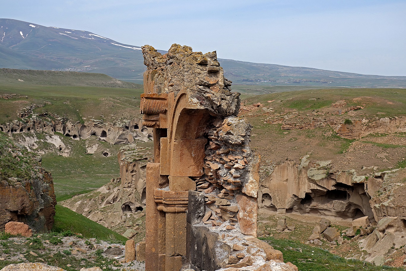
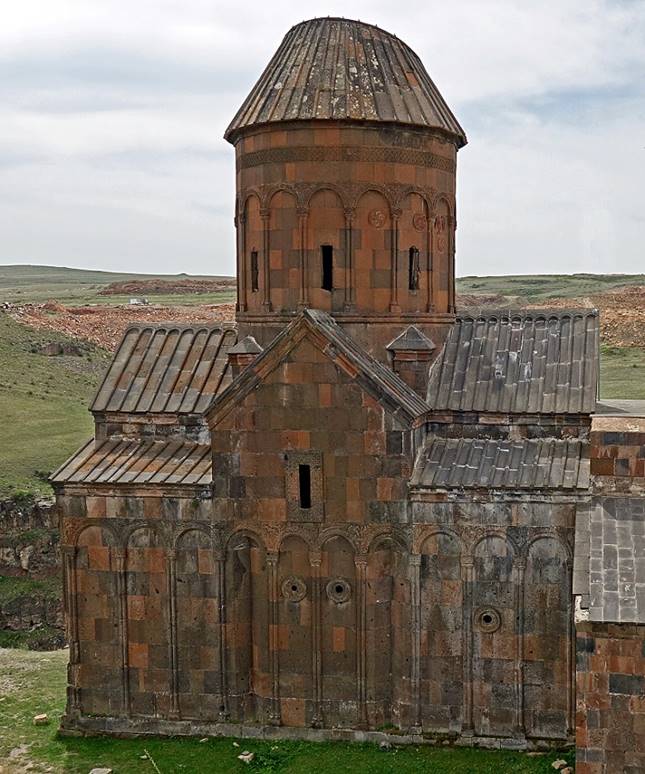
Ruins of the church of Saint Gregory of Gagik I.
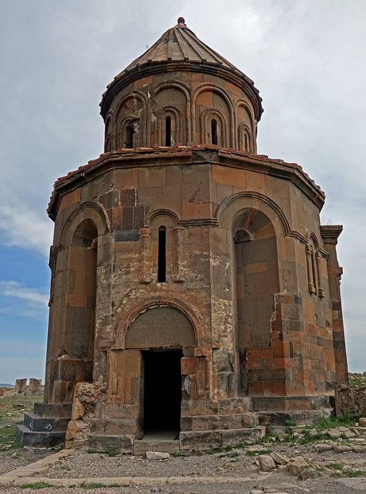
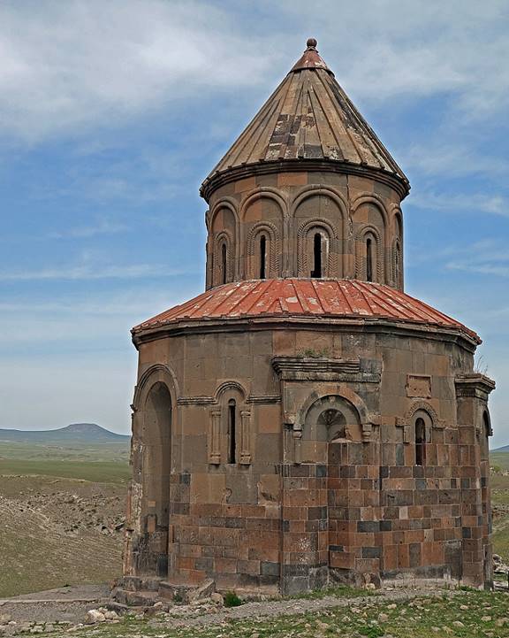
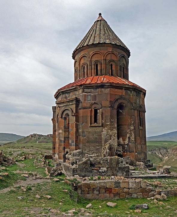
Church of Saint Gregory of Abughamrentz (circa 980), one of the best conserved
churches in Ani.
|
|
|
|
Inscription in Armenian above the
entrance gate.

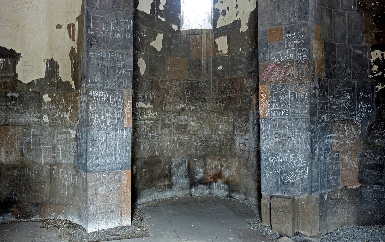
But the church′s interior is
shabby and vandalized.
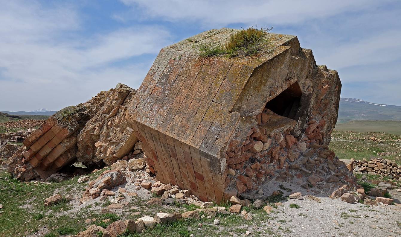
Remains of a
fallen minaret.
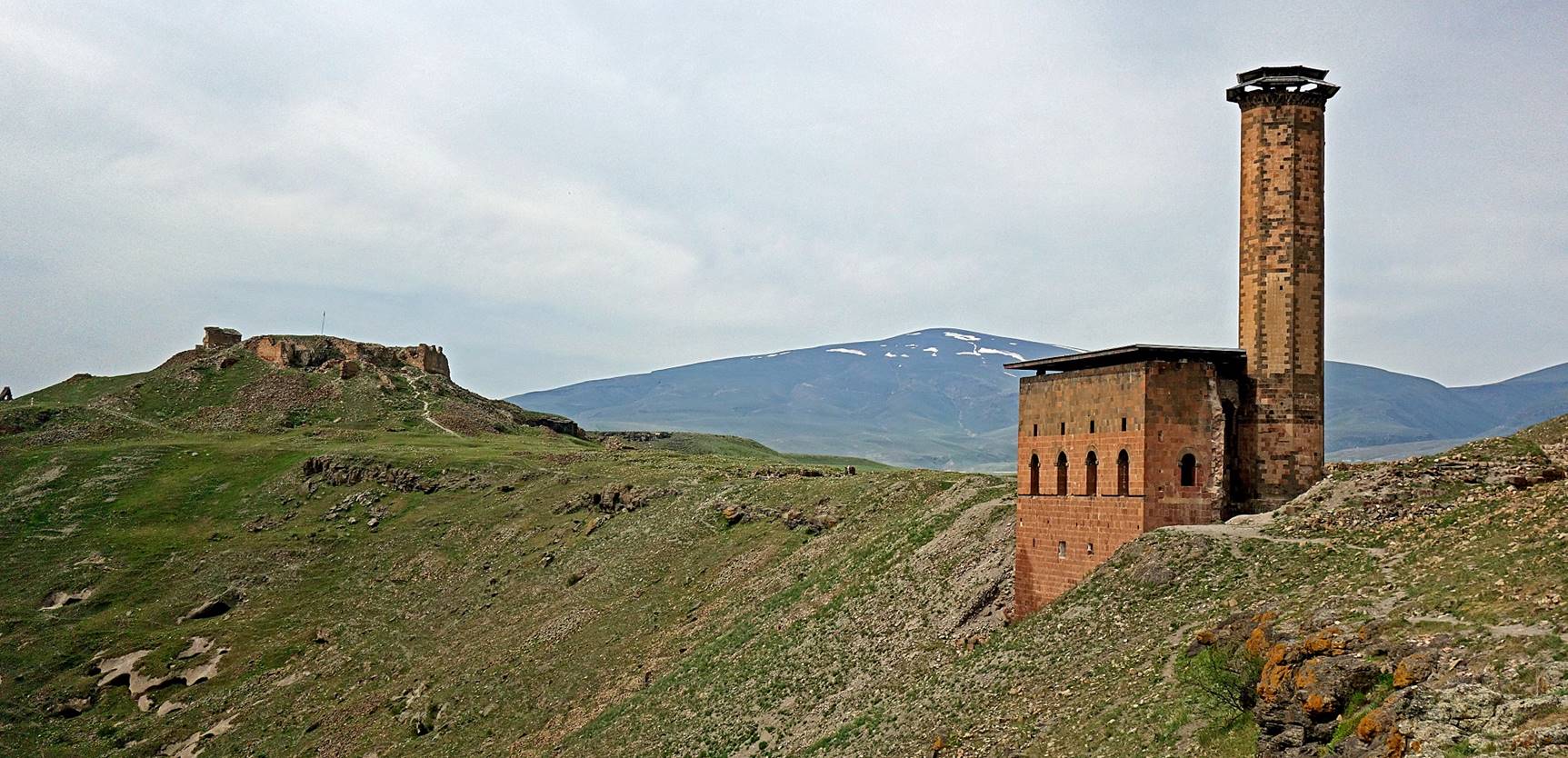
View of Ic Kale (left) and the Menucer
mosque (right) at the south end of the Ani site. Ic
Kale is off limits to visitors. The Menucer mosque
(1072), one of the only two restored buildings in Ani, also benefits from new
protective roofs. (The other restored building is a bland Seljuk palace located
near the church of Saint Gregory of Gagik I.)
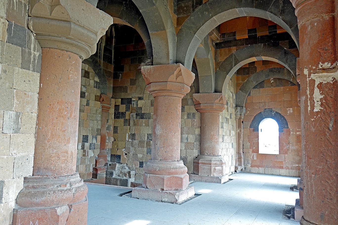
Inside the
Menucer mosque.
View over the Arpacay/Akhurian
and its bends. The first photo below shows the ruined bridge, the left part of
which is in Turkey and the right part in Armenia. The second photo shows bends
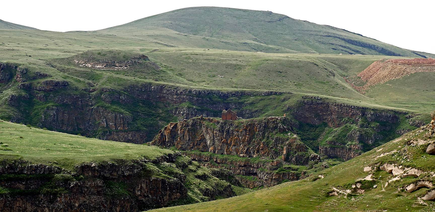
of the river with the Church of Saint Elia on top of a rock bluff in one of the
bends (off limits to visitors).

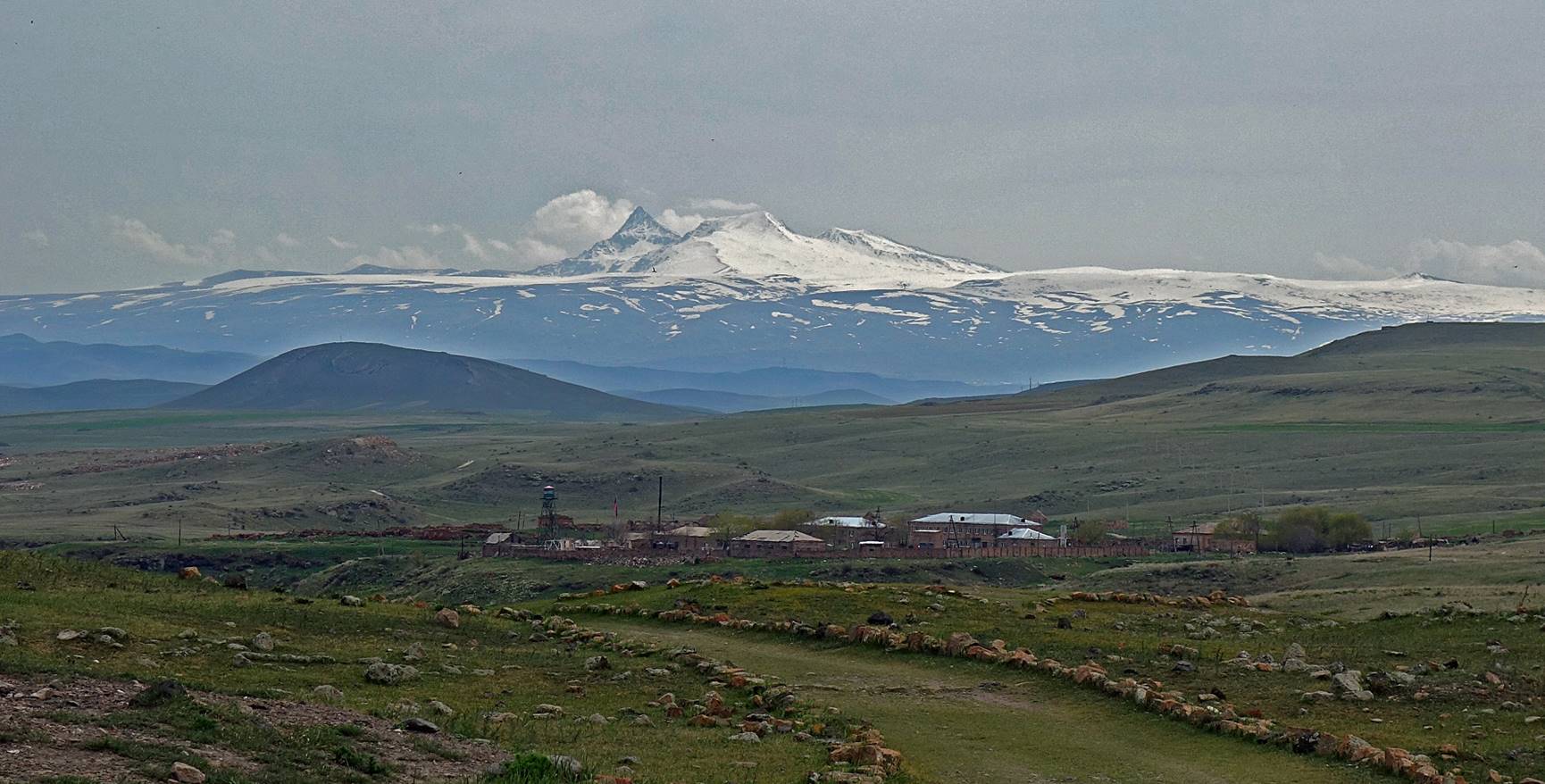
View of the Cathedral from a distance,
with Mt. Aragats (4090m) located in Armenia in the
background.
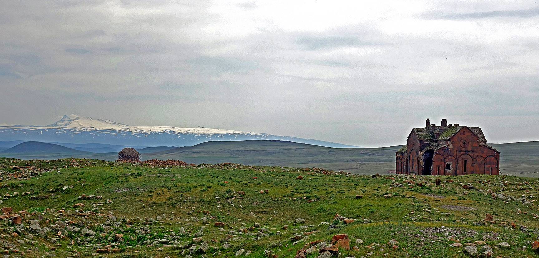
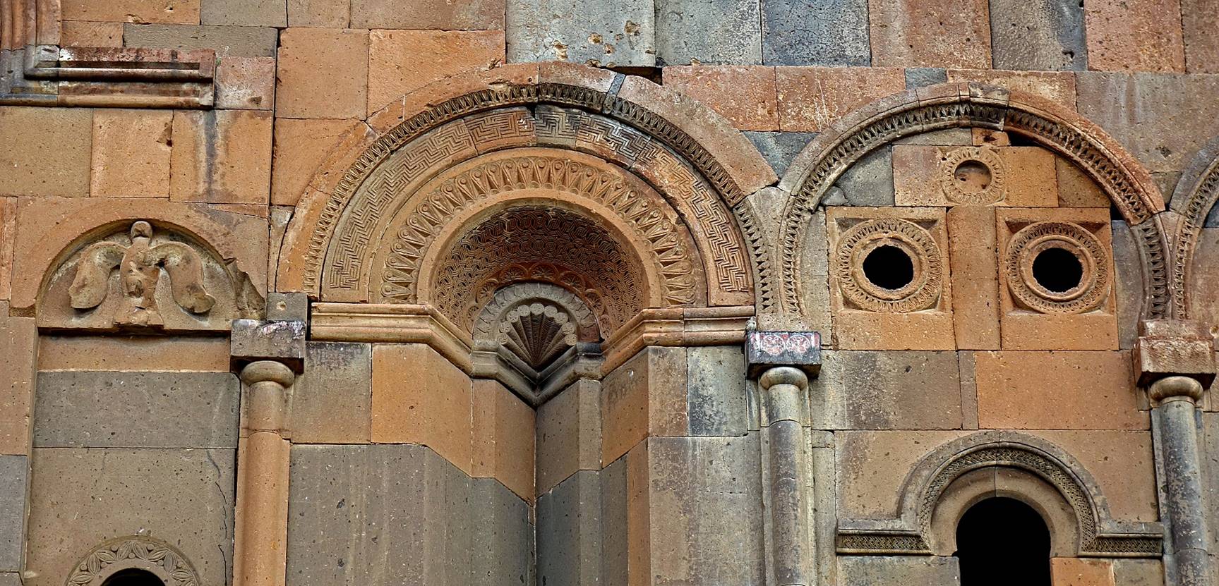
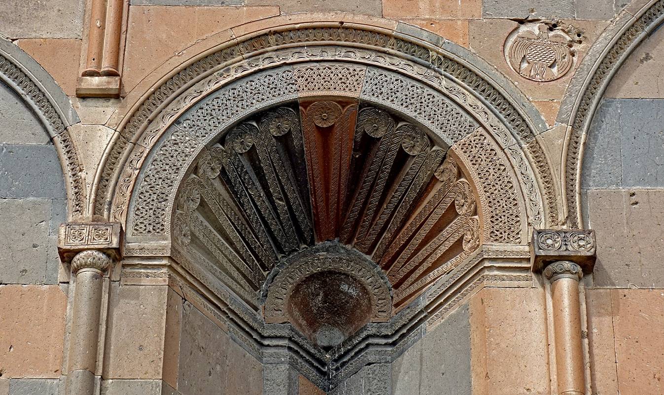
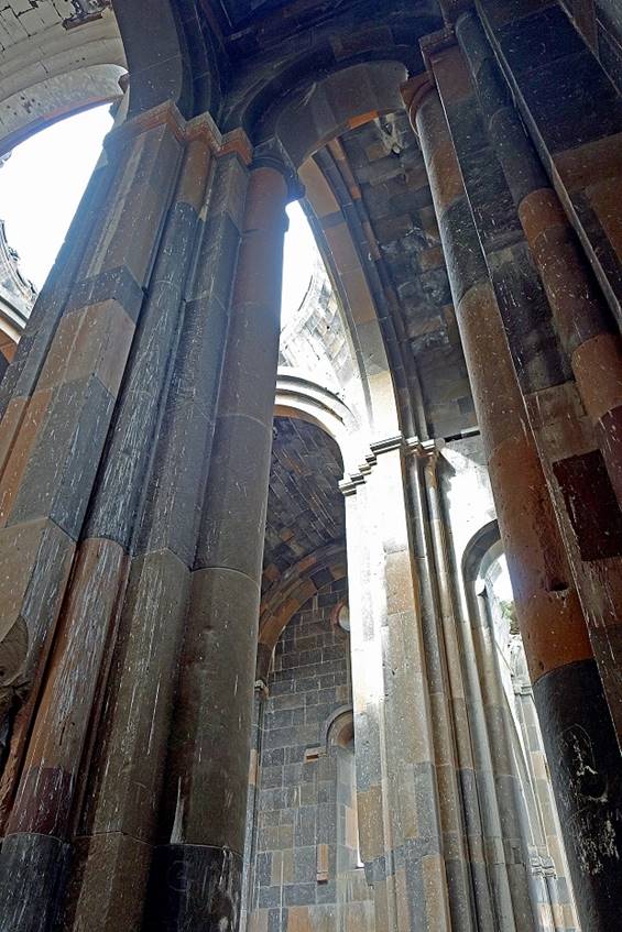
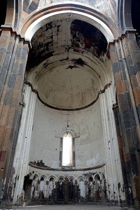
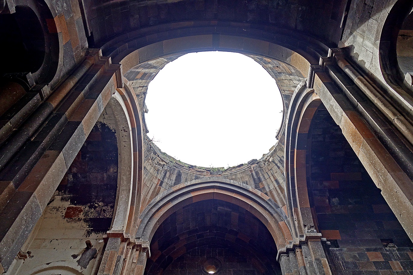
Views of the Cathedral (987-1010).

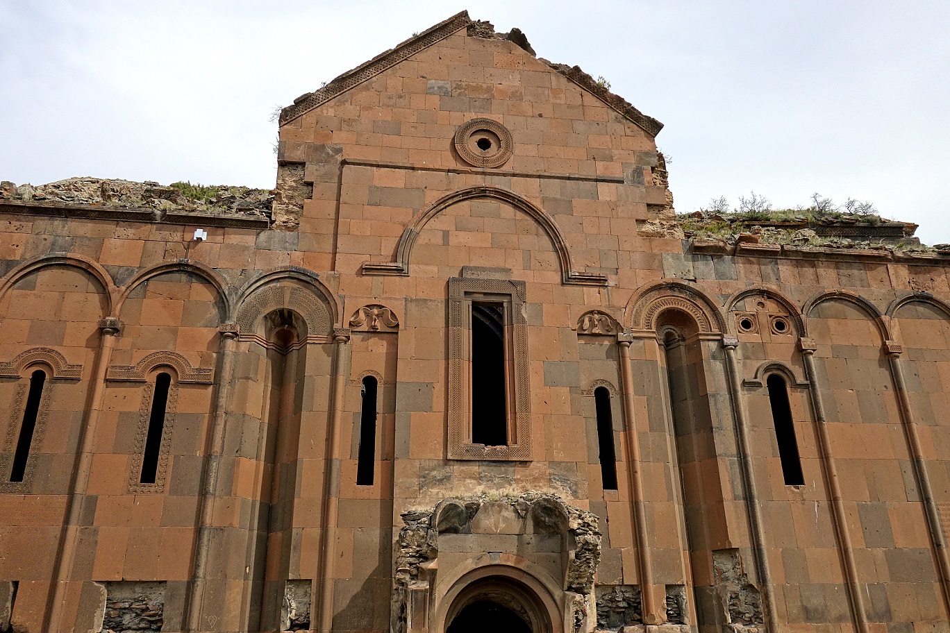
Ornamental details on exterior walls.

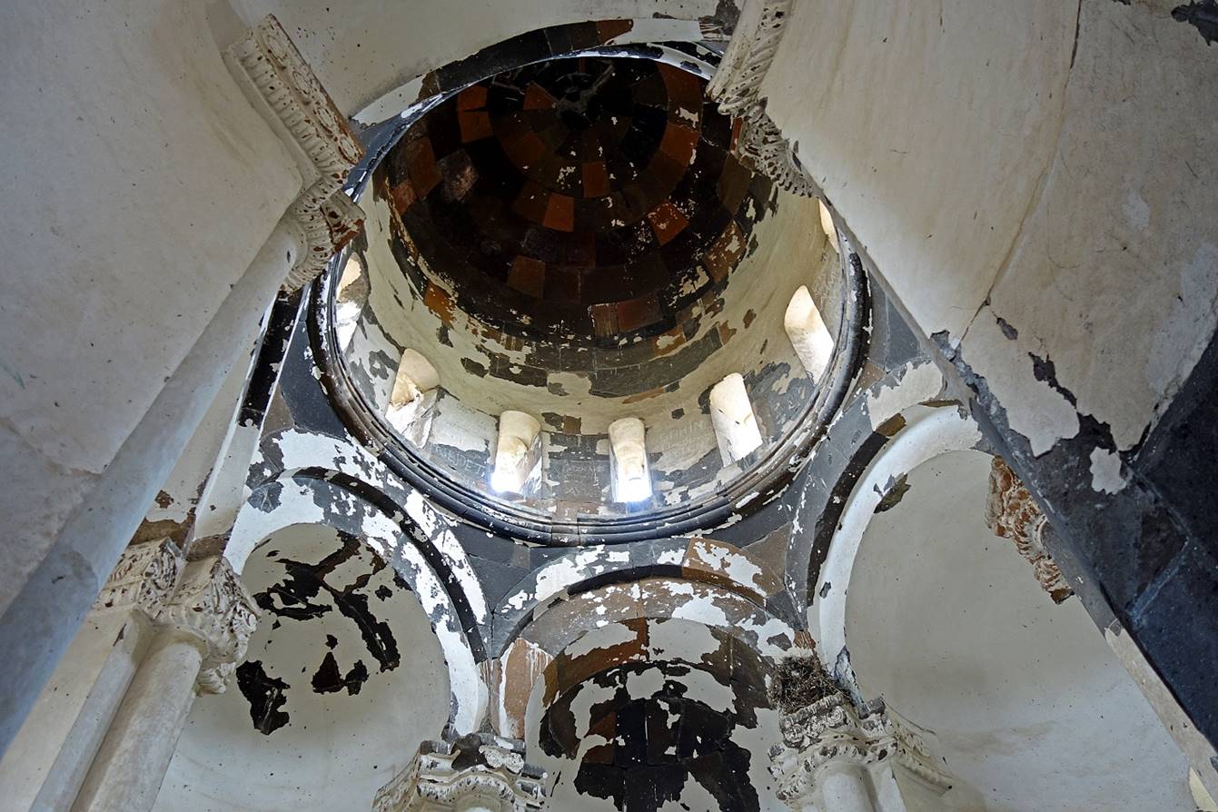
Interior of the Cathedral.
|
|
|
|

View of Mt. Aragats
from the eastern side of Ani site, with an Armenian military post in the
foreground.
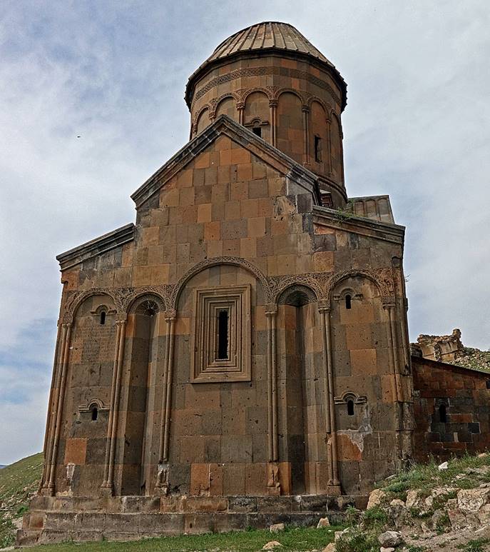
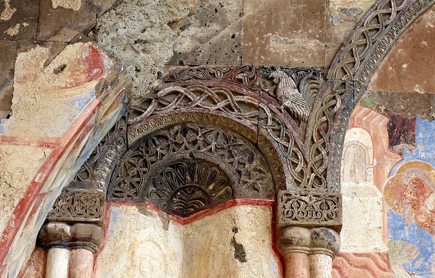
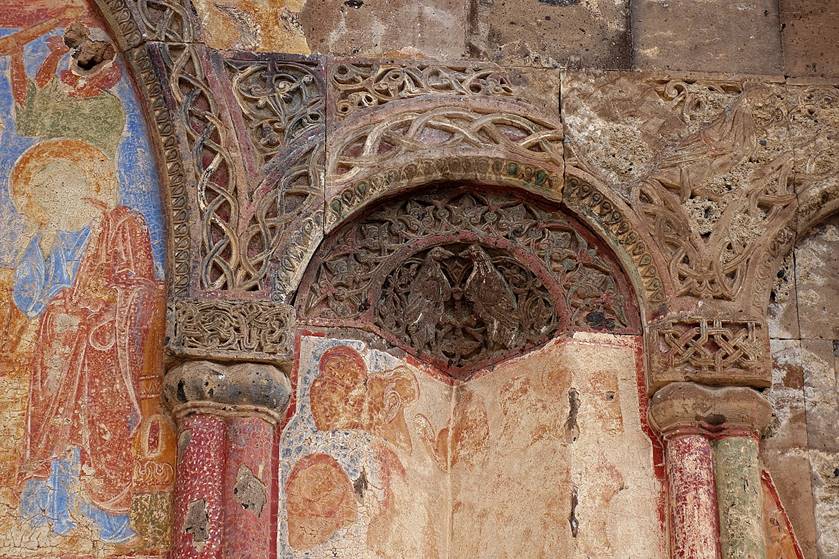
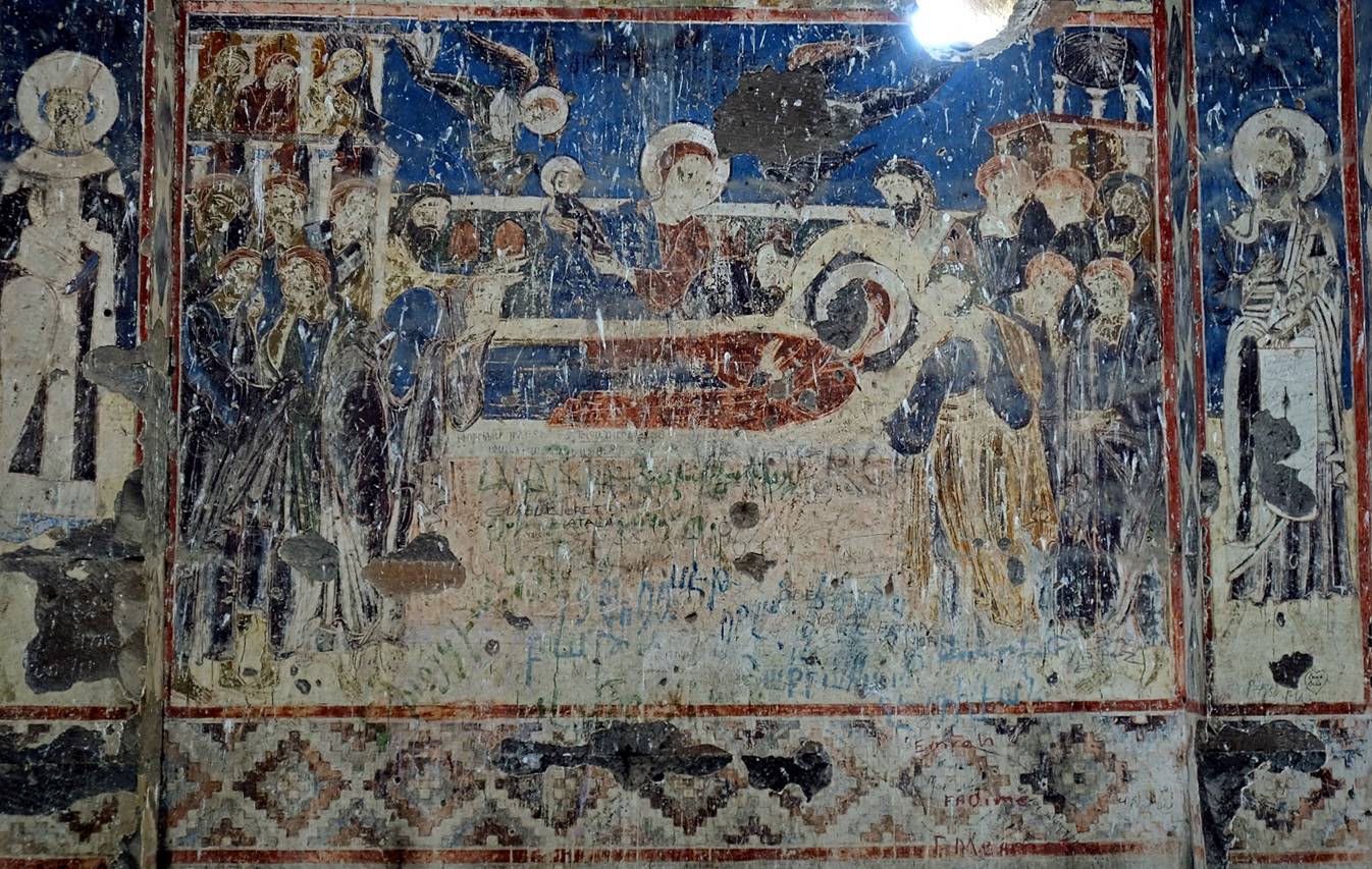
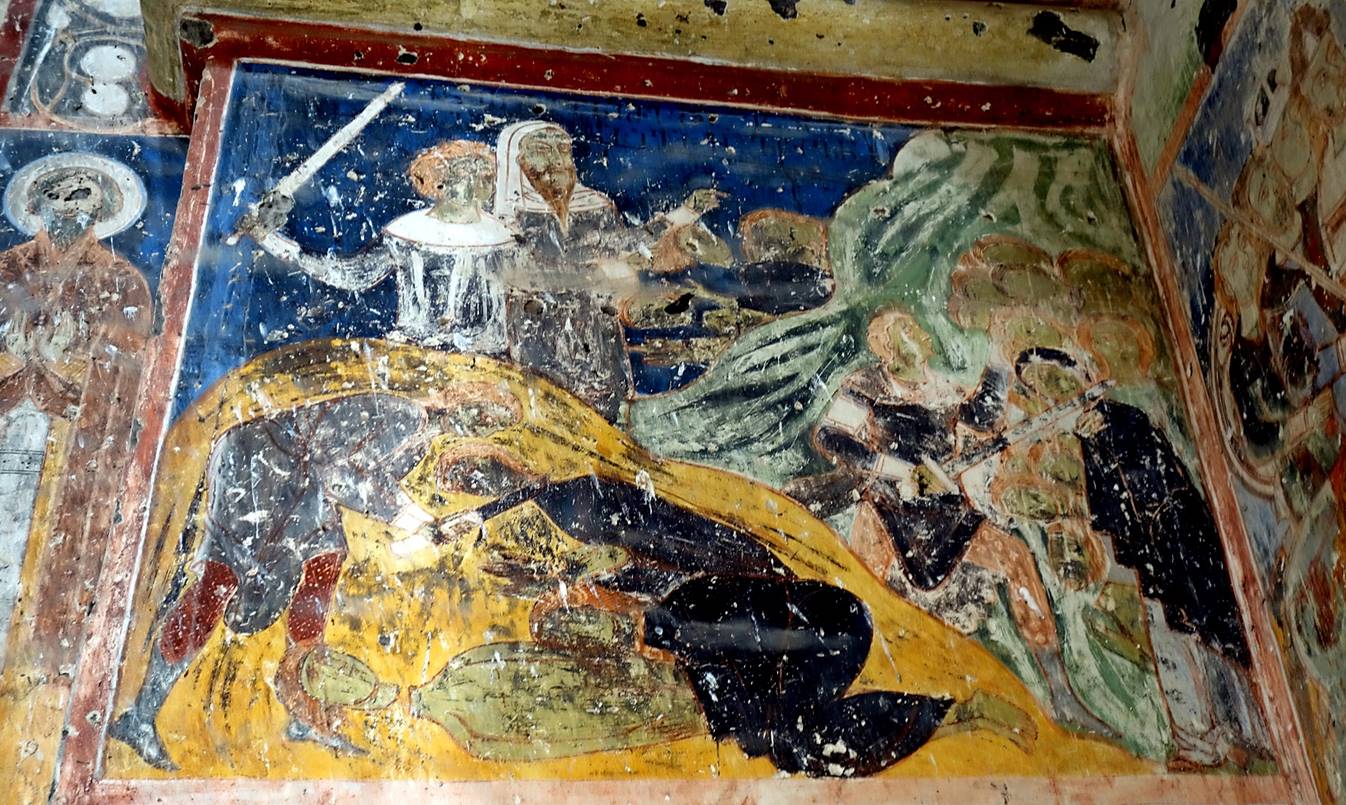
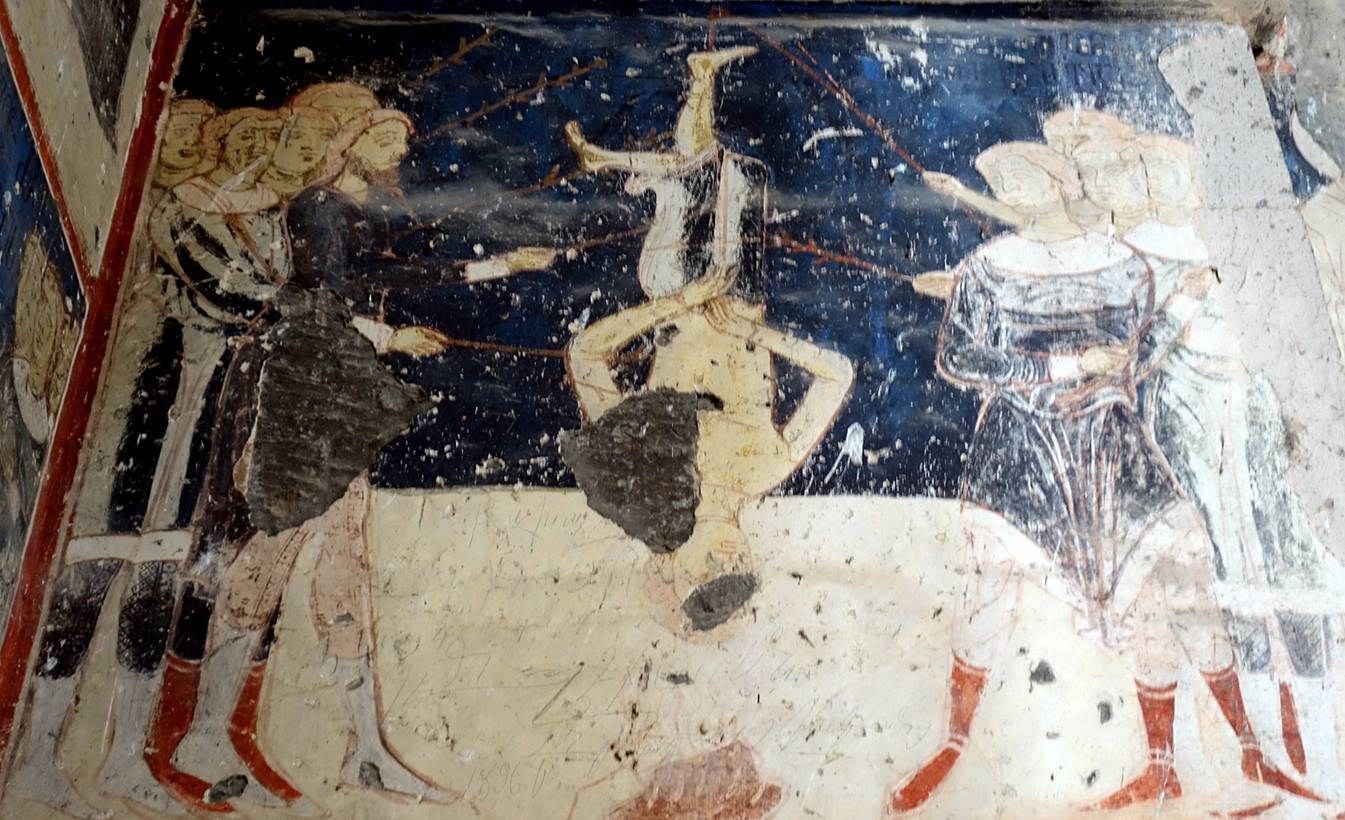
Church of Saint Gregory of Tigran Honentz (1215), another
relatively well conserved church.

|
|
|
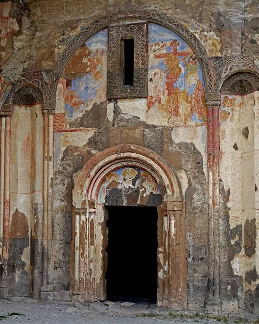
Entrance of
the church.
|
|
|
|
|
|
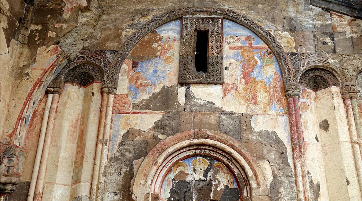
Interior.


|
|
|
|
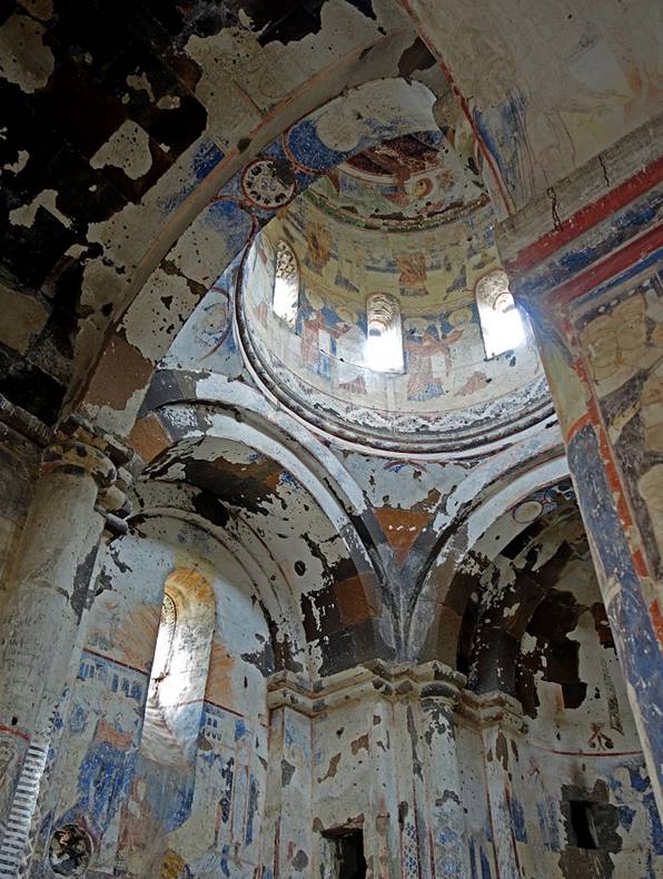
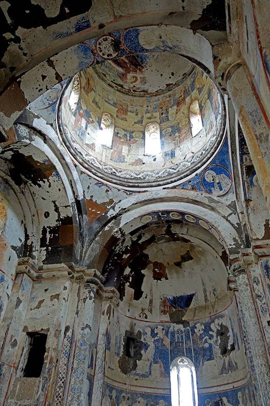

Wall frescoes.
![]()
Back to
main Turkey page | Back
to my mountaineering/trekking/travel webpage