Massachusetts, New Hampshire, Maine, Vermont,
and New York (2015-2024)
![]()
Return
to main United States page
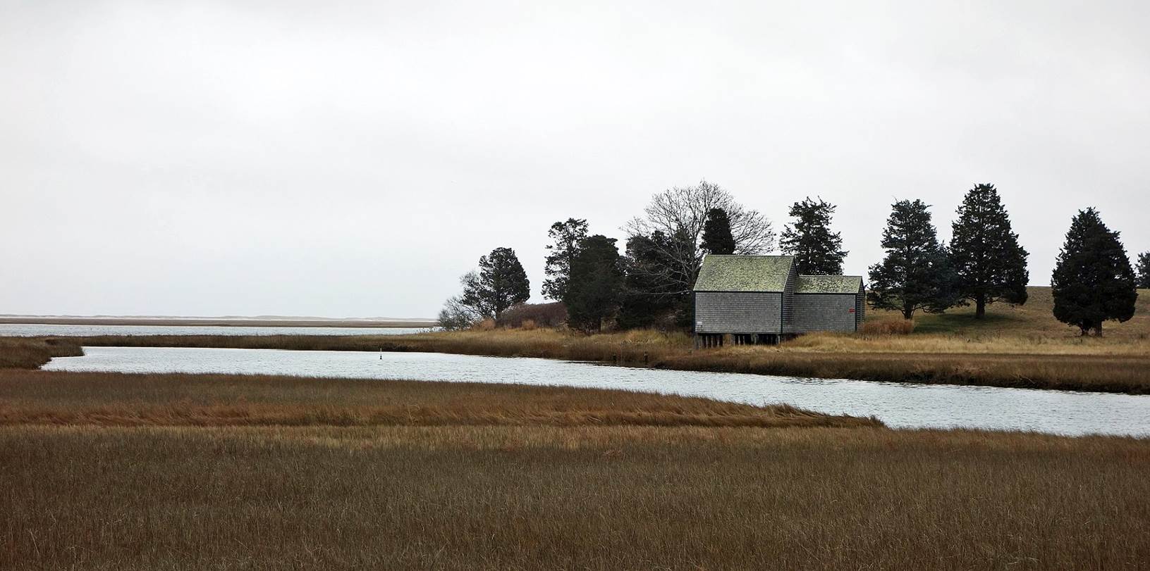
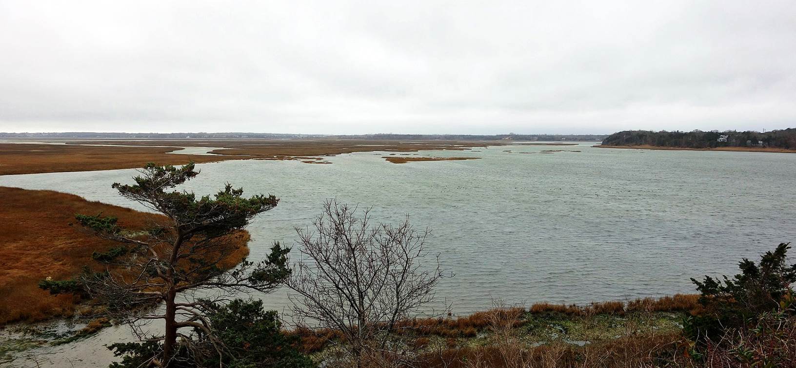
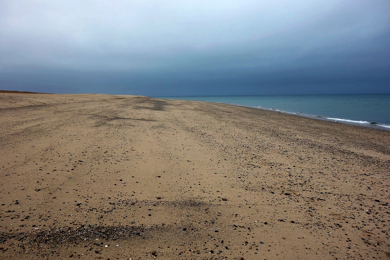
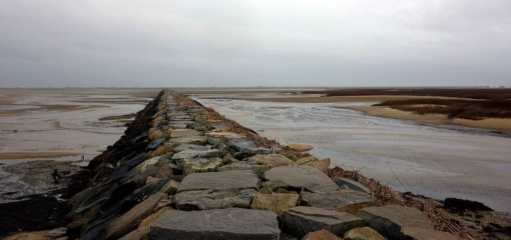
Massachusetts (December 2015):
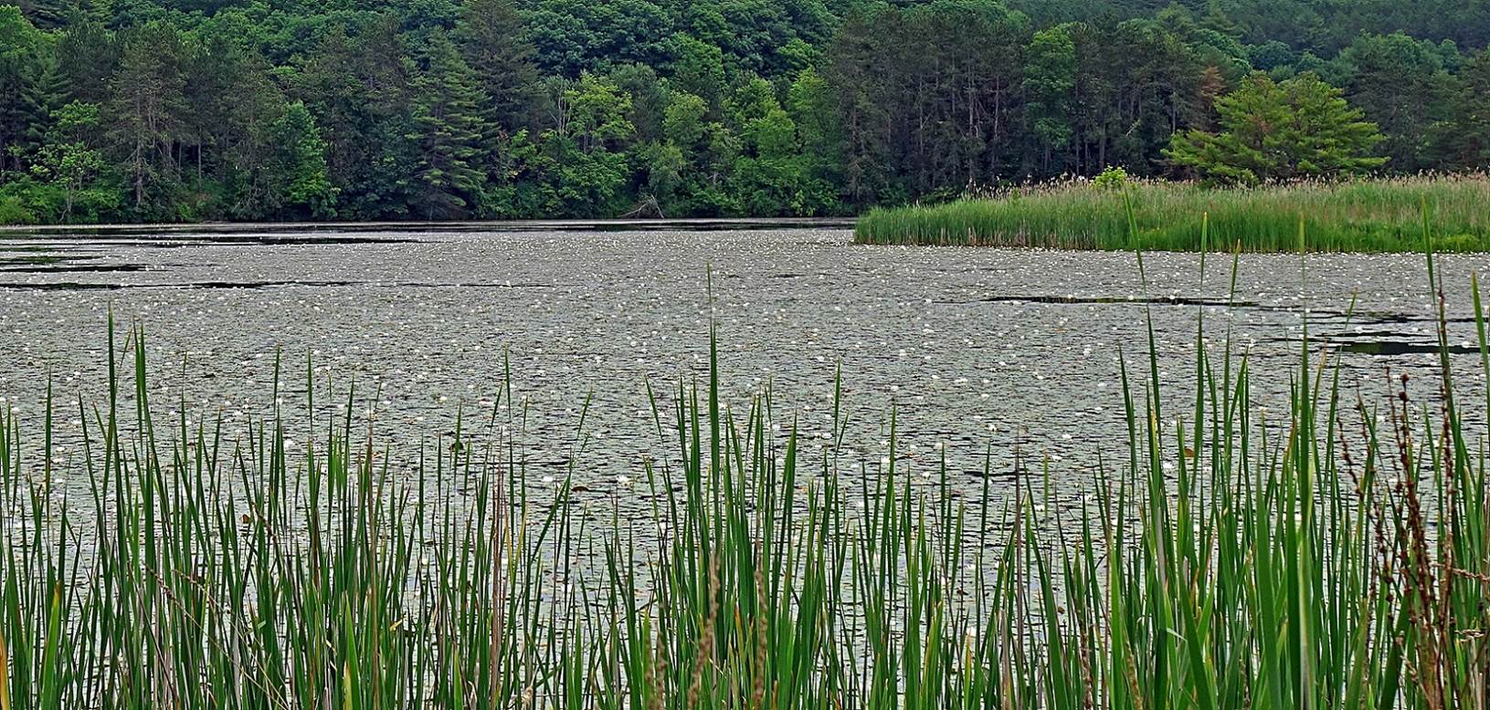
Nauset marsh, Cape Cod.
Race Point beach, Cape Cod.
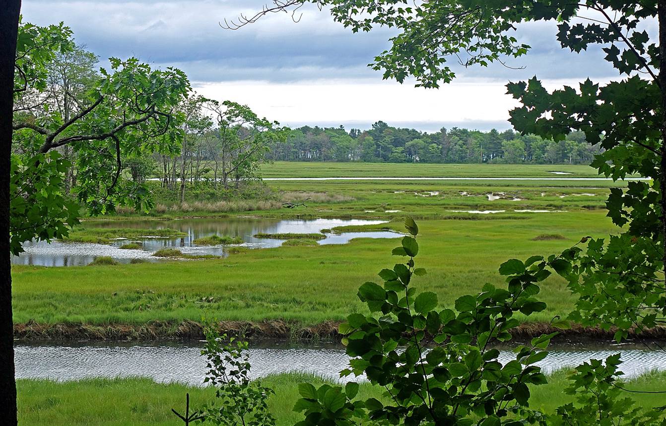
Salt marsh and breakwaterwalk
in Provincetown, Cape Cod.
New-Hampshire (December 2015, June
2017, June 2019, June 2022, June 2023, and April 2024):
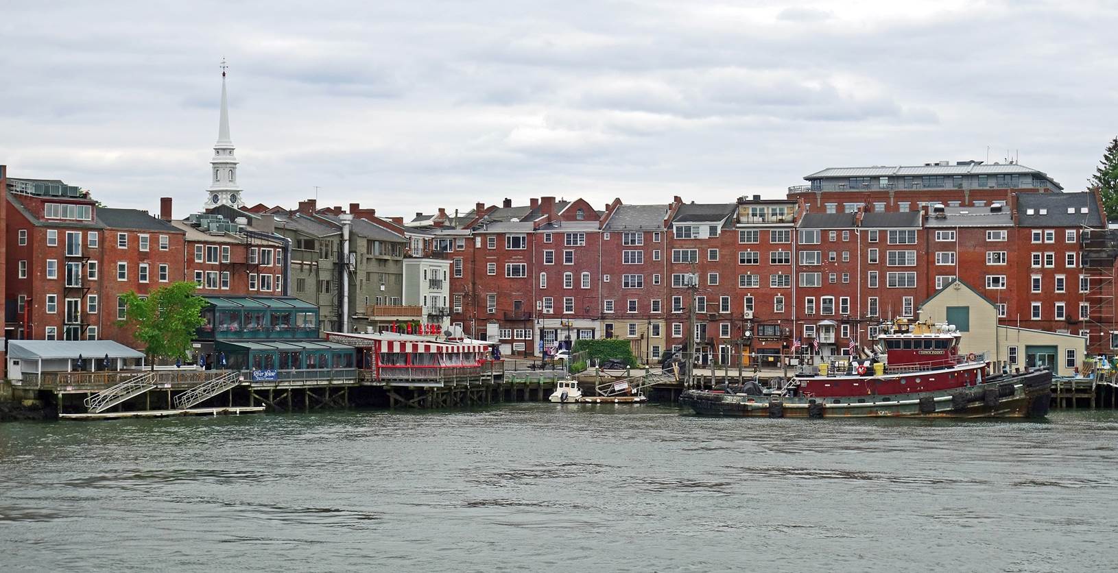
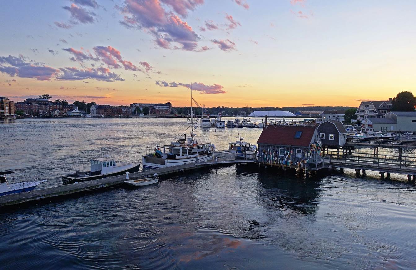
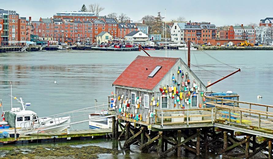
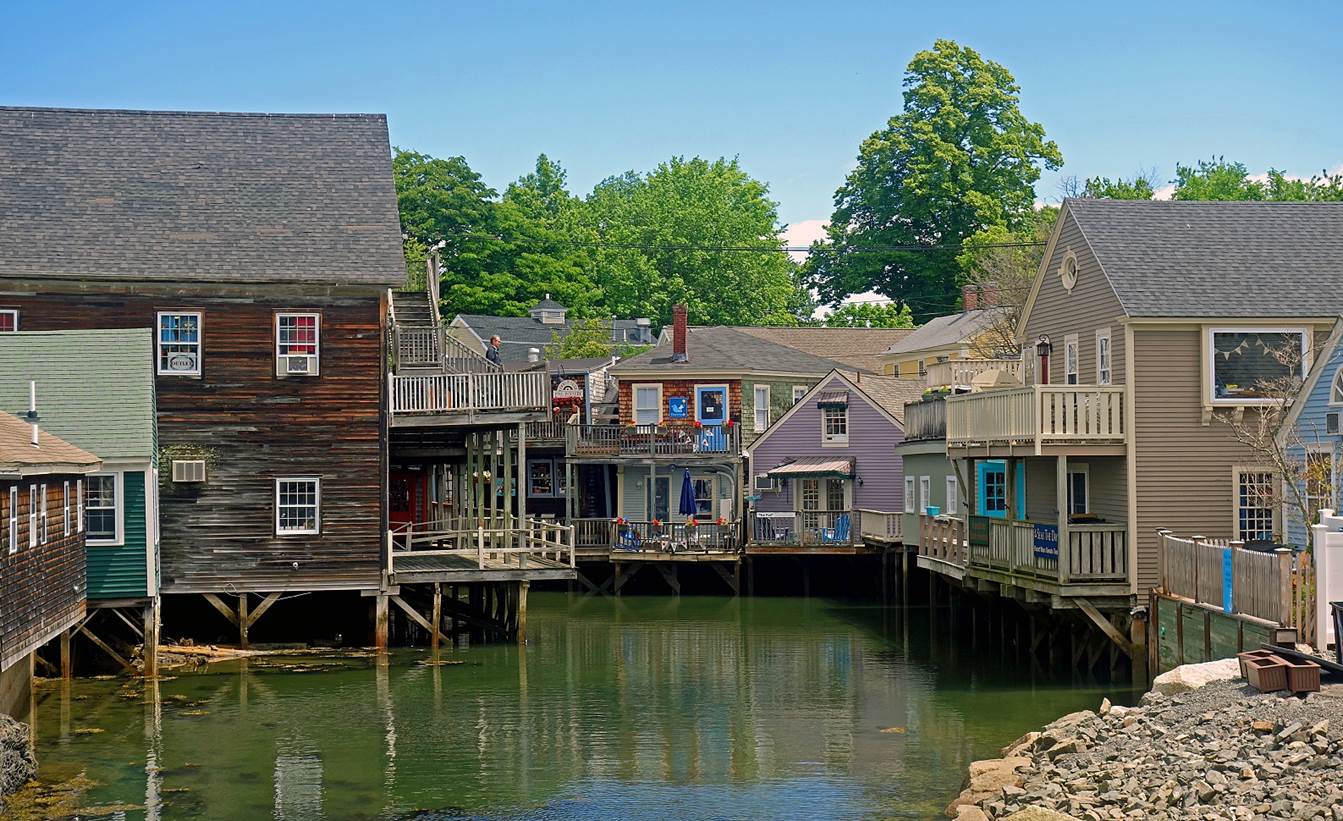
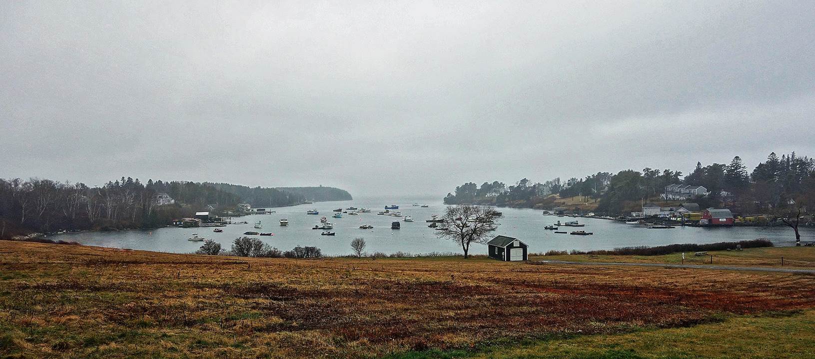
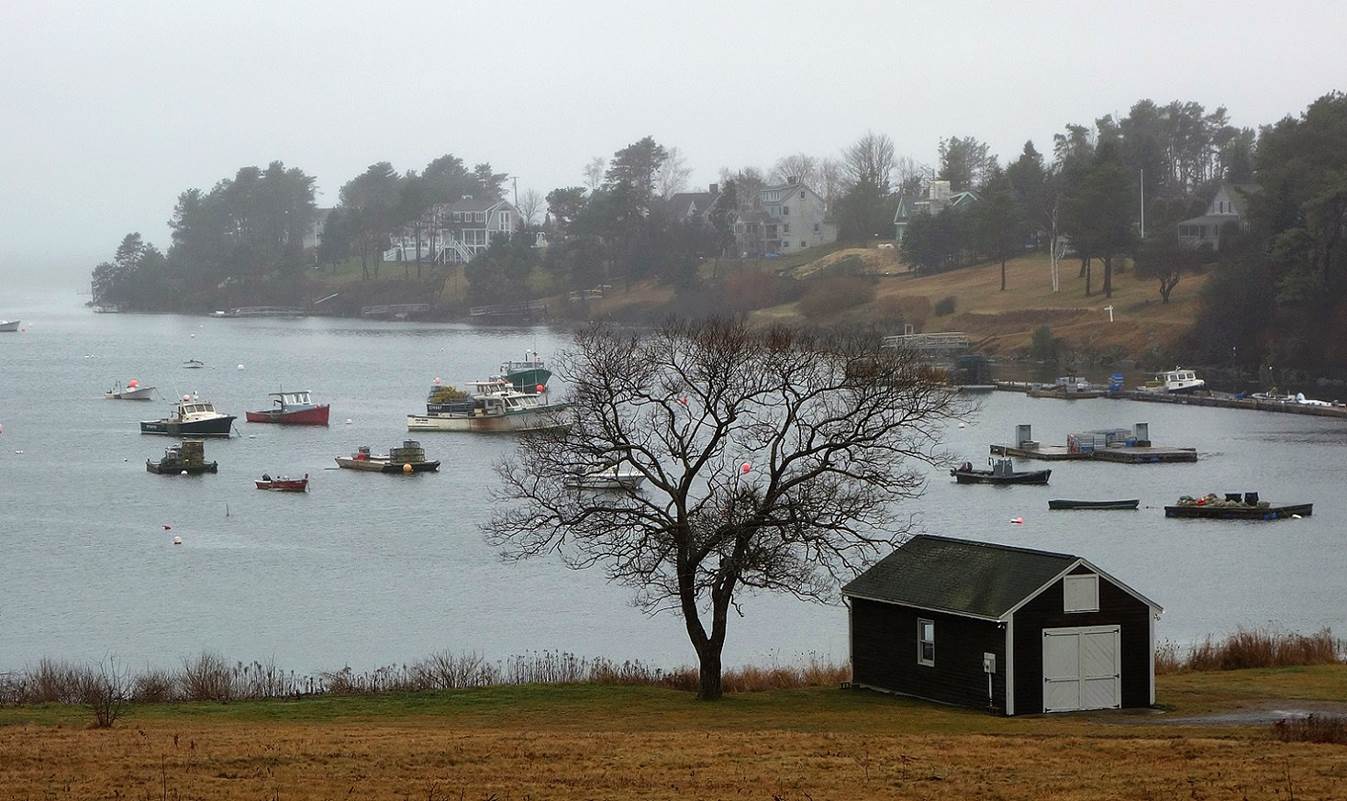
Old harbor waterfront of Portsmouth (June 2022).
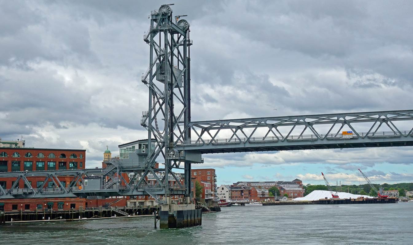
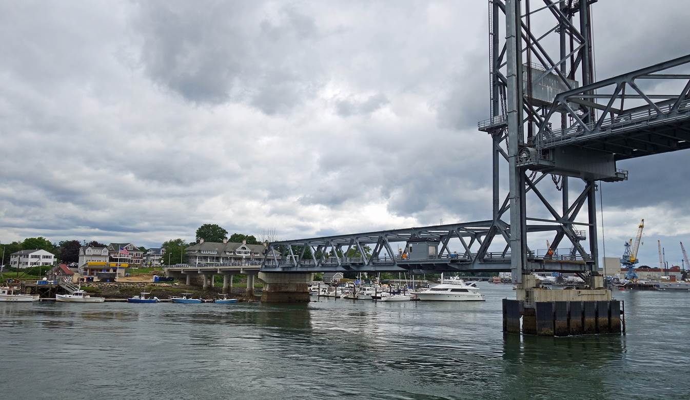
World War I Memorial
Bridge, Portsmouth. The bridge connects downtown Portsmouth to Badger's Island
(Maine) across the Piscataqua river. Its central span can be lifted to allow
boat traffic. The background in the first photo below is a section of the waterfront
of Portsmouth; the giant stockpile of salt on the right is used for road
deicing in winter. The background in the second photo is Badger's Island.
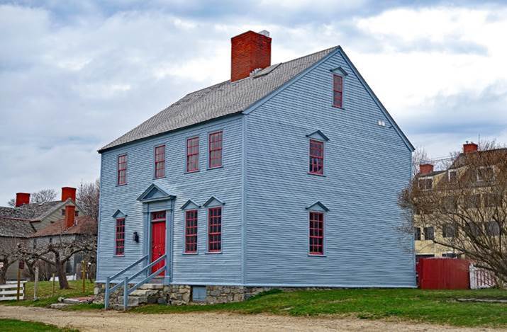
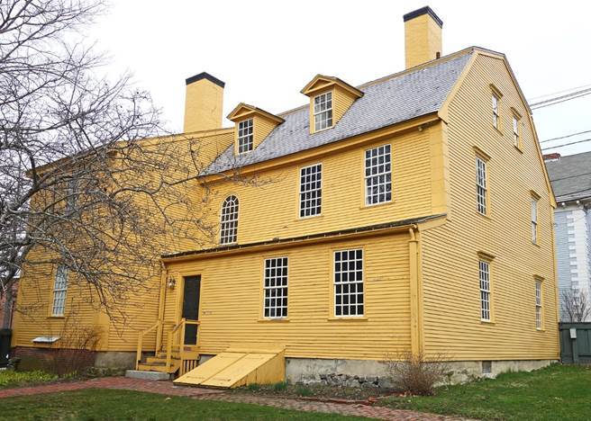
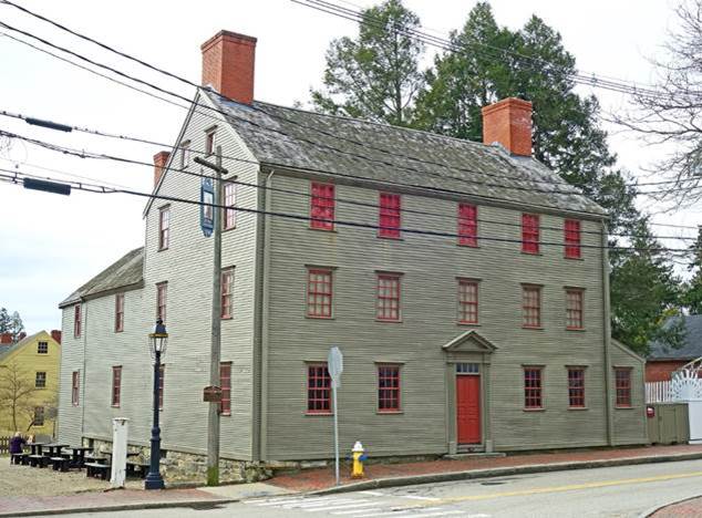
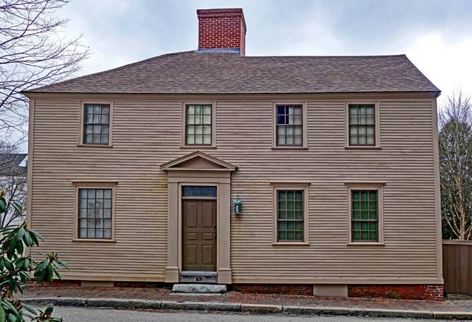
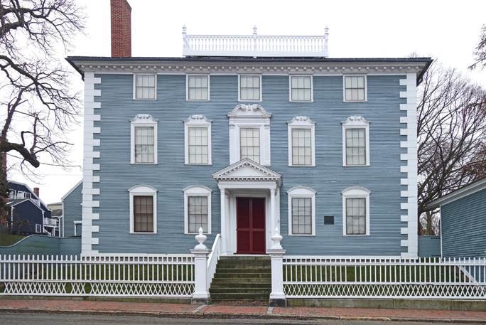
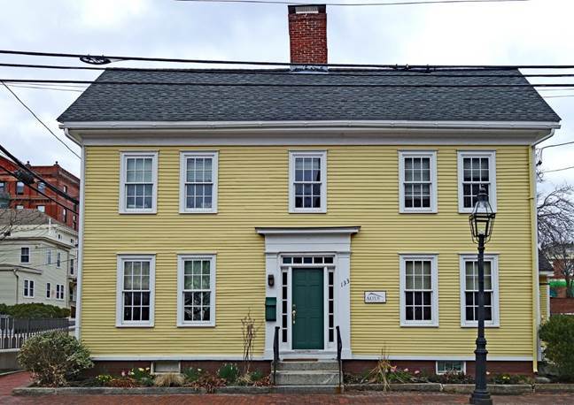
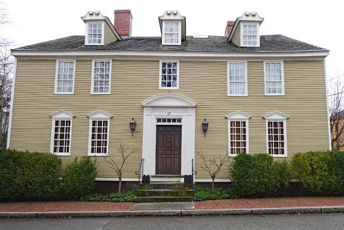
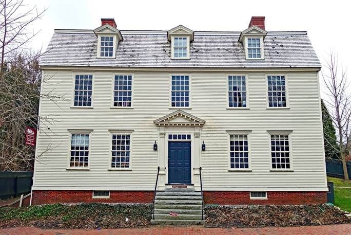
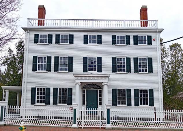
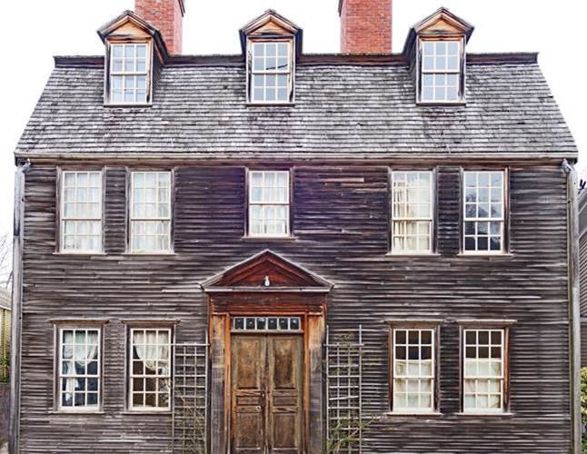
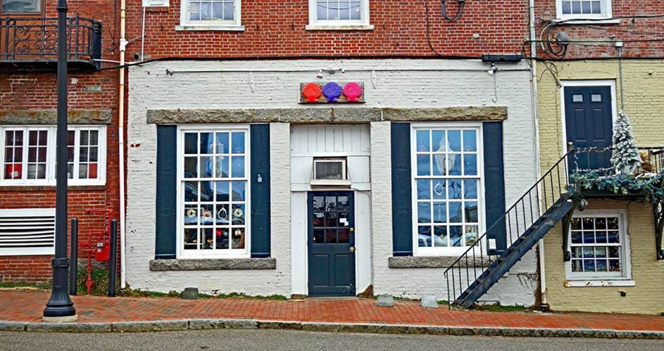
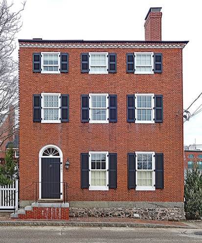
Facades of old houses in
Portsmouth (April 2024).
|
|
|
|


|
|
|
|
|
|
|
|
|
|
|
|
|
|
|
|
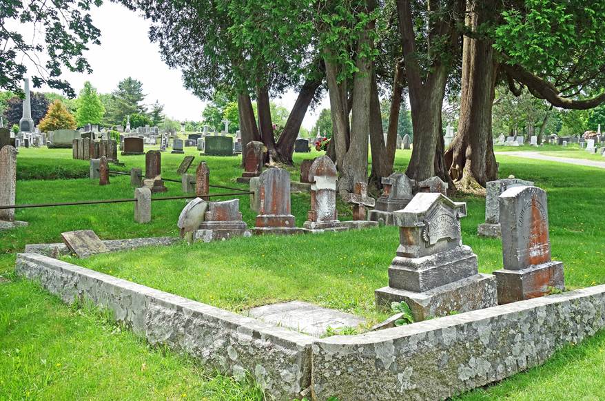
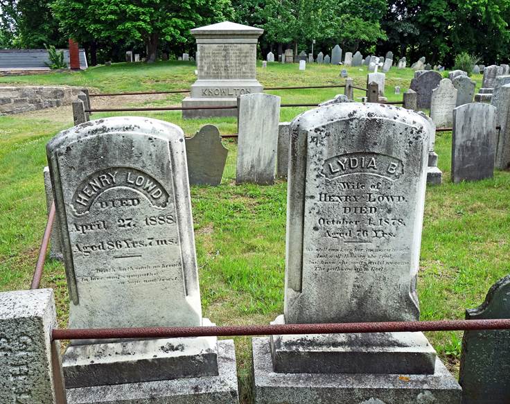
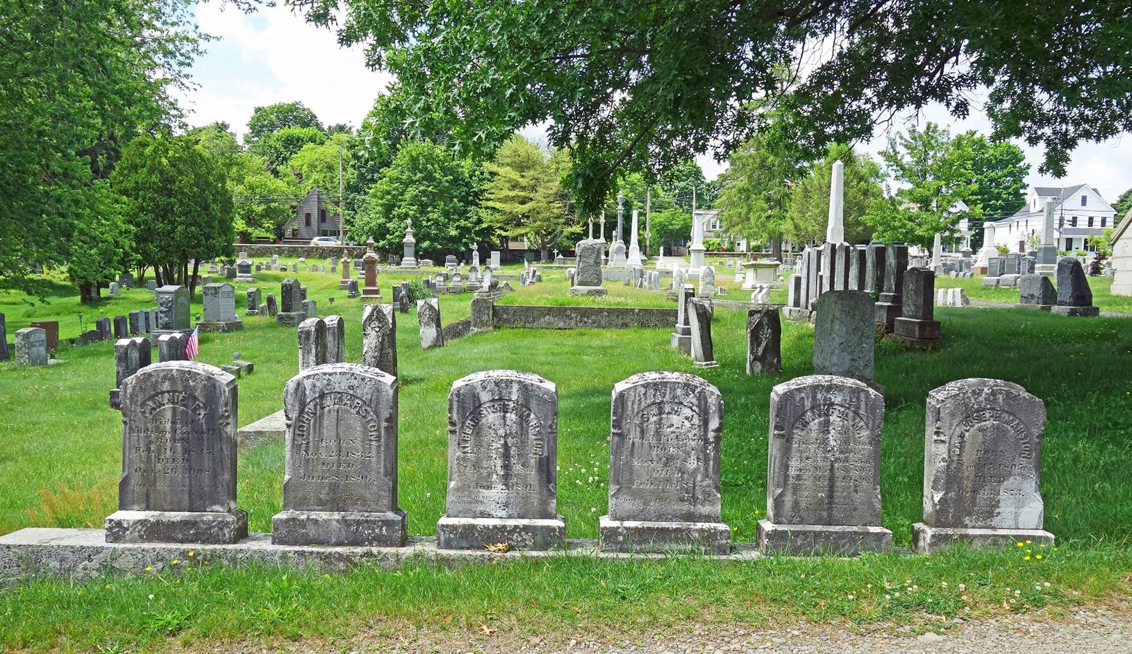
Gravestones in the old South Street cemetery of Portsmouth (June 2022).
|
|
|

|
|
|
|
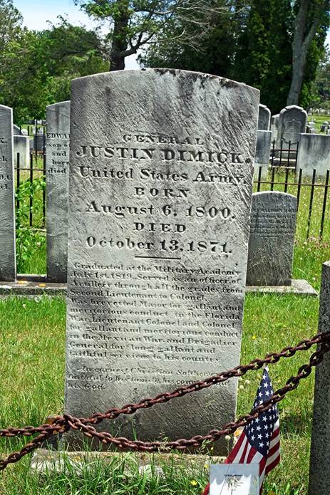
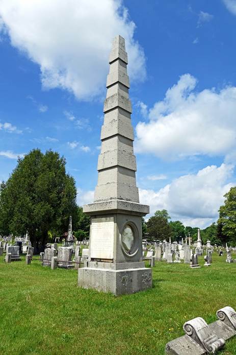
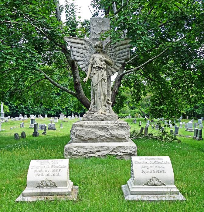
[From left to right: headstone of General Justin
Dimick (1800-1871) who participated in the Florida Wars against the Seminole
and in the Mexican War; grave of Levi Woodbury (1789-1851), a Governor of New
Hampshire, a U.S. Senator, a U.S. Secretary of the Navy, and a judge of the
U.S. Supreme Court; graves of Charles A. Sinclair (1849-1899), the president of
a railroad company and a hotel owner, and of his wife Emma.]
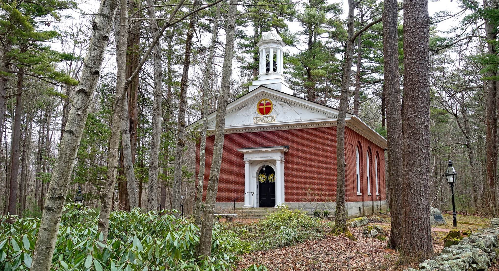
Little Harbor Chapel near
South Street Cemetery (April 2024).
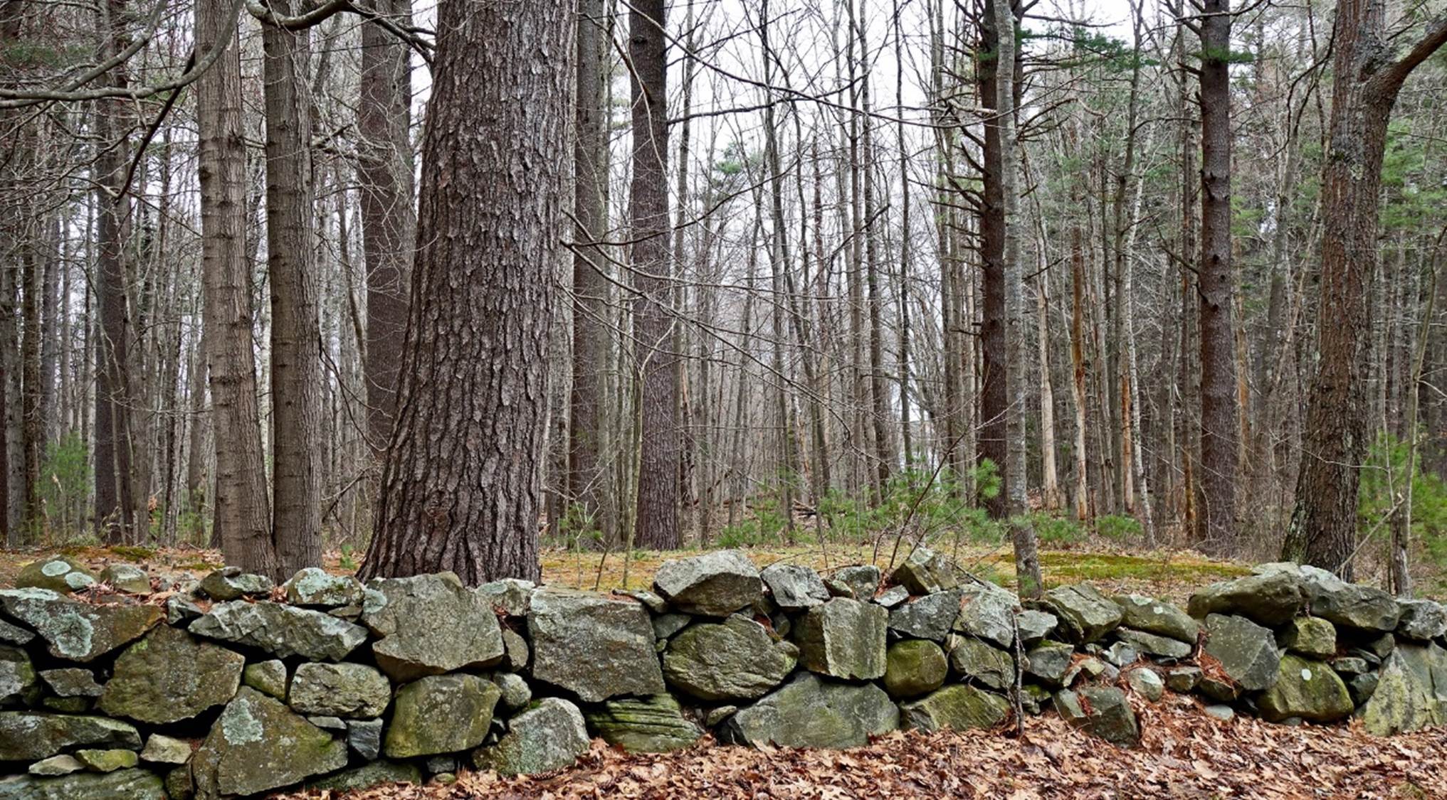
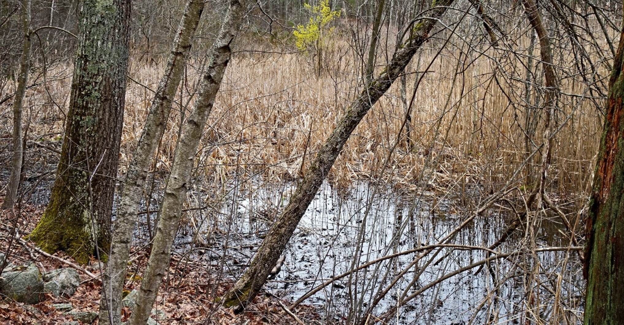
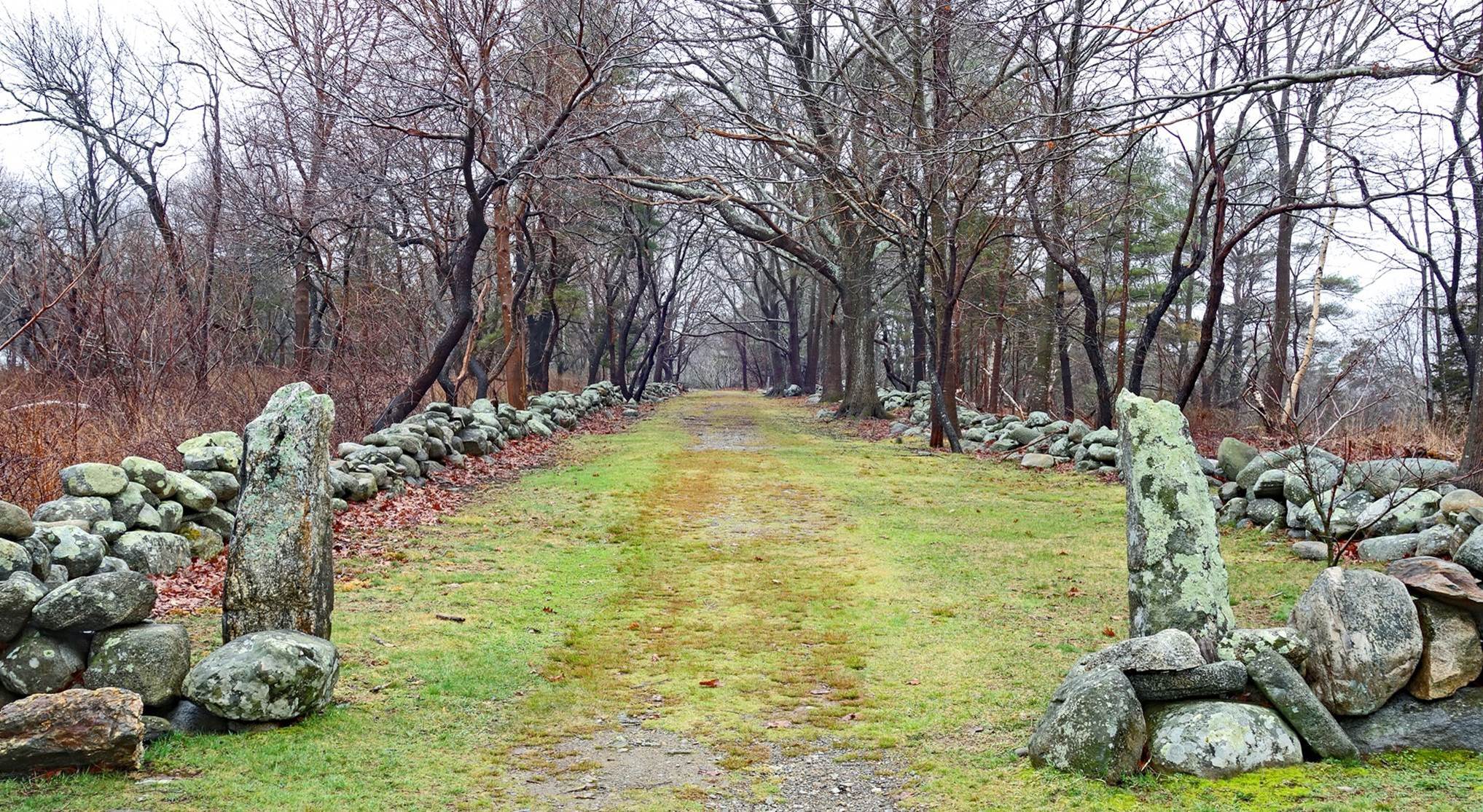
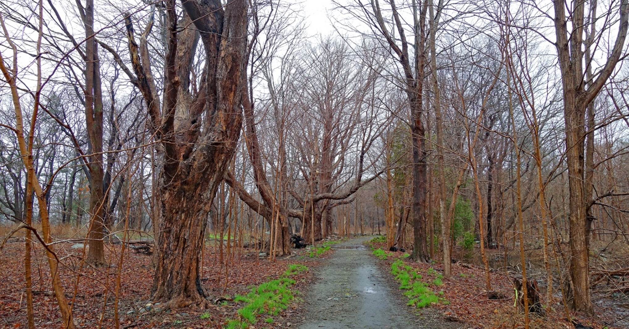
Stone wall and pond in
Creek Farm, south-east of Portsmouth (April 2024).
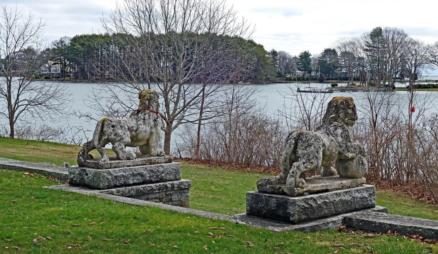
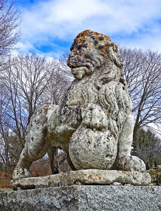
Stone lions at Carrey
Cottage in Creek Farm (April 2024).
|
|
|
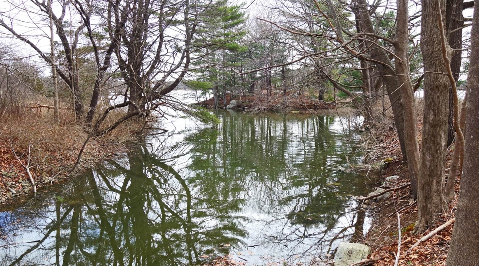
Small cove in Creek Farm
(April 2024).
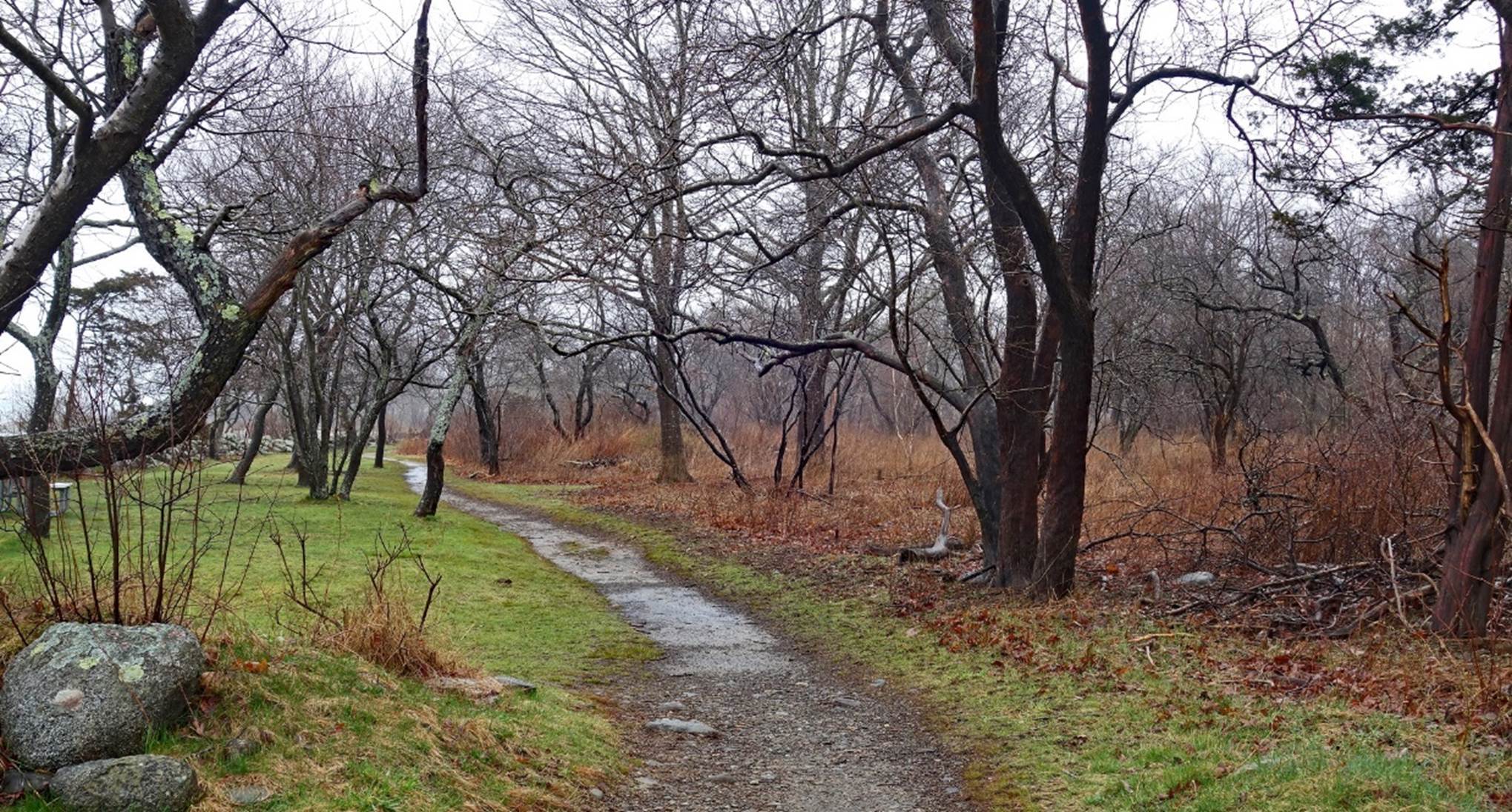
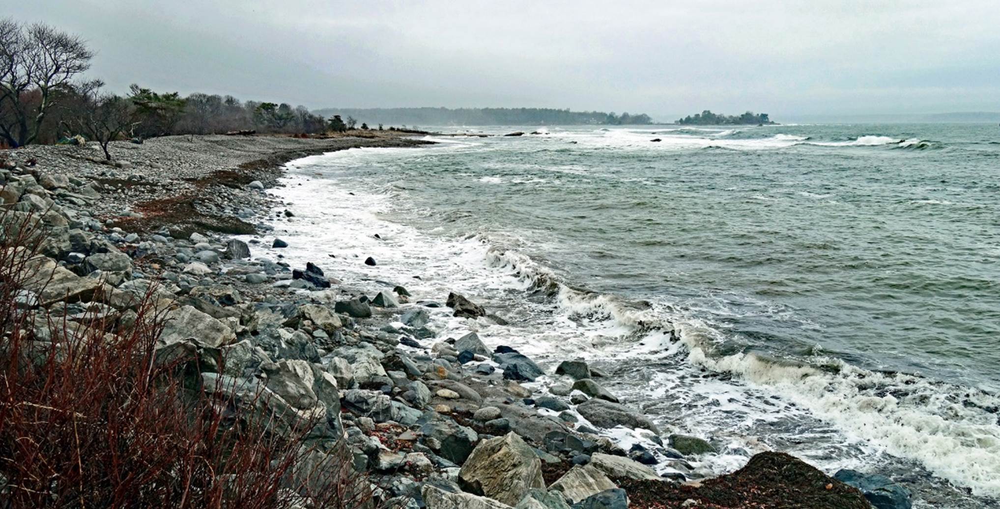
Trails and sea coast at Odiome Point State Park, south-east of Portsmouth (April 2024).
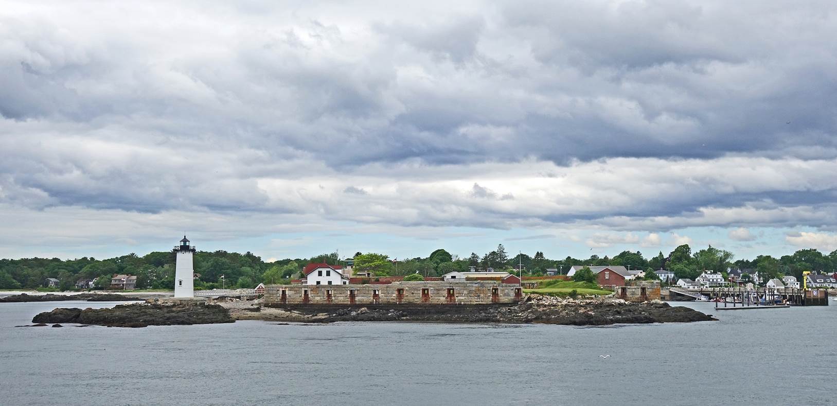
Portsmouth harbor
lighthouse and remains of former Fort Constitution on the island of New Castle
seen from the estuary of the Piscataqua river in the Atlantic Ocean (June
2022).
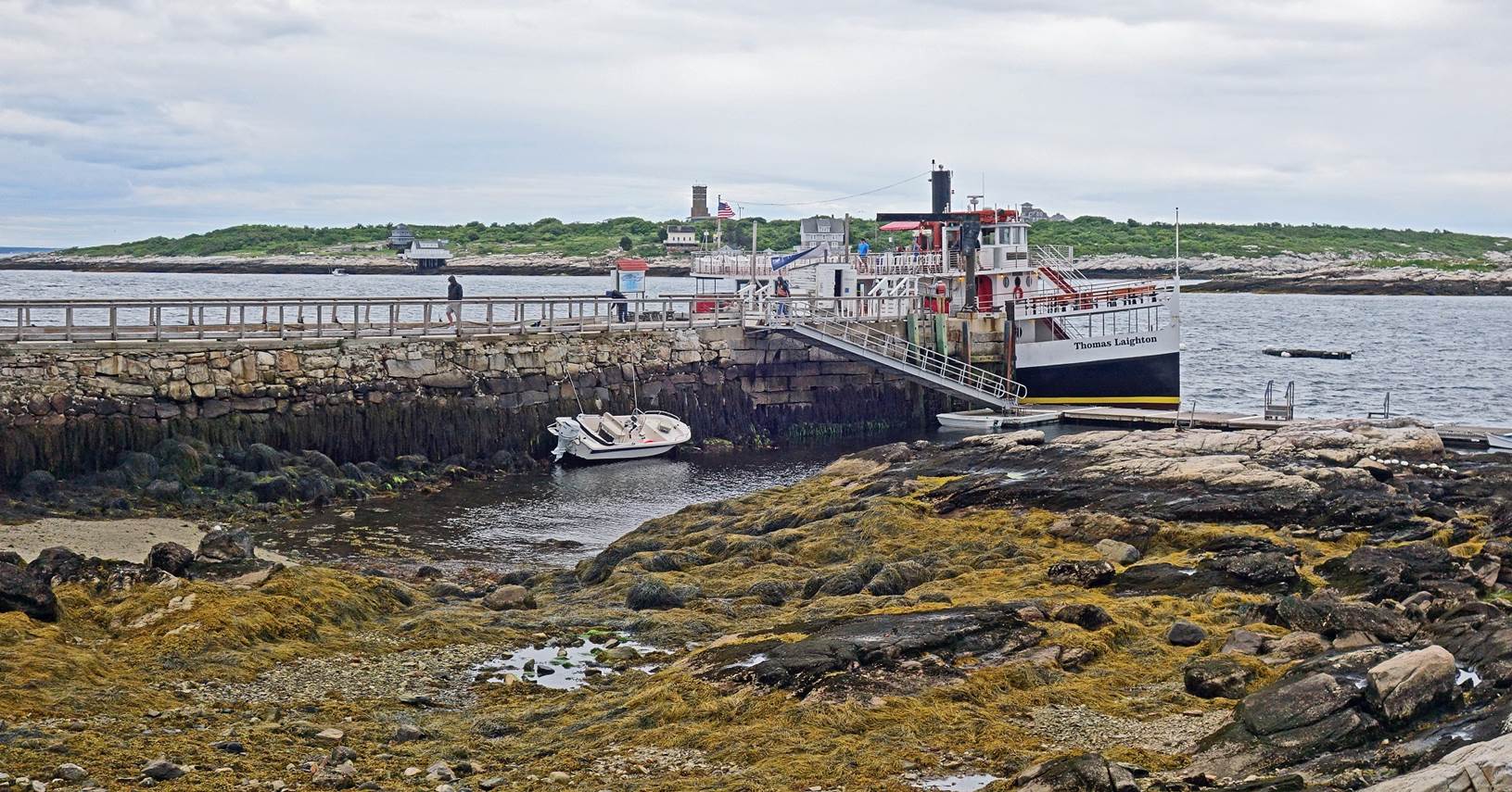
Boat docked on the Star Island, one of the Isles of Shoals (June 2022). The Isles of Shoals are
located 15km southeast of Portsmouth in the Atlantic Ocean. Some, including
Star Island, are part of New Hampshire; the others are part of Maine. The tower
(left of the American flag in the photo) is a former radar station built during
WWII on Appledore Island (Maine).
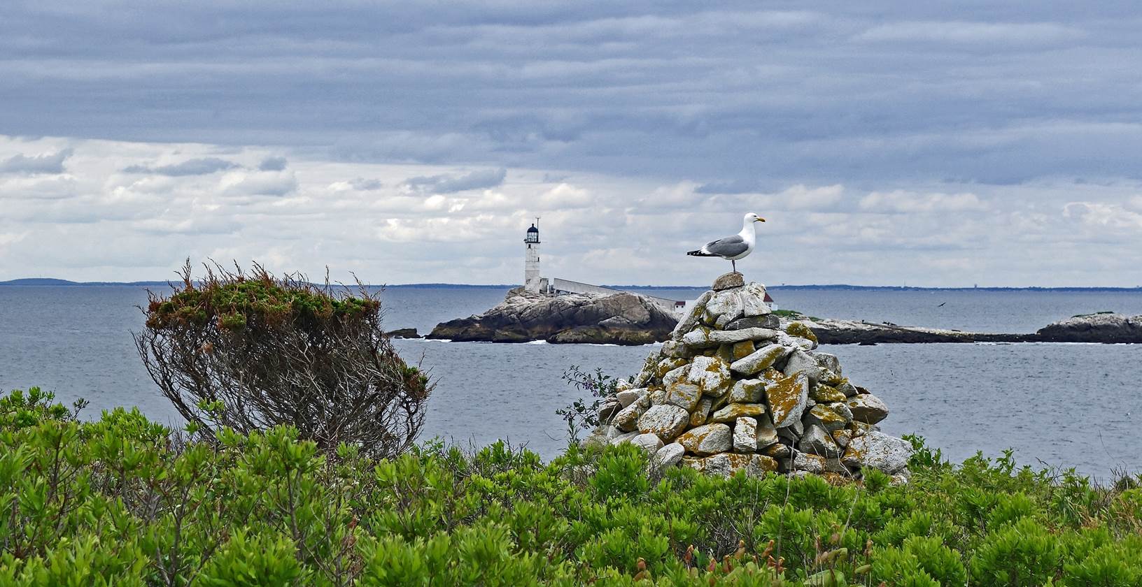
Seaweed on intertidal rocks, Star Island.
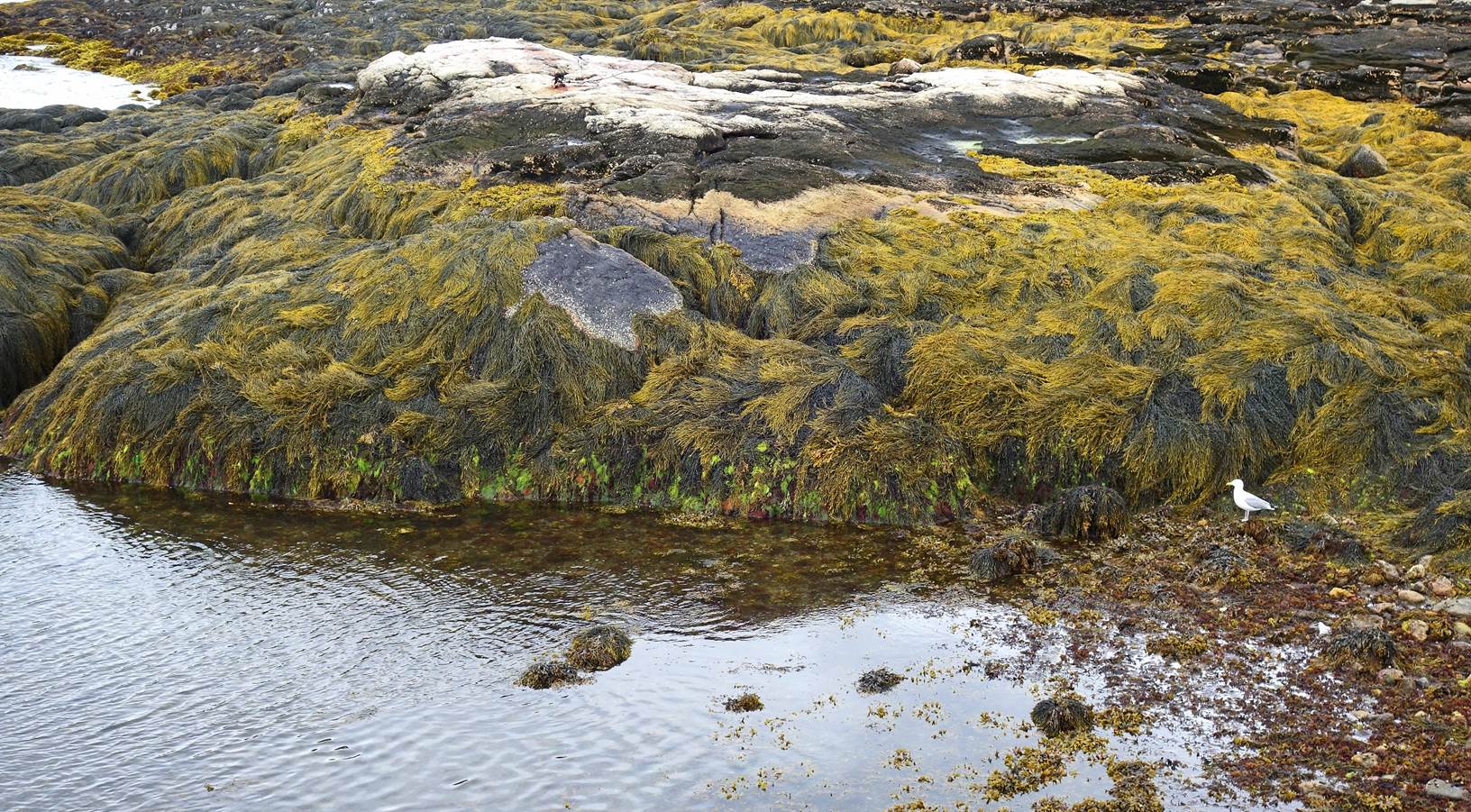
Seagull on a stack of pebbles, Star
Island, with the lighthouse on White Island in the background.
Adams Point, northeast of Portsmouth
(December 2015).
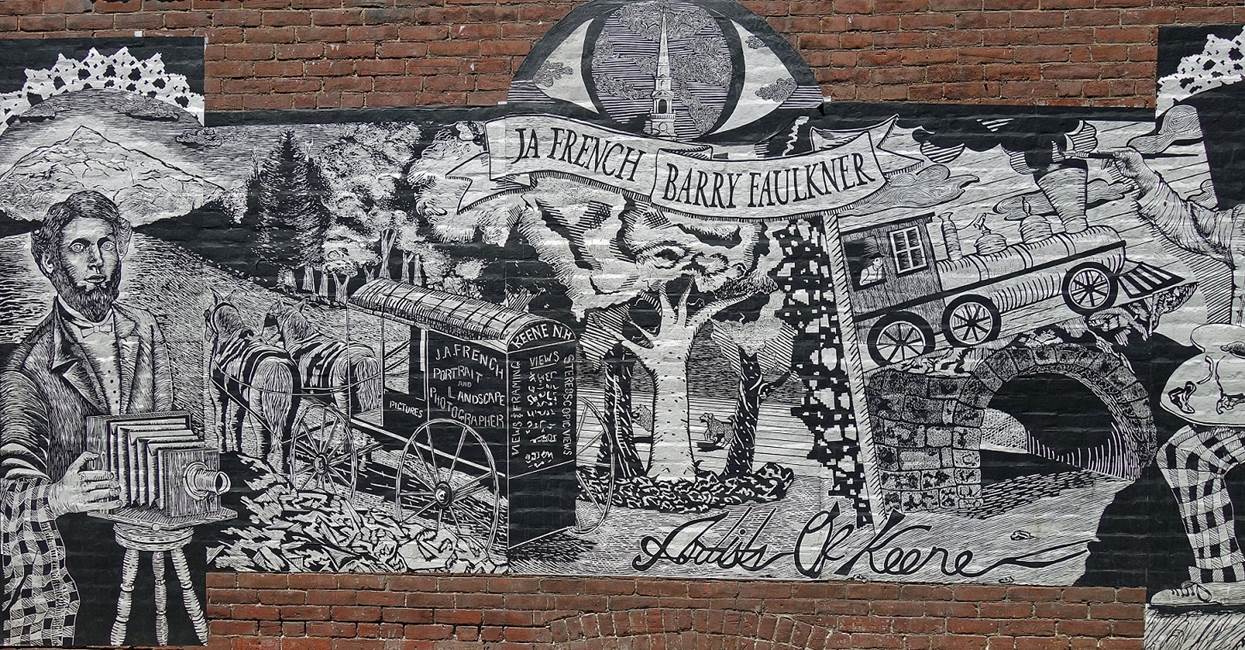
Murals in the town of Keene (June 2019).
|
|
|

Lake Winnipesaukee seen from Mount Major
(June 2017).

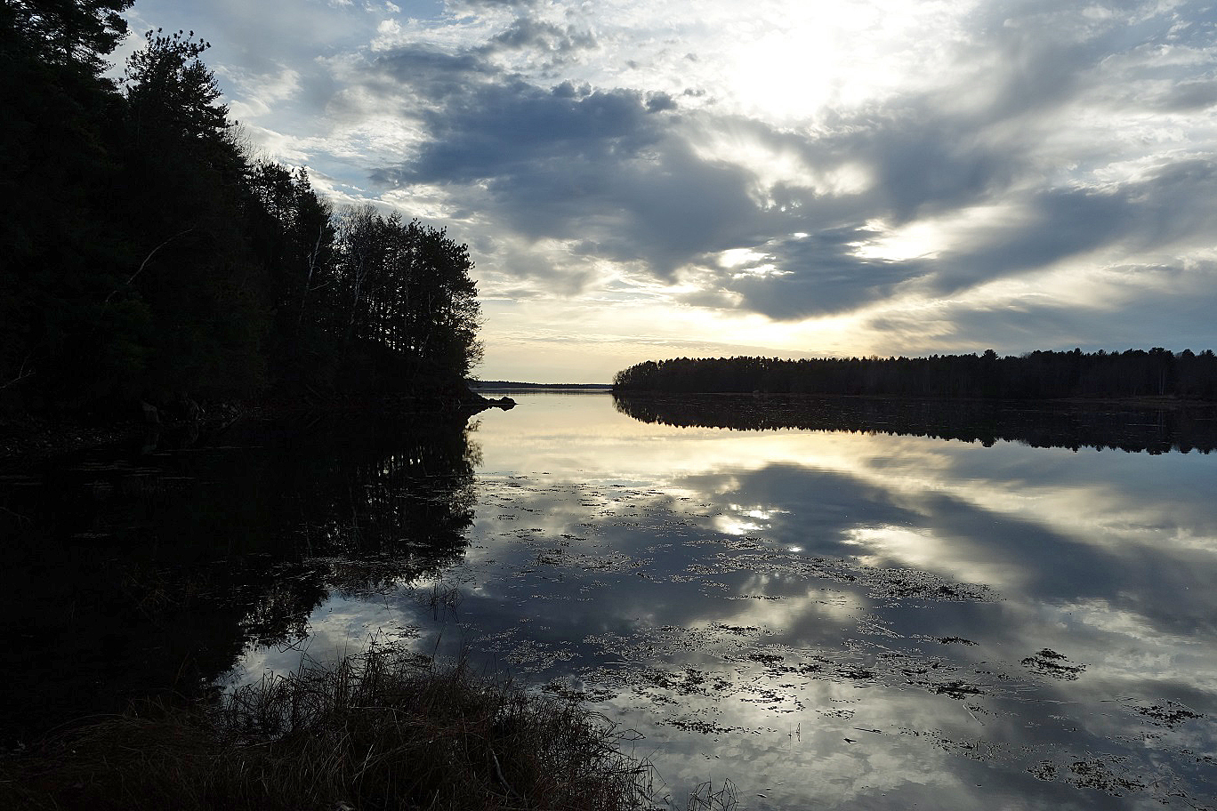
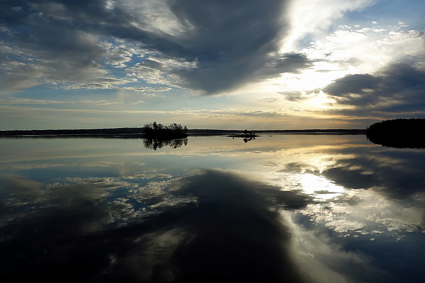
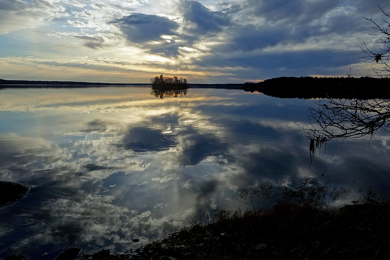
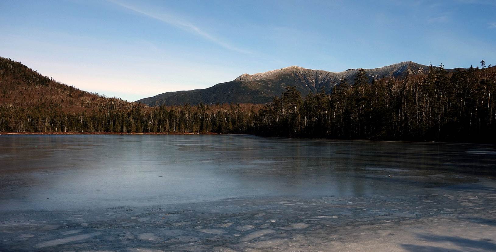
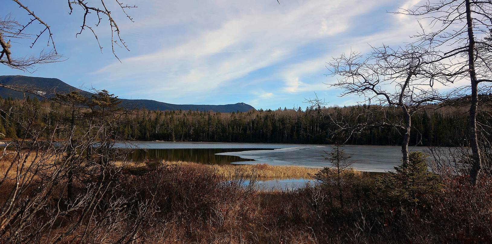
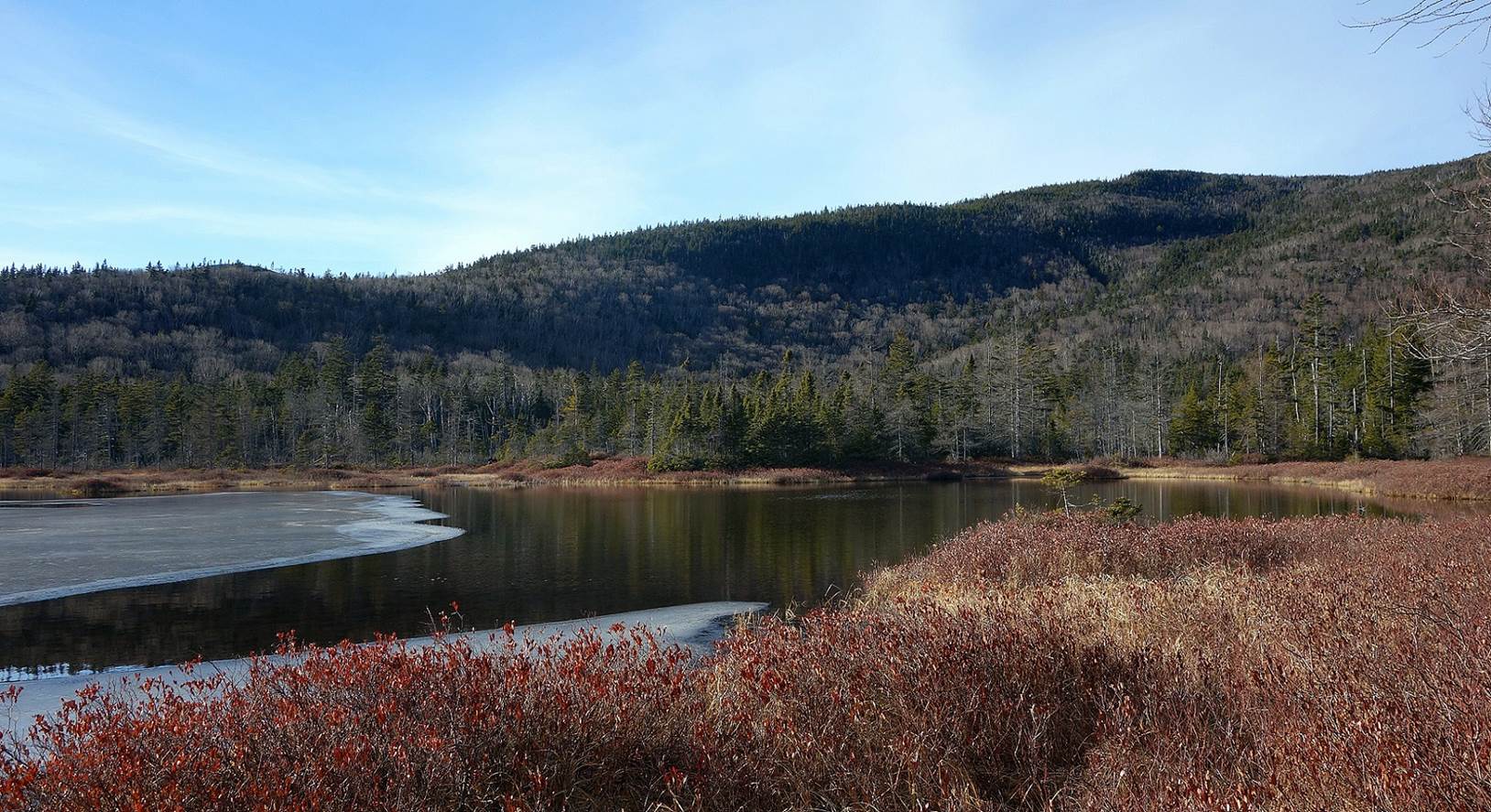
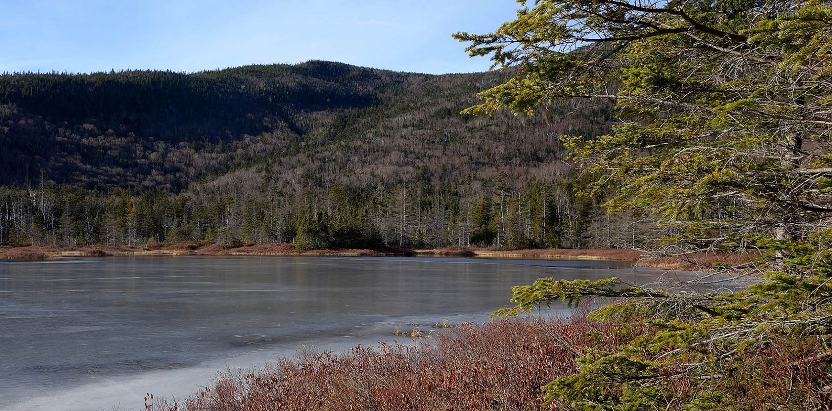
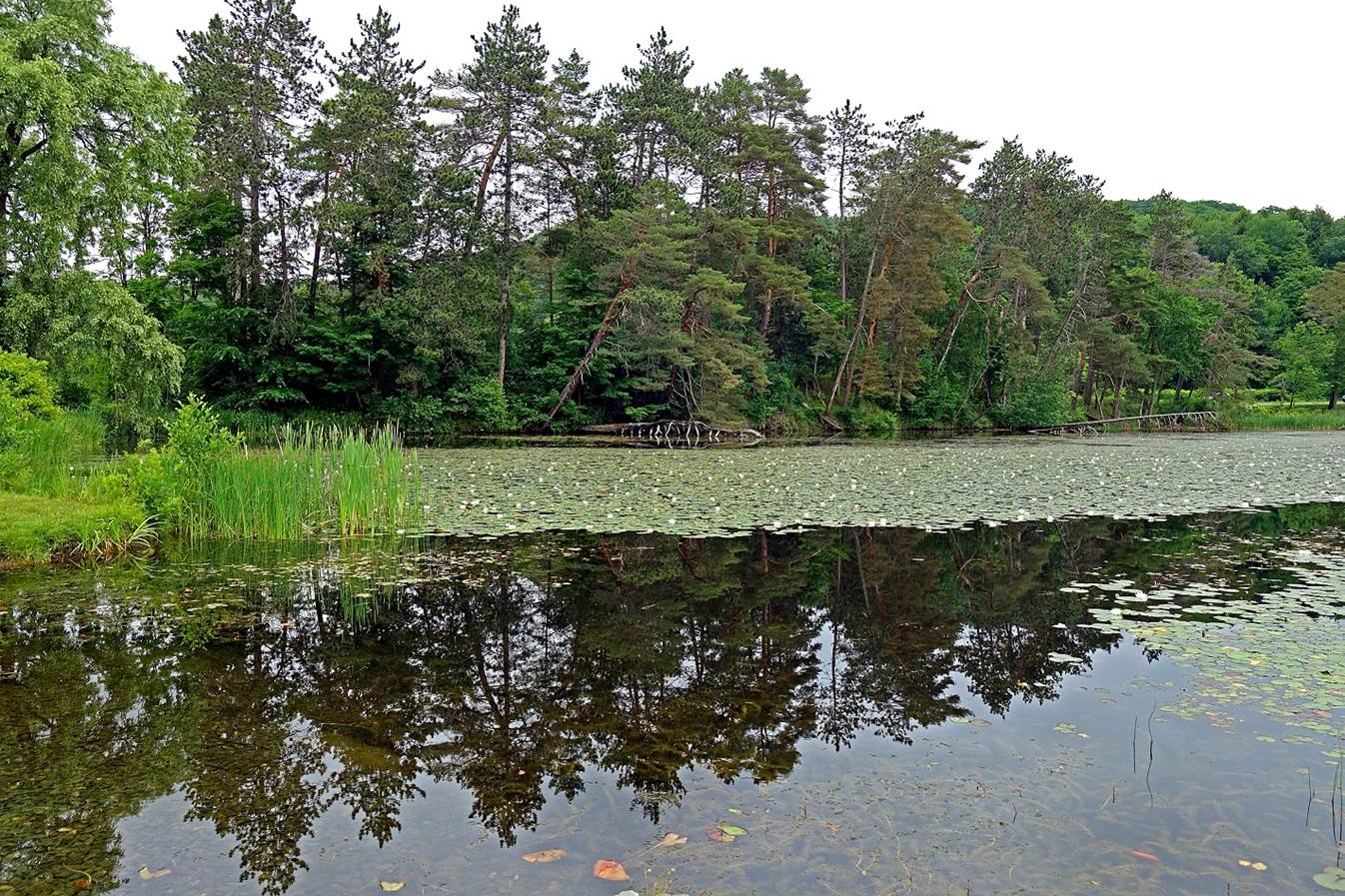
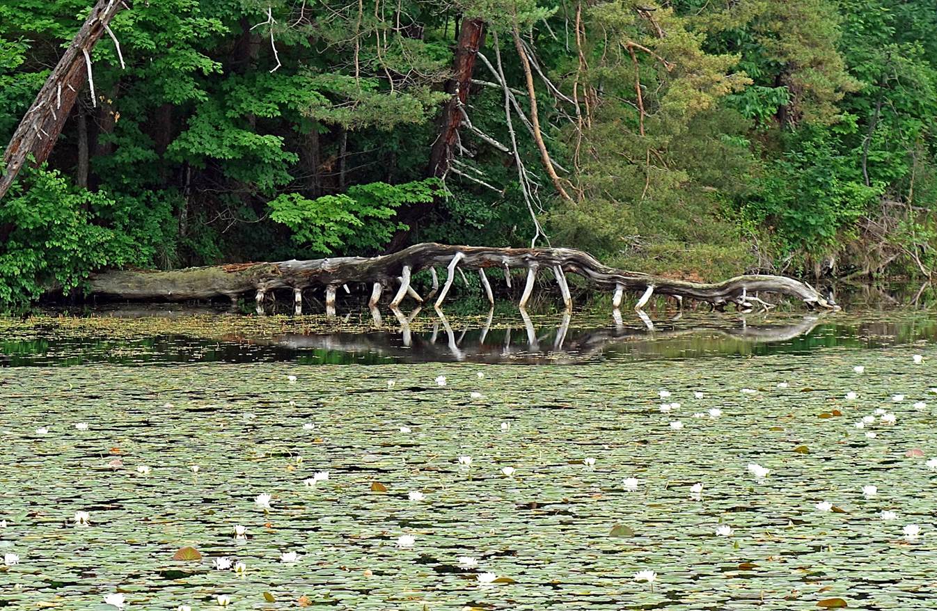
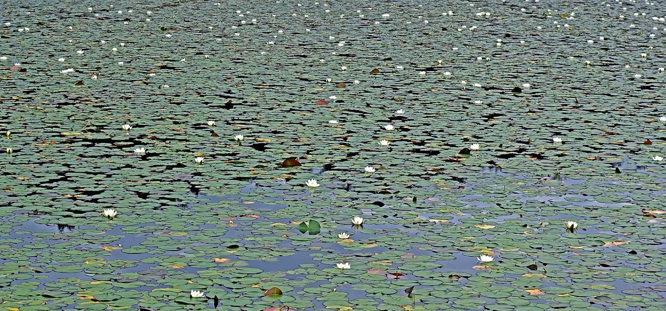
Lonesome Lake and around (December 2015).
|
|
|
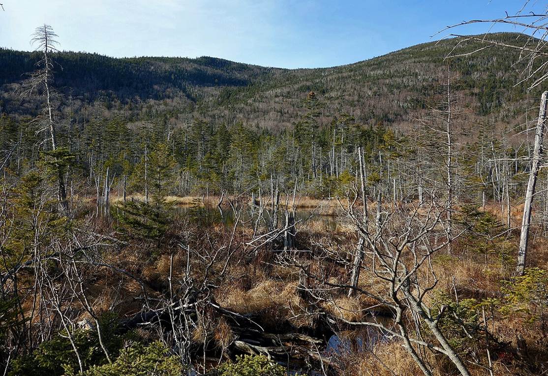
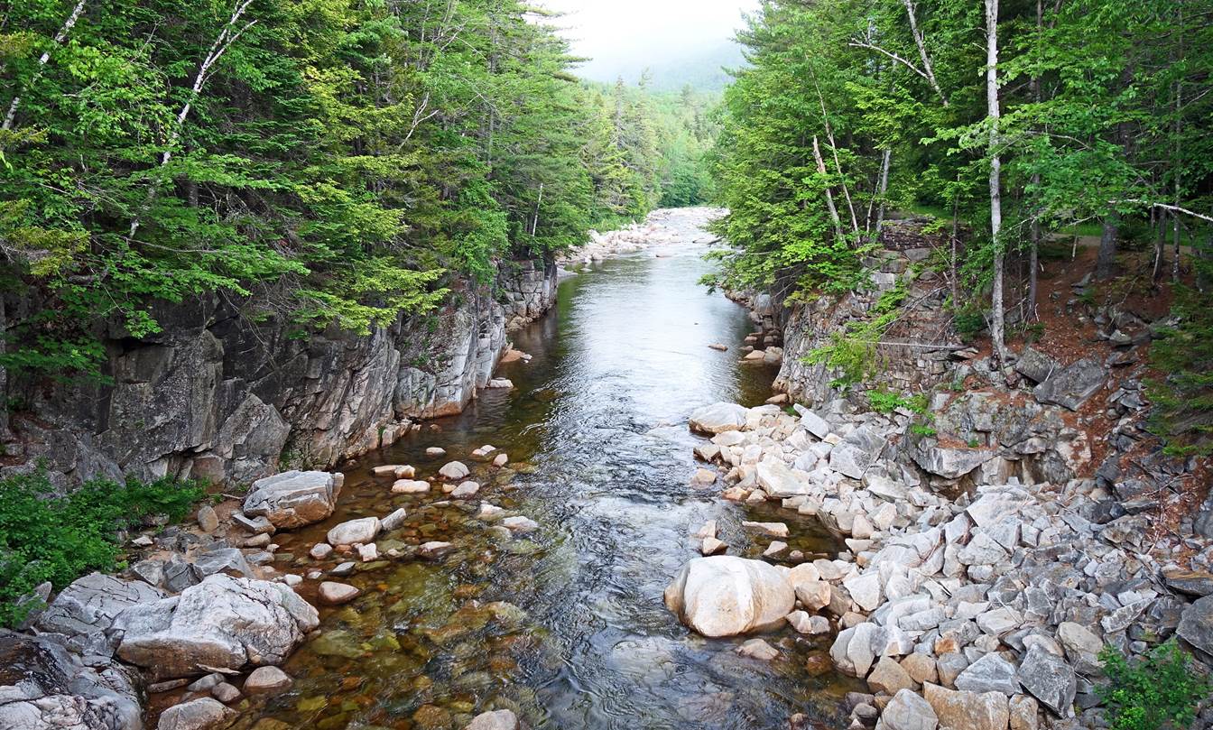
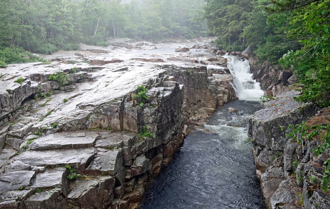
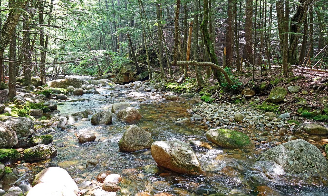
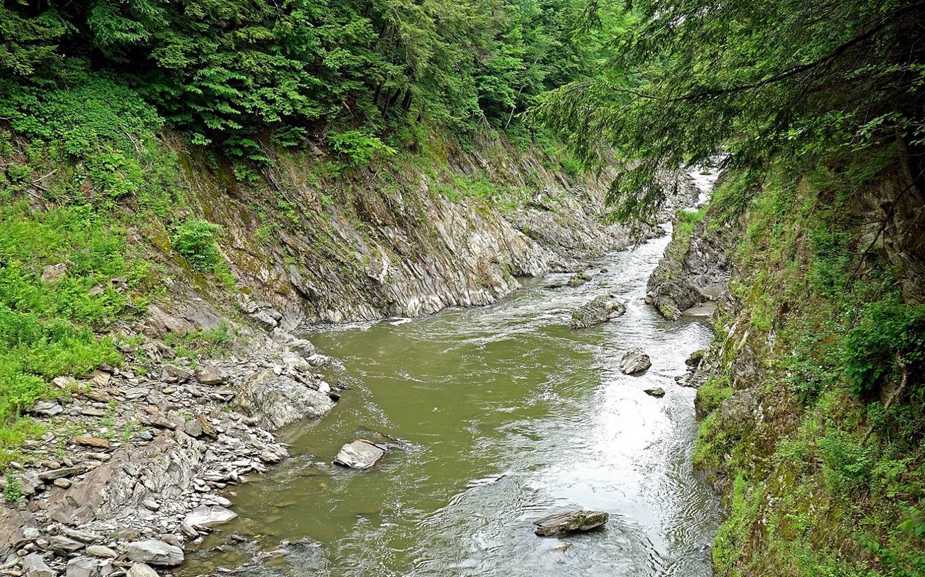
Rocky Gorge next to the Kancamagus Highway (south of the White Mountains
region of New Hampshire), before and under the rain (June 2022).
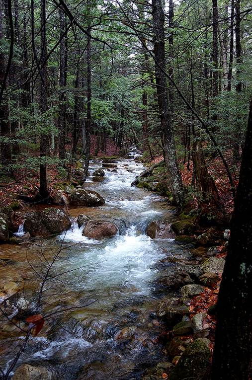
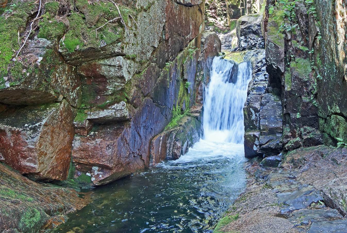
Sabbaday brook and its waterfalls, next to the
Kancamagus Highway (June 2022).
|
|
|
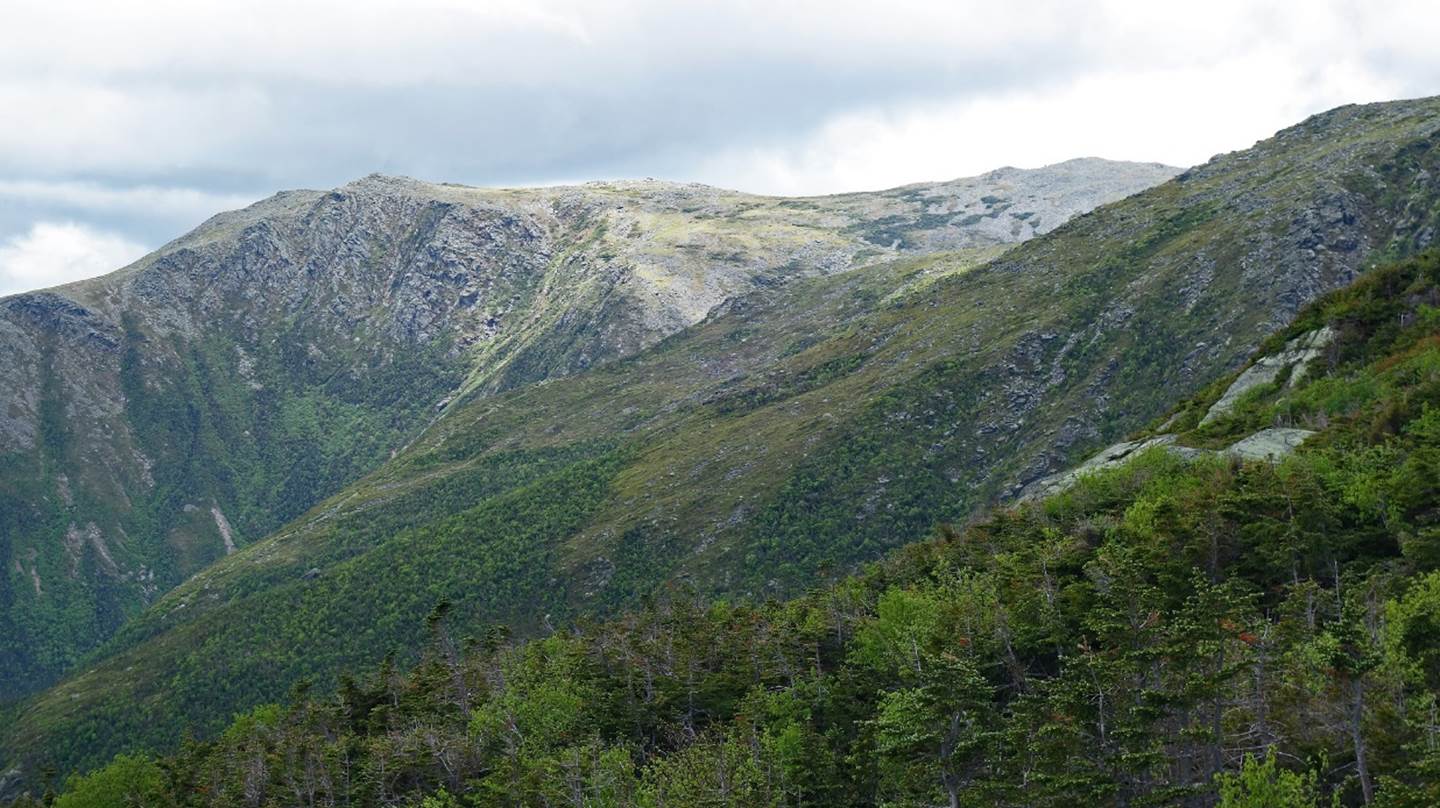
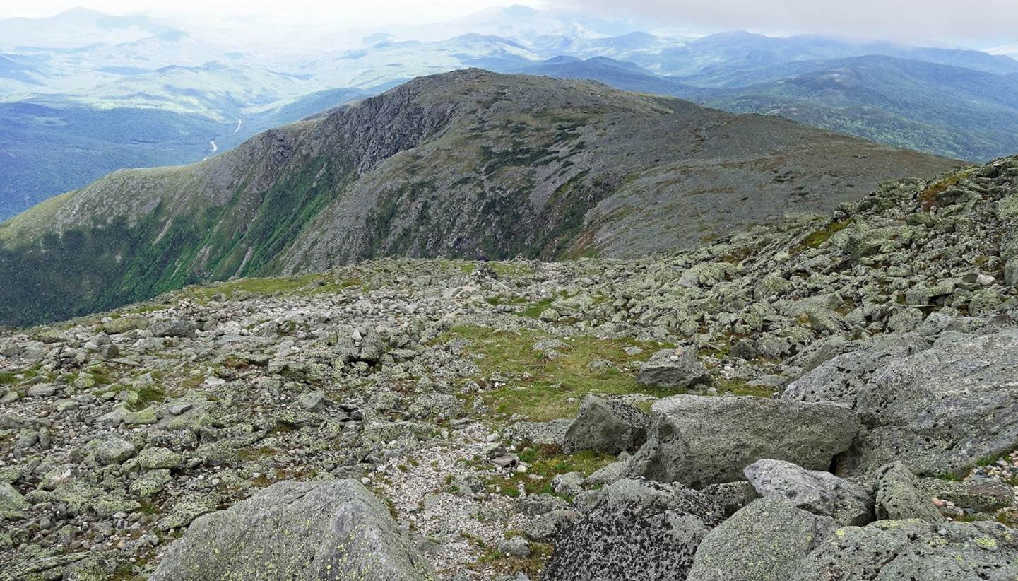
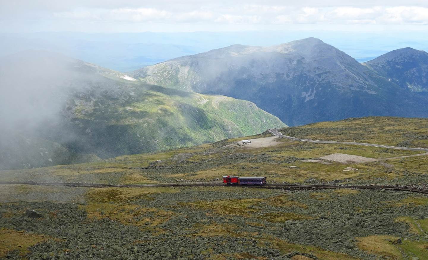
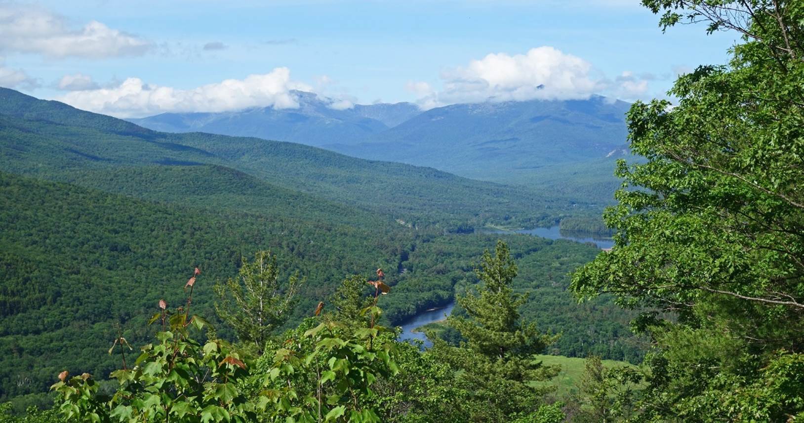
Landscape on Mt. Washington (June 2022).
At 1917m it is the highest peak in the Presidential Range of New Hampshire's
White Mountains and, more broadly, in Northeastern United States. The summit is
reachable by a cogwheel train (third photo below). Completed in 1869, the 5km
railway has an average grade of over 25% and a maximum one of 37%. The mountain
is notorious for its erratic weather. Wind of 231 miles per hour (372km/h) was
recorded by Mt. Washington Observatory on April 12, 1934.
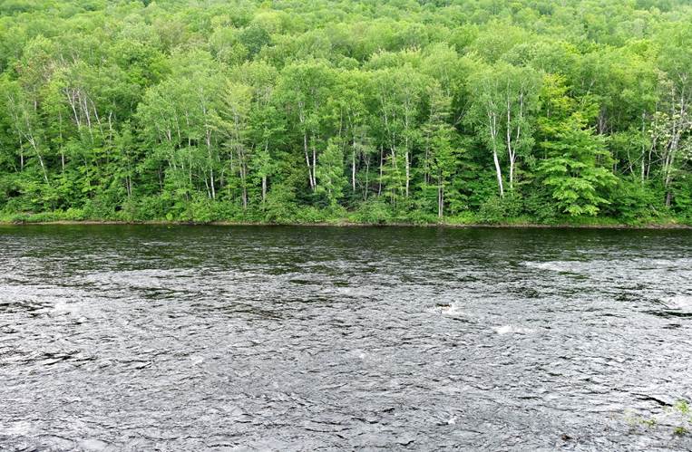
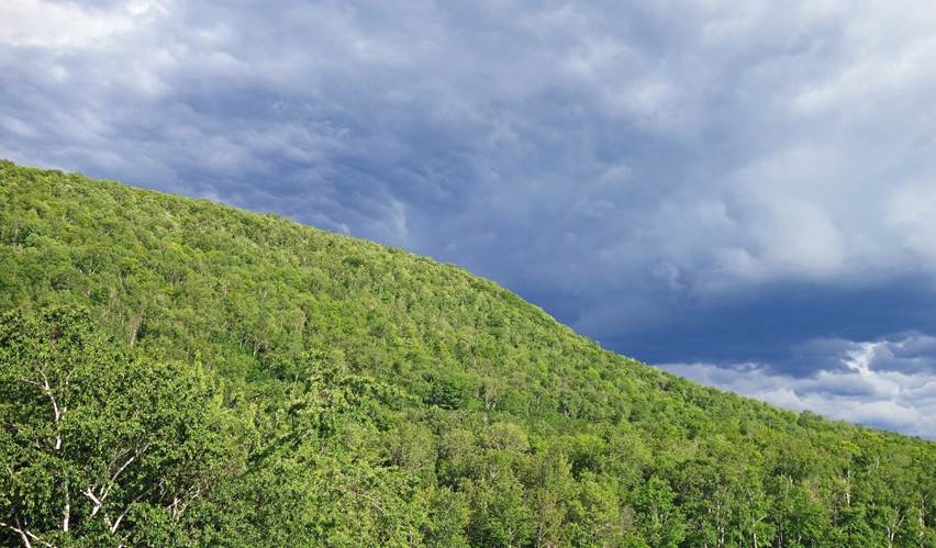
Forests and clouds above the Androscoggin river,
near the town of Gorham, north of the Presidential Range (June 2022).
|
|
|
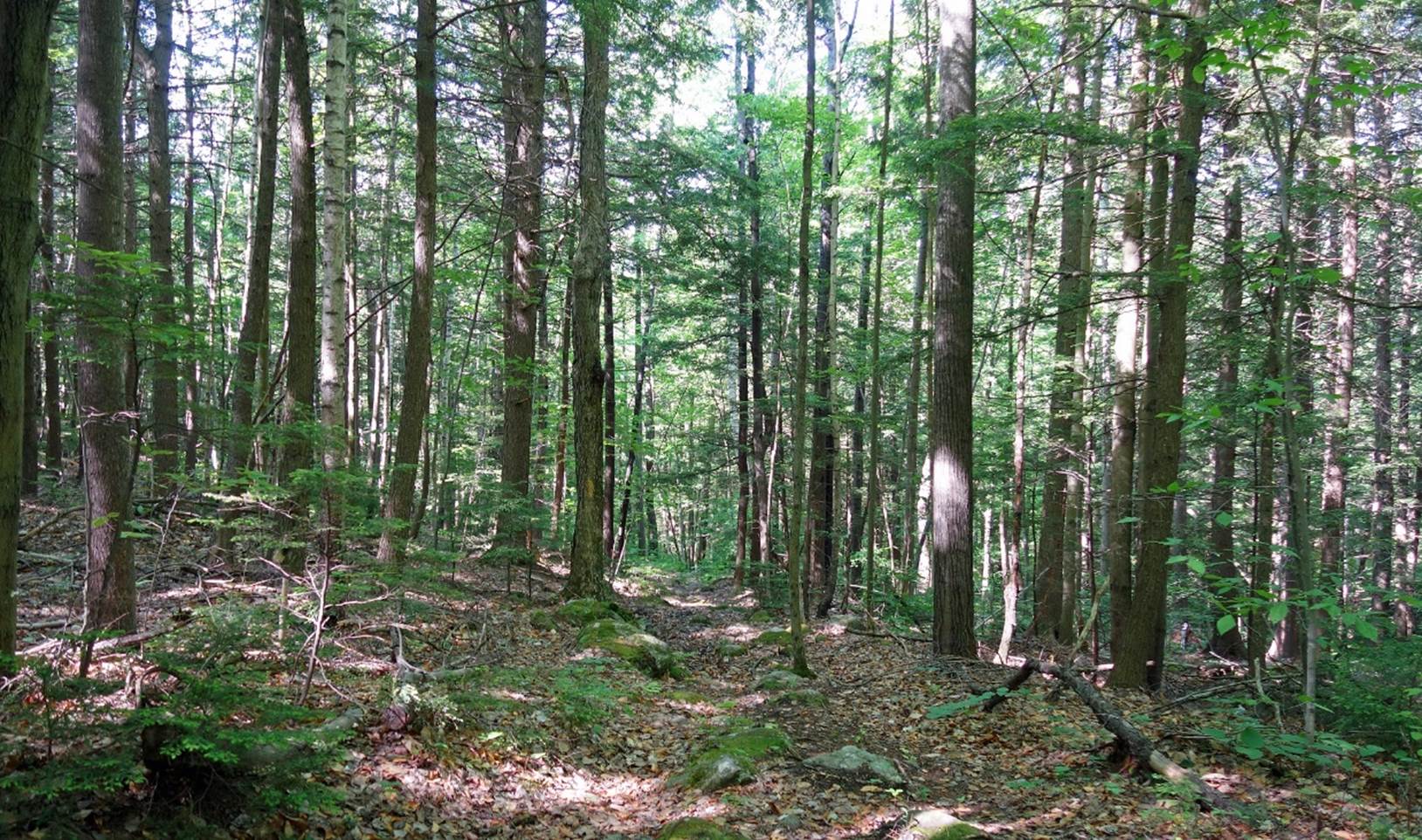
Forest along the Gates Brook trail
toward Mt. Cragg, a few kilometers northeast of Gorham, and views from the
summit of Mt. Cragg over the valley of the Androscoggin river
(June 2022). Mt. Washington is visible in the third photo below.
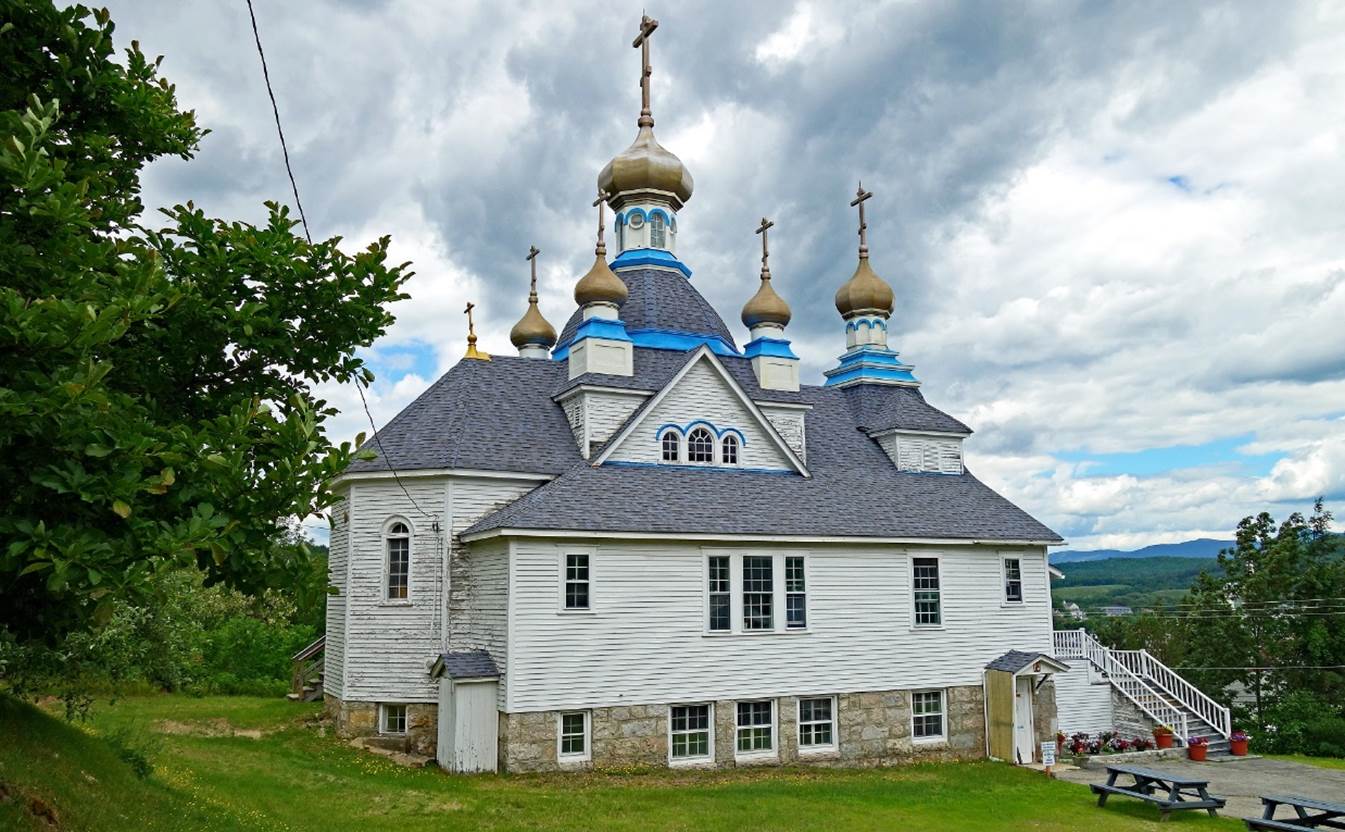
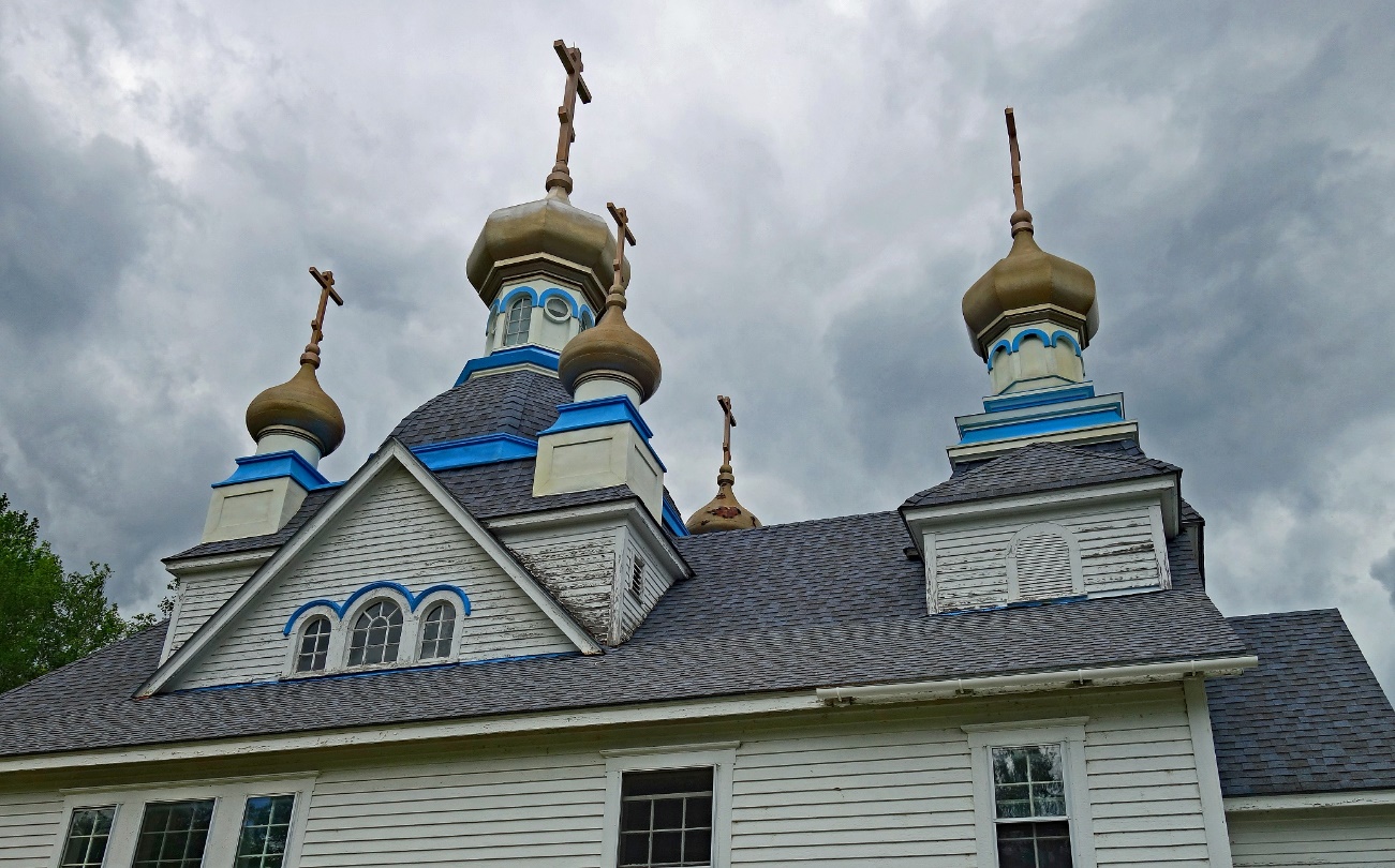
The Holy Resurrection Orthodox Church in
Berlin, 10km north of Gorham (June 2022). It was established in 1915 for the
approximately 500 Russian immigrants living in Berlin at that time. It is one
of the last Orthodox churches whose charter was granted by Tsar Nicholas II
before the fall of the Russian Empire.
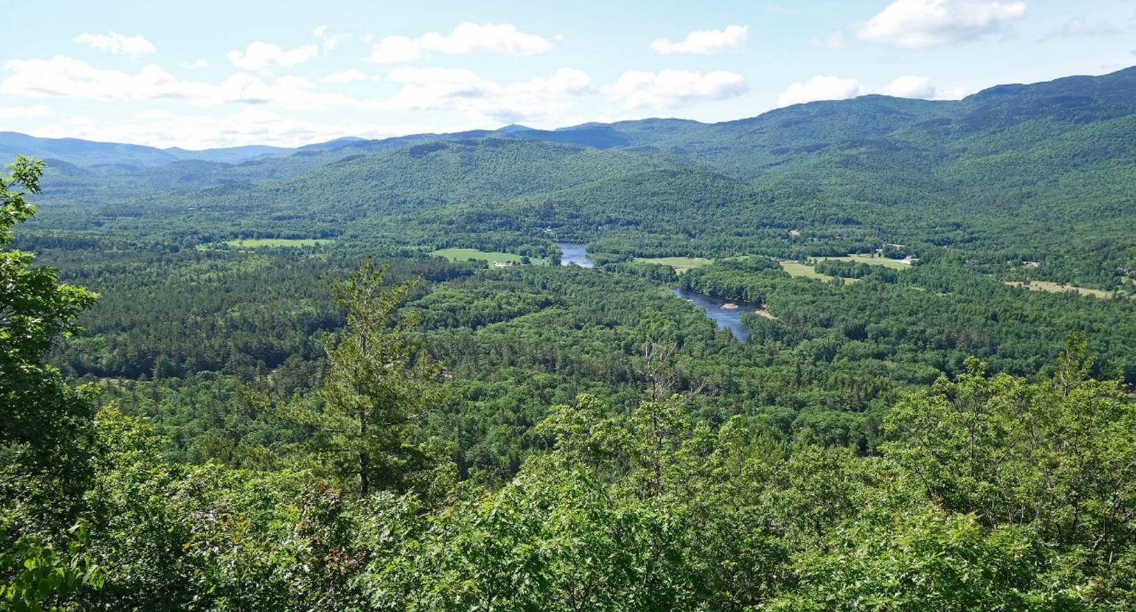
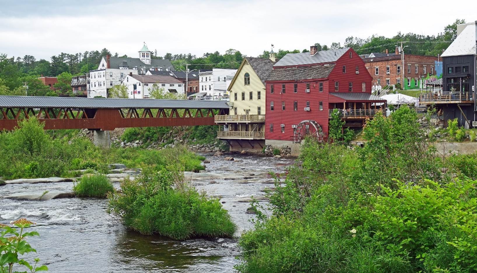
Covered bridge across the Ammonoosuc river and historic water-powered grist mill (opened
in 1798) in Littleton, a small pretty town located at the northern edge of the
White Mountains (June 2022).
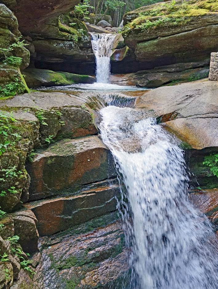
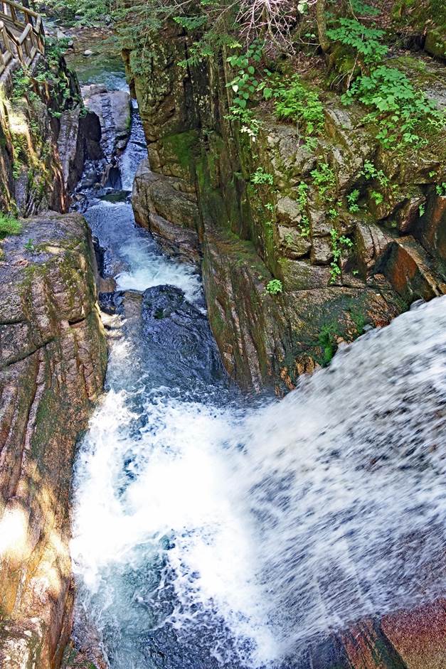
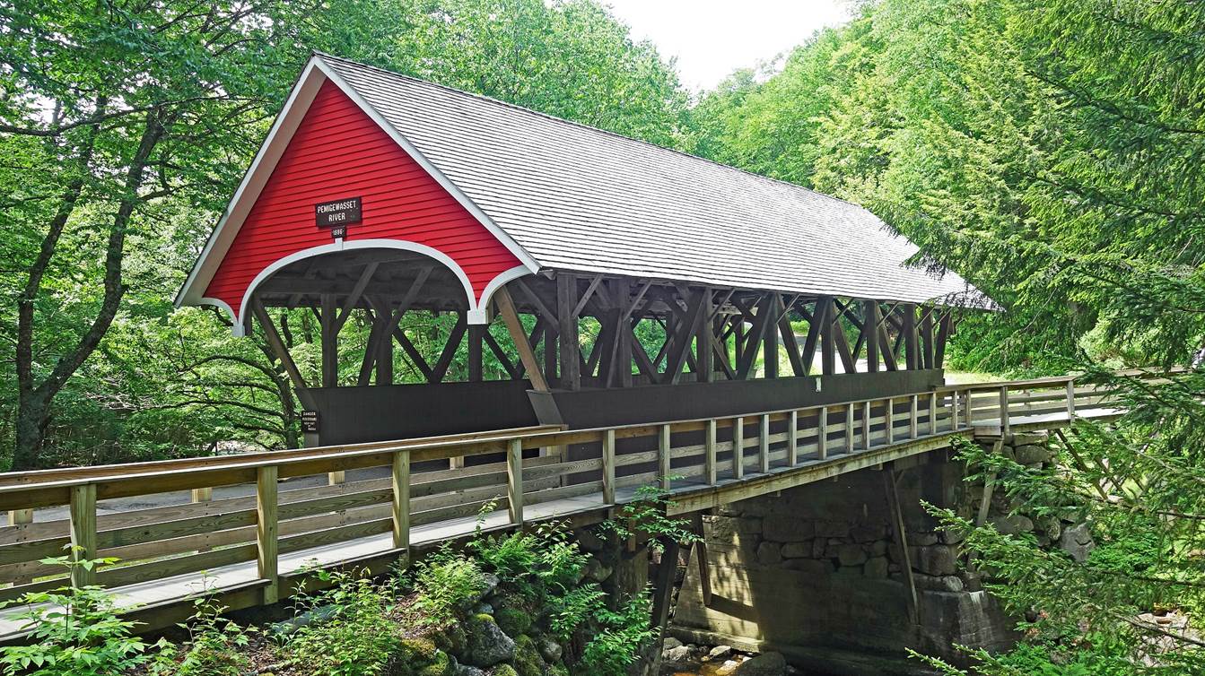
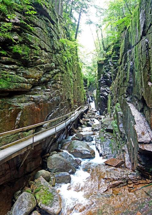
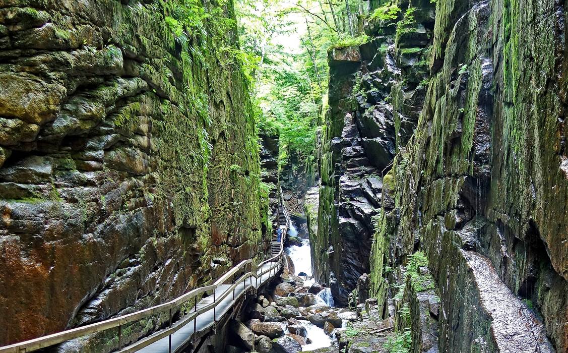
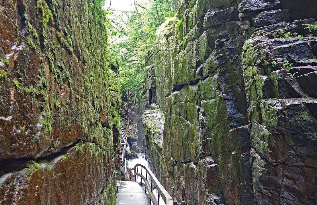
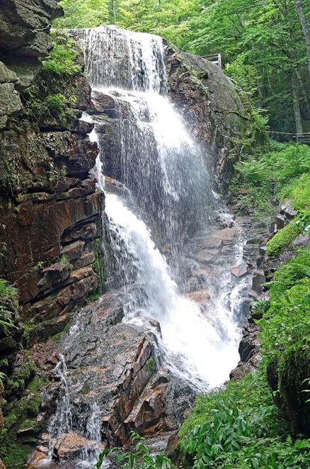
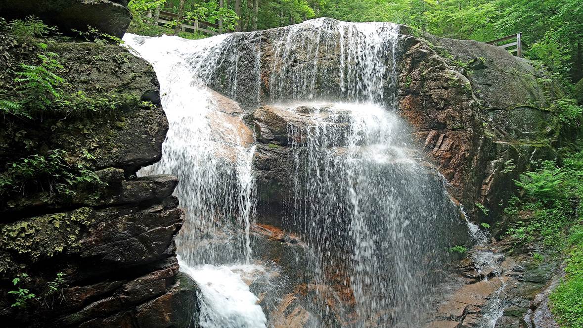
Flume Gorge (June 2023).
- Covered bridge over Pemigewasset River, below
the gorge of Flume Brook.
- In the gorge of Flume Brook.
|
|
|
|
|
|
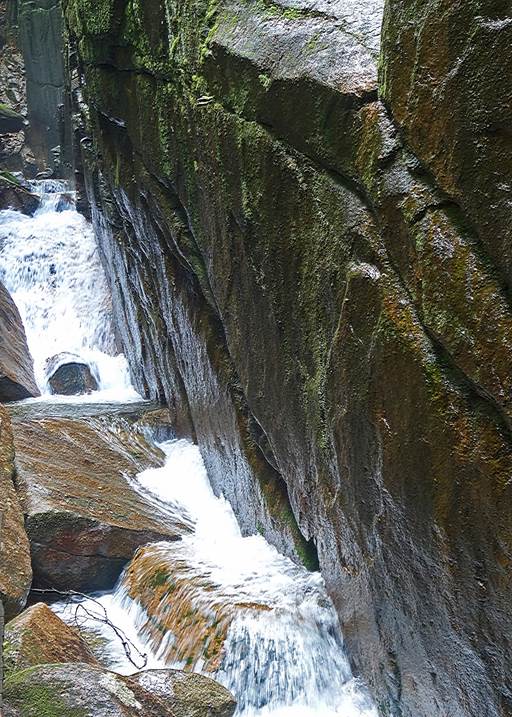
- Avalanche Falls at the upper end of the gorge.
|
|
|
Maine (December 2015, June 2017, June
2018, June 2021, June 2022, and June 2023):
Piscataqua River seen from Badger's Island,
Kittery (Maine), with Portsmouth waterfront (New Hampshire) in the background
(June 2021).
Other views from Badger's Island (April
2024). Left: Toward Portsmouth harbor waterfront. Right: Toward Portsmouth
Naval Shipyard located on Seavey's Island (Maine).
|
|
|
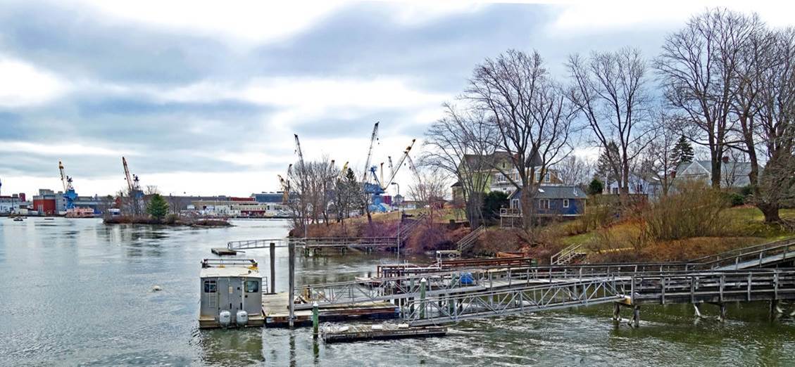
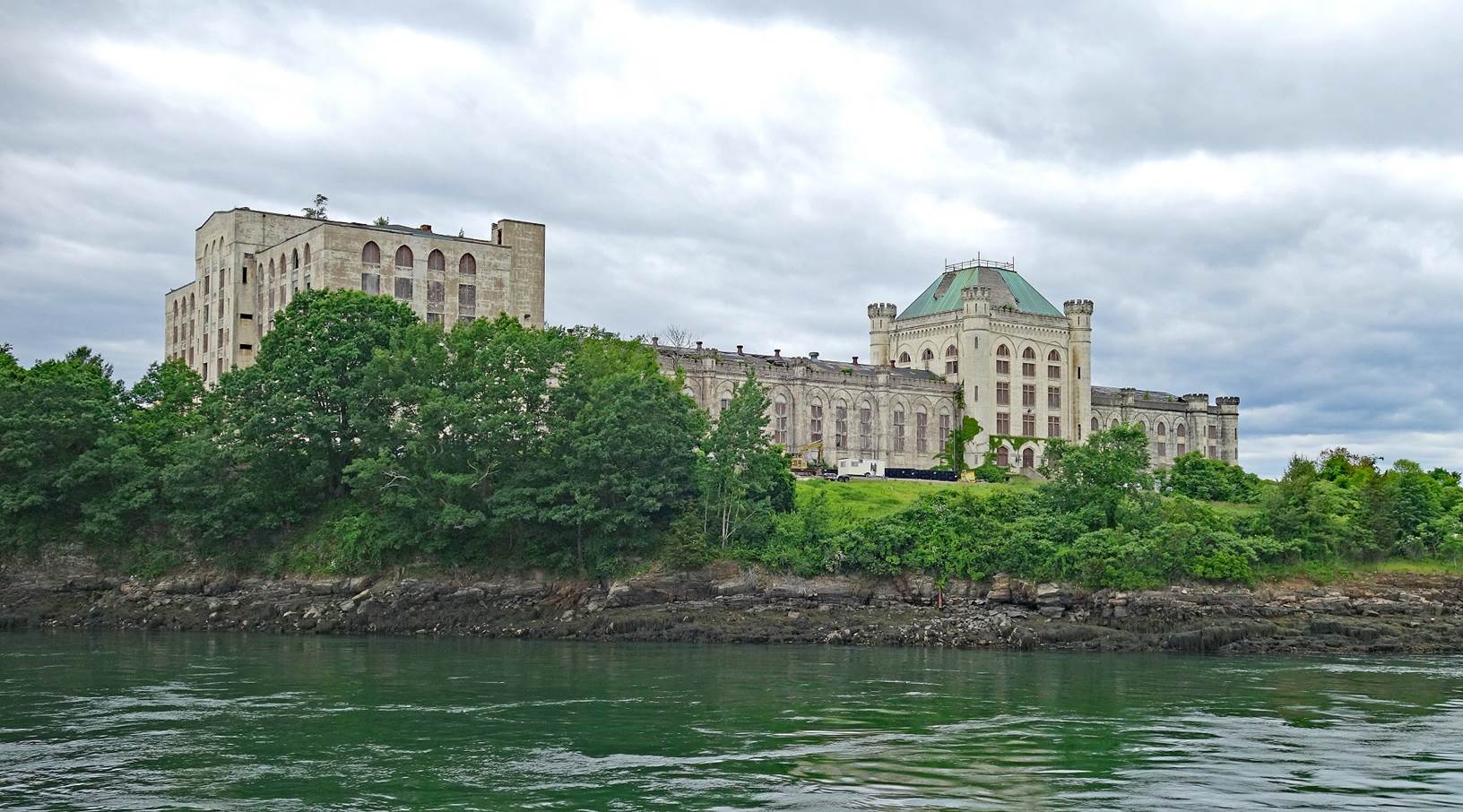
Massive former Portsmouth Naval Prison
on Seavey's Island, Kittery (June 2022). It was
built in the early 1900s and abandoned in the 1970s as too expensive to either
rebuild or tear down.
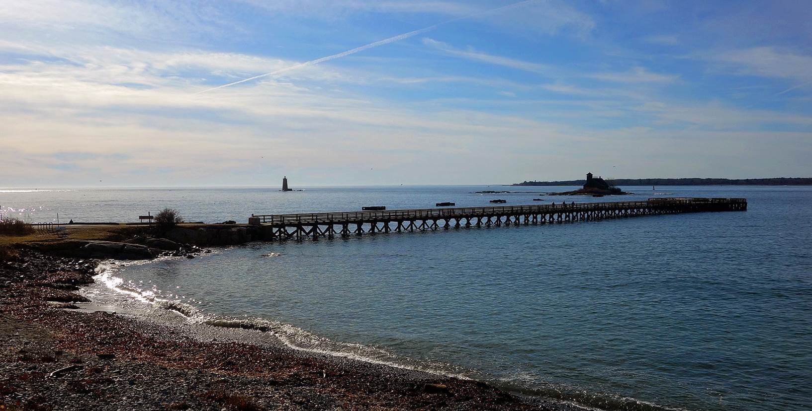
Estuary of
the Piscataqua River in the Atlantic
Ocean, tiny Wood Island, and Whaleback lighthouse seen from Kittery Point,
Kittery (December 2015). New Castle Island (New Hampshire) is visible in the
far background on the right.
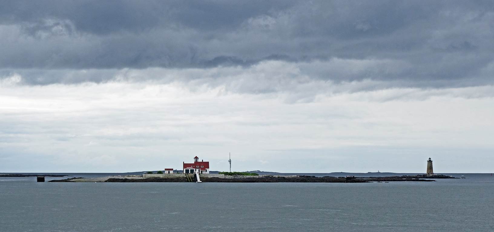
Wood Island and Whaleback lighthouse seen from the estuary of the
Piscataqua River (June 2022).
Fort McClary, Kittery Point, used throughout the 19th century to protect
Portsmouth, New Hampshire. and the Portsmouth Naval Shipyard in Kittery,
Maine (June 2021).

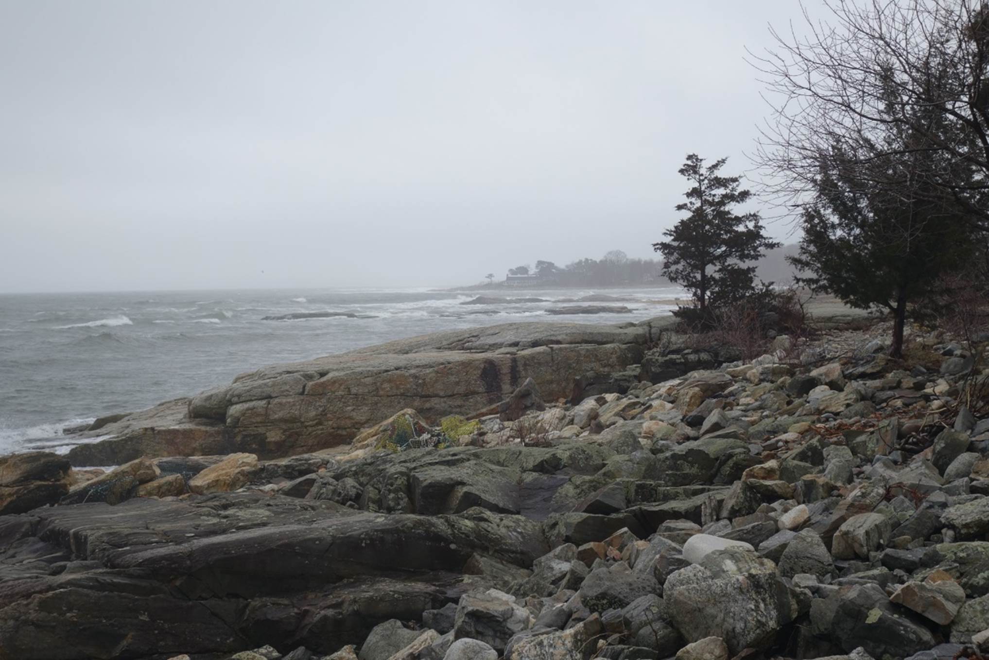
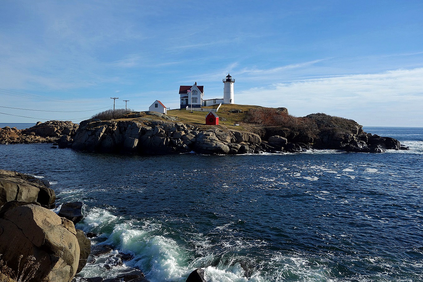
Nubble lighthouse at Cape Neddick (December
2015).
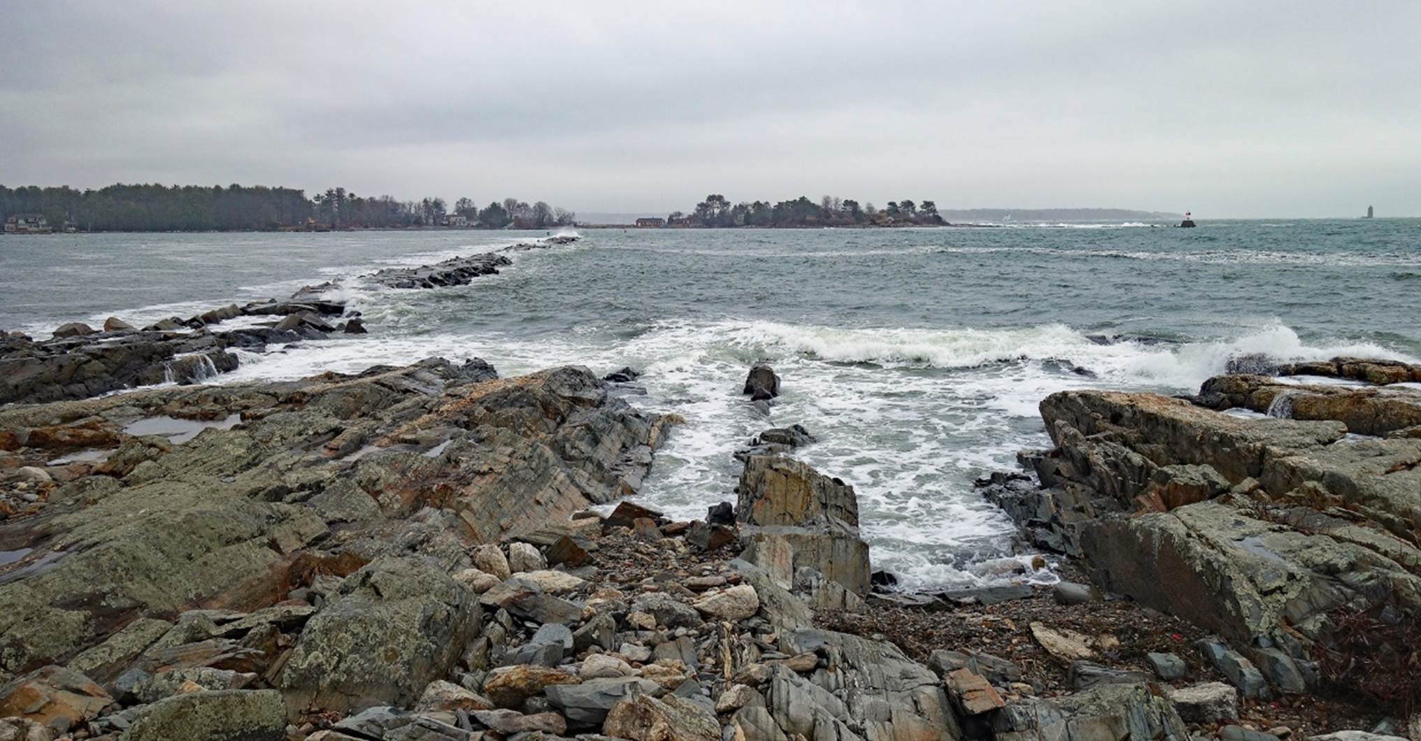
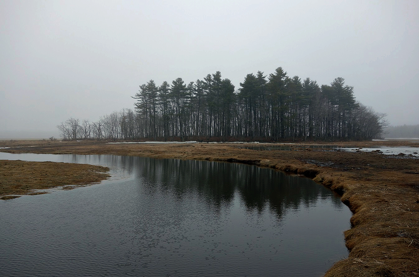
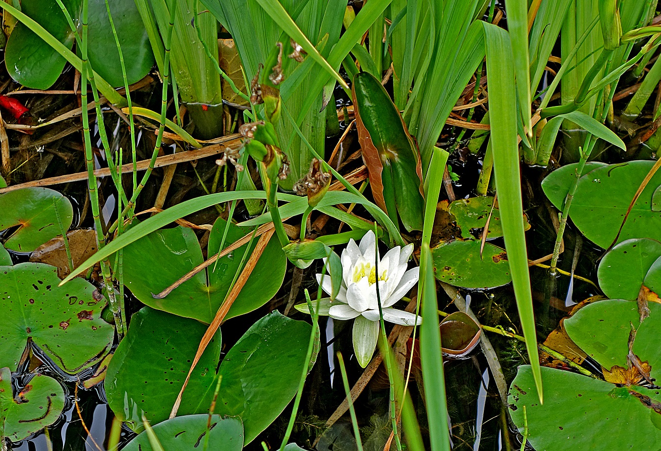
In Rachel Carson National Wildlife Refuge (December 2015).
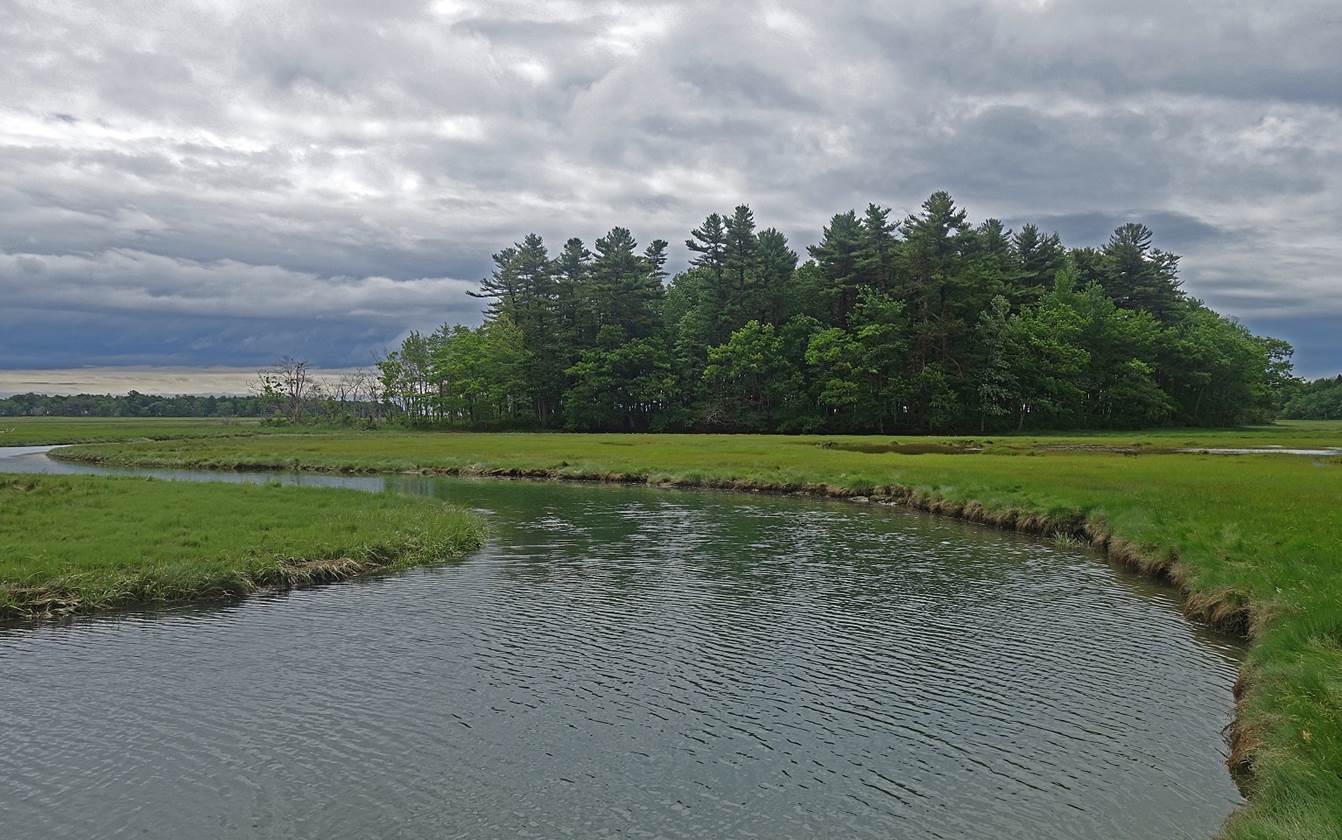
In Rachel Carson National Wildlife Refuge, at another time of year (June
2018).
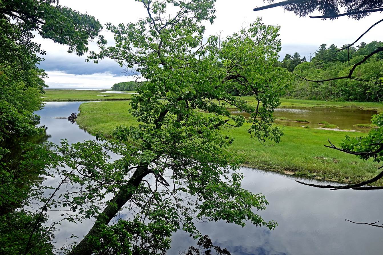
In Kennebunkport (June 2018).
In Wolfe′s Neck Wood State Park, southeast of Freeport (June 2018):
- Tiny Googins Island (sanctuary for nesting ospreys).
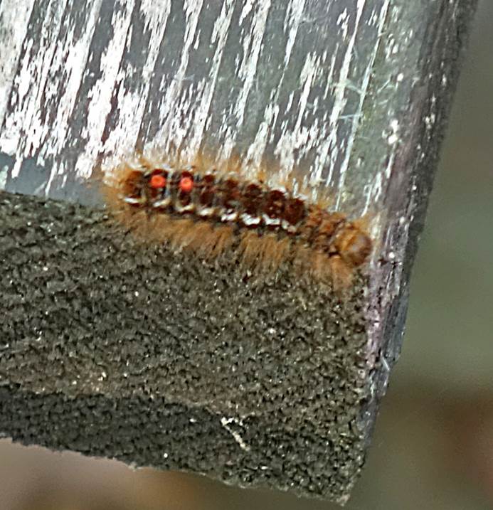
- Caterpillar. Its reddish hairs are stiff and strong enough to penetrate
human skin and cause severe lasting pain.
|
|
|

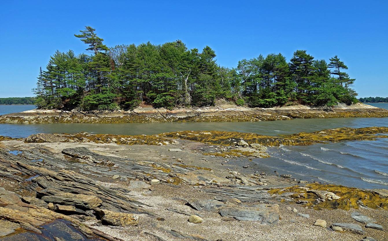
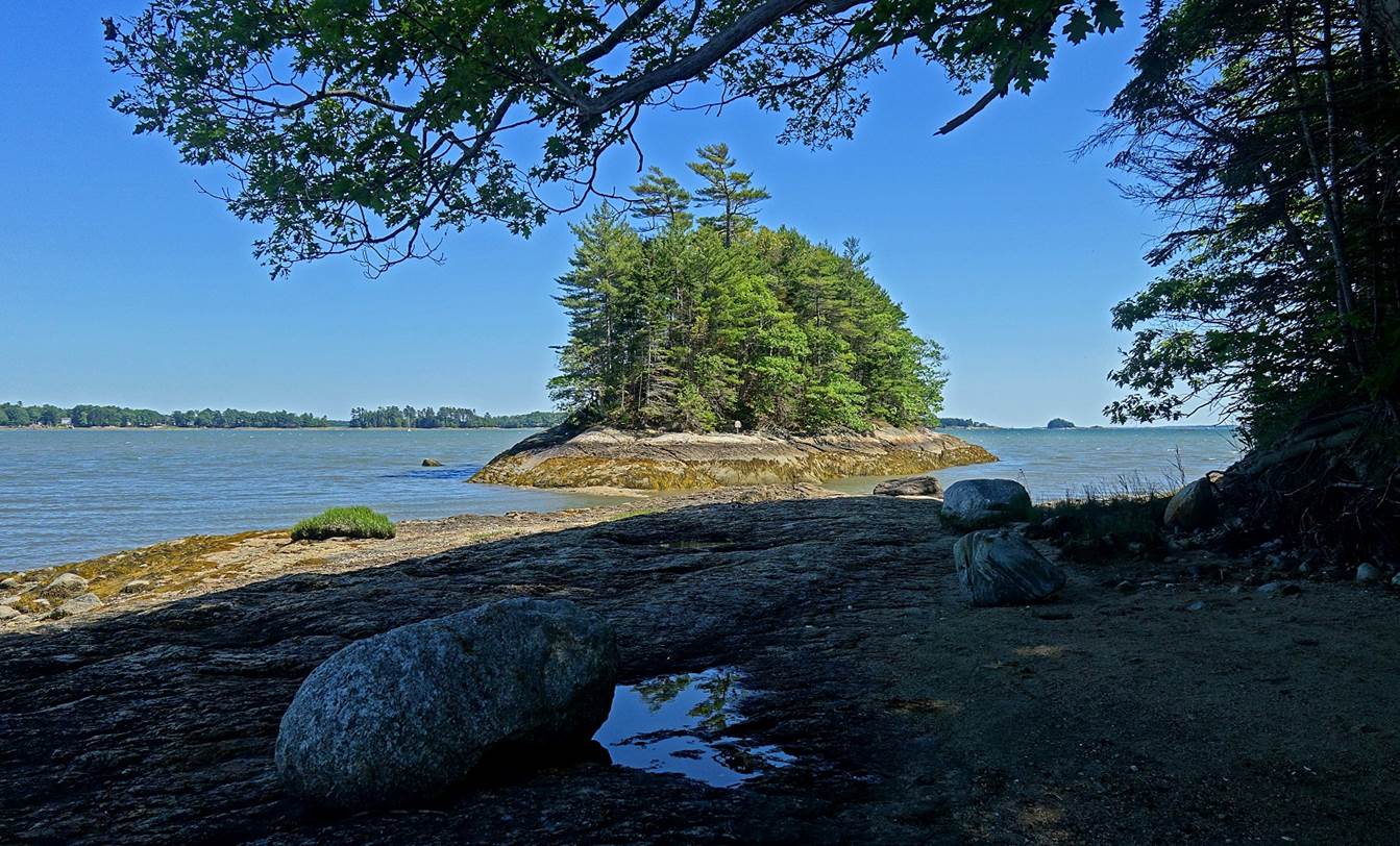
Meckerel Cove, Bailey Island (December 2015).
Fort Popham (June 2018), located at the
entrance of the Kennebec river south of Bath. Its
construction started in 1861 to protect the shipbuilding industry then located
upriver in Bath, but was never completed. Made of large granite blocks, this
half-circular fort is not very elegant; but, had it been completed and used, it
would probably have served its purpose very effectively.
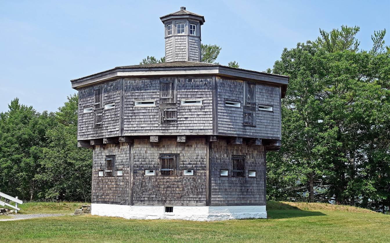
Fort Edgecomb, built in 1808-1809 on Davis Island, overlooking the Sheepscot river (June 2021).
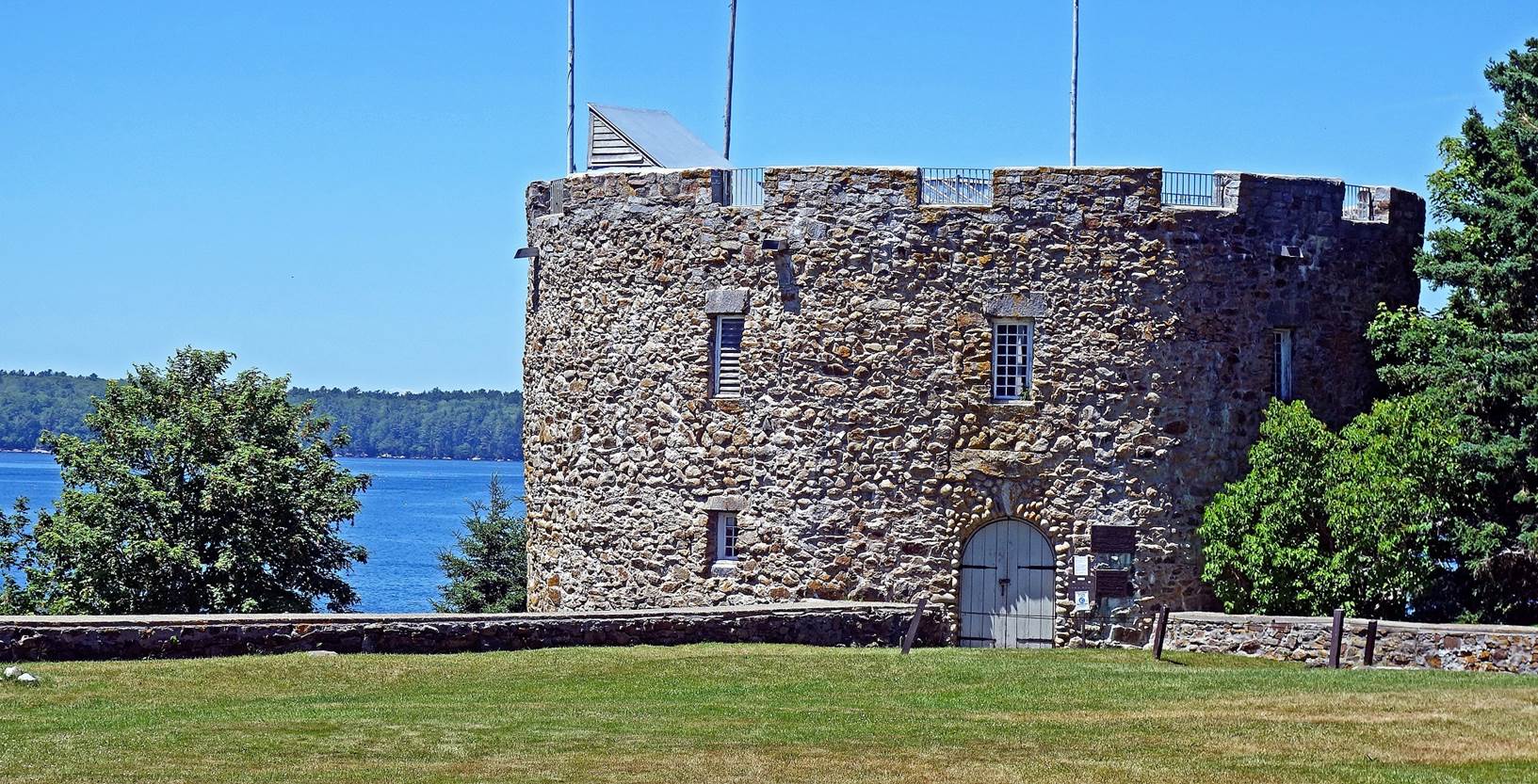
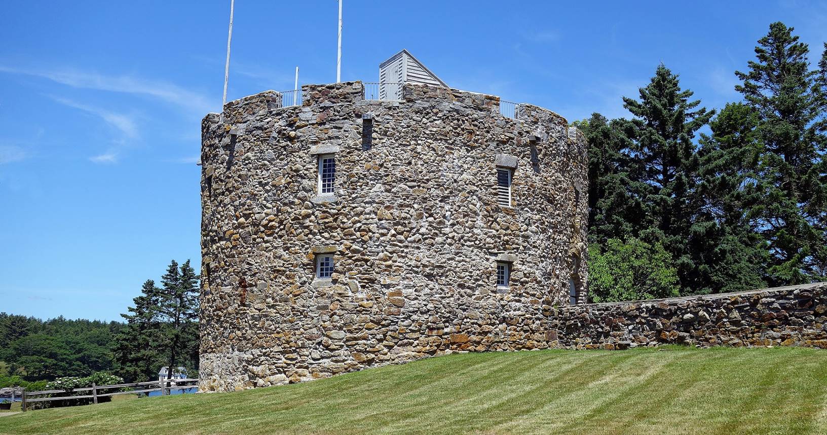
Fort William Henry, built in 1692 to
protect the frontiers of the English Massachusetts colony (June 2021). The fort
fell in 1696 following an attack by natives united with French troops.
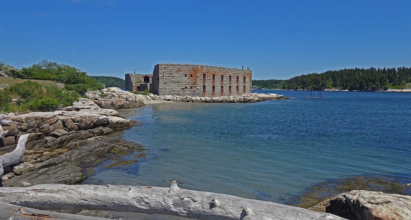
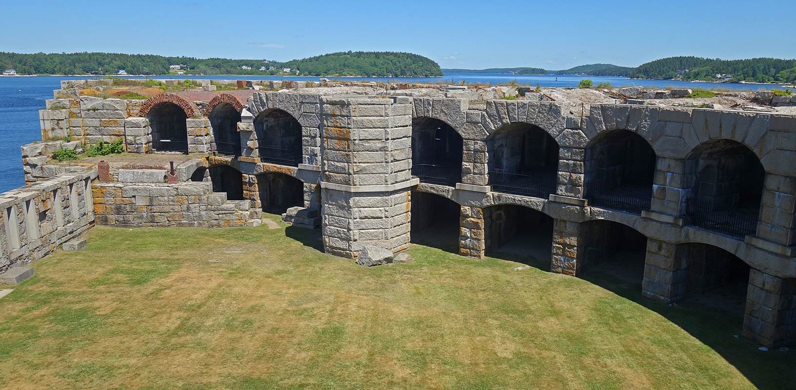
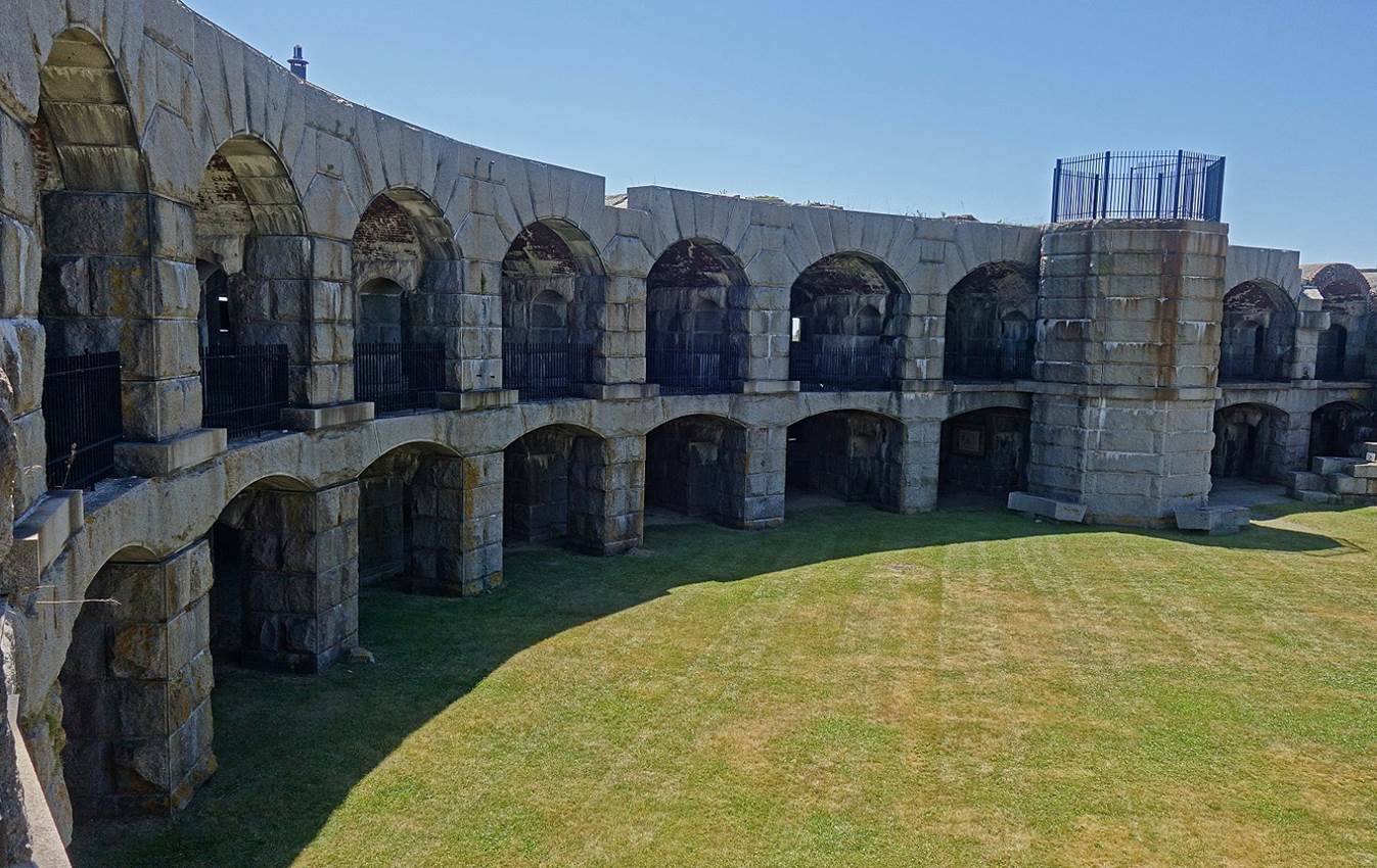
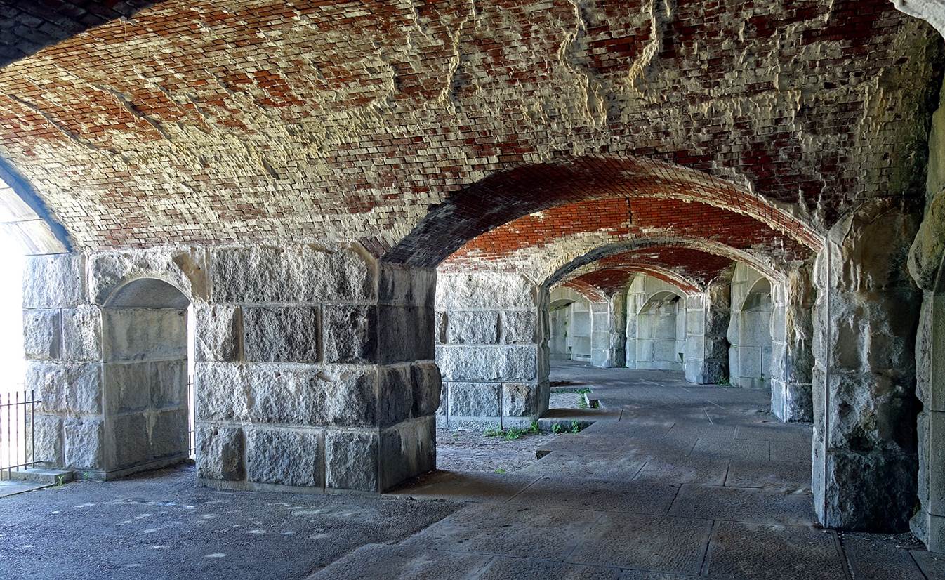
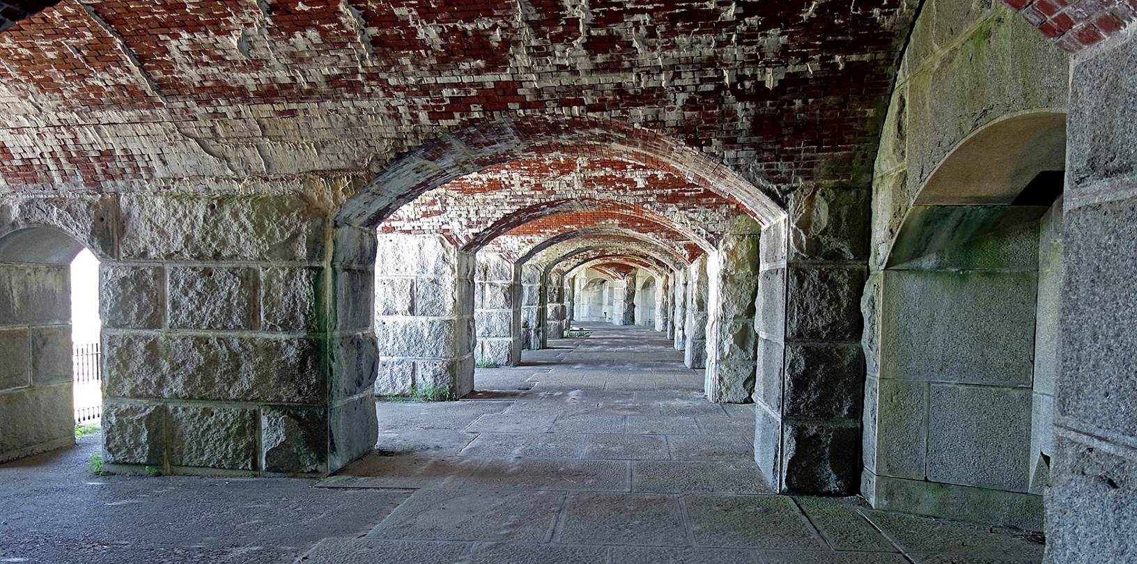
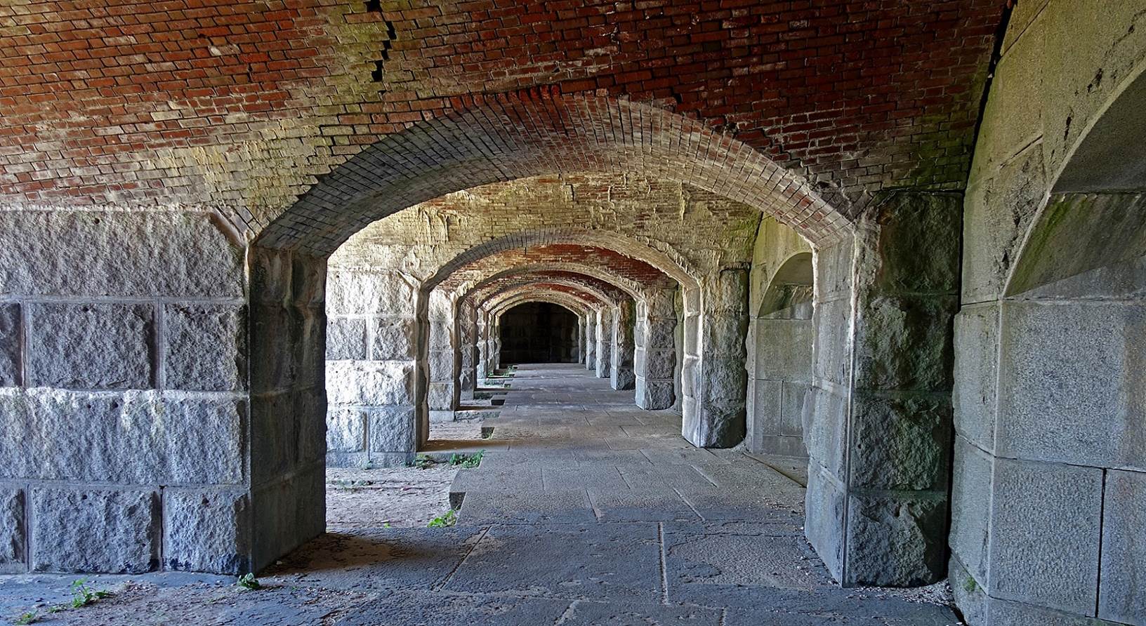
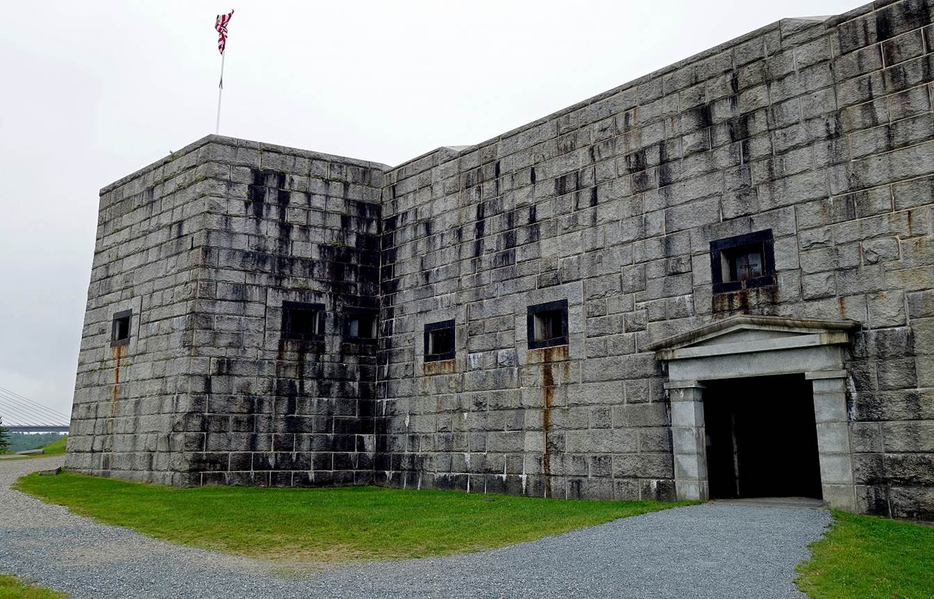
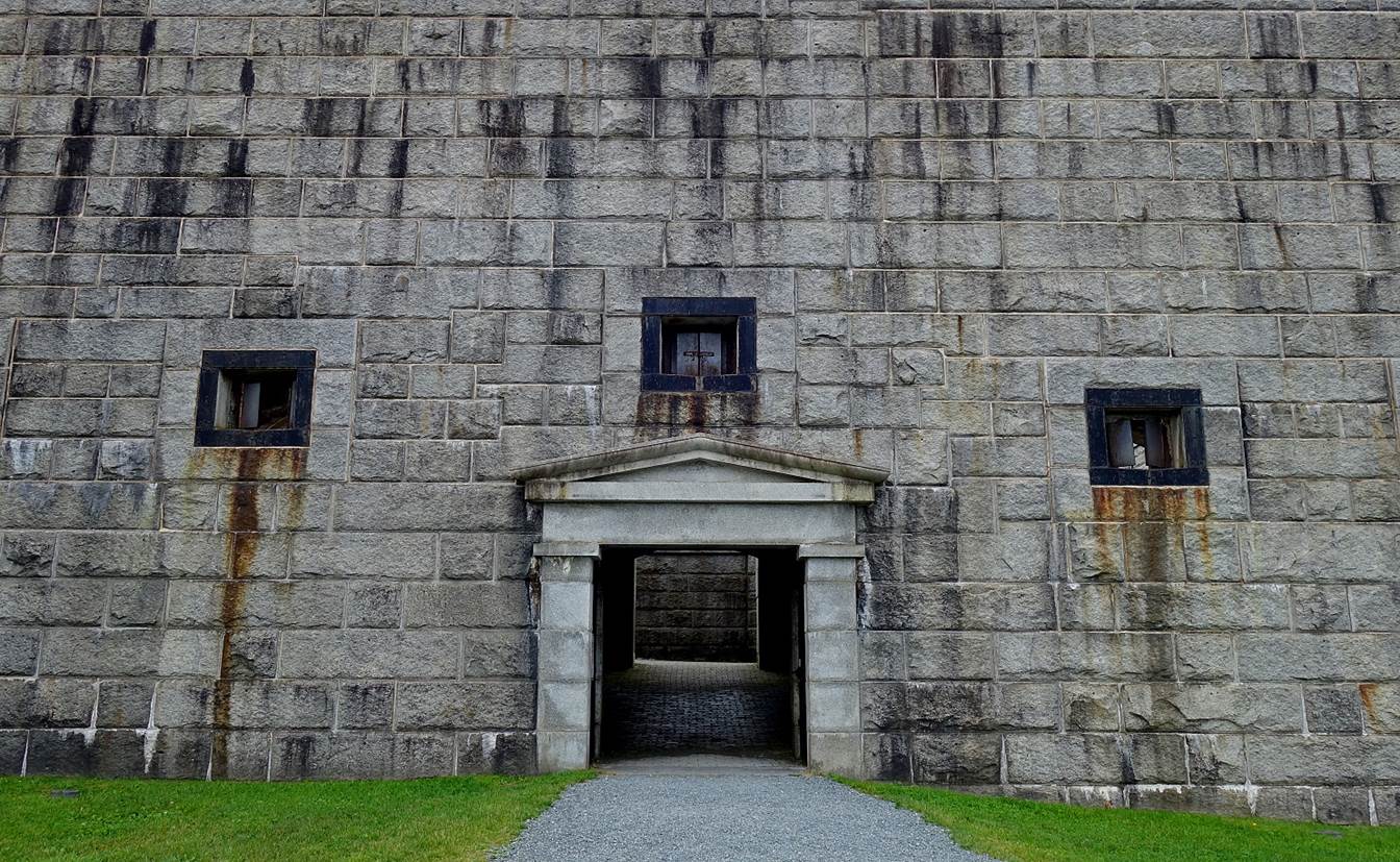
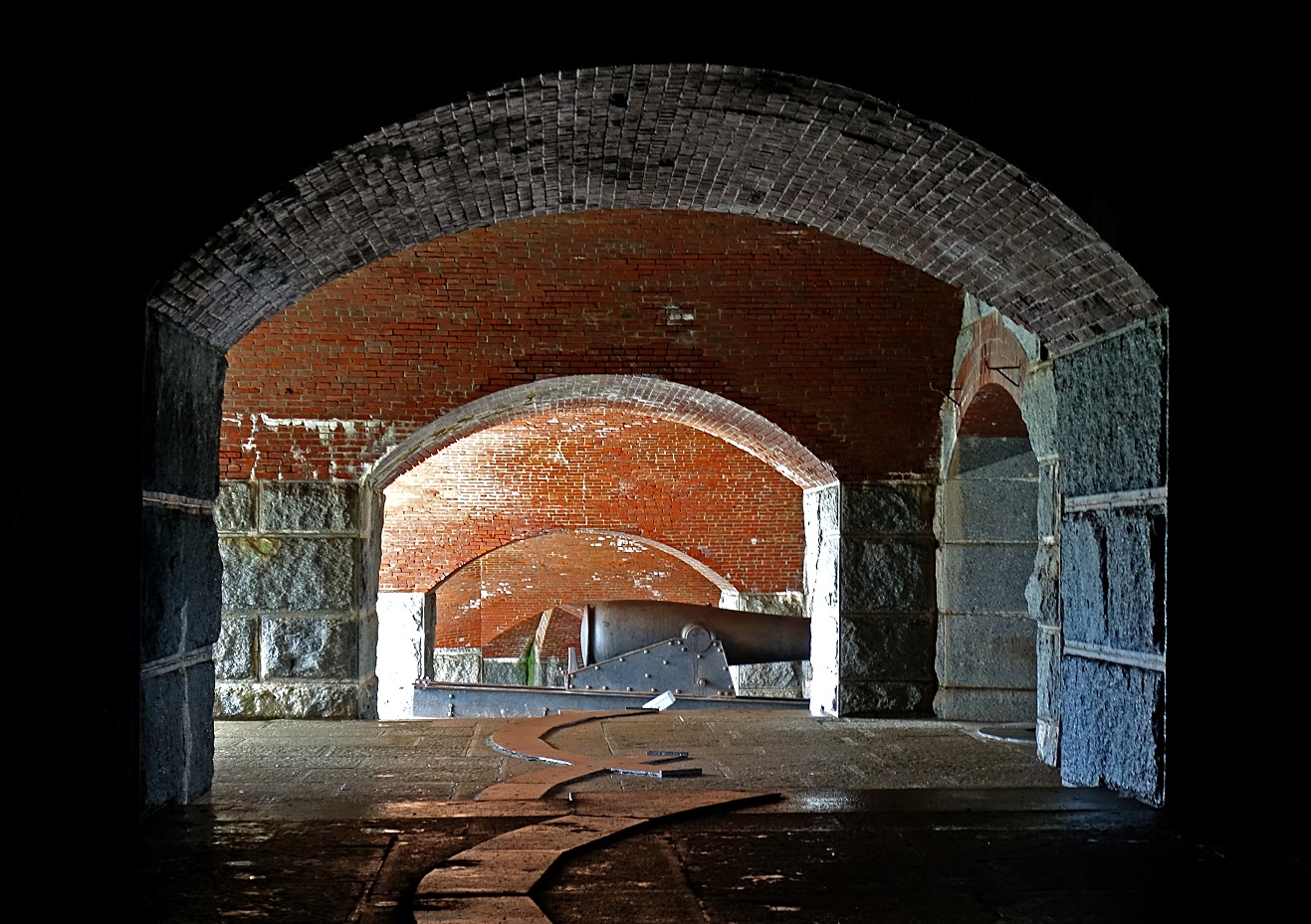
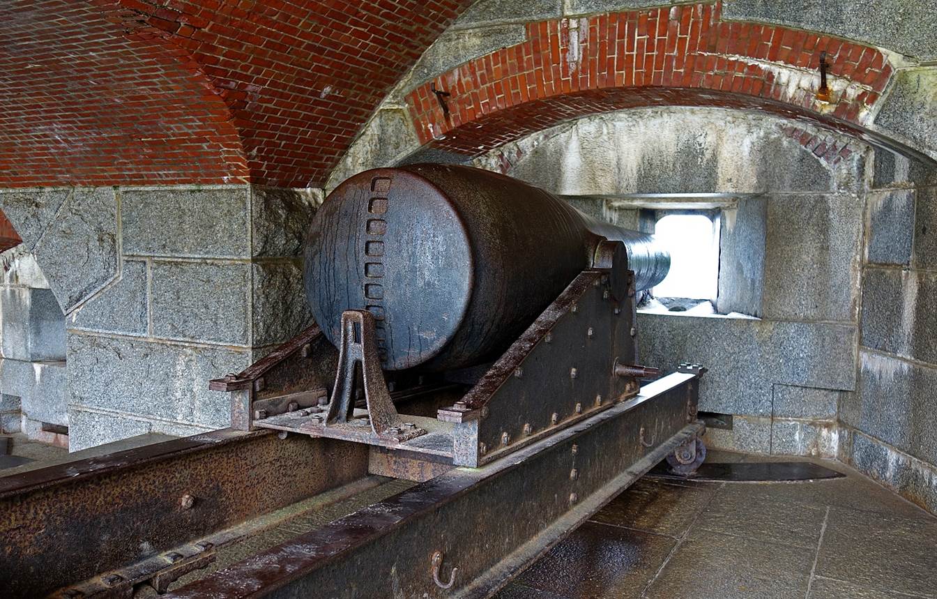
Fort Knox
(June 2017), located south of Bangor. This impressive granite fort contains
mounts for 135 cannons. It was built during the 19th century to protect the
Penobscot River from naval attacks, but these attacks never happened.
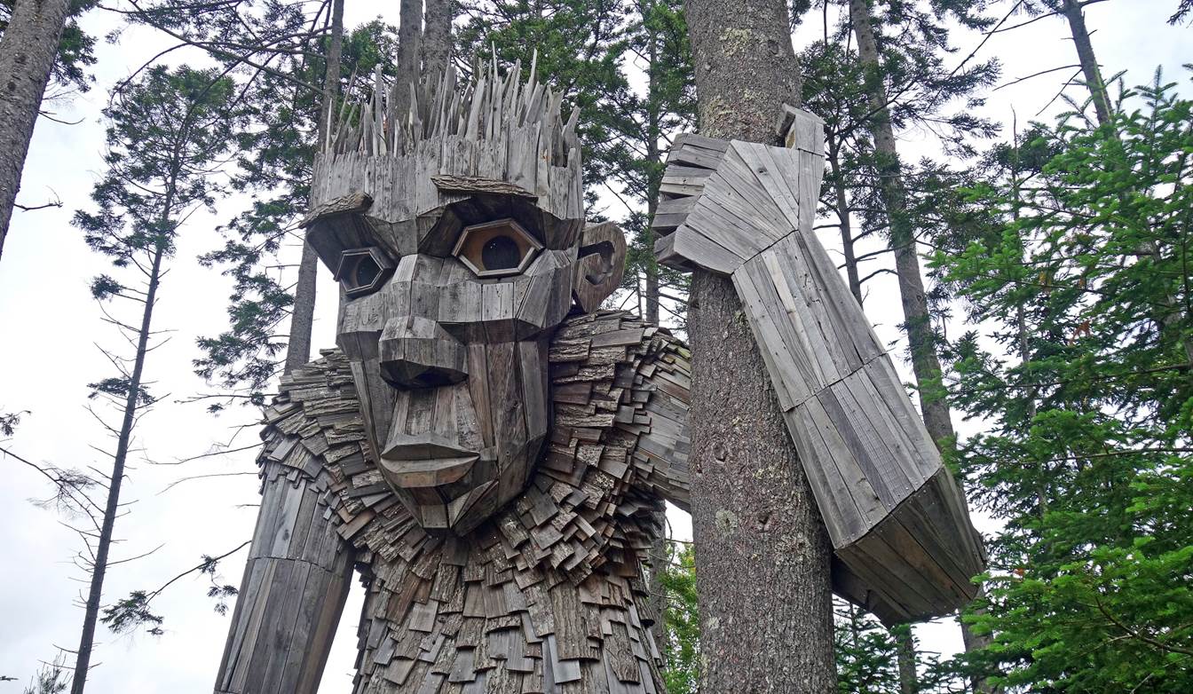
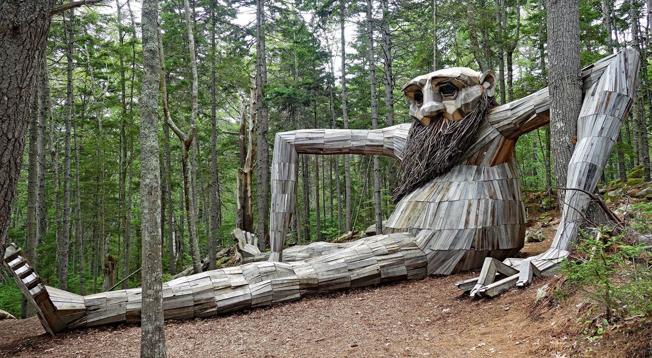
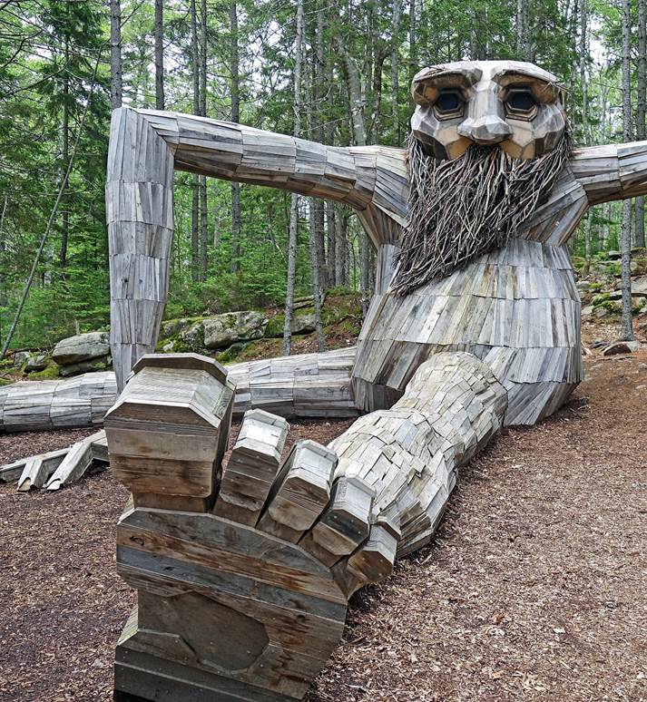
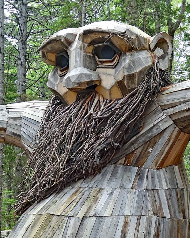
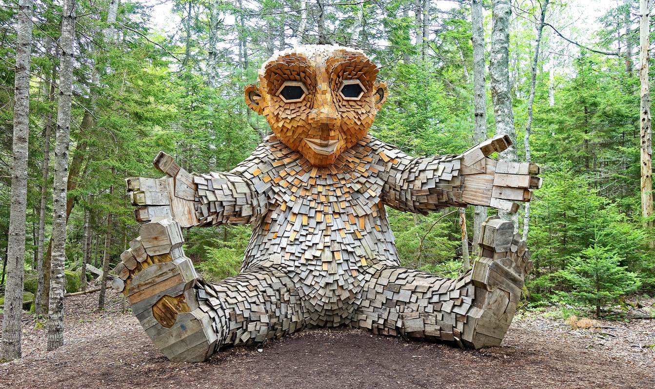
Guardians of the Seeds, Coastal Maine
Botanical Gardens, Boothbay (June 2023). These five trolls are the work of
Thomas Dambo, a Danish ˝recycle art activist˝. They were built
on-site in 2021.
- Gro, the troll of the tree leaves.
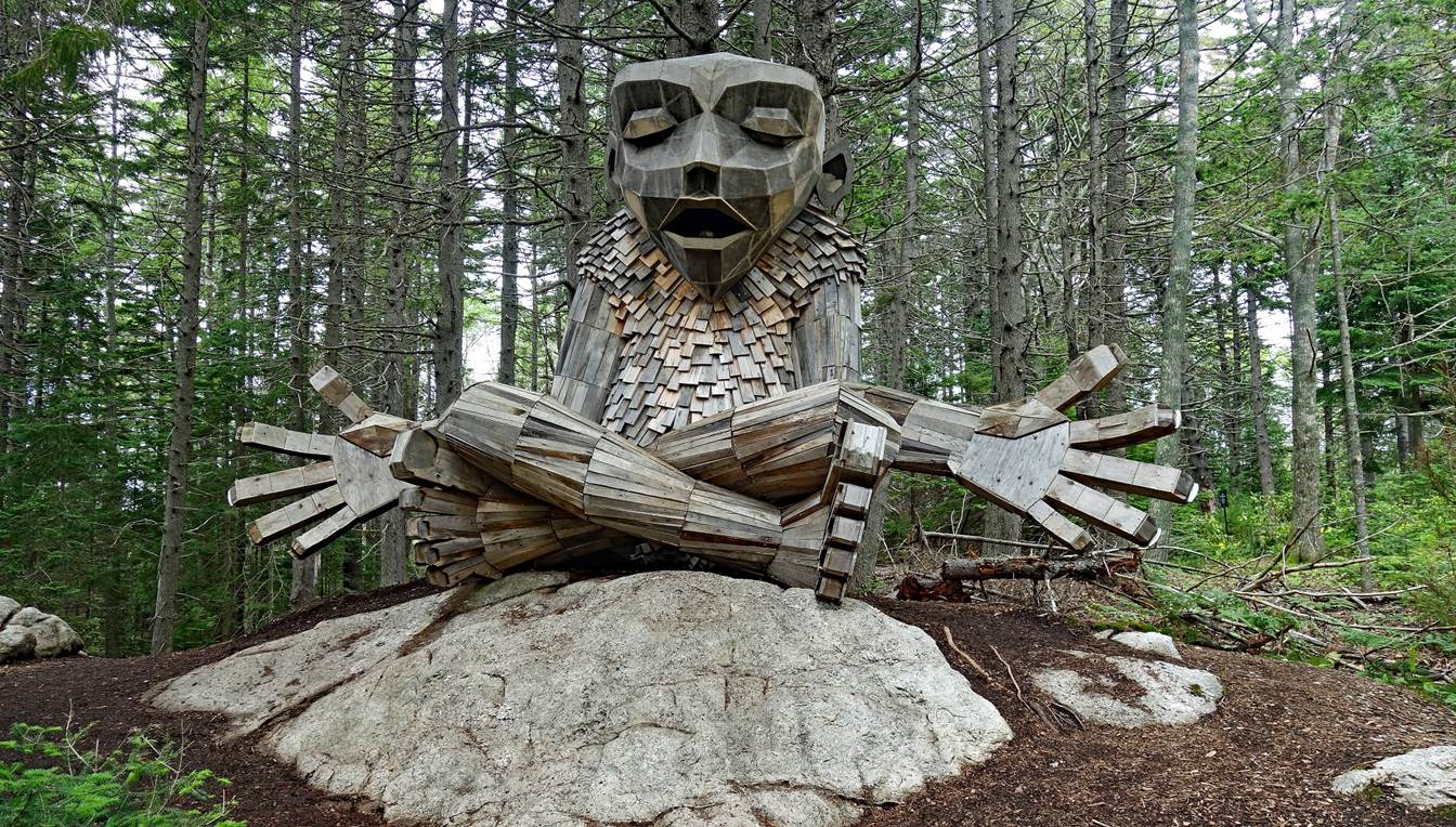
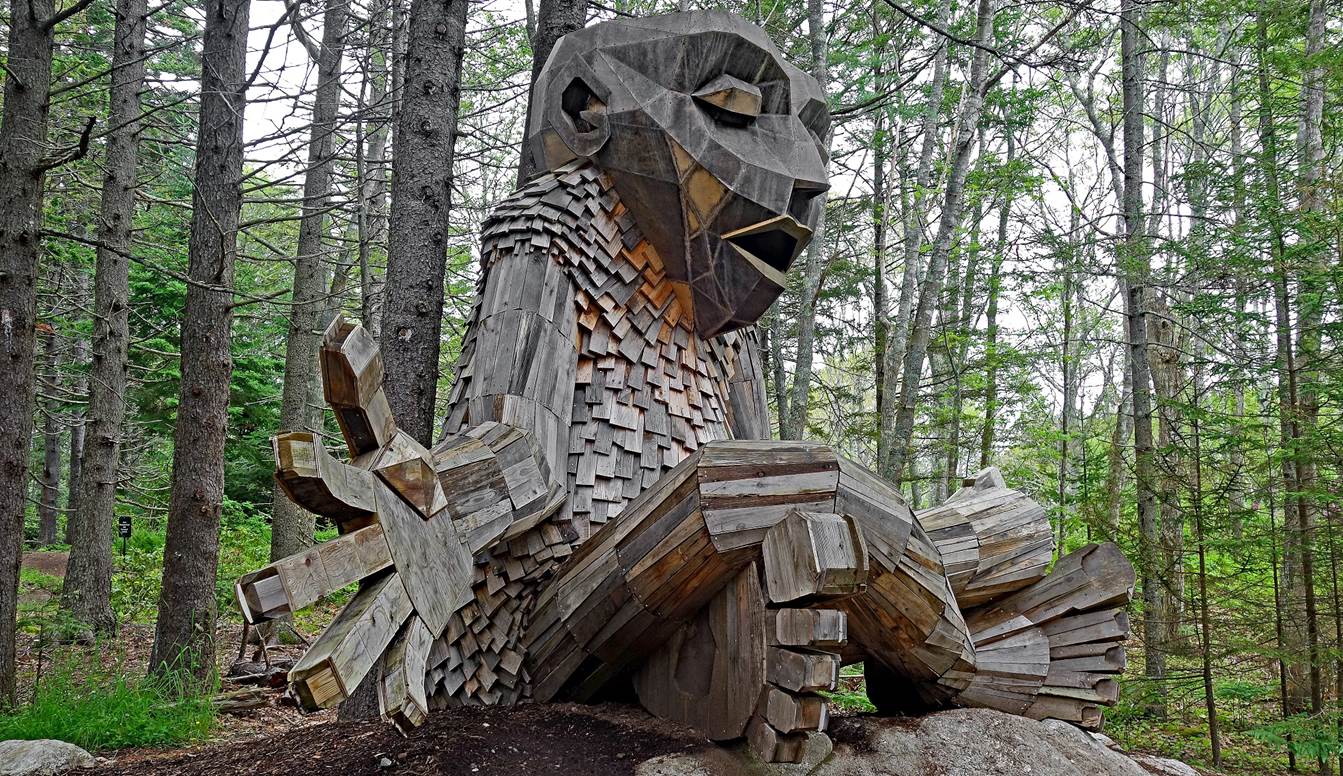
- Roskva, the troll of the tree trunk.
|
|
|
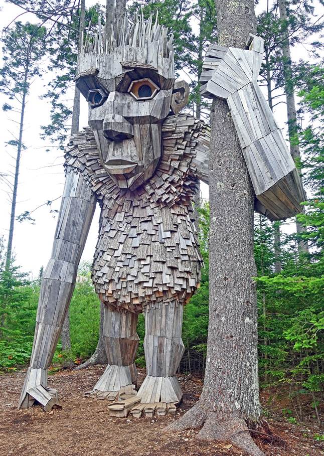
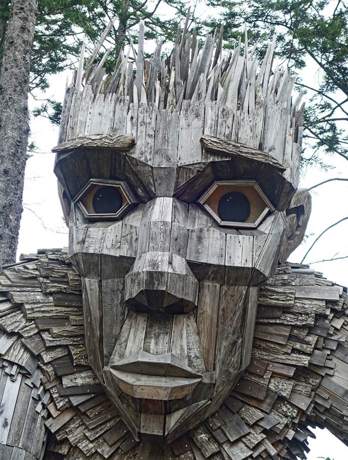
- Birk, the troll of the tree roots.
|
|
|
- Soren, the troll of the tree branches.
|
|
|
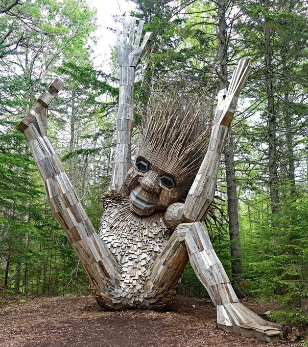
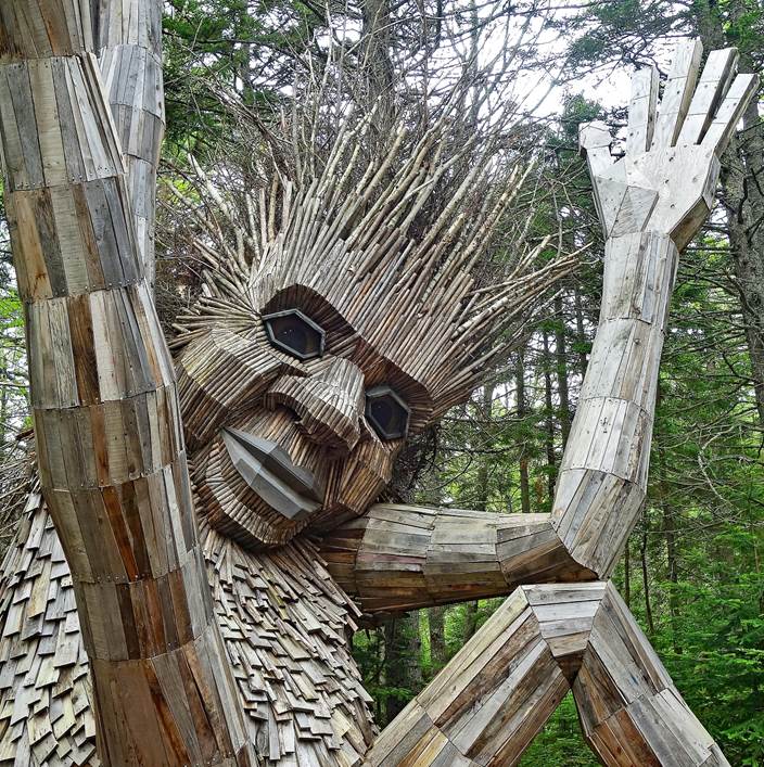
- Lilja, the troll of the tree flowers.
To see more photos of day hikes in Maine (Acadia National Park, Great
Wass Island, Baxter State Park), click here.
Vermont (June 2018, June 2019, and June 2023):
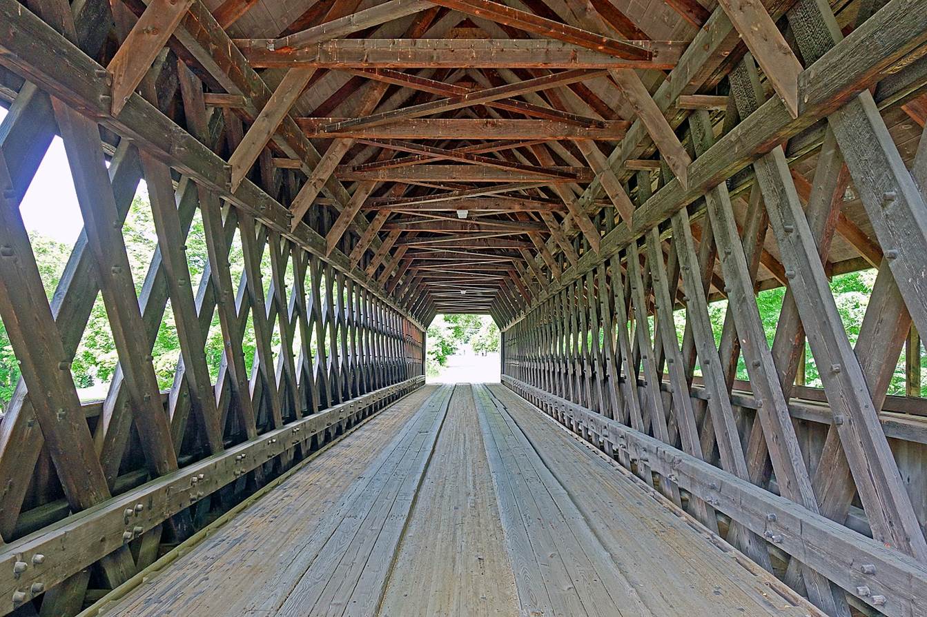
Beautifully built covered bridge over the Ottauquechee
river in the town of Woodstock (June 2018).
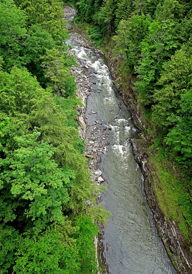
The Quechee gorge (located east of Woodstock)
seen from the bridge above it (June 2018).
|
|
|
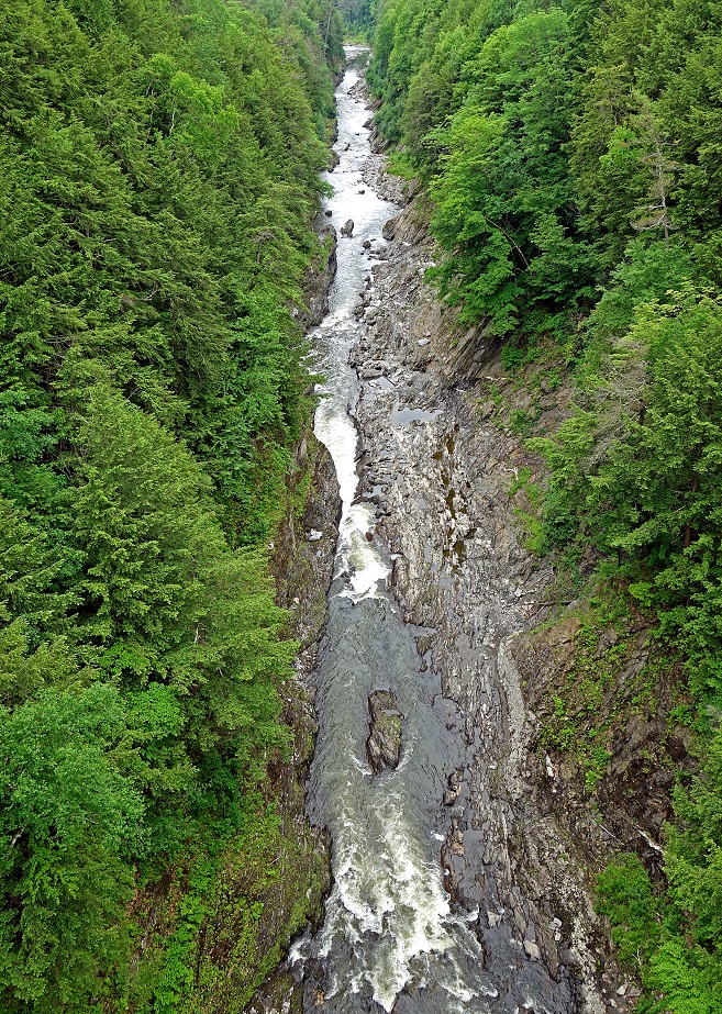
Lower part of the Quechee gorge (June 2018).
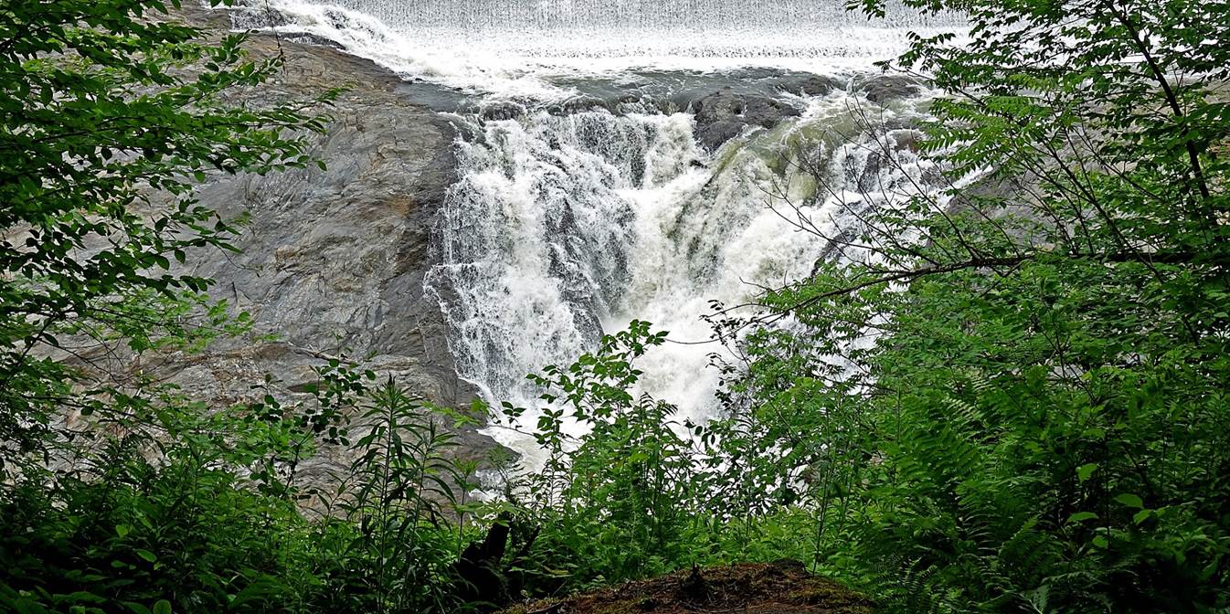
Waterfall at the upper end of the Quechee gorge
(June 2018).
Dewey′s Mill pond above the waterfall
(June 2018).
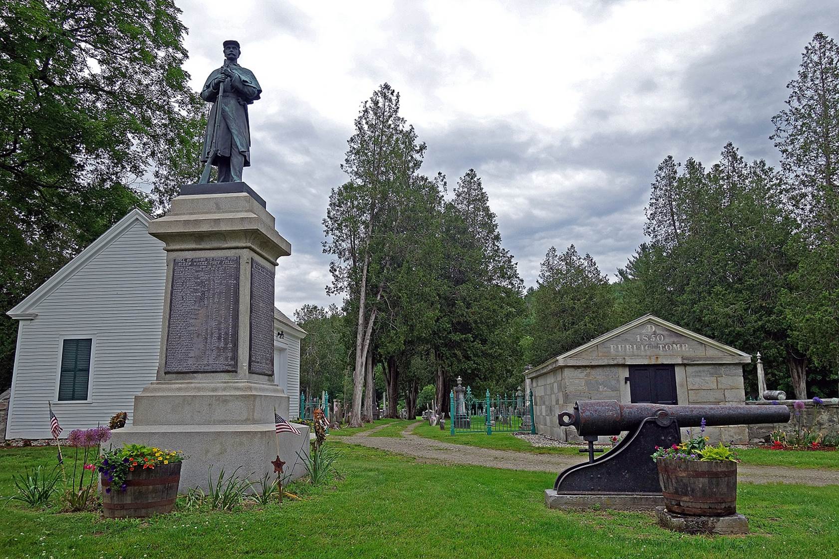
In the town of Chester (June 2019):
- Entrance of the old Brookside
cemetery. The monument on the left was erected in 1884 and is dedicated to
soldiers of the Civil War. The names of Vermont soldiers who served during that
war are written on four plaques posted on its base. The white house behind the
Civil War monument is the renovated former hearse house (dating 1830) that
keeps the last horse-drawn hearse purchased in 1907. On the right of the photo,
the 1850 Public Tomb behind the canon was used in the winter, when the frozen
ground was too hard to dig graves, to store bodies of deceased people.
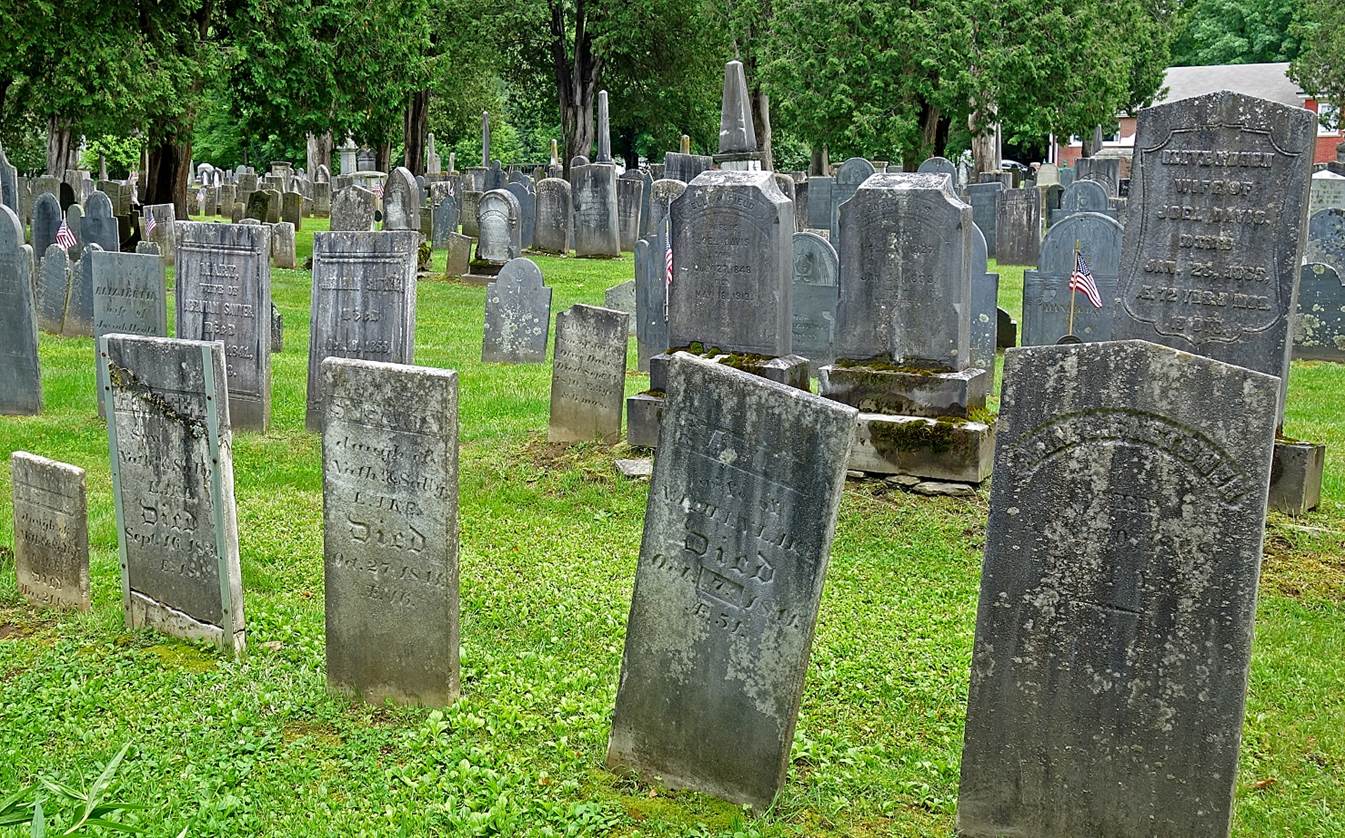
- Old graves in the Brookside cemetery.
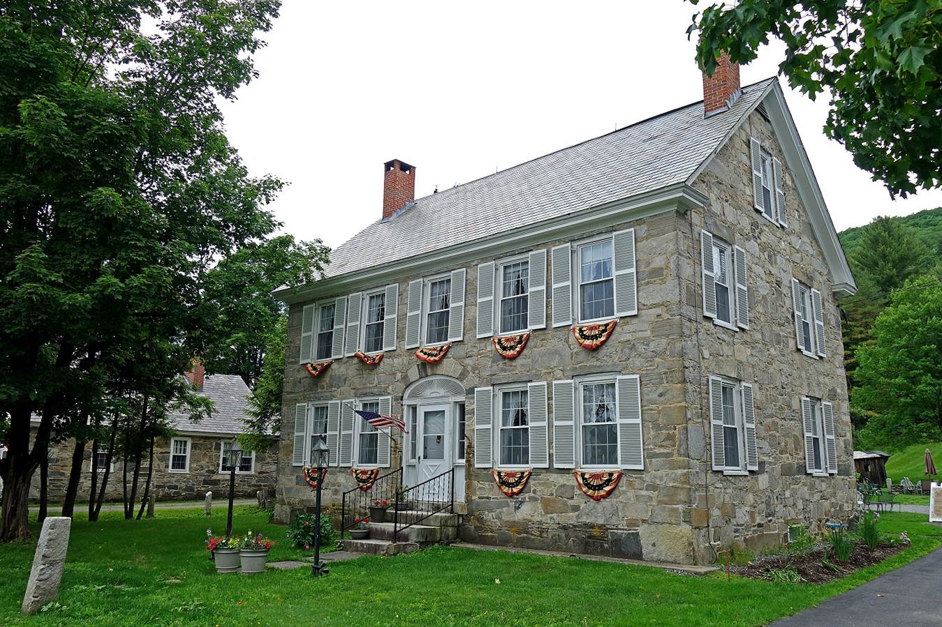
- House in the Stone Village of Chester.
This so-called village contains a rare concentration of ″snecked ashlar″ style houses dating from the first
half of the 19th century. This style of construction, rare in the United
States, consists of affixing stone plates to a rubble wall. The technique was
introduced locally by two Scottish masons who came to Chester in 1832.
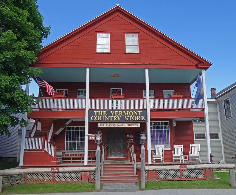
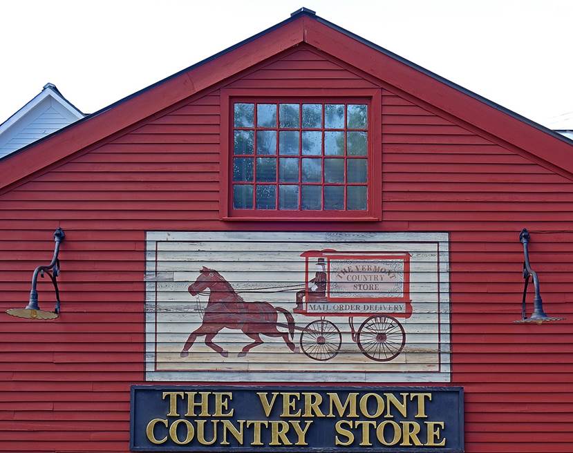
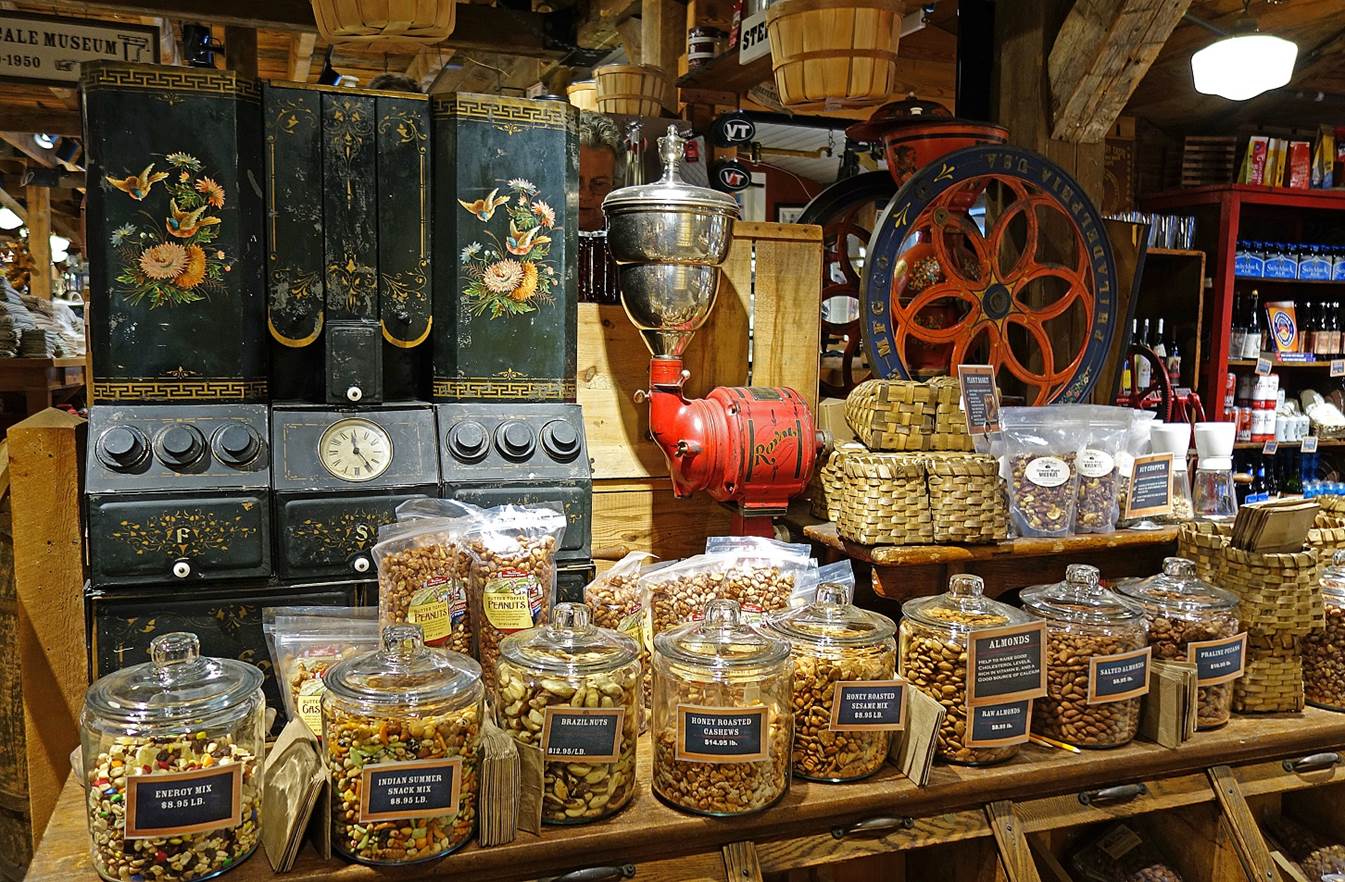
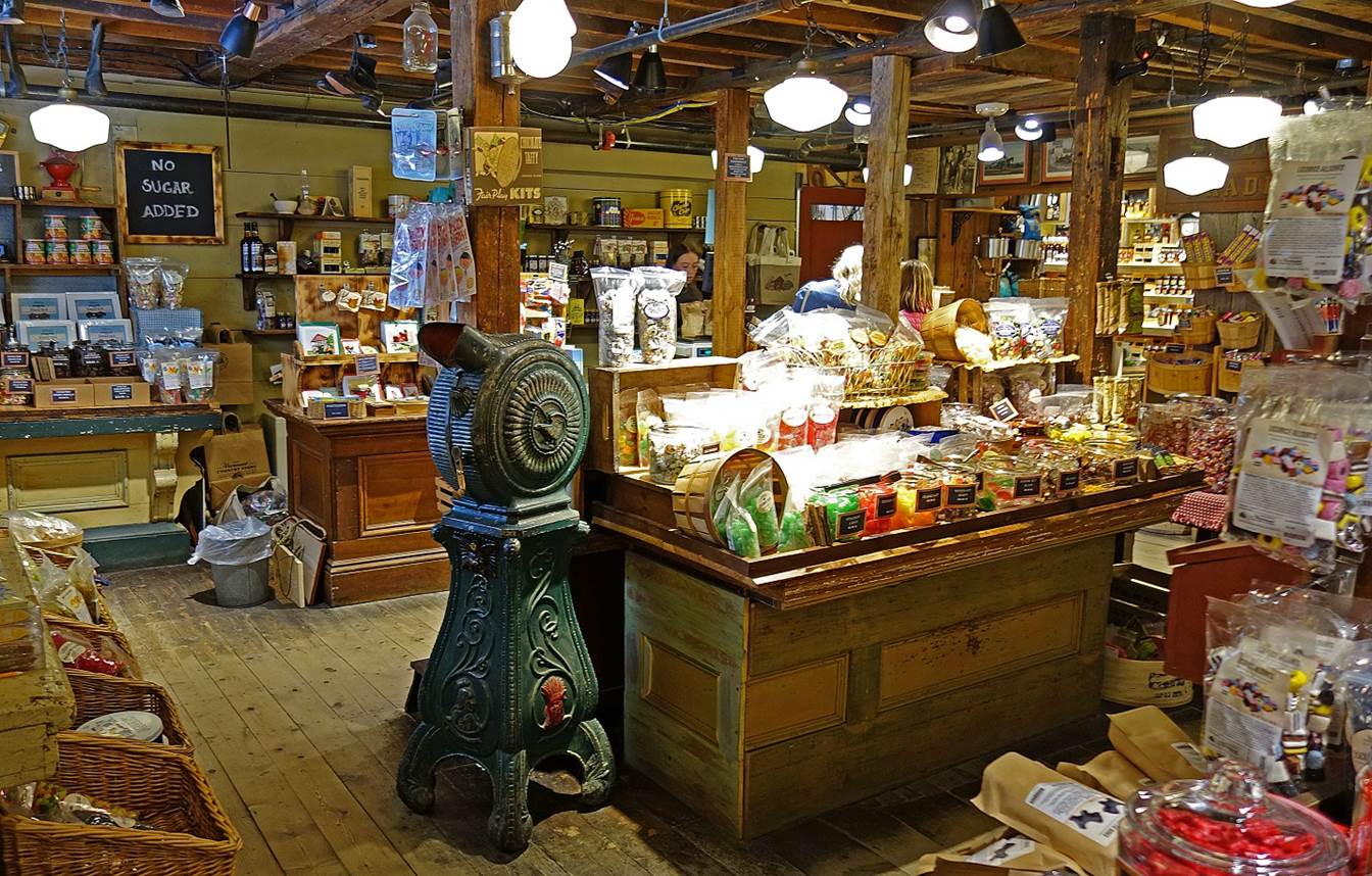
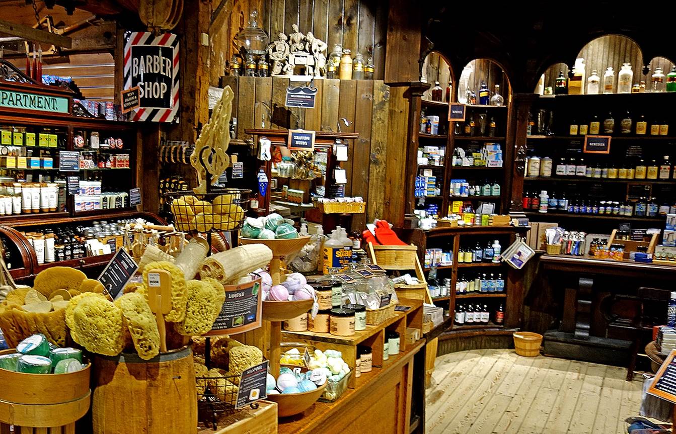
The Vermont Country Store in the town of
Weston (June 2019), which claims to be the ″Purveyors of the Practical
and Hard-to-Find″. Entering this nostalgic store, which opened in 1946,
is definitively stepping back in time. Many products on sale are actually
unusual, useful, and interesting.
|
|
|
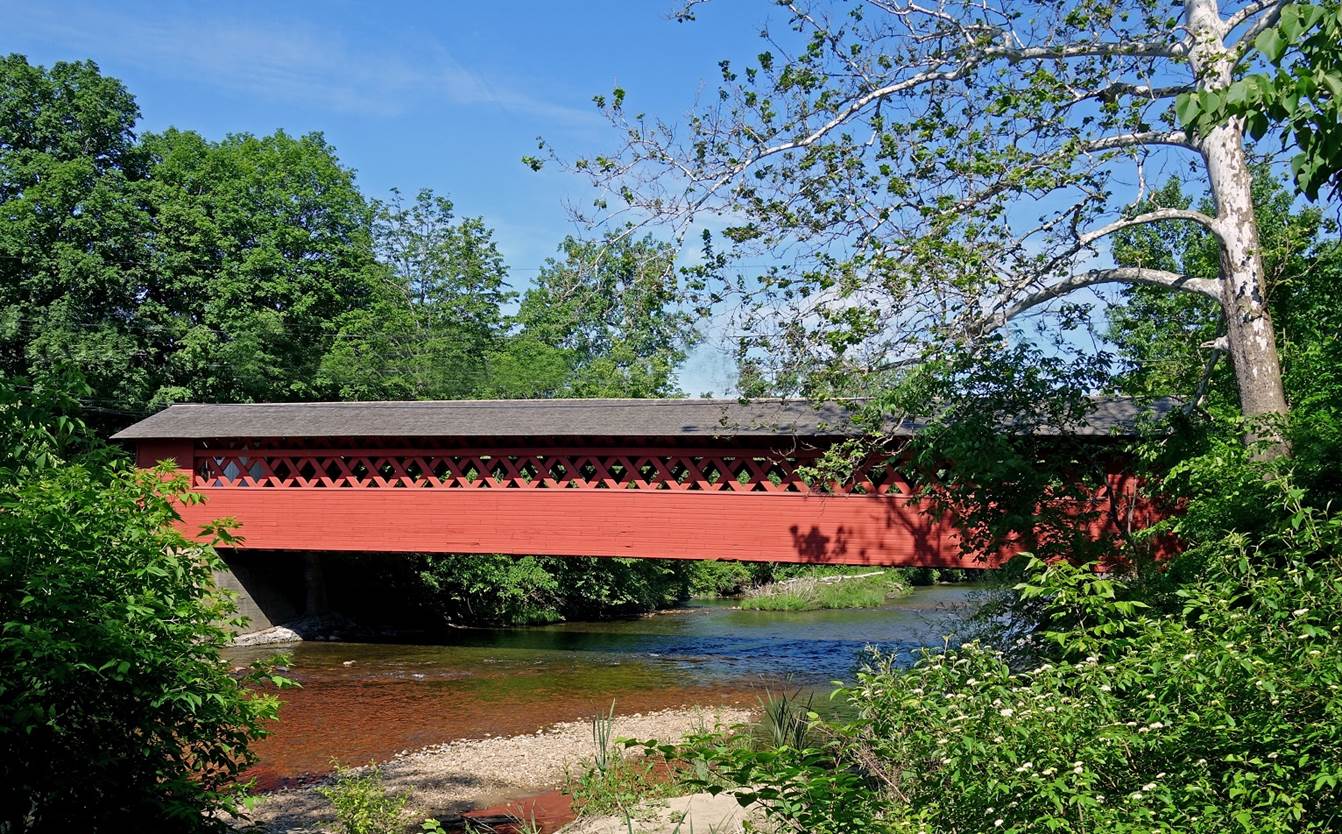
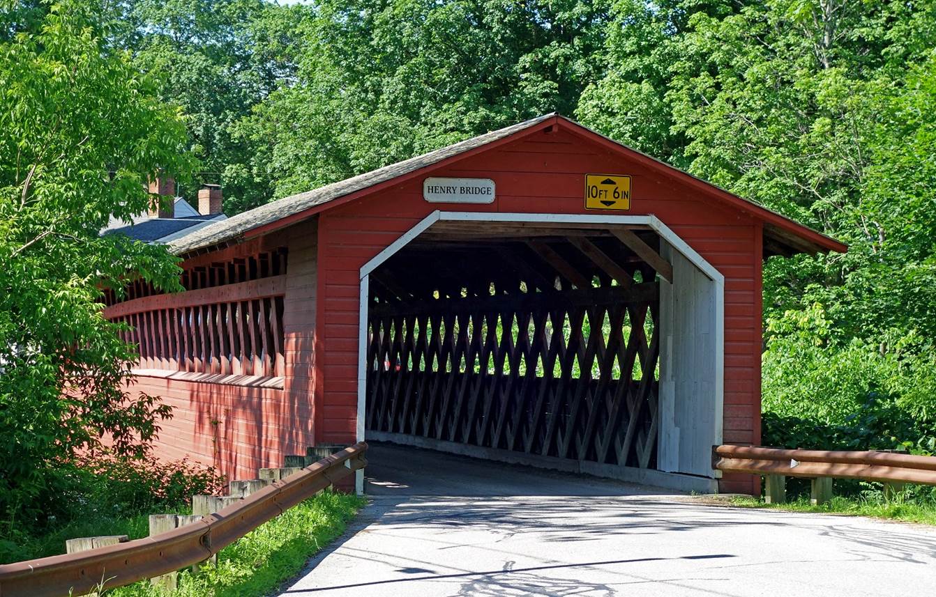
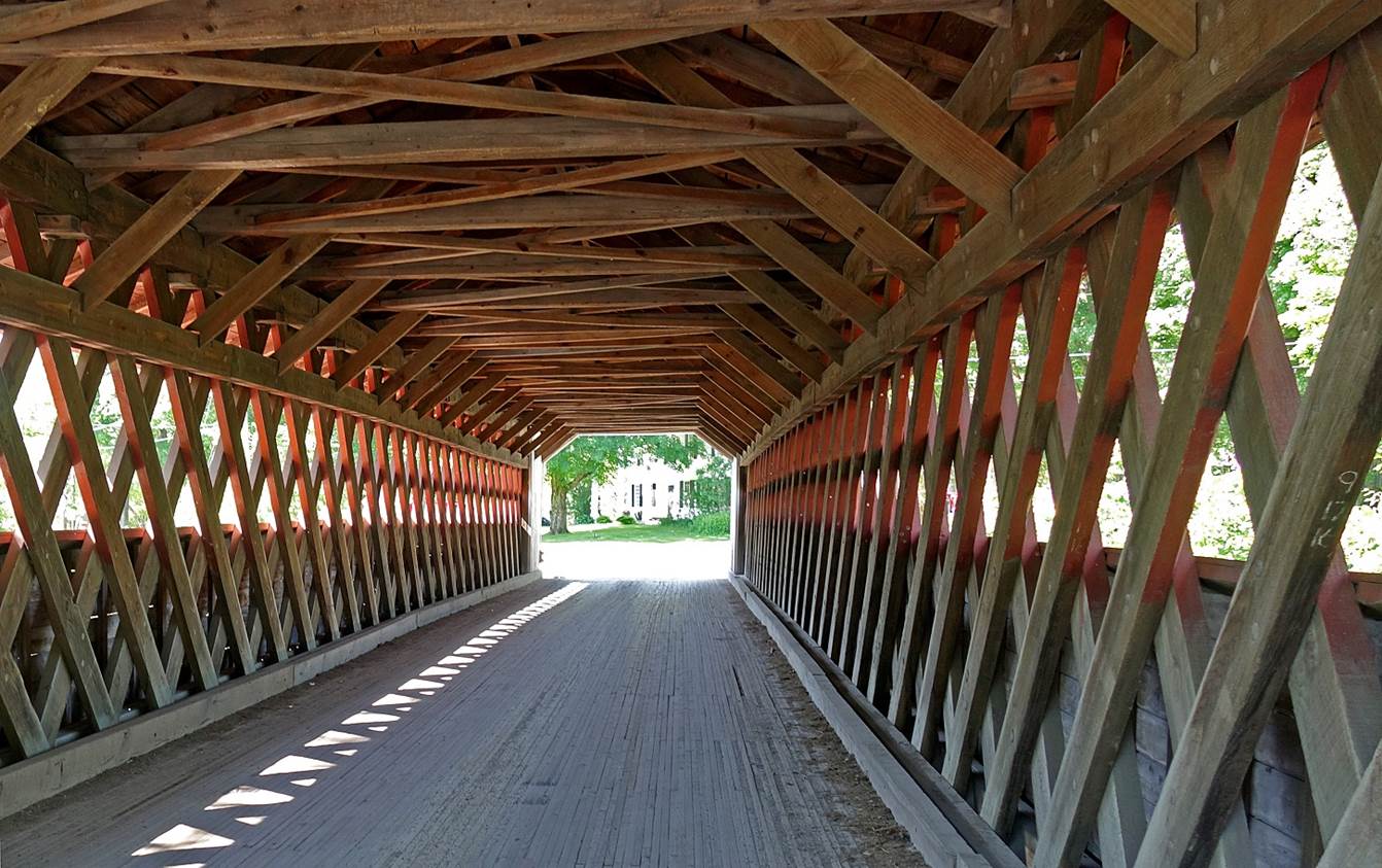
The Henry Bridge (June 2019), one of the three covered bridges in the
town of Bennington.
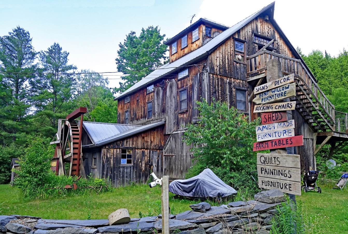
Shop along Road 108 near Cambridge Village, northwest of Stowe (June
2023).
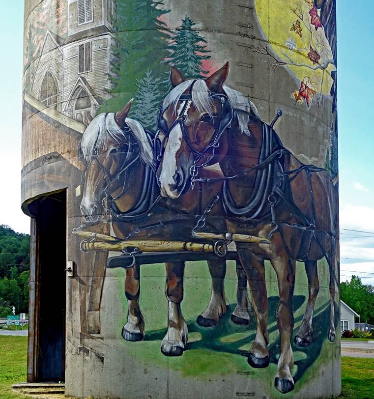
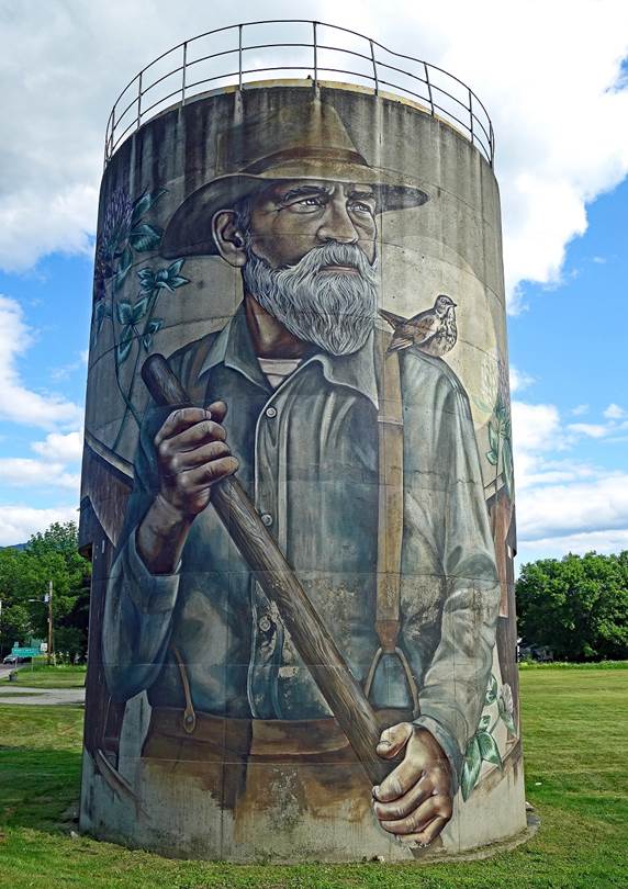
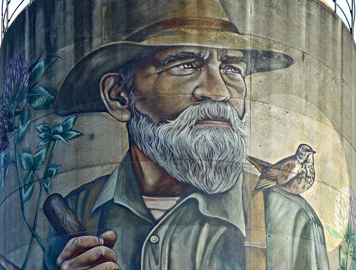
Large murals painted on a former
concrete silo originally used to store sawdust, in Jeffersonville, northwest of
Stowe (June 2023).
|
|
|
In the town of Barre (June 2023).
Barre is located 12 miles southeast of
Montpelier, the capital city of Vermont. It grew in the early 19th century
following the nearby discovery of extensive deposits of fine-grain,
weather-resistant granite. For almost two centuries it has attracted many stone
carver artists from around the world, especially Italy, and calls itself the
˝Granite Capital of the World˝. Its streets and Hope Cemetery boast
numerous sculptures, some quite unusual.
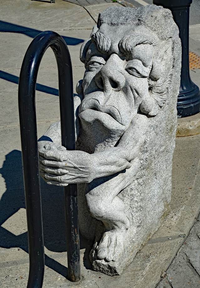
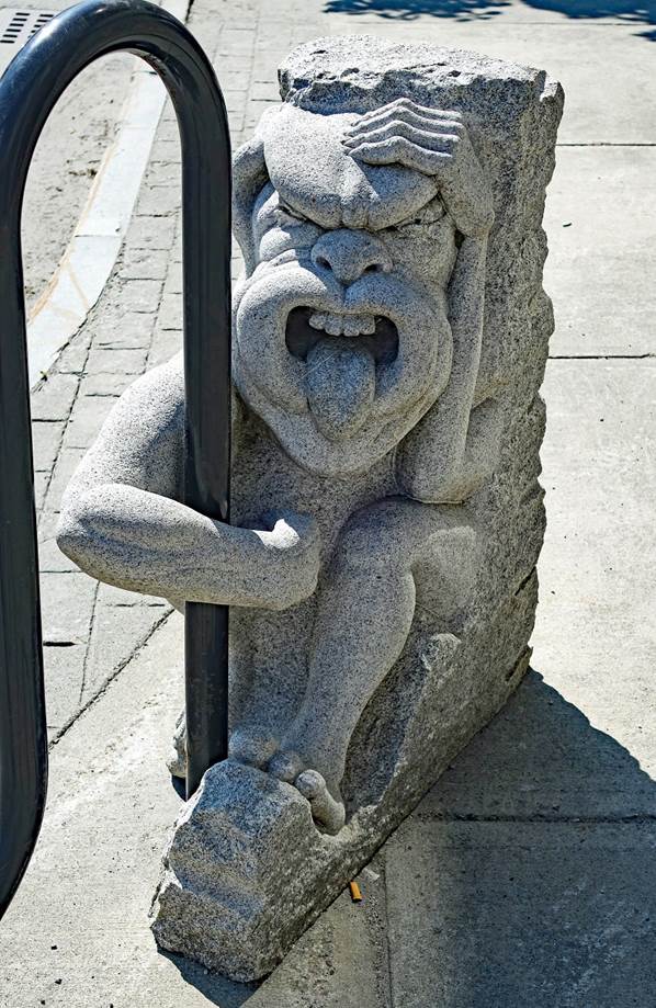
- Gargoyle
sculptures ˝guarding˝ a wave-style bike rack on the Main Street
sidewalk.
|
|
|
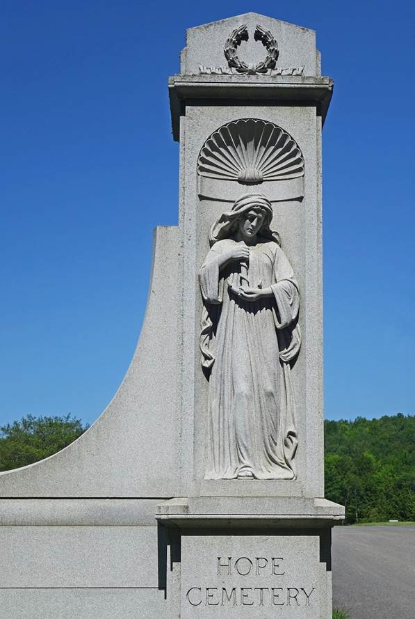
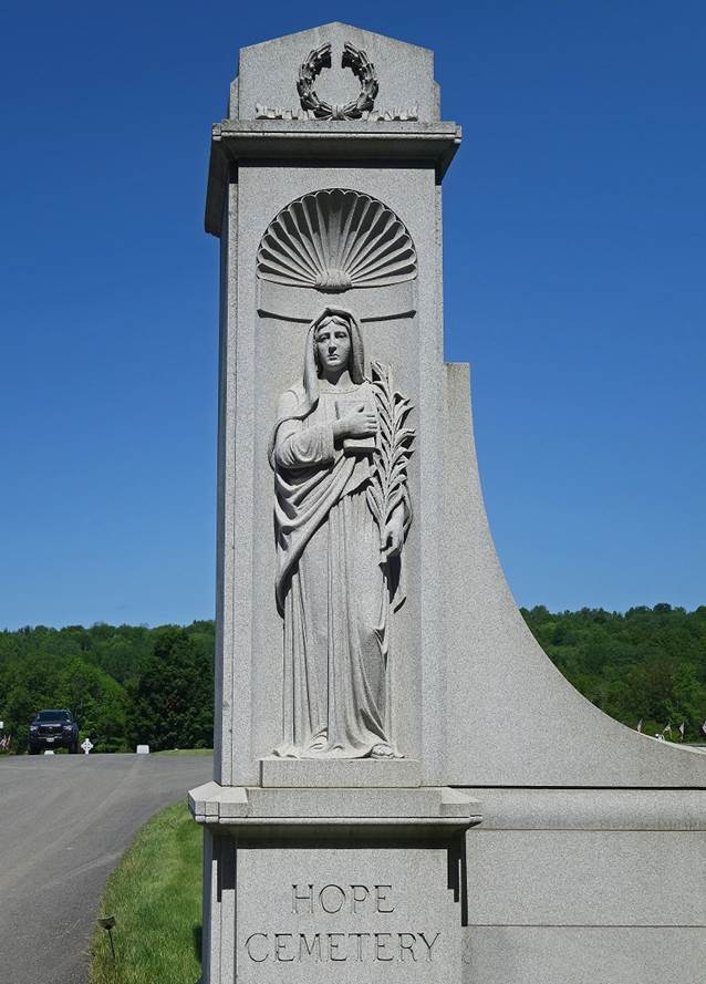
- Granite
sentries standing at the gate of Hope Cemetery (established in 1895).
|
|
|
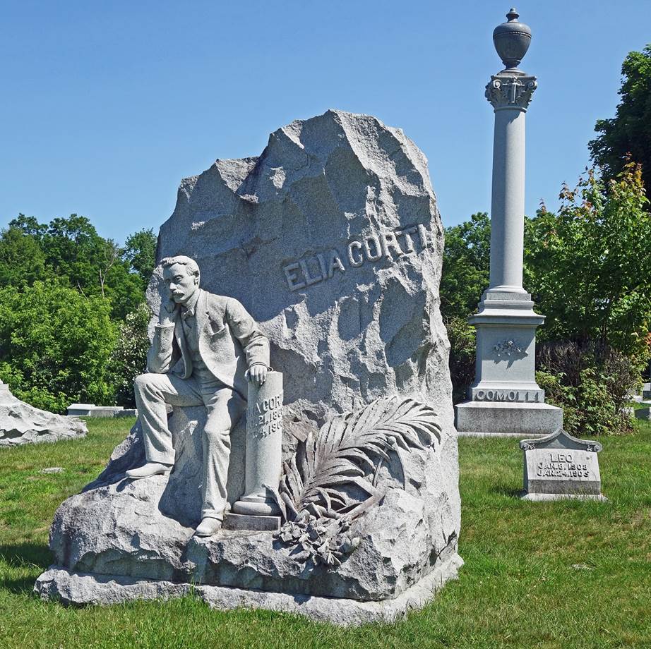
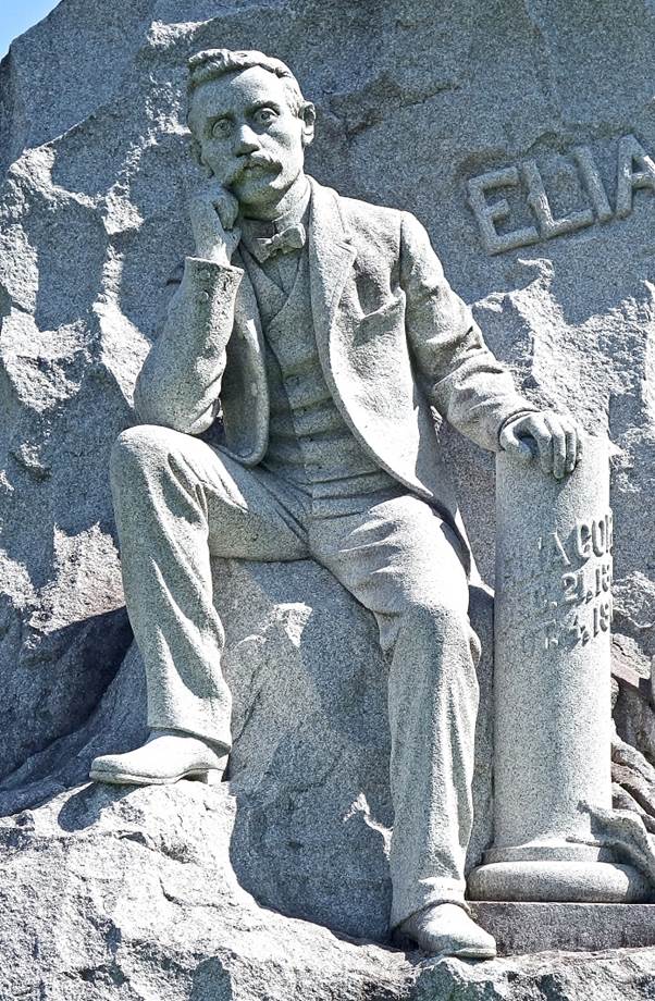
- Sculpture adorning the grave of Elia
Corti in Hope Cemetery. A gifted granite carver, Corti was mortally wounded at
a political meeting between socialists and anarchists on October 3, 1903. Shot
in the stomach, he died on October 4, thirty hours after receiving the bullet.
He was 34 years old. This remarkable sculpture was carved by his brother and
brother-in-law from a single piece of granite. It depicts a life-size,
elegantly dressed Corti with a pensive look next to a broken column symbolizing
his life cut short.
|
|
|
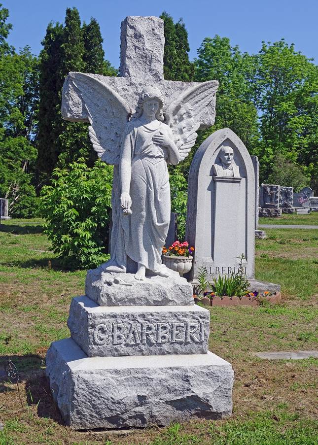
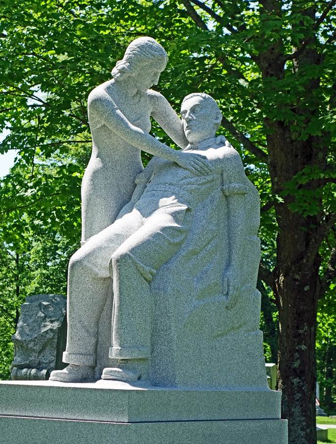
- Left: Gravestone representing an
angel. Right: Sculpture, known as the ˝Dying man˝, erected above the
tomb of Louis Brusa (1886-1937). A native of Como, Italy, Brusa immigrated to
the United States and settled in Barre, where he became a master stone carver.
He died from silicosis caused by breathing granite dust over too many years.
The sculpture depicts Brusa dying in his wife's arms. It was carved by his
friend Don Coletti.
|
|
|
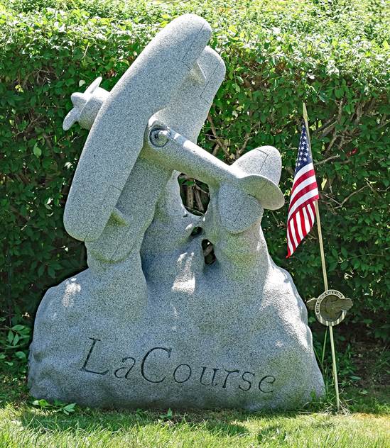
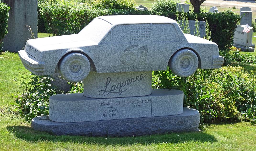
- Two graves adorned with non-traditional granite sculptures representing
an aerobatic biplane and a race car.
|
|
|
For more photos of day hikes in Vermont (Green Mountains), click here.
New York State (June 2018):
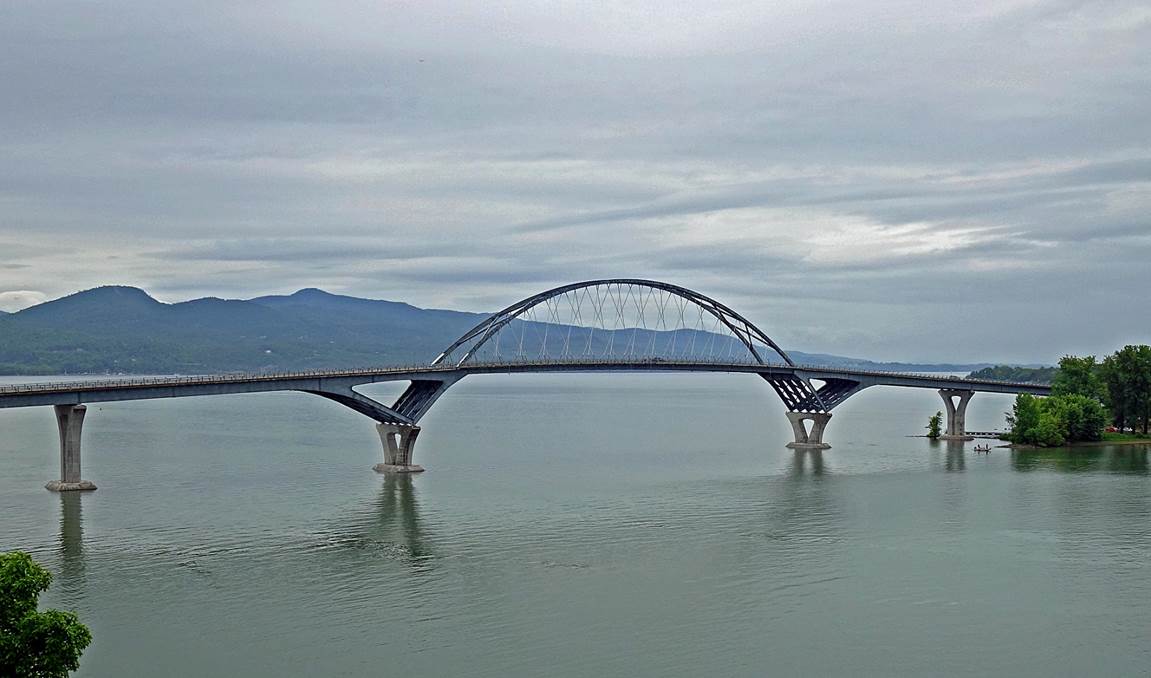
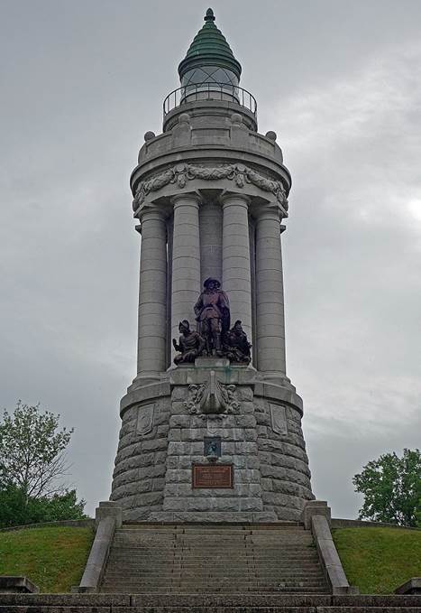
Left: Bridge across Lake Champlain between Vermont and New York State.
Right: Champlain Memorial lighthouse at Crown Point on the western side of the
lake.
|
|
|
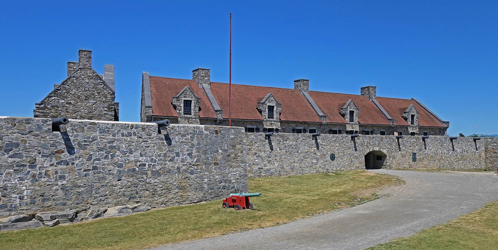
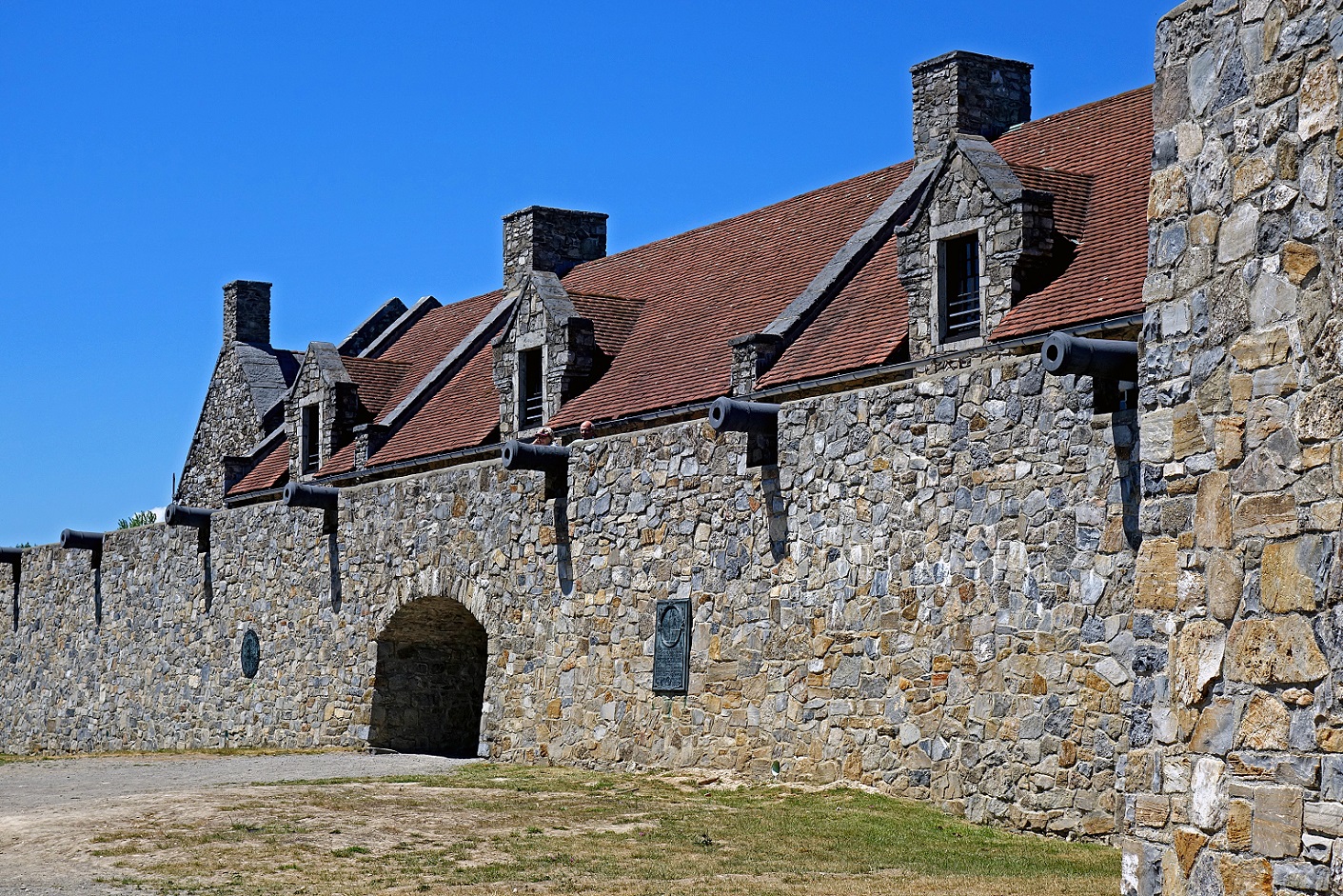
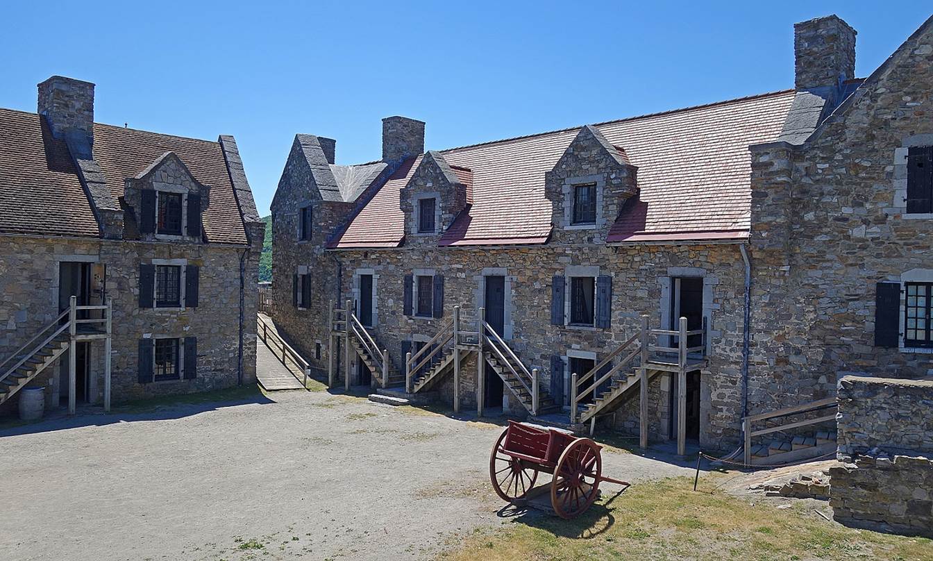
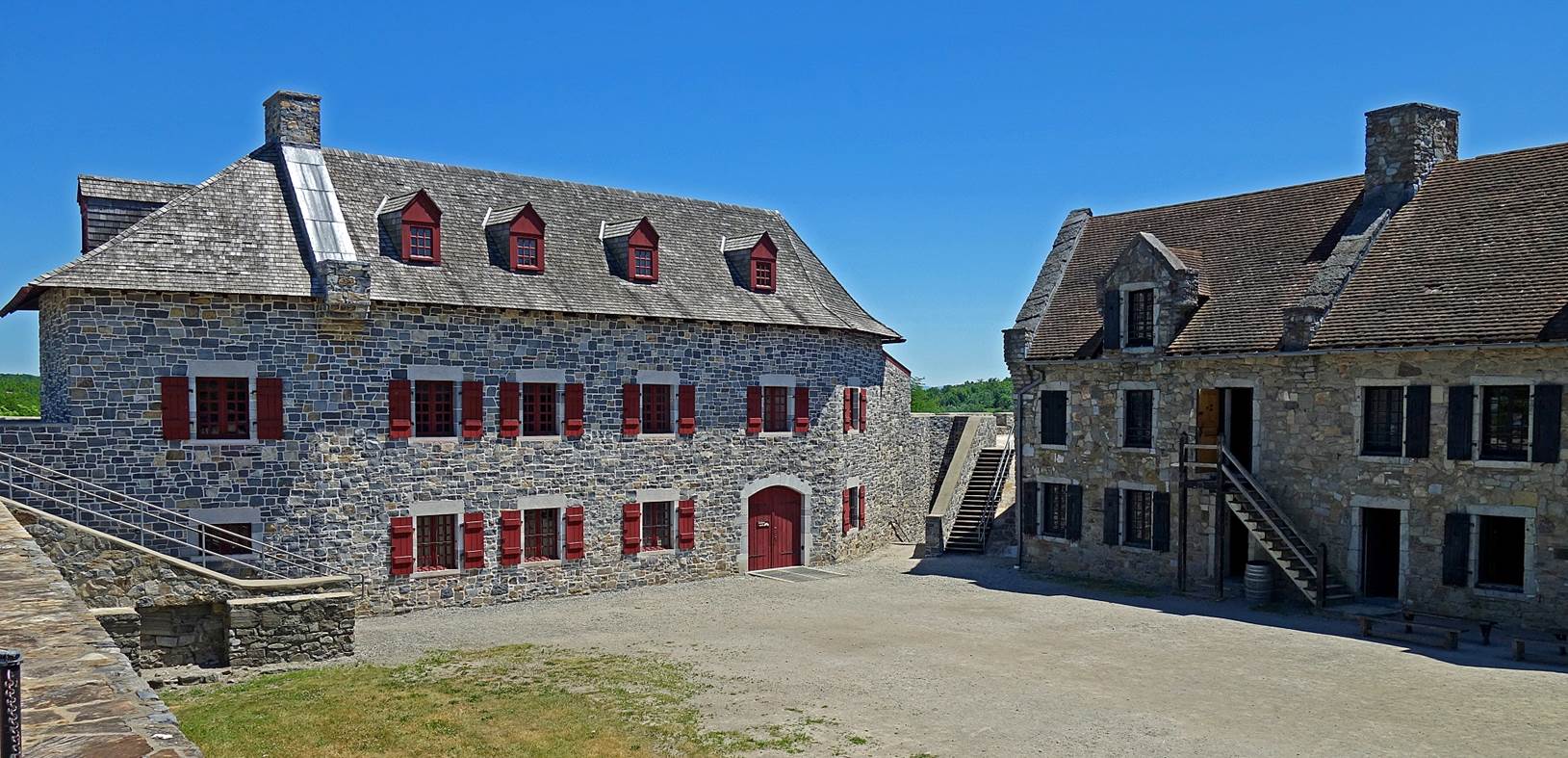
Fort Ticonderoga, some 14 miles south of
the lighthouse, also on the western side of Lake Champlain. It was initially
built by the French in 1755 (under the name Fort Carillon), then taken by the
British in 1759 and renamed Ticonderoga. It was captured by the American
revolutionaries in 1775, retaken by the British in 1777, and retaken by the
American revolutionaries in 1781. It was visited by then General George
Washington in 1783. It was restored in the early 20th century.
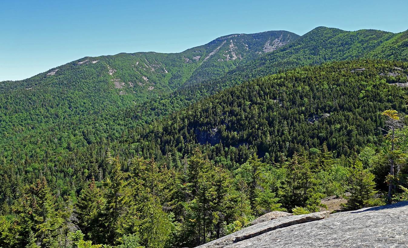
Hike to the Giant′s Nubble, located in the Adirondacks, southeast
of Lake Placid:
- The Giant′s Washbowl, a small lake below the Nubble.
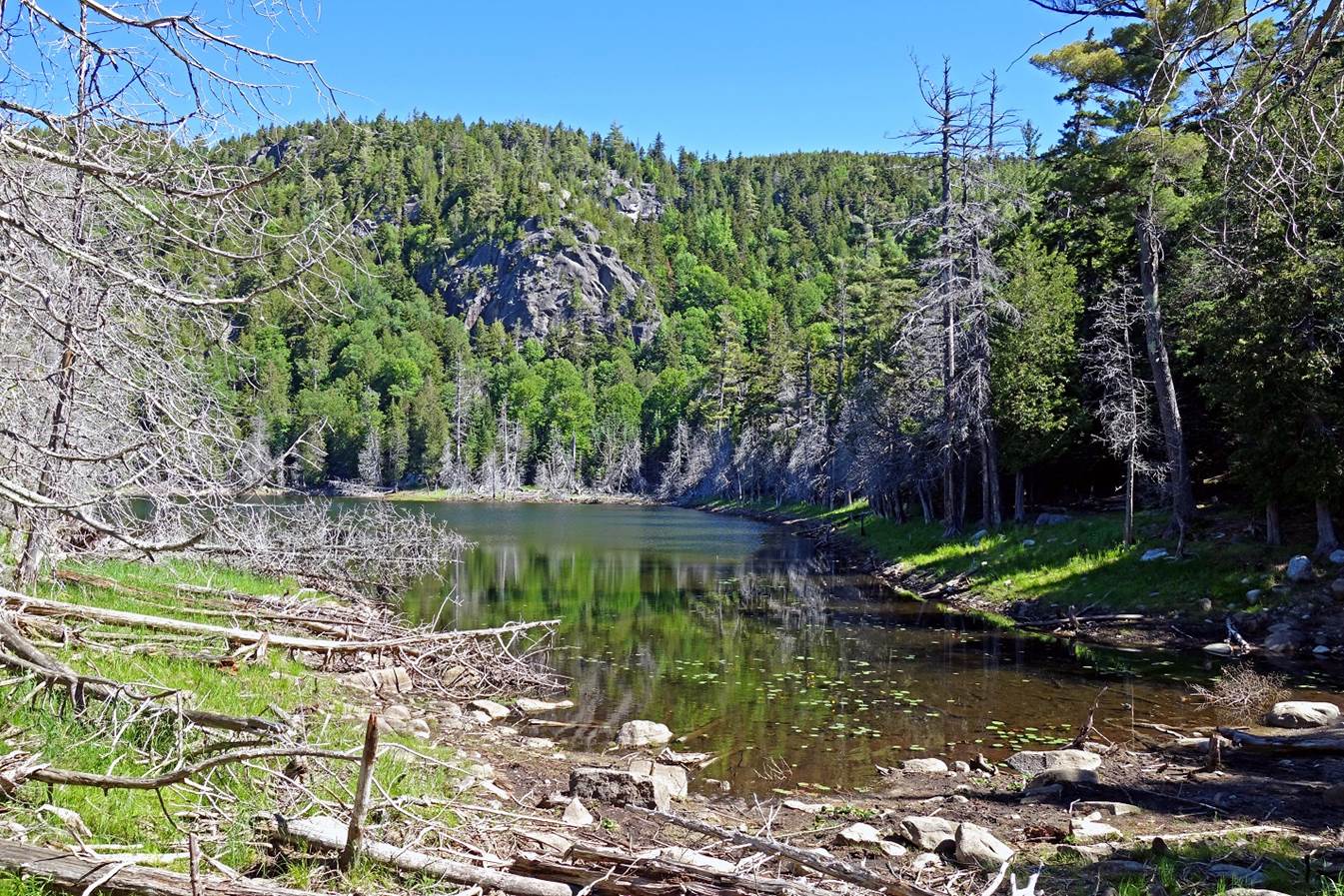
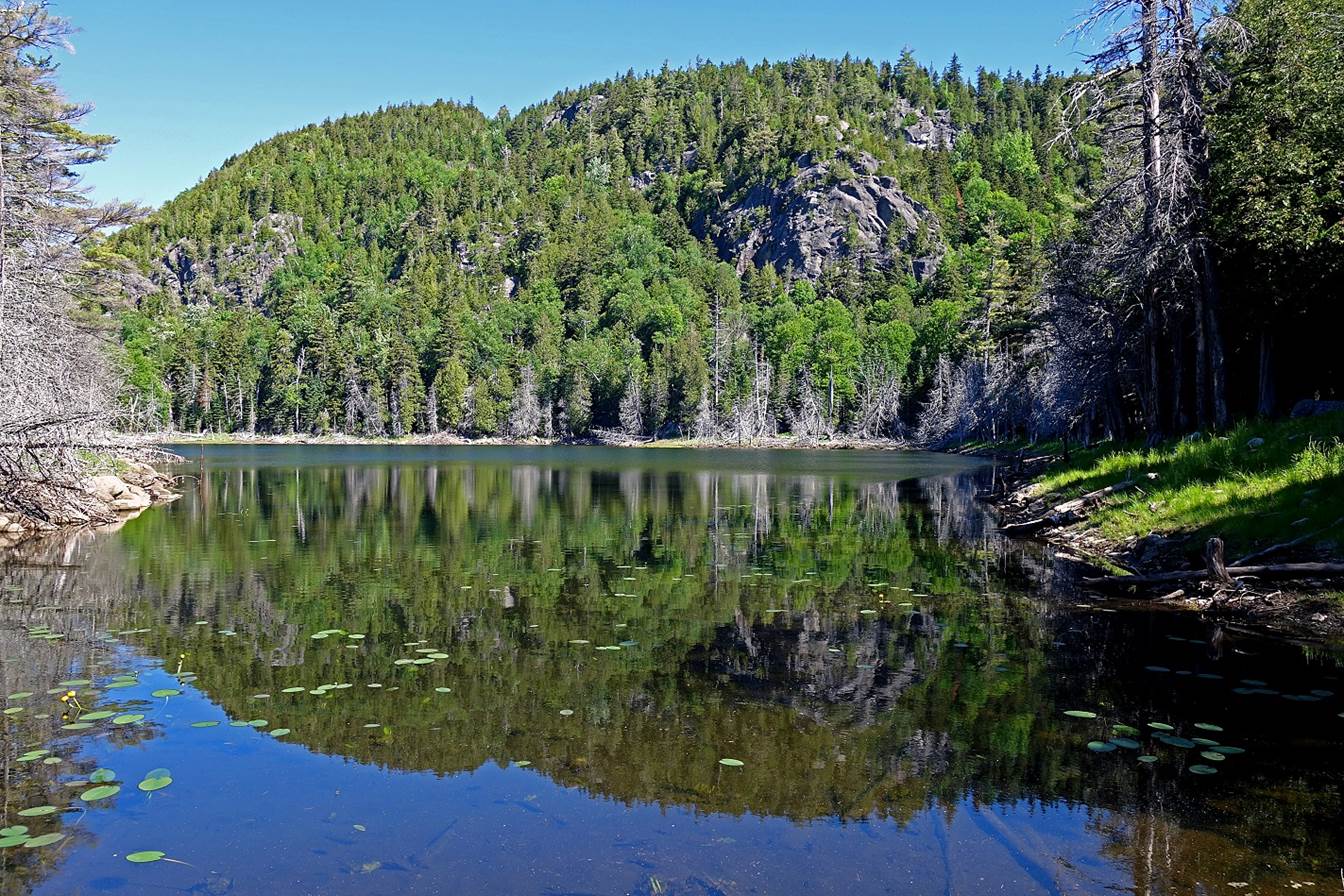
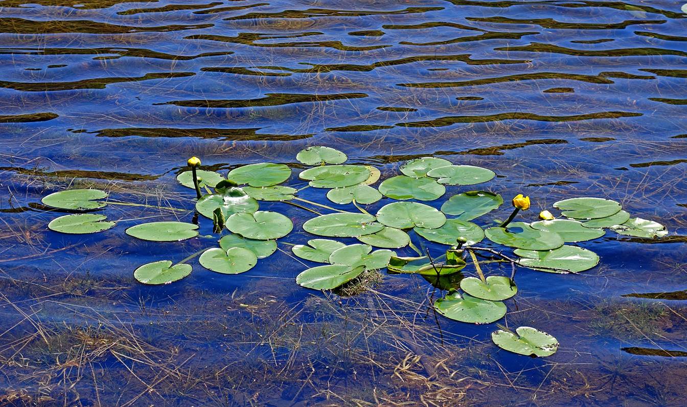

- Views of the Giant′s Washbowl and surrounding mountains before
reaching the Nubble.
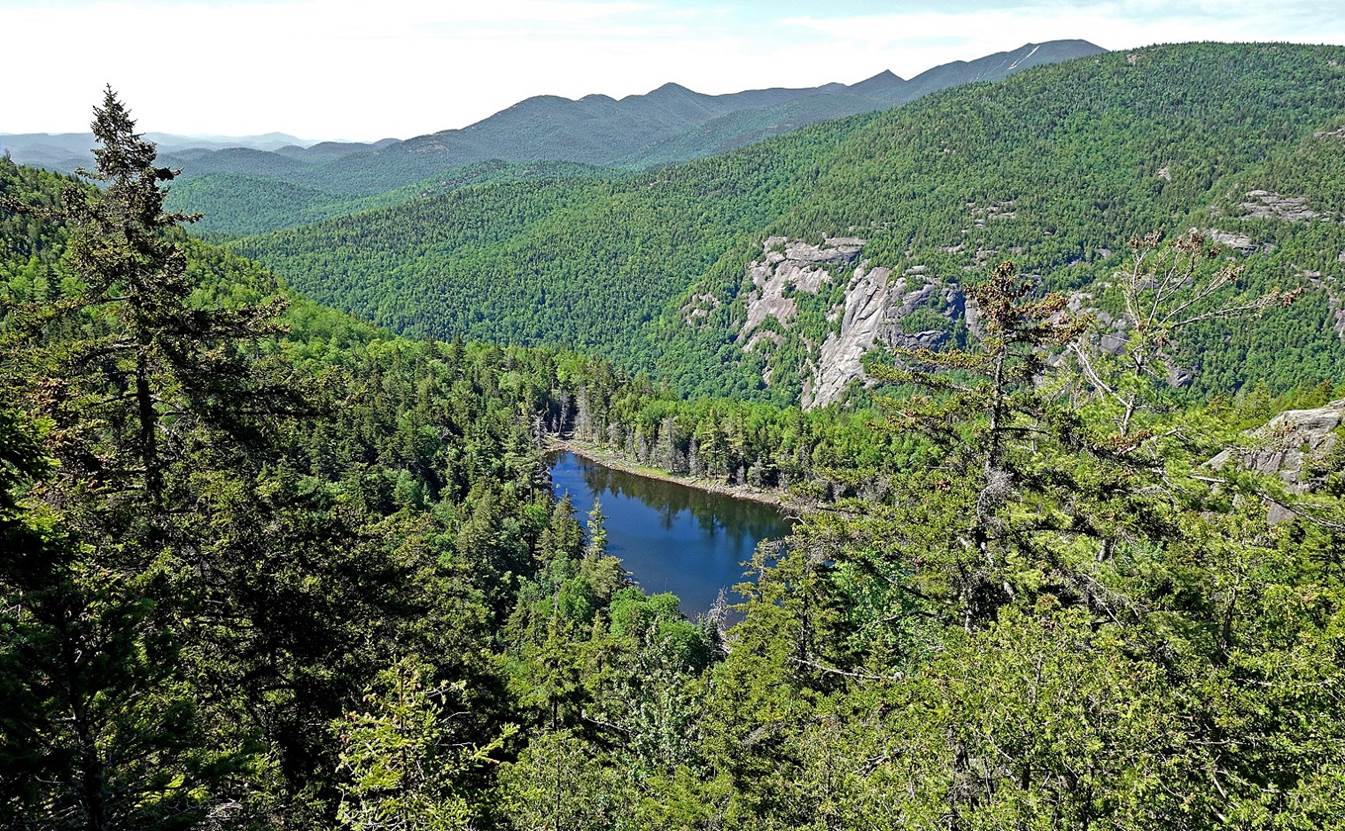
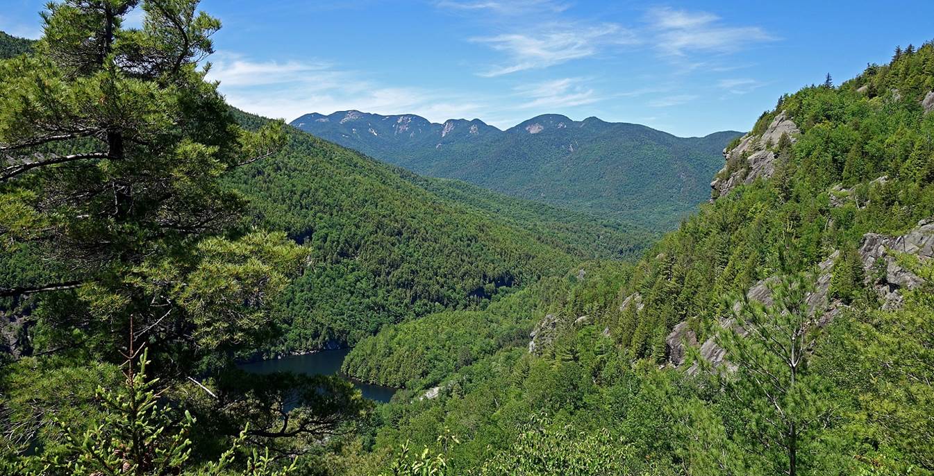
- The Giant Mountain seen from the Nubble.
![]()