Morocco (May-June 2016): From the Sirwa Massif to the Mountains
of Amezmiz
|
|

Return to my
mountaineering/trekking/travel webpage
This two-week, 200km+, trek took me from
the south of the Sirwa massif (which is part of the Anti-Atlas mountain range)
to the mountains of Amezmiz (in the High Atlas
range). I started the trek just south of the village of Atougha located about
27km north-east of the town of Taliwine (also spelled
Taliouine) on the N10 road. The trek ended in the
village of Ameghras, near the town of Amezmiz, about 50km south-west of Marrakesh. The following
two pictures show the approximate itinerary (red lines) in Google Map (left)
and Google Earth (right). Click here
(.kmz file) to access all the recorded waypoints and
placemarks in Google Earth. The red pins point to the start and finish of the
trek, the green pins are the campsites, the yellow pins are the other GPS
waypoints that I recorded during the trek, and the orange pins are placemarks
of major landmarks. For lack of space, the Google Earth picture below includes
no yellow pins and only some of the orange pins.
|
|
|

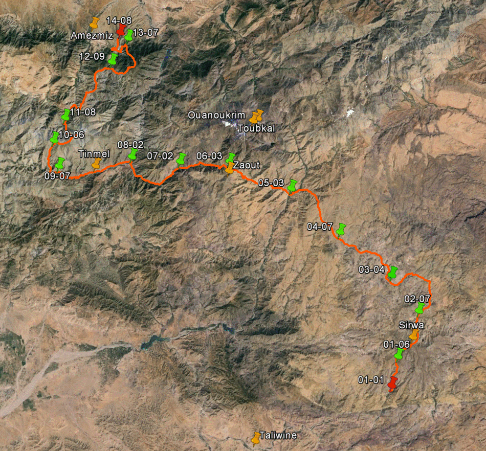
This
itinerary is covered by three 100K topographic maps Taliwine, Tizi-n-Test, and Amezmiz (click on these links to
upload them).
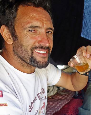
I
did this trek with Oumar Oulaidi, a mountain guide
from the valley of the Ait Bouguemez
and a good friend, whom I have known for almost 15 years. See here
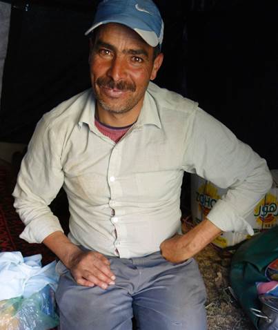
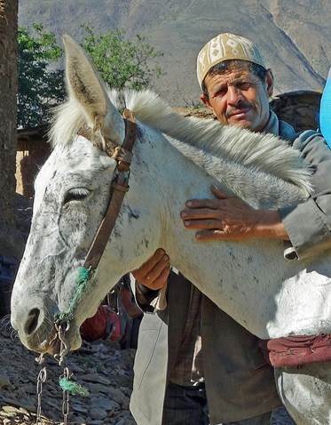
for more information about Oumar and how to contact him. Between Atougha and Ijoukak (located on
the ″Tizi-n-Test″ road R203 connecting Marrakesh to Taroudant) we
were helped by two muleteers, both named Abderrahmane, and their mule. In Ijoukak, we
switched muleteer and mule. Our new muleteer was named Mohamed. All three
muleteers had been arranged by Oumar.
|
Oumar |
Abderrahmane #1 |
Abderrahmane #2 |
Mohamed |
|
|
|
|
|

Click on the
links below to see pictures of the various sections of this trip:
|
|
|
|
A remark on
trekking in the Atlas Mountains:
Over the past few years I have witnessed more changes in the Atlas Mountains
than in the previous 30-40 years. Almost all villages are now reached by dust
and sometimes paved roads. They are all connected to the electricity network.
These changes have many positive effects on local people and are generally
welcome by them. They have better access to health care. Their children have
better access to schools and more of them eventually continue studies at the
university level. However, this trend also impacts trekking. In villages
traditional adobe houses are progressively replaced by not so beautiful
concrete ones. Too often local people who have become richer after moving to
cities or abroad build large ugly houses in their home villages. As a
consequence, the beautiful traditional villages of the Atlas Mountains may soon
be a thing of the past. Even worse for trekkers, many former good trails have
been cannibalized by roads. Remaining trails are less frequently used and often
poorly maintained. Increasingly, avoiding roads during treks requires hiking
off trail. While it used to be relatively easy to trek with 100K topographic
maps without any guide, this is much less so now, as most roads do not appear
on these maps. Also, as mules are less frequently used by villagers, it is more
difficult to directly find and hire muleteers (except on very popular trekking
routes near Toubkal and Mgoun). A guide with good
connections may be needed.
![]()