Zigzagging
in the Fann Mountains (August 8-23, 2006)
![]()
Return to my
mountaineering-trekking-travel webpage
I returned to Central Asia
in August 2006 for the third summer in row. I wanted to hike in the Central
Pamir around the Fedchenko glacier in Tajikistan. But
a last-minute permit problem forced me to change plan. Instead, I ended up
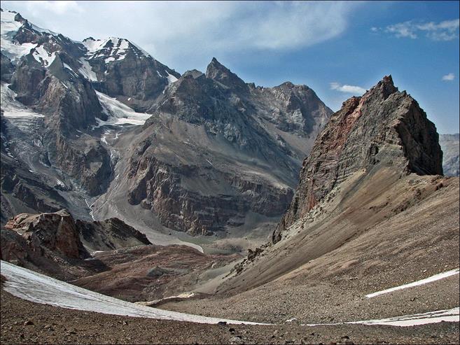
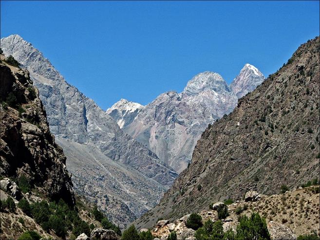
trekking in the more easily accessible Fann mountains, which I had partially
visited in 2004 (see Central
Asia 2004). These are beautiful mountains, with a few summits above 5000m,
culminating at Chimtarga peak (5489m). They are
located in Western Tajikistan, near the Uzbek border (and Samarkand). They
usually enjoy sunny, stable weather during the summer.
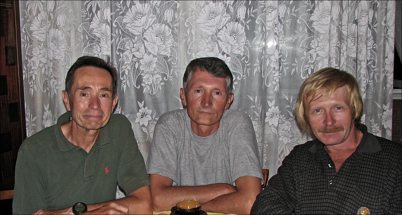
My guides for this trip
were Slava (in the middle of the following photo) and Mishra (right). Slava had
already been my guide in 2004
and 2005.
Both are great and reliable companions. Like in 2005, the logistics for this
trip were arranged by Boris Karpov of Elena
Tours.
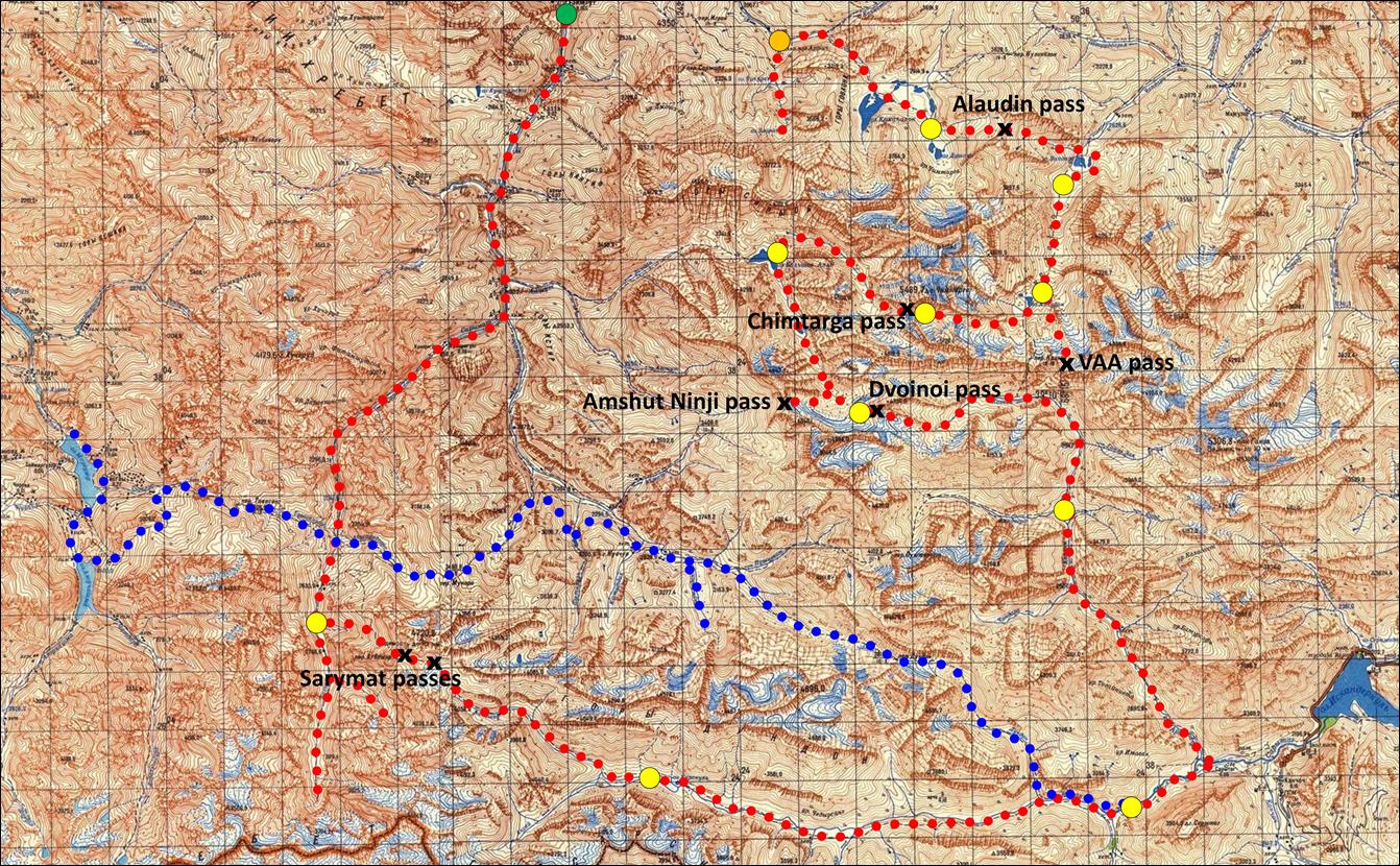
Trek area (red rectangle).
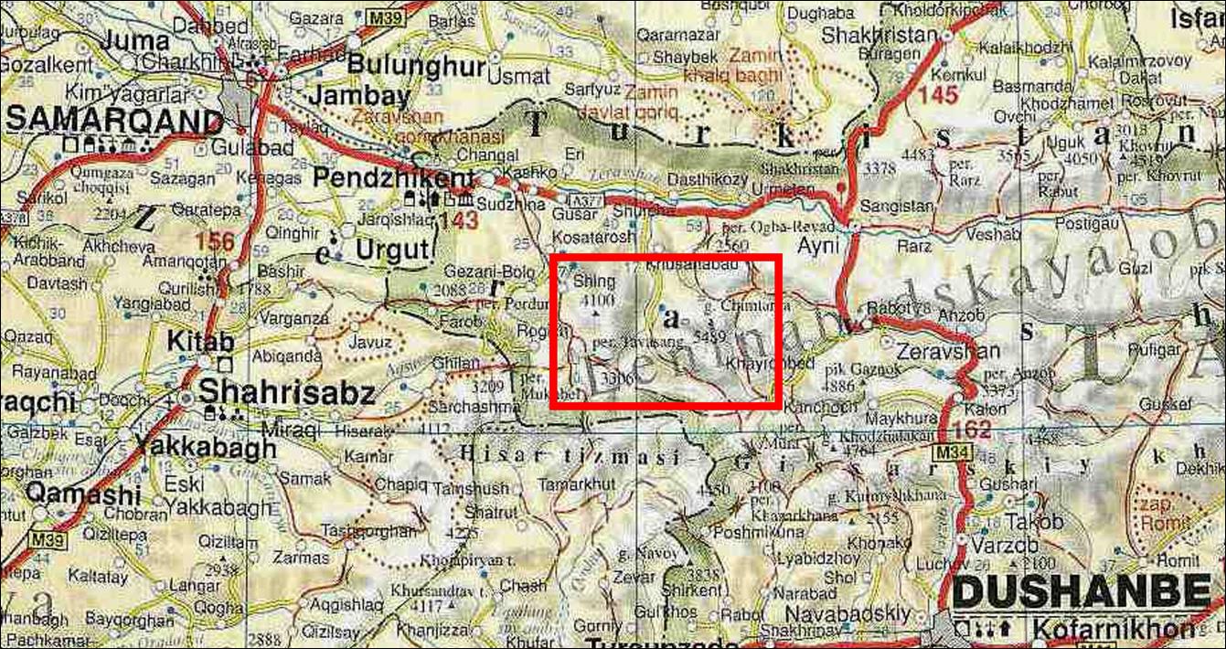
Since the Fann mountains
cover a relatively small area and we had a lot of time due to the change of
plan, we ended up zigzagging in the Fann mountains for a couple of weeks, as
shown on the map below (click here for a full-resolution map):
- Line in red dots: 2006
itinerary.
- Line in blue dots: 2004
itinerary.
- Large orange dot: Artuch mountain center (start of trek).
- Large green dot: Gazza
village (end of trek).
- Large yellow dots:
campsites.
- x (black crosses): passes.
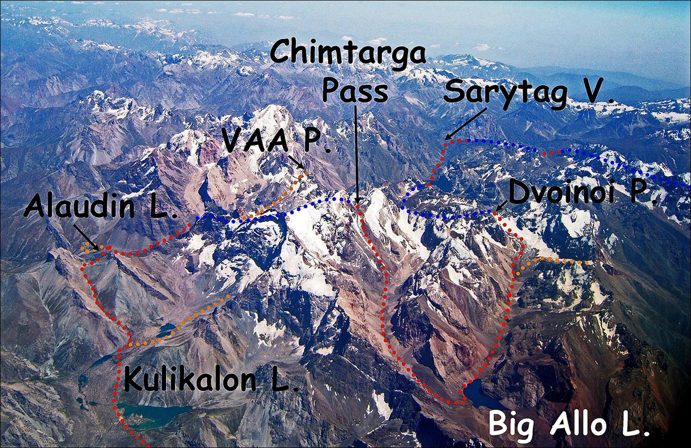
This aerial photo
(provided by Boris Karpov) covers a large portion of our trek. The lines in red
and blue dots show our main itinerary (red: visible; blue: hidden). The orange
dots show side trips. The start and finish of the trek are outside the photo.
To see photos of the trek,
click on the following links:
|
|
|
After this trek I spent a
few days in Samarkand, which I had already visited in 2004, and in Shahrisabz, near the birthplace of Amir Timur, some 80-90
km south of Samarkand. I was not expecting much from Shahrisabz,
but I was wrong. It has a number of impressive monuments, while its lively and
colorful bazaar was more interesting than the more modern bazaar of Samarkand.
See here.
Remark: The Fann mountains have recently
been "discovered" by European (mostly French) trekking agencies. The
northern part (lakes Kulikalon and Alaudin, but also Chimtarga pass and lake Big Allo)
is now visited by large groups (and their porters). This would not be a major
problem if these groups were mindful of the environment. Unfortunately, I have
seen them wash their clothes directly in the lakes using large amounts of
detergent. Their toilet paper flies all around the main camping sites and
abundant trash can be found in many areas. For some reasons trekkers in Nepal
or Morocco seem to behave more responsibly. Why?
![]()