Indonesia (December 2018): Ternate
![]()
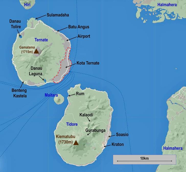
The island of Ternate consists of three
very distinct parts:
- Kota Ternate, a noisy chaotic city
(pop. over 200,000) that spreads along the southeast coast of the island,
- The interior of the island, the Gamalama cone, most of which is covered by dense forest,
- The narrow coastal area along the
quiet road circling the island.
This page contains photos taken in Kota
Ternate and of coastal sights. For photos of my ascent of Gamalama
click here.
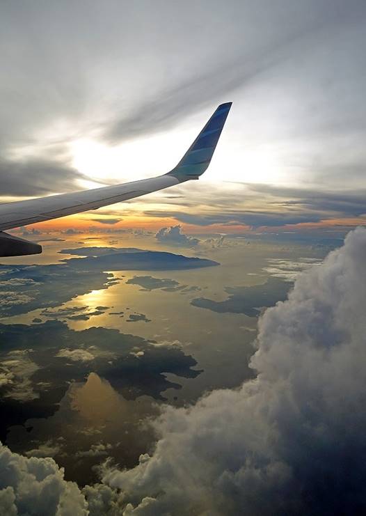
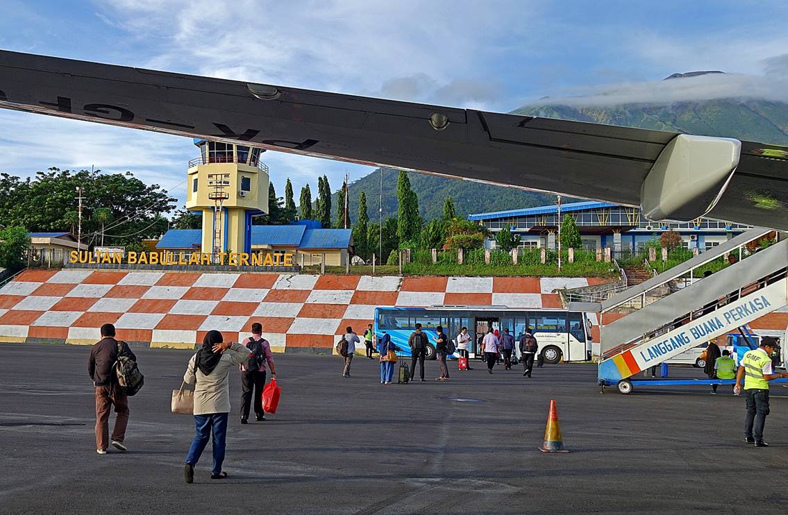
Left: Sunrise seen from the night plane
from Jakarta to Ternate, soon before reaching Ternate. Right: Arrival at the
Ternate airport with Gamalama visible in the upper
right corner of the photo.
|
|
|
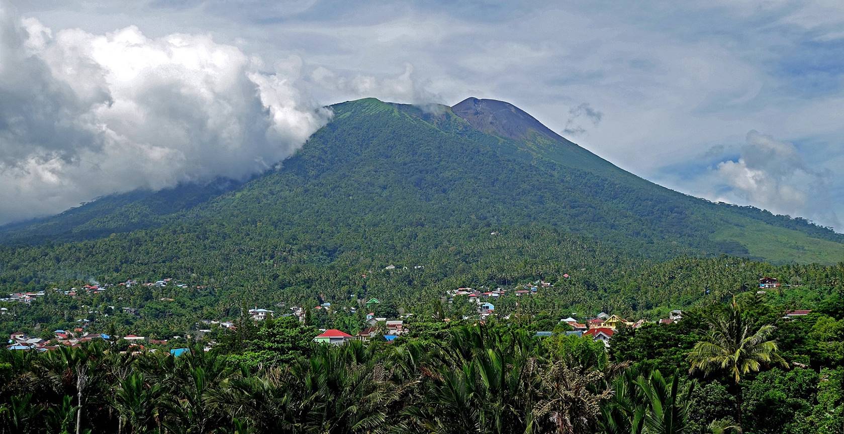
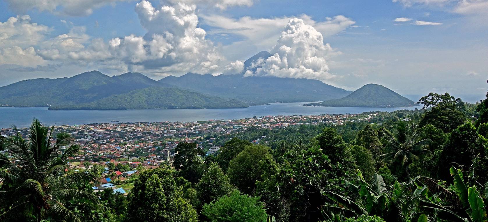
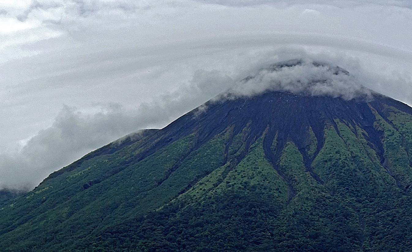
Gamalama dominates the landscape all around
Ternate. The photo below was taken from Benteng
(Fort) Tolukko in the northern part of Kota Ternate.
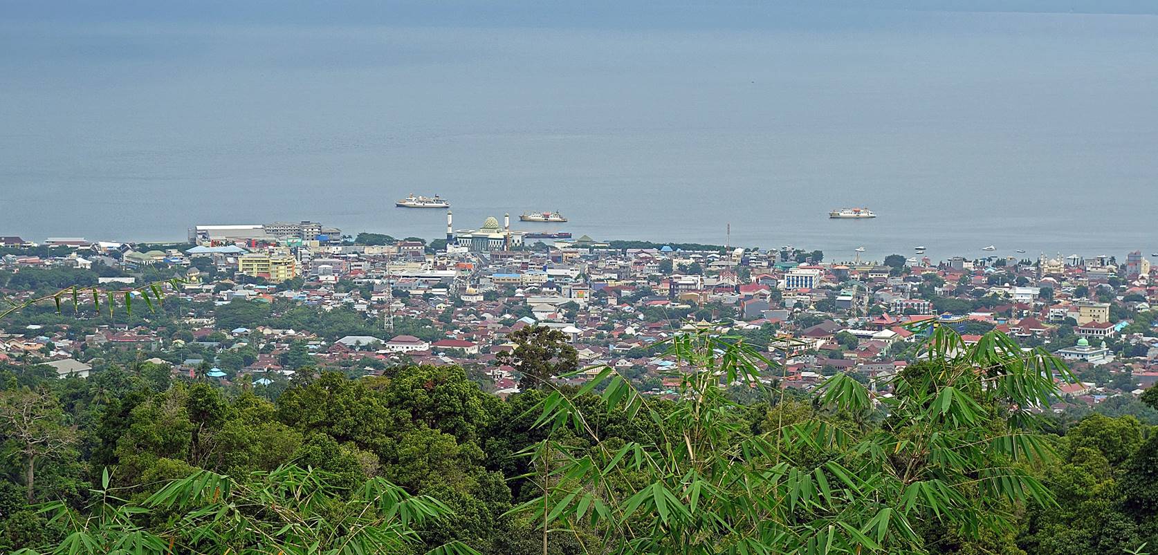
Center of Kota Ternate seen from an
overlooking slope of Gamalama. The large mosque with
two minarets near the center of the photo is the Raya Al Munawar mosque.
View of the southern part of the city,
with Tidore in the background.
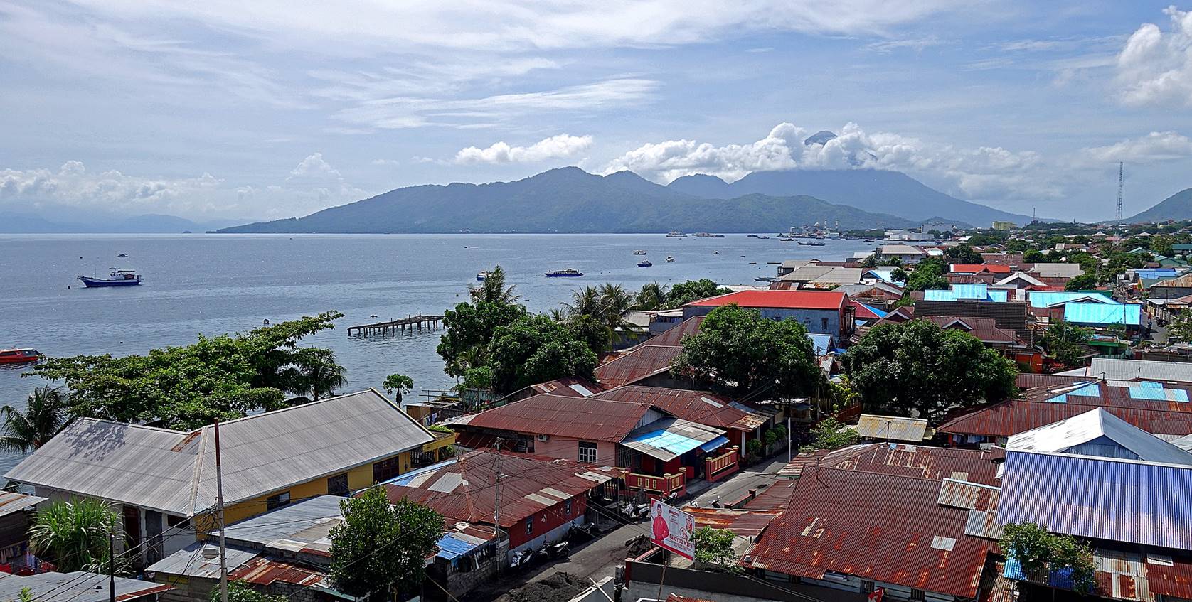
Northern part of Kota Ternate seen from Benteng Tolukko, again with Tidore in the background.
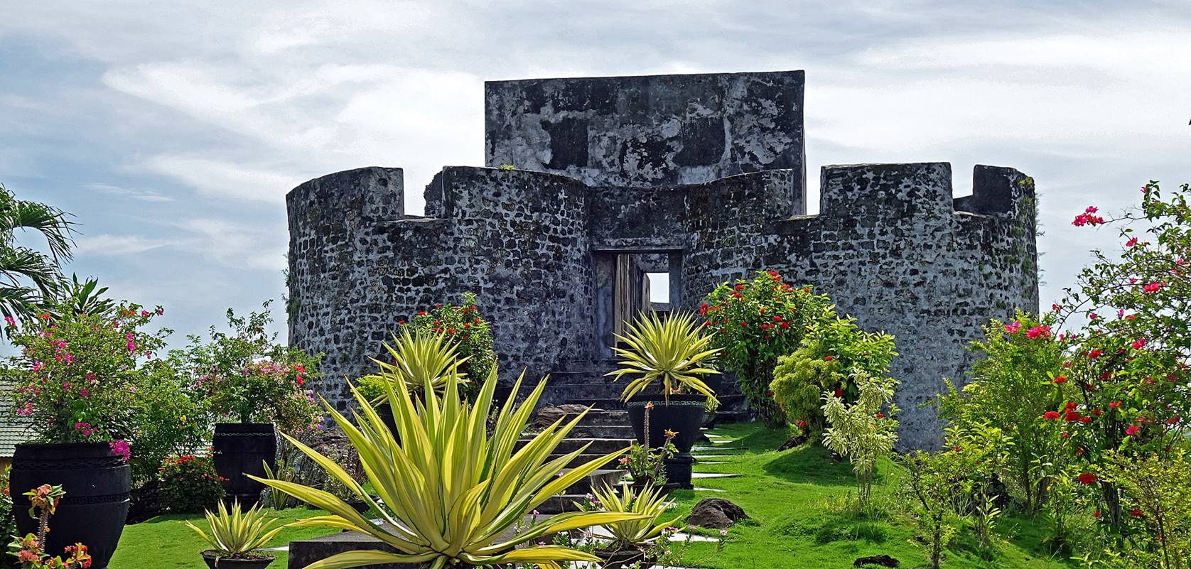
Benteng Tolukko, a Portuguese
fort built in the early 16th century, located in the northern part of present
day Kota Ternate.
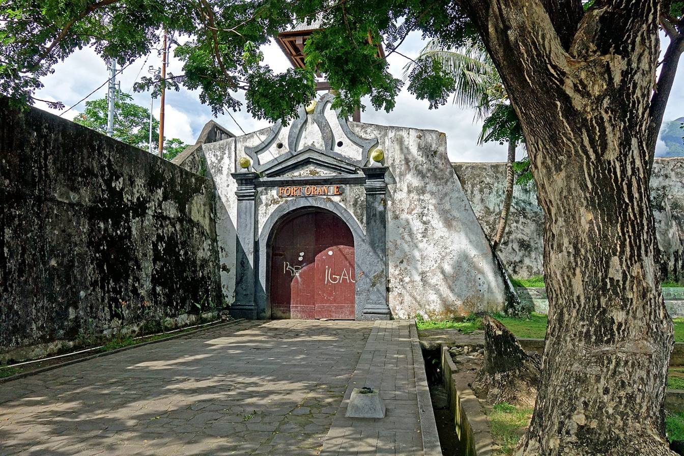
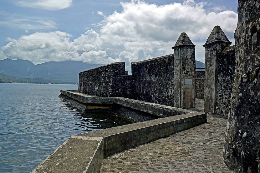
Benteng Oranje, in
central Kota Ternate, a 17th-century fort built by the Dutch soon after they
drove the Spaniards out of Ternate. Some parts are over-restored, others are
poorly maintained and littered with rubbish. For a while in the 17th century,
the fort served as headquarter of the Dutch East India Company (also known as
VOC, after its Dutch name). Part of the fort is currently used by an army
garrison and police families.
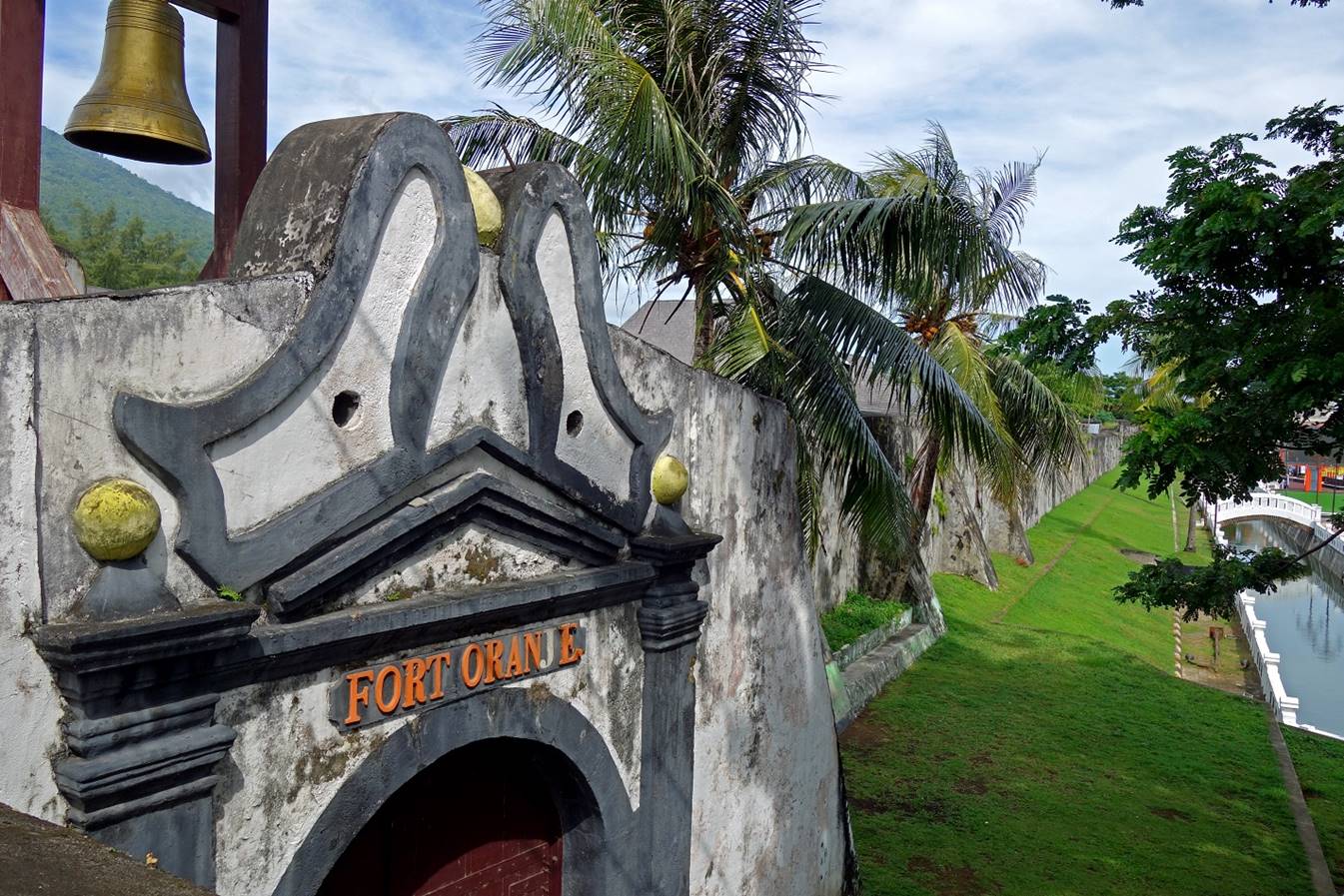
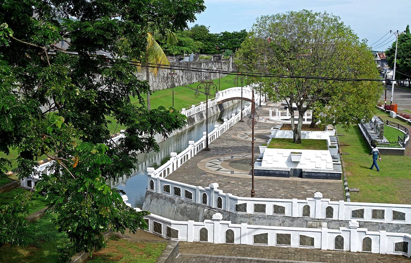
Moat and park on the east side of Benteng Oranje.
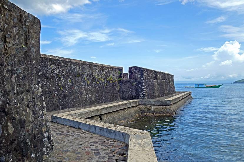
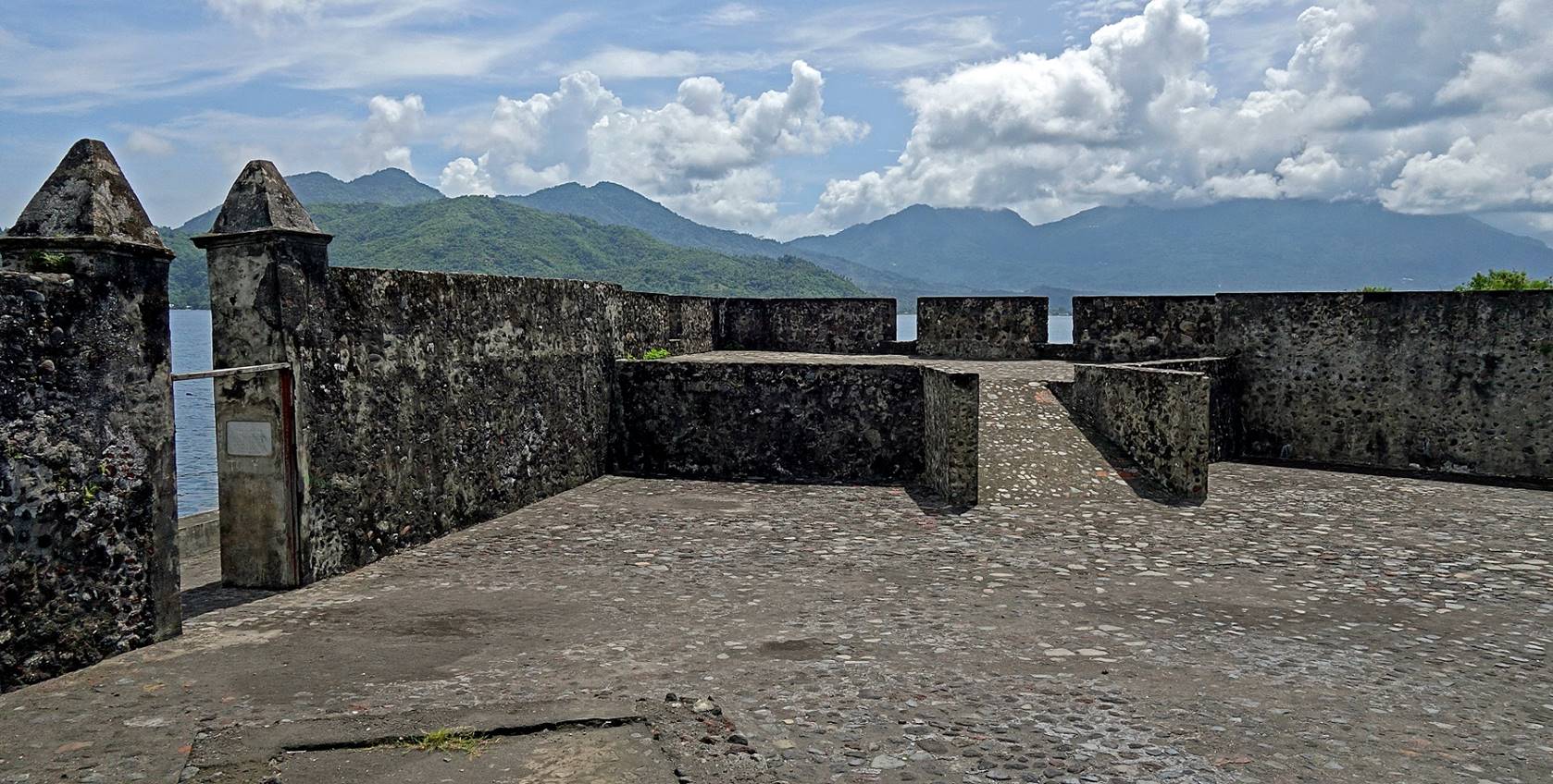
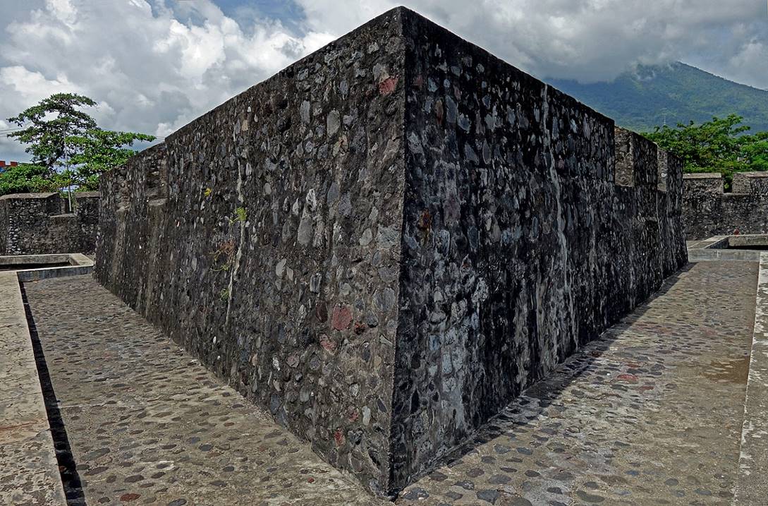
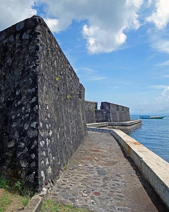
Benteng Kalamata, a star-shaped fort first built
in 1540 by the Portuguese, then rebuilt in 1610 by the Dutch. It is located in
the southern part of Kota Ternate.
|
|
|
|
|
|
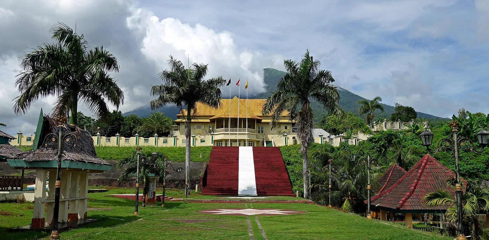
Kraton (Palace) of the Sultan of Ternate, with
Gamalama visible in the background.
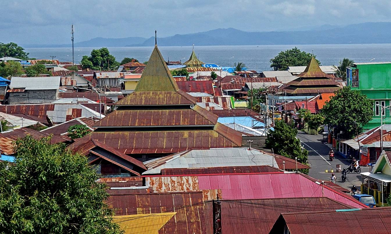
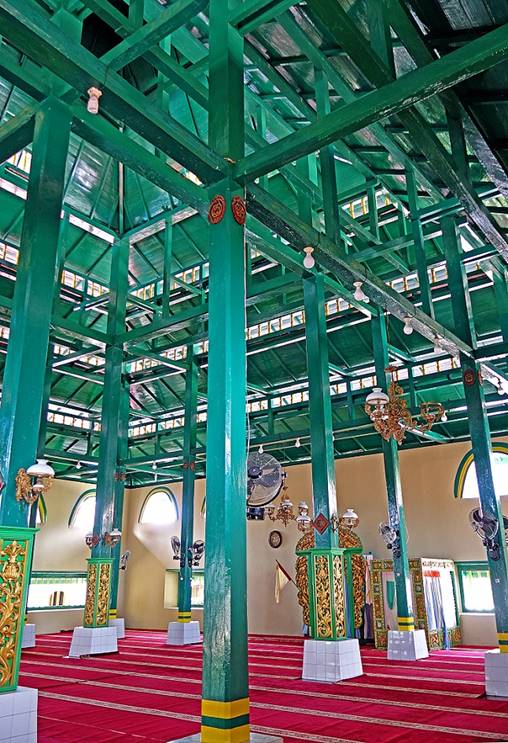
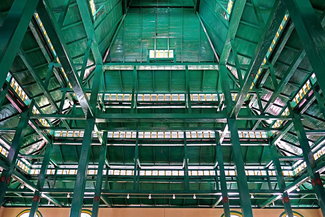
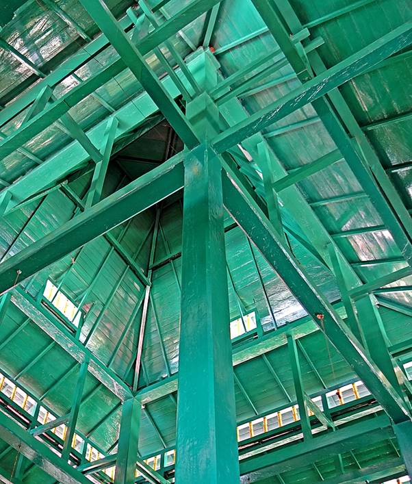
Most mosques in Ternate have a
multi-layered square pyramidal shape with corrugated tin roofs, as shown below.
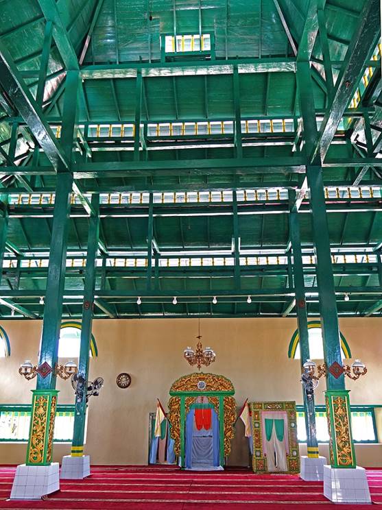
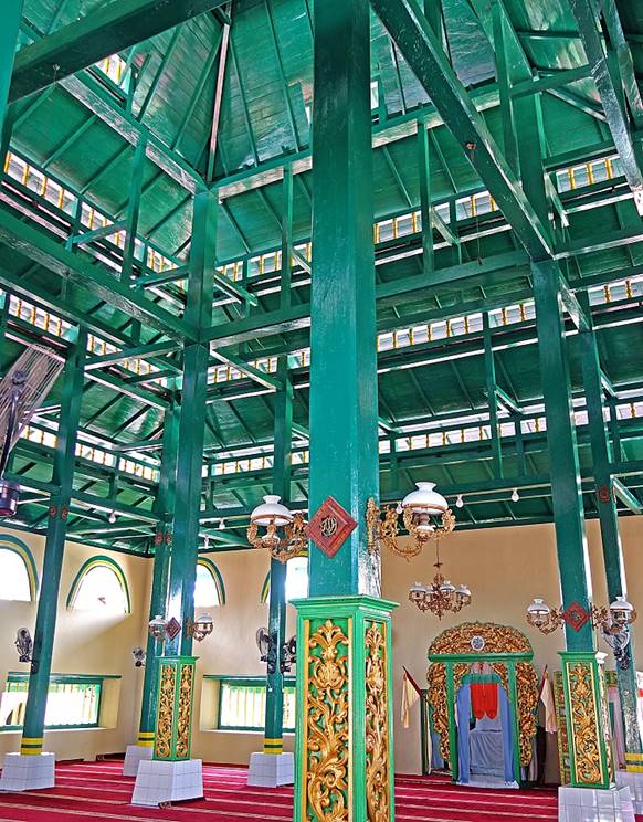
The most famous of these mosques is the
Sultan′s Mosque (Masjid Sultan). The mosque′s exterior is not
particularly interesting, but its interior is remarkable for its impressive and
elegant timber work.
|
|
|
|
|
|
|
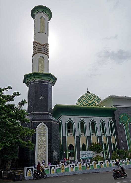
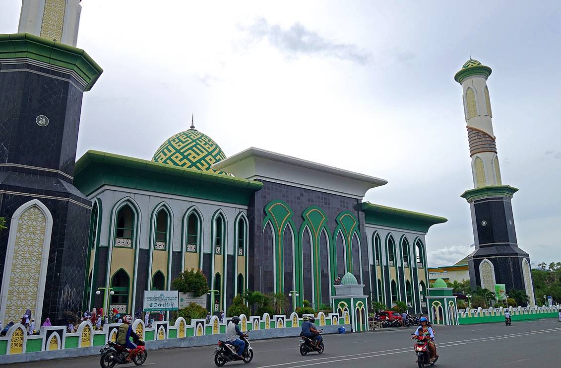
The Raya Al Munawar mosque, the largest
mosque in Ternate, built between 2003 and 2010 next to the sea. Modern, huge
(it can accommodate 15,000 worshipers), but beautiful?
|
|
|
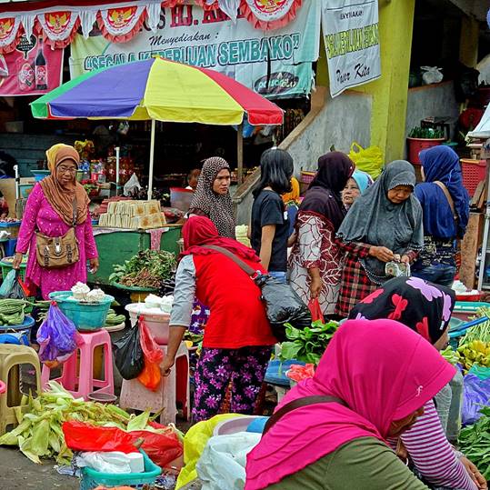
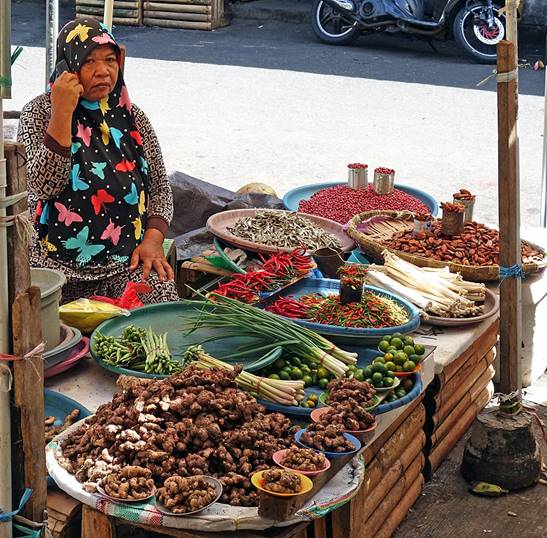
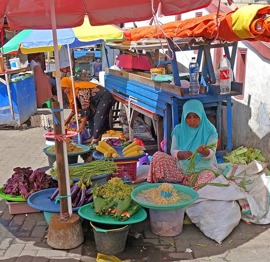
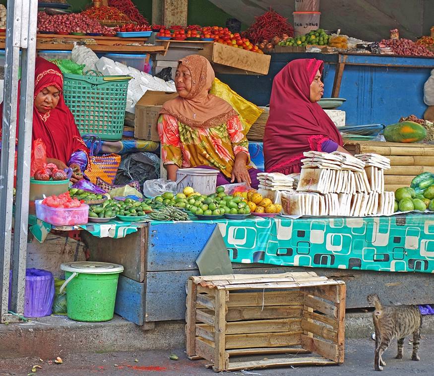
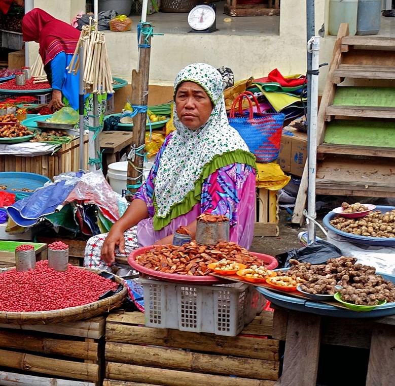
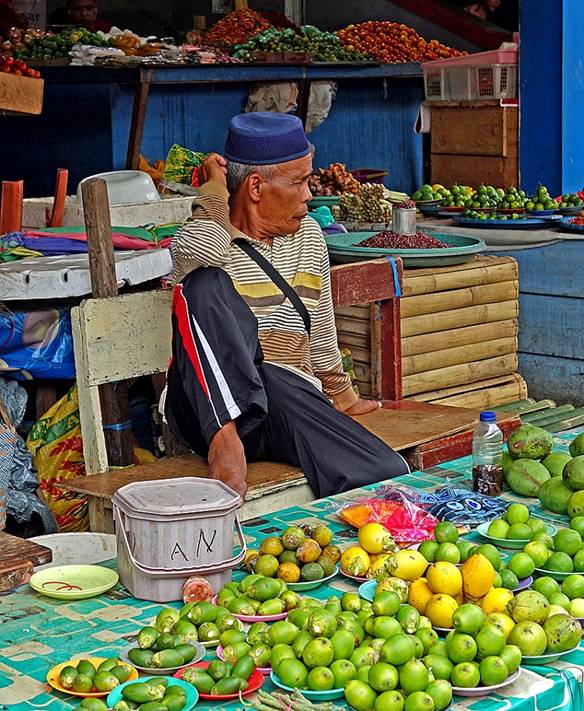
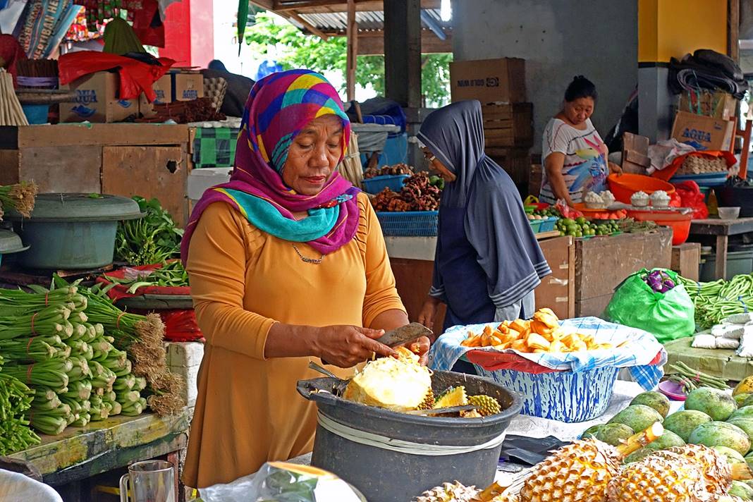
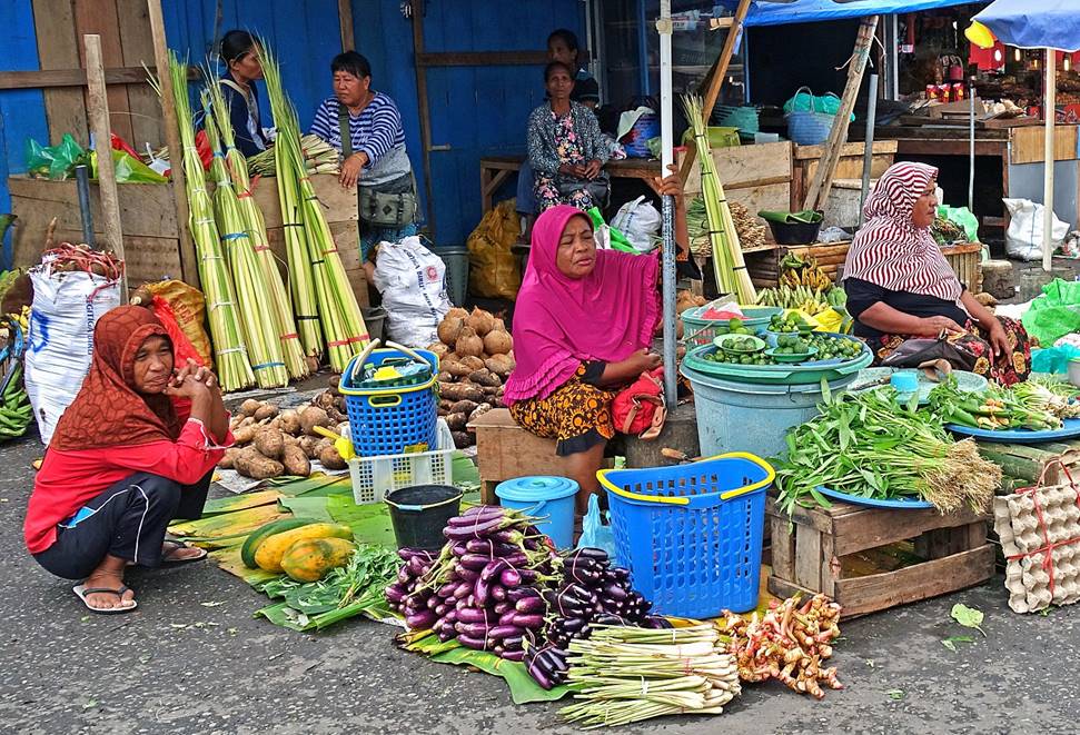
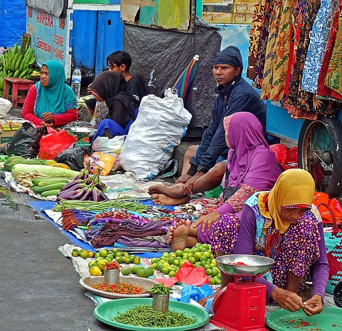
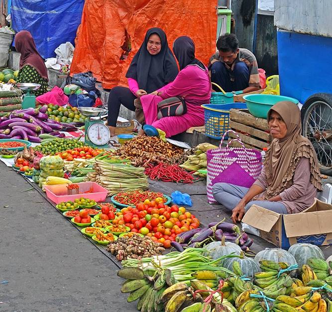
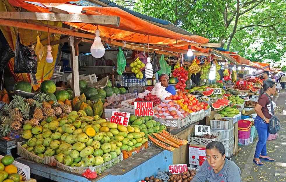
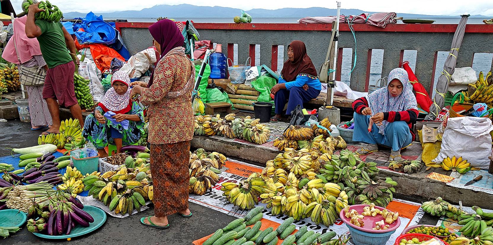
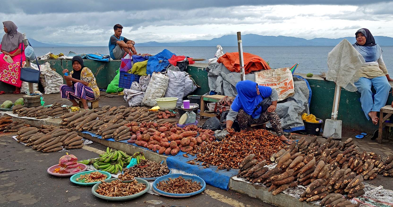
Just north of the Raya Al Munawar mosque
lies a large market area. The area is busy all day long.
Fruit and vegetable stalls.
|
|
|
|
|
|
|
|
|
|
|
|
|
|
|
|
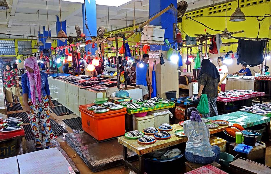
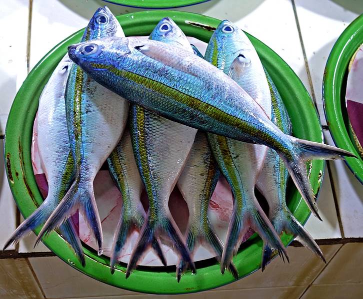
Fresh fish market.
|
|
|
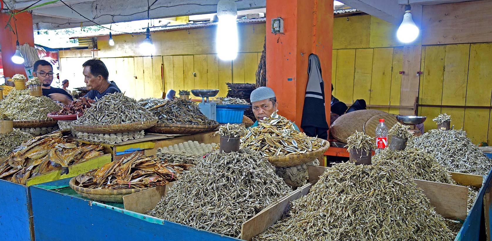
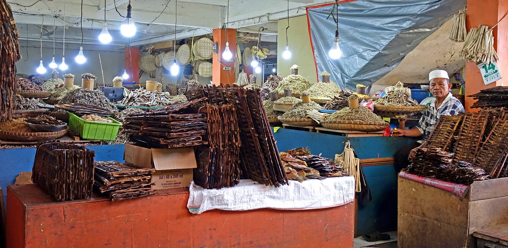
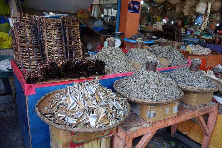
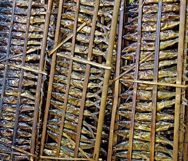
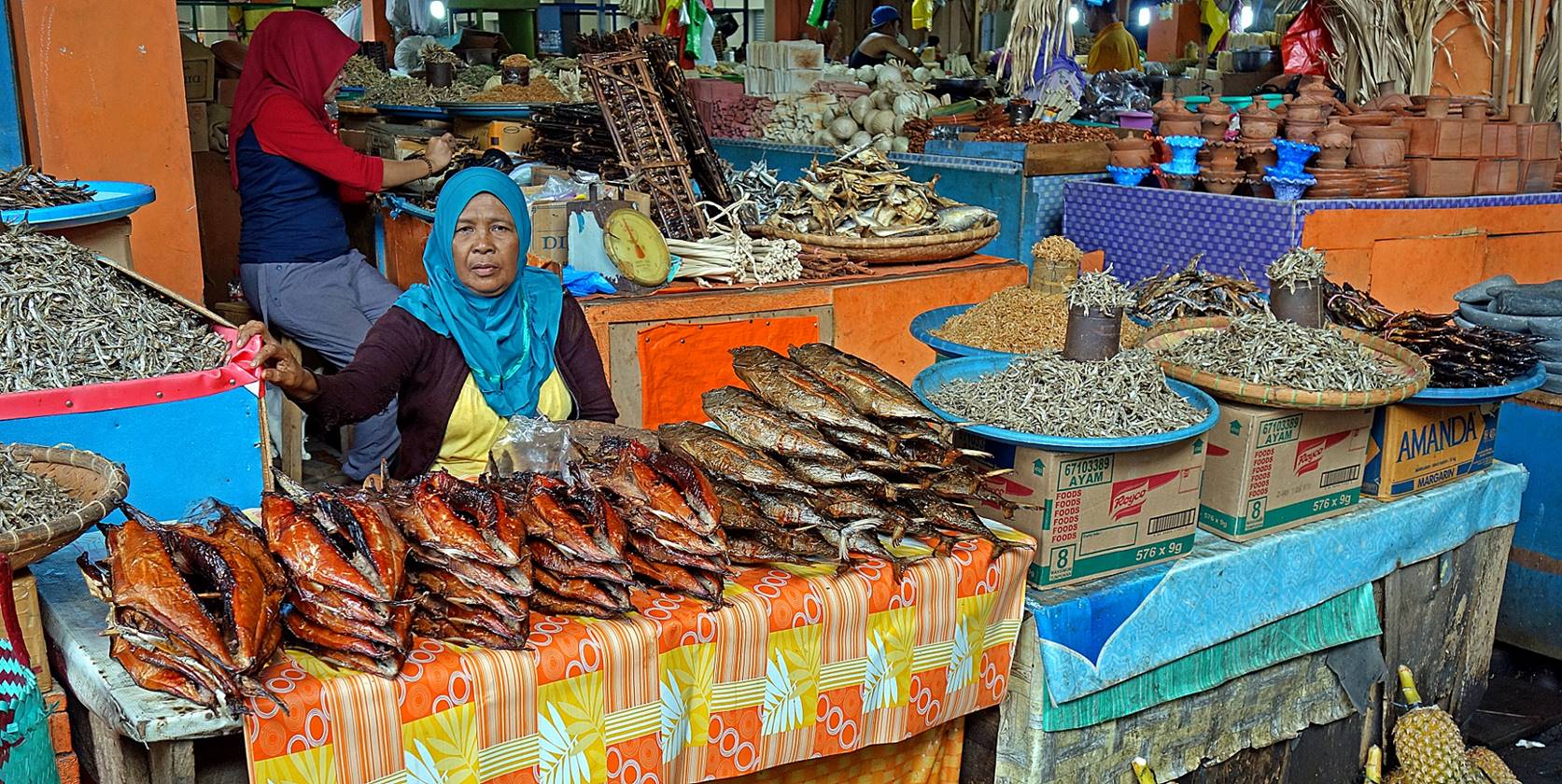
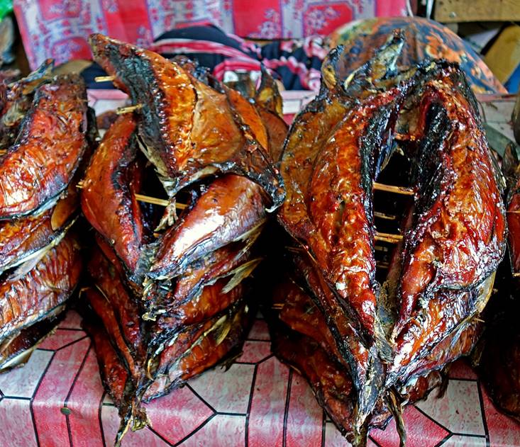
Dried fish market.
|
|
|
|
|
|

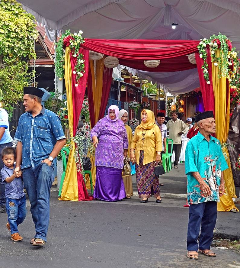
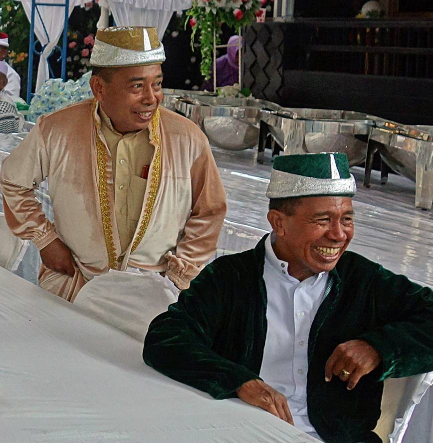
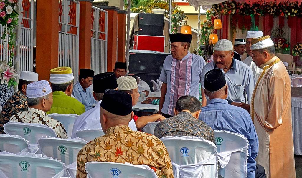
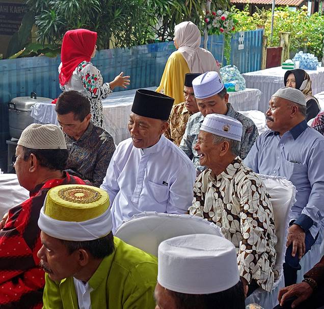
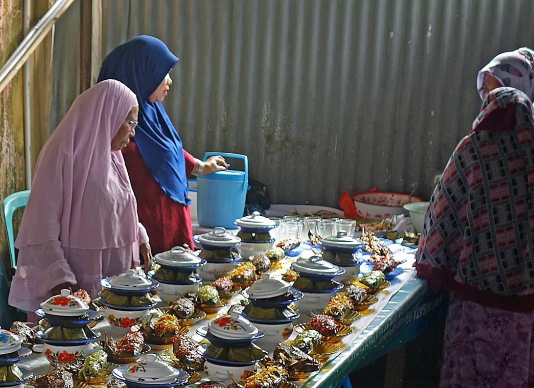
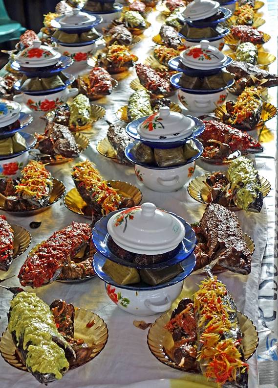
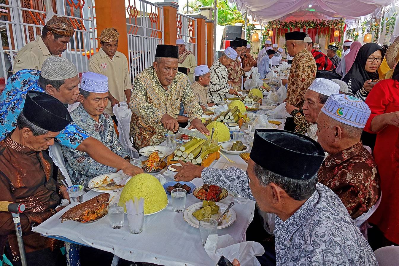
A wedding in Kota Ternate. Like in many
other places around the world, food is a major element of the event.
|
|
|
|
|
|
|
|
|

A few sights along the road circling the
island (in counterclockwise order):
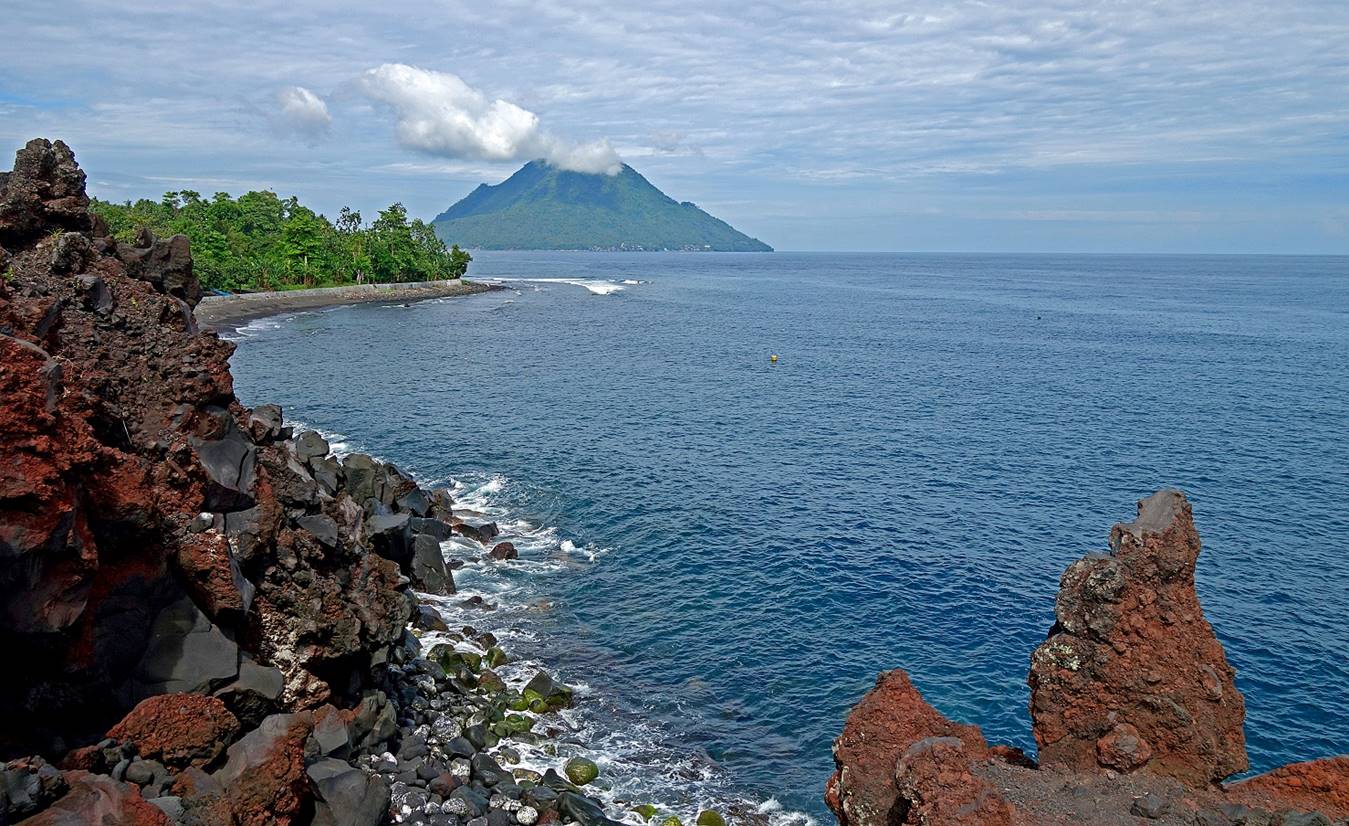
- The small Hiri island (another
volcano) seen from Batu Angus. Batu Angus is a place on the northeast coast of Ternate
covered by dried lava brought by the 1673 eruption of Gamalama.
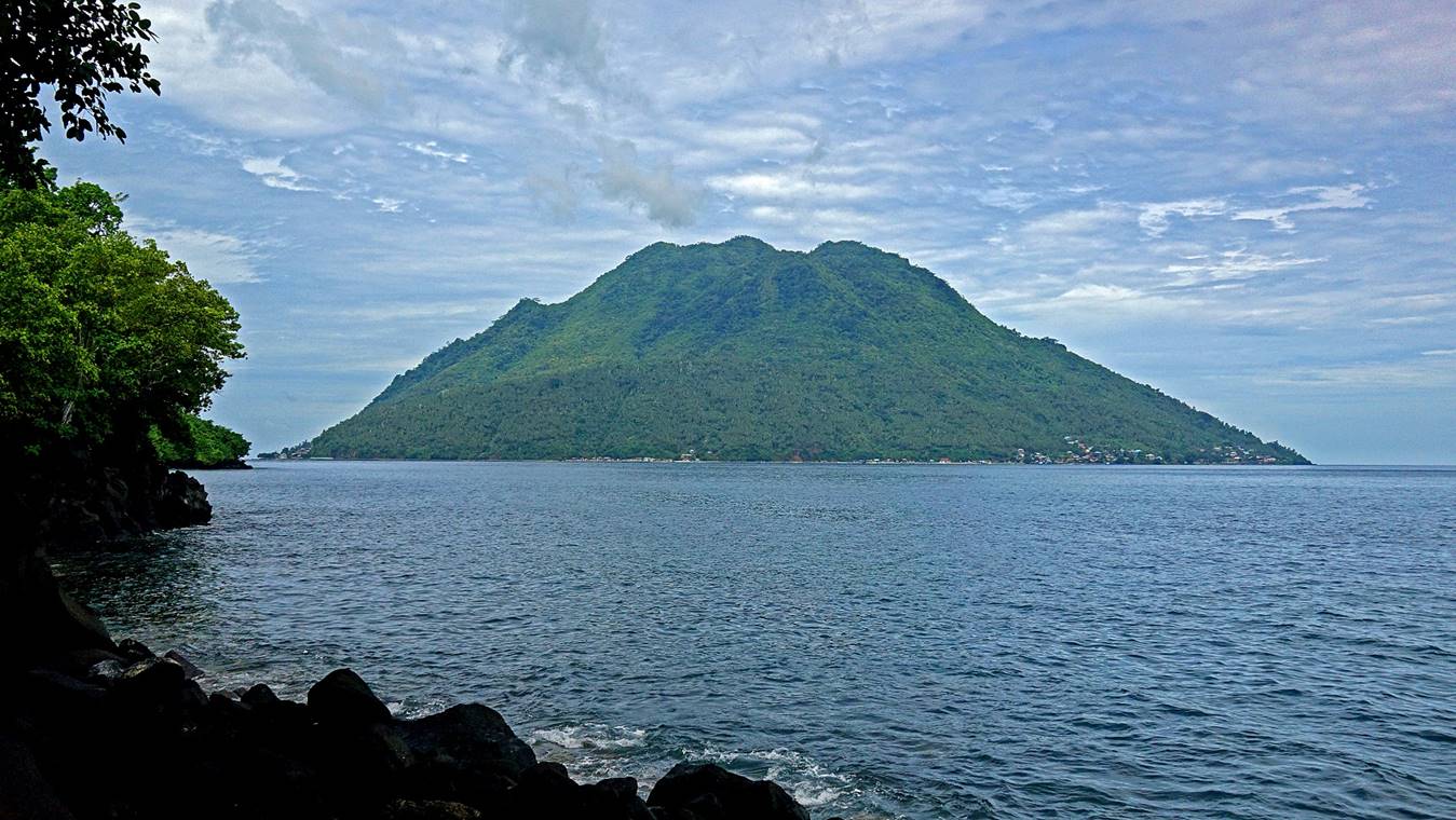
- Another view of Hiri, here seen from Sulamadaha, the place where public boats make the crossing
between Ternate and Hiri.
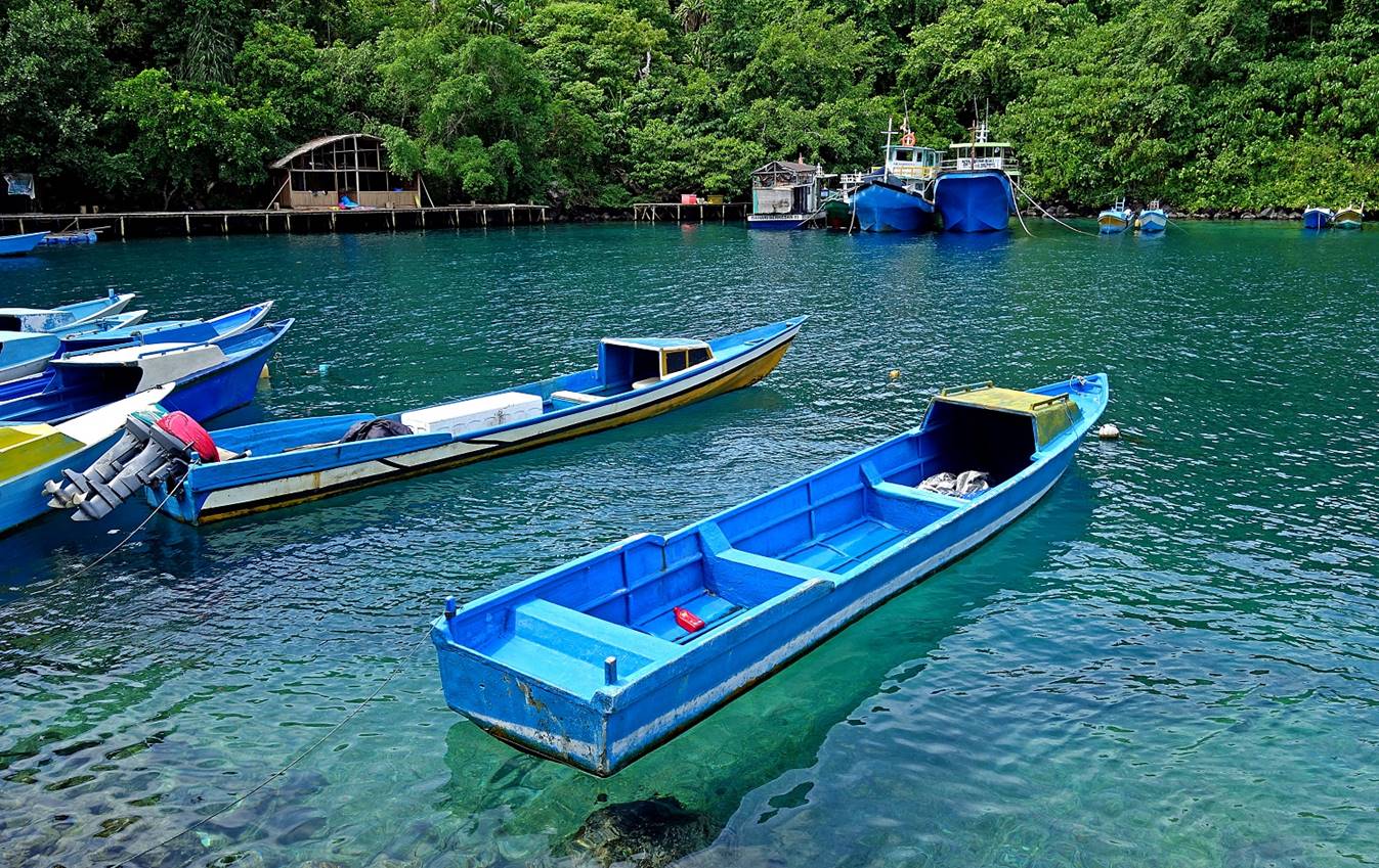
- The cove at Sulamadaha
that serves as a small port for the boats making the crossing.
- View of the north slope of Gamalama seen from the road soon after leaving Sulamadaha.
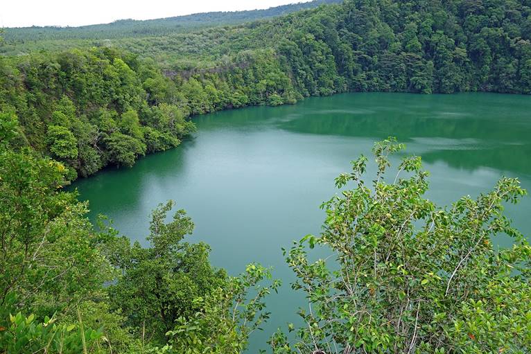
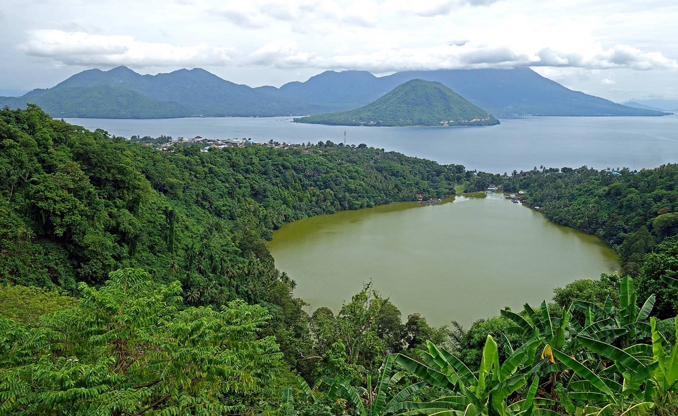
Danau (lake) Tolire, a crater lake
located in northwest Ternate at the foot of Gamalama.
The lake, which covers an area of 5 hectares with a depth of up to 50 meters,
is surrounded by dense forest and bordered by vertical cliffs. Its gloomy
greenish water is said to host a large population of crocodiles and fishes.
|
|
|
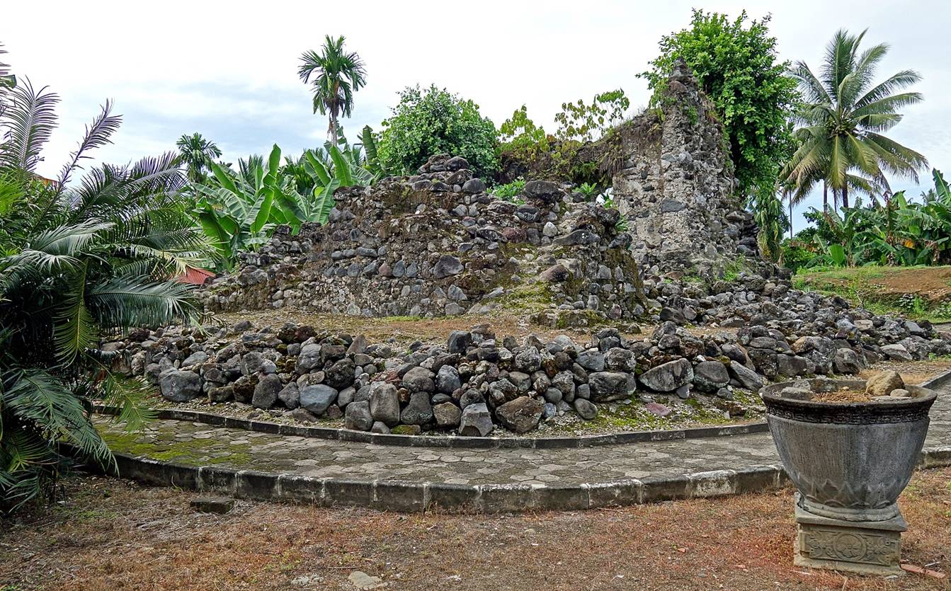
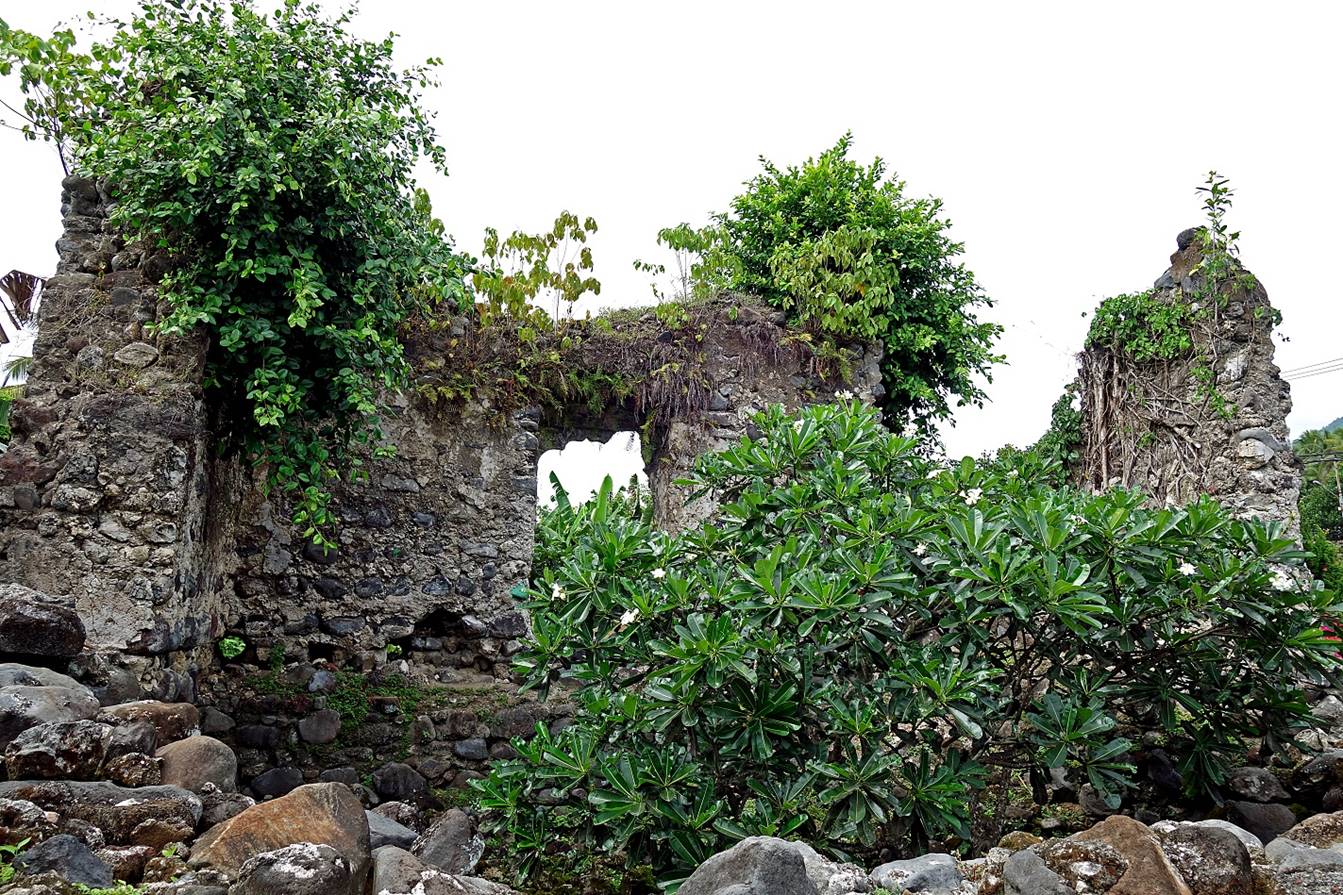
- Benteng Kastela, located on the southwest coast of Ternate. Built
by the Portuguese in 1522 it was the earliest colonial fort constructed in the
Maluku islands. Today only some ruins remain.
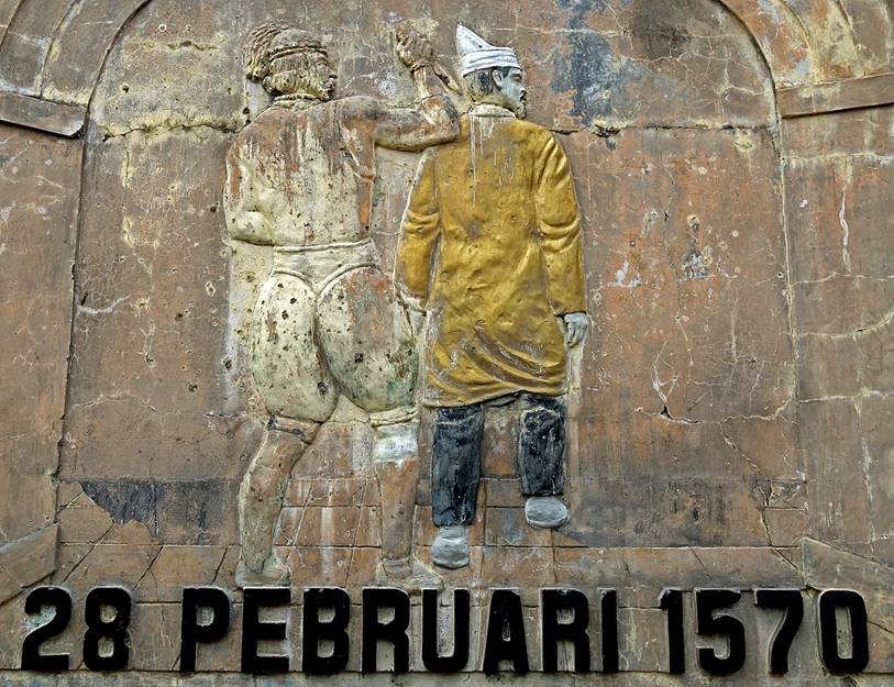
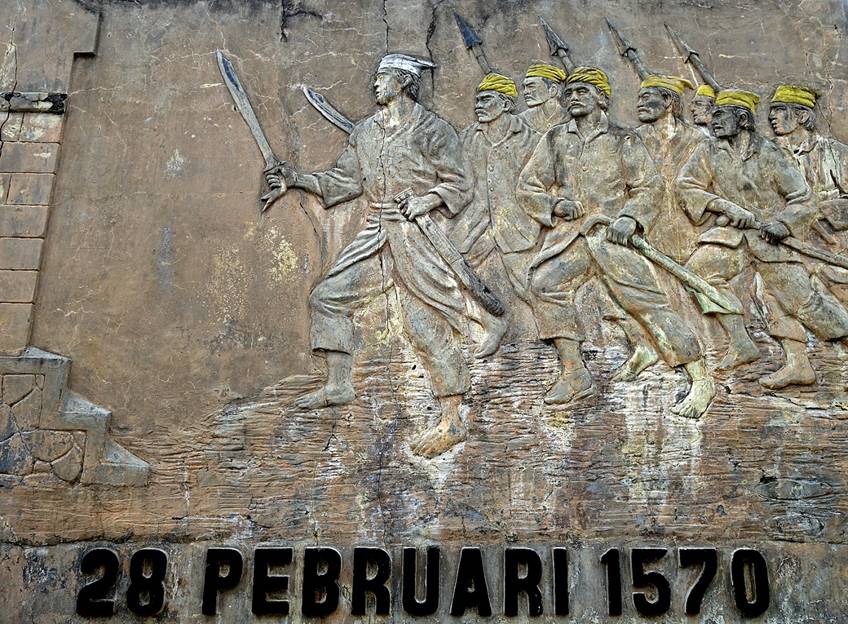
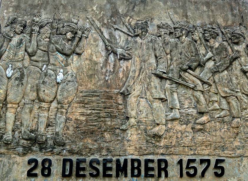
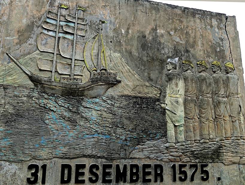
- A four-sided monument on the site of Benteng Kastela relates the events
that led to the departure of the Portuguese: after killing Ternate′s
Sultan Hairun in 1570, the Portuguese were besieged
in the fort by forces of the new Sultan Baad for five years and eventually left
Ternate (to Ambon) in 1575.
|
|
|
|
|
|
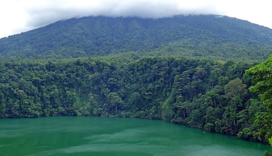
- View over Danau Laguna, with Maitara and Tidore across the
straight in the background.
![]()