Nepal (October 2017): Simikot to Kolti via Mount Saipal
1. Simikot to Chala
![]()
Return to main Nepal 2017 webpage
Dawa#1, Ang Karma and I flew to Nepalgunj, the ″hub″ toward most mountain airports in western Nepal, on the day immediately after my arrival in Kathmandu. In Nepalgunj we met Dawa#2, who had already brought most of our gear and food by bus. We spent a night in a lodge near Nepalgunj′s airport and flew to Simikot on the following morning. After a night in Simikot, we started trekking. We first followed the trail along the northern side of Humla Kanali Nadi (river) that connects Simikot to Hilsa (the last Nepali village on the Tibetan border). Before reaching Yalban, we left this trail and turned south, crossed Humla Kanali Nadi, and followed a trail leading to Chala, a beautiful traditional village.
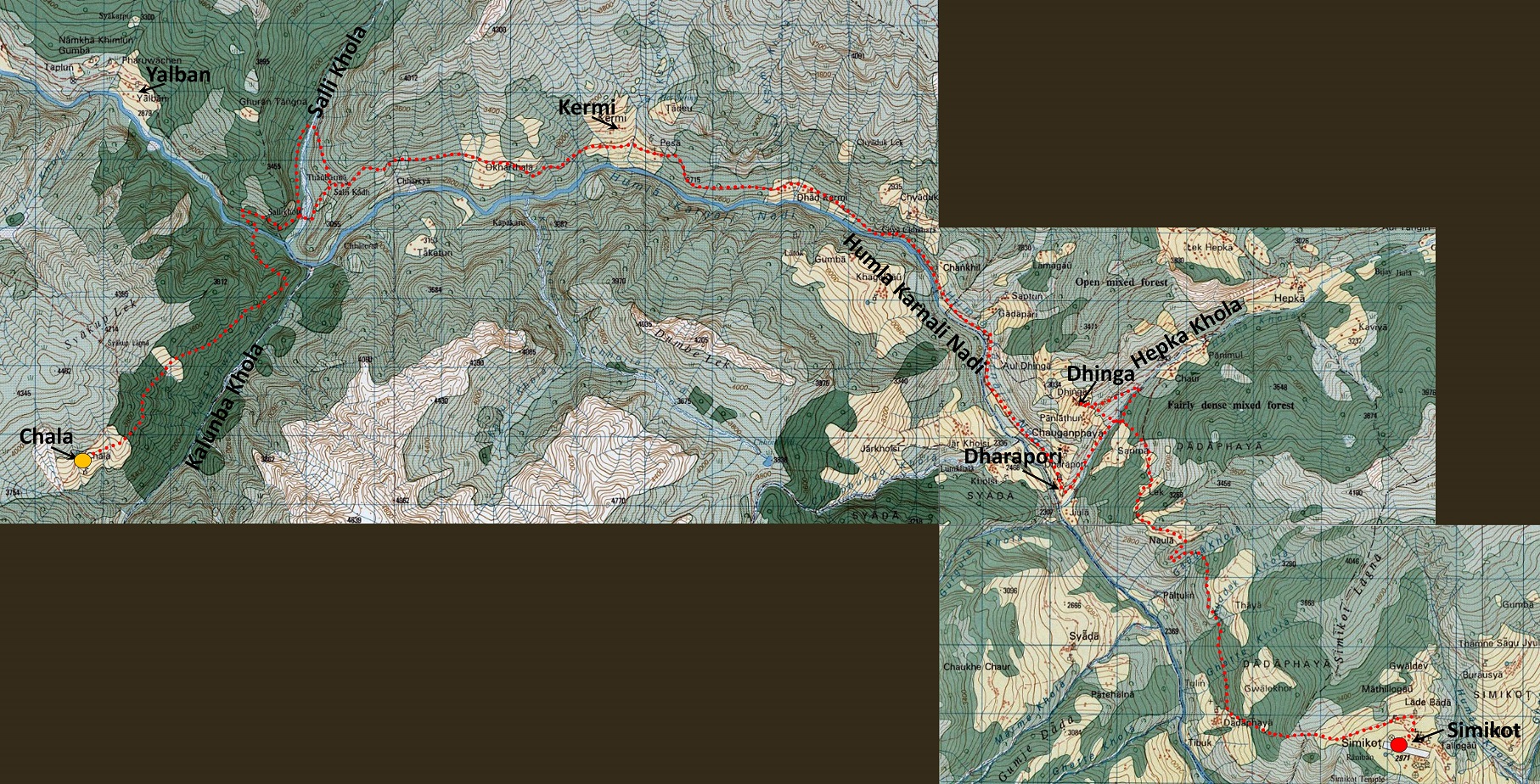
Map: The itinerary of this section of the trek is shown in red dotted line in the topographic map below. The two small loops near Hepka Khola and Salli Khola correspond to side-trips. Consecutive blue vertical and horizontal lines are spaced by 1km.
(Reminder: These 50K topographic maps are available in their entirety at https://jemecasseausoleil.blogspot.fr/2017/07/cartes-du-nepal.html.)
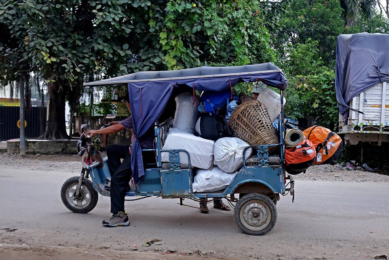
Rickshaw carrying our bags to the airport. It is amazing how much load such a small vehicle can carry.
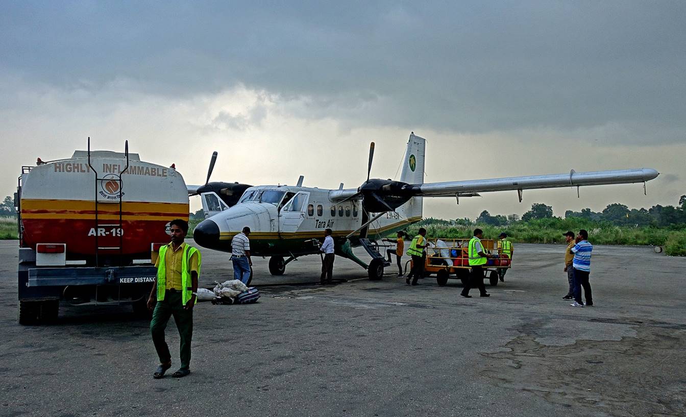
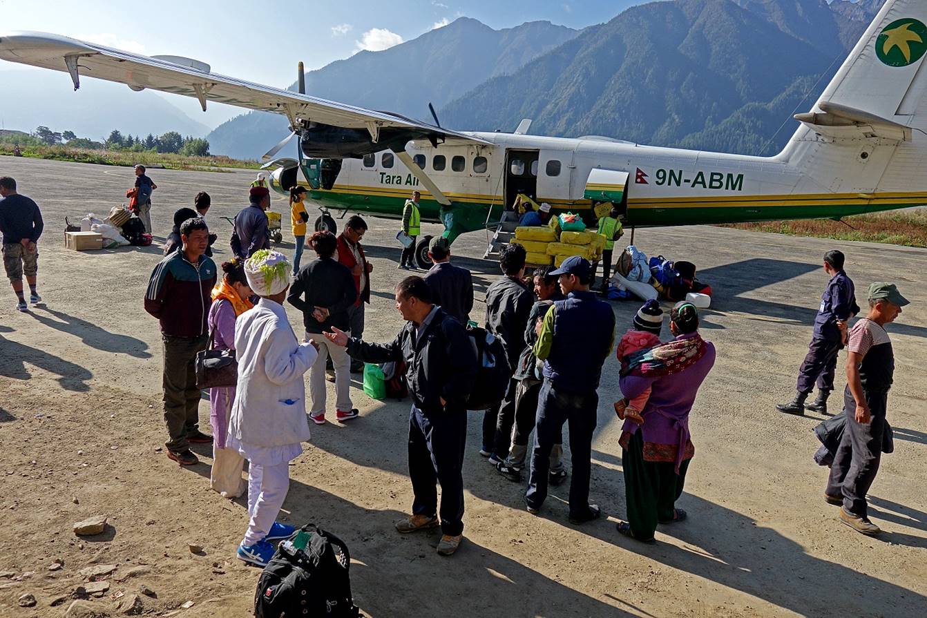
Loading and refueling our plane in Nepalgunj′s airport.
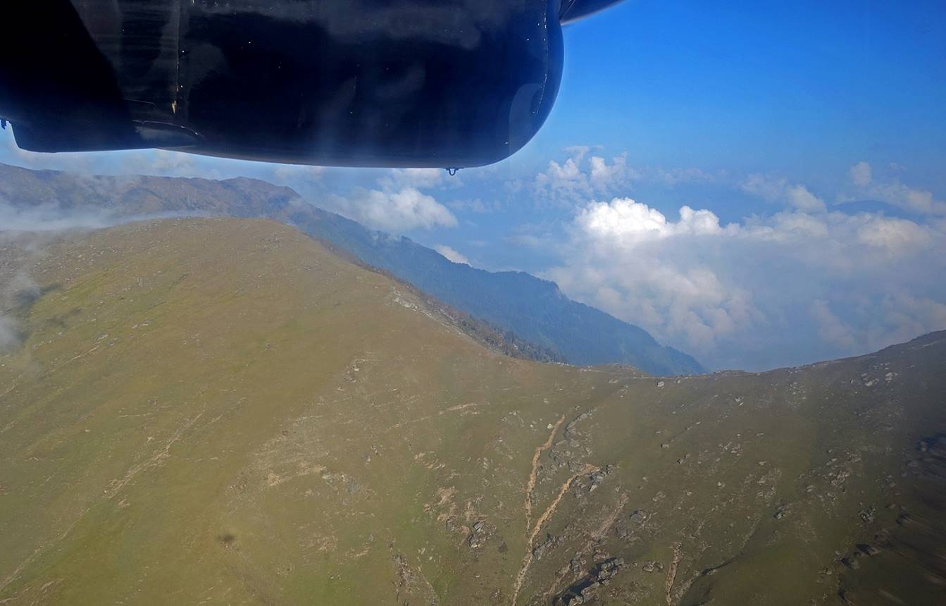
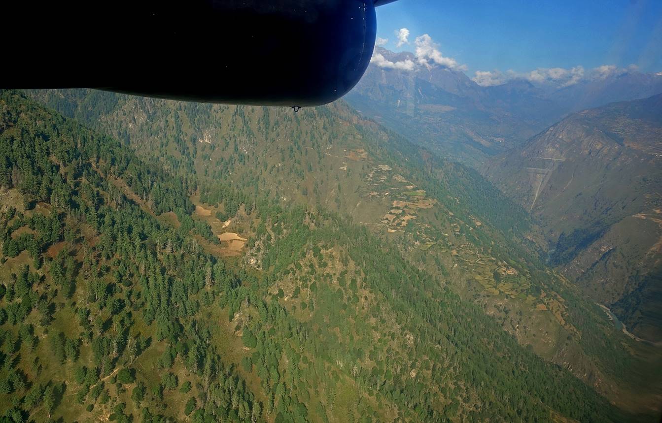
Views during the flight to Simikot. For most of the flight, the plane follows Karnali Khola between two mountain ranges.
Arrival in Simikot. The Dashain festival was being celebrated across Nepal. The man in white was dressed appropriately for this festival.
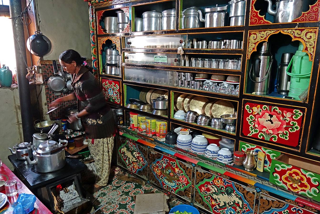
Well-furnished kitchen of our lodge in Simikot.
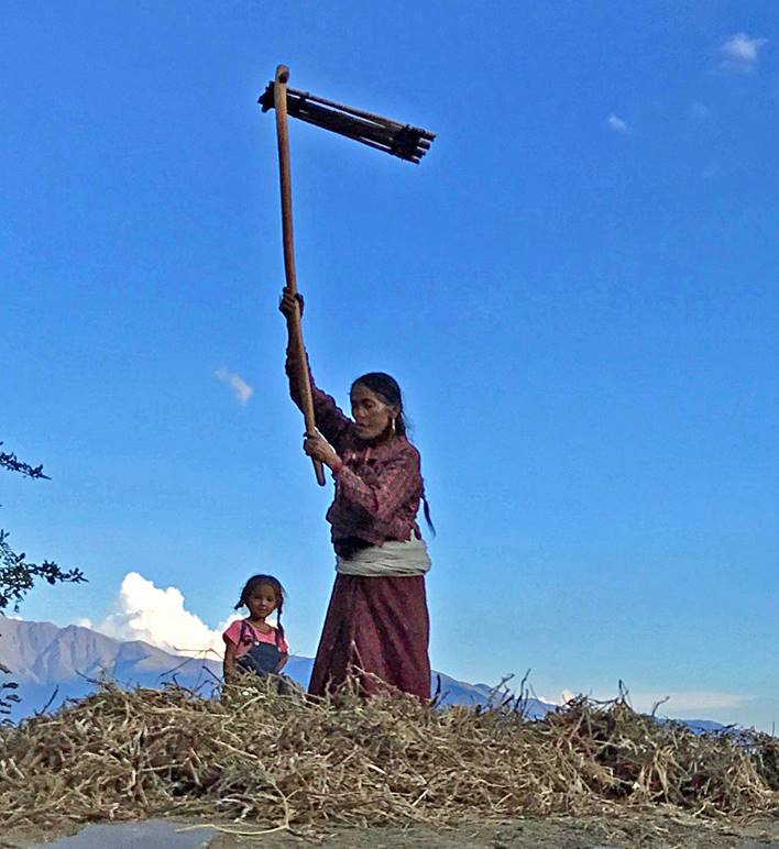
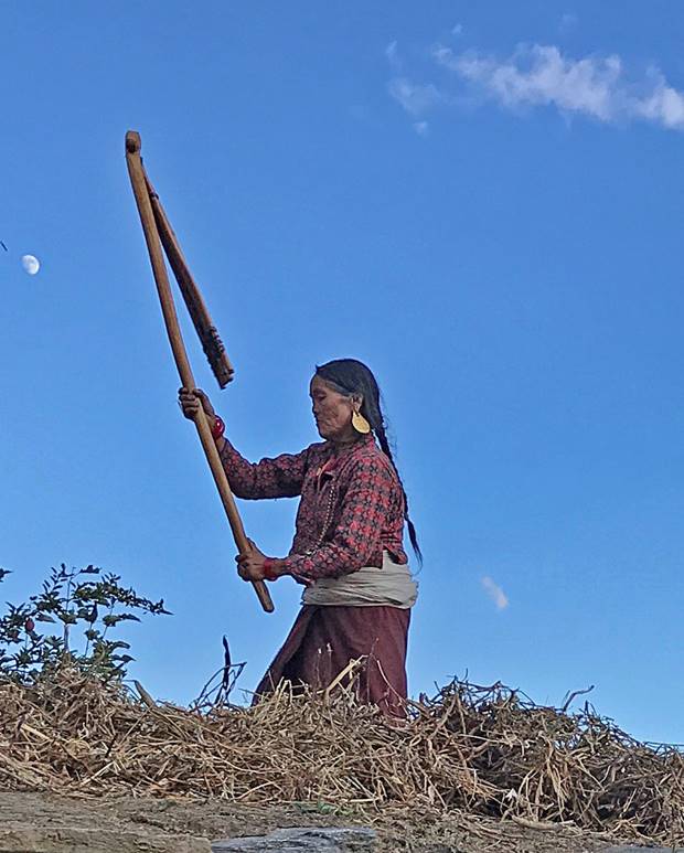
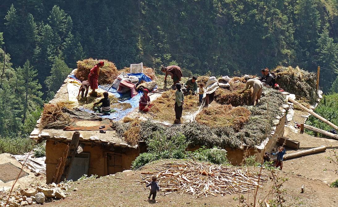
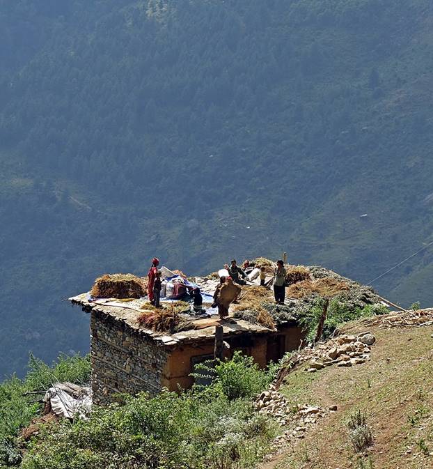
Woman using a flail to separate grains from husks on a rooftop. (Photo by Ang Karma)
|
|
|
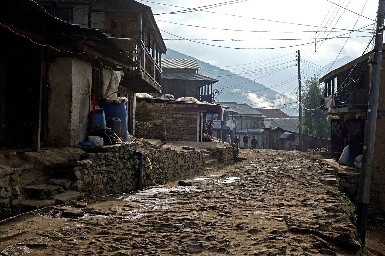
Main street of Simikot in the early morning.
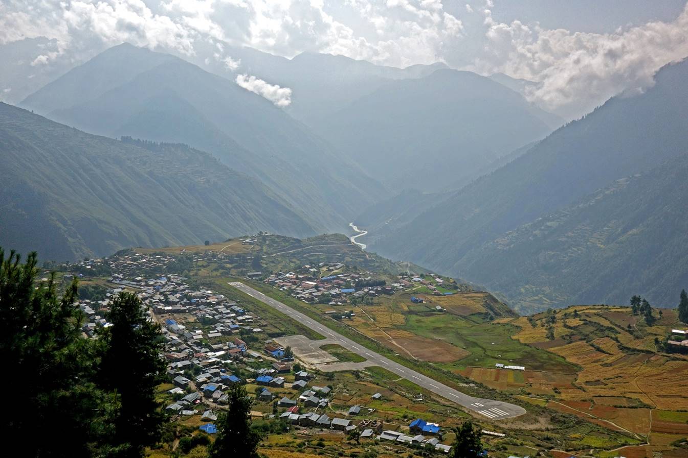
Simikot and its airport seen from the trail toward Dharapori.
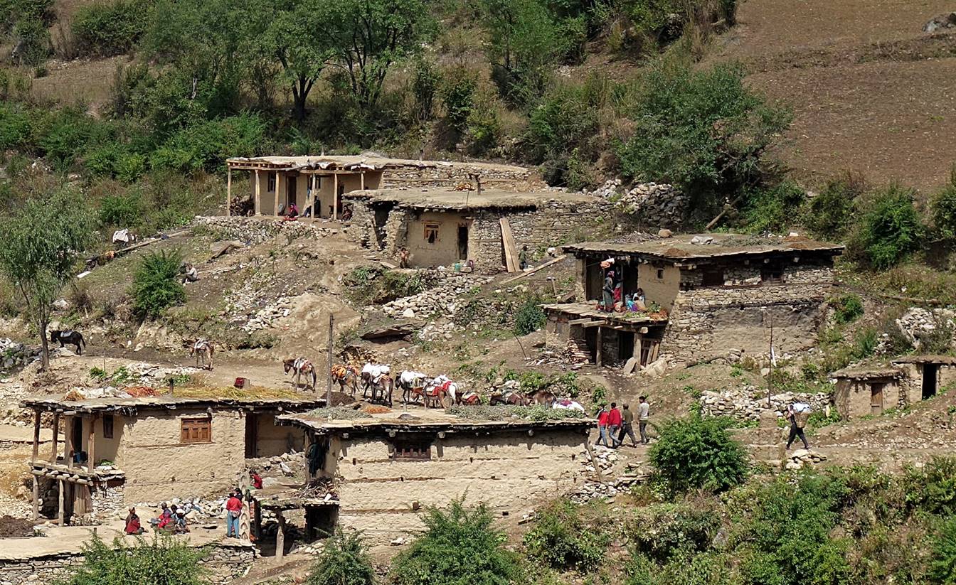
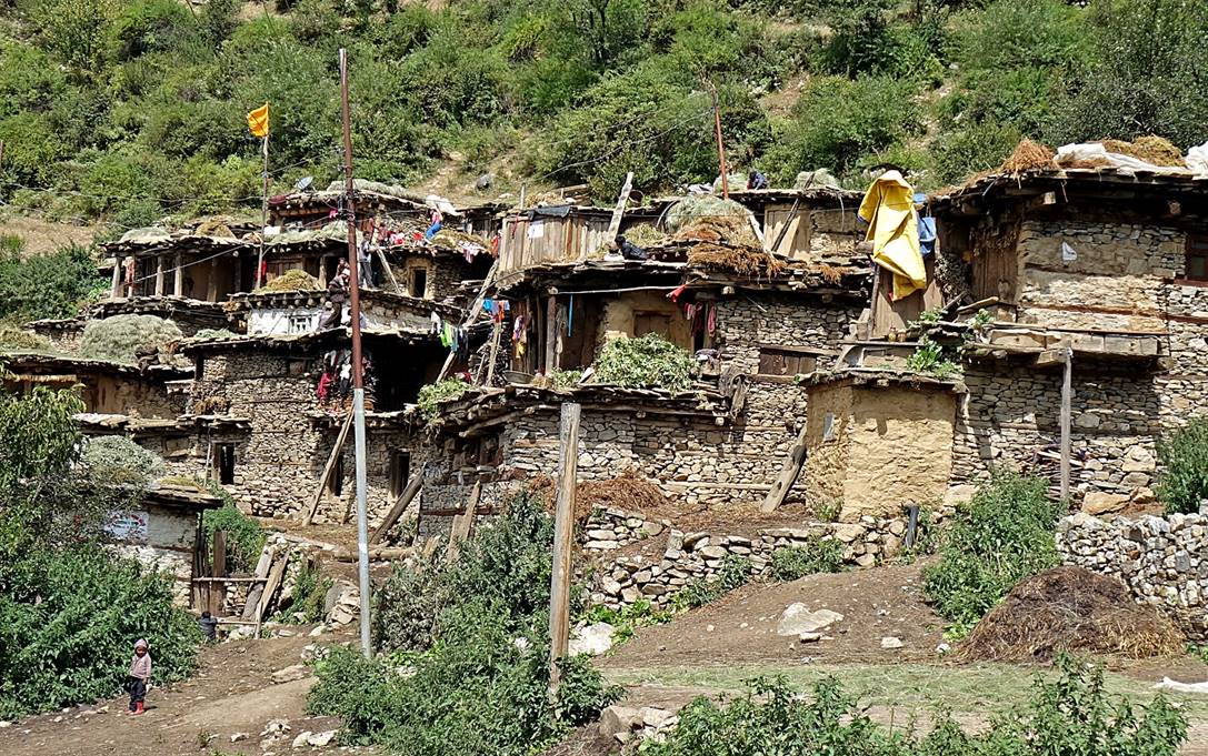
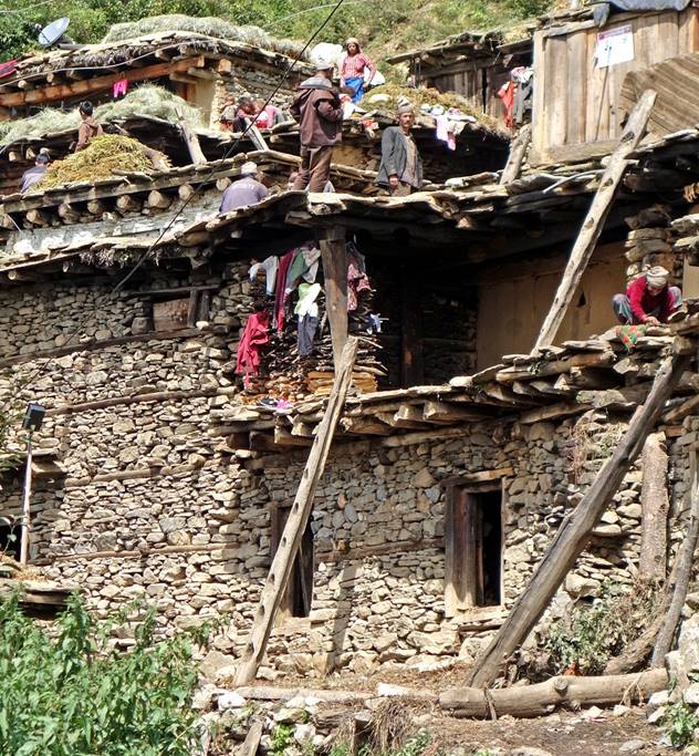
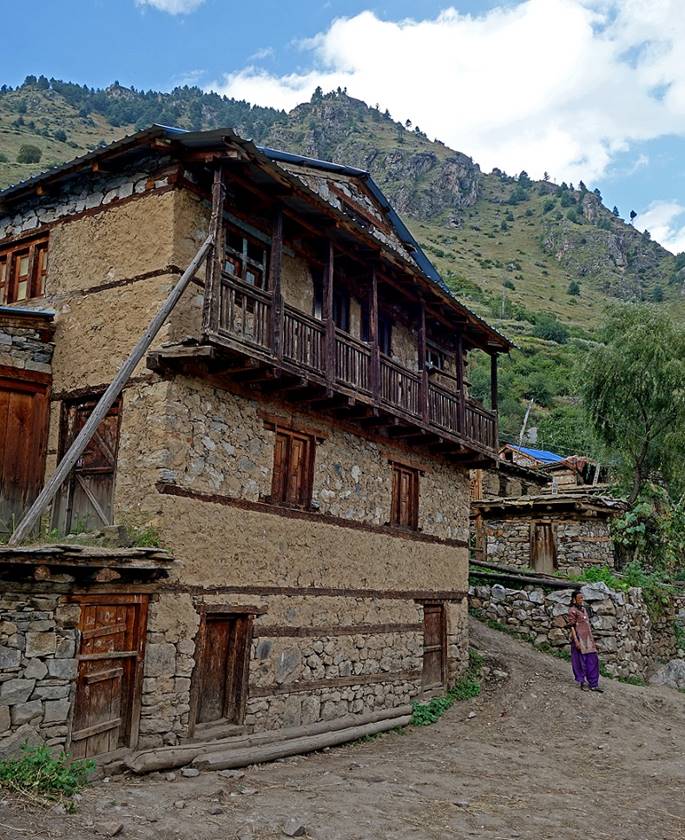
Villages and houses along the trail between Simikot and Dhinga.
|
|
|
|
|
|
|
|
|
We set our first camp near this water fountain below the village of Dhinga (located 200m higher)
Views of the Hepka Khola valley from our camp, looking toward the north-east in the first photo below and toward the south-west in the second and third photos.
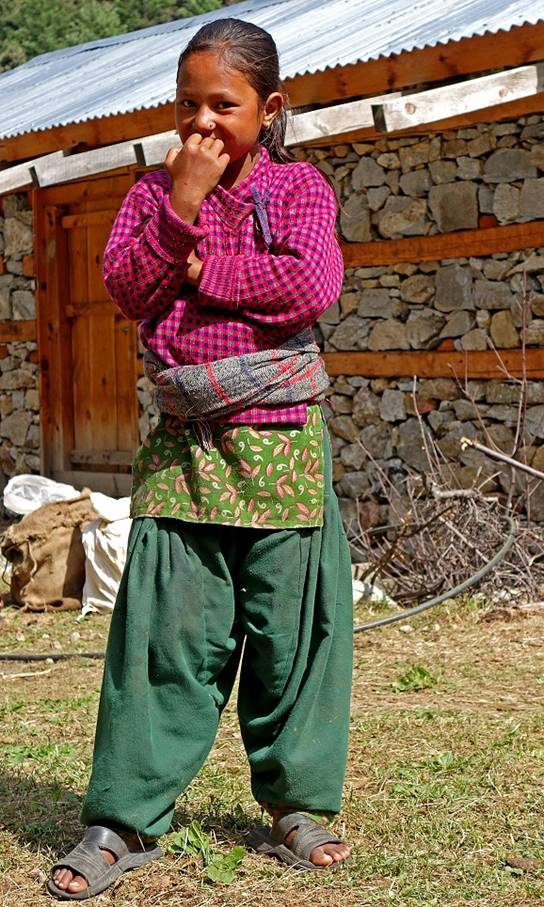
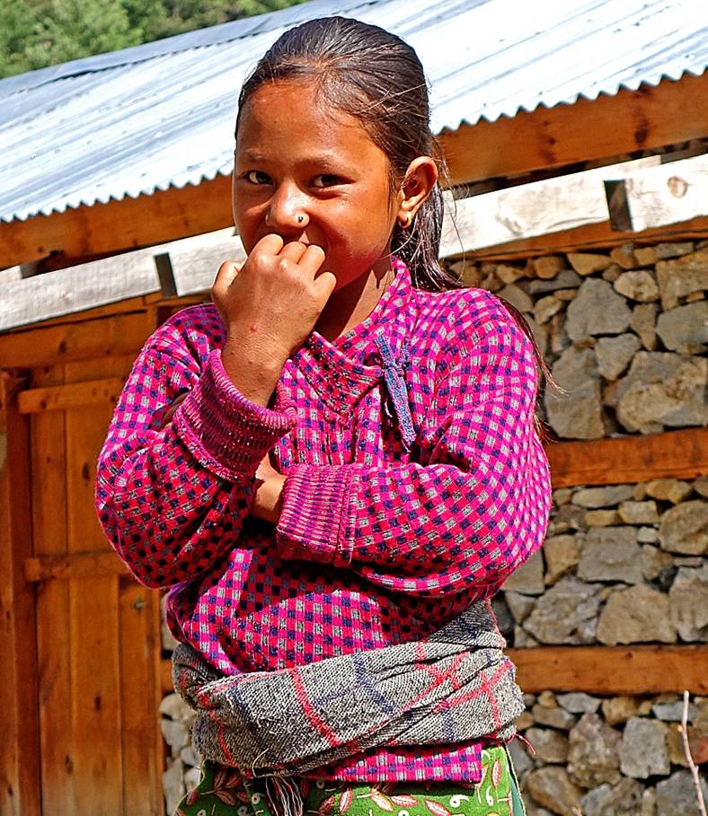
Girl at our camp.
|
|
|
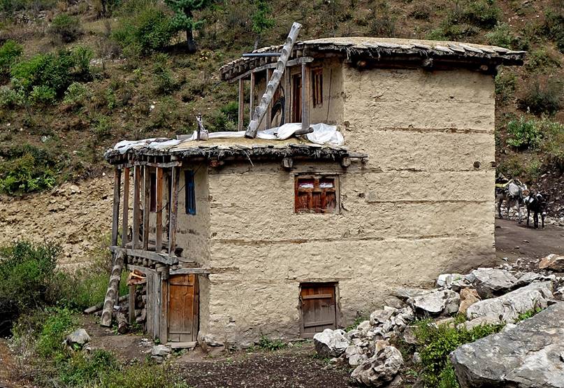
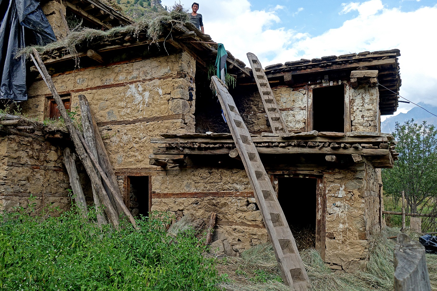
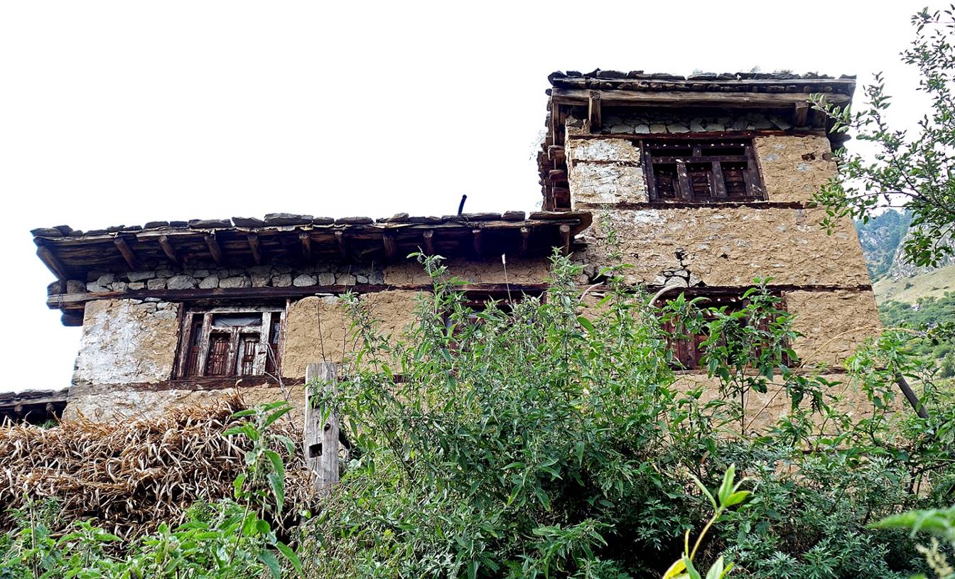
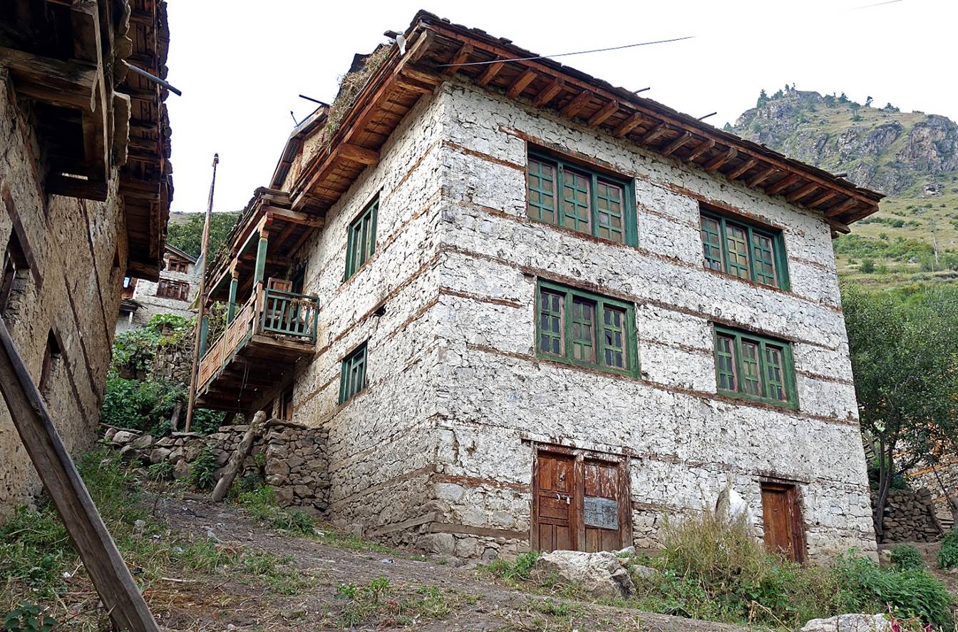
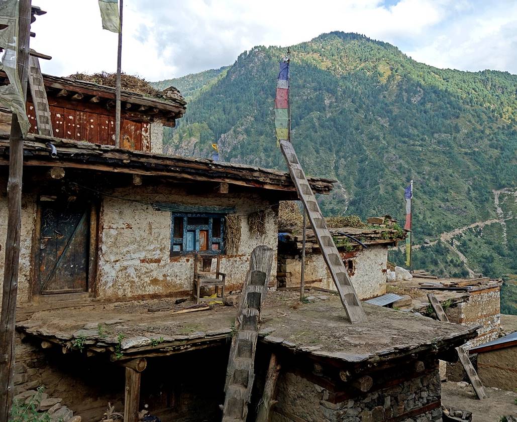
Traditional houses in the village of Dhinga.
|
|
|
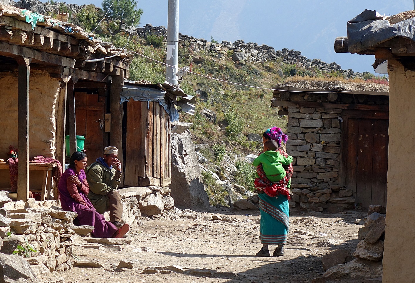
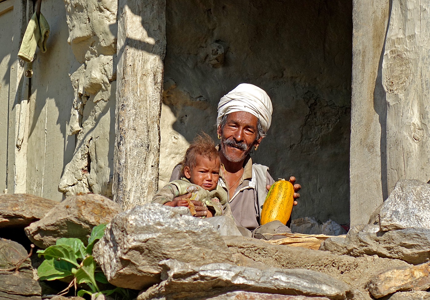
Man and baby in Dharapori.
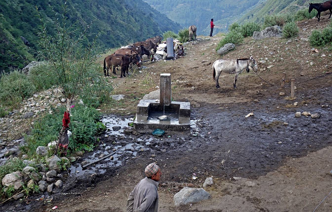
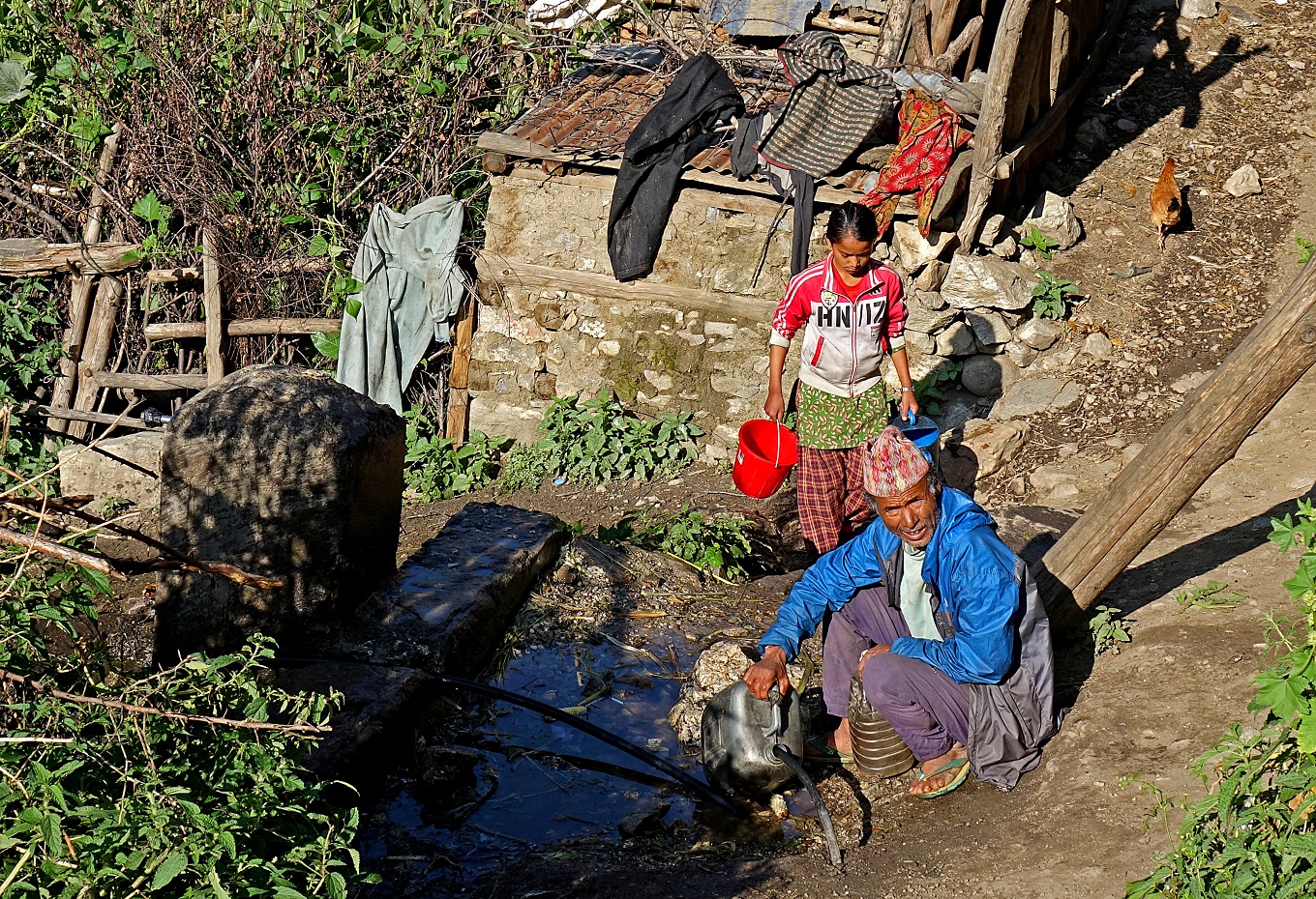
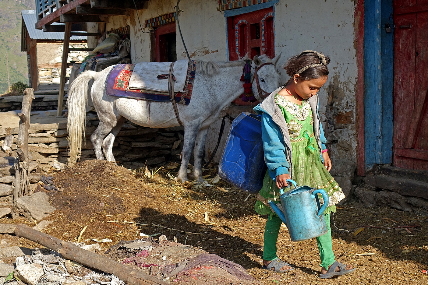
Most villages are equipped with water fountains fed from rivers higher up in the mountain. People carry water from these fountains to their homes.
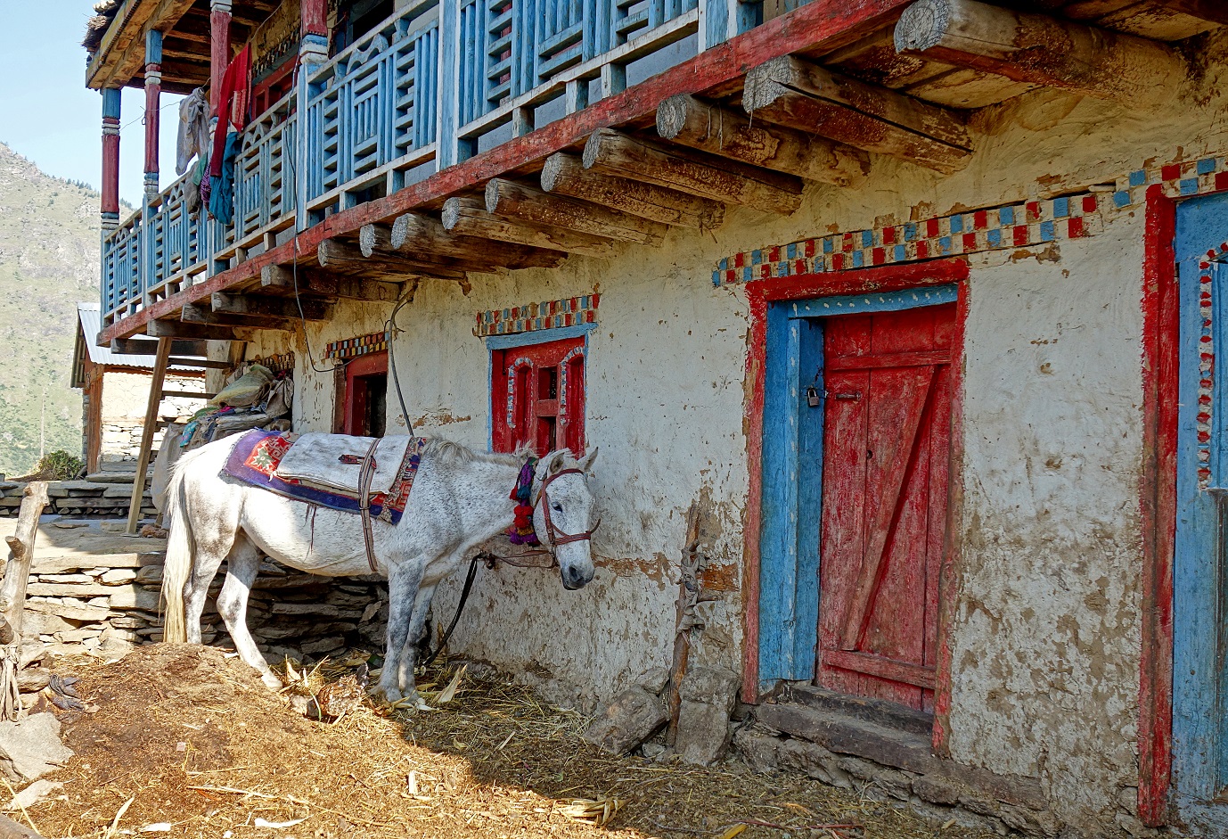
A horse, a colorful house...
...and a young girl on her way to fetch water.
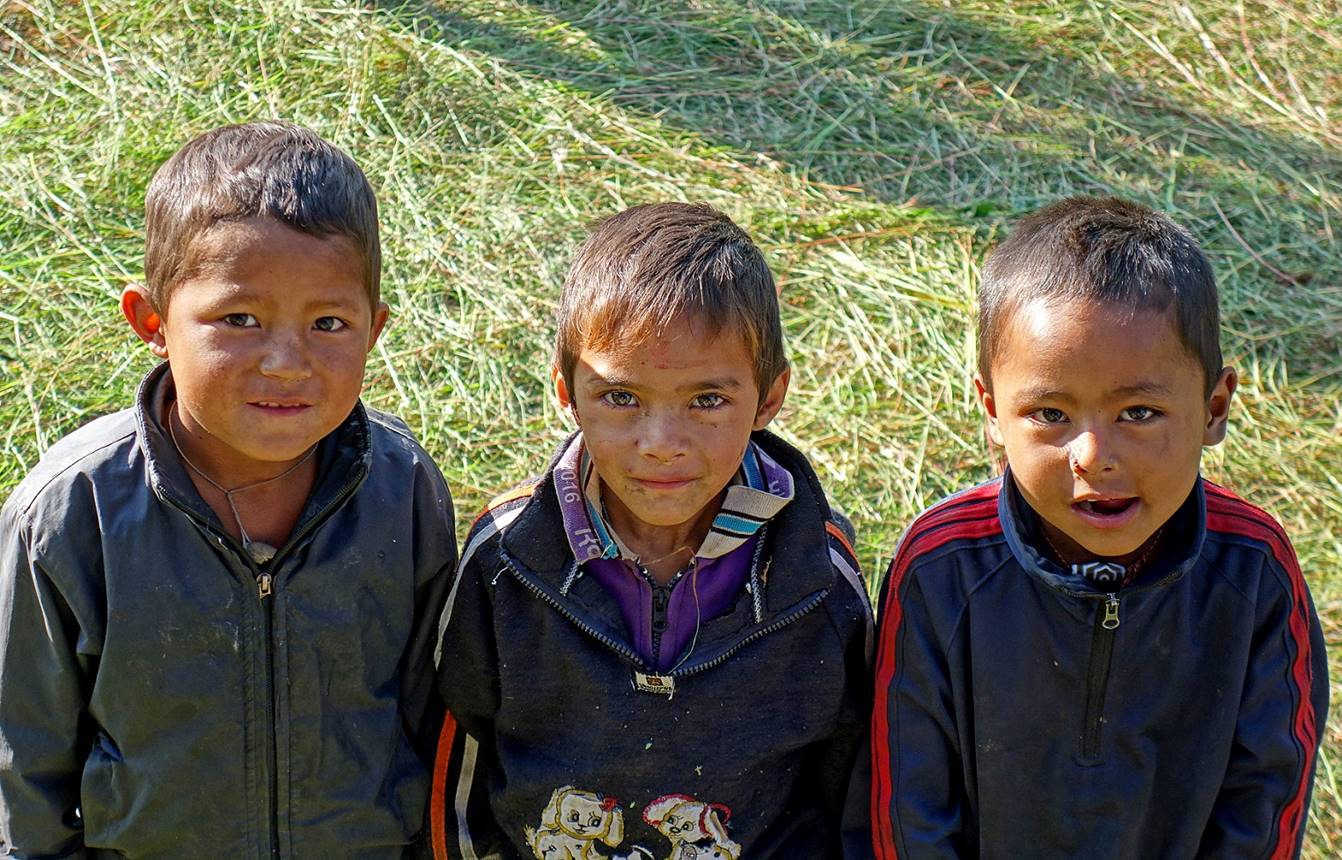
Three young friends.
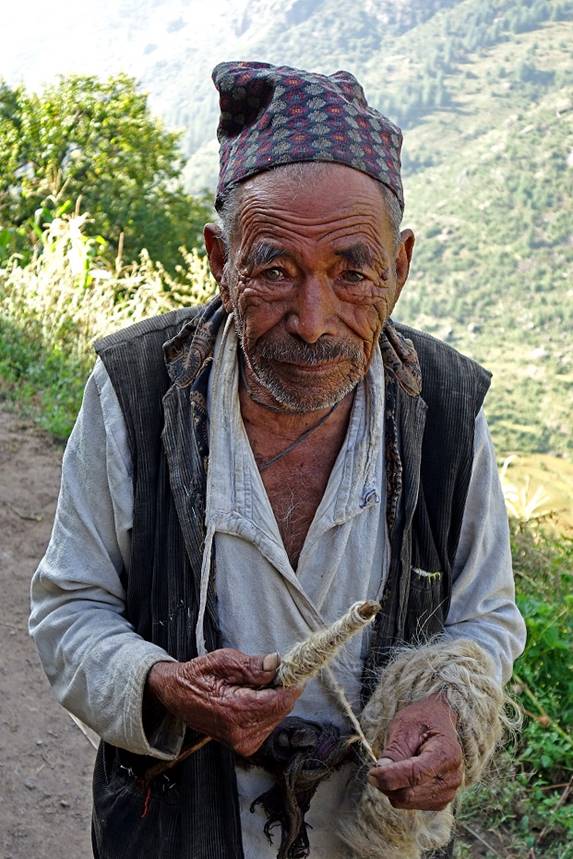
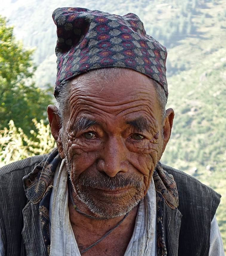
Old man hand spinning wool.
|
|
|
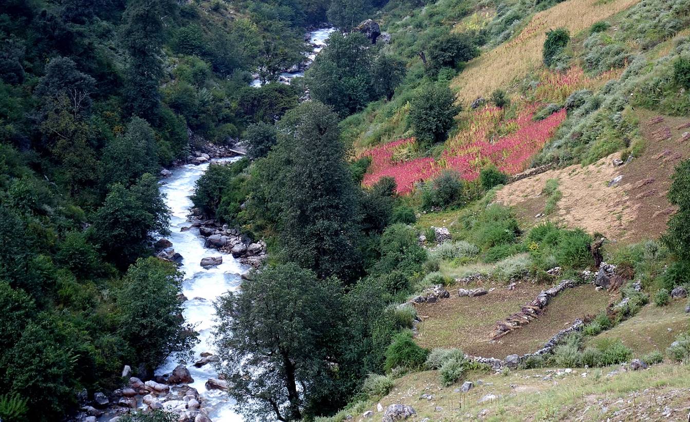
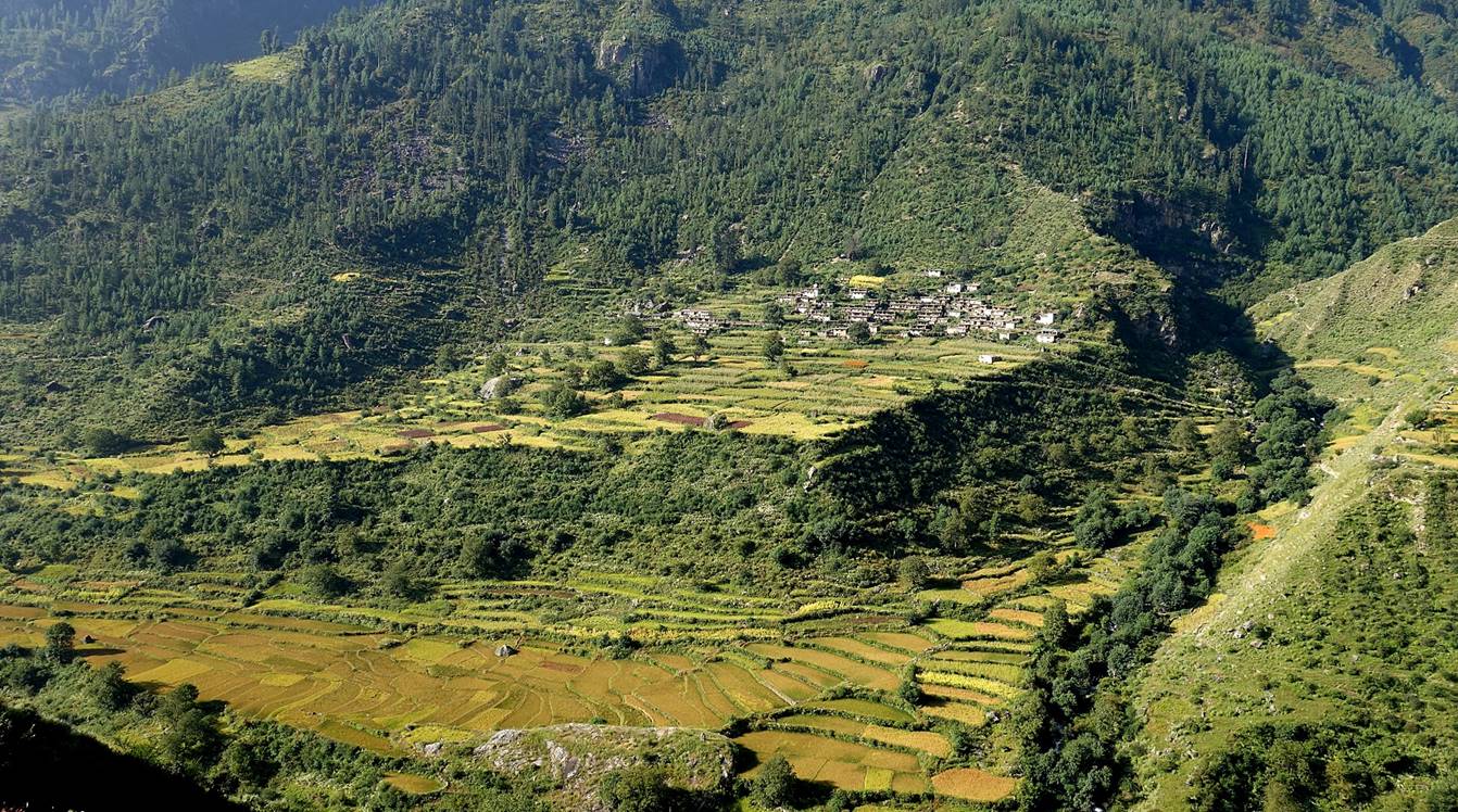
Village on the opposite side of Humla Karnali Nadi. The yellow fields at the bottom of the photo are rice fields. The tasty mountain rice cultivated here (at ~2400m) is called ″red rice″. It is also cultivated in other parts of Nepal, like Dolpo.
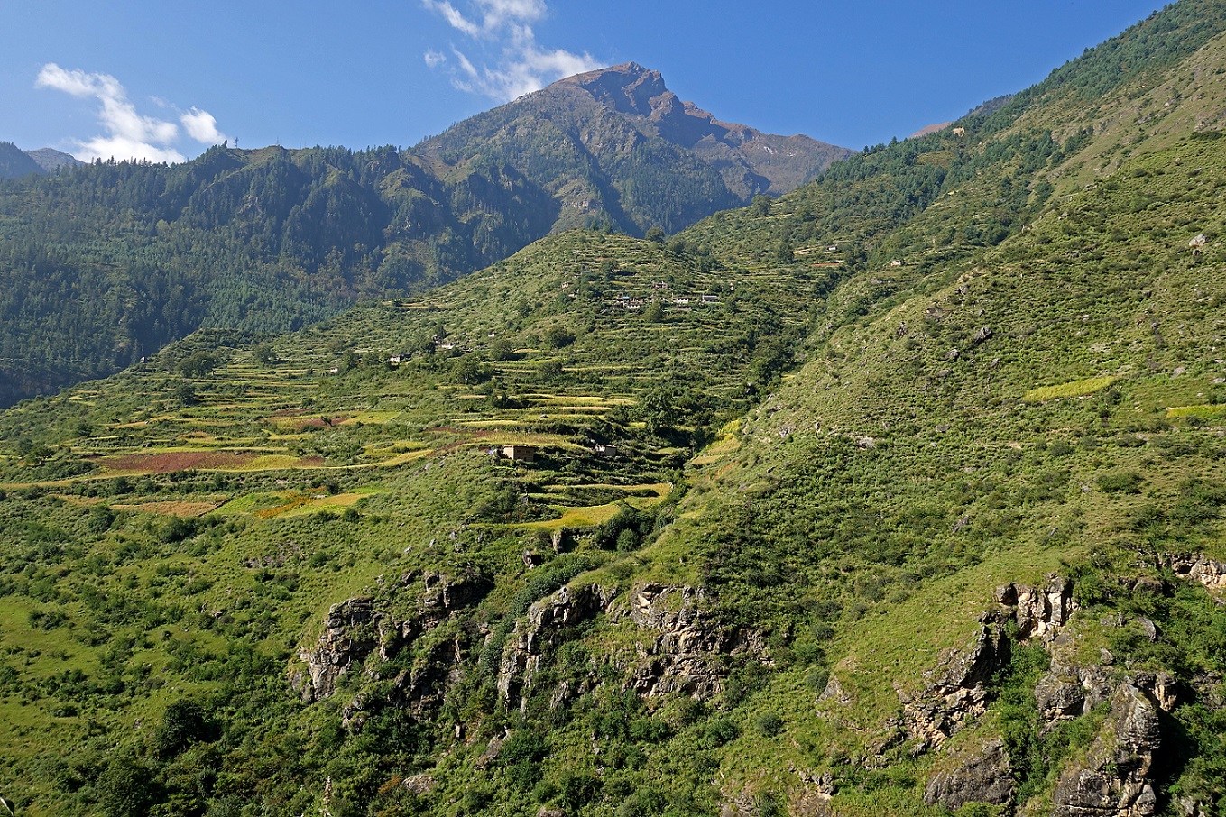
Other villages on the slopes of the Humla Karnali Nadi valley.
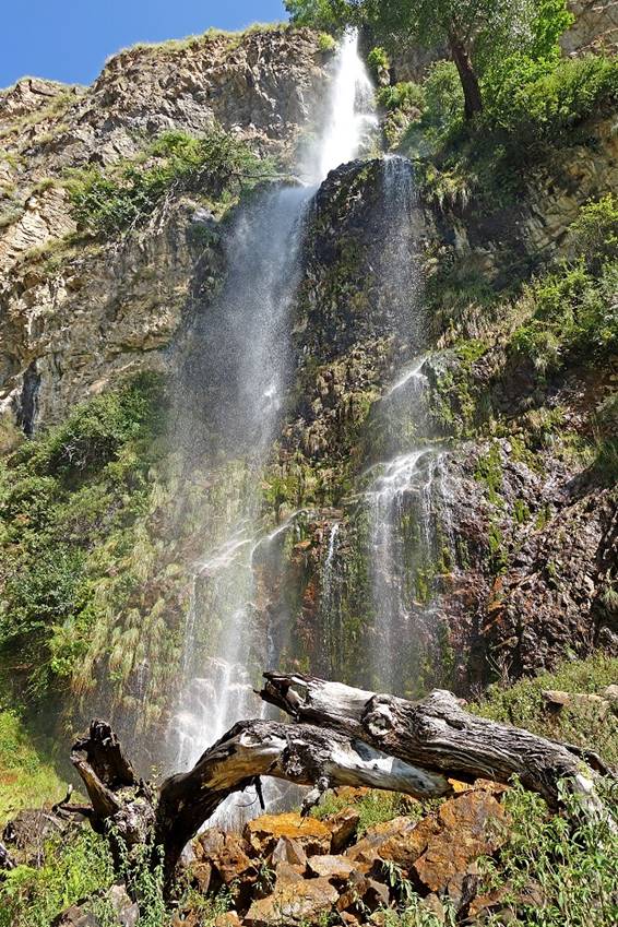
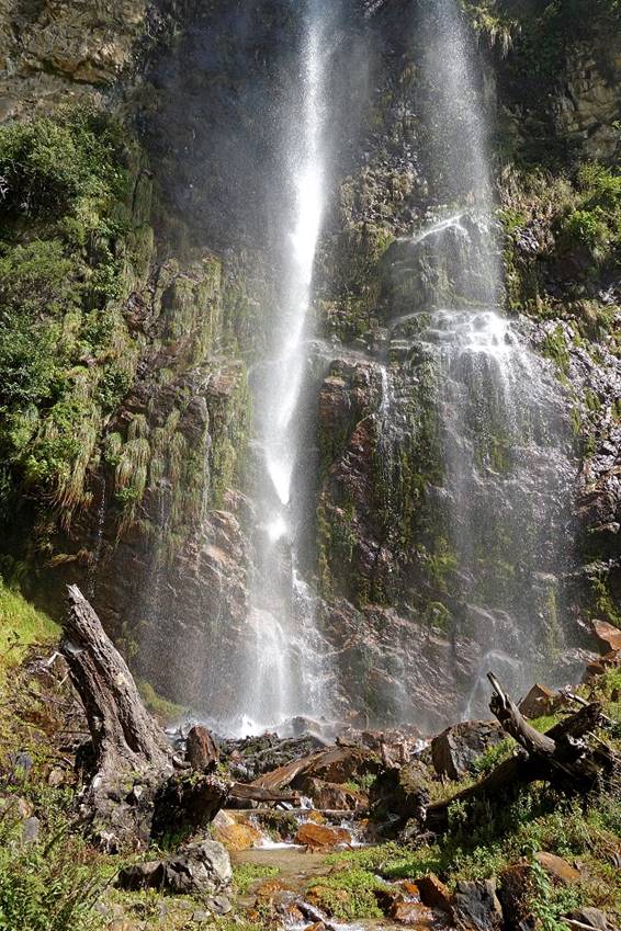
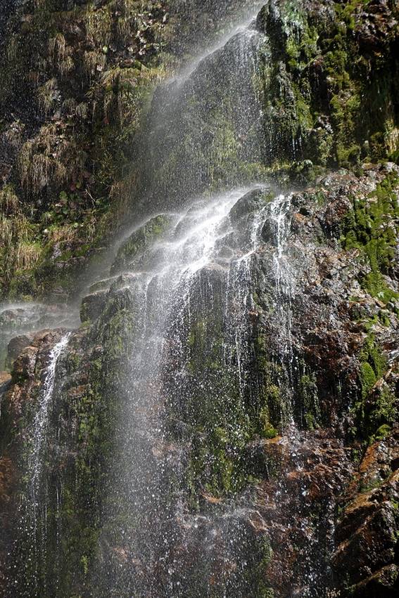
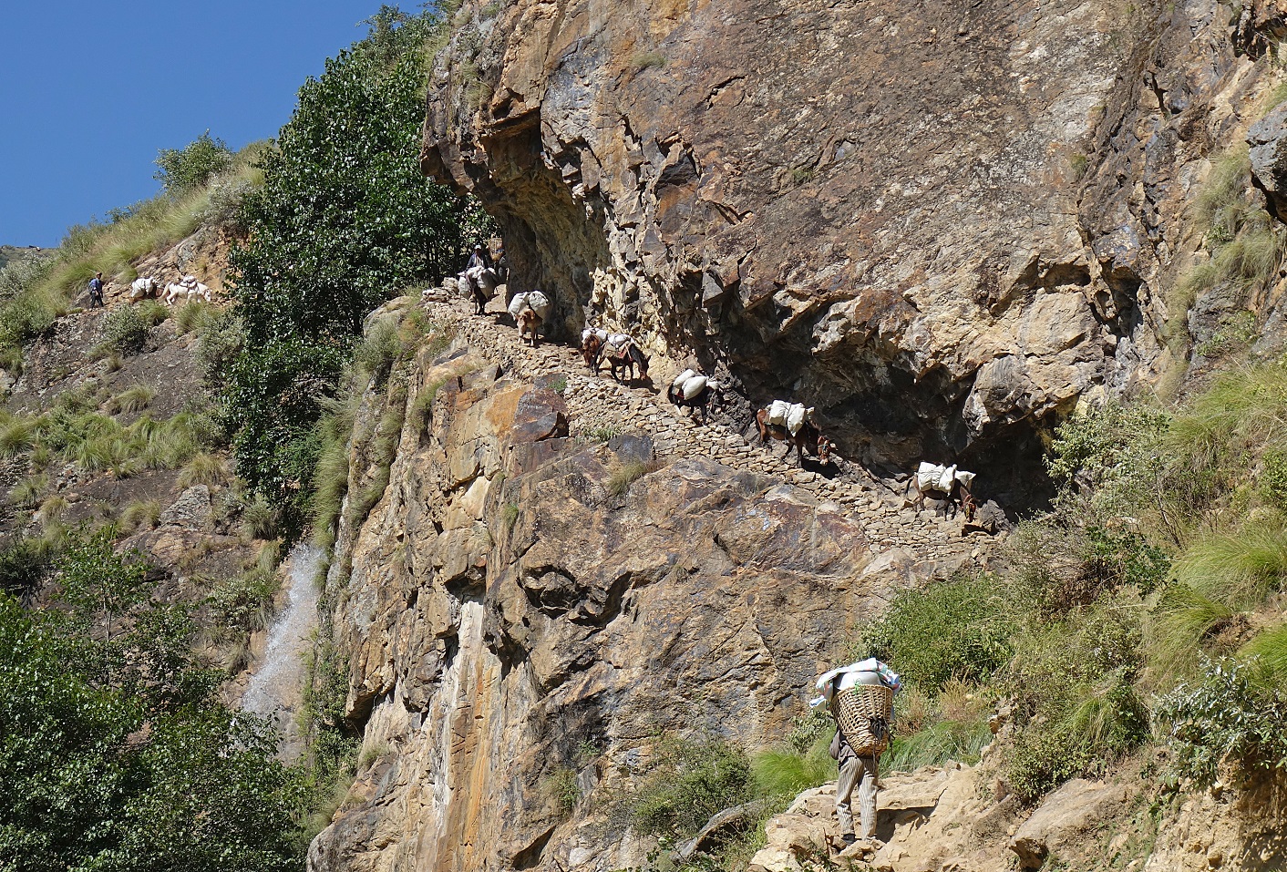
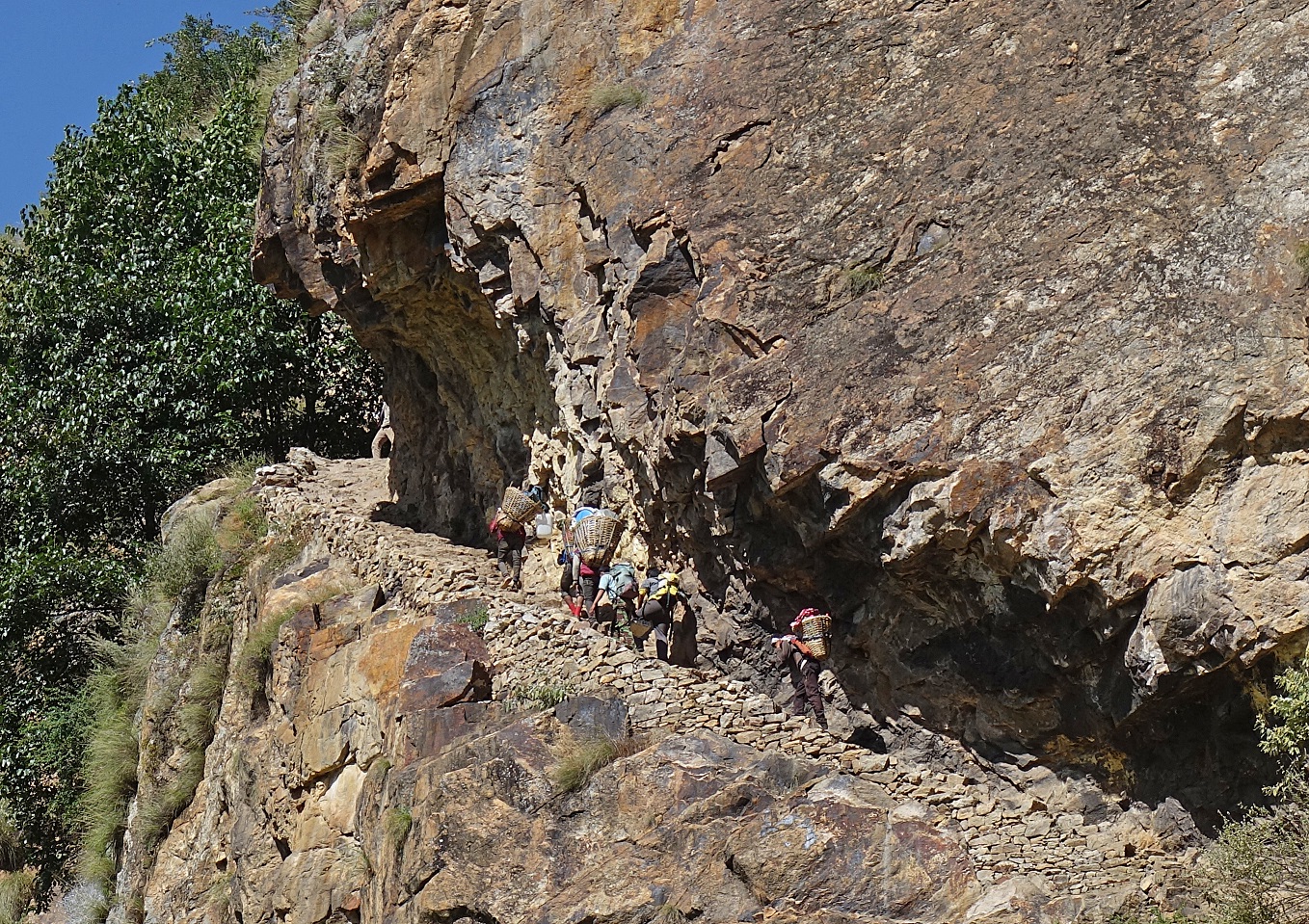
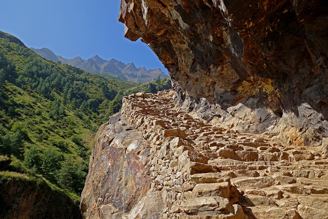
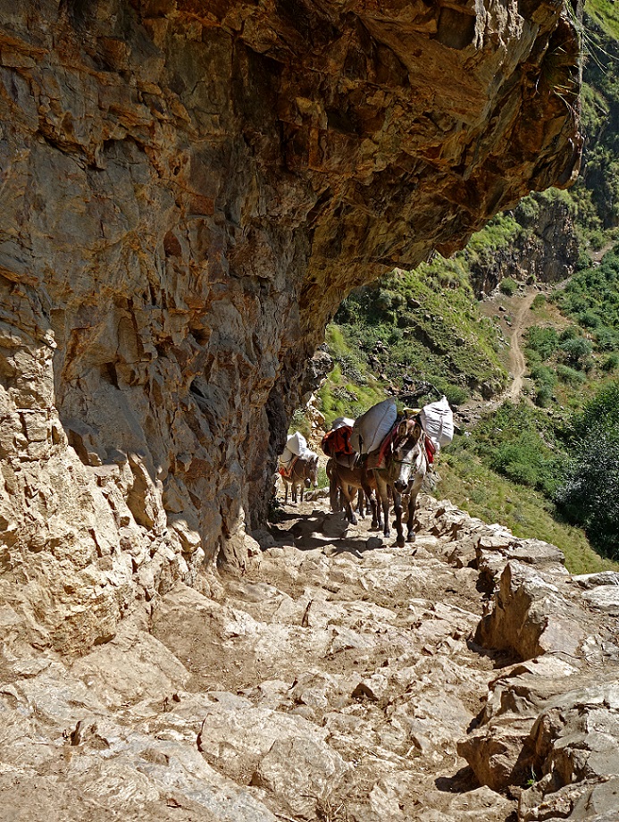
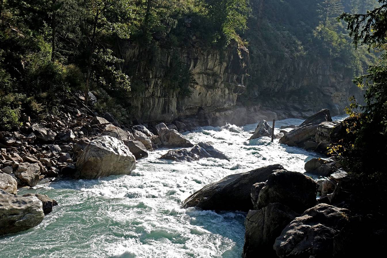
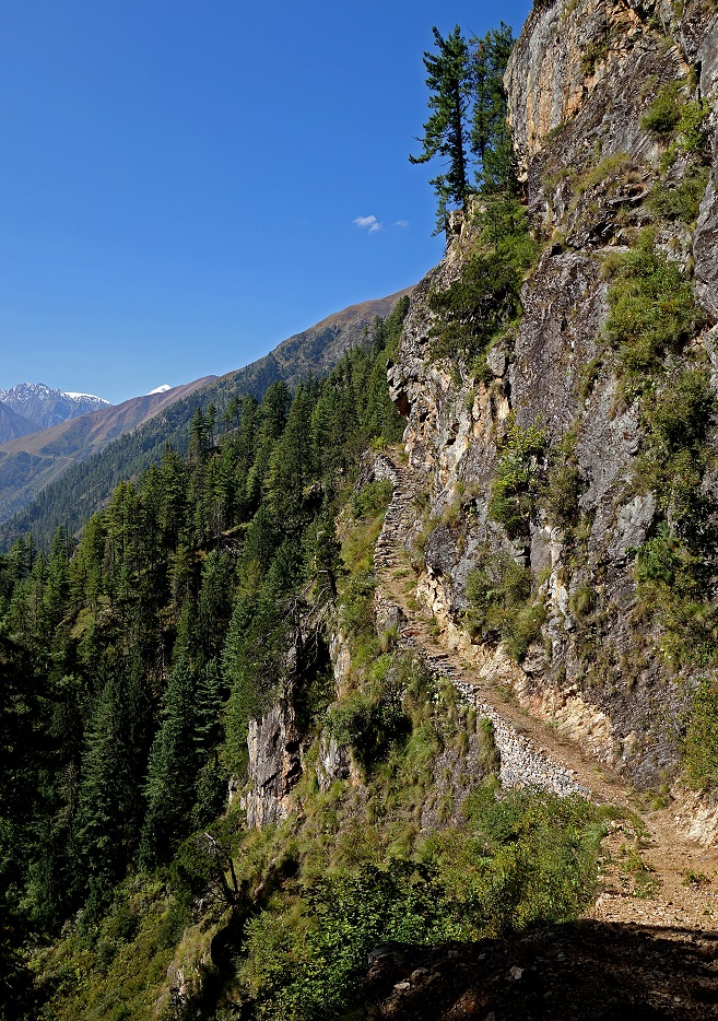
This is perhaps the most iconic site of the trail between Simikot and Hilsa (Tibetan border), with a tall waterfall and a trail section carved into a rock cliff.
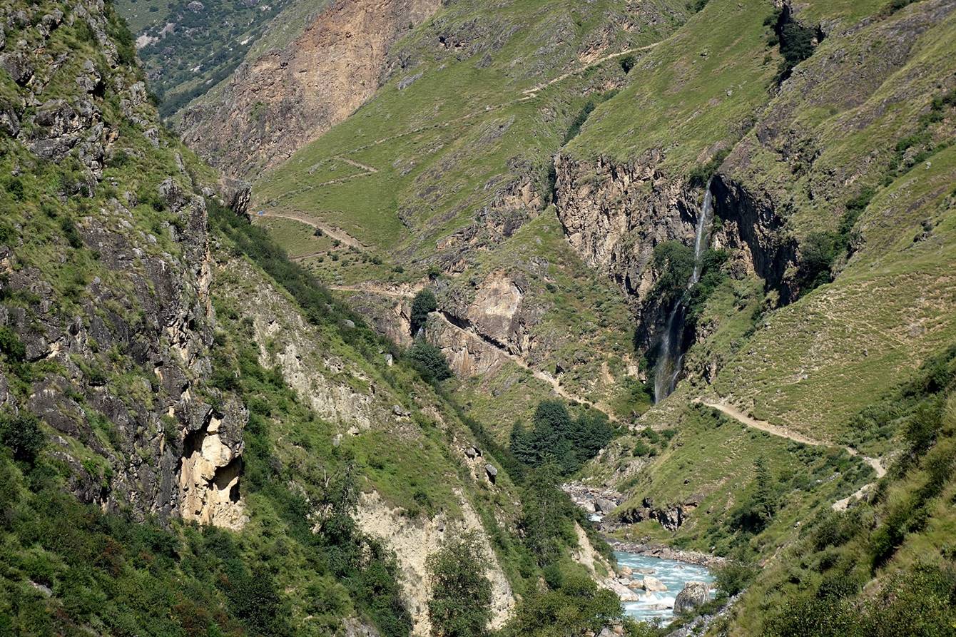
Closer views of the waterfall...
|
|
|
|
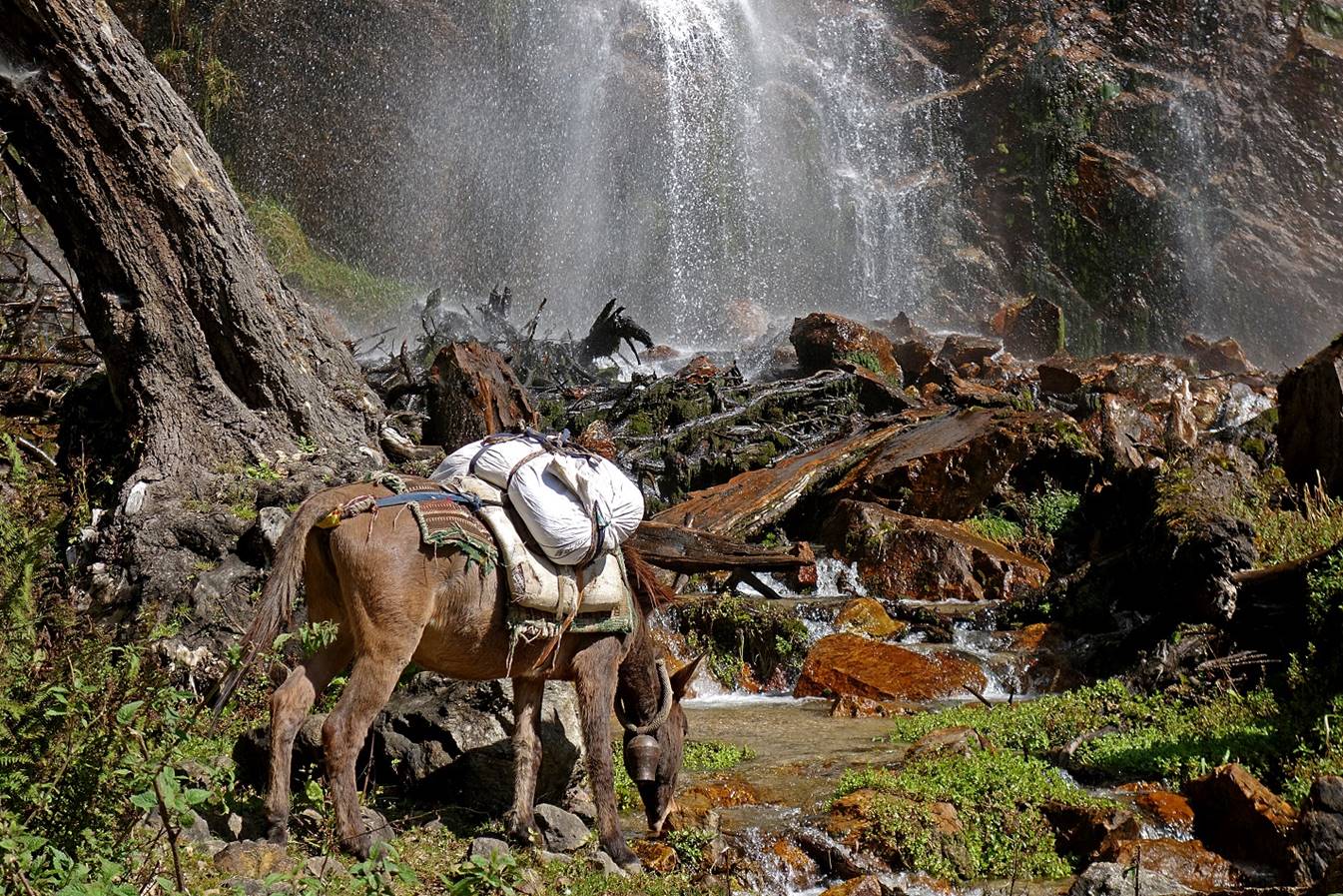
...and the trail in the cliff.
|
|
|
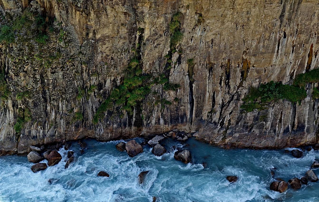
Humla Karnali Nadi seen from the trail.
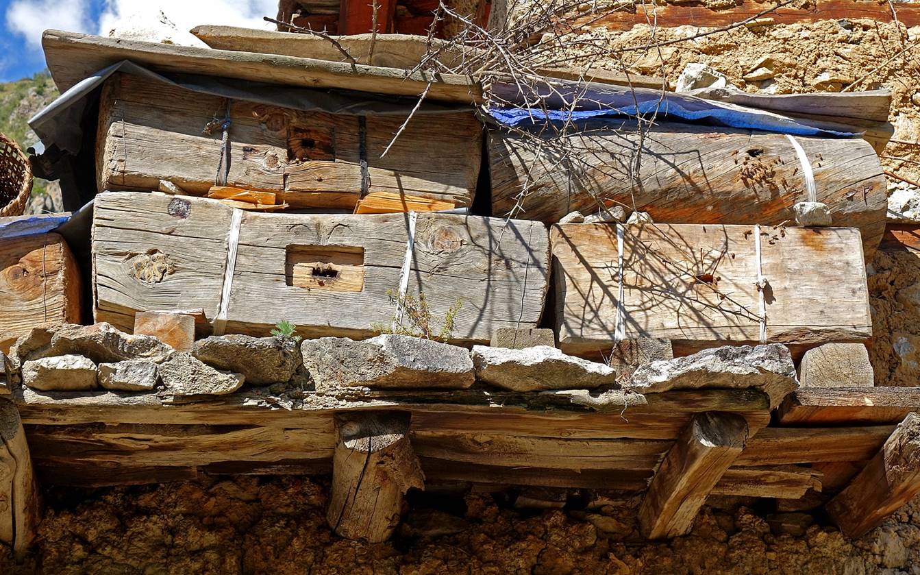
Typical beehives in a village.
In a teahouse near Kermi.
|
|
|
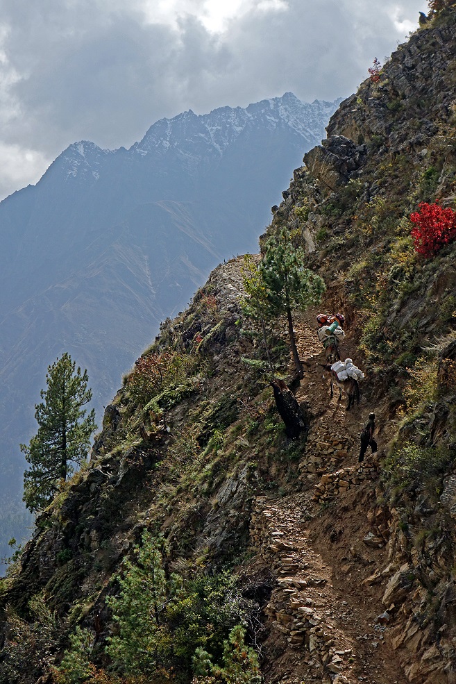
Traders on their way to Simikot.
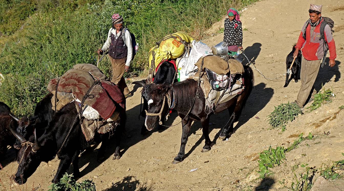
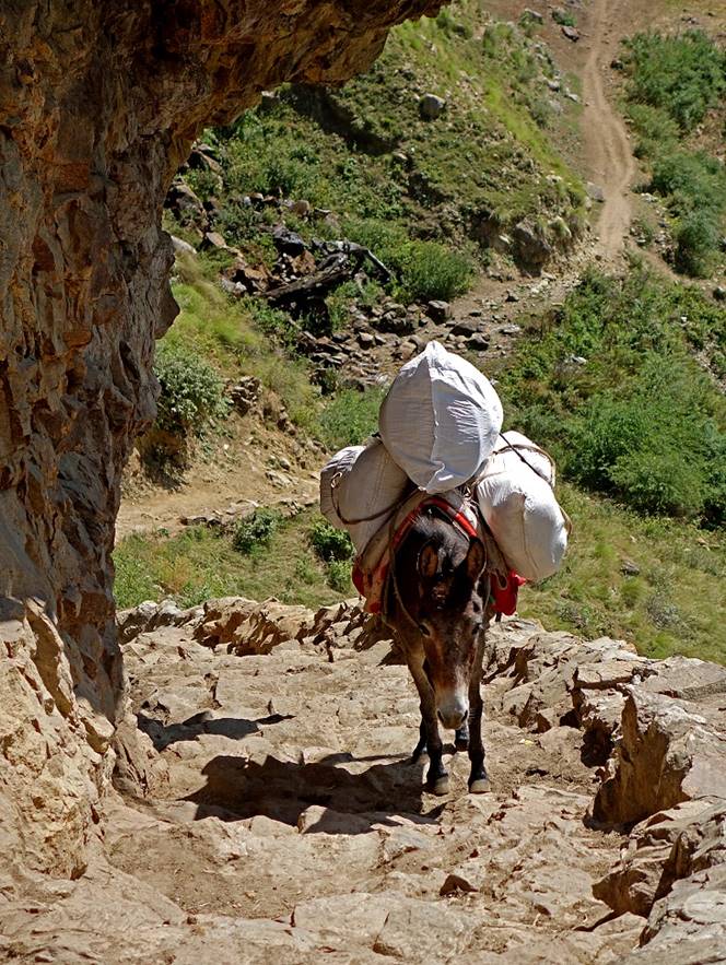
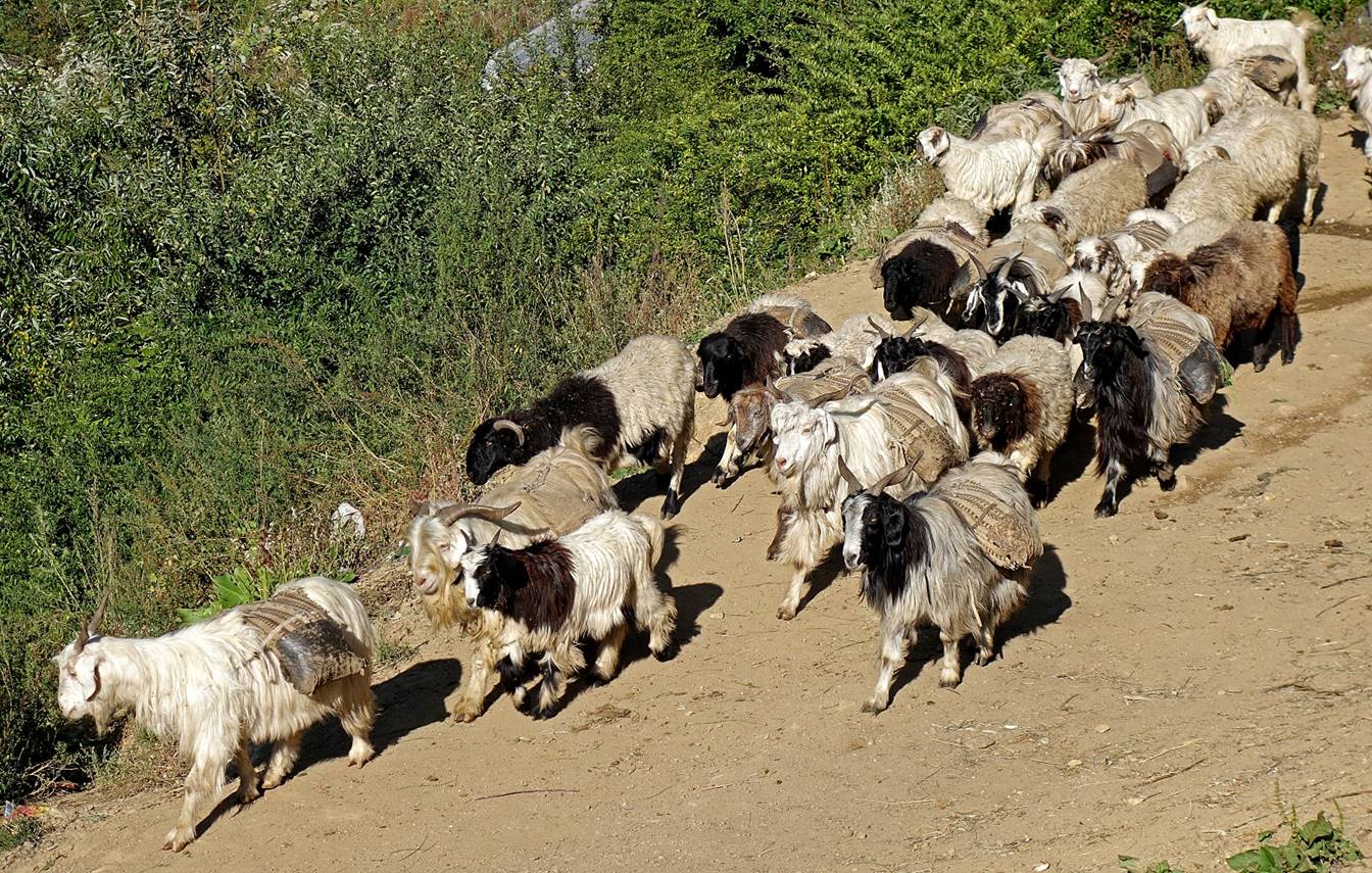
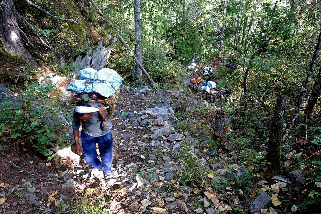
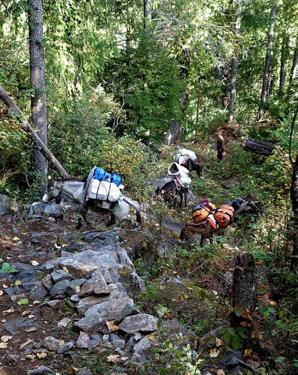
A ″caravan″ of goats and sheep loaded with small bags. In this part of Nepal goats and sheep are widely used to carry grain and salt. On average an animal can carry 15 to 20kg over long distances over several days. During the rest of the trek we will see several such caravans, some with hundreds of animals.
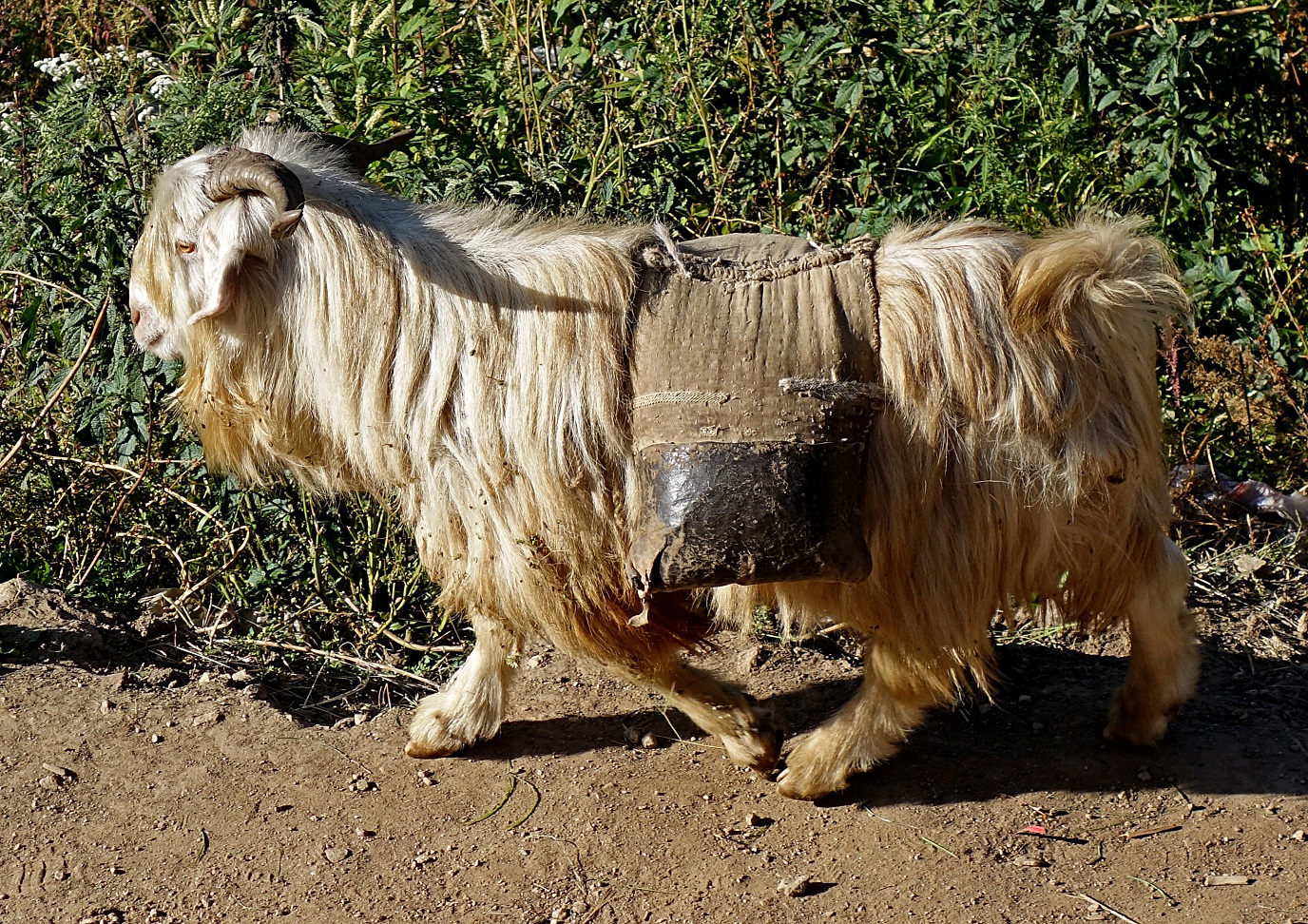
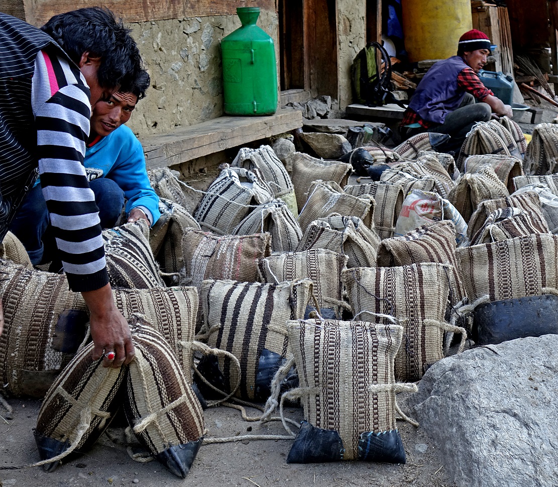
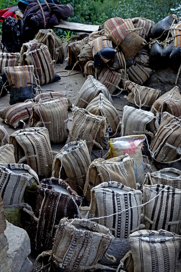
Preparing bags in a nearby village. The weight of each bag is adapted to the size and strength of the goat or sheep that will carry it.
|
|
|
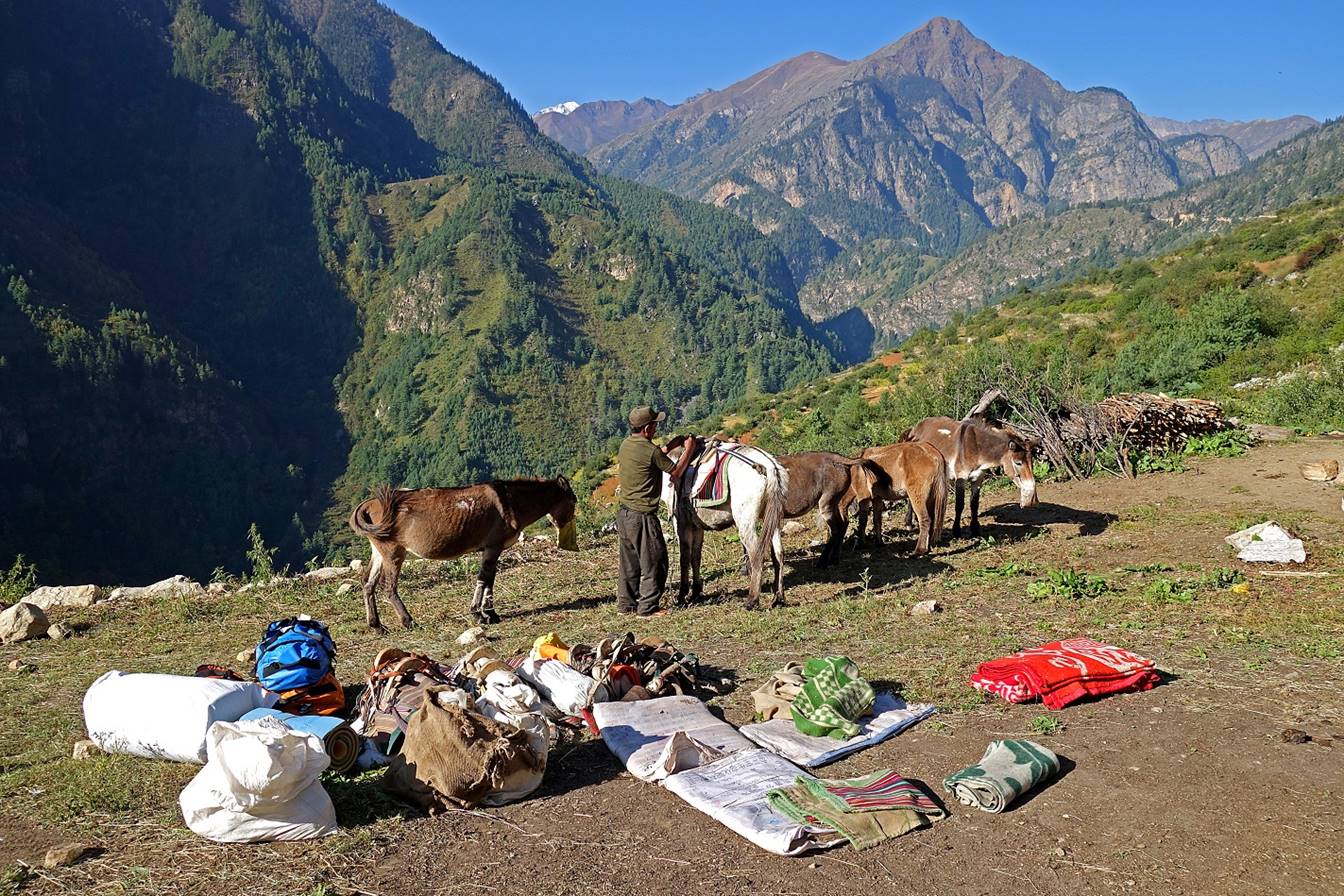
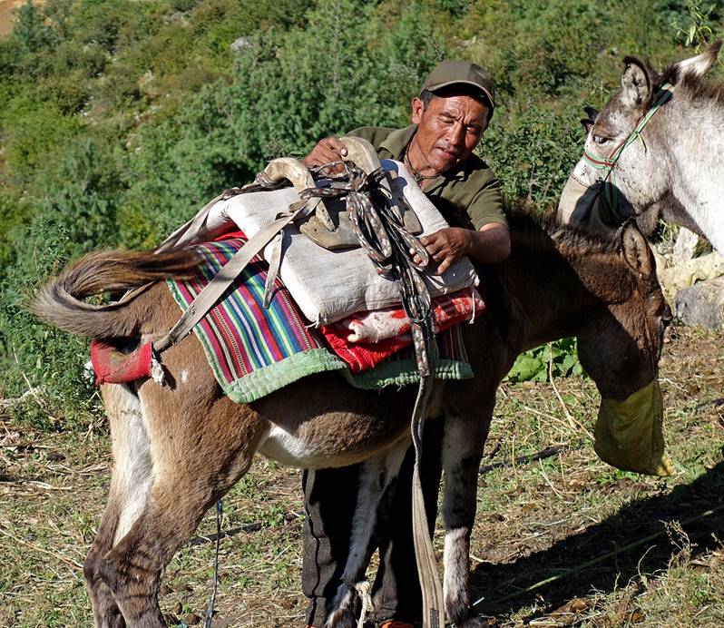
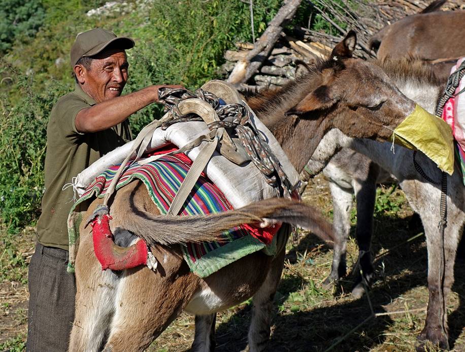
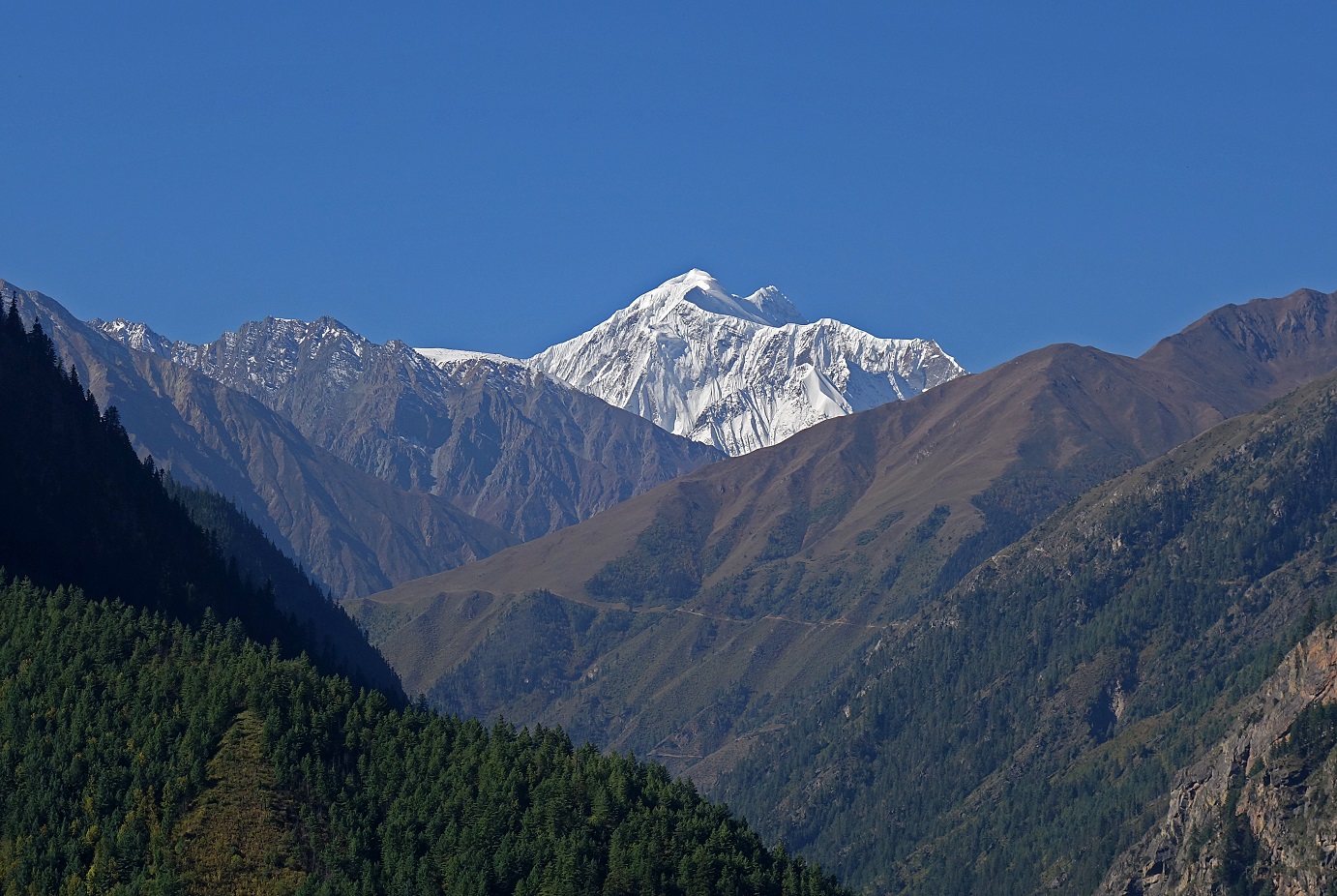
Preparing the loading of our mules on a beautiful morning at one of our camps. The tip of Mount Saipal is visible in the background.
|
|
|
Morning view toward the east (i.e. toward Simikot) of the Humla Karnali Nadi valley. The slight haze is caused by warm and humid air coming from the low-elevation southern plain of Nepal (Terai) and India.
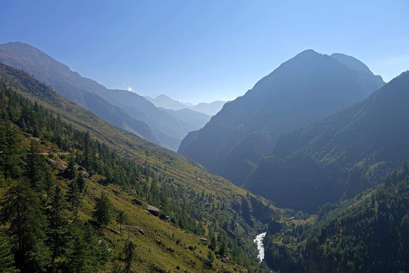
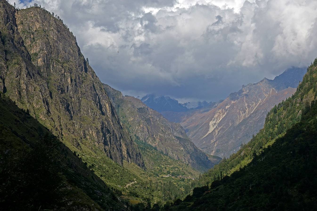
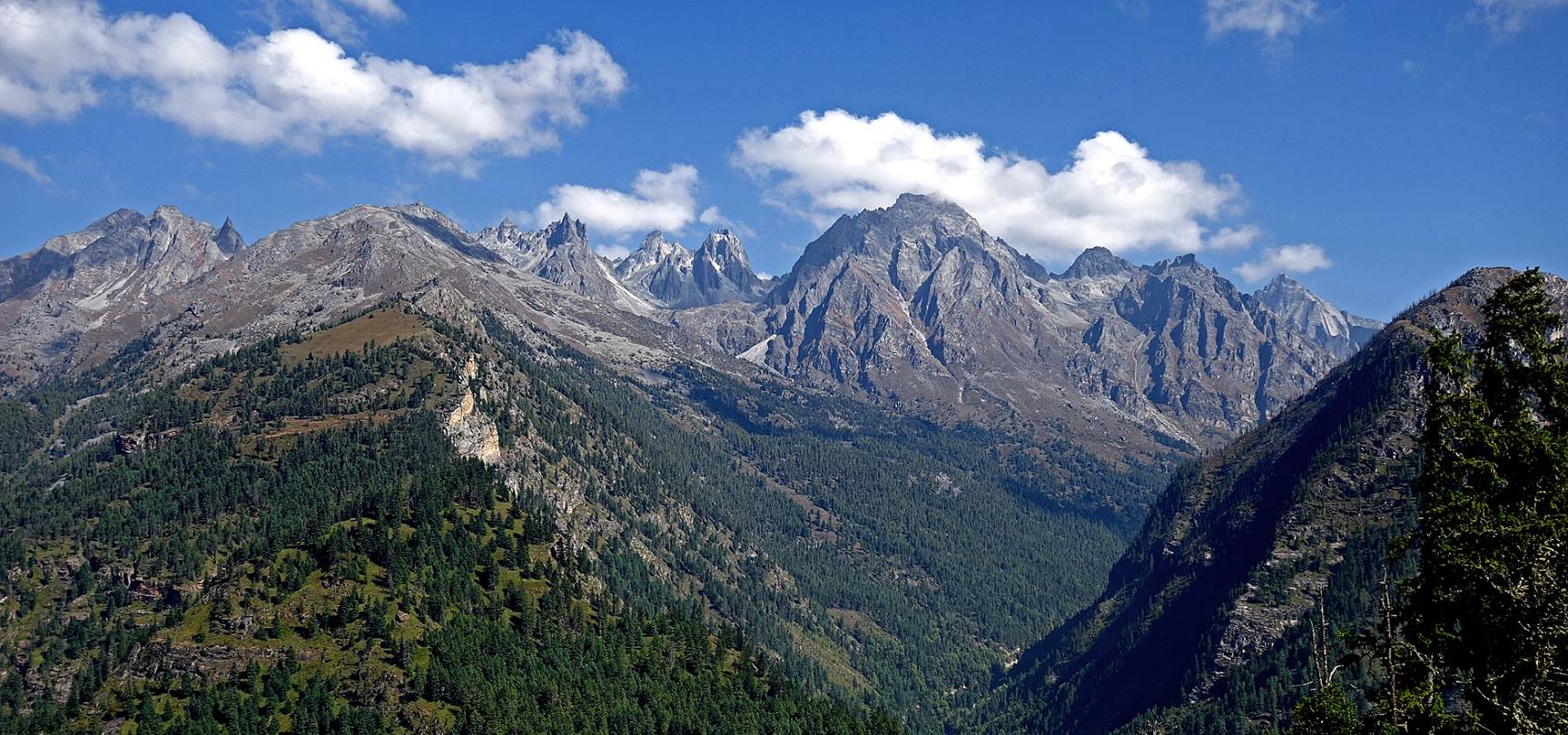
View of the canyon of the Kalunba river and Mount Saipal. A section of the trail leading to the village of Chala is also visible at the center of the photo.
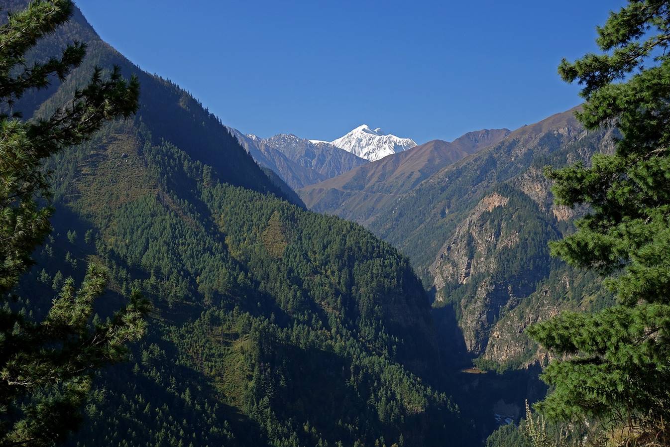
Zoom on Mount Saipal.
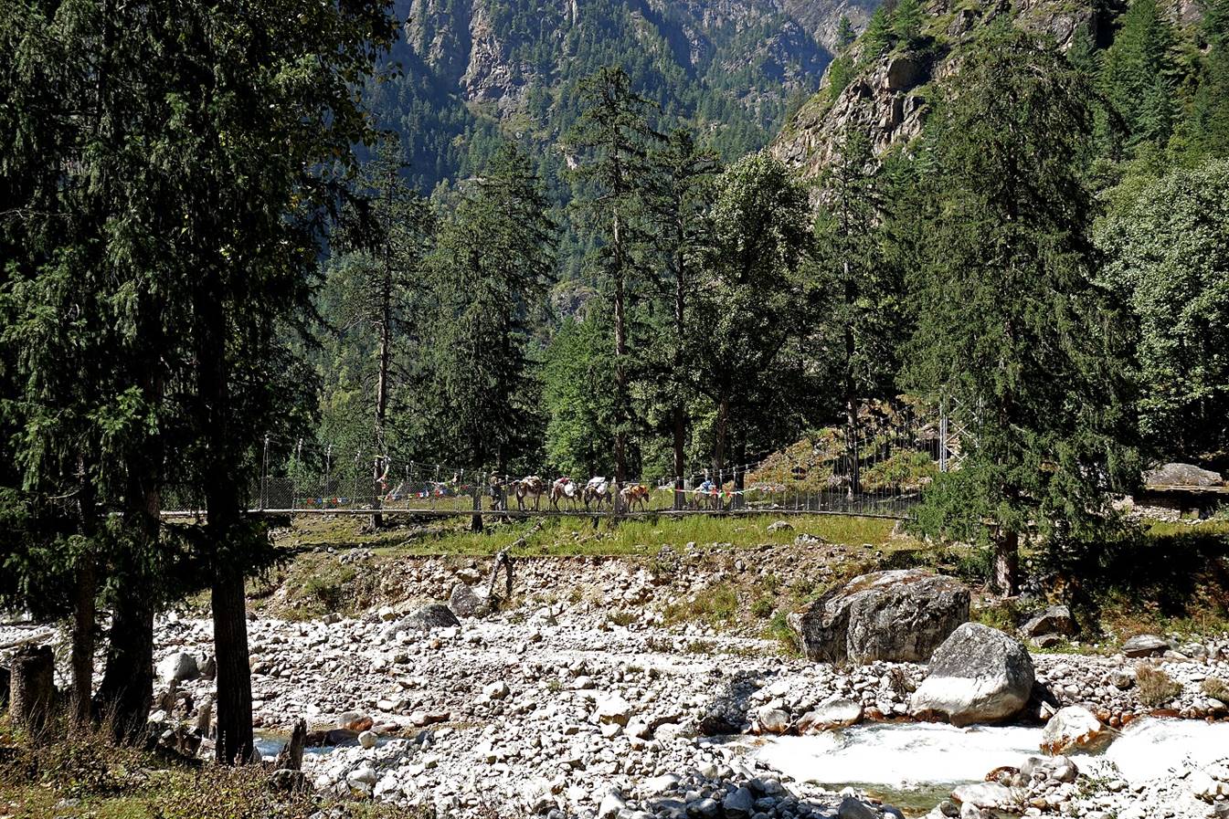
Crossing Salli Khola.
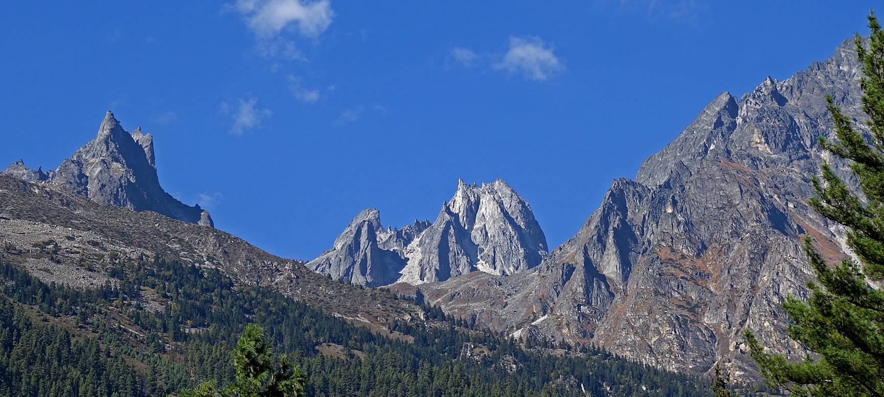
Rock spires above the Salli Khola valley.
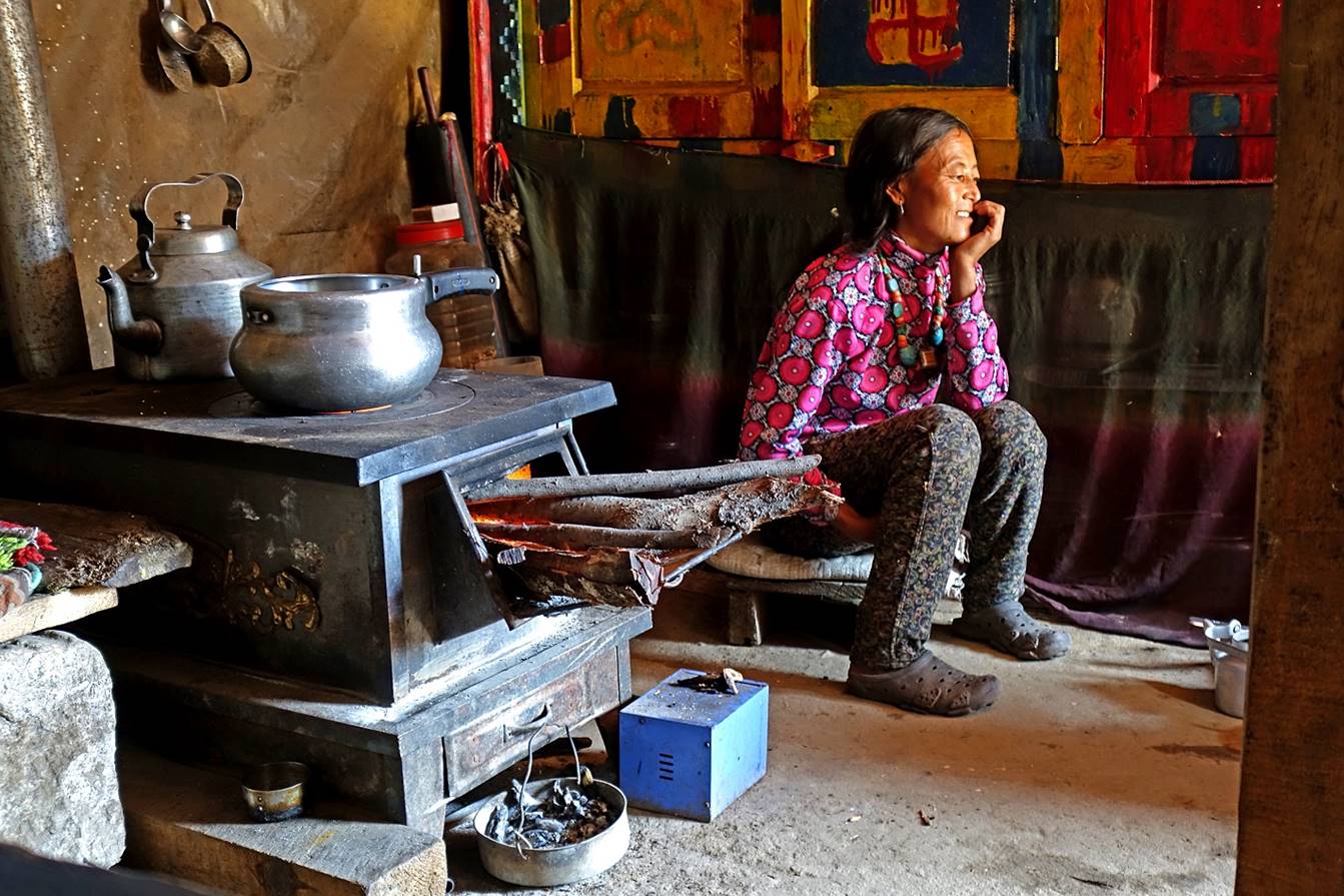
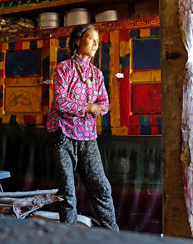
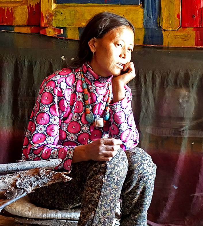
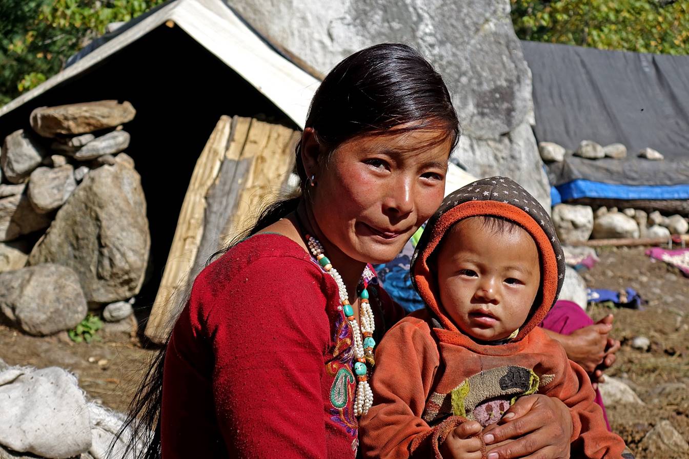
Woman and her child in a Tibetan camp near Salli Khola.
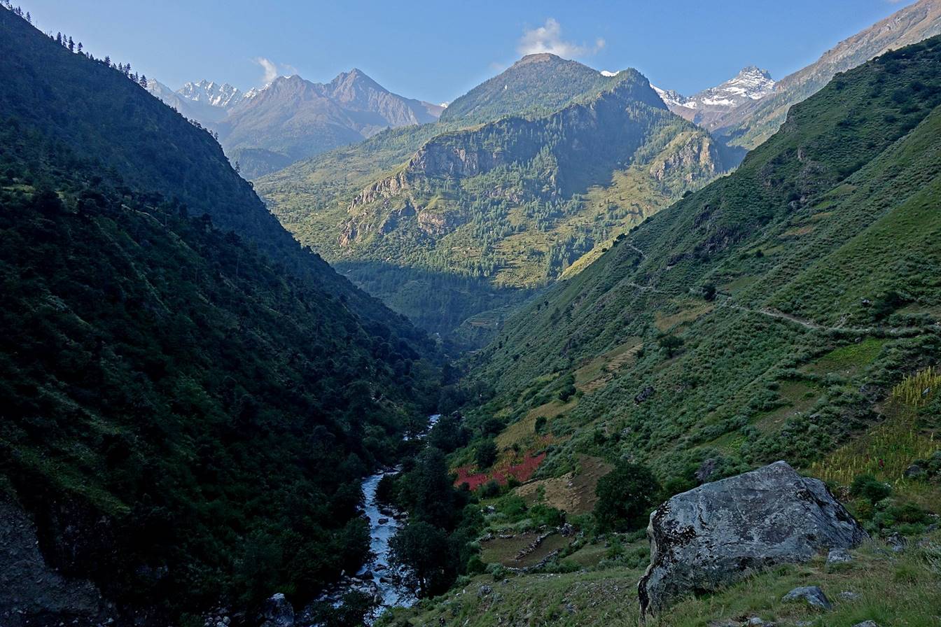
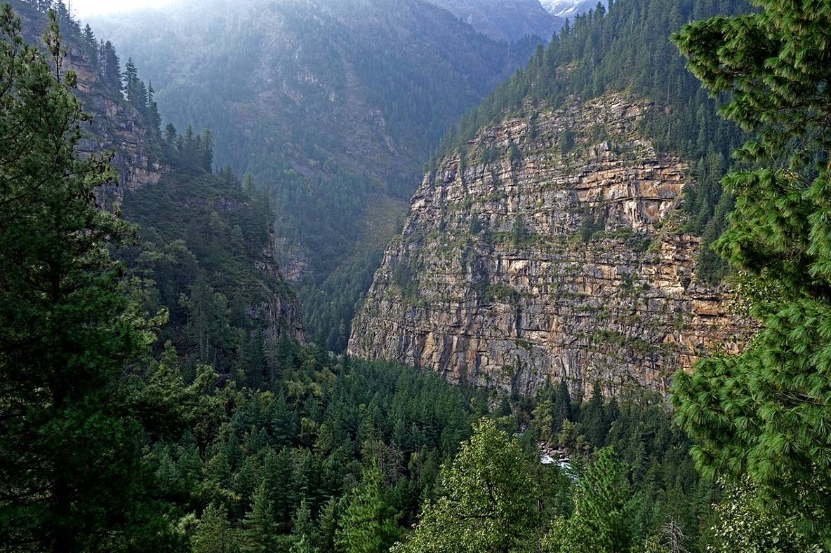
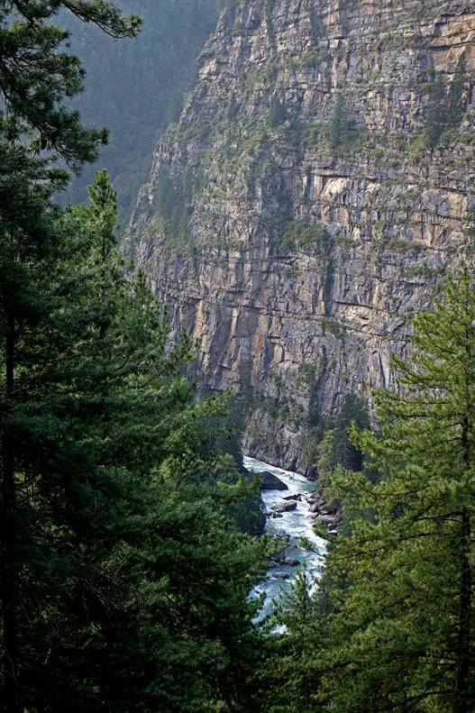
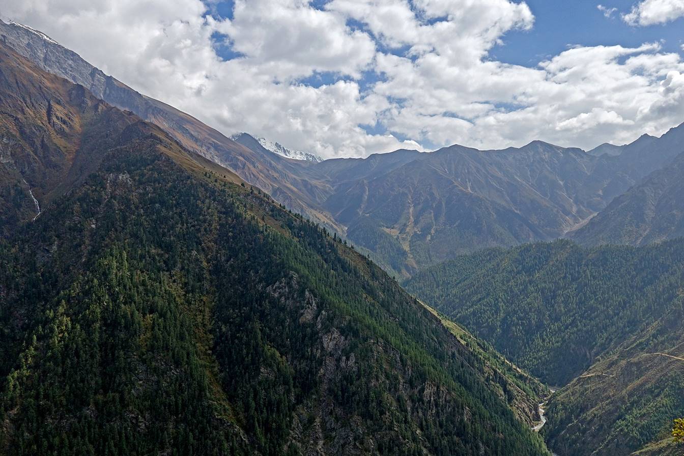
Views of the Humla Karnali Nadi canyon just before heading south toward Chala.
|
|
|
Humla Karnali Nadi seen from the bridge leading to the trail toward Chala.
During the steep ascent (~800m) that immediately follows the crossing of Humla Karnali Nadi.
|
|
|
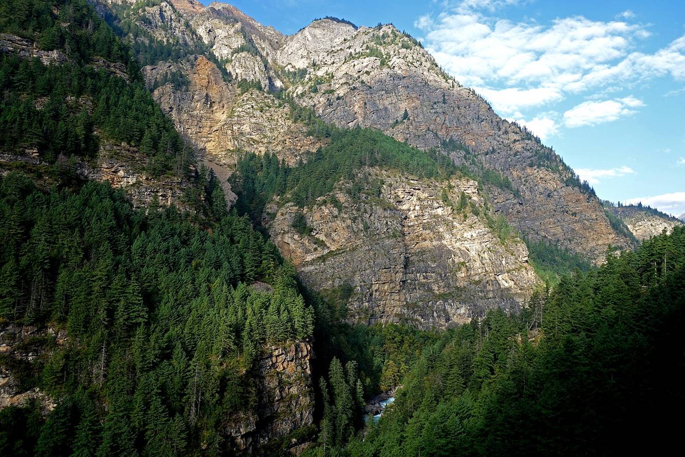
Mountain range north of Humla Karnali Nadi, seen from the top of the steep climb.
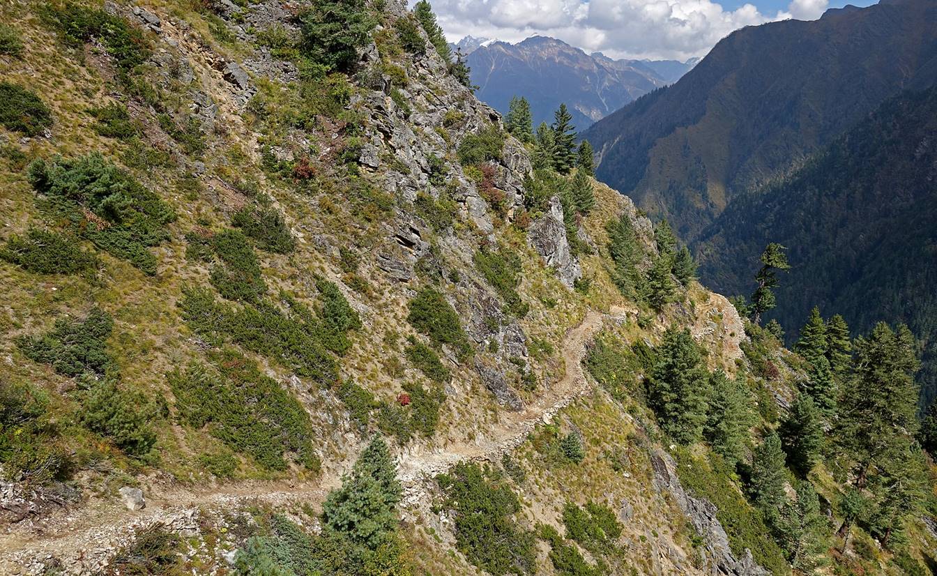
Beautiful sections of the trail toward Chala.
|
|
|
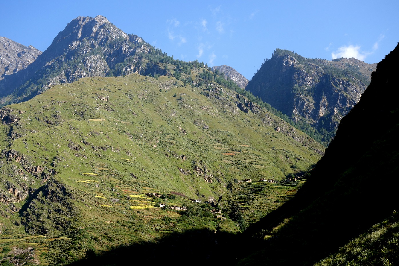
View toward Sakya Lagna before reaching Chala. Sakya Lagna (4709m) is the pass that we will have to cross a few days later to reach Ranikharka on the eastern side of Mount Saipal.
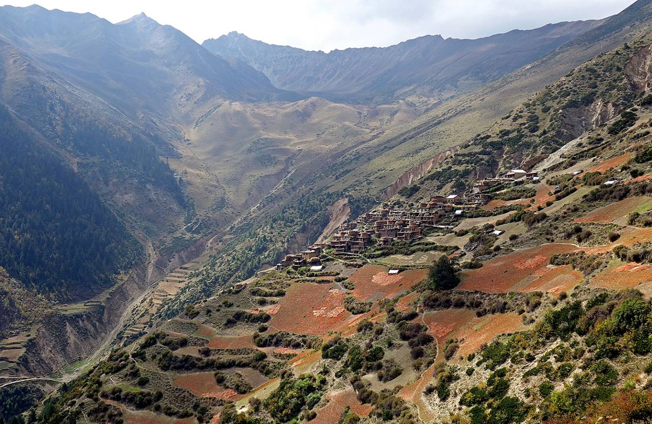
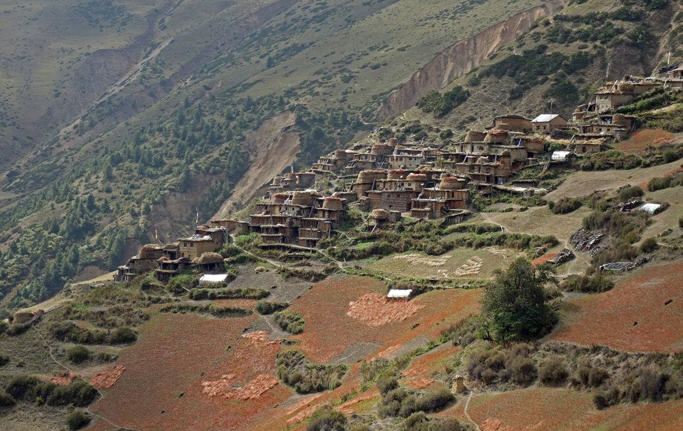
Arriving at Chala.
![]()