Nepal (October 2017): Simikot to Kolti via Mount Saipal
![]()
Return to my mountaineering/trekking/travel webpage
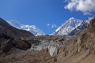
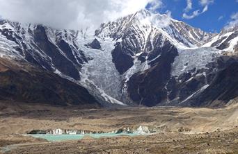
Mount Saipal (7030m) is the second highest peak in far-western Nepal, after Mount Api (7132m) located further west. I had seen Mount Saipal twice before, once in 2008 from a distance during the first half of my traverse of Nepal and in 2014 from the plane between Nepalgunj and Simikot. For several years, I had wanted to get closer to the mountain. During this trip I went first to the upper valley of Karan Khola north of Saipal, then to the upper Kawadi Khola valley east of Saipal. These valleys make it possible to easily reach the bases of the north and east glaciers of Saipal. This area of Nepal area is rarely visited by trekkers and climbers. A dozen, or so, expeditions have attempted to climb Saipal, with most failing to reach the summit. It was not my intention to even try.
Map of the trek area.
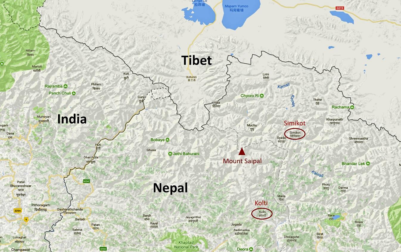
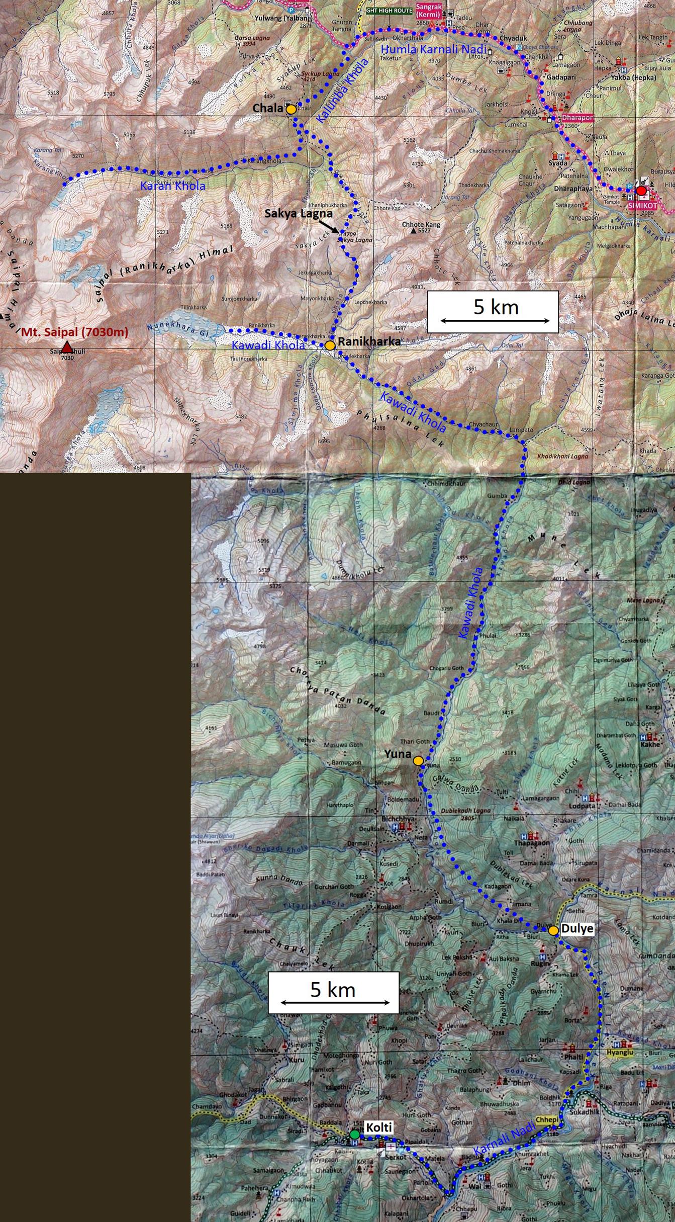
Itinerary: The itinerary is drawn in blue dotted lines in the map below (portion of the GHT Far-West map NP110). We flew to Simikot from Kathmandu via Nepalgunj. From Simikot we followed the trail along the valley of Humla Karnali Nadi toward the west. Before reaching Yalbang (the home of a large Buddhist monastery and school), we left this trail and headed south to the village of Chala. We visited the Karan Khola valley, returned to Chala, crossed Sakya Lagna (a 4709m pass) to reach Ranikharka, a large pasture in the upper Kawadi Khola, and went to the Nonekhara glacier that falls from the eastern slopes of Saipal. From there we followed Kawadi Khola downstream to the village of Yuna, located much further south. From Yuna we crossed some high hills to reach the Karnali Nadi valley at the village of Dulye. Finally we followed Karnali Nadi downstream and then Kunda Khola upstream to reach Kolti. Kolti has a small airport with flights to Nepalgunj. We flew back to Kathmandu via Nepalgunj.
Excellent topographic maps of Nepal are available at: https://jemecasseausoleil.blogspot.fr/2017/07/cartes-du-nepal.html. The nine 1:50,000 maps covering this trek are indexed as followed:
|
|
15 |
16 |
|
02 |
03 |
04 (Simikot) |
|
|
07 (Kolti) |
08 |
|
|
11 |
12 |
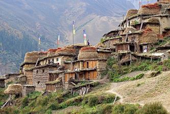
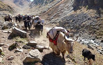
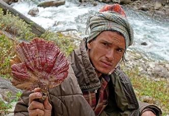
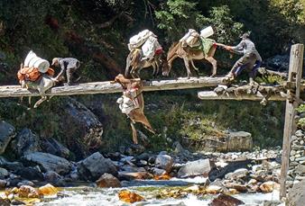
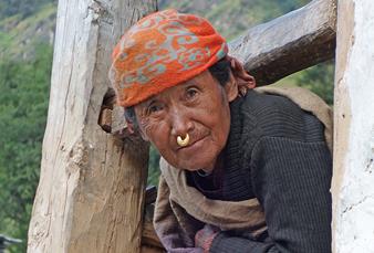
Physically, this trek was relatively easy. The highest point was Sakya Lagna (4709m), making this trek my first in Nepal completely below 5000m. Its highlights were the spectacular views of Saipal from the upper Kawadi Khola valley, the visit of the old and traditional villages of Chala and Yuna, the remoteness of the Kawadi Khola valley, and various encounters with people, in particular villagers returning from their monsoon pastures, caravans of several hundred goats carrying tons of merchandise (grain, salt), mushroom hunters, honey hunters... We saw a single group of trekkers soon after leaving Simikot. After we left the Humla Karnali Nadi valley, we saw no foreigner until we landed in Nepalgunj.
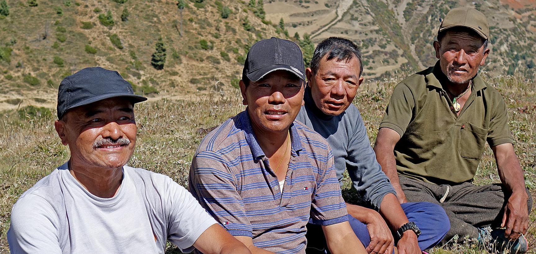
As for all my previous trips to Nepal for almost two decades, the logistics for this trek was arranged by Windhorse Trekking. My friend Dawa, with whom I had been on several trips before (Dolpo, Humla, Api), was the leader of the support team, which consisted of another Dawa, our cook, with whom I had already traveled to Cho Oyu in 2001 and Humla in 2014, and a muleteer recruited in Simikot. Ang Karma Sherpa, the owner of Windhorse Trekking and a long-time friend, also joined the group.
From left to right: Ang Karma, Dawa#1 (team leader), Dawa#2 (cook), muleteer.
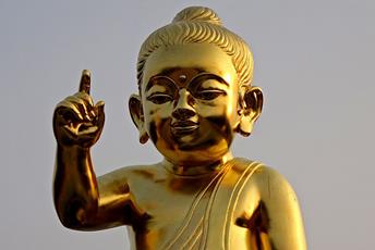
After returning to Kathmandu, as I had a few more days to spend in Nepal, I traveled to Lumbini, the birthplace of Lord Buddha, in southern Nepal.
Click on the links below to see pictures of the various sections of this trip:
|
|
|
|
|
|
|
|
||||
|
|
|
|
|
|
|
|
|
|
|
|
|
|
||||
|
|
|
|
|
|
![]()