Taiwan: Nangan, Matsu Islands (November
2018)
![]()
Return
to main Matsu Islands page | Return
to main Taiwan page
Maps. Left: Location of Matsu Islands
relative to Taiwan and China. Right: Annotated map of Nangan.
|
|
|
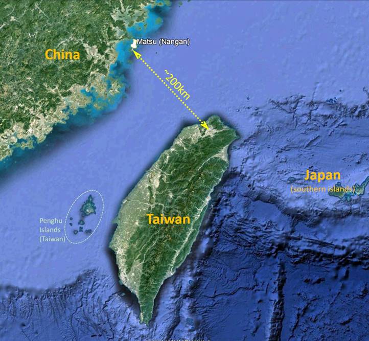
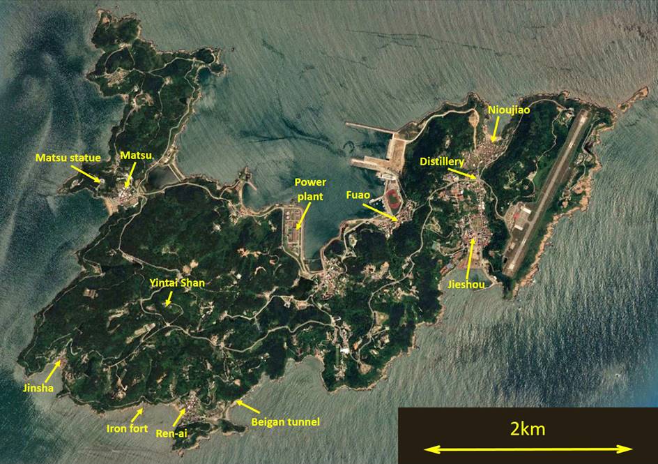
Nangan is the
largest of the Matsu islands. It lies approximately 200km from Taipei and 20km
from the China coast. It is connected to the main Taiwan island by direct
flights and ferries. Although small, the island is hilly with a highest point
of 250m (Yintai Shan, 雲台山) and rather
diverse with a number of small villages spread out. It boasts numerous former
military installations often connected by tunnels. The island is famous as the
legendary resting place of Mazu (媽祖), the
goddess of the sea and protector of the fishermen and sailors. Her earthly body
is believed to have washed ashore on the western side of Nangan near the
village of Matsu and to be buried in the village′s temple. [Note: Oddly,
the usual romanization of the goddess 媽祖 is Mazu, while that of the 媽祖 archipelago is Matsu.]
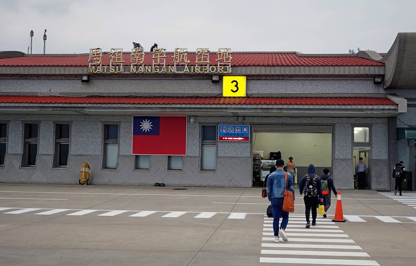
Arrival from
Taipei at the small, quiet Nangan airport, located on the eastern edge of the
island.
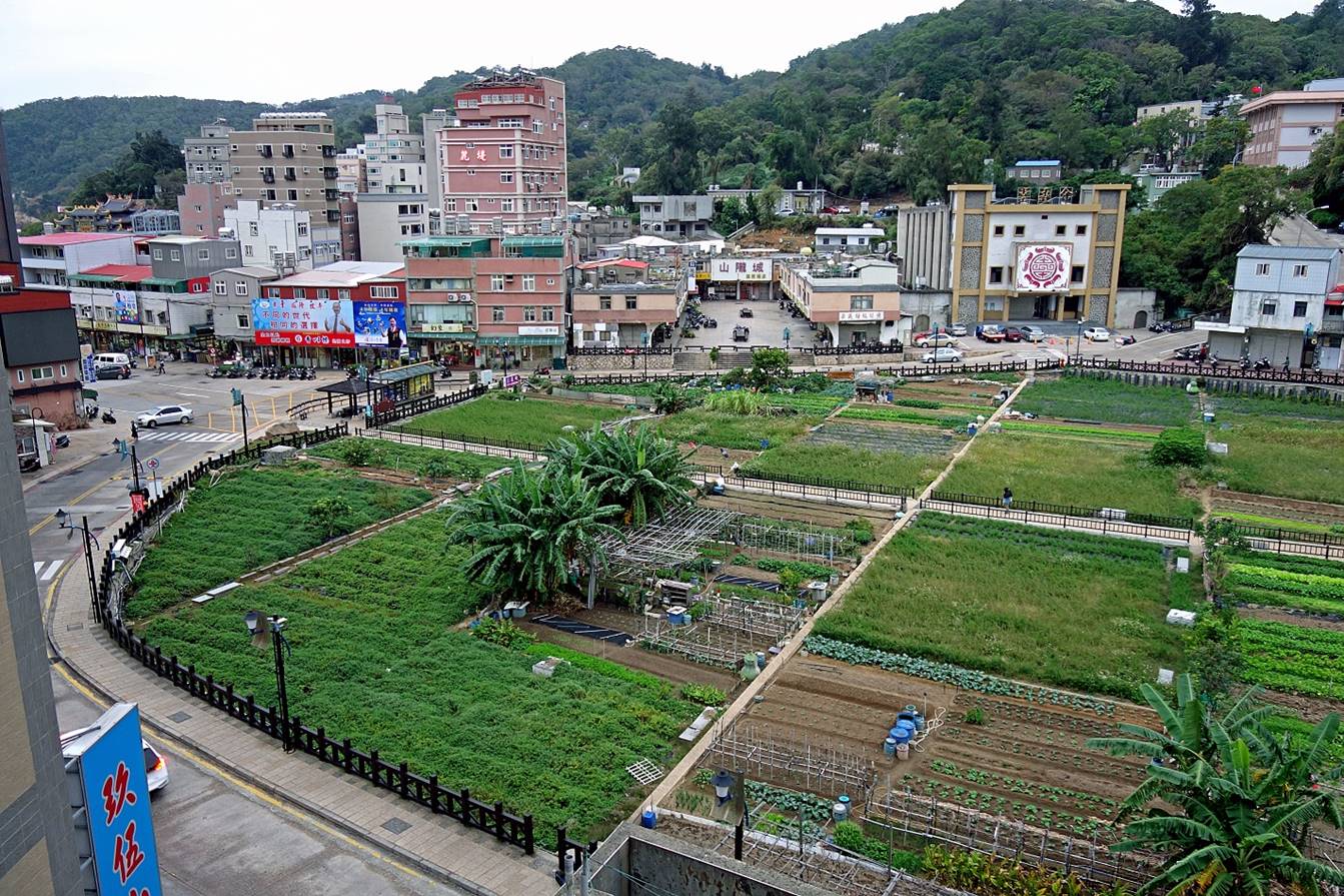
Jieshou village
It is the
largest village on the island, where most of the shops and restaurants are
concentrated.
The village
surrounds the Vegetable Park, a large area where local people grow vegetables
and fruits.
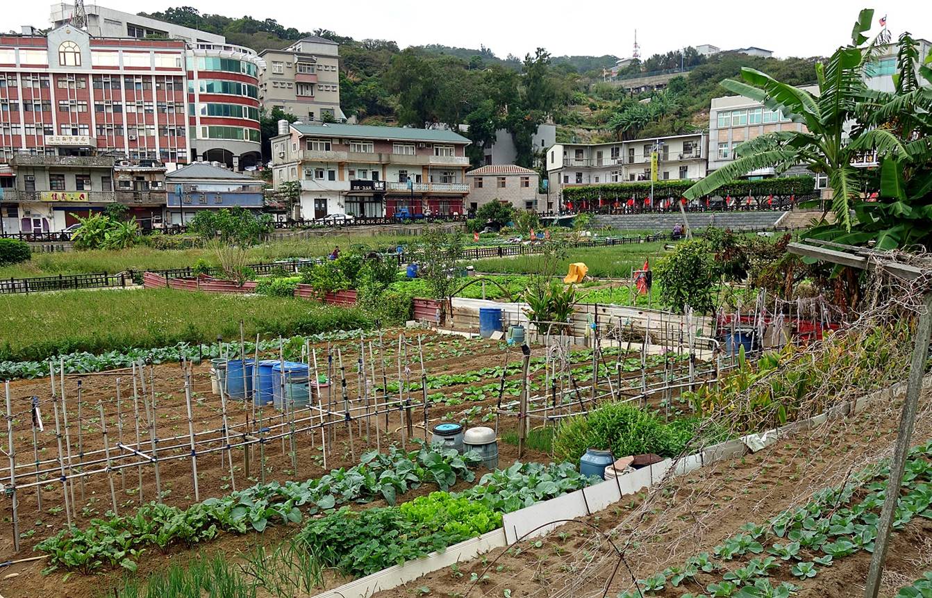
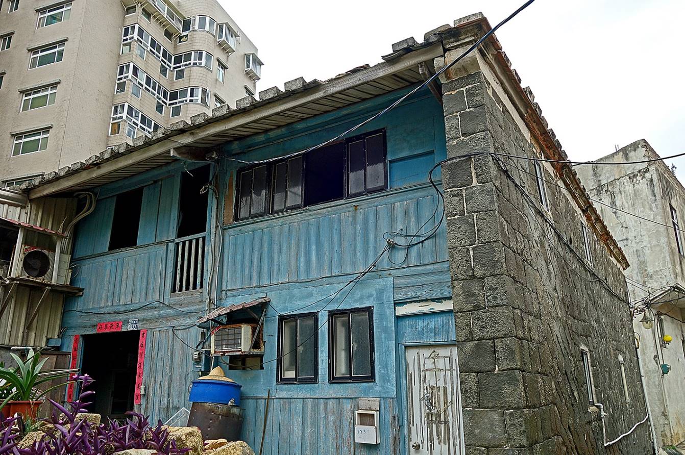
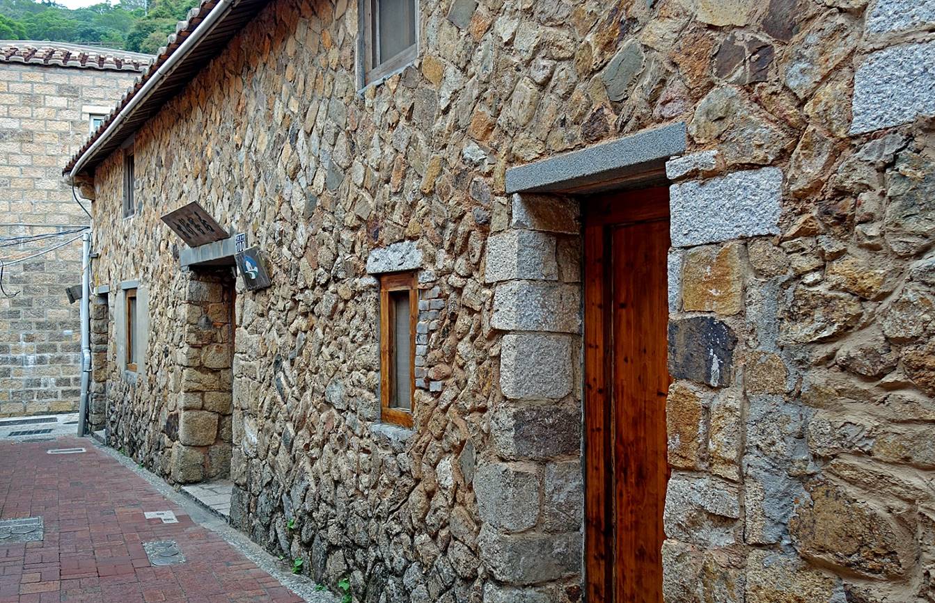
House with a
stone wall reminiscent of the past. There are more stone houses in other
villages on Nangan, but the best place to see such houses is by far in the
village of Qinbi on Beigan island (see here).
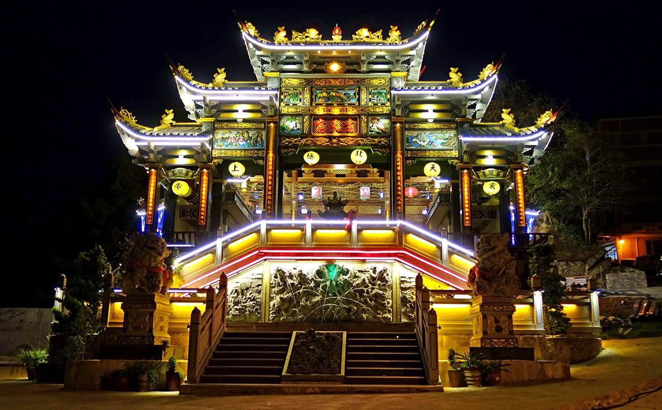
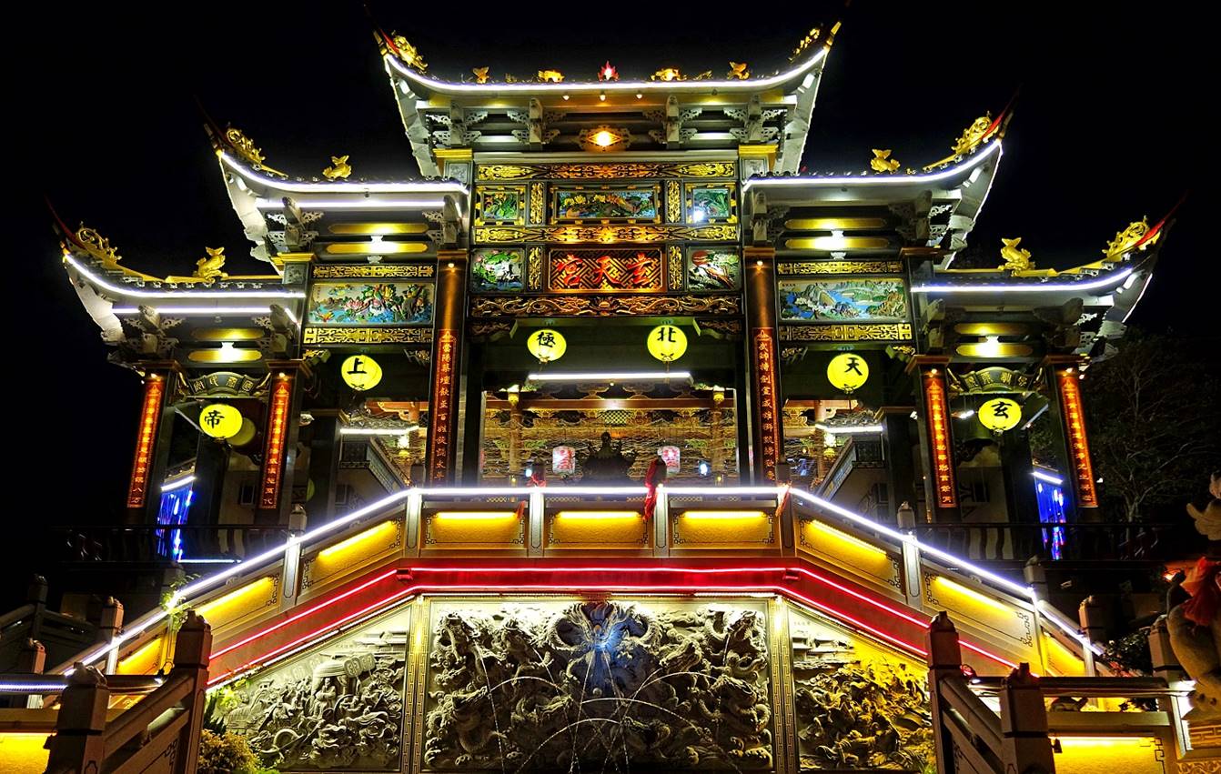
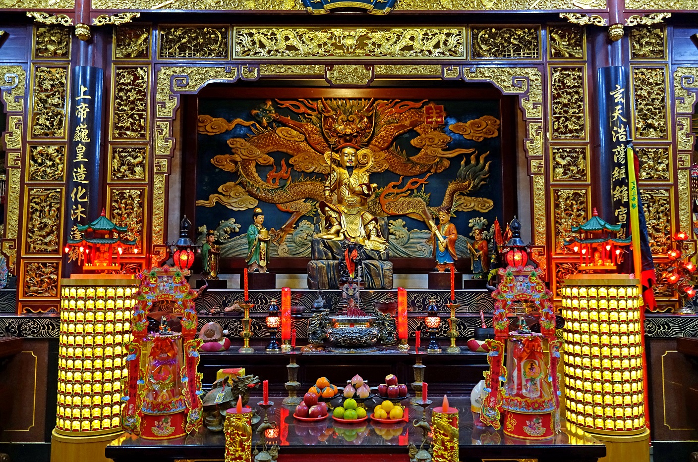
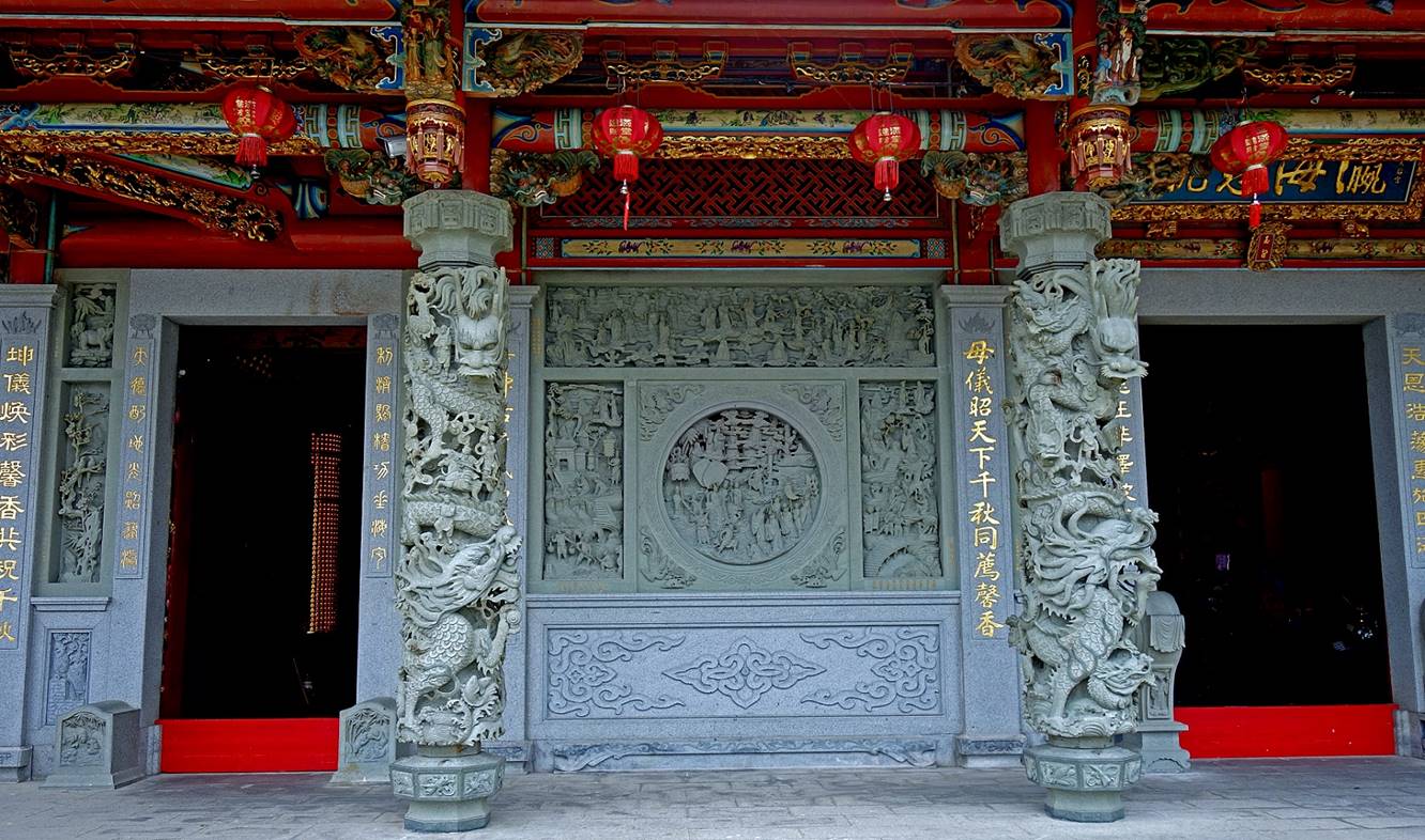
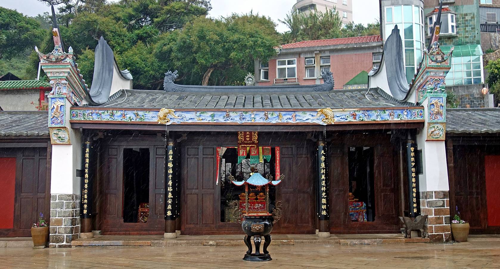
Xuantian
temple (玄天宮):
This temple
is located a short distance south of the Vegetable Park. Its construction was
completed in 2015. It is mainly dedicated to Xuantian Shangdi (玄天上帝), the Emperor of the Dark Heaven (the North). While being a fierce
warrior, he is considered a benevolent protective god.
- Illuminated
facade of the temple at night.
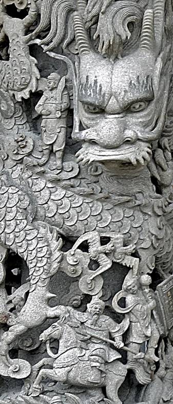
- Stone
relief carving on the left-hand side of the stairs.
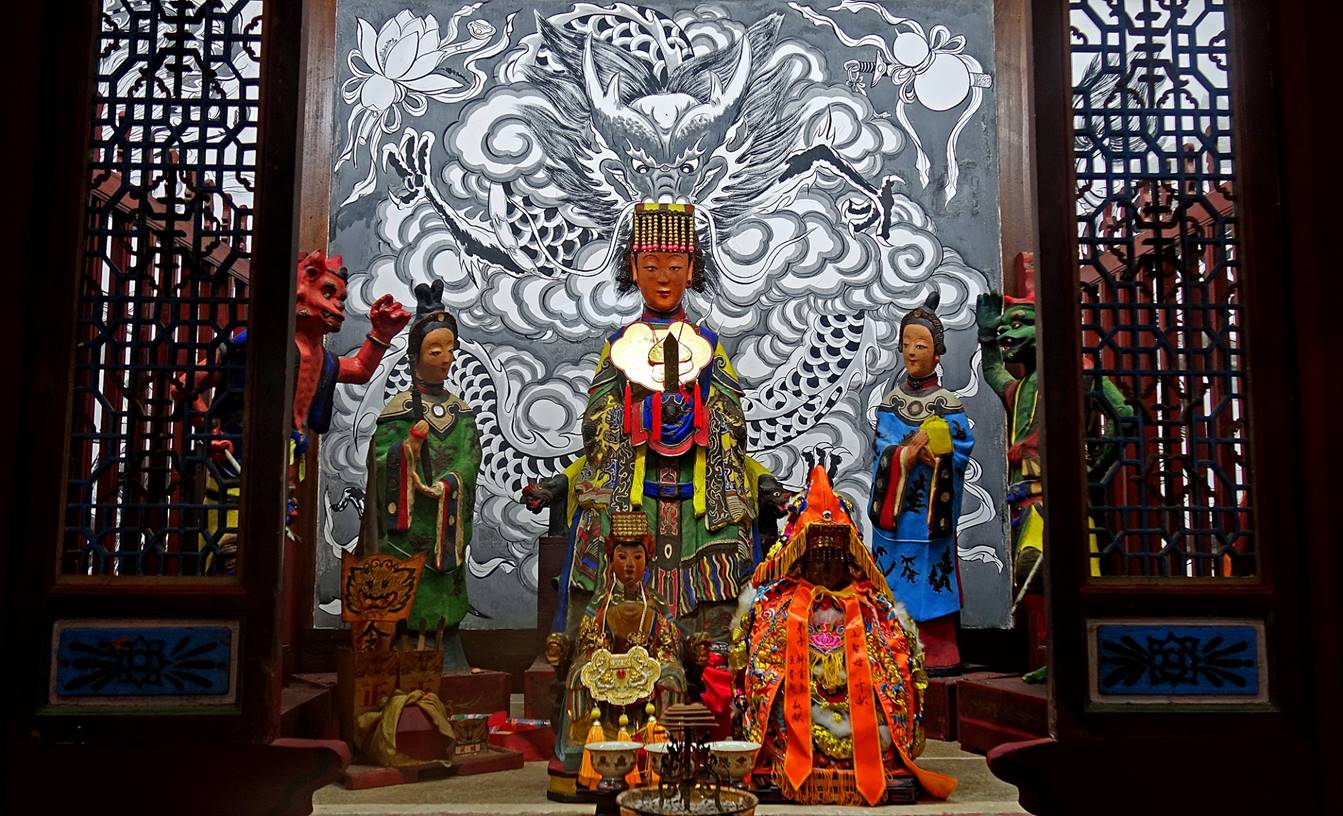
- Altar
dedicated to Xuantian Shangdi.
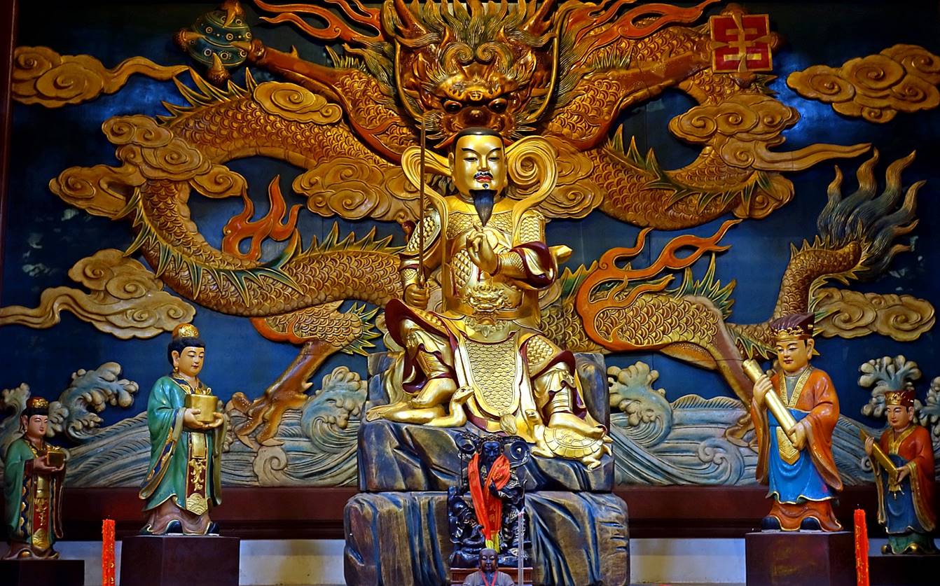
- A closer view of the statue depicting
Xuantian Shangdi. According to legend, he cleansed himself of his
sins by washing
his internal organs in a river. These then transformed into a demonic snake and
a turtle. After subduing them, Xuantian Shangdi kept them under his feet (as
shown in the photo below) to serve as his attendants. The statue symbolizes the
control over inner demons, specifically desire and fear.
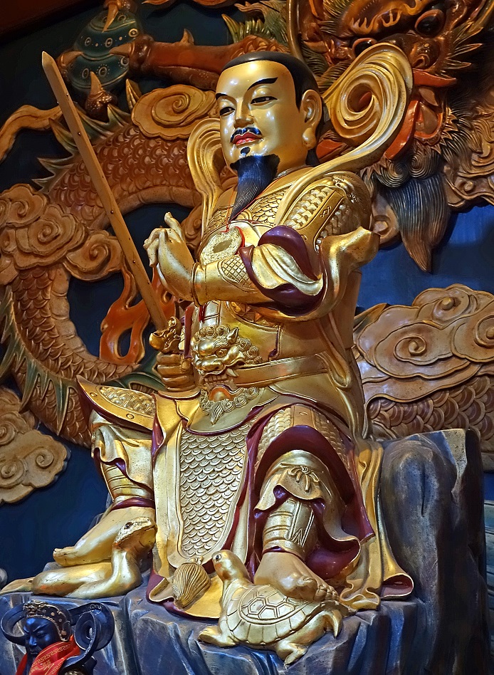
- Left: Another view of the statue of
Xuantian Shangdi. Right: Statue of Mazu, the goddess of the sea, also enshrined
in the temple.
|
|
|
Matsu distillery
Located
between the Jieshou and Nioujiao villages, this distillery produces Kaoliang
sorghum liquor (38 to 63 percent alcohol by volume) and Laojiu rice wine (about
30 percent).
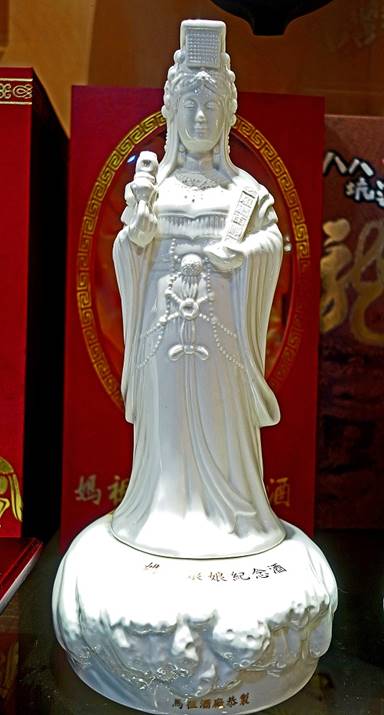
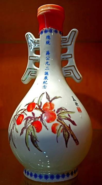
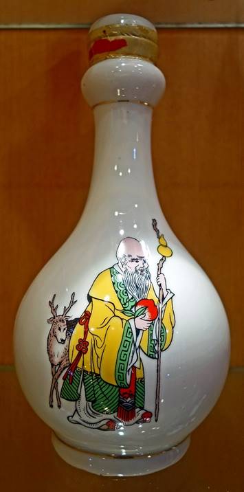
Beautiful Kaoliang liquor bottles. The one on the left represents
the goddess Mazu. The decoration on the third bottle from the left depicts Shouxing (寿星), a Taoist deity associated with long life, holding a Peach of
Immortality in his right hand.
|
|
|
|
|
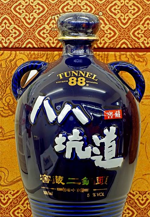
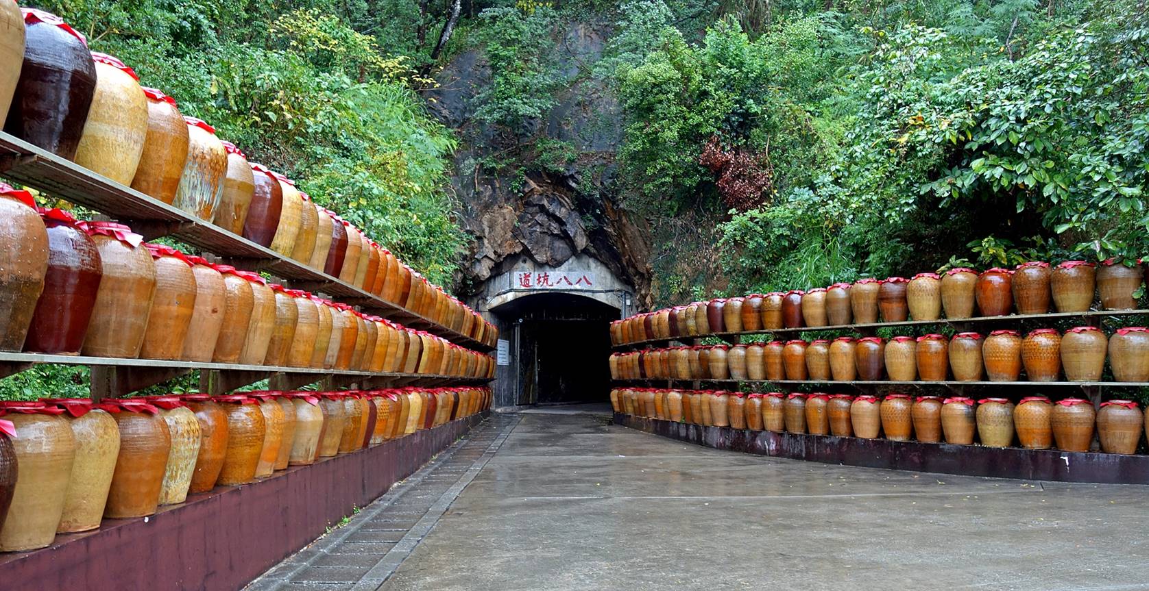
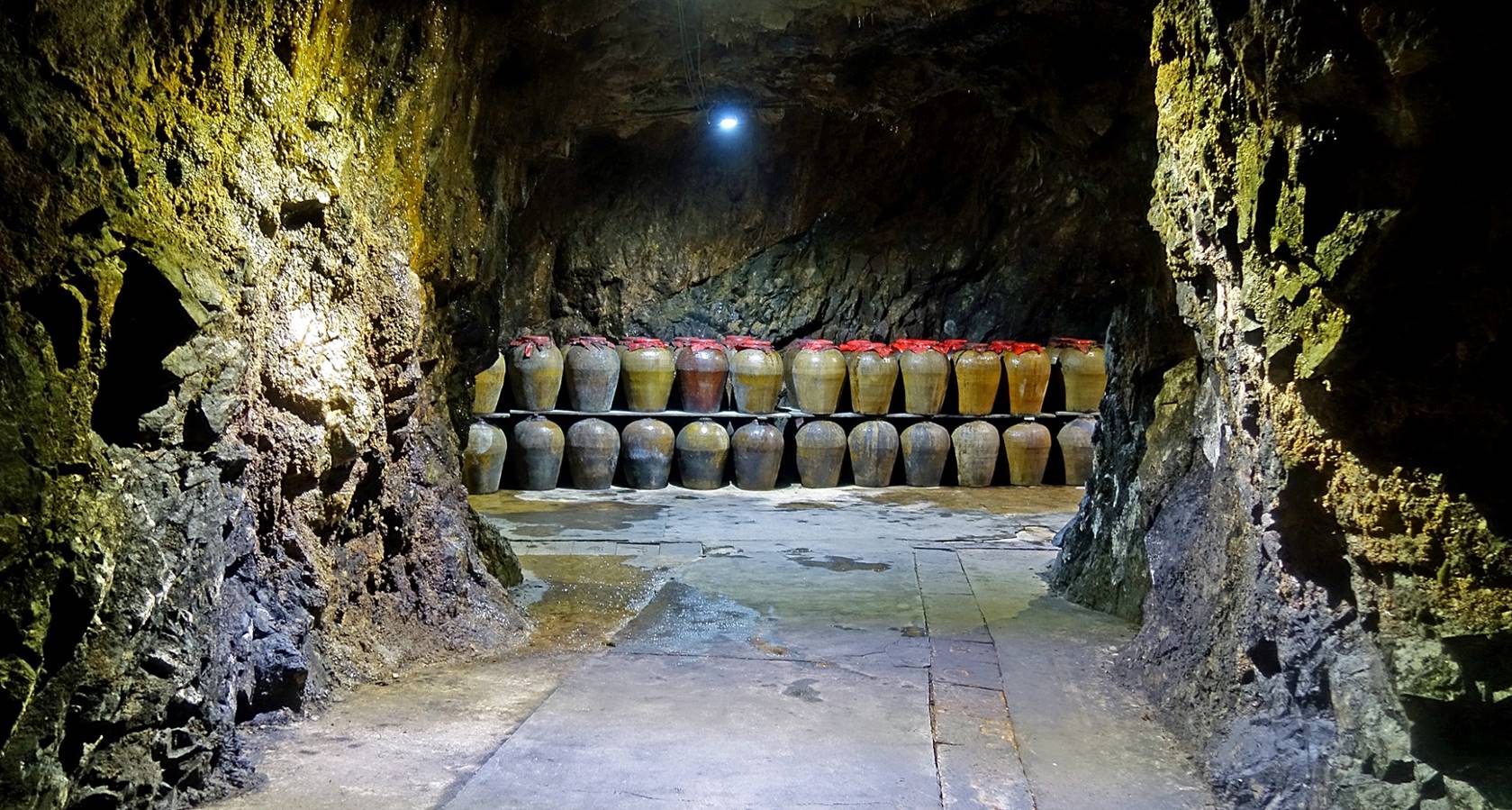
Near the distillery, Tunnel 88, a former
military installation, now used to age liquor and wine. ″Tunnel 88″
has become the brand name of the Kaoliang liquor produced in Nangan (see the
bottle shown in the rightmost photo above).
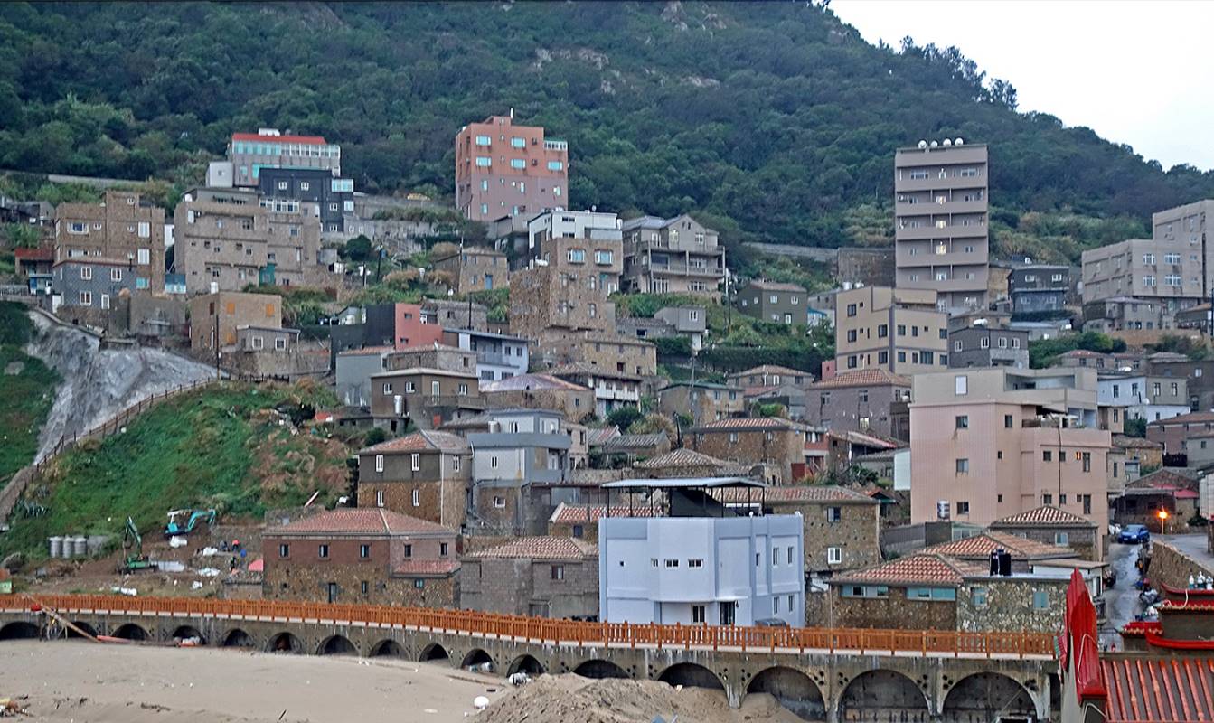
Nioujiao village
This village
built on a steep slope facing the sea mixes old stone houses (some remodeled,
some crumbling) and new buildings.
View of the
village from Niufengjing Wulinggong temple (see below).
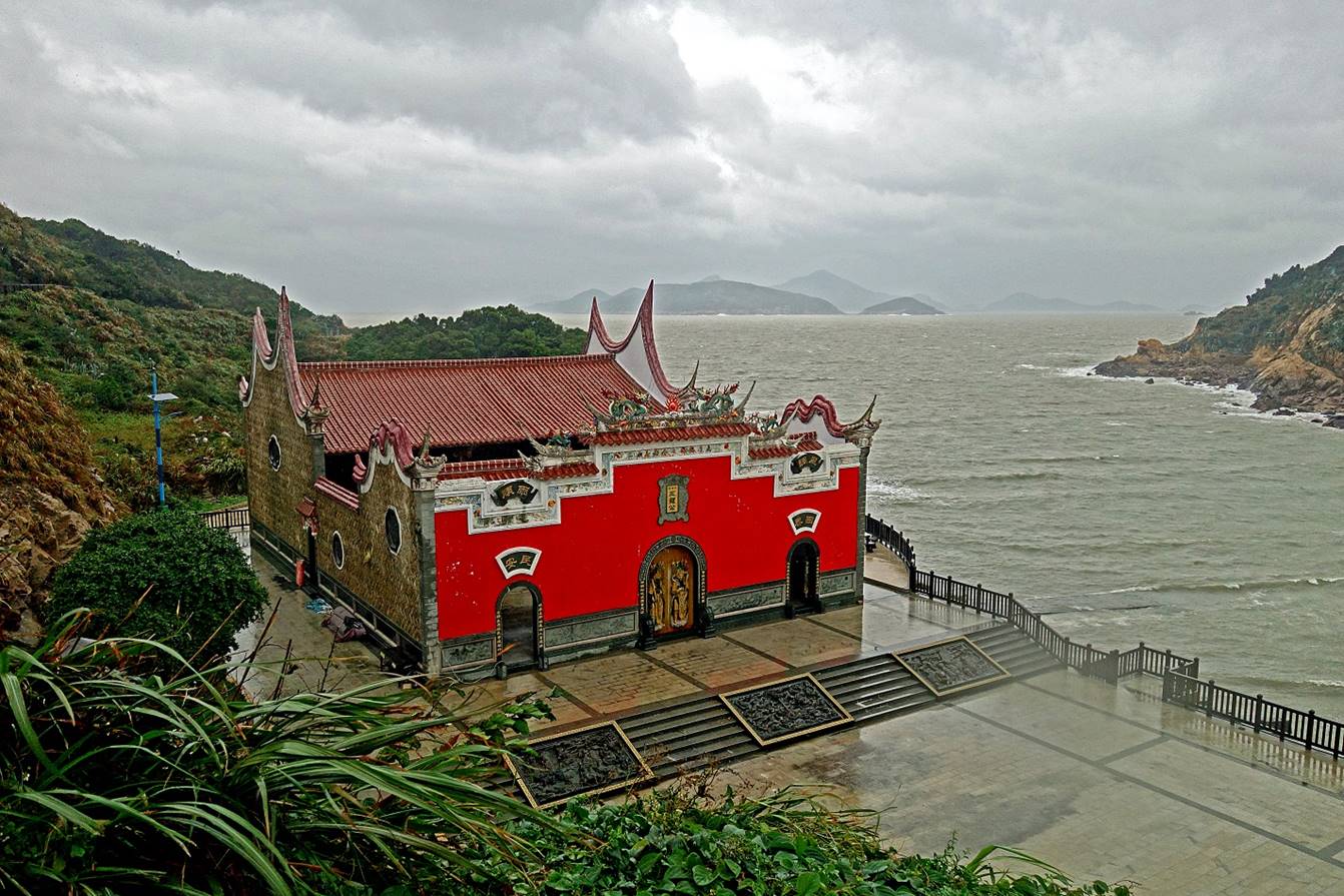
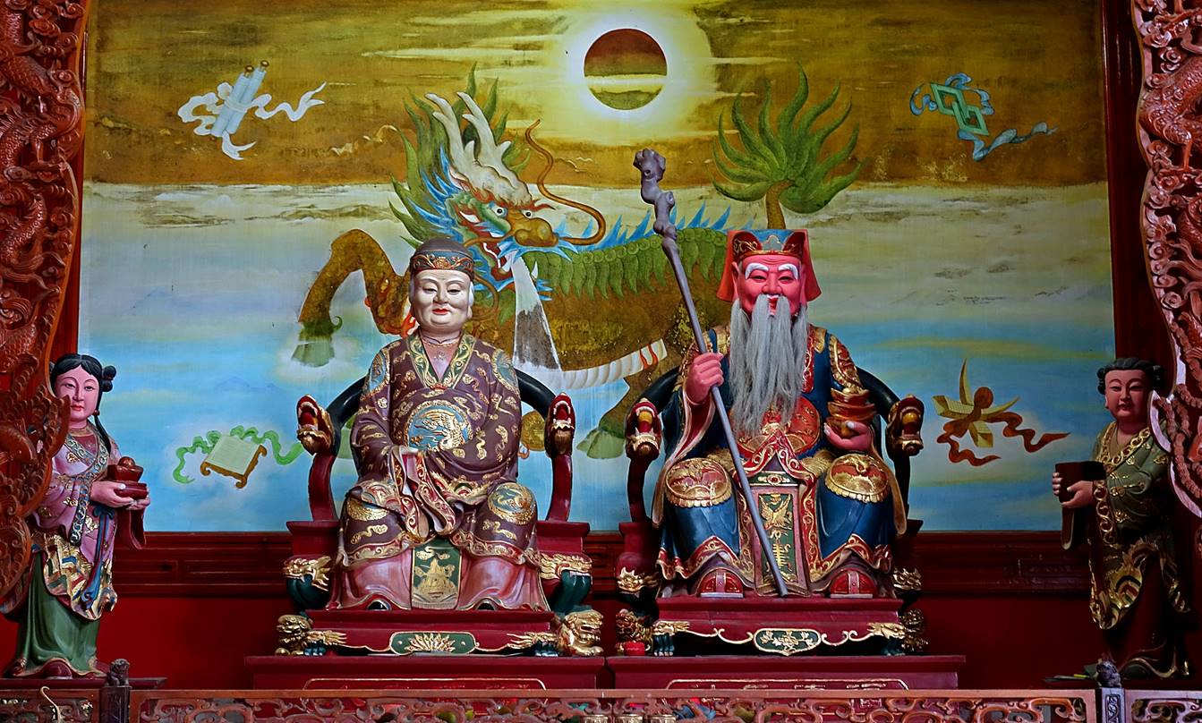
Niufengjing Wulinggong temple (牛峰境五靈公廟):
Located below the village of Nioujiao, this temple
is dedicated to the Five Lords of Plague Eradication (五靈公, ″wulinggong″), a group of Taoist deities widely revered in the
Fujian and Matsu regions. A striking
architectural feature of the temple resides in its ″firewall″
gables (封火山牆) extending above the roofline and shaped as waves
resembling rising flames. The temple is also locally known for its bright red
facade. The Nioujiao villagers like to say that they gave all the color they
could find to their temple, rather than to their houses.
- Views of
the temple.
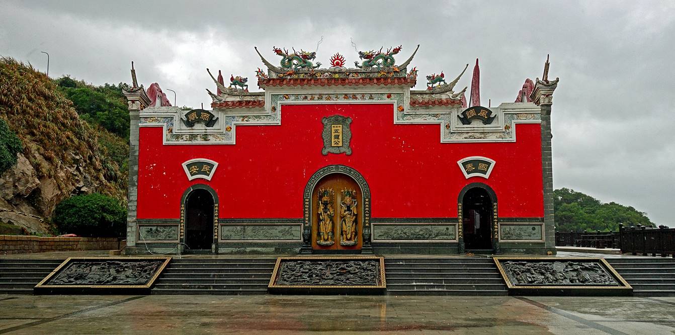
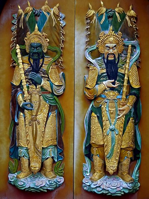
- Wood carvings on the front doors.
|
|
|
|
- Inside the temple's courtyard, behind
the front doors.
- Altar
dedicated to the Five Lords of Plague Eradication. Due to my camera viewpoint
and the depth of the altar, two of them are largely obscured by side
decorations.
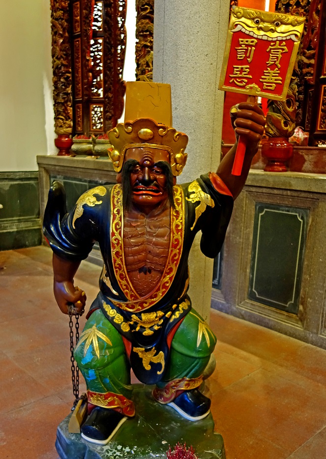
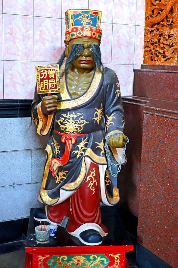
- Left photo:
General Fan (黑無常, ″Black
Impermanence″). The text on the sign he holds reads 罰惡 on the left and 賞善 on the right, which translates to ″Punish
Evil″ and "Reward Good″.
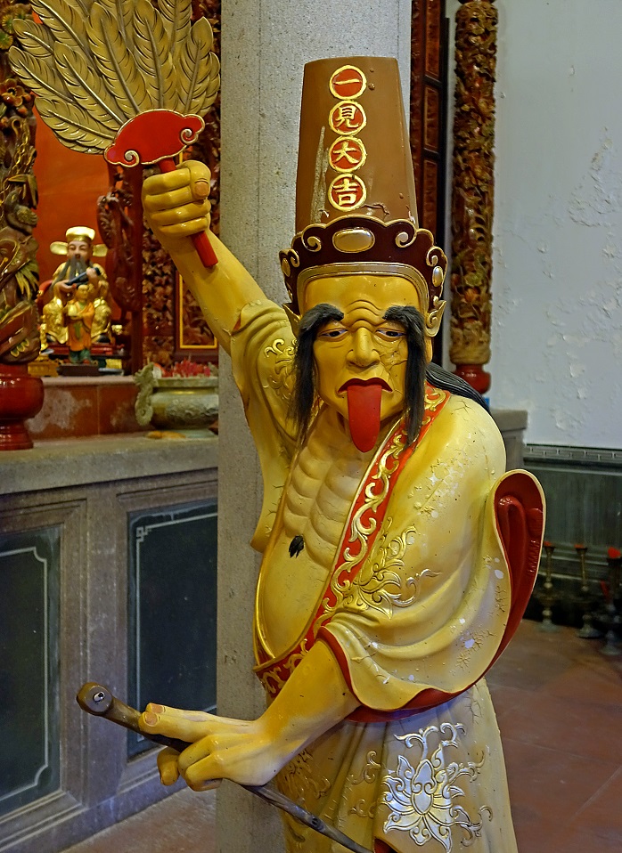
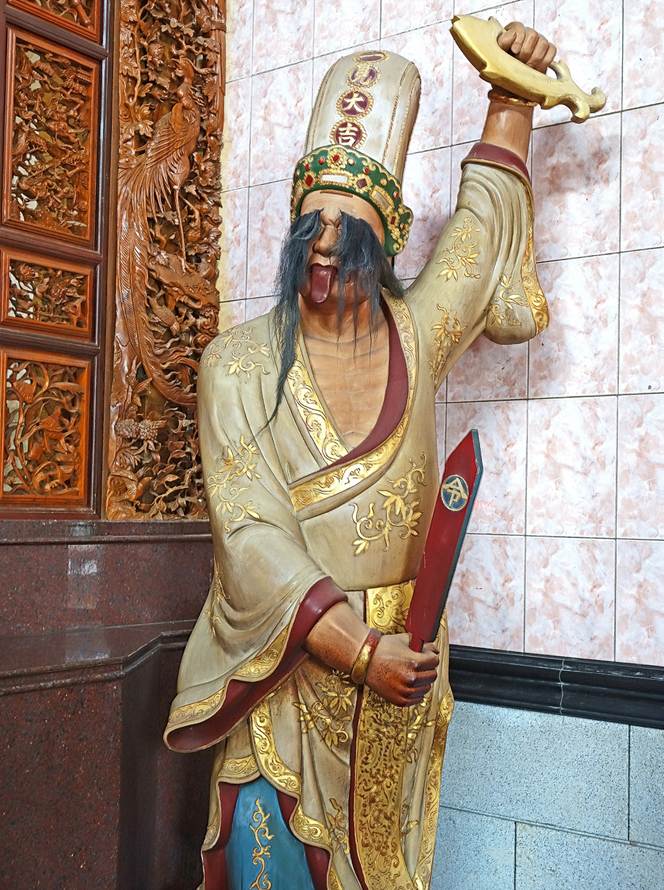
- Right photo:
General Xie (白無常, ″White
Impermanence″). The text on his hat, 一見大吉, translates
to ″Good luck at first sight″.
They are both
guardians of the temple.
|
|
|
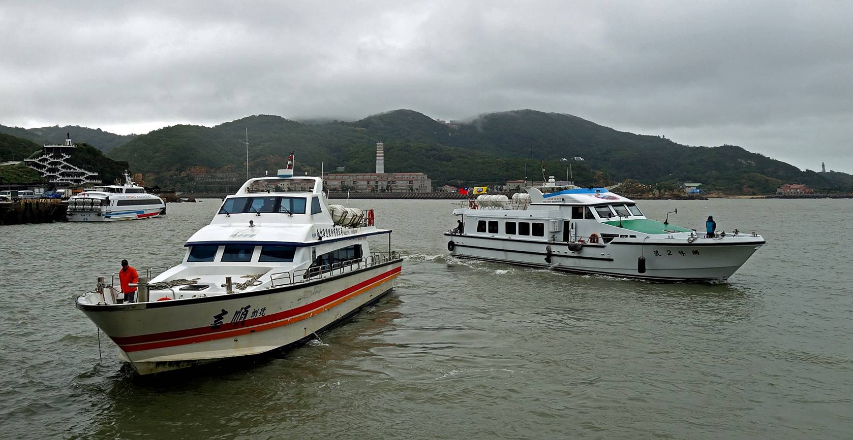
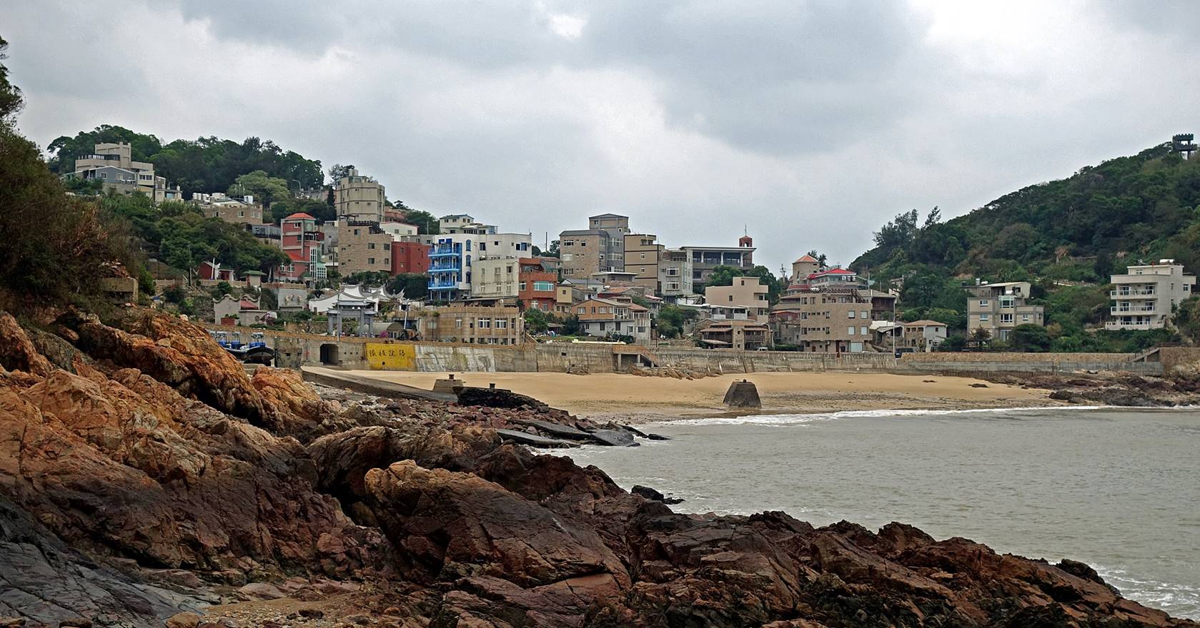
Fuao village and harbor
The Fuao port
concentrates ferry traffic between Nangan and Taiwan′s main island and
other Matsu islands.
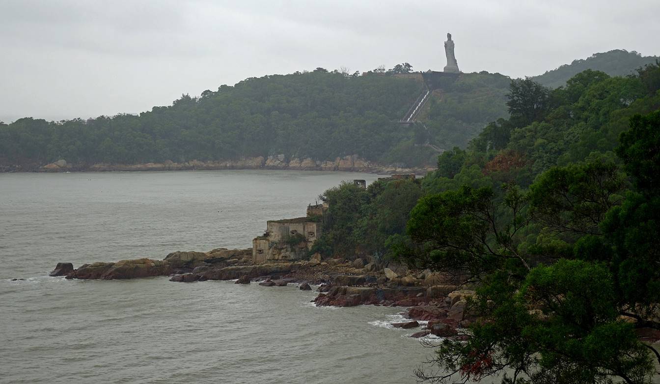
Ferries in the port. The
power plant that serves the Matsu islands, located on the other side of the
bay, is visible near the center of the photo. The large statue of Mazu (see
further down in this page) located on the western side of the island is also
slightly visible on the right of the photo.
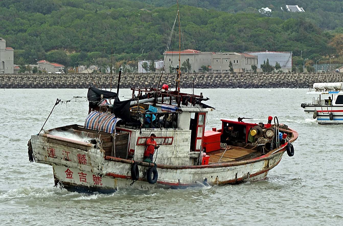
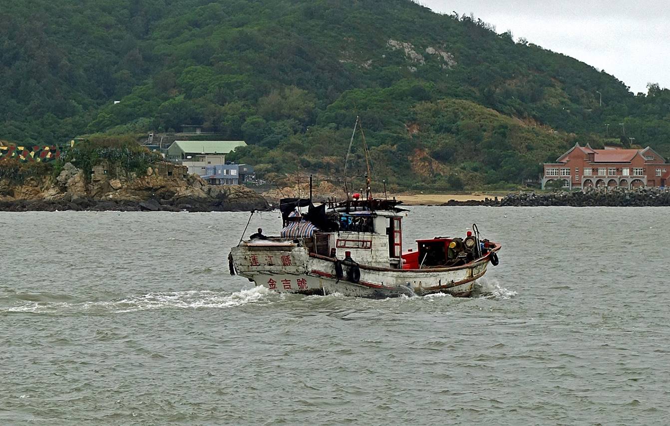
Old traditional
fishing boat leaving the port.
Statue of
Chiang Kai-shek looking toward China.
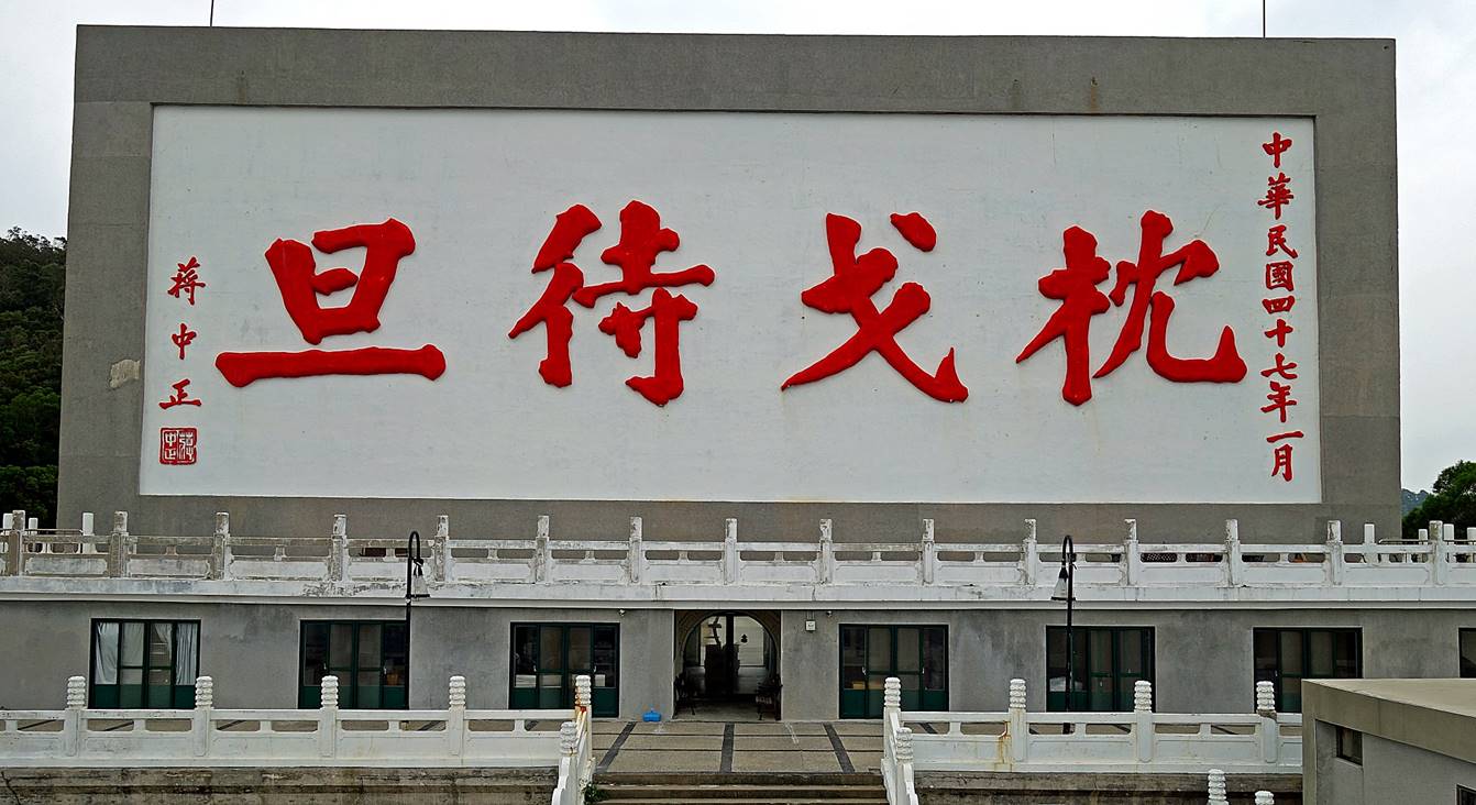
Sign on the hill facing China, above the statue
of Chiang Kai-shek. It says ″We are sleeping on our guns waiting for
the sun to rise″, meaning ″We are ready and will attack soon″.
The sign is supposed to be big enough to be readable from the China coast.
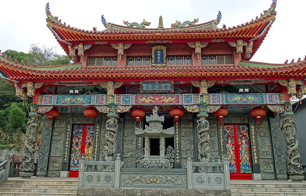
White Horse King temple (南竿清水境 白馬尊王廟)
Located a short distance
southwest of the Fuao village, in the Qinshui village, this temple enshrines a legendary local
hero, known as 白馬尊王 (meaning ″White
Horse King″), who fought a malevolent sea monster that was killing people.
Riding a magical white horse, he killed the monster, but died during the fight.
There are several White Horse King temples in the Matsu islands.
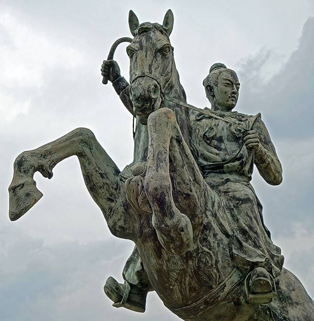
Left: Facade of the
temple. Right: Statue depicting the general on his horse (actually this statue
is located in Jieshou).
|
|
|
Wood carvings on the doors of the temple.
|
|
|
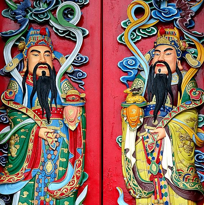
Altar dedicated to the White Horse King
and his wife.
Altar featuring Tudigong (土地公), the Earth God in Taoism, seated next
to his wife Tudipo (土地婆), the Earth Goddess.
Left: General
Fan (黑無常). Right:
General Xie (白無常).
|
|
|
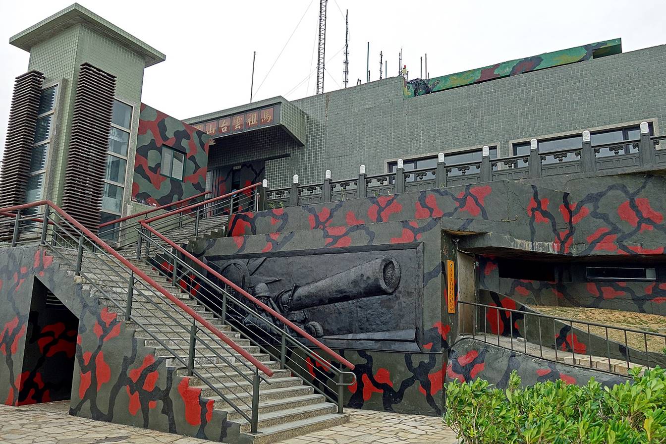
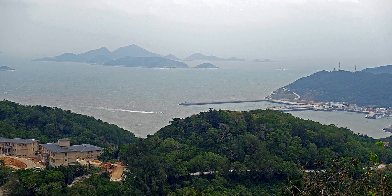
Yintai Shan (雲台山)
Nangan
culminates at the summit of Yintai Shan (250m), the second highest point in all
the Matsu islands, just behind Bi Shan (298m) on Beigan island. Not
surprisingly, the summit is occupied by an operational military installation.
View from Yintai Shan toward the
north-east. The island of Beigan (with Bi Shan at its center) and the port of
Fuao are respectively visible on the center-left and on the right of the photo.
Matsu village (馬祖村)
Located on
the west coast of the Nangan island, this coastal village is where, according
to legend, Lin Moniang (林默娘), the
historical woman who was deified as Mazu, drowned while attempting to save her
father, a fisherman. It is believed that her body was recovered by the
villagers and buried in the local Mazu Tianhou Temple (馬祖天后宮).
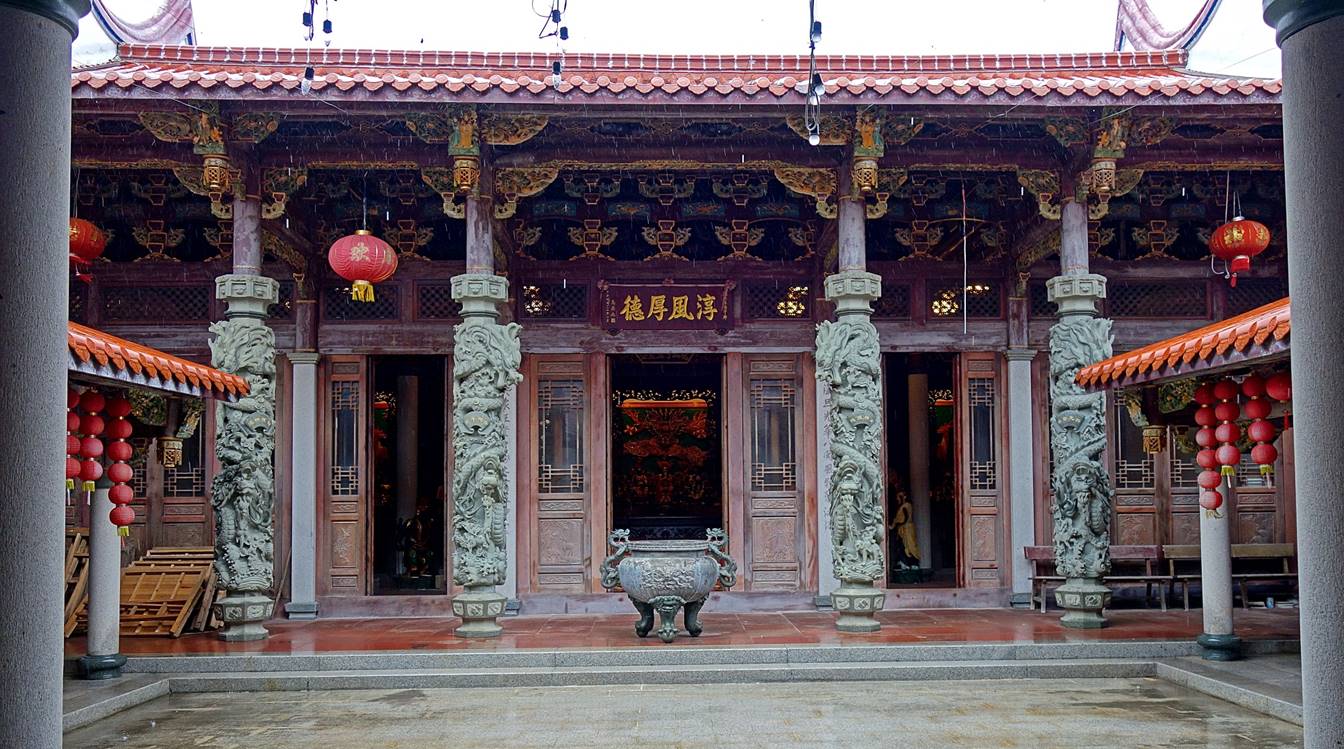
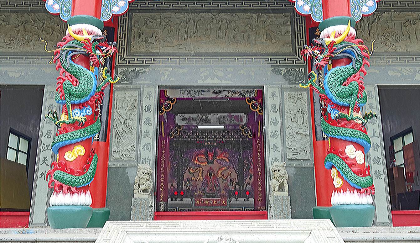
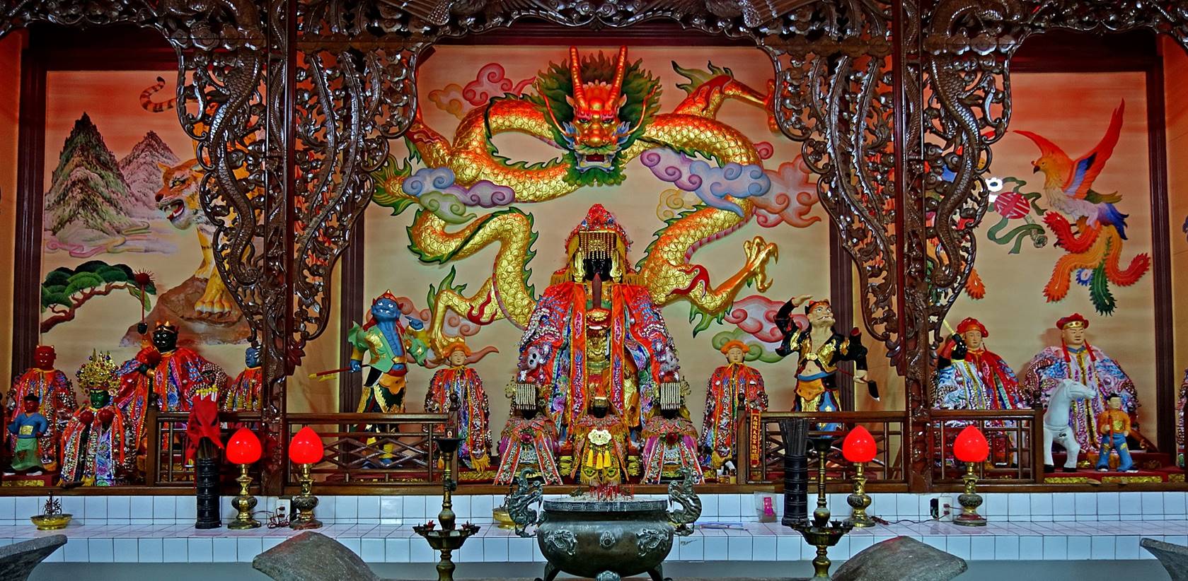
Mazu Tianhou temple (馬祖天后宮):
This temple was founded centuries ago, but it was rebuilt several times.
The last reconstruction dates of 1963, but it underwent a major restoration in
2000.
- Left:
Entrance to the temple. Right: Detail from the carved stone column on the left.
|
|
|
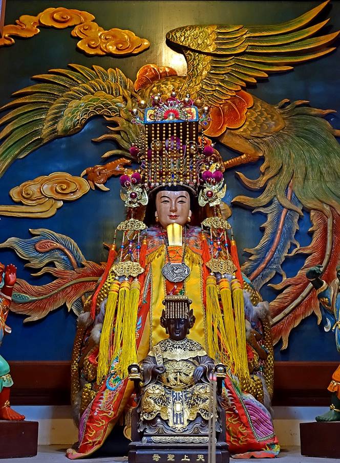
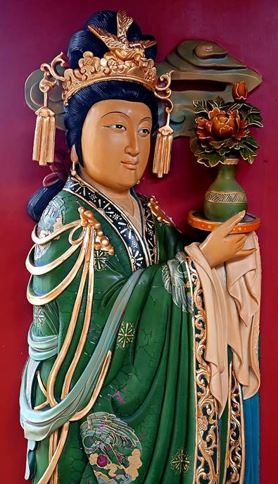
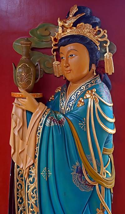
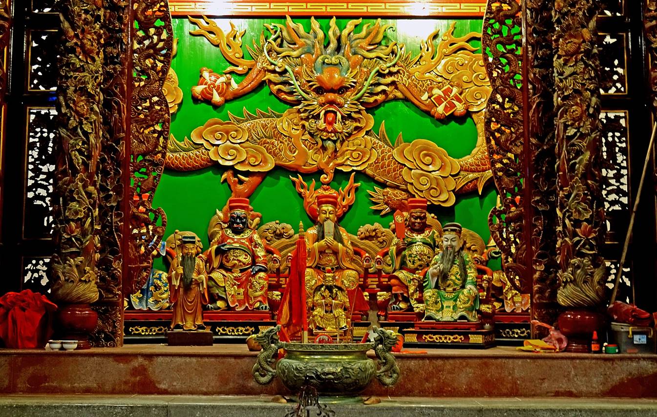
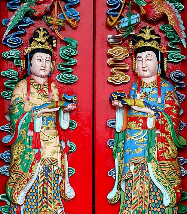
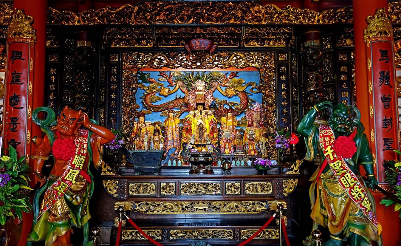
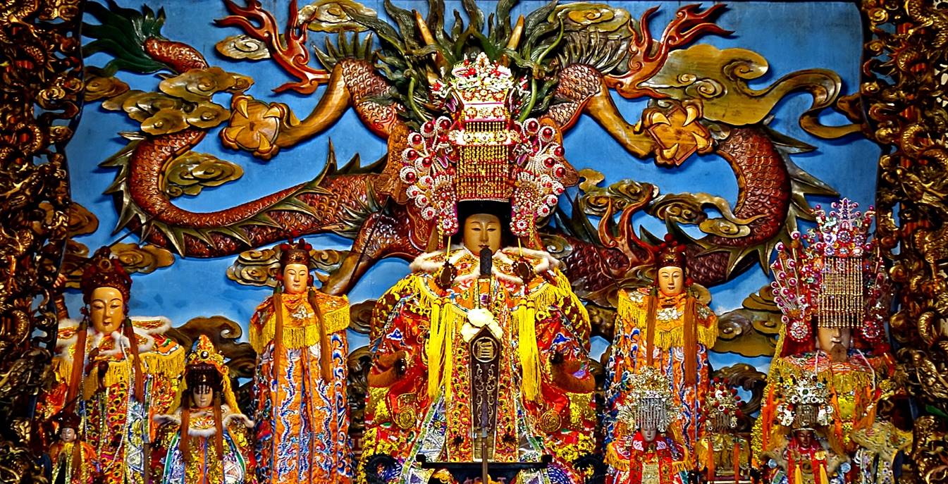
- Main altar dedicated to Mazu. The body
of Mazu is believed to be buried in front of the altar. The two large statues
standing on the sides of the altar represent Mazu's customary guardians. The
red one on the left is Shunfeng'er (順風耳), who can hear sounds from very far.
The green one on the right is Qianliyan (千里眼), who can see very far.
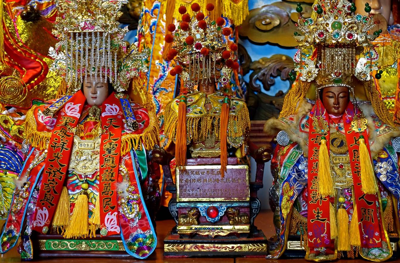
- Closeup on the altar.
- Close-up on
the small statues located in the right side of the altar. The statue of Mazu in
the middle of the photo, mounted on a support adorned with a bright red stone,
was carried to the summit of Everest in May 2009 by Lee Hsiao-shih (李小石), a native
of the Matsu archipelago.
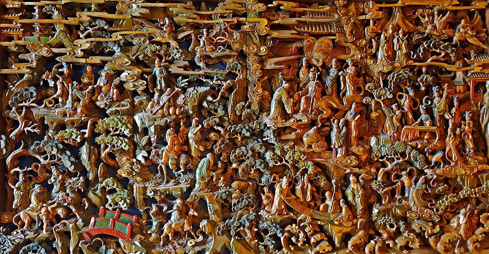
- Finely crafted wood carving adorning a
wall of the temple.
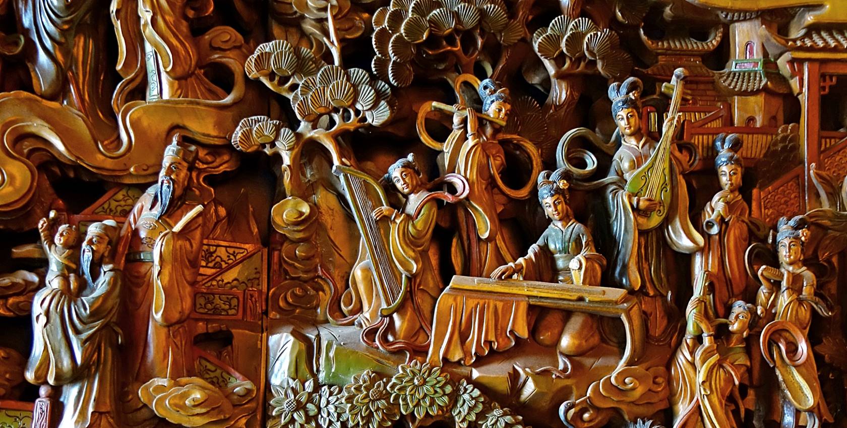
- Close-up of a section of the right
side of the wood carving shown above.
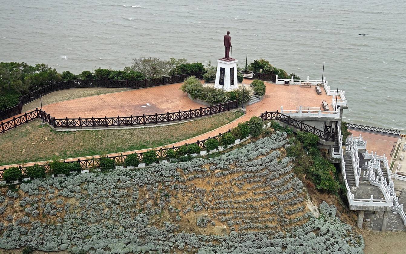
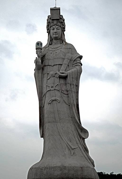
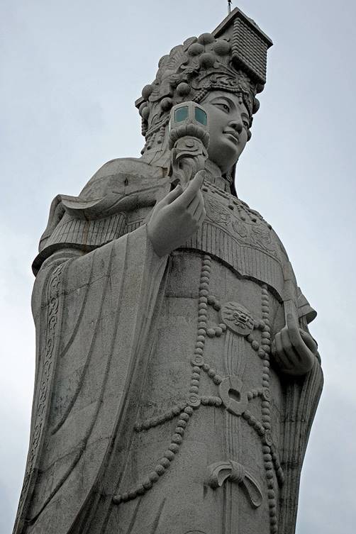
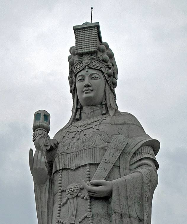
Giant stone
statue of Mazu, located a short distance north of the Mazu Tianhou temple. Completed in 2009, it is 29.6m tall.
|
|
|
|
Former fort
on the bay of Matsu harbor.
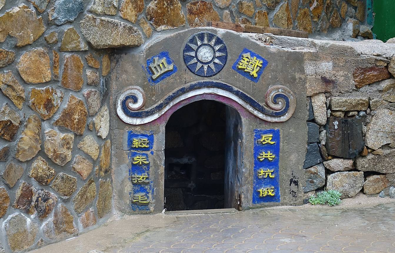
Jinsha village
This village
features several stone houses. Unfortunately, some have been over-restored,
while others are still crumbling.
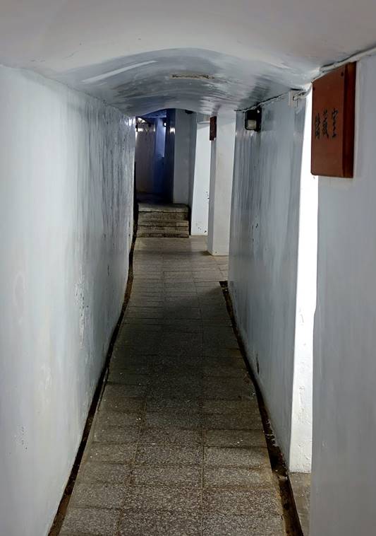
Entry to a small former military tunnel connecting
positions along the coast. The signs are slogans like ″iron blood″
(at the top) and ″death to Mao Zedong and the communists″ (on the
sides)
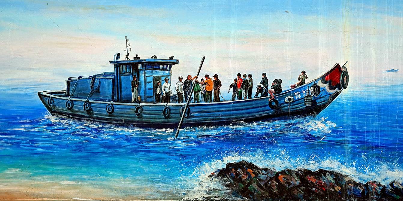
Mural.
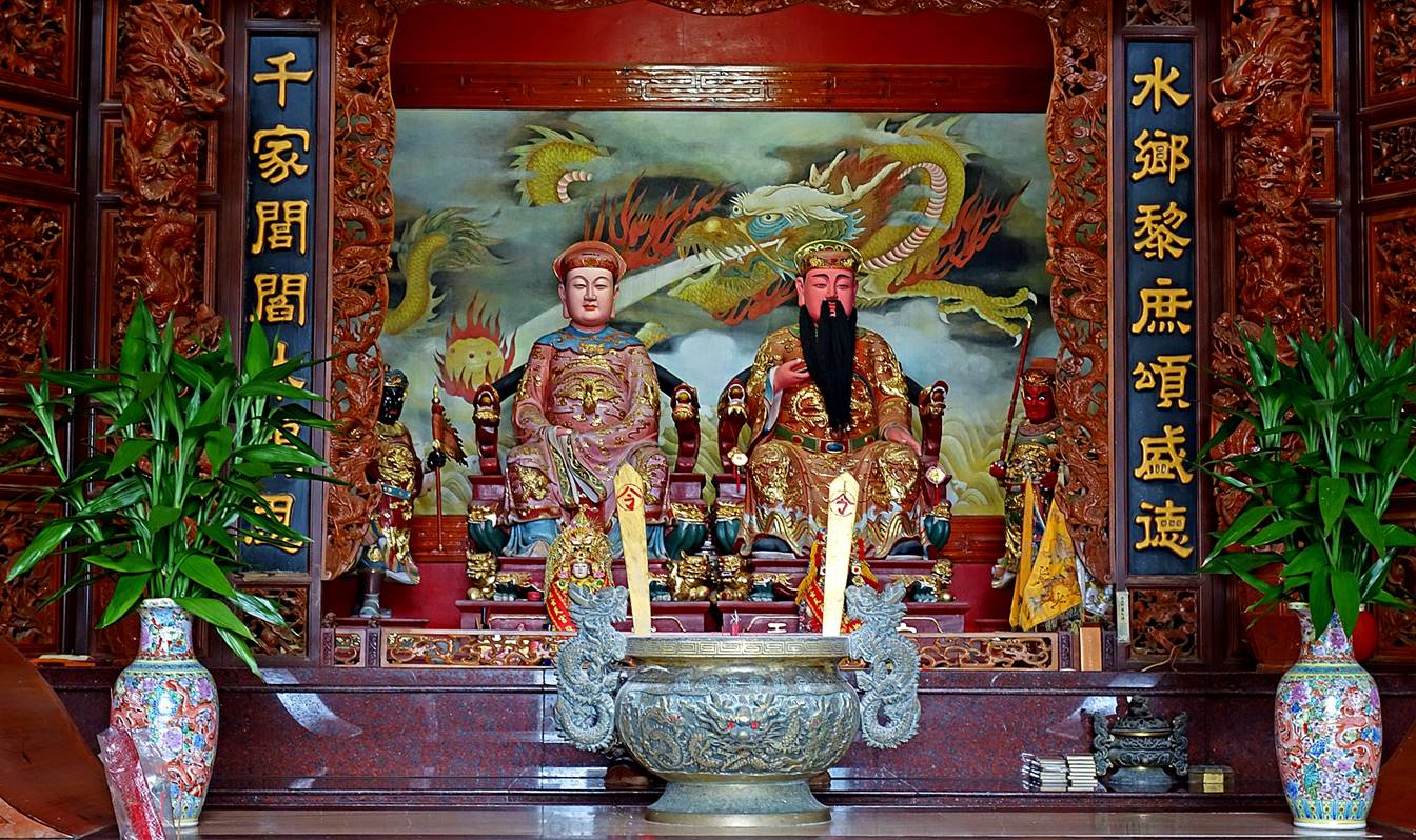
Mazu temple:
- Facade of
the temple
- Altar
dedicated to Mazu.
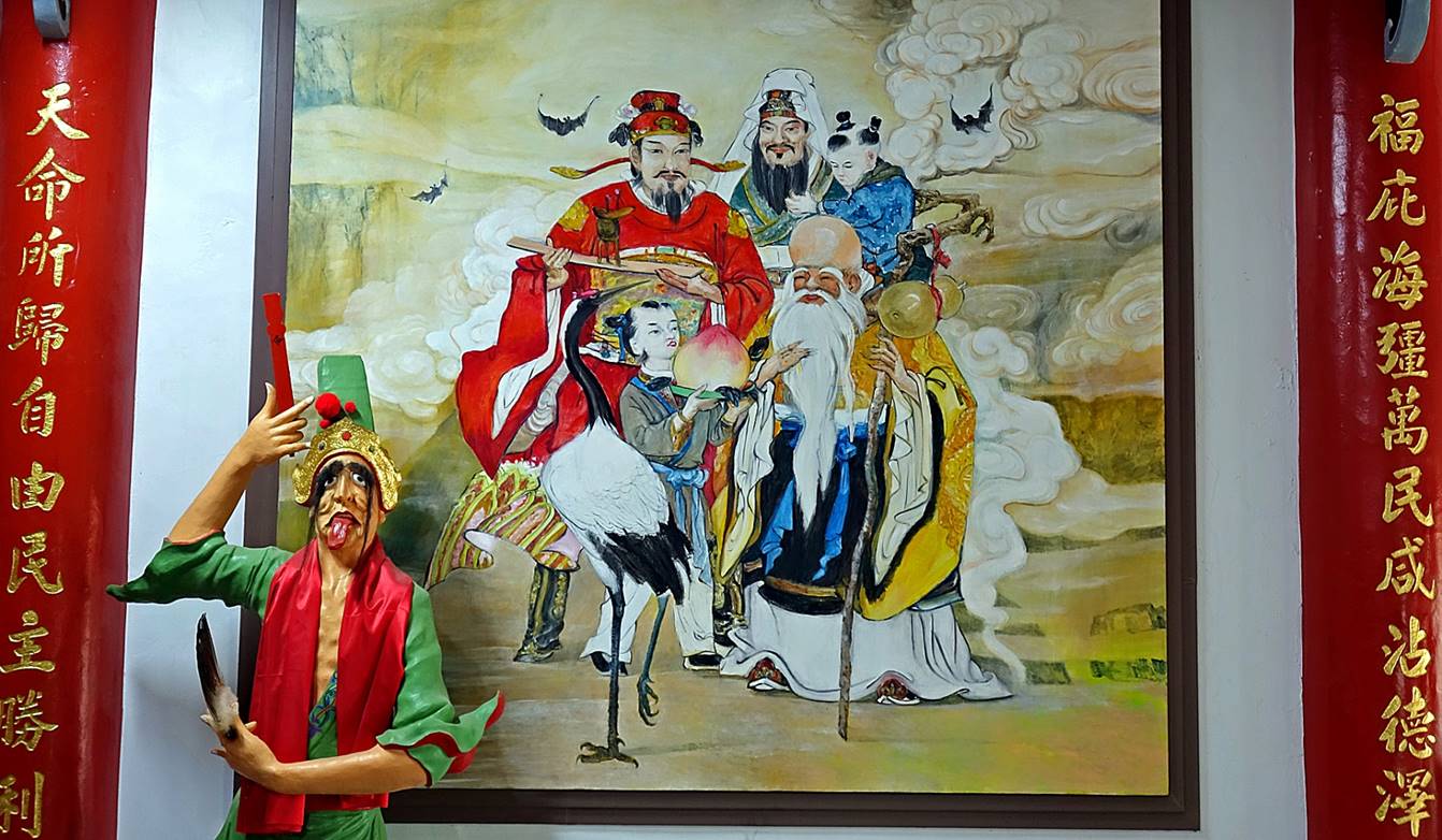
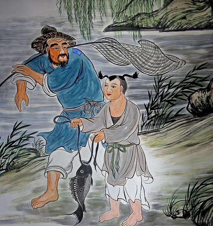
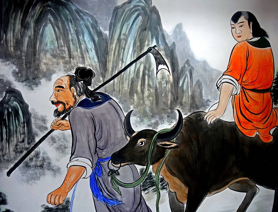
- Statue of General Xie (白無常), a guardian of the temple, who seems
to pose for this photo in front of a painting. The old man in the painting is
Shouxing (壽星), the Taoist god of longevity. His young attendant on his right holds a
Peach of Immortality.
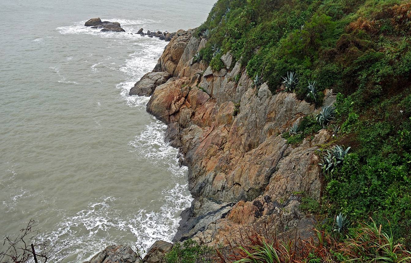
Between
Jinsha village and Ren-ai village (also called Tieban)
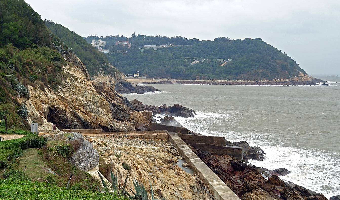
Steep rocky coast typical of most of the
coastline of the Matsu islands, one of the reasons why they have been so
difficult to attack and capture.
Remains of
fort 53. (Every fort on the island has a number.)
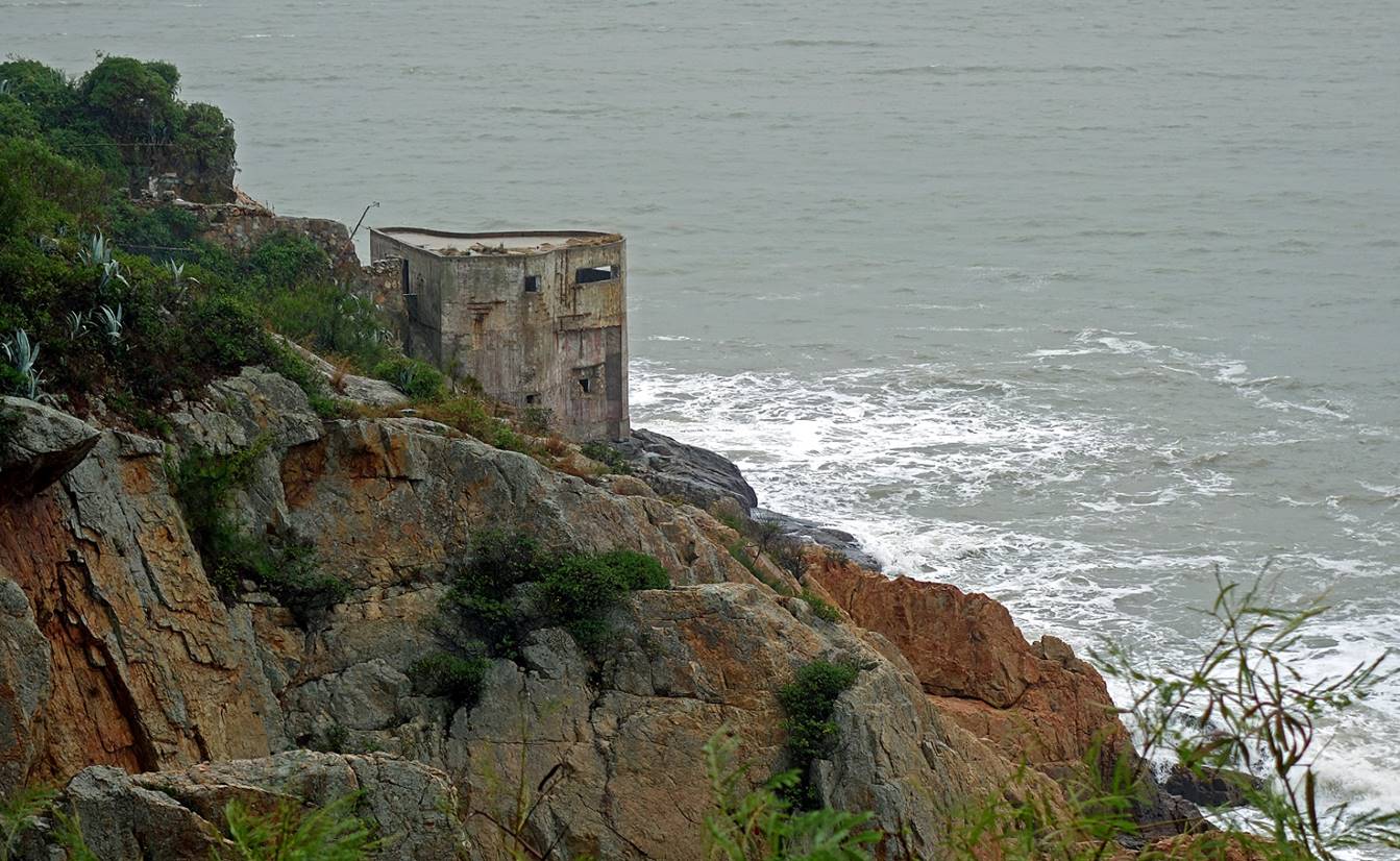
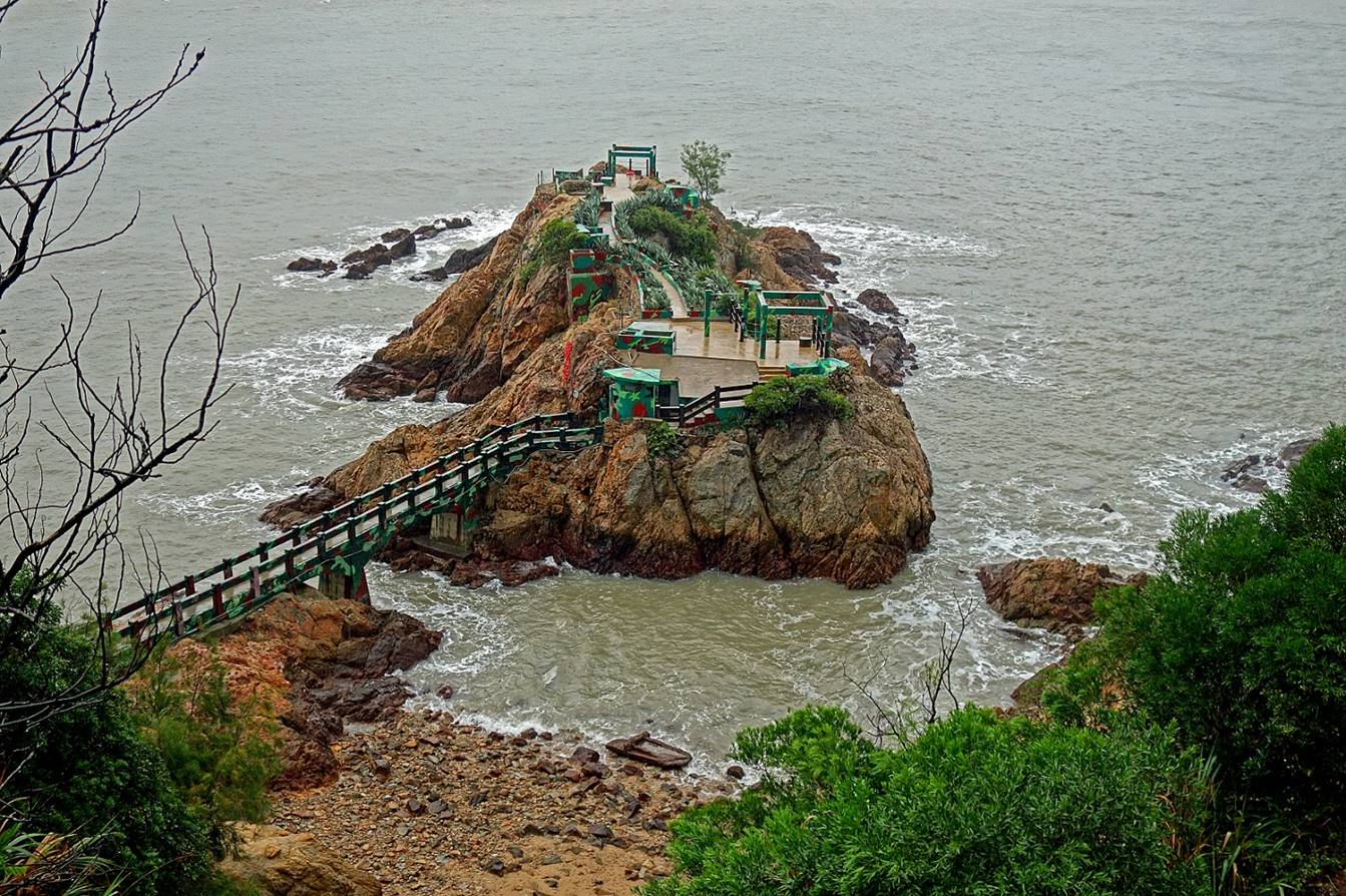
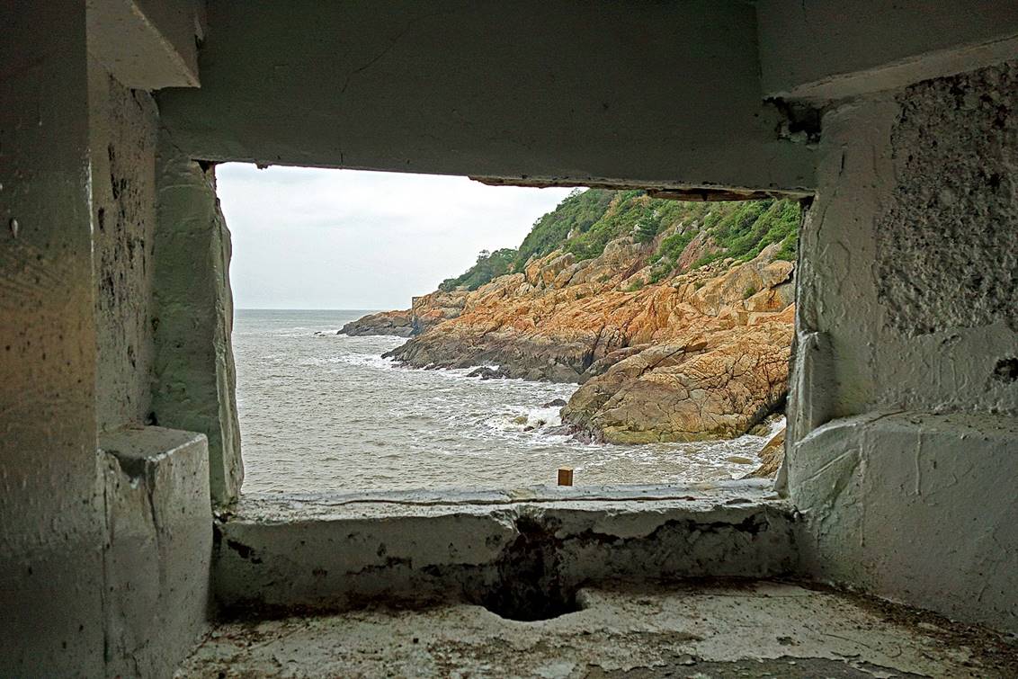
Iron fort, a
bunker dug into a small rocky outcrop. It consists of a central tunnel giving
access to living quarters and several sniper rooms located on both sides of the
outcrop. The entrance of the tunnel is located on the right of the small green
building at the end of the bridge. (This bridge was added after the fort was
decommissioned as a military installation to allow visitors to more easily
access the bunker.)
|
|
|
Ren-ai
village (仁愛村)
View of the village.
Jinbanjing Tianhou Temple (金板境天后宮):
Tianhou (天后), which translates to ″Heavenly Empress″,
is one of the honorific names of Mazu. This Mazu temple is believed to have
been built by the pirate Cai Qian (蔡牽) during the late 18th century. Since then, it has
been rebuilt and renovated several times. The most recent major restoration was
completed in 2018. The temple is notable for its ″firewall″ (封火山牆) gables [See
Niufengjing Wulinggong temple, in Nioujiao village (above)].
- Facade of the temple
- Altar dedicated to Mazu. The statues
appear somewhat unusual compared to those found in other temples. They were
carved by local artisans who endowed them with facial expressions specific to a
regional style of eastern Fujian.
- Murals in the temple.
|
|
|
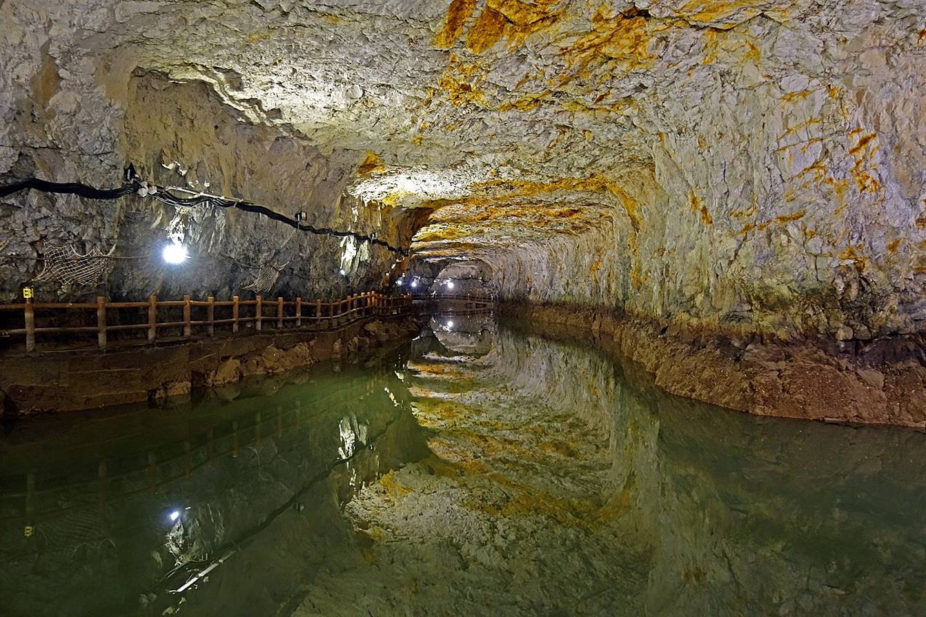
Beihai
tunnel (北海坑道)
It was built in 1969-1971 by the
Taiwanese military using only explosives and hand tools. Aimed at protecting
small naval vessels against attacks by the PRC army, the tunnel forms an
impressive underground waterway of 640m in length, 18m in height and 10m in
width. Two branches of the waterway provide access to/from the sea. Another
side tunnel gives foot access. It was open to the public in 2000.
Entrance of the foot tunnel. The
accesses from the sea are hidden in the rocks.
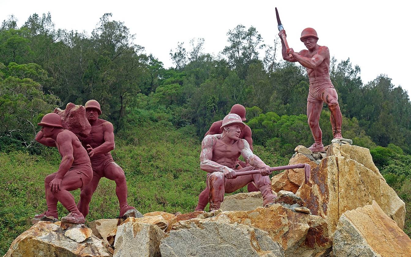
Monument commemorating the soldiers who
built the tunnel. A number of them lost their lives in the process.
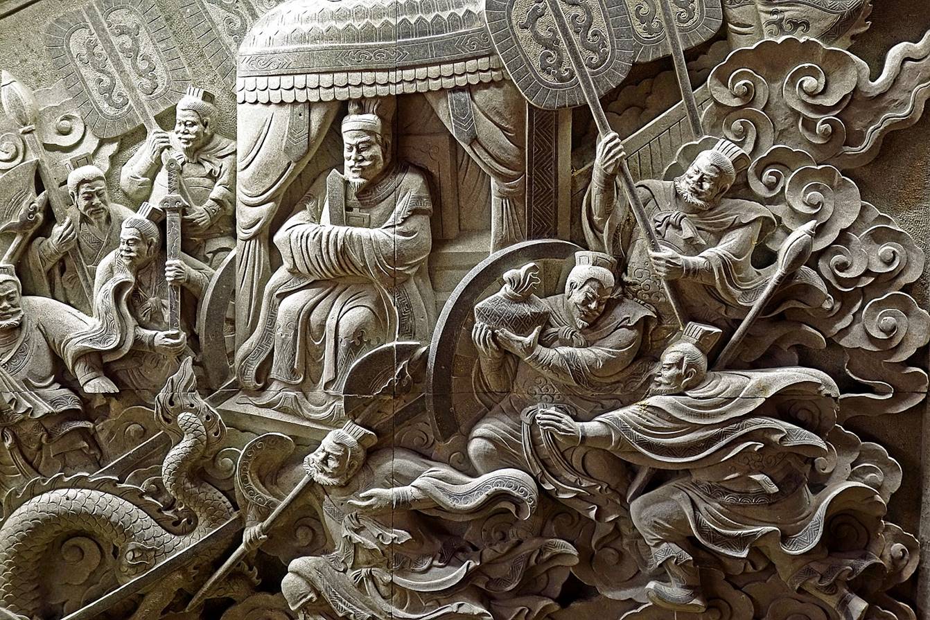
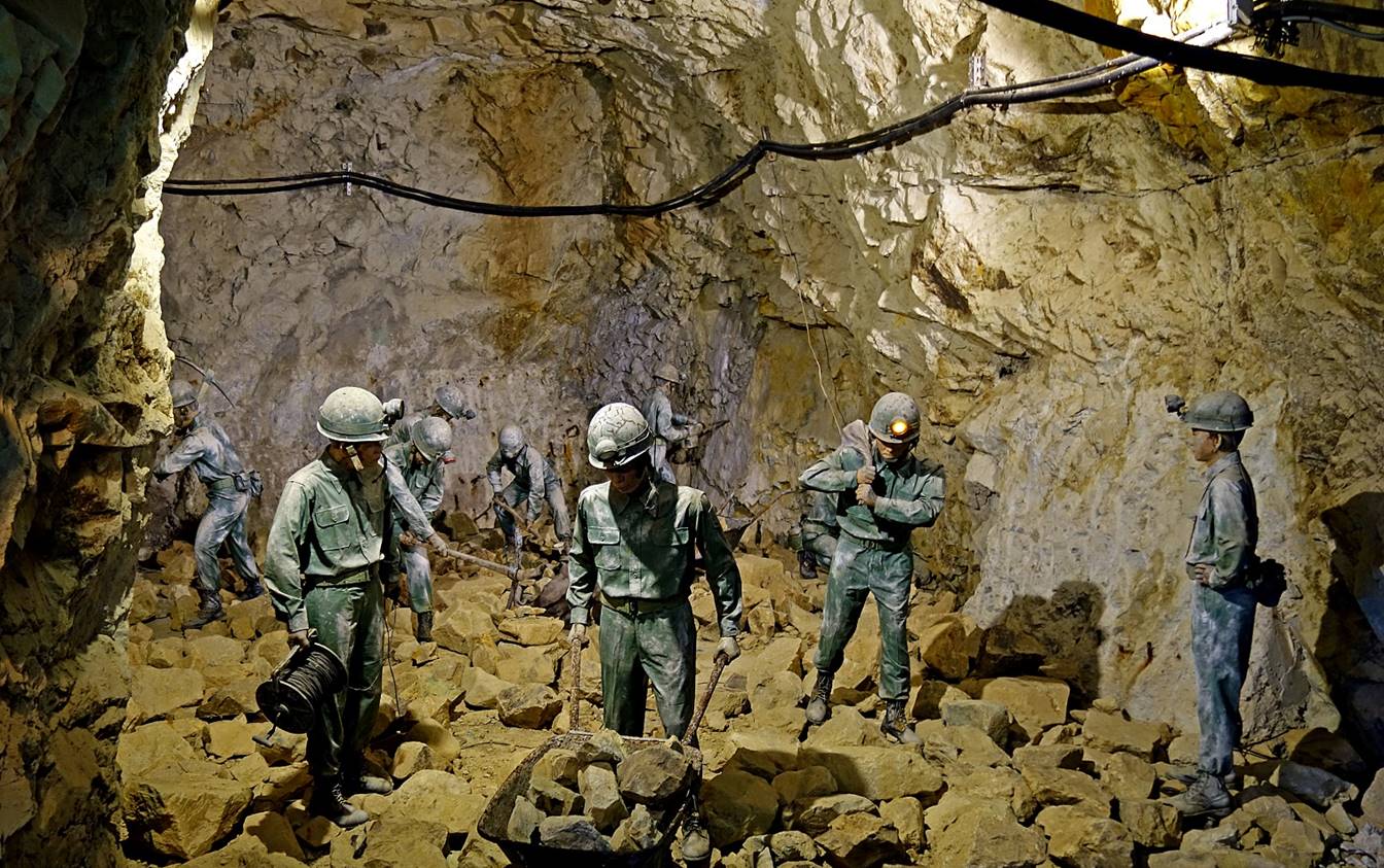
Representation of a typical scene during
the construction (displayed in the foot access tunnel).
Map sketch of the tunnel. The numbers 1,
2, and 3 and their associated arrows show the locations and orientations of the
three photos below.
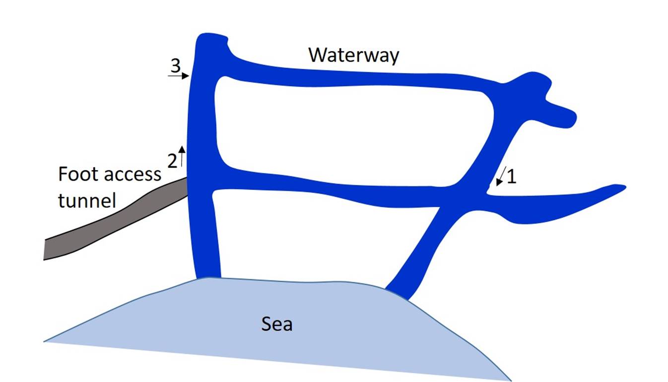
Photo #1.
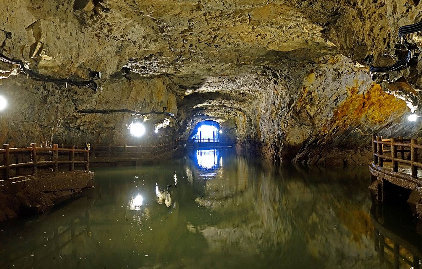
Photo #2.
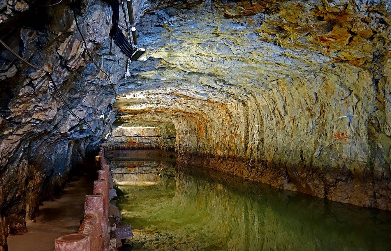
Photo #3.
![]()
Return
to main Matsu Islands page | Return
to main Taiwan page