Nepal (October 2023): An Unplanned Mini-Trek South of Simikot
![]()
Return to my mountaineering/trekking/travel webpage
|
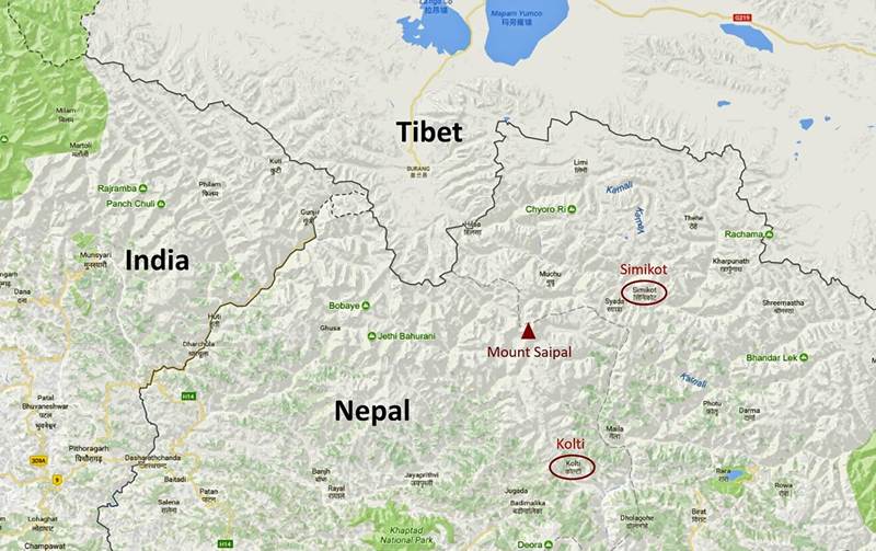
My
goal for this trip was to do a 23-day trek from Simikot, the administrative
headquarters of the Humla District of Nepal, to Pipalkot, a village in the
Bajhang District (southwest of Humla), via several high passes including
Chaufa La near the border with Tibet, Gudpal La (4950m) roughly 36km west of
west of Mount Saipal, and Dubayi Bhanjyang (4583m), a
pass I had already crossed in September 2008 (see here)
during my
West-to-East traverse of Nepal. But
nothing went as planned. The trek
schedule had been set months in advance, with Windhorse Trekking in charge of
logistics and (on my request) Dawa Sherpa as support team leader. This was my
14th trek or mountain expedition organized by Windhorse Trekking and my 5th
trek with Dawa. Dawa had been a very effective organizer and leader on our 4
previous trips together (Dolpo
in 2012, North
Humla in 2014, Api
Himal in 2016, and South
Humla in 2017). For each of them, he had hired either horses or seasoned
porters well before the start of the trek and he had brought food and group
equipment (tent, cookware, and basic gear for the support team) from
Kathmandu. For this new trek, none of that happened. Dawa had
˝planned˝ (clearly a euphemism) to hire porters, buy food, and rent
tent and cookware upon arrival in Simikot. But Simikot is a small and remote
town and Humla does not have a trekking, nor a porter culture like some other
regions of Nepal. With difficulty he managed to hire 4 porters, but, except
for one, they lacked porter strength and experience, and were clearly
under-equipped to cross the high passes of the trek. Two of them were over 60
years old. In addition, the rented gear was very heavy, especially a ridge
tent that consisted of a thick canvas, steel poles, and iron pegs. This type
of tent is suitable for herders who set up long-term monsoon camps, but not
for trekkers who move daily. We nevertheless left Simikot as planned, heading
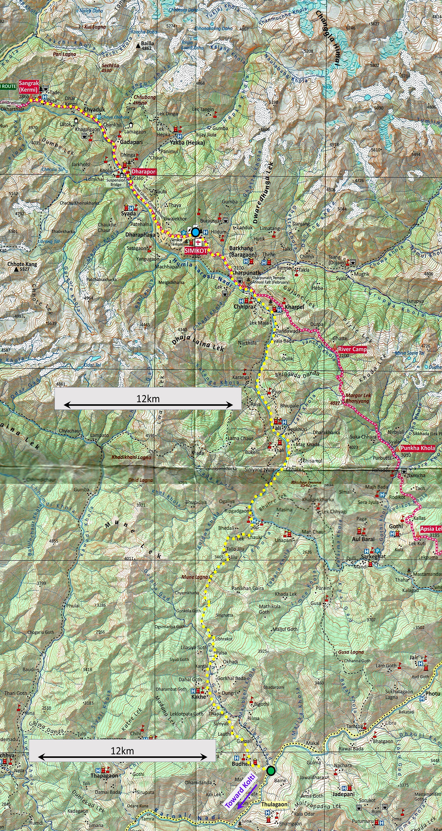
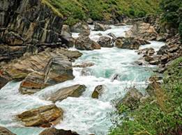
west along the Humla Karnali Nadi (river). We spent the
first two nights in Dharapori and Kermi (see map on the right). It rained
both nights. On the second night, one porter became seriously ill and had to
abandon the trek. No one was found locally to replace him. Dawa then told me
that, due to the bad weather of the last two nights, there was now probably
too much snow on the passes and that we should turn around, return to
Simikot, and take a different route south. I remembered that in 2008 I had
crossed Dubayi Bhanjyang (one of the high passes on the 2023 itinerary) under
a snowstorm that had already deposited a thick layer of fresh snow on the
ground, but then my team of porters was very strong and well-equipped. I
realized that sticking to the planned itinerary with a weak team lacking
proper clothing and equipment could be dangerous. Reluctantly, I agreed to
return to Simikot. Back in
Simikot, I had the option to fly back to Kathmandu and return home. Instead,
I chose to try another hiking itinerary heading south, first along the Humla
Karnali Nadi, next across a moderate pass (Mune Lagna, 3712m), and finally
along the Galpha Gad (river) to reach the Humla Karnali Nadi again (see map
on the right). I figured that beyond the confluence of Galpha Gad and Humla
Karnali Nadi I would have several route options to choose from. However, the
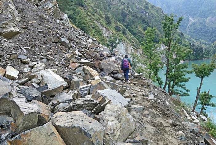
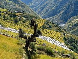
Nepalese Himalayan hills between 1500m and 3500m have undergone significant
changes in recent years. Many roads have been quickly and poorly
˝built˝ (with no drainage) on steep mountain sides, using dynamite
and excavators, too often in place of well-built secular trails. Many of them
are already badly damaged by rock falls, landslides, and collapses (often due
to their inadequate construction) and are not drivable, perhaps never were.
So, too often, villagers, who rightly hoped for better transportation, lost
their good trails, got no drivable roads in exchange, and are now left with
ugly scars on mountainsides that will persist for decades, or more. We reached
the confluence of the Galpha Gad with the Humla Karnali Nadi after five
hiking days. Out of the eight hiking days (including the three days to reach
Kermi and return to Simikot), we only hiked two full days on actual trails,
away from any road. As I did not travel to Nepal to hike along roads,
motorable or not, I decided to end the trek here. The porters returned to
Simikot. Dawa and I took a Mahindra jeep to Kolti, where we expected to fly
back to Kathmandu (as we did in 2017). After two
days of waiting in Kolti and still no flight expected soon, with two other
locals we hired a jeep to reach Dhangadi in southern Nepal, a relatively
large town well connected to Kathmandu by daily flights. We reached Dhangadi
early in the morning almost 24 hours after leaving Kolti and caught a flight
to Kathmandu a few hours later. In none of
my more than 70 previous treks and mountain expeditions have I experienced
such a collapse of plans. I blame myself for having been too trusting and realizing
Dawa's lack of preparation only in Simikot. But, rather than making me upset,
this collapse should remind me how incredibly lucky I was before. |
Trekking area.
Actual trekking route
shown in yellow dotted line in the map below. (Click on this map to see a
higher resolution, more redable image of the map in a seperate window.)
[Portion of Far-West Map, NP110,
Trekking Map 100 Series,Himalayan Map House, Kathmandu, Nepal.] |
These are some
pictures illustrating the above introduction:
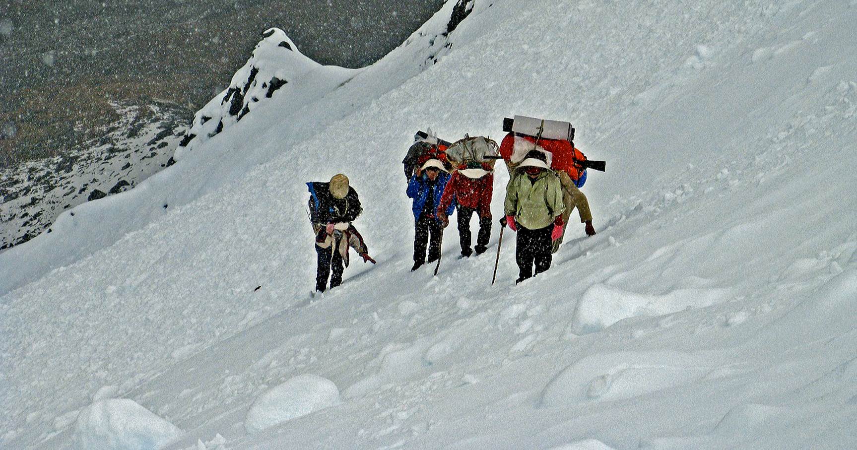
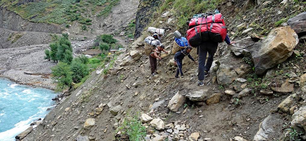
- My team
of porters ascending Dubayi Bhanjyang (4583m) during a snowstorm in September
2008.
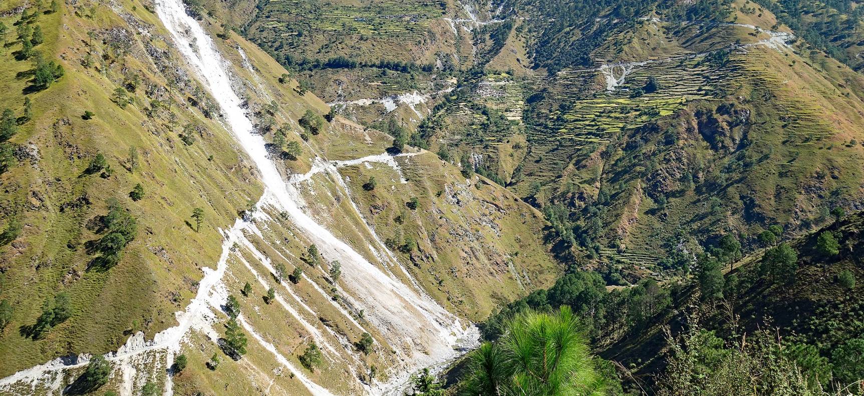
- Damaged ˝roads˝
along the Humla Karnali Nadi.
|
|
|
- Scars
left by non-motorable ˝roads˝ on mountainsides.
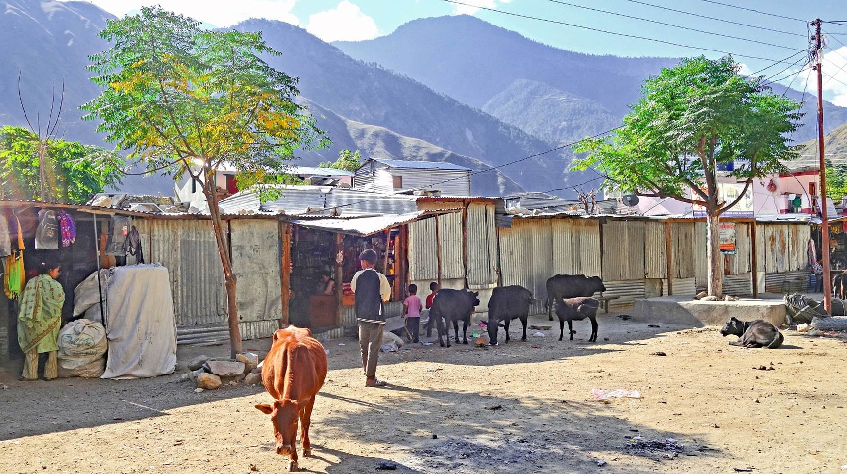
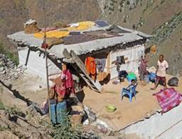
- One of
the many settlements made of corrugated iron houses that have sprouted along
drivable roads.
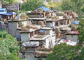
On this trip, I was much more saddened by the quasi-irreversible
destruction of the beautiful landscapes of Nepal's high hills and the
traditional way of life of their inhabitants than by the collapse of my trekking
plans. Paraphrasing Charles Baudelaire (1821-1867), let me say: ˝Old Nepal
is no more. The shape of a country changes faster, alas! than a mortal heart.˝
Click on the
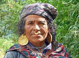
links below to see pictures of this trip. Despite what I wrote above I still enjoyed
some beautiful sights and interesting encounters.
|
|
|
|
|
|
|
|
|
|||||
|
|
|
|
|
|
|
|
|
|
|
|
|
|
![]()