Morocco,
January-February 2026: Trek across the Anti-Atlas mountain range![]()
Back
to my
mountaineering/trekking/travel webpage
The purpose of this trip was to do a
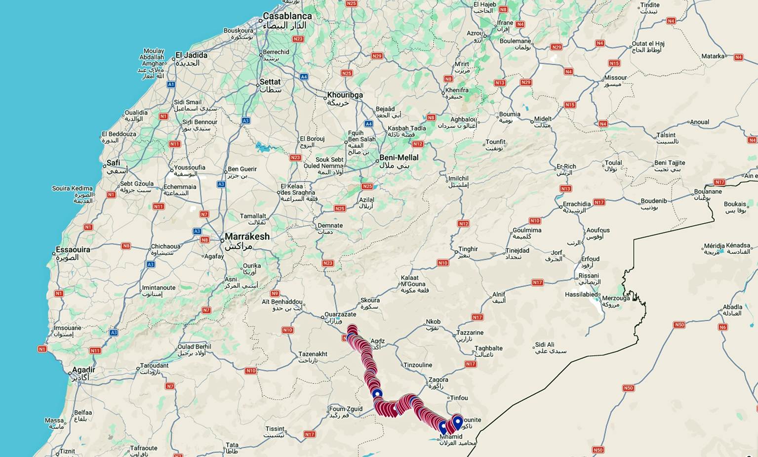
hiking traverse of the Anti-Atlas mountain range between the village of Ait
Saoun, located some 40km southeast of Ouarzazate on the main road between
Ouarzazate and Zagora, and the tiny village of Tiraf, located about 230km
southeast of Ouarzazate near the town of Tagounite (see maps below). Starting
near the Atlantic coast, the 500km-long Anti-Atlas range extends eastward between
the much higher Atlas Mountain range to the north and the Sahara to the south.
It has a mean elevation of 1500m.
Map showing the location of the trek in
Morocco.
The itinerary and logistics of the trek
were organized by my friend Oumar
Oulaidi (pictured below). For over 20 years, Oumar has organized my many
treks in Morocco and has accompanied me on several of them. He again came on
this trek, which was new for him.
|
|
|
Oumar and I had agreed on a rough
itinerary prior to departure. But, due to lack of prior information, he relied
on advice collected from day-by-day encounters with villagers and nomads to
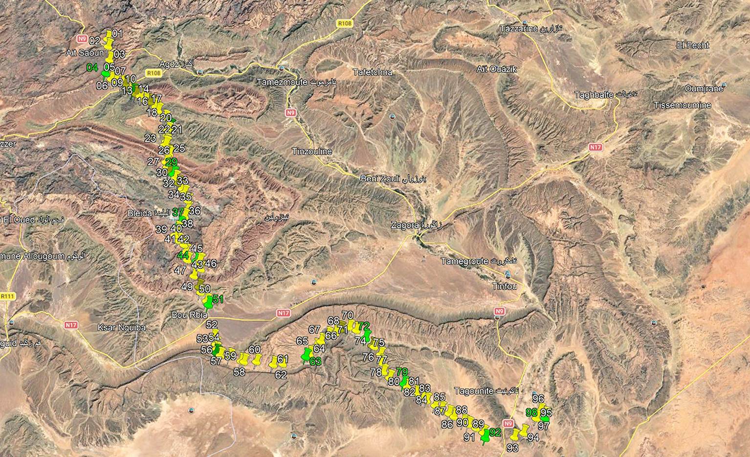
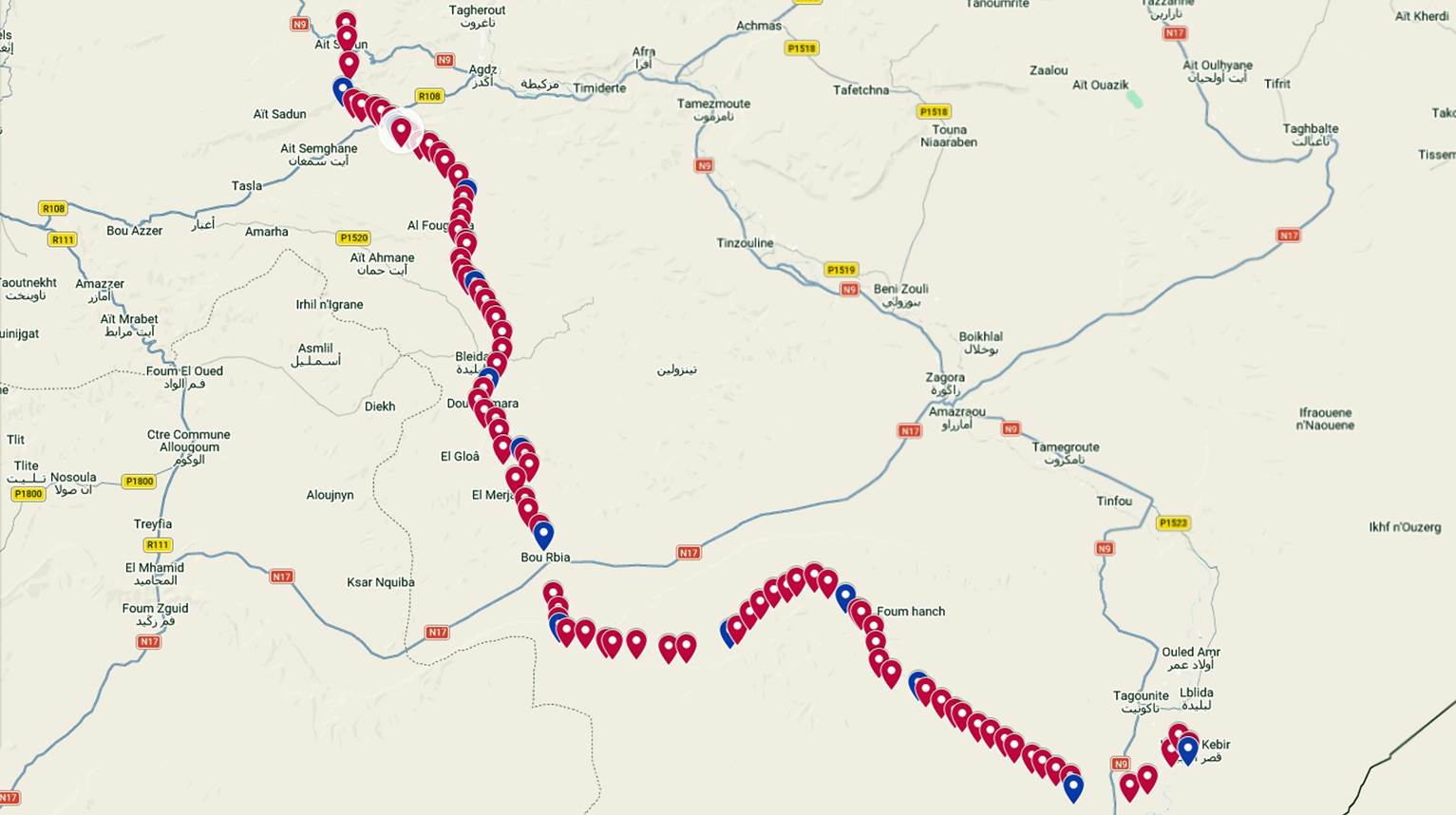
make adjustments. The map below shows the GPS waypoints I recorded during the
trek. They are numbered 01 (start of the trek in Ait Saoun) to 98 in Tiraf.
Green markers show the locations of our camp sites. To access this map in
Google Earth, click here,
download the file morocco-2026.kmz, and open this file with Google Earth.
The map below shows the same GPS
waypoints in Google Map. To access this map in Google Map click here. In this map the campsites are marked in blue and the
other waypoints in red.
The trek lasted 13 full days. Its total
length was about 190km, mostly on open terrain. Changes of elevation were
moderate. Although the trek included several somewhat monotonous stretches,
overall, it was extremely diverse in terms of scenery and points of interest.
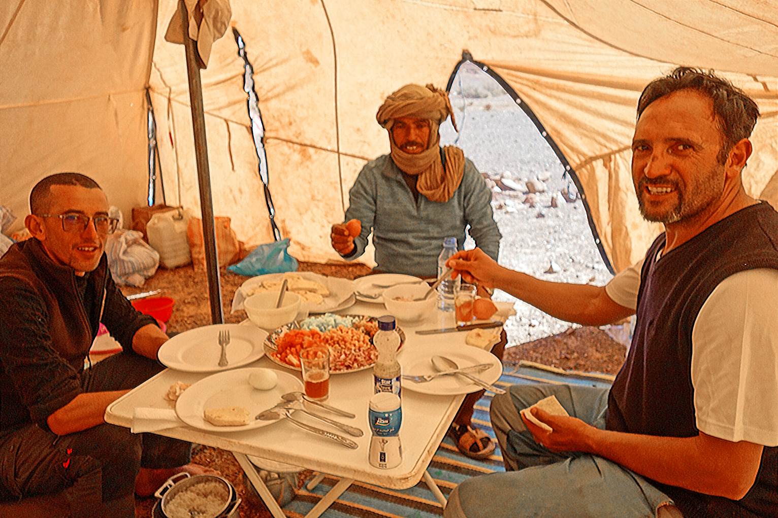
We had two other companions on this trek: Mohamed
and Ahmed. Mohamed was a friend of Oumar from the Mgoun valley; he helped us a
great deal during the trek, particularly by setting up camps, preparing meals,
and getting fresh food and water from villages. Ahmed was the experienced
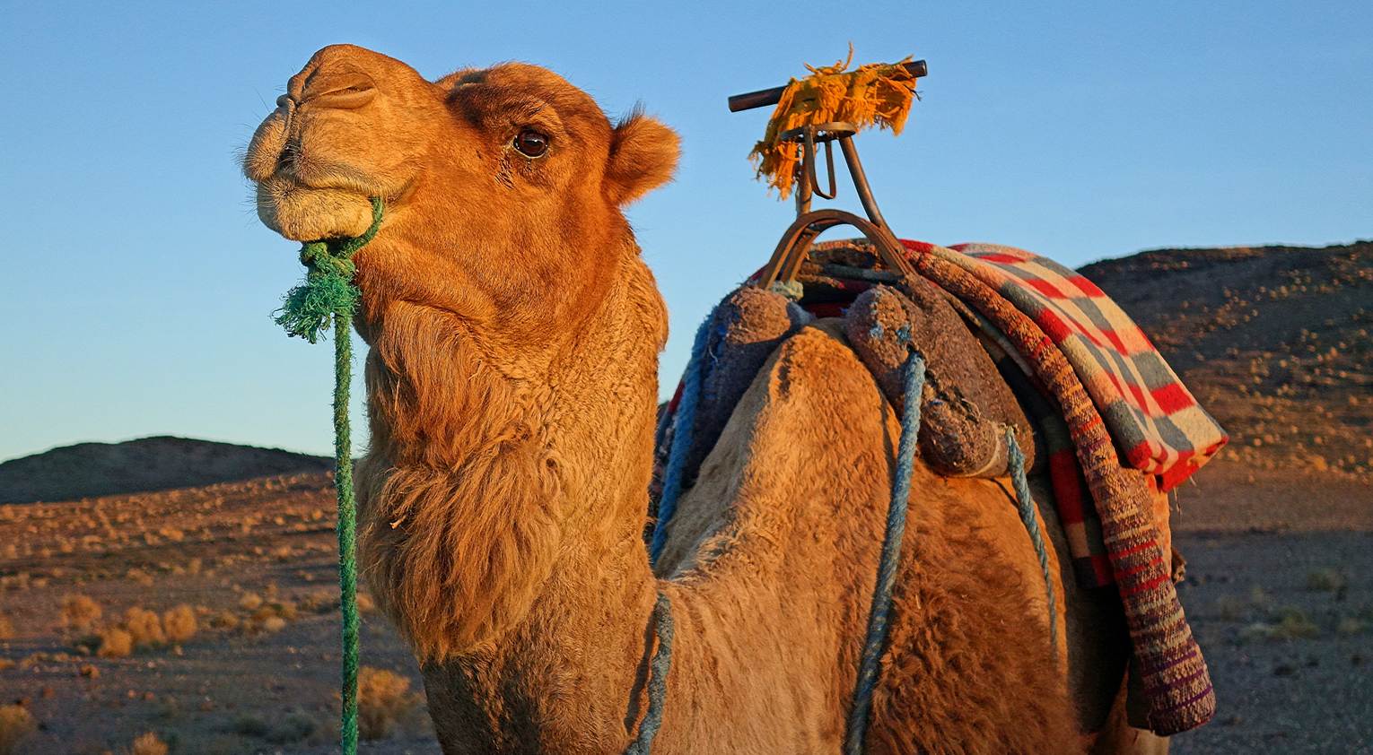
driver of two dromedary camels, each of which carried our heavy loads,
sometimes over difficult rocky terrain.
From left to right: Mohammed, Ahmed, and Oumar in
our large tent.
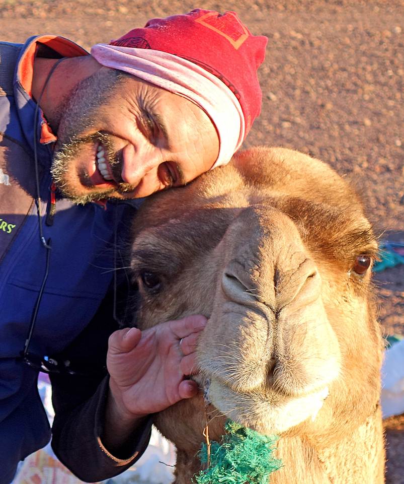
One of our two friendly camels, who always
seemed to like having his picture taken.
To see photos of this trip, click on the
links below (captions or photos). The link on the left contains a small number
of photos I took before and after the trek, in Marrakesh, Ouarzazate, and
Tameggroute.
|
|
|
|
To access webpages of my previous treks
in Morocco, click here.
![]()