Tajikistan (2017): Trek in Badomdara and Rostovdara valleys
![]()
Back
to main Tajikistan 2017 webpage
On the day after our return from the trek
in the Rivak valley we drove to the small village
of Shavoz in the Shakhdara
valley southeast of Khorog and started a second trek
in the Badomdara and Rostovdara
valleys. See maps below. Our two Pamiri companions of
the first trek, Nozimsho and Muboriz,
had decided to stay in Khorog. Instead, we were
joined by another Kyrgyz from Murghab, Siyew (uncertain spelling). Our goal had been to cross the Shakhdara range between Sahvoz
and the village of Darshai in the Wakhan
valley, near the southernmost tip of Tajikistan, via the Darshai
pass (5100m). However, on the third trekking day, after traversing more rocky
slopes and ravines, I felt exhausted and unable to ascend the pass ahead. In
addition, my left knee was still hurting from a fall on hard ice on the glacier
below Yurievskij pass three days earlier. I decided
to turn back. In retrospect, I think that it would have been much wiser for me
to spend a couple of nights in Khorog both before and
after the first trek, to reduce tiredness accumulated during the flights to
Tajikistan, the long drives on bad roads from Dushanbe to Khorog
and around Khorog, and the first trek. This was a big
disappointment, but on the positive side it gave me more time to visit (by car)
the upper Shakhdara valley (see here)
and the Wakhan valley (see here),
with their old fortresses and mazors (shrines).
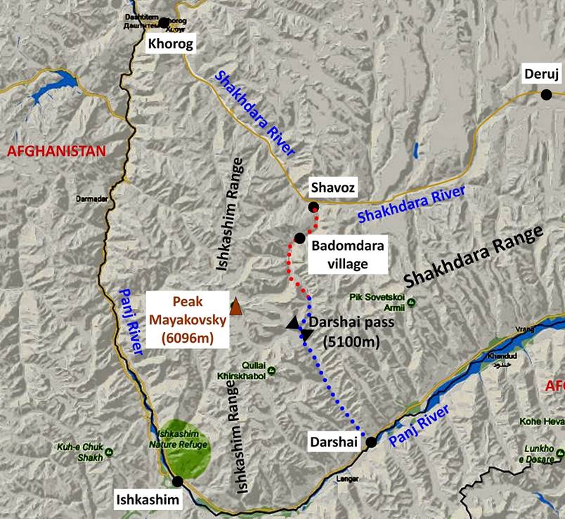
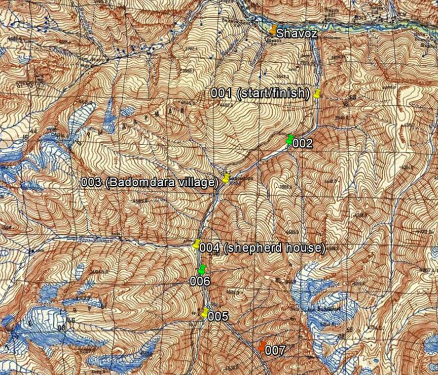
Maps:
Left: Map
showing the location of the trek relative to Khorog:
the paths in red and blue dotted lines are the planned itinerary, with the red
part being the actual itinerary. Right: Topographic map of the trek area
annotated with recorded GPS waypoints; the two waypoints marked with green pins
are our camps on the way up; the waypoint in red (007) is where we turned back.
Click here to access the topographic map at full resolution.
|
|
|
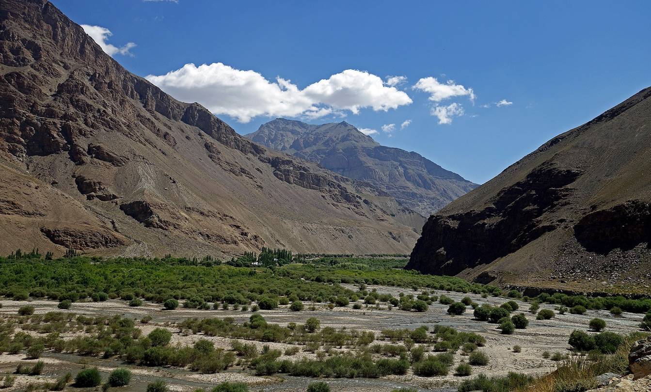
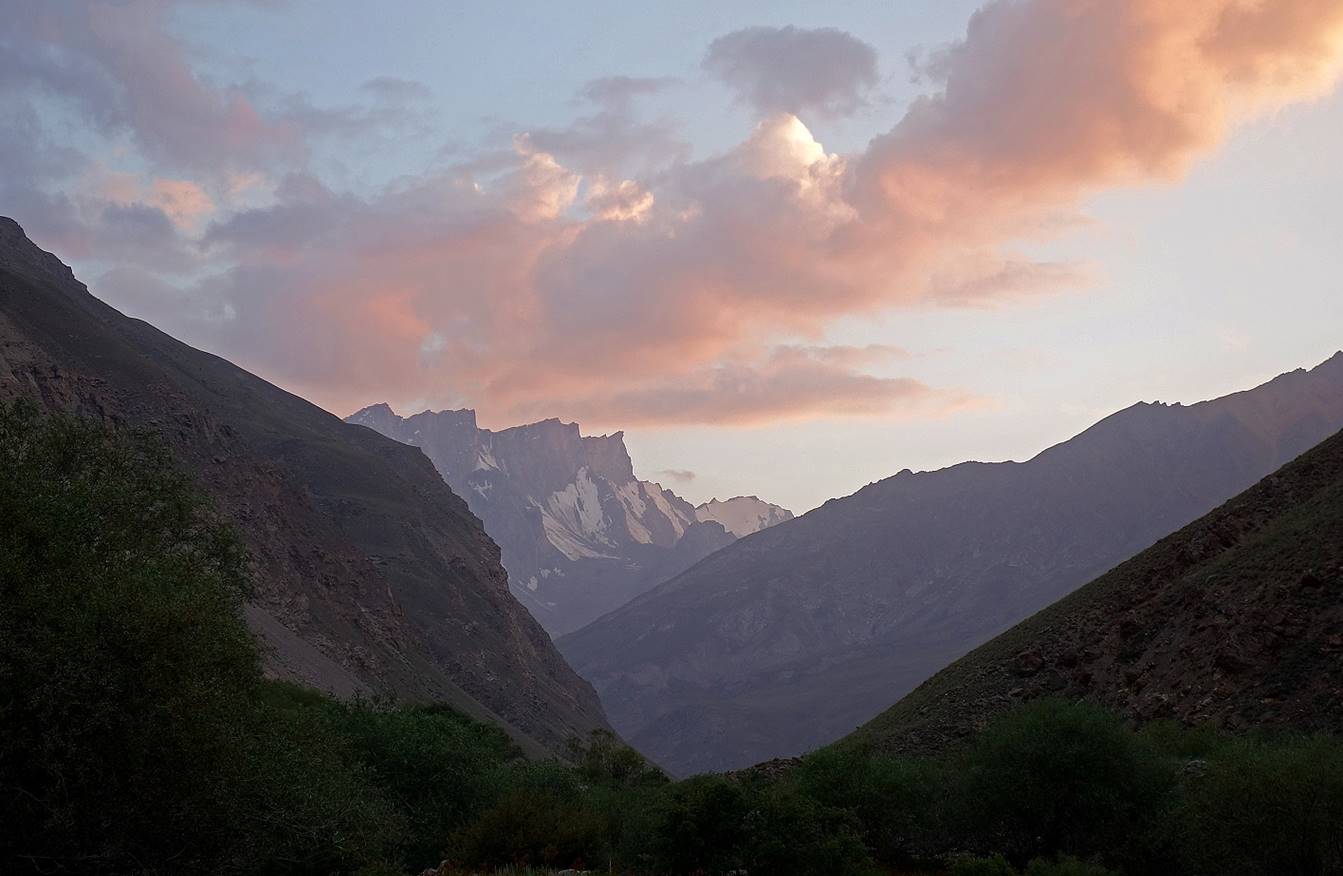
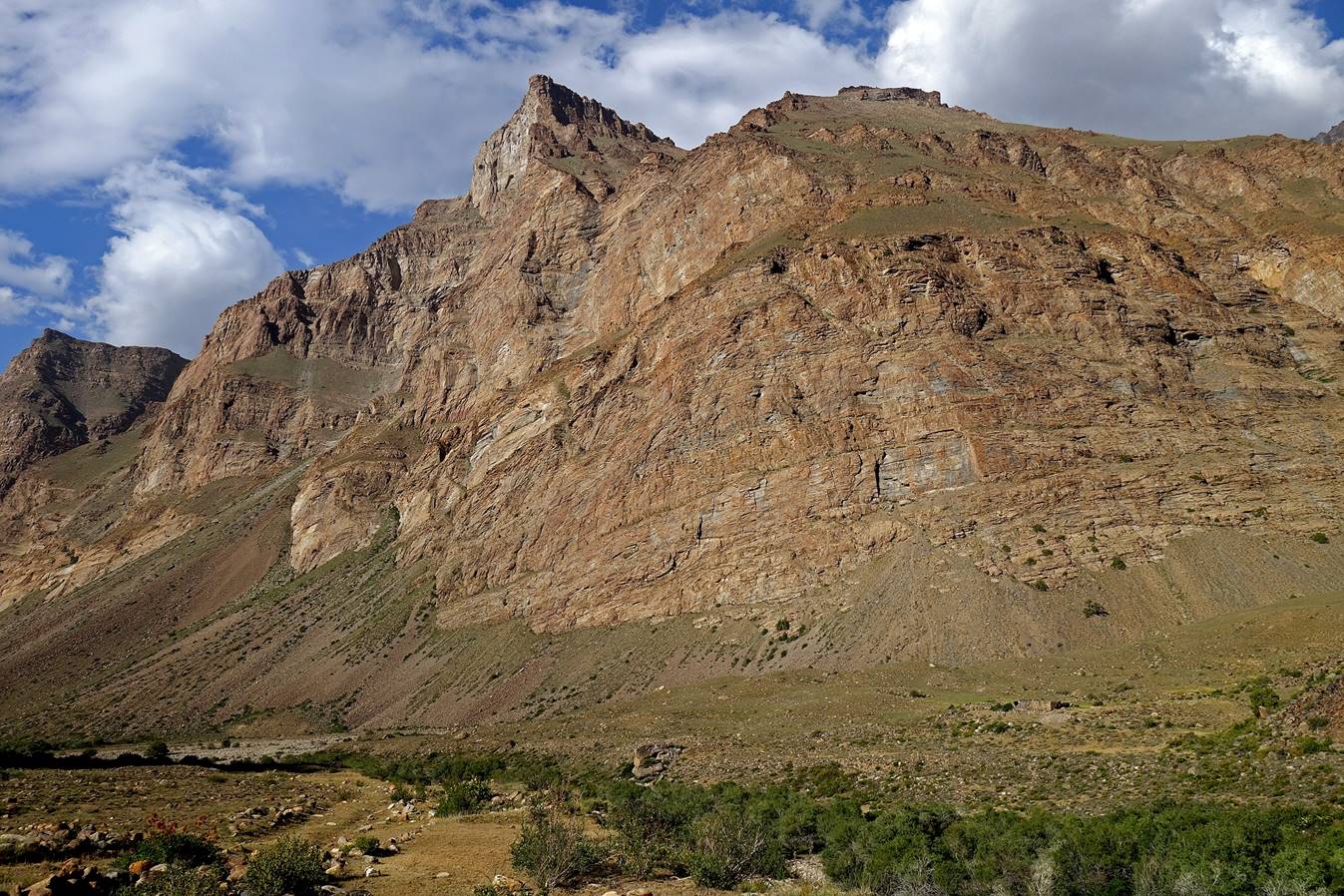
View of the Shakhdara
valley from the village of Shavoz at the entrance of
the Badomdara valley.
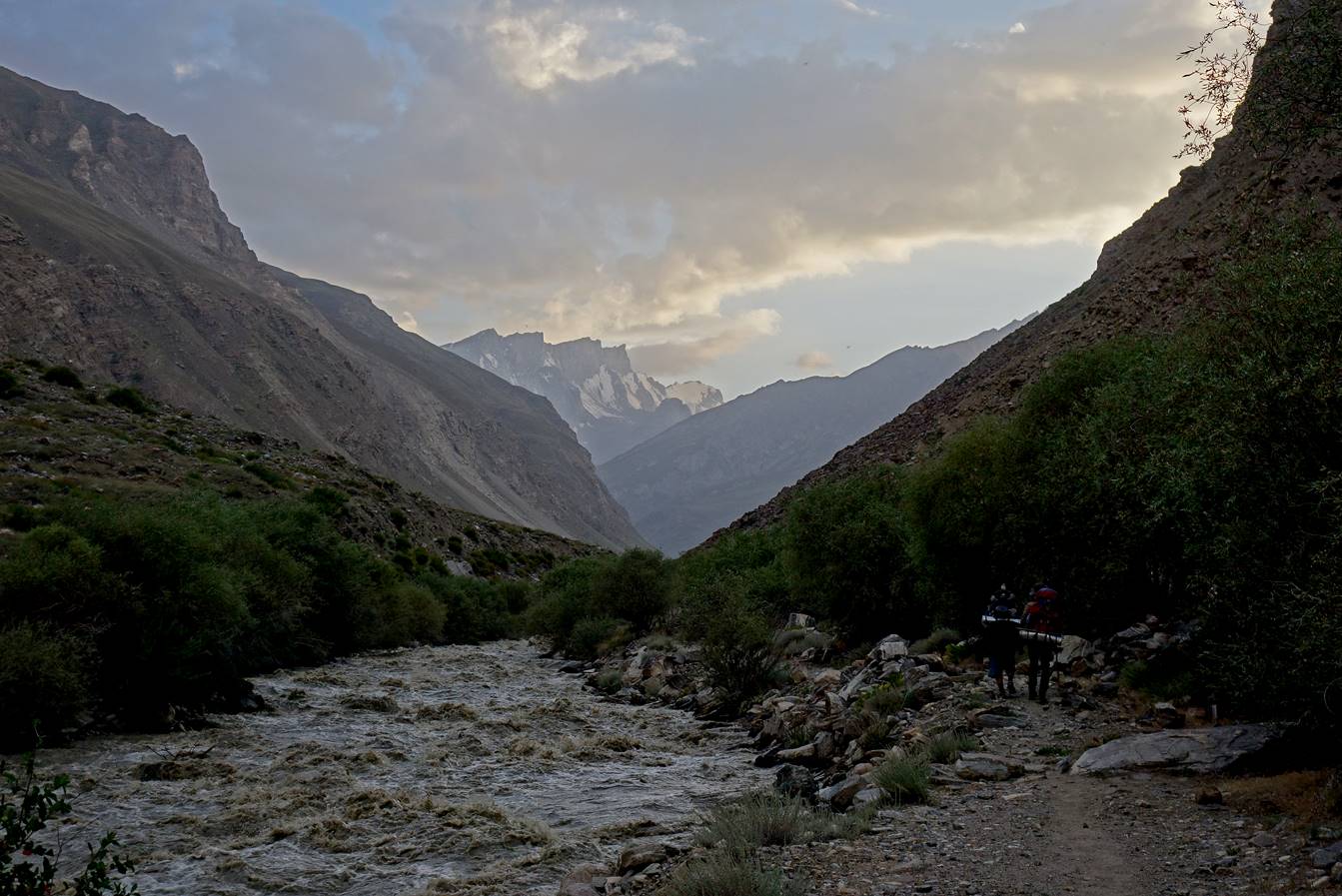
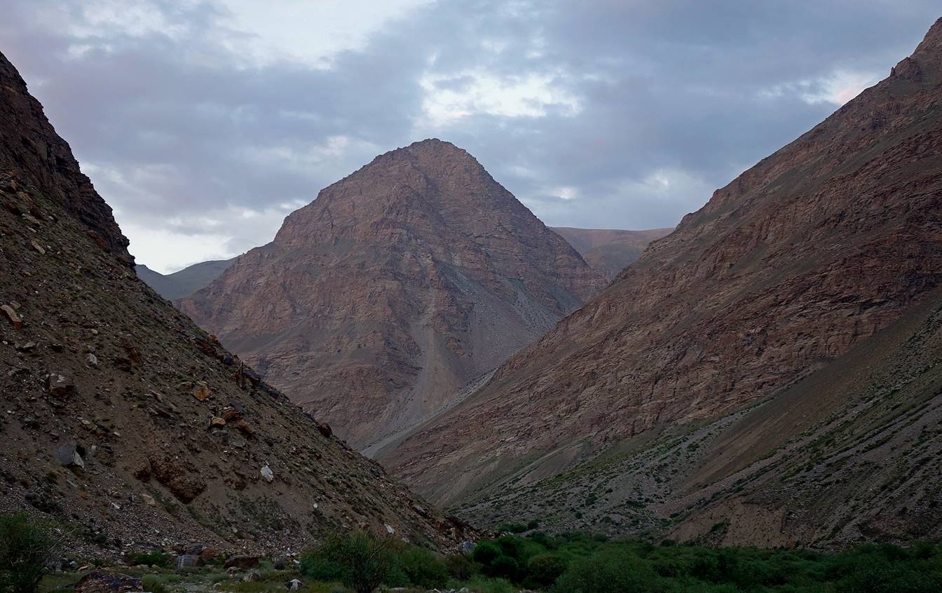
Along the lower section of Badomdara river before reaching our first camp, with some
high peaks of the Ishkashim mountain range in the
background.
Views of the Badomdara
valley in the morning of the second day.
Reaching the Badomdara village (a few scattered houses) on the
left bank of the Badomdara river.
In Soviet time a mine was exploited further up in the valley and a dust road
connected the villages of Shavoz and Badomdara. Today, this road is only drivable to the point
where we started our trek (see topographic map at the top of this page).
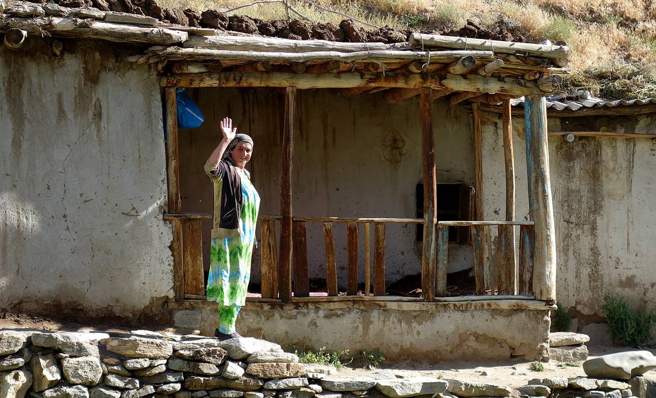
House in the
Badomdara village.
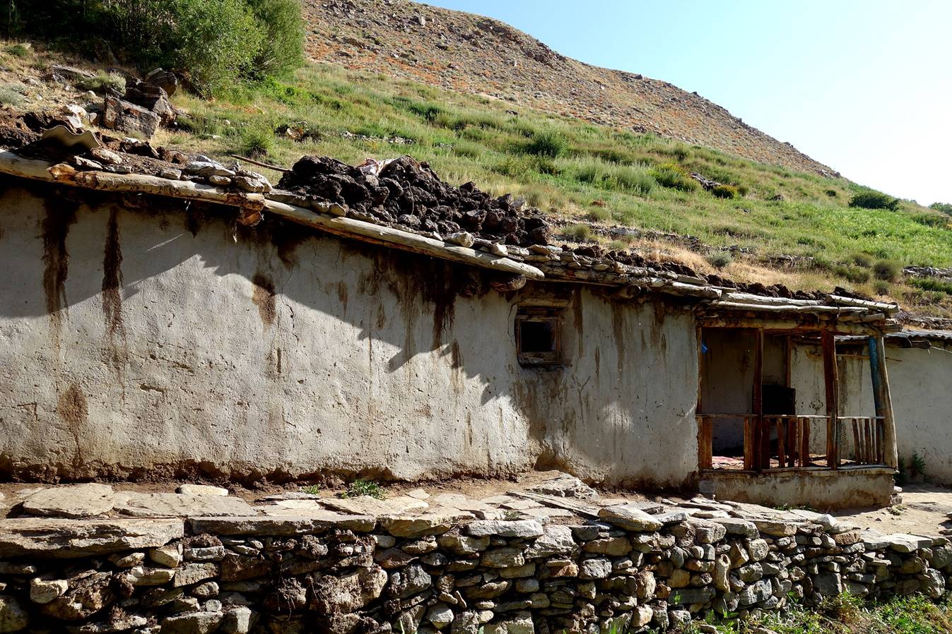
There we were offered hospitality and food
(yoghourt, cream, butter, and bread) by a very friendly woman.
|
|
|
|
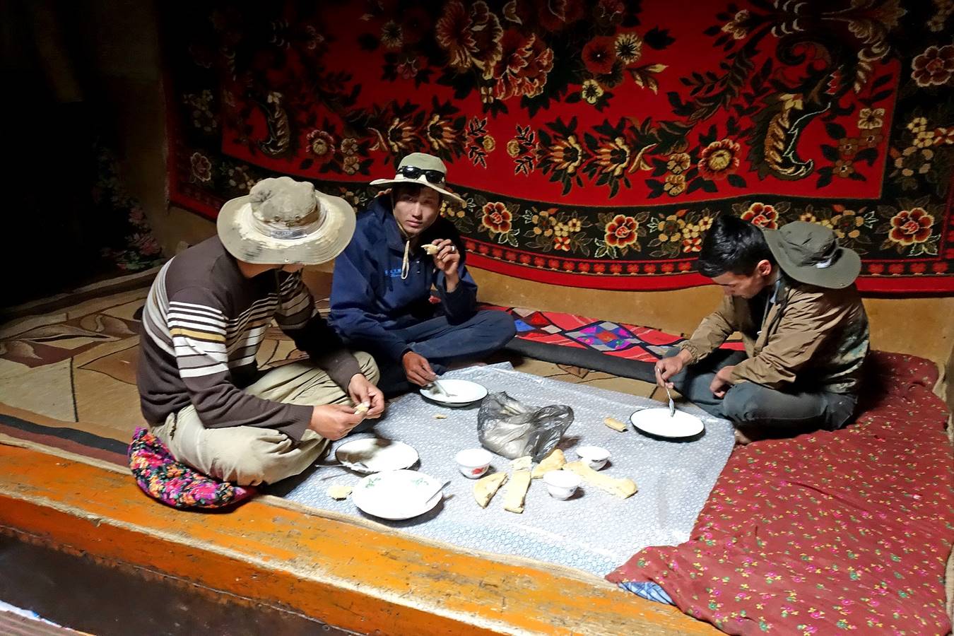
From left to right, Almaz,
Jumach and Siyew eating in
the traditional setting of a Pamiri house.
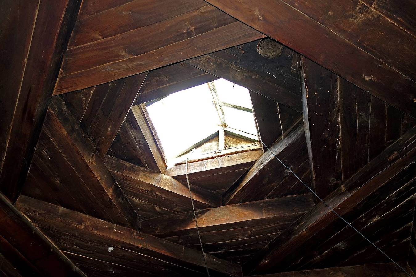
Traditional Pamiri
ceiling, with four stacked square layers, each representing one of the four
Zoroastrian elements (from bottom to top: earth, water, air and fire).
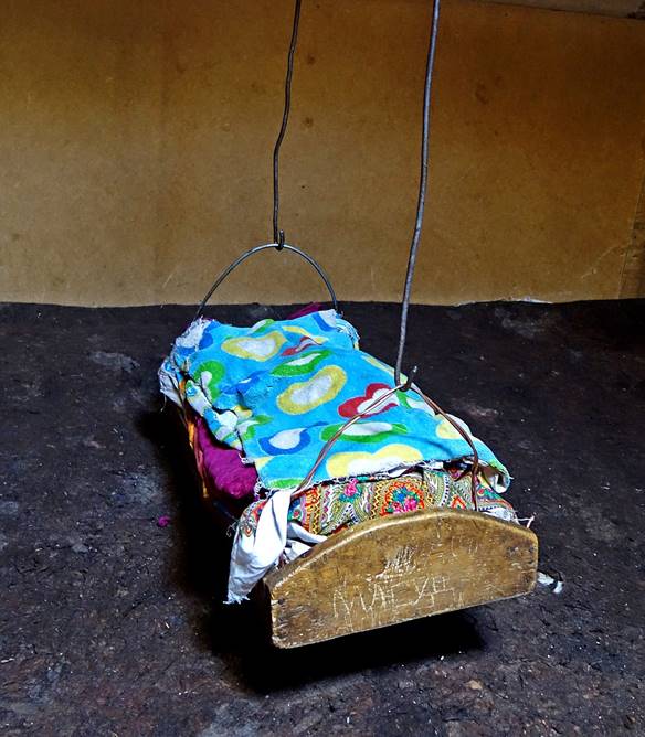
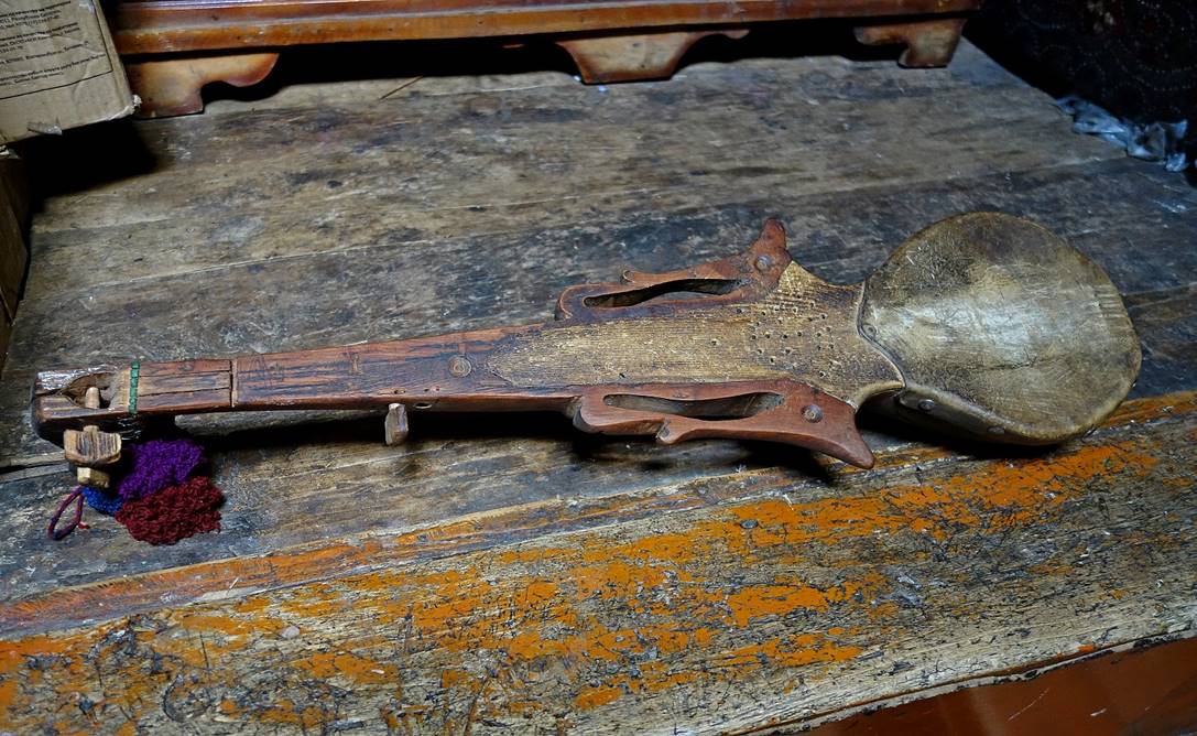
Left: Hanging cradle. Right: Pamiri rubab (without strings)
carved in a single piece of wood, with a skin head.
|
|
|
Leaving the house.
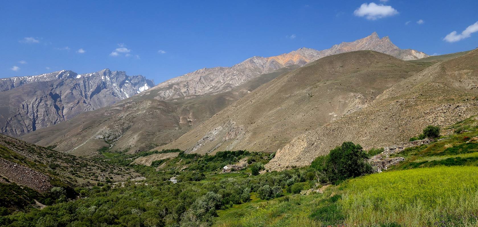
Looking back toward the Badomdara village
(bright green area) from higher up in the valley
View of Mayakovsky
peak (6096m), the highest peak in the Ishkashim
mountain range, west of the Shakhdara
range.
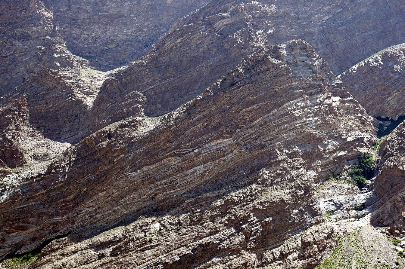
Striped cliff on the right (east) bank
of the Badomdara river.
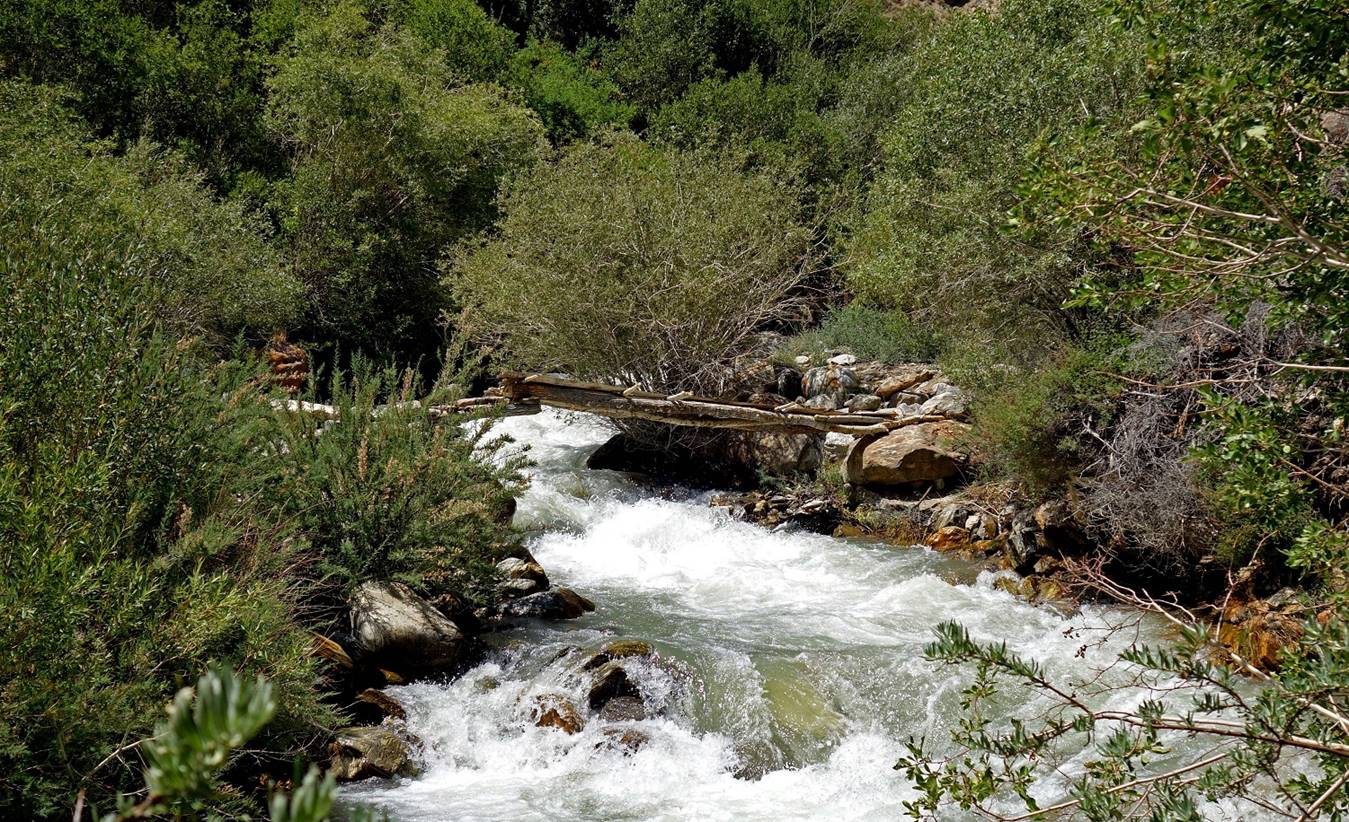
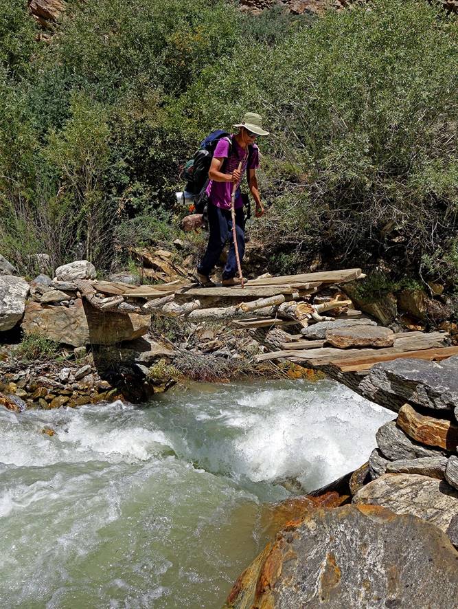
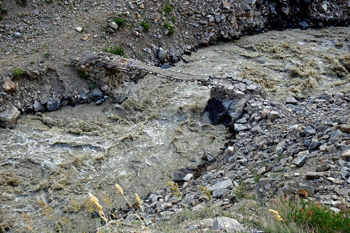
Less than one hour after leaving the Badomdara village, we reached a tributary of the Badomdara river that was too big
and fast to ford. Fortunately, a (shaky) bridge had been recently built further
up along this tributary to give access to a shepherd settlement and pastures.
Below: Almaz (left) and Jumach
(right) crossing.
|
|
|

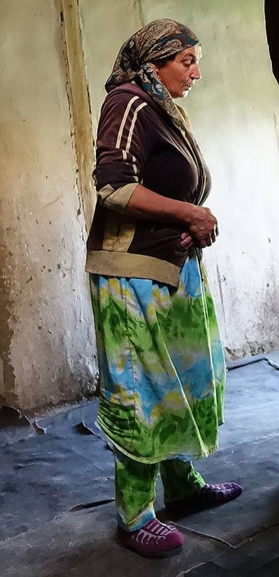
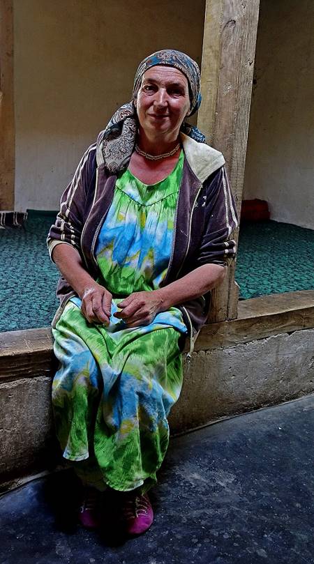
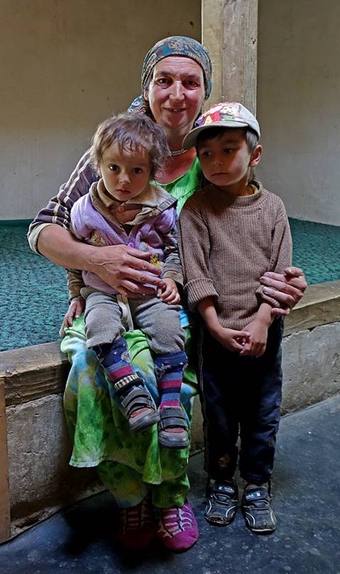
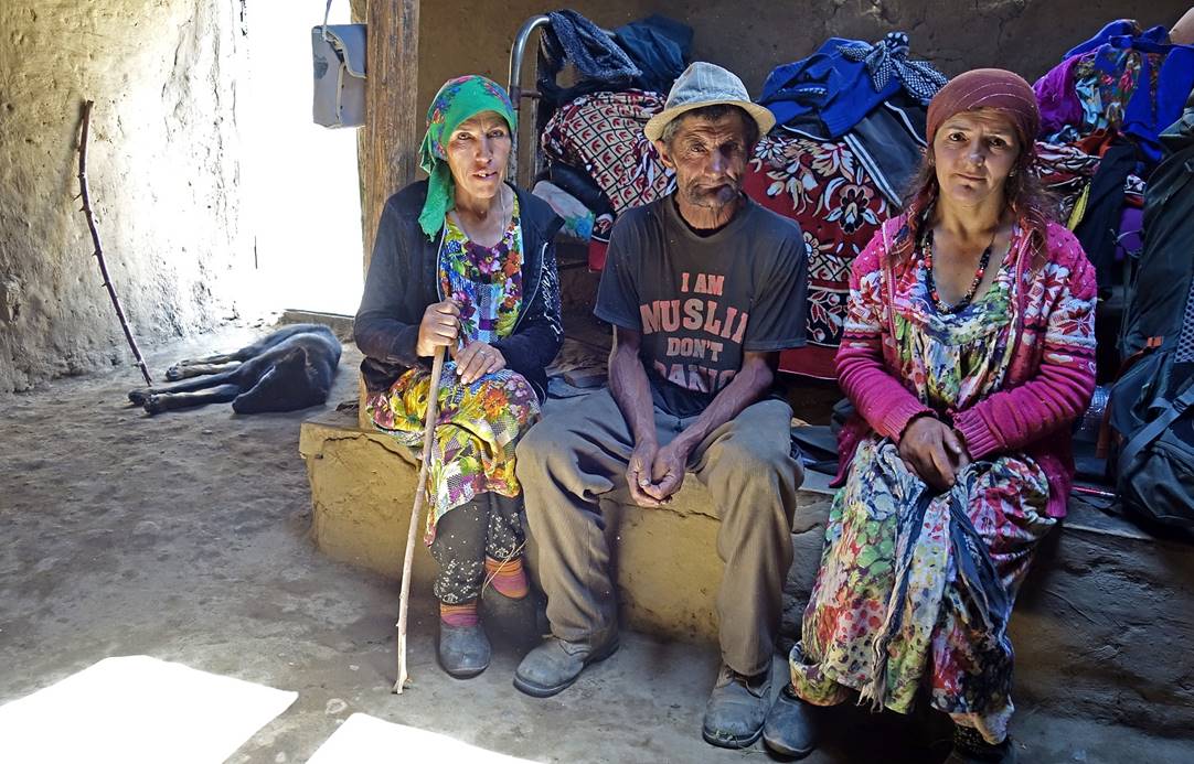
Reaching the shepherd settlement.
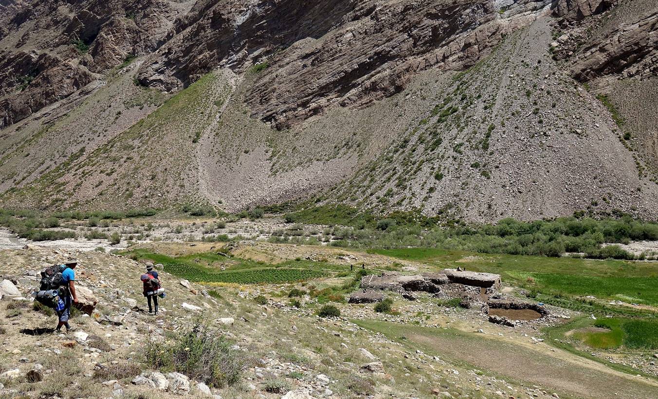
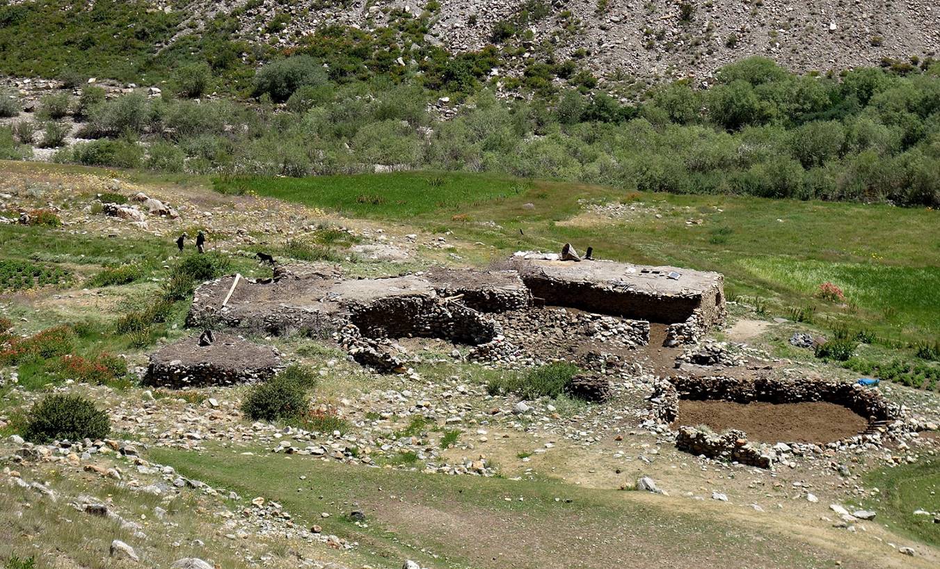
This settlement was inhabited for the
summer by a man, his wife, and his daughter. These friendly people offered us
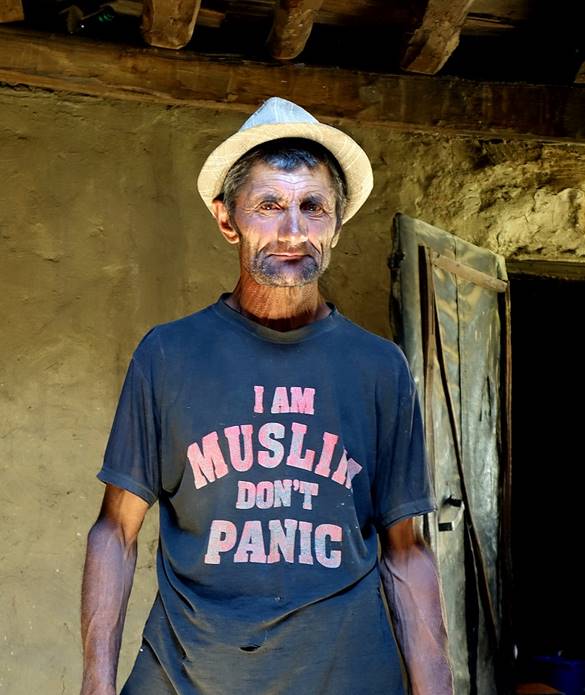
very tasty yoghourt. The man (an Ismaili Muslim) had no idea what was written
on his T-shirt.
|
|
|
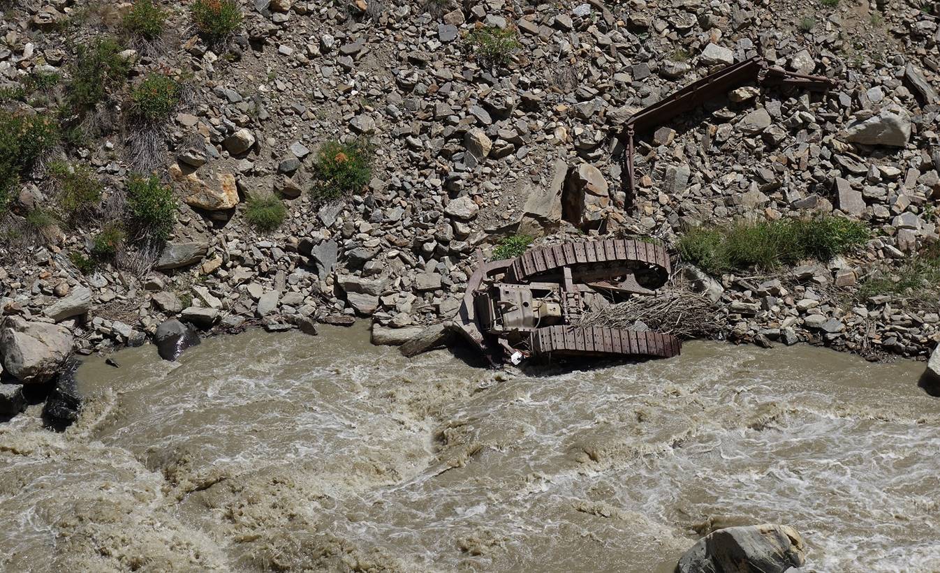
Former mining equipment in the river?
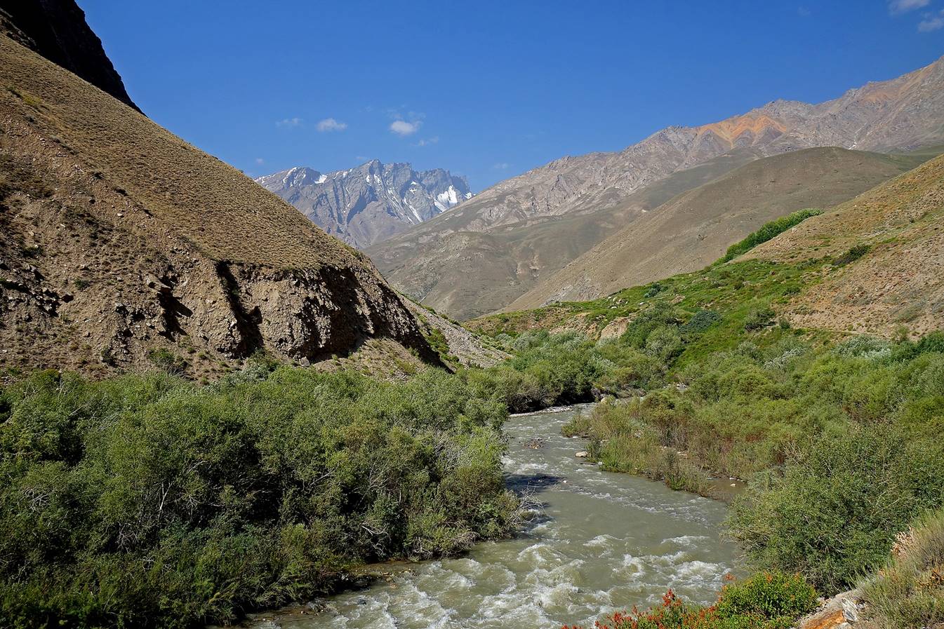
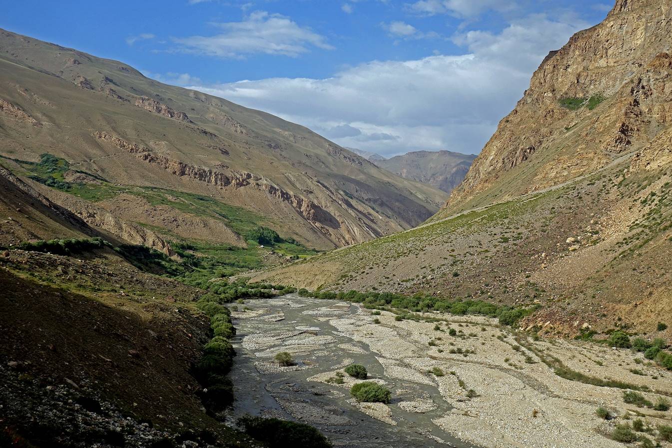
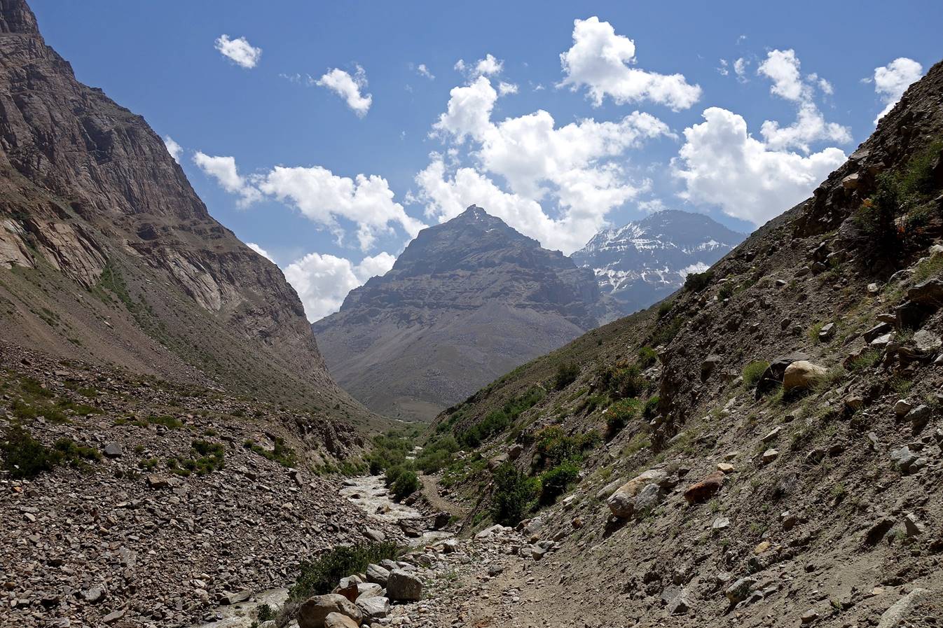
View of the valley further up. At the
bifurcation, the Badomdara river
branches out to the right toward the former mine, while the Rostovdara
river (a tributary of the Badomdara river leading
toward the Darshai pass) branches slightly to the
left.
At the confluence of the Badomdara and Rostovdara rivers.
We were on the left bank of the Badomdara river. Here, the trail (former road) turns right (west)
toward the old mine. We realized that we were on the wrong side of the river
and we returned to a bridge that we had noticed earlier across the Badomdara river.
Back to the bridge across the Badomdara river. We established our second camp on the
right bank of the river soon after crossing the bridge.

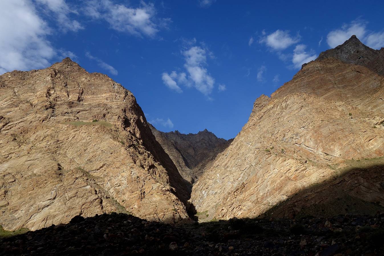
Side-canyon near our camp.
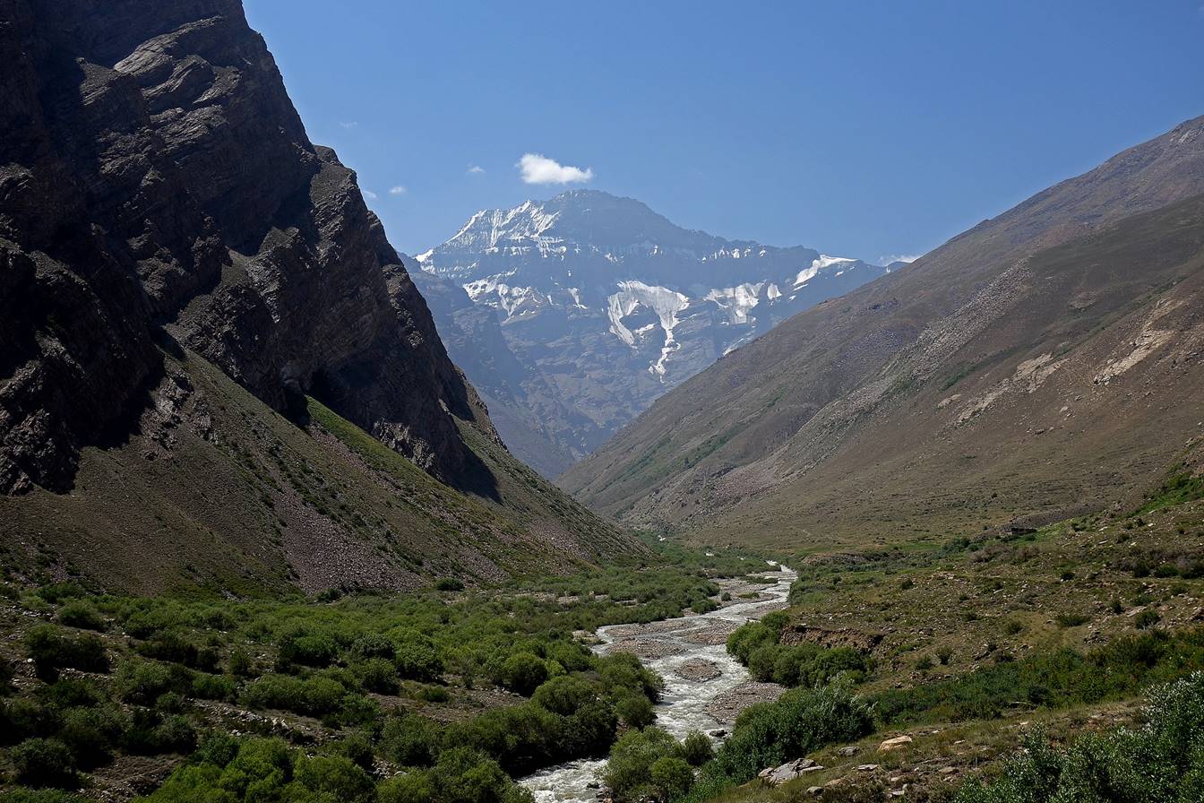
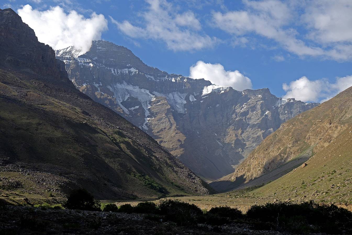
Mayakovsky peak (6096m), on the right, seen from
our camp in the evening.

Another view of Mayakovsky
peak further up along the Rostovdara river on the next morning.
From there the climb
was on broken rocky terrain cut by side ravines. I felt much too tired to reach
and cross Darshai pass (still much higher). I eventually decided to turn around
and return to the trailhead near the village of Shavoz.

![]()
Back
to main Tajikistan 2017 webpage