India (October-November 2019):
Trekking in Arunachal Pradesh, plus
Varanasi and more

Return to my
mountaineering/trekking/travel webpage
Arunachal
Pradesh:
|
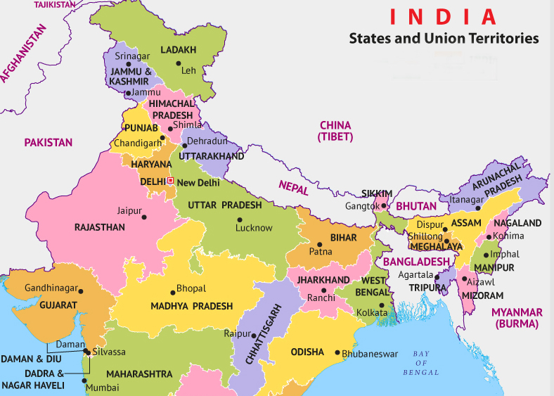
States of northern India. |
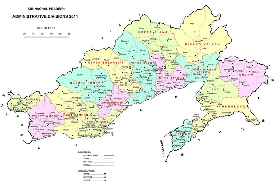
Districts of Arunachal Pradesh. |
Arunachal
Pradesh (AP) is the north easternmost state of India. It borders Bhutan to the
west, Tibet to the north, Myanmar to the east, and the Indian states of Assam
and Nagaland to the south. From the low-elevation plain on its south it rises
dramatically to reach over 7000m at its highest peaks (Kangto and Nyegi Kansang) and over
6000m at the peaks of the Gorichen and
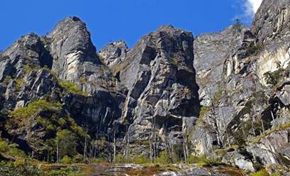
Chomo groups. In-between, the state is an immense maze of steep-sloped ridges
and spurs dissected by deep river valleys. Its climate varies from subtropical
to alpine with high levels of humidity.
The northern border of AP with Tibet
is the so-called McMahon Line. This 890km line was drawn along the crest of the
Himalayas by British colonial administrator Henry McMahon and agreed upon by
(then British) India and (then independent) Tibet at the Simla Convention in 1913-1914. After the independence
of India in 1947 and the establishment of the People′s Republic of China
(PRC) in 1949, the PRC considered this agreement invalid, especially after it
annexed Tibet. In 1962, the PRC army took India by surprise and invaded most of
AP. Under international pressure, China withdrew back to the McMahon line, but
still claims a large fraction of AP as its own, in particular the area
around Tawang in the westernmost part of
the state. In January 2007, the Dalai Lama said that AP was part of India under
the 1914 Simla agreement.
The
two districts of AP that I visited on this trip, the Tawang
and West Kameng districts, are the home of the Monpa people, one of the major tribes in AP (see below).
This area was called Monyul in the past.
Trek organization:
I have been interested in trekking in
Arunachal Pradesh for several years. For various reasons (other priorities,
notorious difficulty to get permits, lack of local contacts), I only became
serious about this trip in the summer 2018, during a discussion with Sonam Dawa of Adventure Travel Mark in Ladakh. Sonam Dawa, who has organized three of my recent treks
in Ladakh and Zanskar,
has become a good friend. He put me in contact with Lobsang Phuntsok, who runs Tawang Tour and Travel in Tawang.
Though living far apart from each other, Lobsang and Sonam Dawa are close
friends since the time when they went to the same school in Delhi 20 to 30
years ago. After many email exchanges I agreed upon a trekking program
with Lobsang. I was not completely satisfied
with the program; in particular, I would have liked to do a longer and more
difficult trek. But I realized that it was probably the best I could get for a
first trip. In fact, I had previously contacted several other tour companies in
AP. Most did not even reply. Those who replied had no clues of the treks
proposed on their websites and could not answer any of my questions. During my
trip to Arunachal Pradesh it became apparent that arranging a trek there is
quite difficult. Not only has one to deal with the complexity and volatility of
the Indian permit bureaucracy. In addition, each tribal group/village has
specific customs and taboos and maintains a tight control over its territory.
Entering a village territory without the prior consent of the village leaders
could be a major mistake. Moreover, few people, other than the Monpa brokpas (yak herders), have
knowledge of the mountain trails and passes. In retrospect, I realize
that Lobsang, a Tawang
Monpa, did a superb job. His contacts in the army and
among local people were instrumental to the success of the trip.
Itinerary, maps, and
schedule:
|
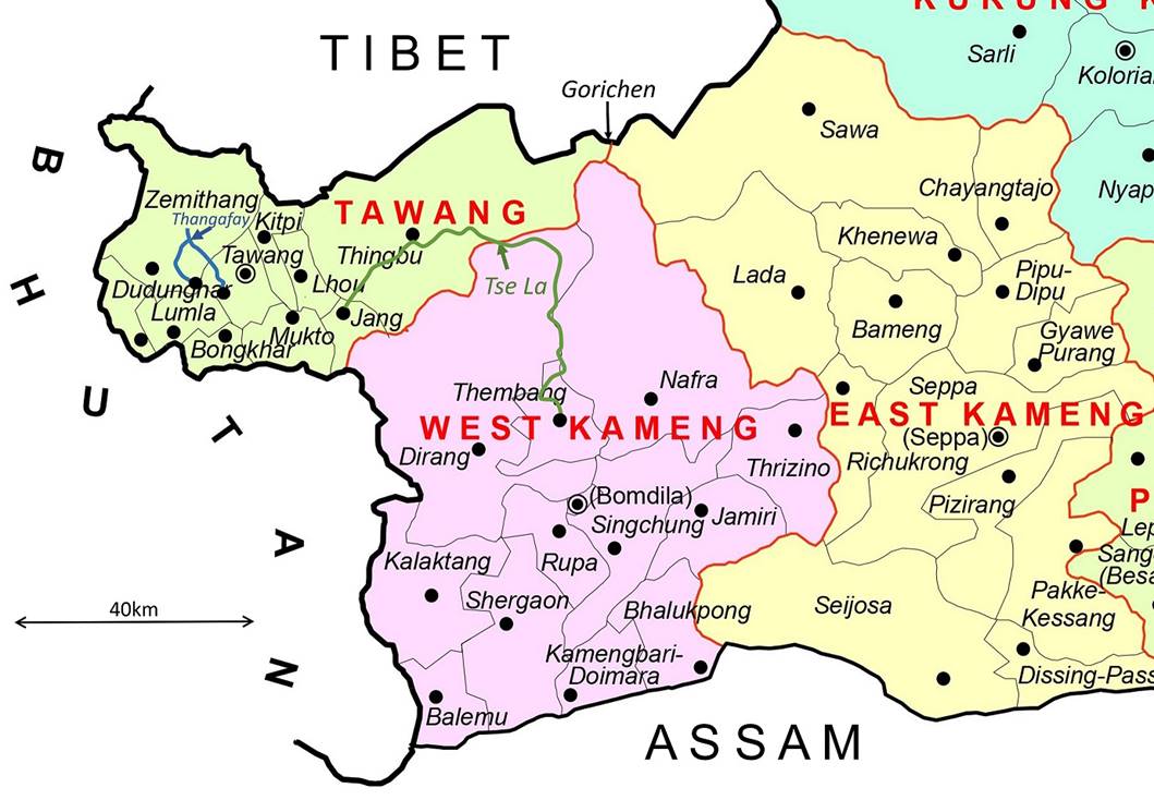
Portion of NE India visited during this trip. |
Tawang and West Kameng districts of AP, with approximate paths of
first and second treks respectively drawn in green and blue. |
I
did two back-to-back treks on this trip:
- A 9-day trek (marked in green line
in the above map on the right) from the village of Thembang in
the district of West Kameng to the town of
Jang in the district of Tawang via Tse La, a 4712m pass on the border between the two
districts. [Tse La should not to be confused with Se La (less
commonly spelled Ze La), a 4170m pass
located on the road connecting the towns of Tawang and Dirang, also on the border between the Tawang and West Kameng districts.]
- A 4-day trek (marked in blue
line in the above map on the right) between the villages of Kudung
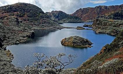
and Thongleng, both located southwest of the town of Tawang, via Thangafay, a locally
important pilgrimage destination surrounded by gorgeous lakes.
The
paths of these two treks can be seen in more detail by clicking here and opening
the downloaded file (trek-ap-2019.kmz) in Google Earth.
-
A 1:250,000 topographic map compiled by the US Army in 1955, which covers both
treks, is available here.
In comments of some photos of the first trek, I use names of rivers and passes
drawn from this map.
-
A Russian 1:200,000 topographic map covering only the first trek (except the
area close to the town of Jang) is available here.
Part
of the first trek approximately follows a section of an exploratory route taken
by two British officers, Lt.Col. F.M. Bailey and
Capt. H.T. Morshead, in 1911-12. Click here to see a map sketch of this route (source: H.W. Tilman: The Seven Mountain-Travel Books).
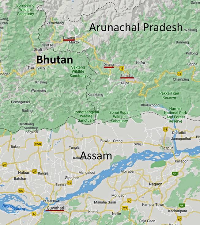
In
addition to these two treks, I stopped briefly in Guwahati, the largest city in
the state of Assam and the closest airport to the Tawang and
West Kameng districts of AP. Following the
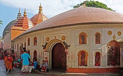
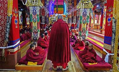
two treks I visited the town of Tawang (the
headquarters of the Tawang district, pop:
11,202), which is home to the second largest Tibetan Buddhist monastery in the
world after the Drepung monastery near
Lhasa in Tibet. Then, on my way back to Guwahati, I briefly stopped at Dirang and Bomdila (the
headquarters of the West Kameng district).
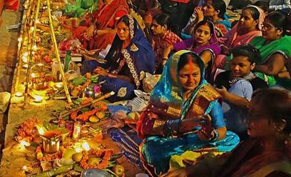
At the end of the trip I traveled to Varanasi and spent 3 days there at the
time of the Chhath festival dedicated to
the Hindu solar deity Surya and the goddess Shashti.
The overall schedule of the trip was
as follows:
- Day 1: Early arrival in Delhi.
Flight from Delhi to Guwahati. Visits of temples in Guwahati.
- Days 2-3: Drive from Guwahati to the
village of Thembang.
- Days 4-12: Trek from Thembang to Jang via Tse La.
Drive from Jang to Tawang.
- Days 13-17: Drive from Tawang to Kudung. Trek from Kudung to Thongleng via Thangafay.
Drive
to Lumla, then to Tawang.
- Day 18: Tawang.
- Days 19-20: Drive back to Guwahati,
with stops in Dirang and Bomdila.
- Day 21: Flight from Guwahati to
Varanasi (via Delhi).
- Days 22-24: Varanasi.
- Day 25: Flight back from Varanasi to
Delhi.
During
my entire stay in the states of Assam and AP I only saw a handful of visitors
that were obviously non-Indians, including the US ambassador and his wife who
made a one-day official visit to Tawang when I was
there. In Tawang there were probably visitors from
neighboring Bhutan, but except in one occasion I could not distinguish them
from local people. I saw no trekkers or climbers.
Permits:
Every non-Indian visitor needs a PAP
(Protected Area Permit) to enter Arunachal Pradesh. This permit must be
obtained in advance through a travel agent (in my case Lobsang).
However, entering some regions of AP requires additional permission. The
itinerary of my first trek passes by several Indian army camps. I had to spend
an afternoon and a night at the first camp (located at a place called Thungri), while the local military requested instructions
to let me pass, or not. Lobsang, who was
separately informed by my guide (Bodong) of the
issue, activated his own contacts among the military. The permission allowing
me to continue on my trek came in the morning and had apparently been taken at
a high level. Getting such a permission in advance is probably not possible, as
the decision may depend on fluid and unpredictable factors. So, with just a
PAP, there is no advance guarantee that a trek will be allowed. On the positive
side, after getting permission, all the following military camps had been
informed of my visit and itinerary. In each of these camps, the military were
polite, courteous, and even friendly. They often offered me and my support team
tea, coffee, breakfast, and even medical assistance (if needed).
Monpa people:
The two districts of Tawang and West Kameng form
the land of the Monpas, one of the main tribes
living in AP (some Monpas also live in
southern Tibet). About 60,000 Monpas live
in AP. They form 97% of the population in the Tawang
district and 77% in the West Kameng district.
The Monpas practice Tibetan Buddhism, but
they mix their Buddhist faith with a variety of other beliefs, some specific to
each village. They are sub-divided into 6 main sub-groups (e.g., the Tawang Monpas, the Dirang Monpas) based on
variations in their languages, all of them parts of the Tibeto-Burman family of
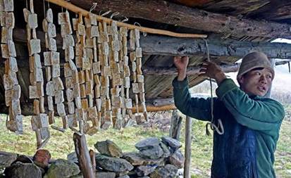
languages. Many of the Monpas, the
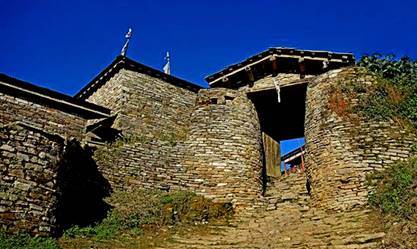
so-called brokpas, depend on animal breeding and
rearing, especially yaks. During the monsoon pasture season the brokpas live in stone huts spread in the mountains.
The 6th Dalai Lama, Tsangyang
Gyatso (1683-1706), was a Monpa
born at the Urgeling monastery near Tawang. Another source of pride of the Monpa
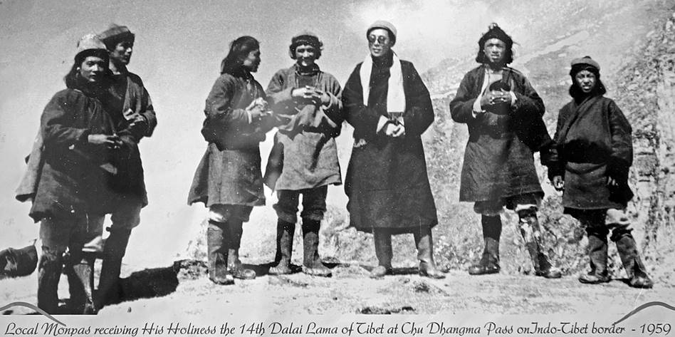
people is that they were the first to welcome the 14th Dalai Lama on the
Indo-Tibetan border, when he escaped Tibet in 1959 near Tawang
(see photos below).
|
|
|
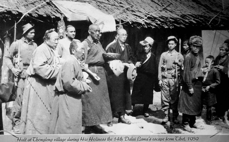
The photo on the right shows the Dalai
Lama in Thongleng, the village that I reached at the
end of the second trek.
Photos:
Click on the links below to see
pictures of the various parts of the trip
|
|
|
|
|
Trek
#1: Thembang to Jang via Tse
La (1/3) |
||
|
|
|
|
|
|
|
|
|
|
|
|
|
|
|
|
|
|
|
|
|
|
|
|
|
|
|
|
![]()