Morocco (April
2022): Hikes on the Southern Side of the Mgoun Massif
![]()
Return to my
mountaineering/trekking/travel webpage
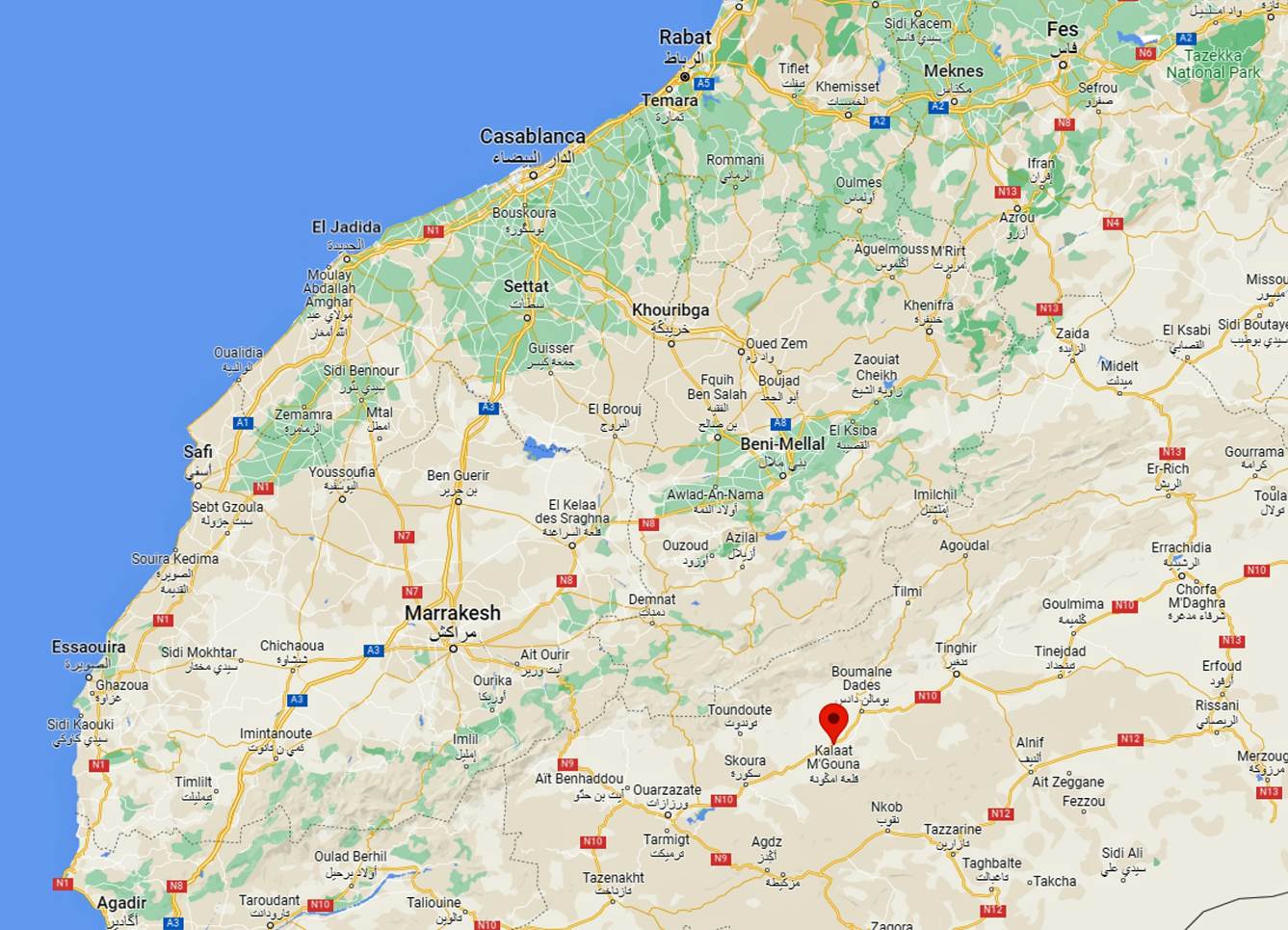
On this
one-week trip to Morocco, I did a series of hikes with my friend Oumar Oulaidi south of the Mgoun Massif and north of the town of Kelaat
M'Gouna (see map above). I set my base in the
comfortable Zen Ecolodge recently built by
Oumar near the traditional villages of Alemdoun and Rbat (yellow dot in
the topographic map below), some 21km north of Kelaat
M'Gouna. These hikes consisted of three distinct loops:
a one-day loop shown in brown dotted line in the topographic map, another
one-day loop shown in purple line, and a 3-day loop with two intermediate camps
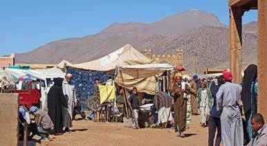
shown in red line. I also spent a final day visiting nearby villages (Rbat, Azilal, Ait
Toumert, and Ait Khlifa), and the weekly souk el-Arba
(a short distance west of the lodge). I had originally planned to climb Jbel Aklim on the second day of
the third loop, but due to unexpected fierce winds I eventually chose not to do
it and, instead, spend more time on the southern slopes of Jebel Asselda.
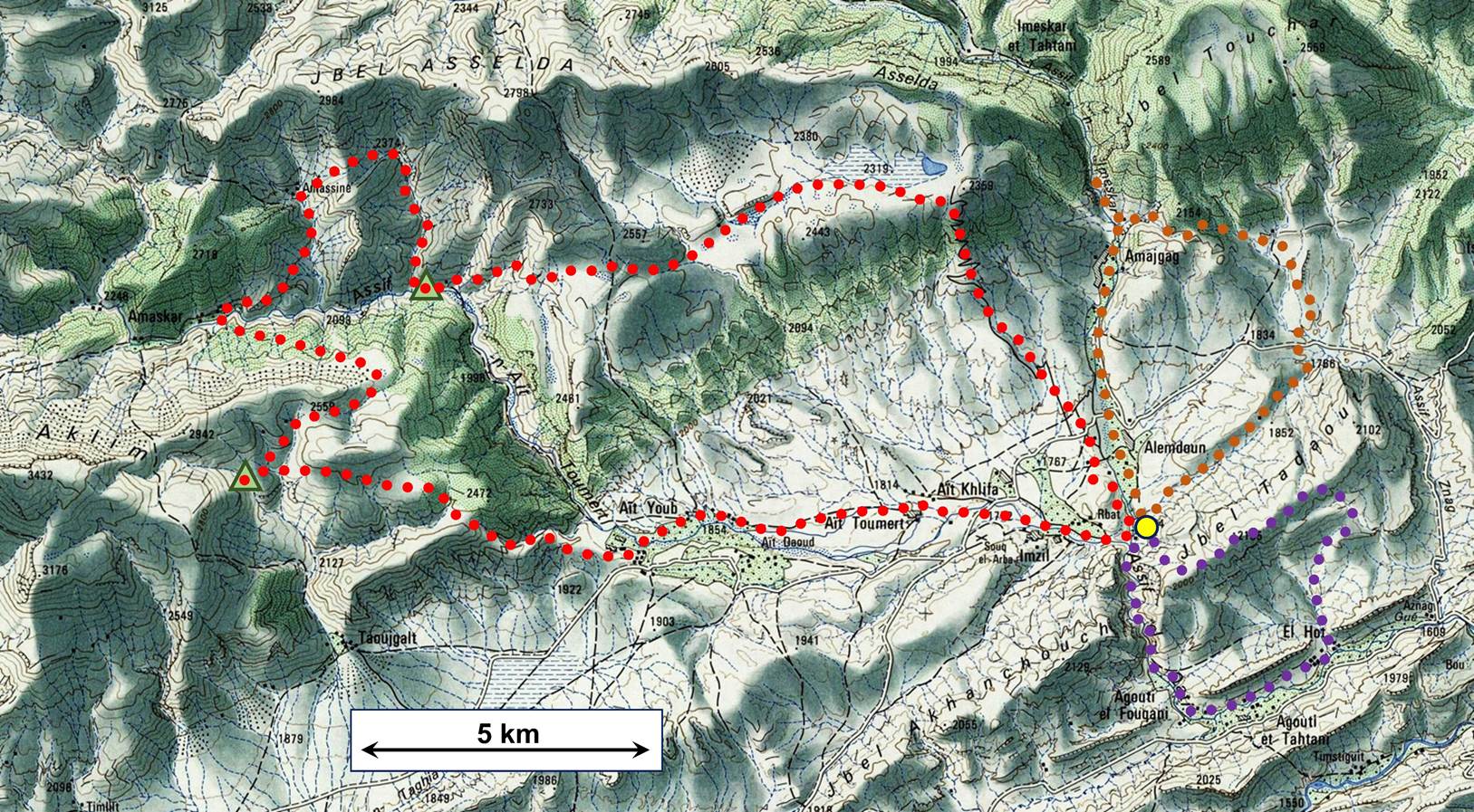
[For an extensive source of topographic
maps of Morocco click this link: https://jemecasseausoleil.blogspot.com/2017/06/cartes-du-maroc.html. The above map is part the 117
- QALAT MGOUNA map sheet. To access the waypoints I recorded
during the hikes, first click here
to download the morocco-2022.kmz file and then open this file in Google Earth.
The successive waypoints are numbered 0 to 72, with 0 being the location of the
lodge, 1 through 15 being the waypoints of the first loop, 16 to 29 being those
of the second loop, and 30 through 72 being those of the third loop. The two
intermediate night camps set during the third loop were located at waypoints 41
and 57. They are shown with green triangles in the map above.]
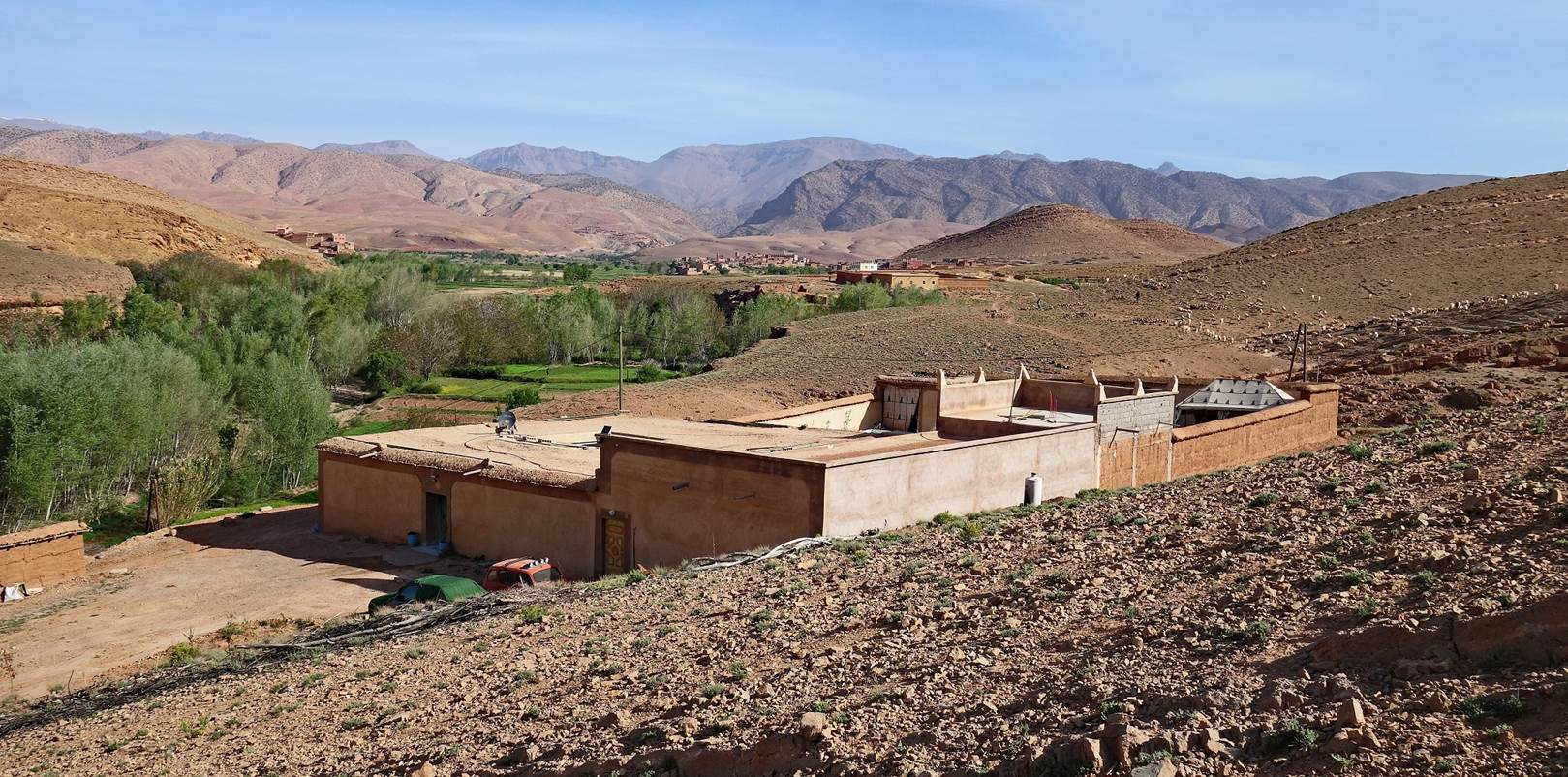
View of the Zen
Ecolodge, with the village of Alemdoun visible in the
background at the center of the photo.
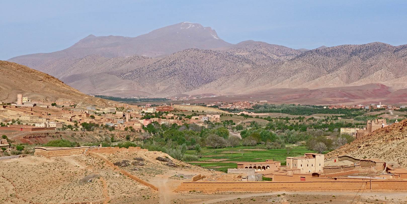
View toward the west
from the lodge, with Jebel Aklim at the center, the
village of Imzil on the left, and the village of Rbat (partially visible) on the right.
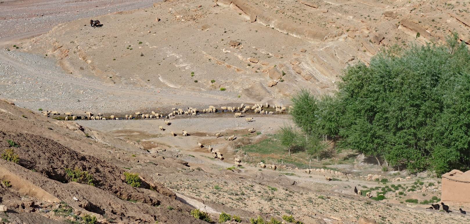
Sheep drinking at the
small river flowing below the lodge.
To see pictures of the various parts of this trip, click on the following
links (photos or captions):
|
|
|||
|
|
|
|
|
![]()