Uzbekistan (August 2023):
Hiking in a Land of High Cliffs and Deep Gorges
![]()
Return to my
mountaineering/trekking/travel website
My main
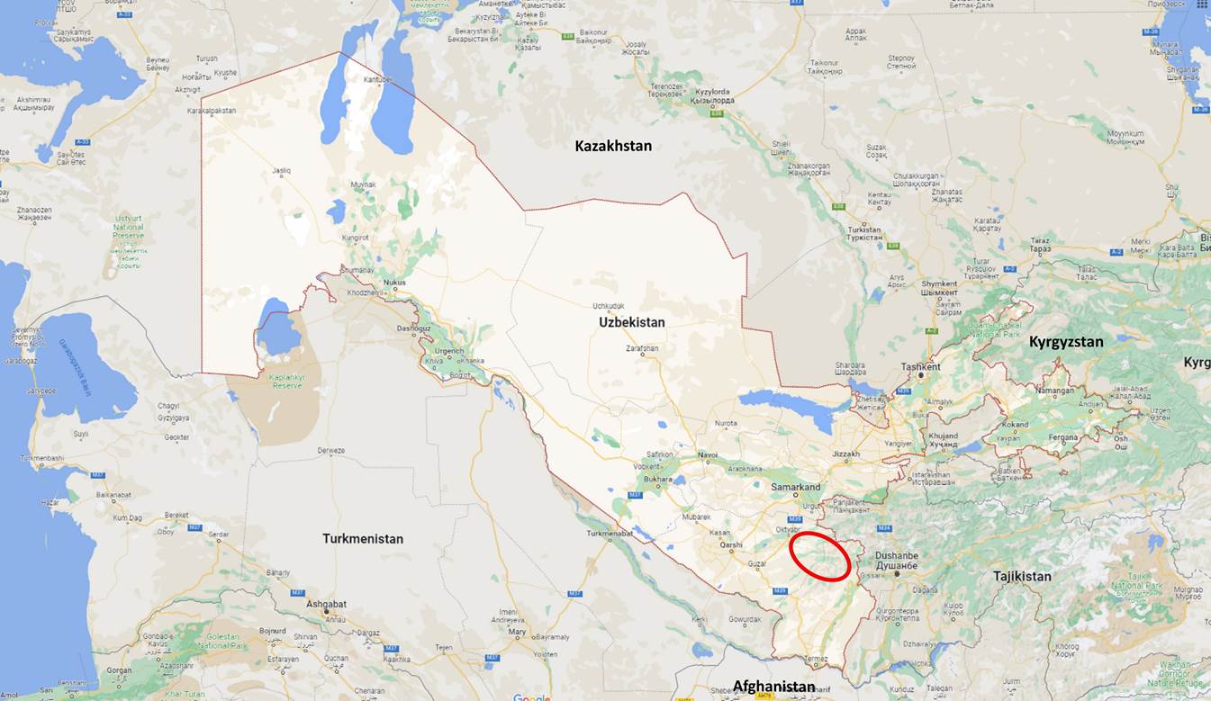
purpose for this trip was to hike with my friend Boris Karpov in the southern
mountains of Uzbekistan, north of the town of Boysun (area outlined in red in
the map above). In 2018, during a brief visit (without hiking) of the area
around Boysun (see here),
I noticed that the surrounding mountains offered a good potential for multi-day
hikes. I then planned a hiking trip with Boris in this region in 2021, but I
had to postpone it due to the Covid pandemic.
Between 2004
and 2011, Boris, a former Soviet climber and a resident of Tashkent, organized
several trekking trips for me in Kyrgyzstan and Tajikistan (see here), but prior
to 2023 he only joined me on a couple of day hikes in the Chimgan mountains in
northern Uzbekistan, in 2012 and 2018. He designed the itinerary of this 2023
trip together with his friend Cholmurat Eschmuradow (a resident of
Shakhrisabz). Cholmurat arranged most of the logistics (especially,
transportation and load carry by donkeys). During the trip Boris and I were
joined by Lutfilo. A native Uzbek and Tajik speaker, Lutfilo served as an
interface with local people and occasionally as a cook.
Email
contacts:
- Boris
Karpov, karpovb@bk.ru
- Cholmurat Eschmuradow, shakhrisabz_tour@mail.ru
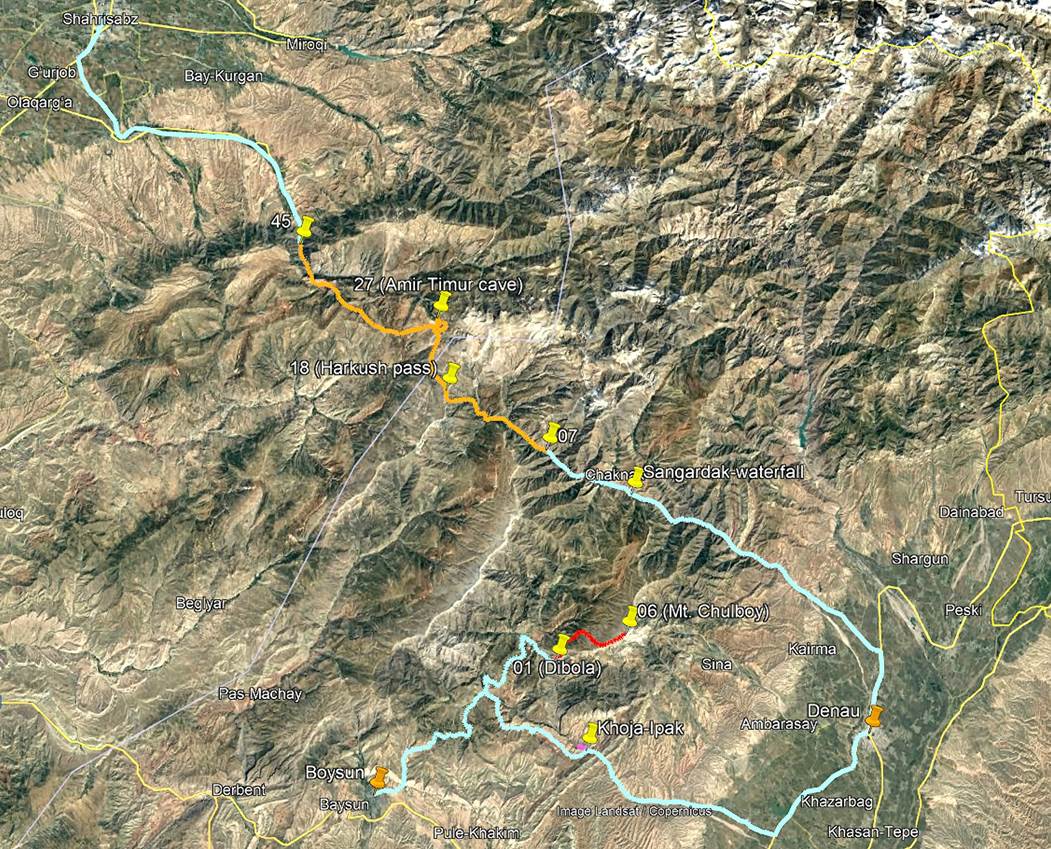
Boris and I
took a night train from Tashkent to Boysun (see aerial photo above). Lutfilo met
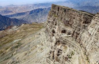
us there and we drove together to the mountain village of Dibola (marker 01 in
the map above) to do a first hike, an ascent of Mt. Chulboy (3812m) and back,
over 3 days. We then drove to Khodja-Ipak, a local tourist attraction (thanks
to a hydrogen sulphide spring), where we spent a night and did a morning hike
in the narrow gorge section of the Kurganchasai river. After another night
spent in Denau we drove to the mountain village of Bakhcha (marker 07), where
we started a six-day hike ending at a place named Tatar (marker 45). From Tatar
we drove to Shakhrisabz.
Prior to
these hikes, I spent a day in Tashkent, where I visited a few places that I did
not know from previous trips. After the hikes I also spent one day in
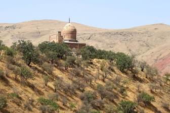
Shakhrisabz and did a one-day excursion to the village of Langar, some 65
kilometers south of Shakhrisabz. Langar is home to both the mausoleum of Mohammed Sadik, a
famous 16th-century Sufi leader, and a beautiful 16th-century mosque.
To access
both the GPS waypoints I recorded during the hikes and the paths I created in
Google Earth, first download the uzbekistan-2023-gps.kmz file from here
and open this file in Google Earth. For the hike to Mt. Chulboy the GPS
waypoints are labeled 01 to 06 and the approximative path is shown in red. For
the hike in the gorge of the Kurganchasai river, no GPS points were recorded,
but the approximative path is shown in pink (barely visible in the above
image). For the 6-day hike, between Bakhcha and Tatar, the GPS waypoints are
labeled 07 to 45 and the approximative path is shown in orange (the path
consists of a main section and two side-paths). The waypoints with green icons
mark the places where we spent nights during the hikes. The three points with
orange icons were added on sight. For the location of
the entrance of the Boybuloq cave, I used the coordinates on the cave's Wikipedia page. The paths in
light blue were done by car. The five GPS waypoints labeled with capital
letters (A through E), are located along the rather complex road between
Boysun, Dibola. and Khoja-Ipak. I recorded them to help me re-trace those
roads, once at home.
To see photos
from my previous trips to Uzbekistan, click on the two links below:
- 2004,
2005, 2006, 2010, and 2012: Samarkand, Shakhrisabz, Bukhara, and Khiva.
- 2018:
Tashkent, Termez, Boysun,
Karshi, Qalas of Karakalpakstan, Nukus to Aral Sea, Little Chimgan.
To see photos
from this 2023 trip, click on the following links:
|
Khodja-Ipak, gorge of Kurganchasai
river, Denau, and Sangardak waterfall |
||||
|
|
|
|
|
|
Below are a
few additional photos taken during this trip:
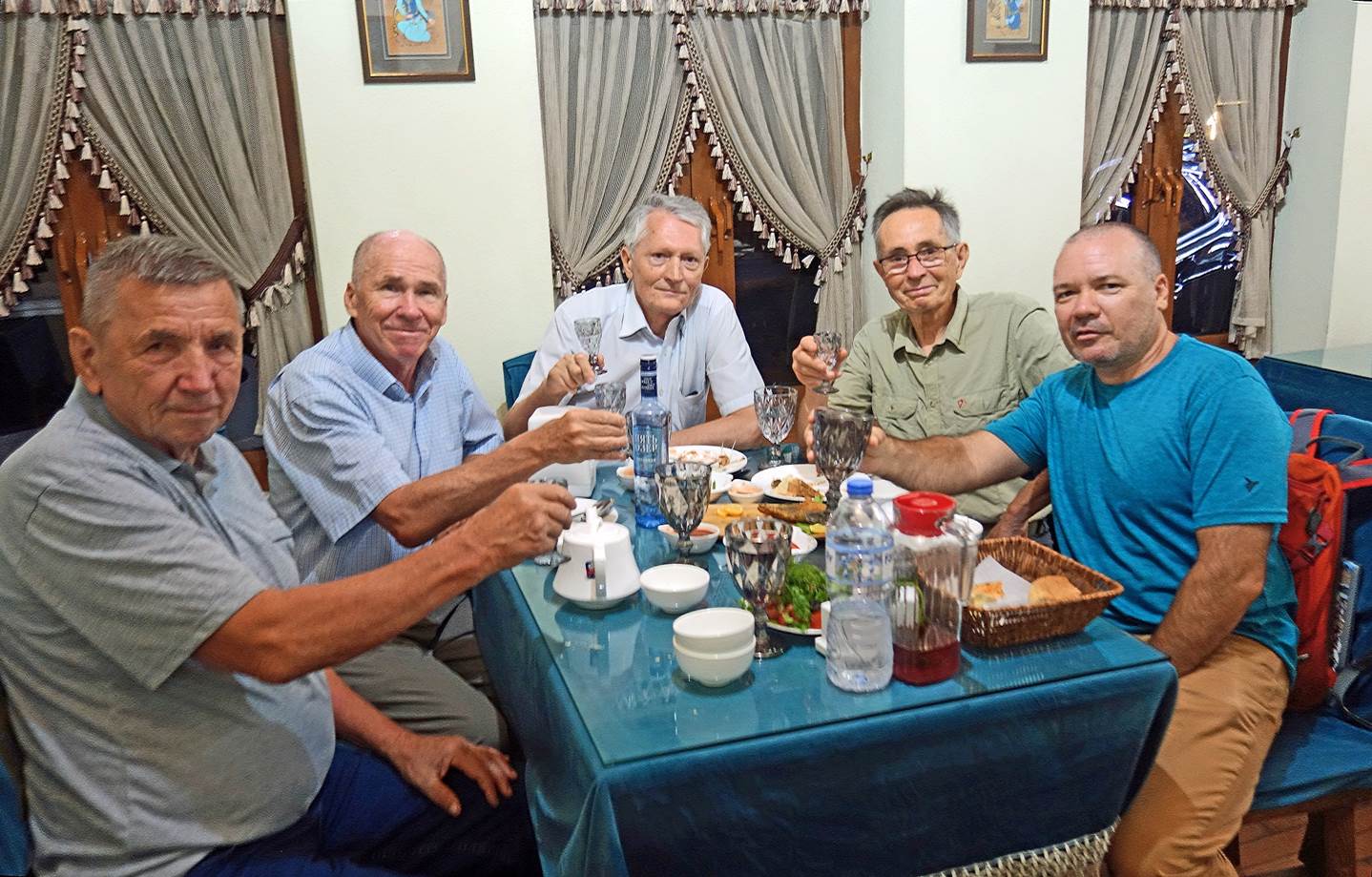
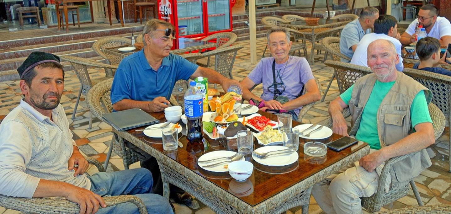
- In a
restaurant in Tashkent, on my arrival day. From left to right: Fiodor, Boris,
Slava, me, and Maksim. With all of them, except Boris, I did numerous treks in
Kyrgyzstan and Tajikistan between 2004 and 2011. It was a wonderful
heart-warming gathering.
- In a restaurant in Shakhrisabz, after
the completion of the 2023 hikes. From left to right: Lutfilo, Cholmurat, me,
and Boris.
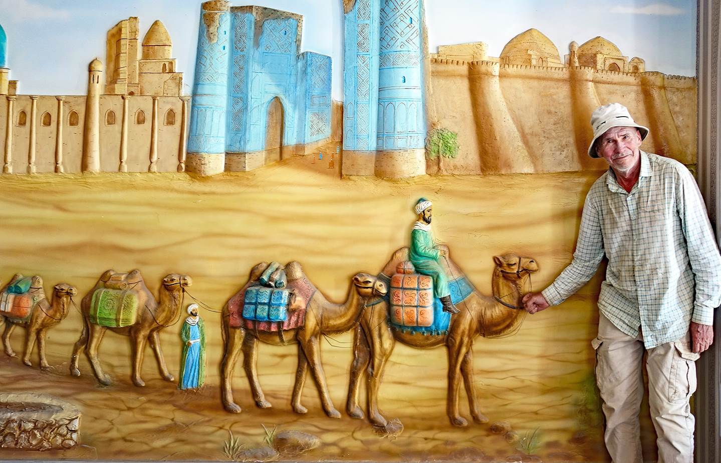
- Boris, in the role of a caravan leader
on the Silk Road, in Shakhrisabz.
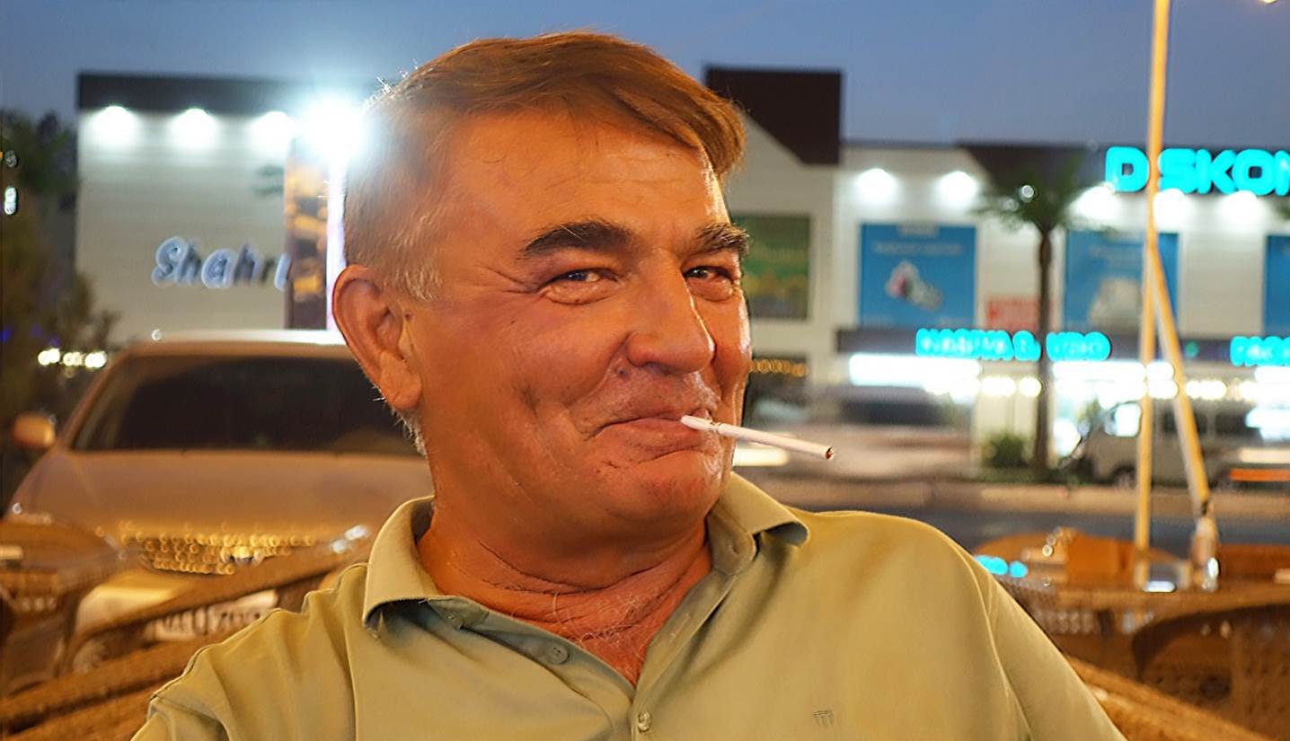
- Below, Cholmurat, a man with a good
sense of humor.
![]()