Trek from Kidmang to Kiangdam,
Changtang region, Ladakh, India (August 2024)
|
|
Return to my
mountaineering/trekking/travel webpage
Trek
overview:
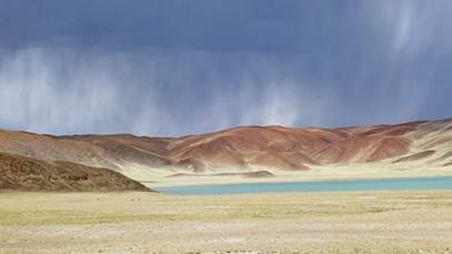
The main
component of this trip to India was a 9-day trek in Changtang, the eastern
region of Ladakh bordering Tibet. This trek started from Kidmang, a small
village on the Indus river located 110km southeast of Leh. It ended at
Kiangdam, at the southern tip of Tso Moriri (lake). Check out the maps posted
below, but note that many names have multiple different spellings and some
places have even multiple names.
This was my
second trek in Changtang, after the one of August-September 2022 (see here).
Changtang is the land of the Changpa, formerly a nomadic pastoralist people who
roamed freely between Ladakh and Tibet. But in the past few decades, the
invasion of Tibet by the Chinese army and the closure of its border by the
Chinese government, as well as modern socio-economic developments, have brought
deep changes to the Changpa lifestyle. In present-day Changtang, most Changpa
reside in small settlements. Few are herders moving their livestock between
pastures. When they do, they often use 4X4 vehicles on ad hoc dusty roads, even
over high passes. The old nomadic walking trails are no longer maintained and
many have almost completely disappeared.
|
|
|
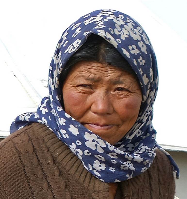
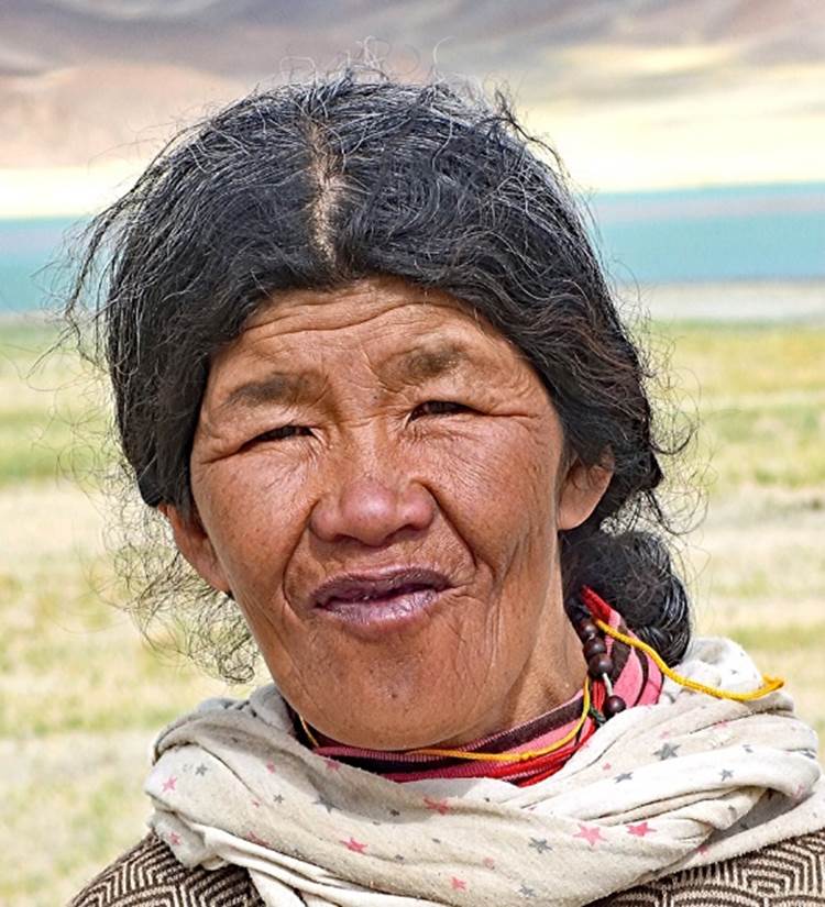
Changpa
women.
Most of this
trek is on faint trails or open terrain at elevations ranging between 4800m and
5200m. It crosses 5 passes, in chronological order: Zildal La (5230m), Rebel La
(also spelled Ribil La and sometimes named Sumdo La, 5730m), Nidar La (5140m),
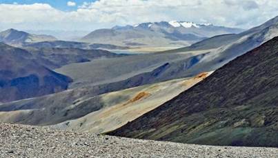
Salkom La (5170m), and Norbu La (4970m). The general landscape consists mainly
of mild slopes in wide valleys and on gentle hills, with relatively few
snow-capped peaks above 6000m in the background. Its grandeur, often
breathtaking, is typically what one would expect from a nomadic high-altitude
Central Asian land.
Maps
and GPS waypoints:
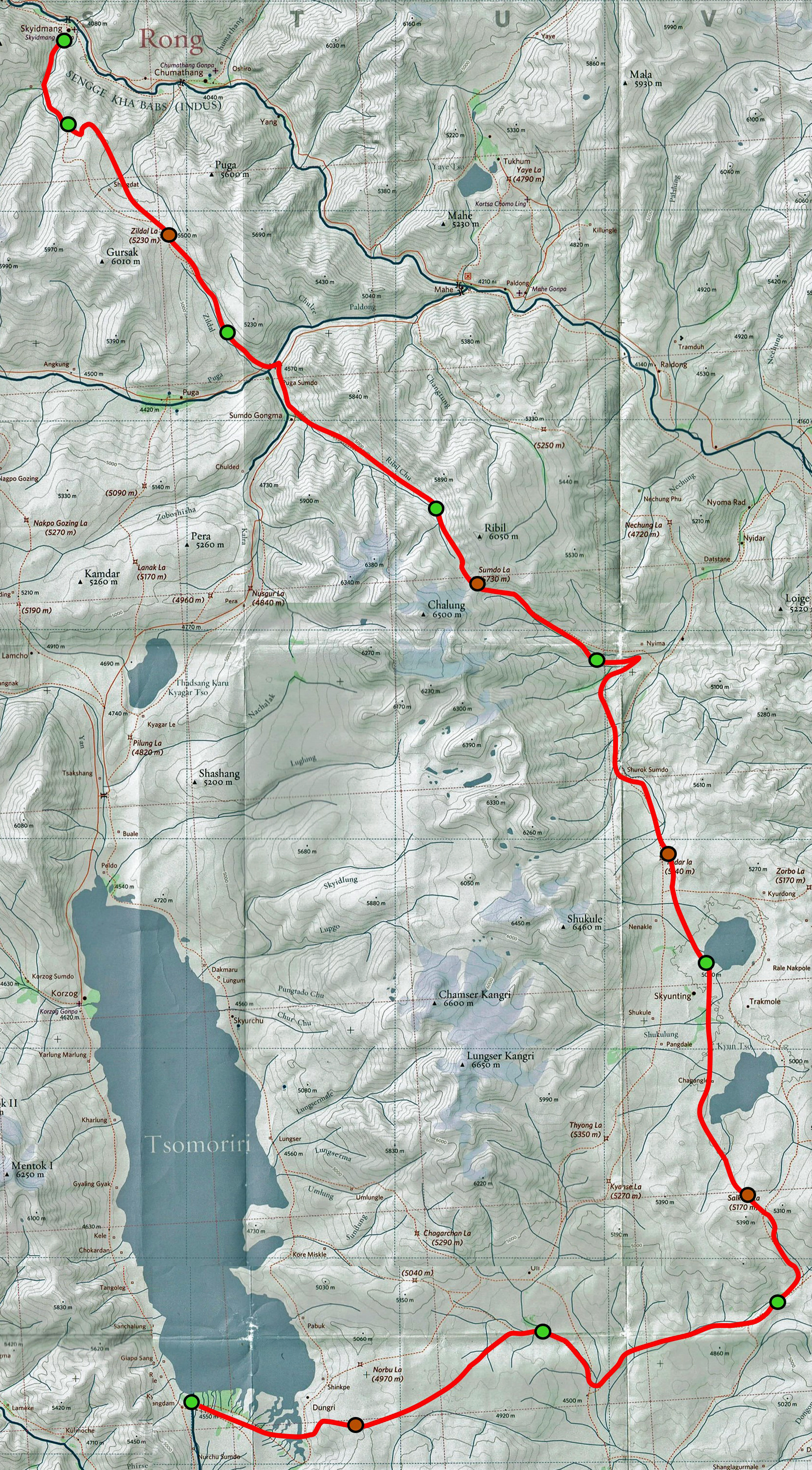
Left: Map
showing the approximate locations of my 2022 and 2024 treks in Changtang.
Right: Red-line route of the 2024 trek drawn on a portion of the 1:150,000
South Ladakh & Zanskar map, Editions Olizane, Switzerland (click on this
map to see a larger version of it in a different window). The green dots mark
the locations of our successive campsites and the brown dots mark those of the
five successive passes.
|
|
|

The red-line
route shown above is based on a series of 57 GPS waypoints I recorded during
the trek. To access these waypoints, click here, download
the ladakh-2024.kmz file, and open this file in Google Earth. The successive
waypoints are numbered 1 (start of the trek at Kidmang) to 57 (end of the trek
in Kiangdam). The waypoints with green icons are night camp locations and those
with brown icons are the locations the five passes crossed during the trek. The
remaining waypoints, all with yellow icons, are intermediate locations. The
following are numbers extracted by Google Earth from the red-line route:
- Total
length of the trek: 115km,
- Highest,
lowest, and average elevations: 5730m, 4130m, and 4850m,
- Total
elevation gain/loss: 5080m/4660m,
- Average
slope: 8%.
Note: In
addition to the 57 GPS points, the ladakh-2024.kmz file contains the portion of
the Olizane map shown above and the red line connecting the waypoints. I
geo-referenced the Olizane map by aligning some of its features (e.g., rivers)
with the aerial view shown in Google-Earth. Overall, the positions of the GPS
waypoints on this geo-referenced map turned out quite good. The only noticeable
discrepancies are the positions of the waypoints recorded at the last two
passes, Salkom La and Norbu La, which differ rather neatly from the locations
of these two passes in the map. In fact, these two passes are so wide (and
flat) that they do not have a clear crossing place where to record a waypoint.
This is especially true for Norbu La, which is essentially anywhere along the
edge of a plateau overlooking the southern tip of Tso Moriri and Kiangdam.
Logistics
and support team:
|
|
Like in 2016, 2018, 2019, and 2022, the logistics of this trip
(including the support team, transportation, accommodations, and food
supplies) was expertly arranged by Sonam Dawa, the owner/manager of Adventure Travel Mark. After so
many years, Sonam Dawa is now a very good and trusted friend. I always enjoy
staying at his home, the Zanskar Courtyard, in Choglamsar, a small town
southeast of Leh. In 2022 he opened a second beautiful homestay, also called
the Zanskar Courtyard, near Padum in Zanskar (see here). |
My support
team selected by Sonam Dawa consisted of Nurboo Rigzen (a wonderful cook and
guide, who previously traveled with me in 2016, 2018, and 2022), Tse-Wong (a
Changpa from the village of Puga) and his horses, Stanzin, and Tundup.
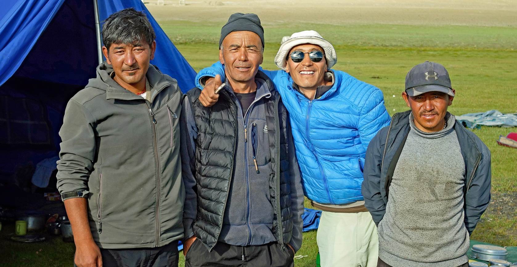
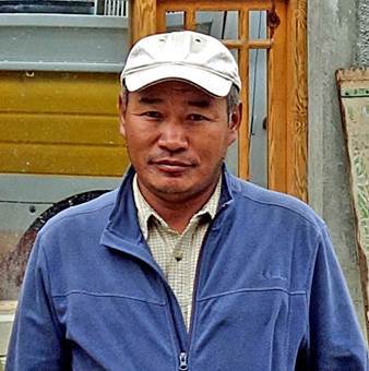
From left to
right: Tundup, Nurboo, Stanzin, and Tse-Wong.
|
|
|
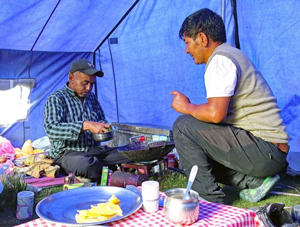
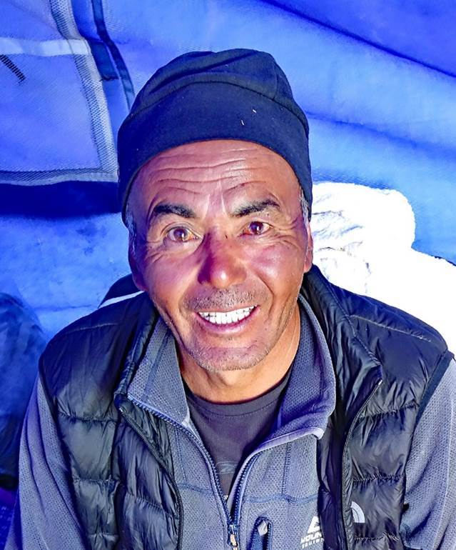
Left: Nurboo
and Tundup preparing dinner in the main tent. Right: Smiling Nurboo.
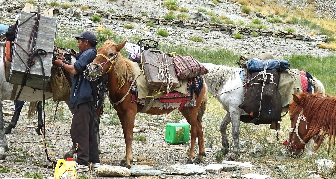
Tse-Wong and
his horses. Tse-Wong did not talk much, but he was friendly and efficient. He
also treated his horses with great care. One of the horses was a foal that
carried no load.
Side
visits:
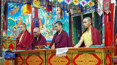
At the
beginning and the end of the trip I spent a few days in Leh and around, first to
acclimatize and recover from the jetlag, then, at the end, to fill reserve days
that I had set aside and did not use. Among other things, during that time, I
attended a morning puja with the monks of the Stakna gompa. I also used a
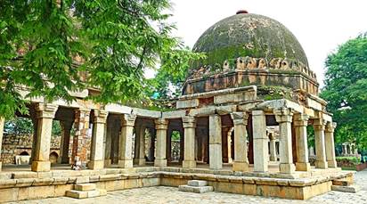
stopover in Delhi between Leh and San Francisco to visit the old complex of
Hauz Khas in South Delhi, the remains of a 13th-century fort including the tomb
of Tughlaq ruler Faruz Shah, a madrassa, and multiple pavilions.
Photos:
Click on the
links (captions or photos) below to see pictures of the various parts of this
trip.
|
|
|||
|
|
|
|
|
|
|