Ethiopia (April-May
2012)
|
|
Return to my mountaineering-trekking-travel webpage


|
Ever since my first trip in 1973, I have wanted to
return to Ethiopia. During that trip I had learned the great joy of
adventure, exploration and discovery, which has influenced not only most of
my more recent mountaineering and trekking trips, but also my professional
life as an academic researcher (see ″Second Life″ slides). For
various reasons, I returned to Ethiopia only in 2012. Of course, during this
lapse of 39 years, Ethiopia has changed a lot. It underwent two revolutions.
In 1974 it went from a quasi-feudal system under King Haile Selassie to a
communist military dictatorship. Since December 1994, it has been a federal
republic made of eight regions and three city-states (including Harar).
During the past decades, Ethiopian population has grown several folds. Its
main towns are much more modern. In particular, Mekele, the capital of
Tigray, which had been the launching point of my trek through the Danakil
desert, was a small and dusty town in 1973. Today, it is a vibrant city with
a new airport, a new university, many schools, and fancy hotels. However, the
countryside has not changed much and remains as fascinating as before.
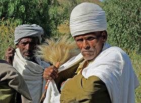
Traveling in Ethiopia is never boring, but is not very easy. Every single day
provides at least one truly magic moment, yet once in a while you ask
yourself ″Why am I here? ″.
″Faranji hysteria″ (swarms of shouting people around you, a
foreigner) can be overwhelming, and takes some time to get used to (in fact,
some foreigners never adapt to it). In retrospect, however, I realize that it
is this combination of experiences that makes Ethiopia so exciting. I wish it
will never get too polished as it develops and gets more
″modern″. |
|
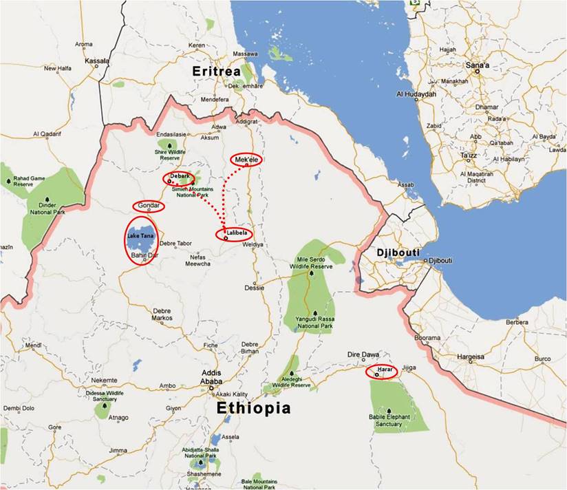
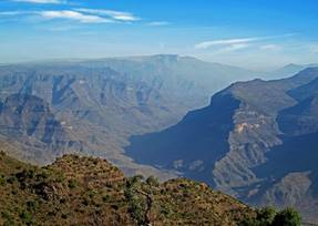
My main goal for this trip was to
trek from Mekele (the capital of the province of
Tigray) to Lalibela and then from Lalibela to Debark (province of Amhara). The approximate
itinerary is shown in dotted red line in the map on the right and is
described in more detail below. I had selected this itinerary mainly for its
expected diversity of terrain (a combination of low- and high-lands), as well
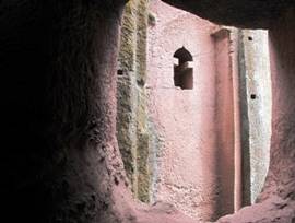
as to visit the famous rock-hewn churches of Lalibela
along the way. This trek lasted a month. It is approximately 450km in length. After the trek I visited Gondar, a
former Abyssinian capital, for its remarkable 17th-century castles, and Lake Tana, for its old mysterious churches and monasteries,
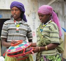
some of which were founded in the 14th century. I then traveled to Harar in eastern Ethiopia. Harar
is neither beautiful, nor blessed with spectacular monuments. It is
nevertheless one of the most exciting towns in Ethiopia, due to the
exceptional diversity of the people who meet there (Hararis,
Argobbas, Oromos,
Somalis, Yemenites...). It is an important trade center and a holy place of
Islam. It is also a major production and trade center of khat,
a stimulant that causes euphoria (and, later, loss of appetite and
depression). Chewing khat leaves is a widespread
social custom dating back hundreds of years in Harar.
French poet Arthur Rimbaud lived in Harar the last
11 years of his life (1880-1891), during which he traded coffee and weapons.
I enormously enjoyed Harar and its colorful people. The entire trip lasted 7 weeks. |
|
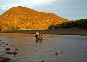
Mekele-to-Lalibela-to-Debark Trek:
Itinerary
|
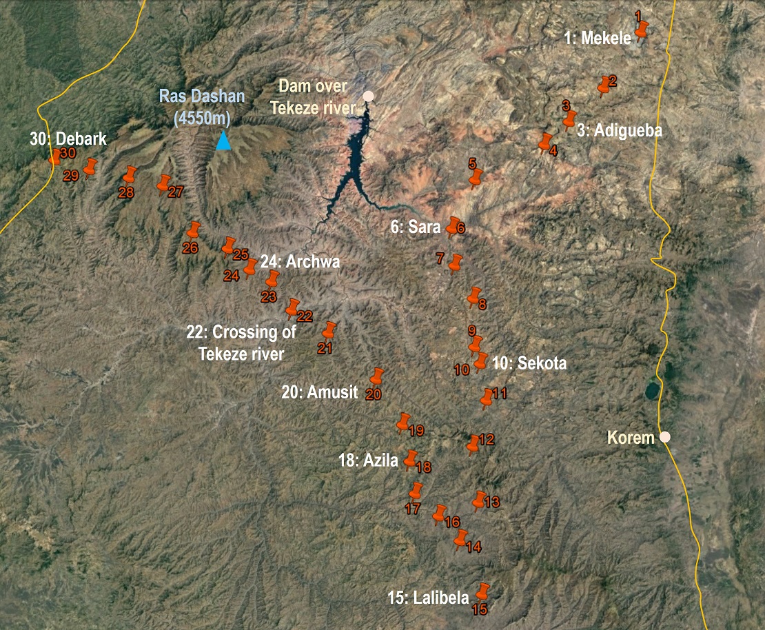
The successive GPS waypoints (WP),
numbered 1 to 30, that I recorded each evening are shown with red pins in the
map on the right. (Click on the map to get a better-resolution picture in a
separate tab.) The table below lists the names of these places based on my
phonetic perception. Entries without names have no names or I did not note
them. We spend one night at each WP, except in Mekele
(WP #1) and Lalibela (WP #15), where we spent 2 and
3 nights, respectively. Click here
to access the waypoints in Google Earth.
Between Mekele
and Lalibela, the itinerary remains close to an
unpaved road with very light traffic. For the first couple of days, it
remains above 2000m where days and nights are comfortable. Then, for 3 days
it traverses a lowland area (less than 1500m) where days are very hot. Between
Chakra (WP #7) and Lalibela (WP #15), it has many
ups and downs, but overall regains some elevation (with Lalibela
lying at 2400m). From Lalibela we returned to Bilbala (WP #14) by bus and resumed our trek from there.
This second part of the trek has more pronounced and steeper ups and downs.
Its lowest point is the crossing of the Tekeze
river (1200m). Between WP #18 and #25, water was very scarce. We often had to
buy jerrycans from villagers. These jerrycans are filled at remote sources or wells, and
carried by donkeys back to the villages. The last 4 days followed a trail
south of the Simien Mountains National Park. |
|
Support Team
|
It consisted of Mulat and Negussie from Debark
and Gebru and Gebrehiwet
from Adwa (northern Tigray). In the photo on the right, Negussie
stands on my left. Next are Gebru, Mulat, and Gebrehiwet (with one
of Negussie′s brothers on the far-right). Mulat was the only one to speak English. Negussie, a former military, had the best knowledge of
the country and its people. He was also our main cook. Gebru
and Gebrehiwet acted mostly as porters.
The team was
excellent. It had been provided by Solomon Berhe, who
arranged most of the logistics for this trip. Solomon has intimate knowledge
of Ethiopia and has developed many contacts across the entire country. In
Addis Ababa, I had passionate discussions with him about the past and future
of Ethiopia and about possible future trips. Though he is an expert in
arranging bird watching tours (not my favorite type of trips), he can as well
organize all kinds of touristic or adventurous trips anywhere in Ethiopia. I
highly recommend him. |
|
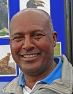
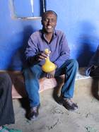
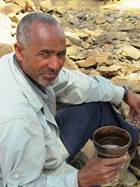
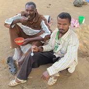
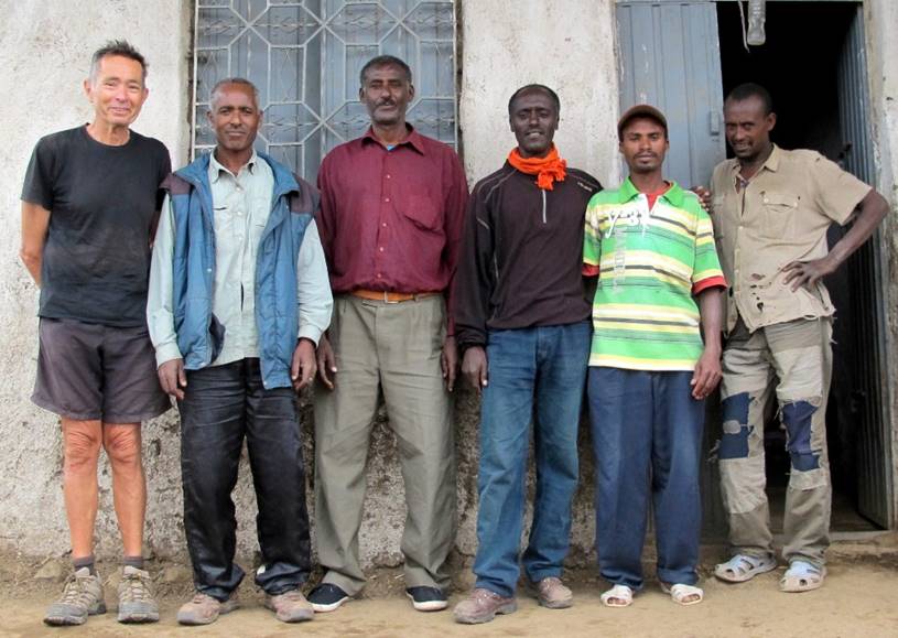
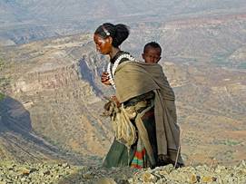
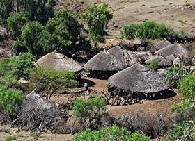
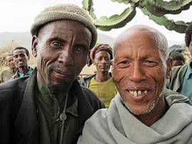
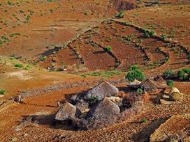
Photo Gallery
Click on the links below to see
pictures of the successive sections of this trek.
|

|
|
|
|
|
Lalibela, Gondar, Lake Tana, and Harar:
Click on the following photos or their captions to access
the corresponding photo galleries.
|
|
|
|
|

|
|