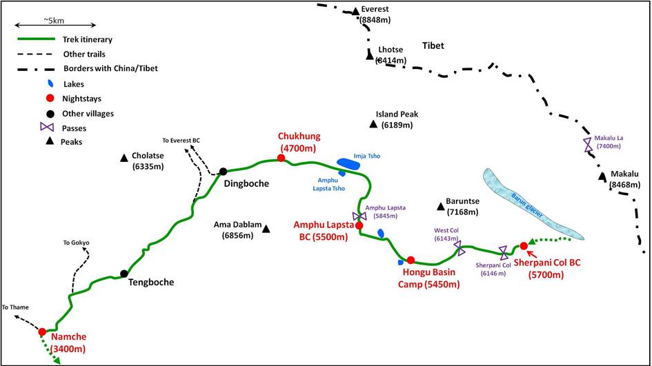
Taplejung to Jiri via Lumba Samba Pass, Sherpani and West Cols, and Amphu
Lapsta (October-November 2012):
7. Crossing of Sherpani and West Cols (1
day)
![]()
|
We crossed Sherpani
Col (6146m) and West Col (6143m) in a single day and put our camp on dry
terrain in the Hongu basin at 5450m between West
Col and Amphu Lapsta. Sherpani and West Cols are separated by a flat glacier,
so that the total elevation gain and loss for the day were modest.
Nevertheless, this was a long, tiring day, as Nyima
Gyaltshen and Lhakpa had
to set up several fixed ropes and carrying loads along some steep sections of
the passes took more time than expected. On the other hand, the weather was
almost perfect (though quite cold and slightly windy) and the views in all
directions were awesome. We were the only group crossing these passes on that
day. |
|
|
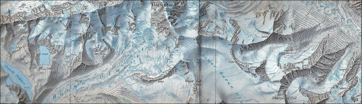
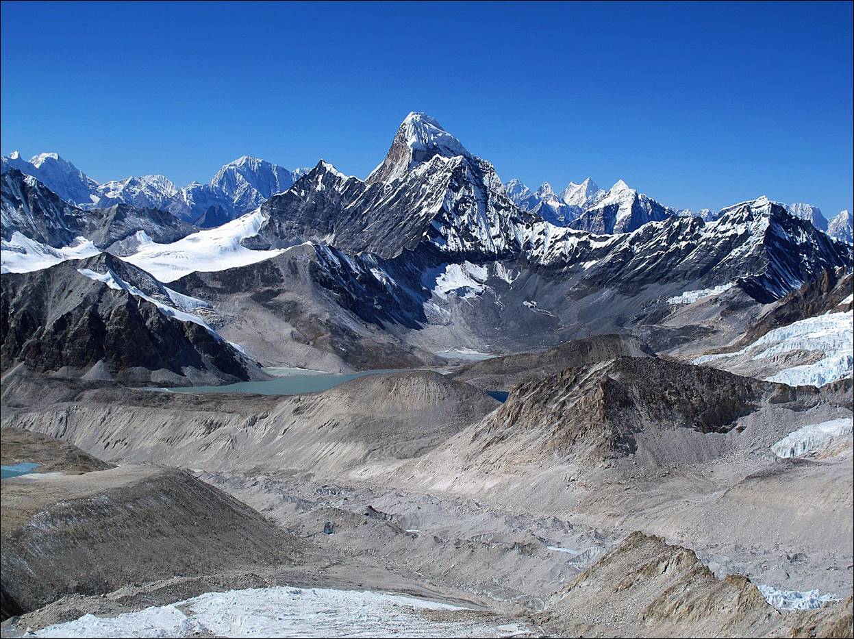
The Hongu basin
is dominated by peak Baruntse (7168m) on its
northern side. The 3 passes (Sherpani, West, and Amphu Lapsta) are located on
three main ridges of Baruntse: the south-east ridge
for Sherpani Col, the south ridge for West Col, and
the west ridge which for Amphu Lapsta.
This west ridge connects Baruntse with Ama Dablam (6856m) and at 5845m
Amphu Lapsta is its
lowest point |
|
[The Hongu river that flows southward
out of the Hongu basin reminded me of my unsuccessful
attempt to follow this river down to the trail connecting Lukla
to Tumlingtar in the spring of 2011 (during the
second half of my West-to-East
traverse of Nepal). During that trip I had reached the Hongu
river south of the Hongu
basin, after crossing Mera La. But the river′s
canyon became increasingly narrower and steeper, and eventually turned out too
difficult to follow. I had to return to Mera La,
cross it back, and follow another route toward Tumlingtar. See here.]
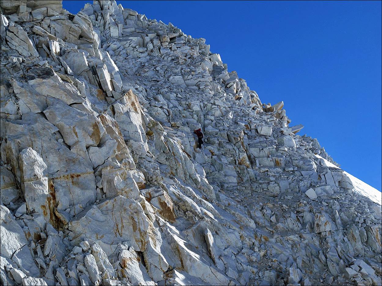
The first part
of the ascent to Sherpani Col was on an easy, gentle
snow slope...
...but the
final section was on steep loose rocks (on the left side of the photo).
Nyima Gyaltshen placed a fixed rope on the
lower part of this section. Its ascent was not very difficult, but the loose
rocks increased the likelihood of a bad fall. Higher the rock was of better
quality, and we then climbed without rope (class 4).
At the pass,
with peak Baruntse on the left. The descent was even
steeper than the ascent, again with many loose rocks. Nyima
Gyaltshen and Lhakpa set up
fixed ropes for the group.
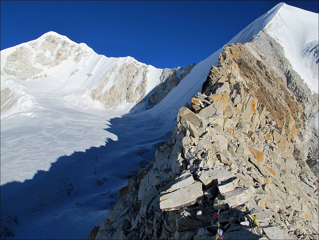
View from Sherpani Col in direction of West Col, with the flat
glacier between the two passes and the start of the South ridge of Baruntse on the right.
Lhakpa preparing for the descent.
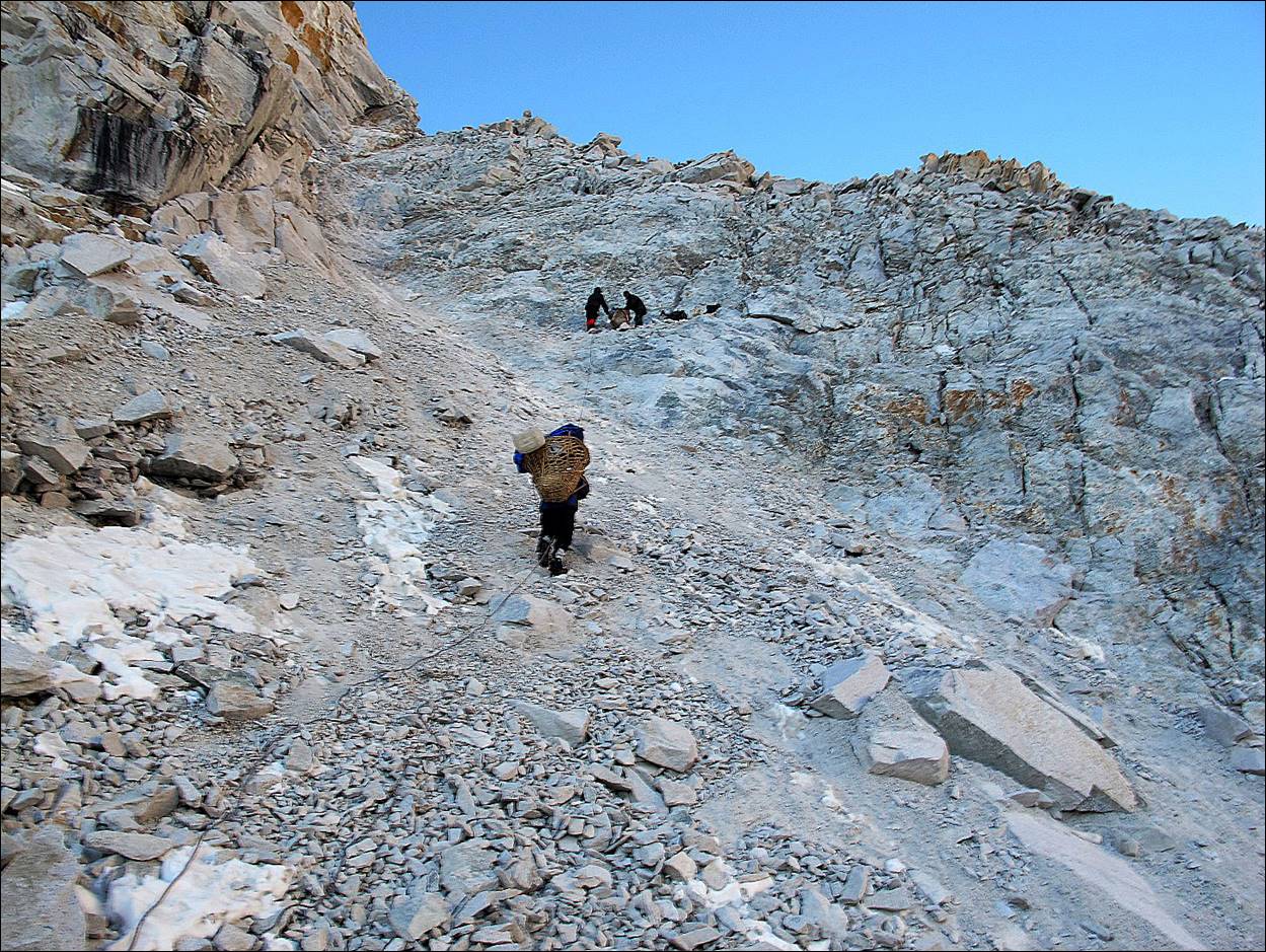
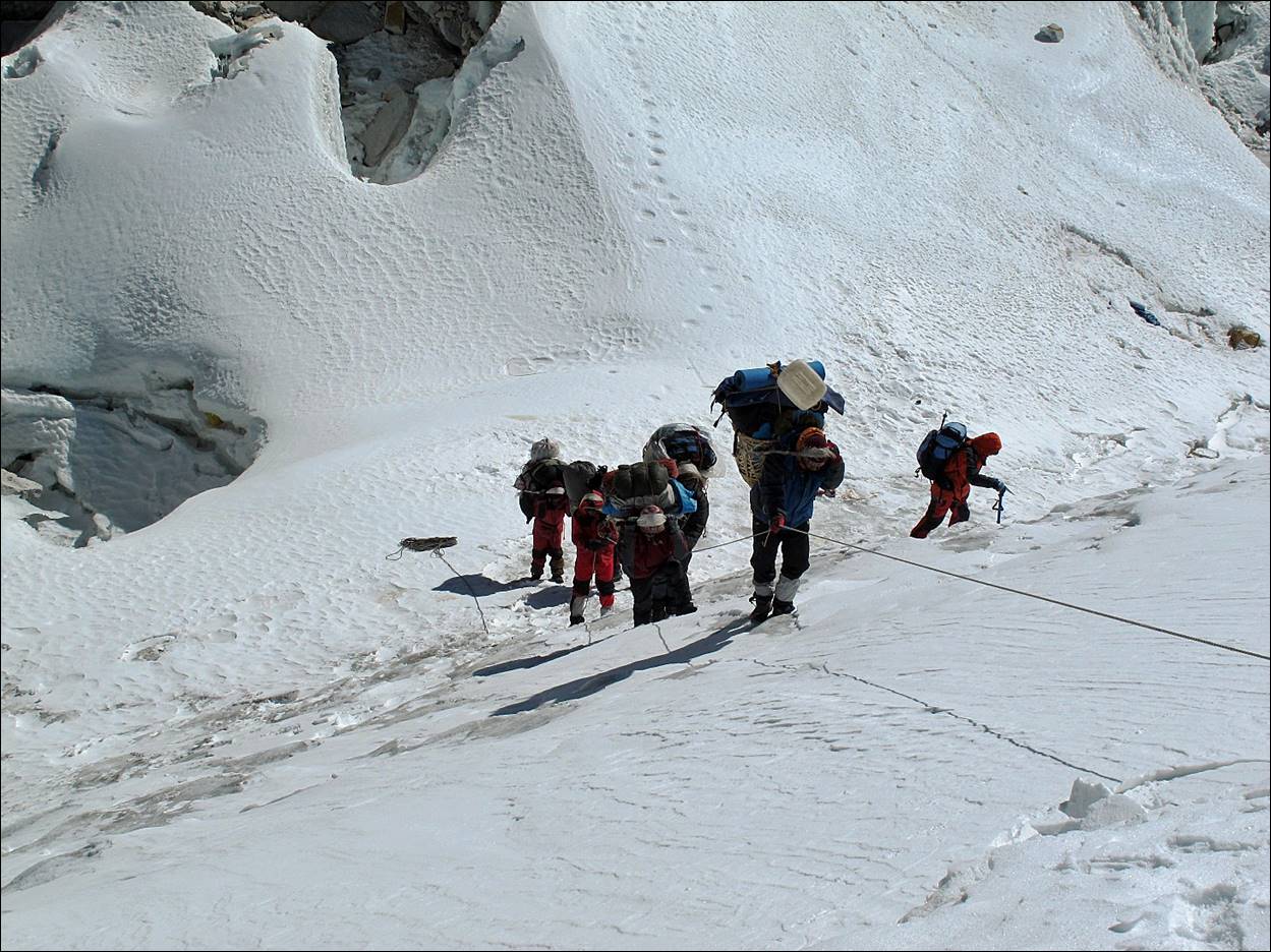
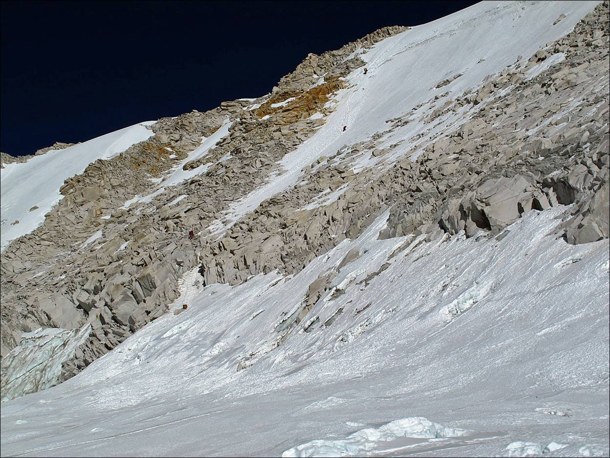
One of the
porters descending from the pass without his load. (Nyima
Gyaltshen ended up carrying most of the porters′
loads on this descent. I believe he climbed back to the pass 5 times.) The
loose rocks made the terrain potentially quite dangerous, so only one of us was
descending at any one time. I heard that a few days later a European climber
was killed here by a falling rock.
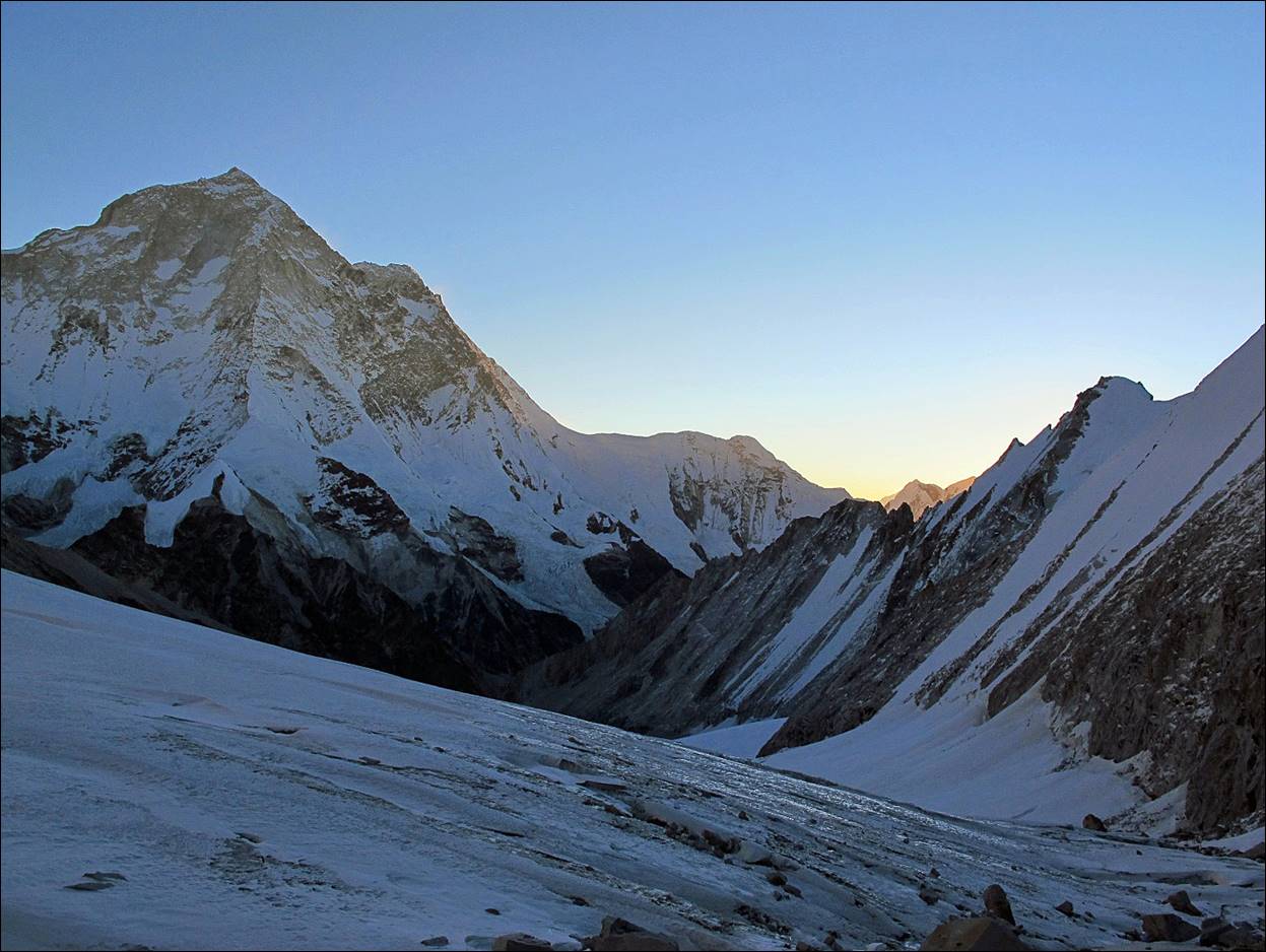
The porters
climbing back onto the flat glacier from the gap at the bottom of Sherpani Col.
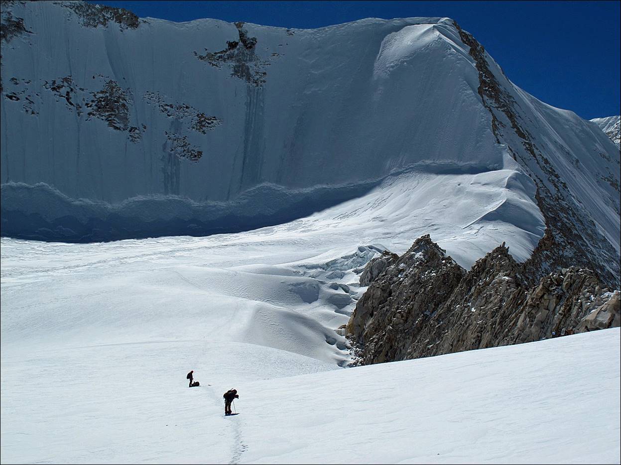
Looking back
at Makalu and Sherpani Col (the rocky band in the
middle) during the traverse of the flat glacier.
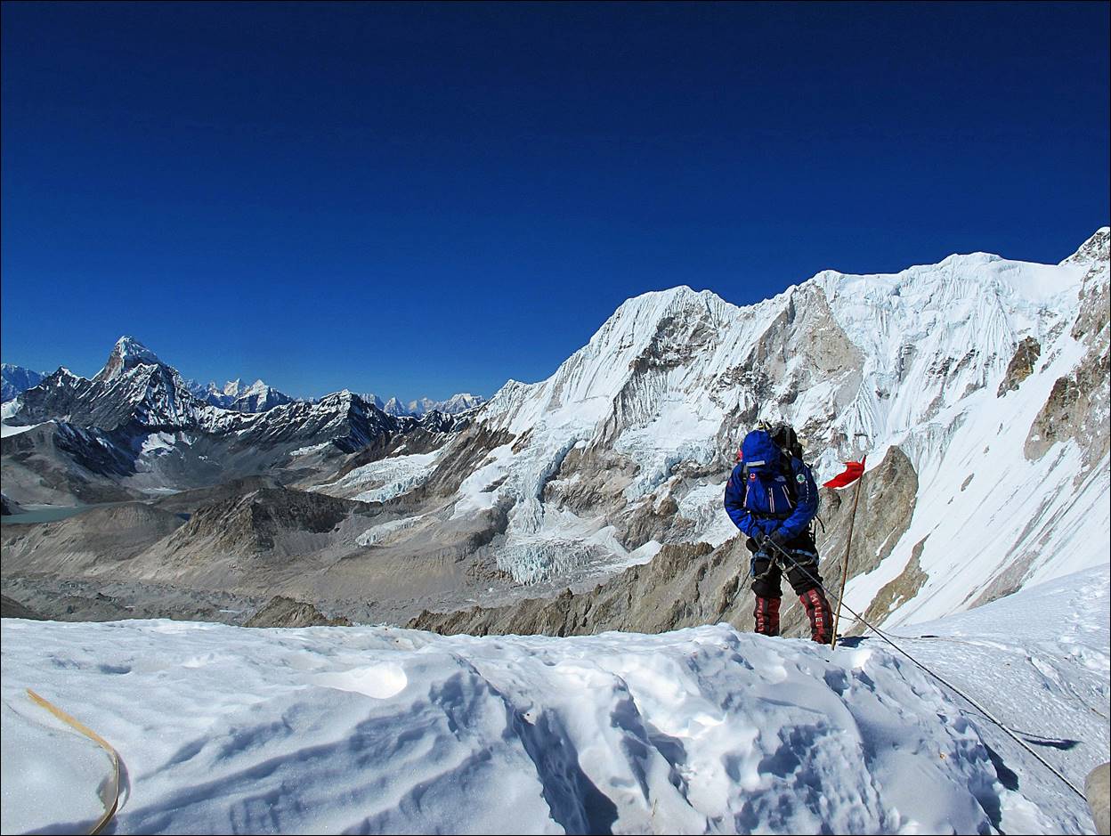
Reaching West
Col. The descent from the pass starts near the
triangular shadow that appears above the rocky section in the photo.
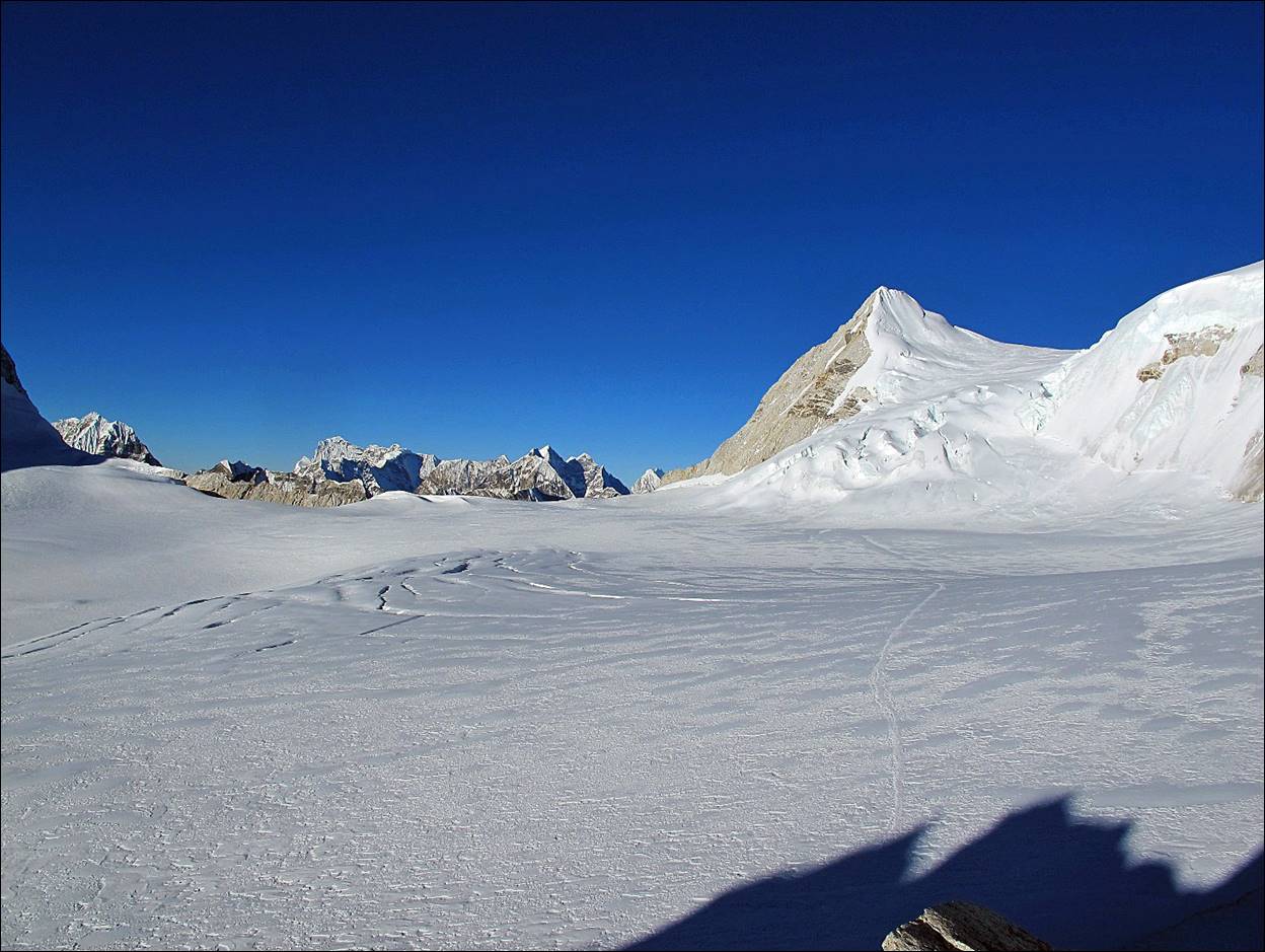
Views of the Hongu basin from West Col. The
highest peak in the middle is Ama Dablam.
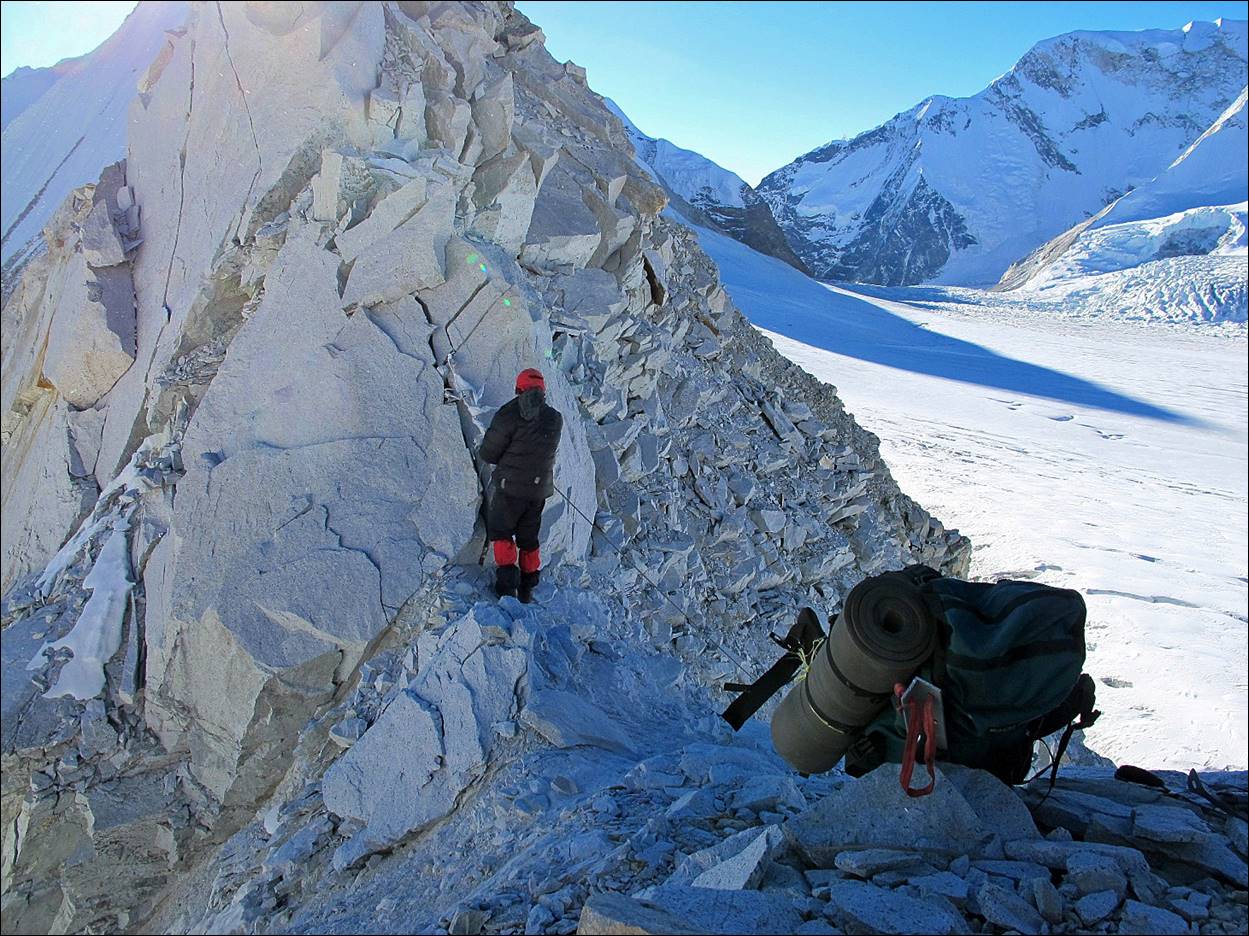
Nyima Gyaltshen starting his descent from
West Col.
West Col seen
from below, with two porters descending. The hardest section was a short
passage between the rocks in the lower part, where old snow had been
transformed into hard ice.
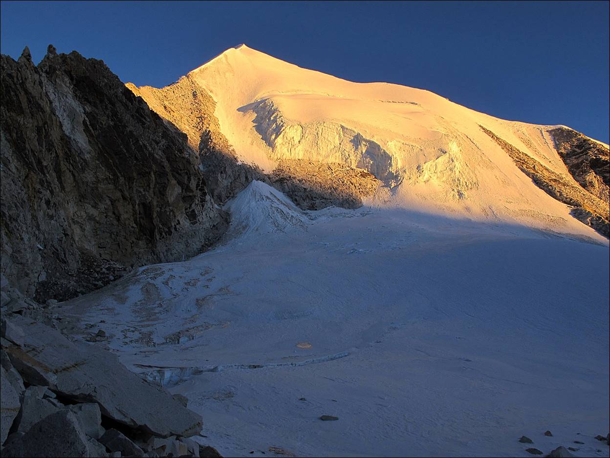
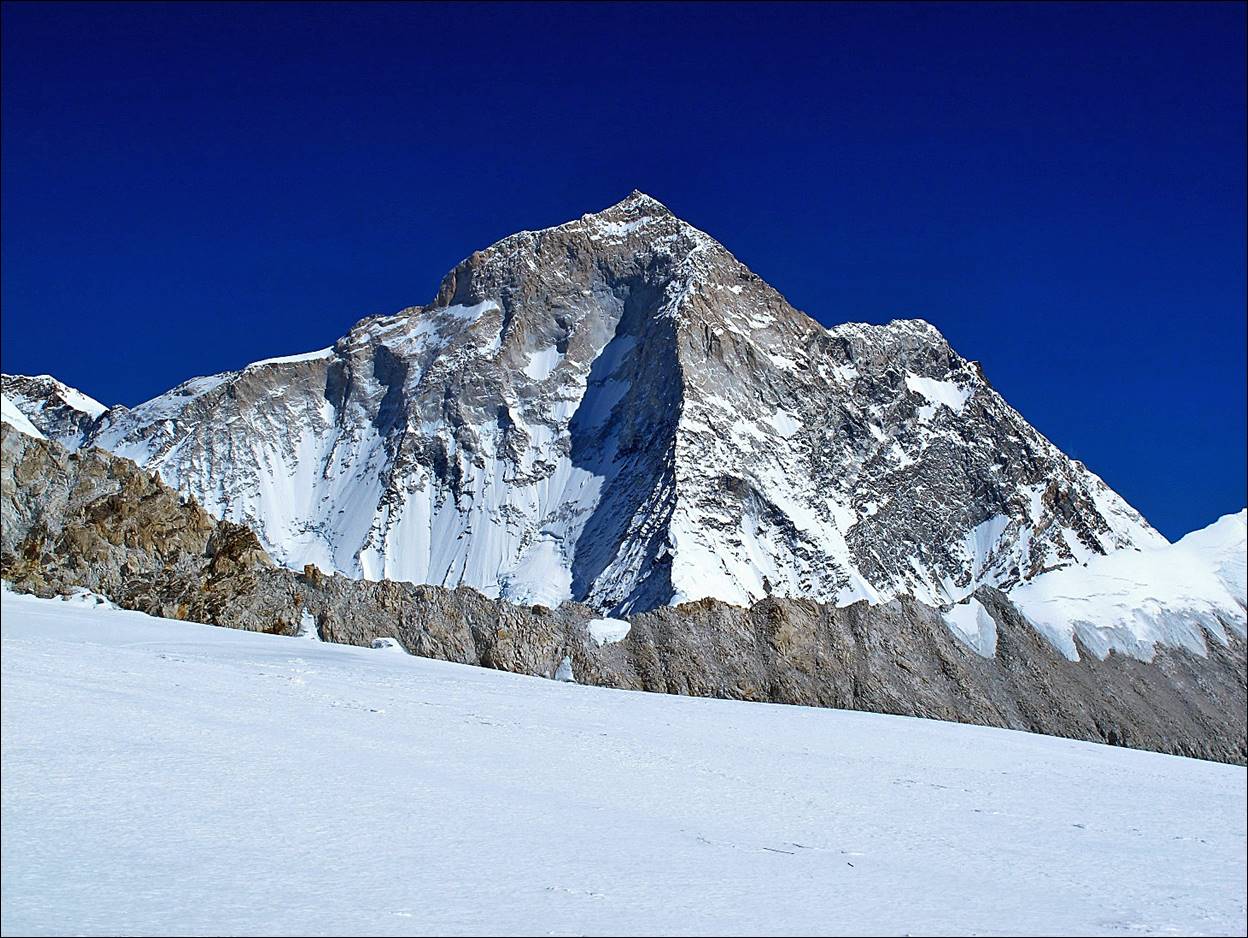
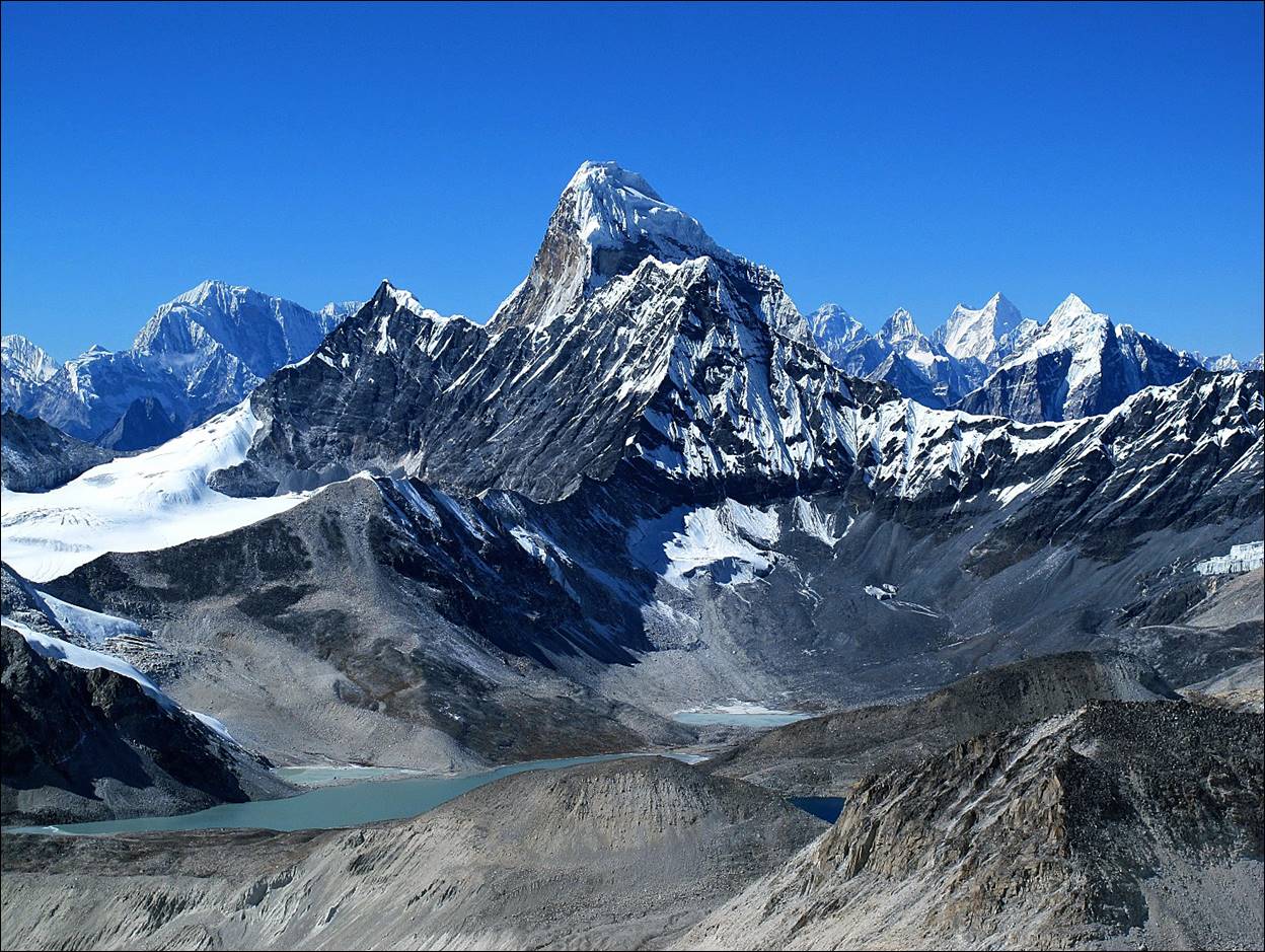
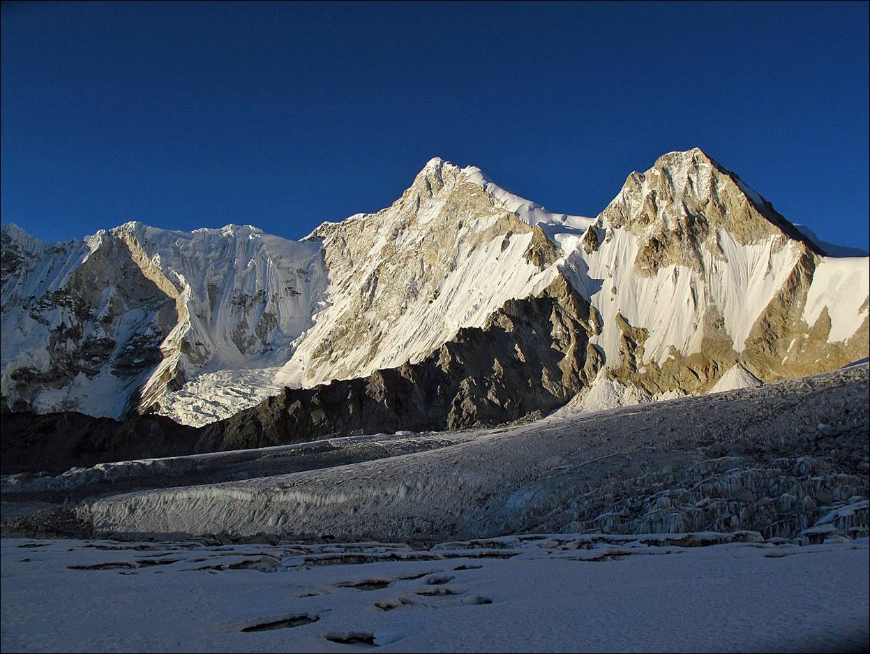
Baruntse (7168m) at the center of the photo, viewed from
the Hongu basin. The snowy ridge on the right of the peak is the normal ascent
route. However, near the summit, the snow often forms a dangerous cornice.
![]()
Links to all sections of
the trek:
1.
Taplejung to Olangchun Gola
(4 days)
2. Olangchun Gola (1 day)
3. Crossing
Lumba Samba pass (3 days)
4. Tudham to Hongon (3 days)
5. Hongon to Yangla Kharka (5 days)
6. Yangla Kharka to Sherpani Col High Camp (4 days)
7. Crossing
of Sherpani and West Cols (1 day)
8. Hongu basin to Namche across Amphu Lapsta (3 days)
9. Namche to Jiri (5 days)
![]()