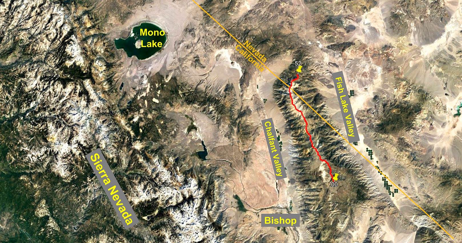
Day 4/5 of the White Mountains
traverse, California and Nevada, United States,
June 27th - July
1st, 2022
![]()
Return to main Whites +
Sierra 2022 trip webpage
|
|
GPS Waypoints of
Day 4 (white-mountains-wp-2022.kmz). |
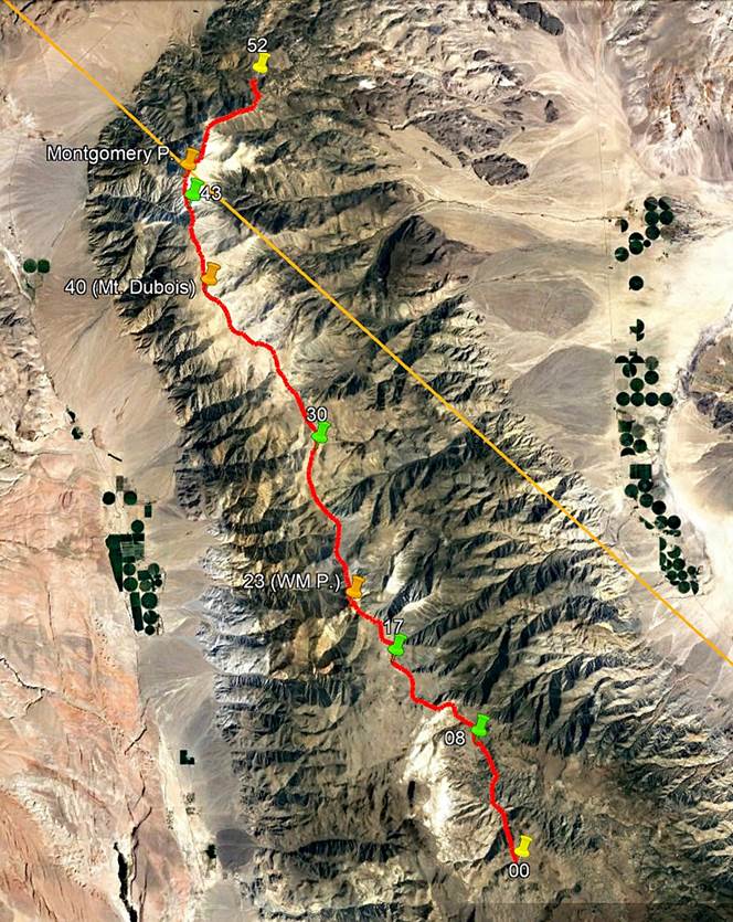

This fourth day of
the traverse was another long day with more than 9 hours of actual hiking. The
route presented no special difficulty, but was long, with a nasty steep descent
on unstable rocks at the end. We set our 4th camp (waypoint 43) on the thin
ridge of the Montgomery Creek saddle, between The Jumpoff, an aptly named 4111m
peak (given the steep descent to the saddle that lies below it), and Montgomery
Peak.
View of Cabin Creek
(left) and Birch Creek (right) soon after leaving our 3rd camp.
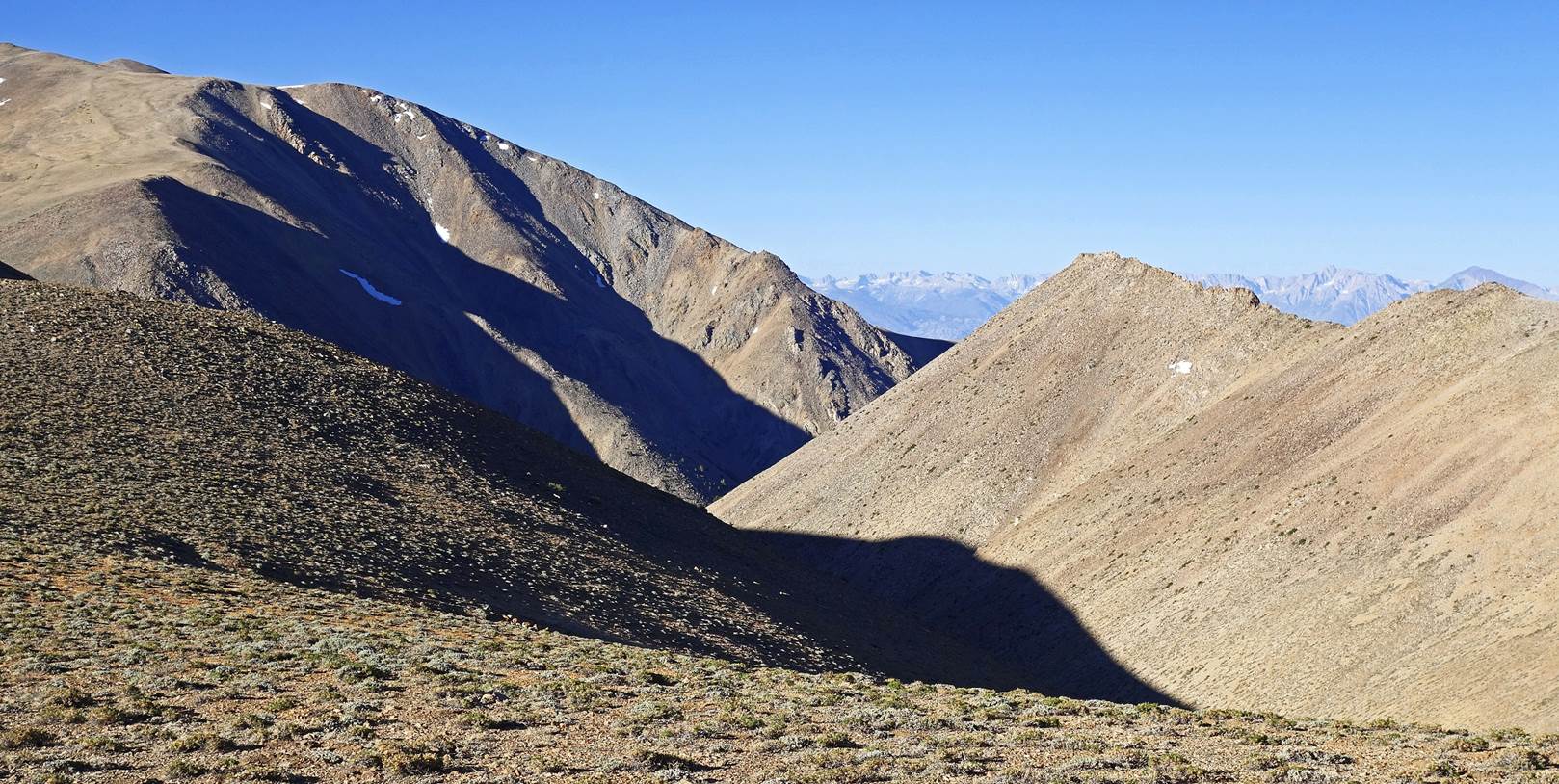
Small valley higher
up, where we saw bighorn sheep, unfortunately from very far away.
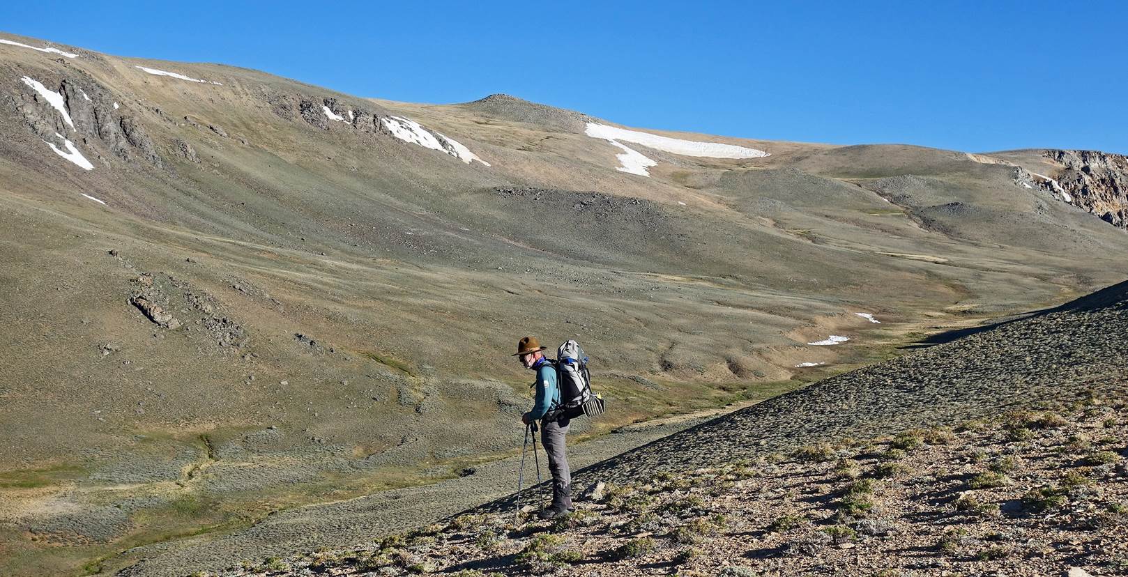
Partial view of the
Sierra Nevada in the background.
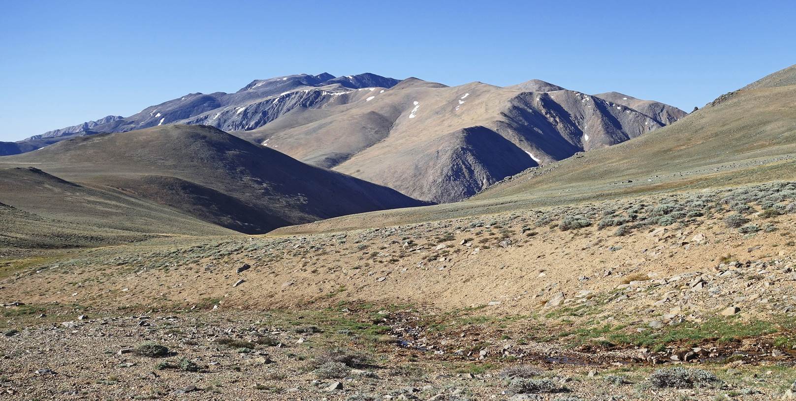
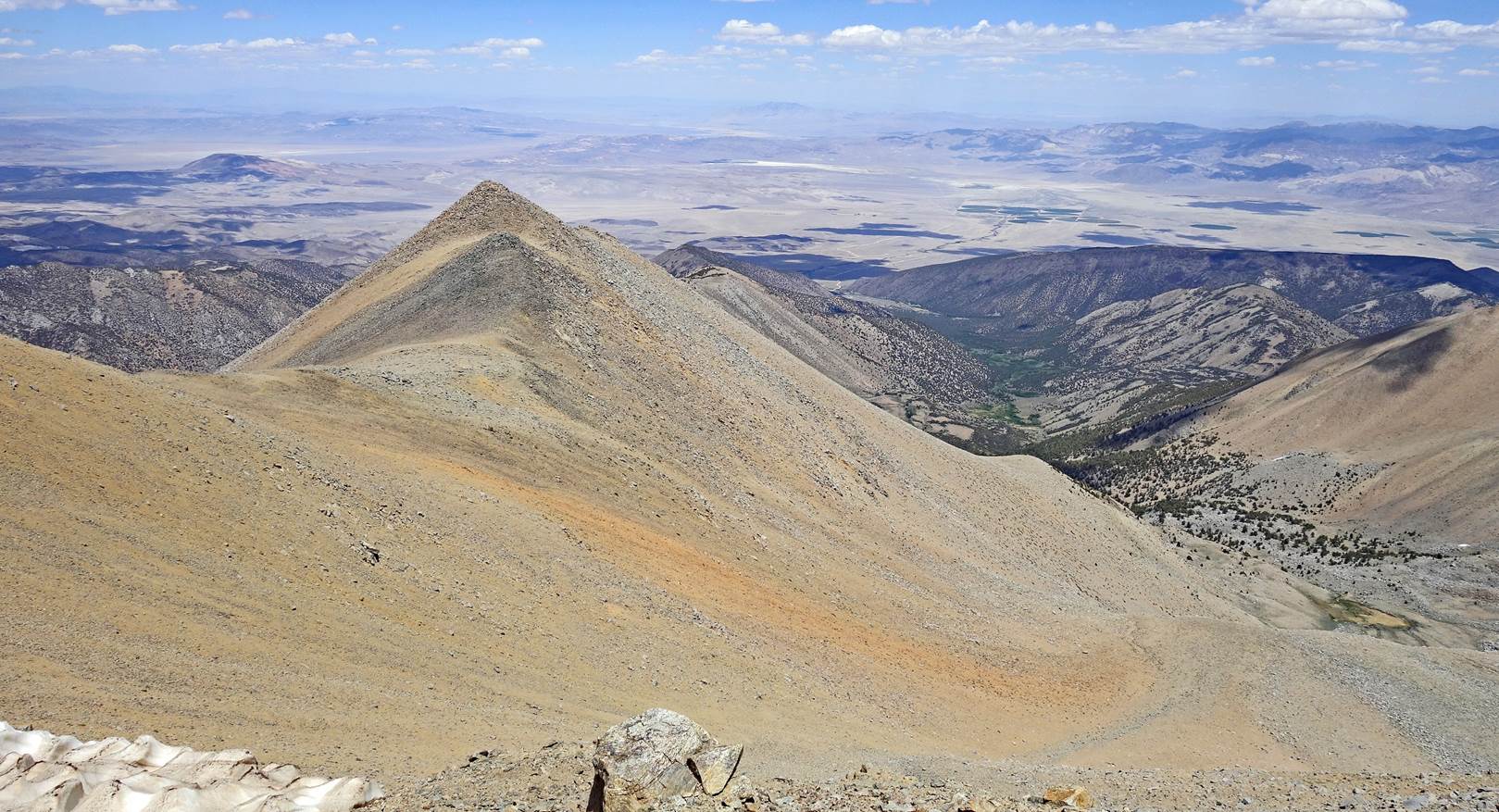
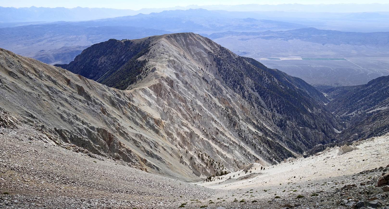
Looking back toward
the south. Here, we have regained enough elevation for White Mountain Peak to
be visible again: it is the sharpest peak at the center-left of the photo.
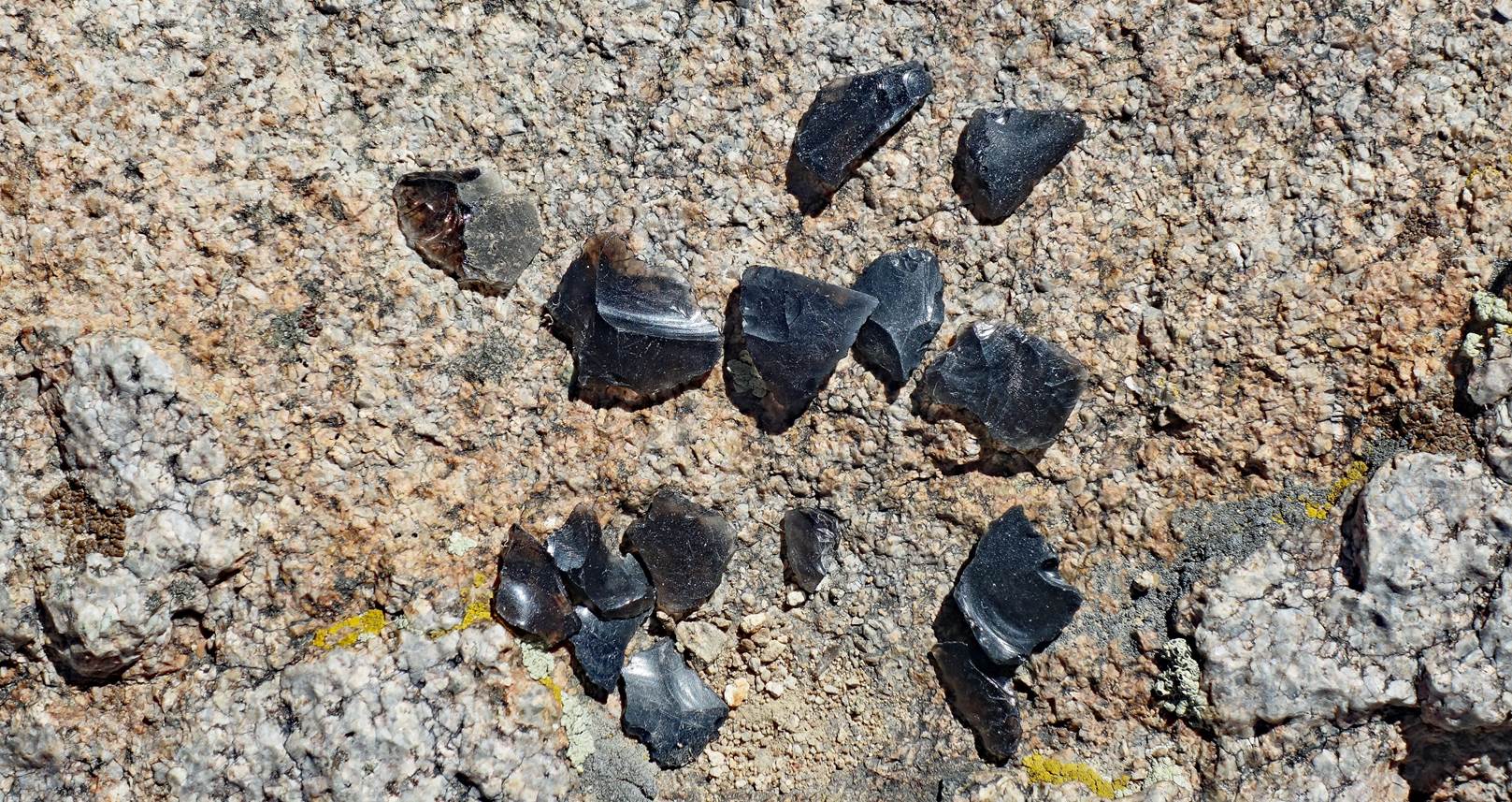
Gathered obsidian
shards found along the way that were probably brought and left here long ago by
Native Americans. (There is no natural deposit of obsidian stones in the White
Mountains.)
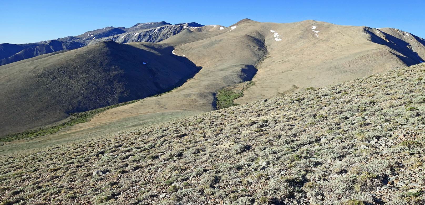
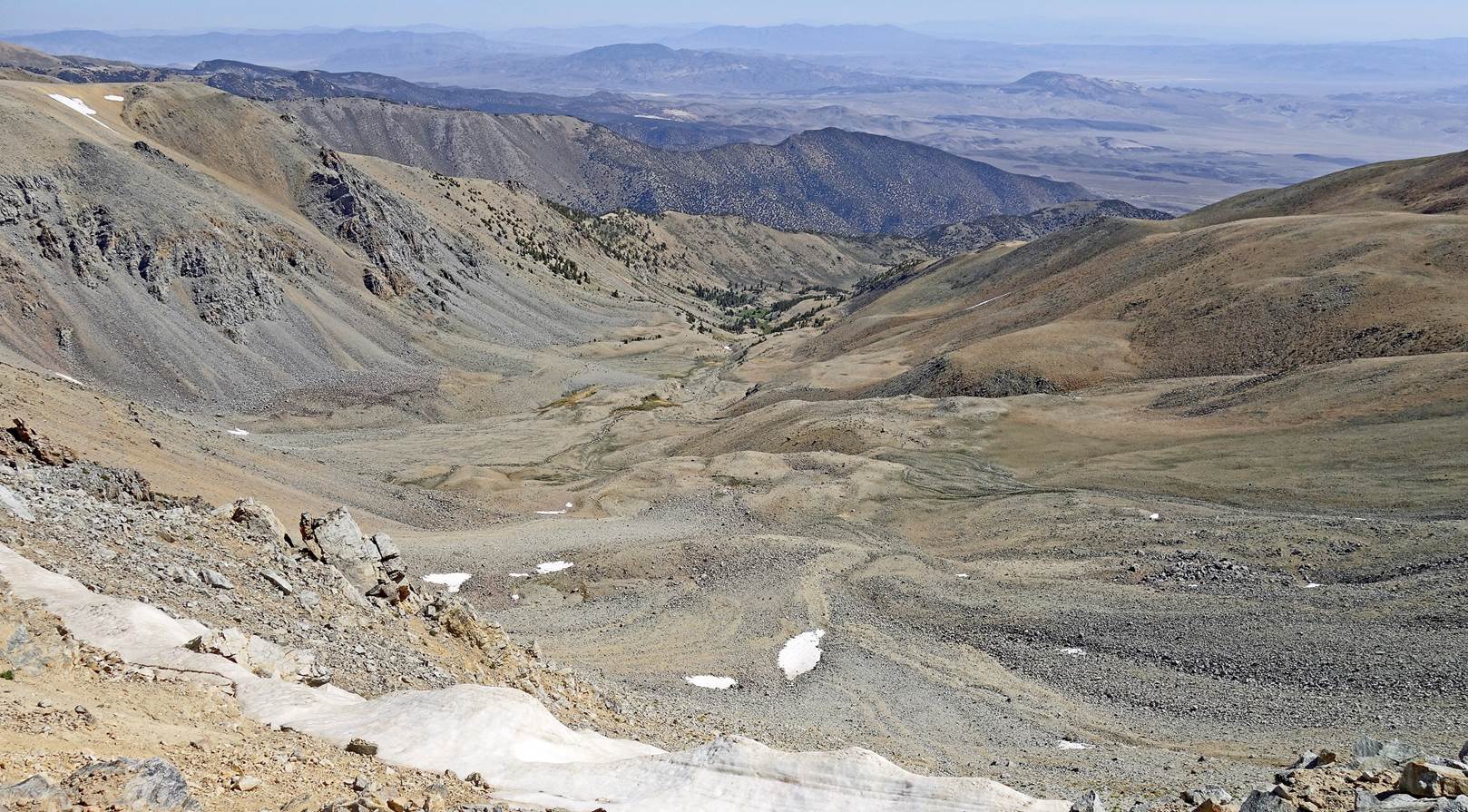
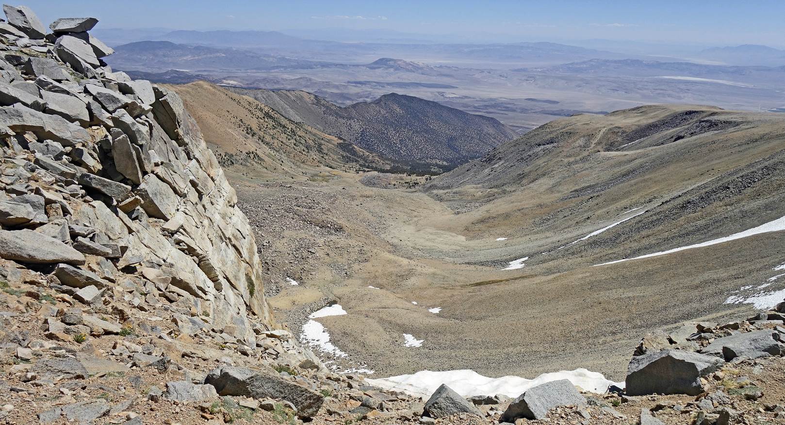
Two converging
glacial valleys on the east side of the range.
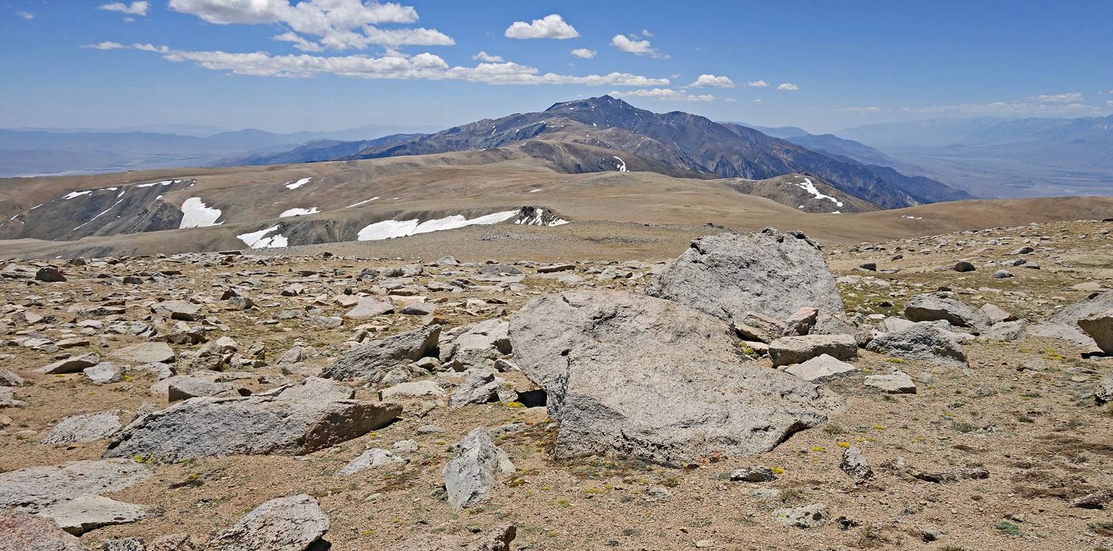
Another view toward
the south, here from Pellisier Flats.
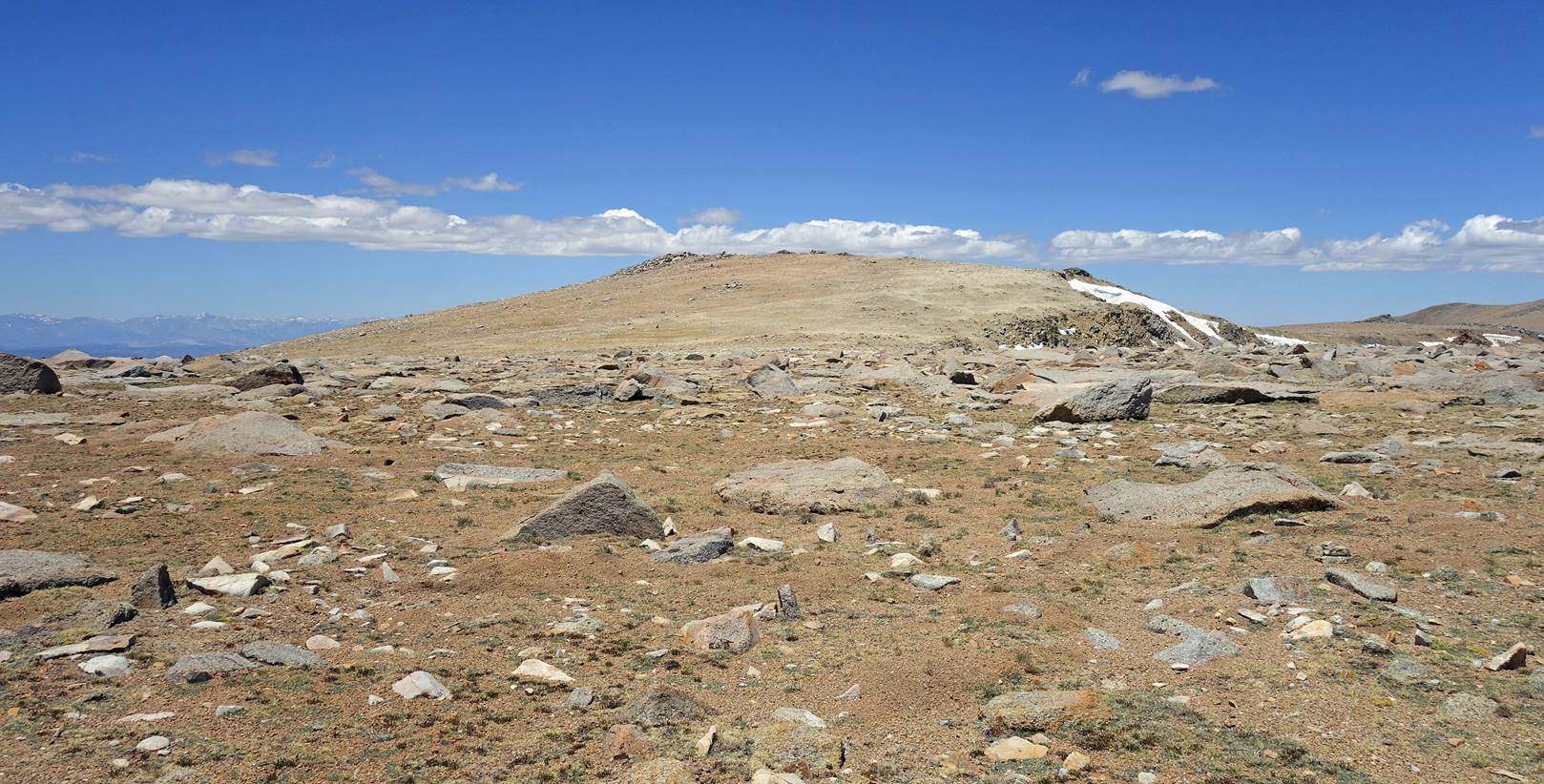
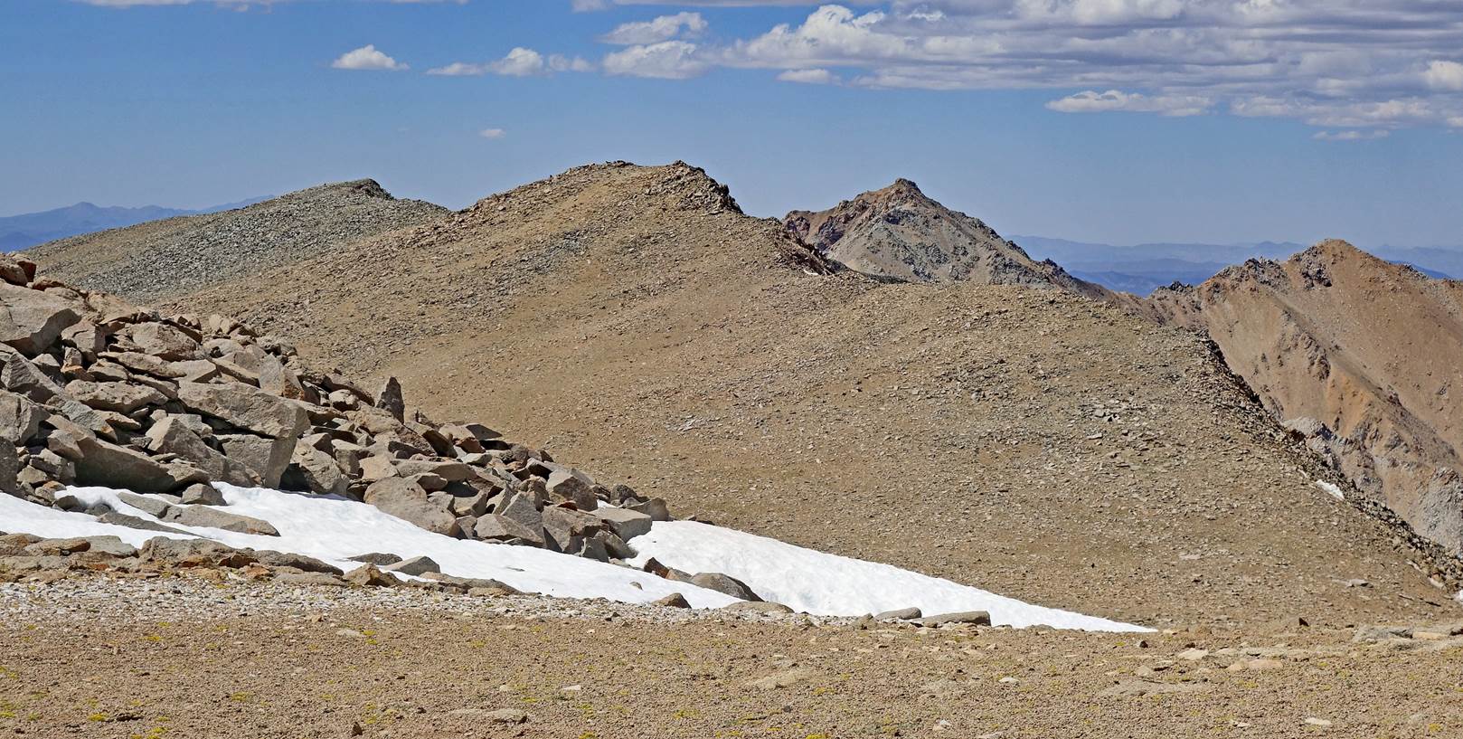
The unimpressive Mt.
Dubois seen from Pellisier Flats. Just a slightly higher bump on the crest.
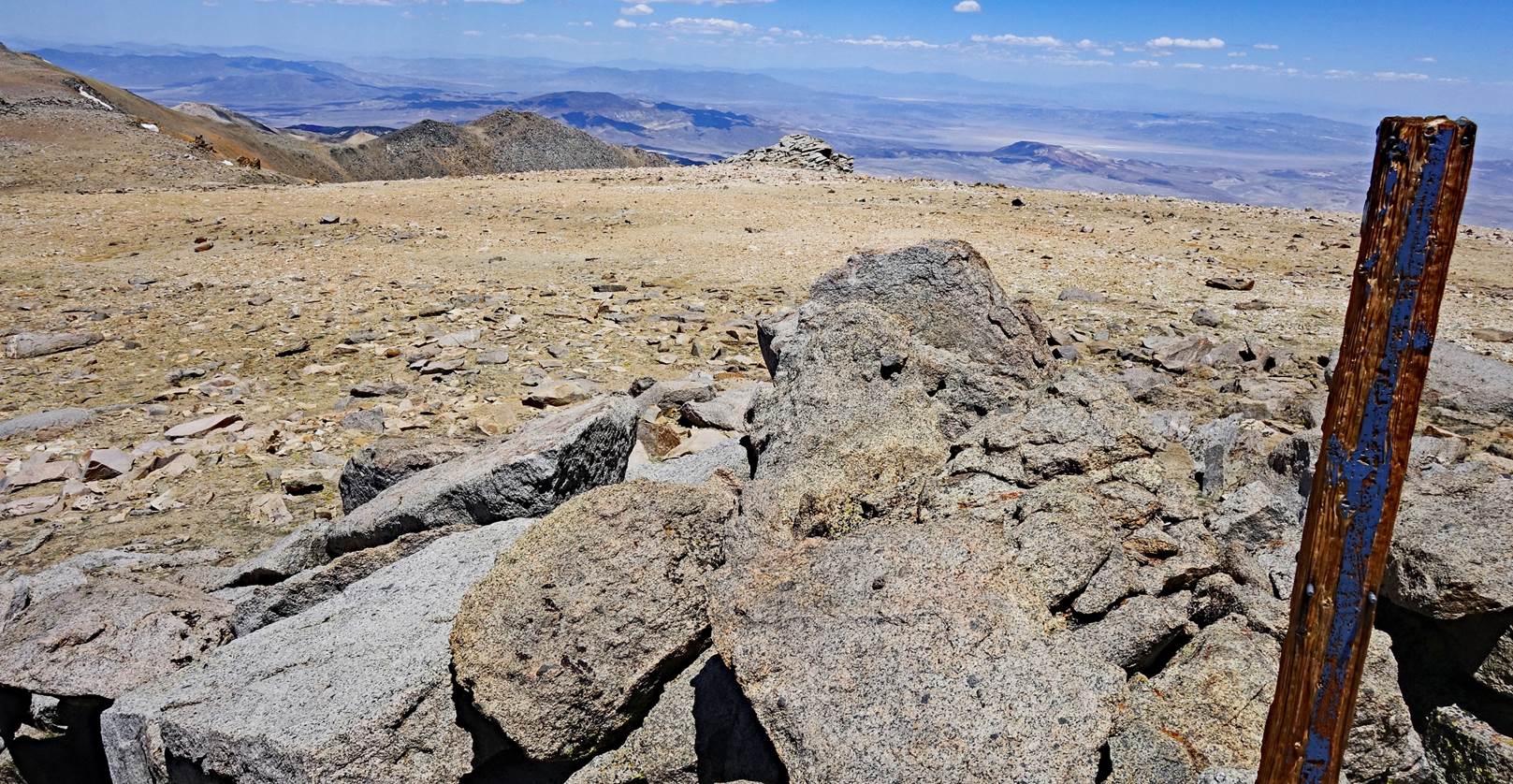
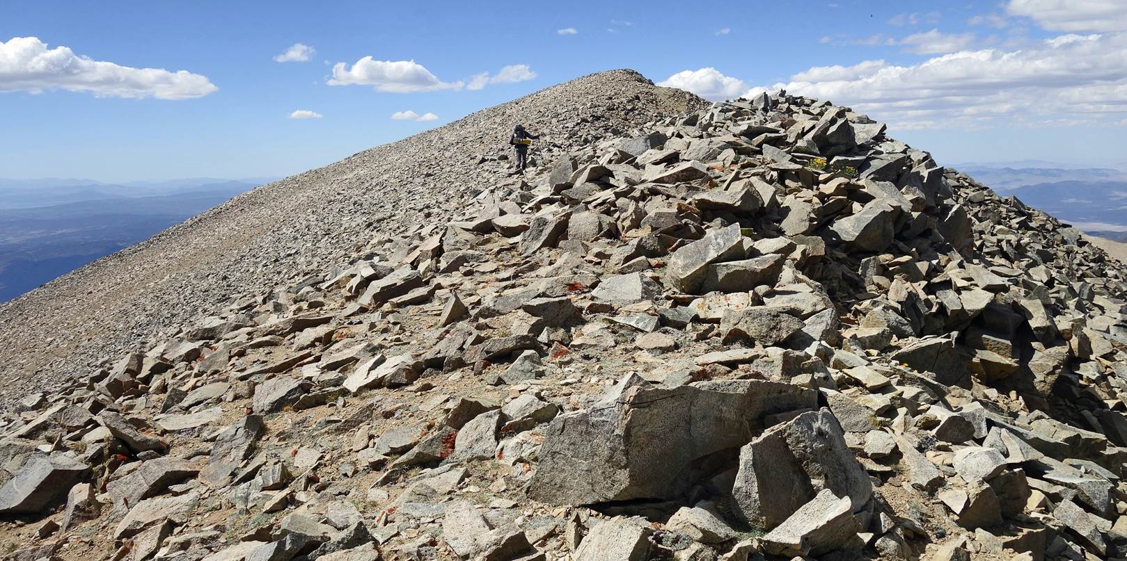
At Mt. Dubois.
Fortunately there is a marker to show where the exact summit is.
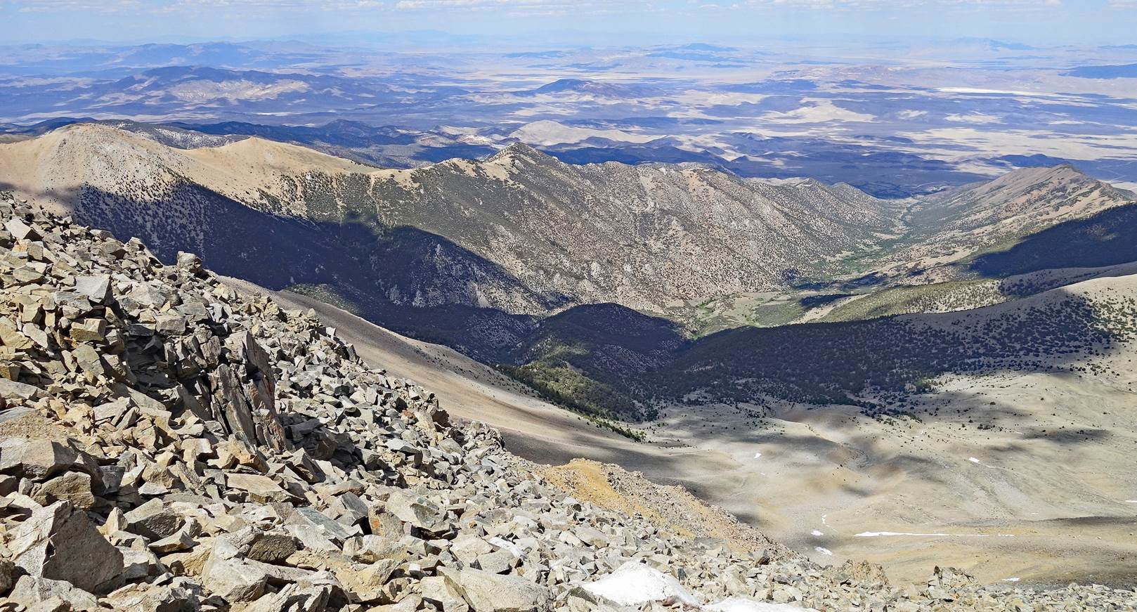
View from the east
edge of the crest, after having passed Mt. Dubois.
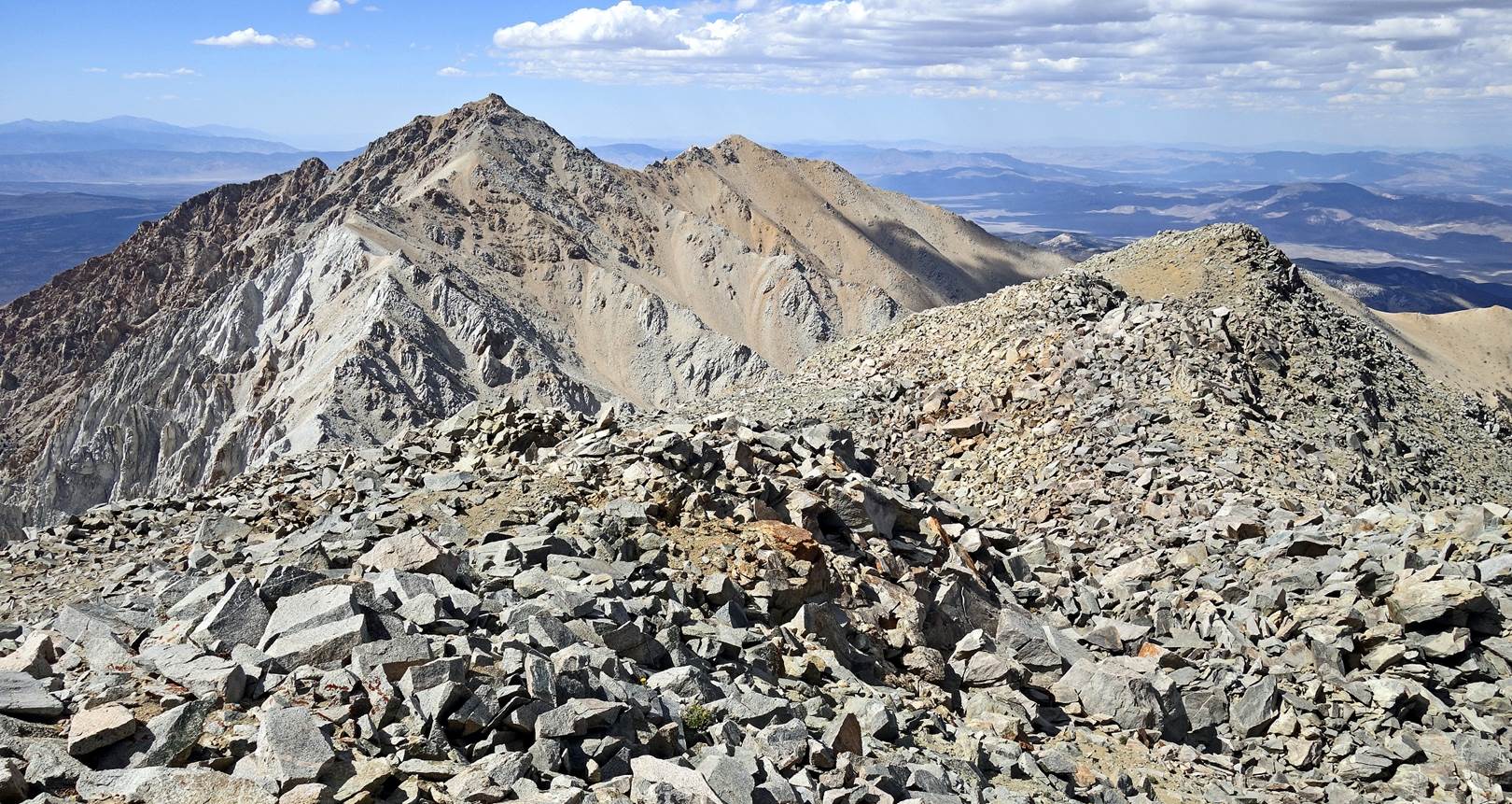
View of the last ridge
that we were to follow before descending to the Montgomery Creek saddle, where
we set our 4th camp. The start of this descent is the leftmost high point of
the ridge, called The Jumpoff (4111m). The peak behind the ridge, on the
center-right side of the photo, is Montgomery Peak; Boundary Peak is also
visible further to the right. These two peaks look deceptively close; reaching
them will require a few more hours of hiking and scrambling.
We stopped at this
location (waypoint 41) because there was a good patch of snow. SP feared that
we would not find any more water or snow until the very end of the traverse.
So, we melted snow and filled all our bottles. SP was right: except for a few
tiny snow patches, we saw no water or snow after this point.
Spectacular view
toward the northeast from the ridge.
Reaching The Jumpoff
at the end of the ridge.
Montgomery Peak and,
on its right, Boundary Peak, the last two peaks of the traverse, seen from The
Jumpoff. The Montgomery Creek saddle where we set our 4th camp is about 400m
lower below The Jumpoff and is not visible. The descent to the saddle from here
is a rather unpleasant one, steep and entirely on loose rocks. Even the
substrate terrain below the rocks had cracks and seemed unstable.
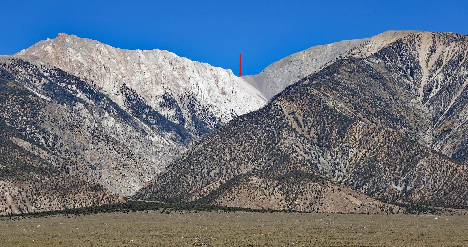
This photo (taken a
day later from Chalfant Valley on our way back to Bishop) shows the Montgomery
Creek saddle (red arrow) where we set our 4th camp. The Jumpoff is the summit
on the right. Montgomery Peak is the summit on the left.
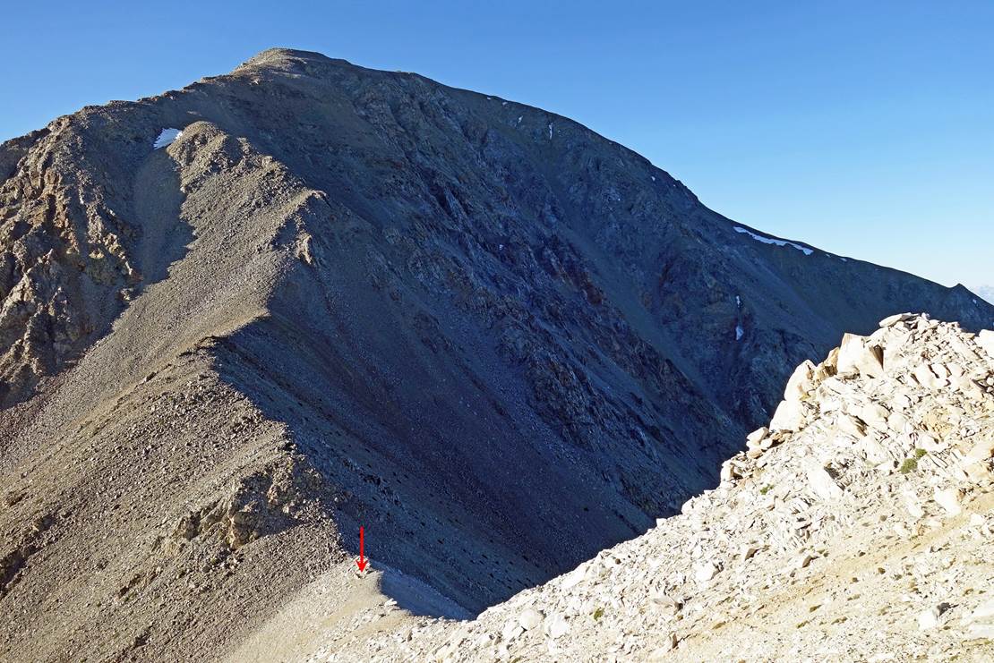
Left: View of the
saddle and the descent from the top of The Jumpoff (photo taken on the next
morning during the ascent of the ridge toward Montgomery Peak).
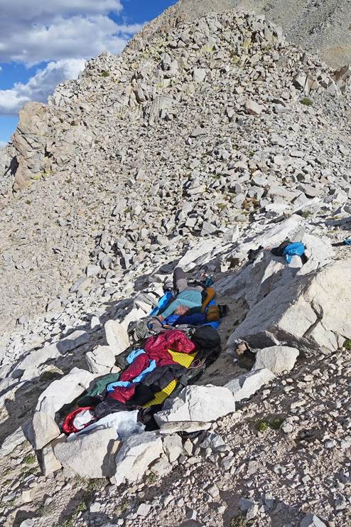
Right: Our 4th camp
(waypoint 43) at 3702m on the saddle, without a tent for lack of space and
thanks to good weather. Its location is marked with a red arrow in the photo on
the left.
|
|
|
View toward the west
from our camp.
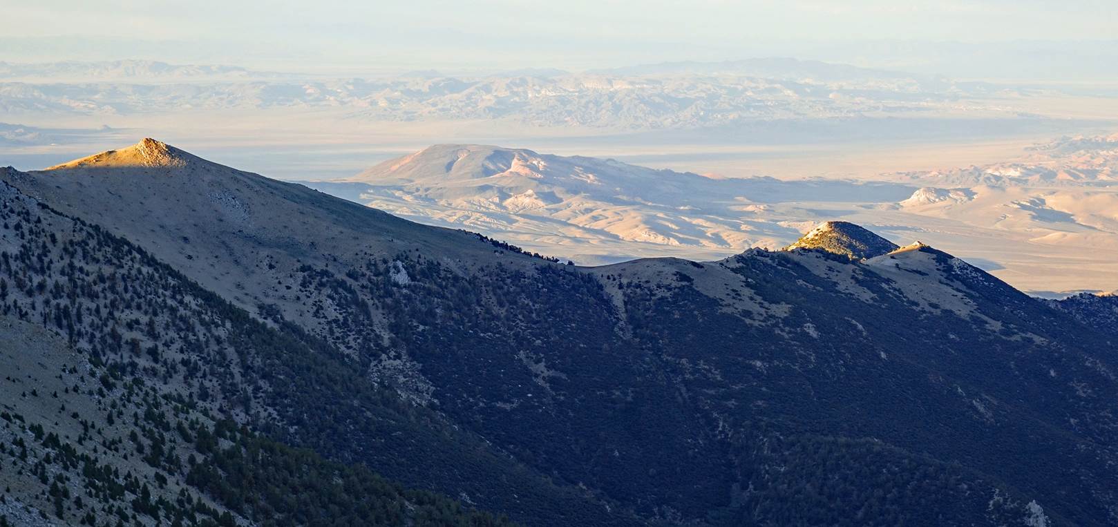
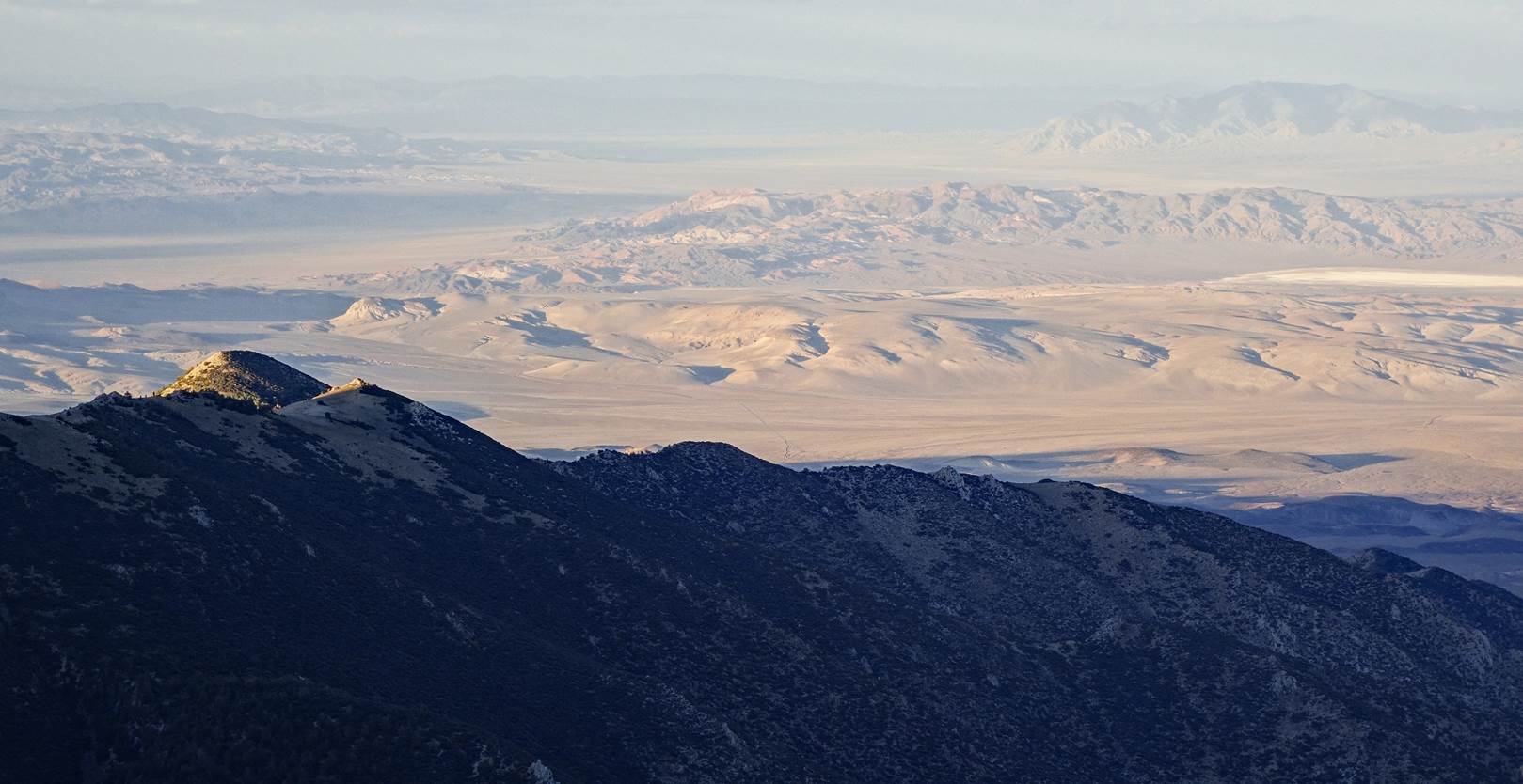
Evening views toward
the east over the Nevada desert from our camp.
To
directly access the other day-by-day pages of the traverse, click the following
links:
![]()