Five-day traverse of the White Mountains of California
and Nevada
and acclimatization day hikes in the Sierra Nevada of
California,
United States, June 25th - July 1st, 2022
![]()
Return
to main United States webpage | Return to my
mountaineering/trekking/travel webpage
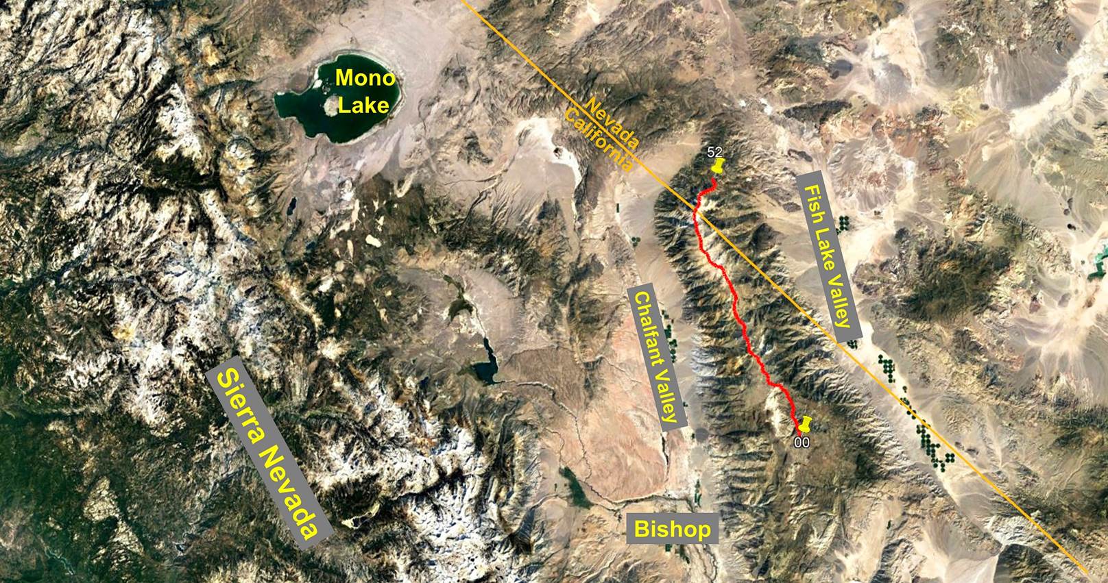
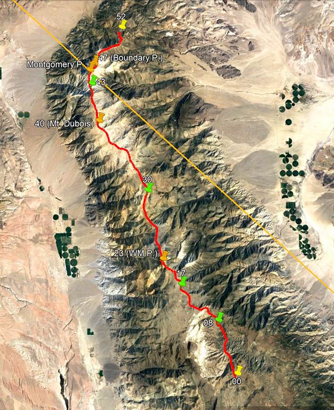
Situation map:
Perspective view
(from the east, toward the west) of the traverse:

This set of pages
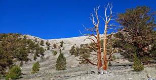
shows photos taken during a 5-day south-to-north traverse of the White
Mountains, a relatively unknown and little traveled 4000m mountain range that
overlaps the U.S. states of California and Nevada, east of the larger and much
better known Sierra Nevada mountain range. I did this traverse with SP Parker,
an amazingly experienced mountain guide from Bishop, the owner of the Sierra Mountain
Center, and a long-time friend with whom I did many mountaineering trips as
far back as the late 1990s (see here).
The Sierra Mountain Center's webpage
about the traverse provides much additional useful information.
|
|
The traverse follows the red line
drawn on the satellite image on the left, based on my GPS-recorded waypoints.
To access these waypoints, download the white-mountains-wp-2022.kmz file from
here
and then open this file in Google Earth. The successive waypoints are numbered
00 (start of the traverse) to 52 (end of the traverse). The waypoints with
green icons are the locations where we set our 4 camps. For clarity, only a
subset of waypoints is shown in the image on the left. The other waypoints
will be shown in the pages dedicated to each of the 5 days of the traverse
(links below). Note that the red line (also included in the file
white-mountains-wp-2022.kmz file) is approximative; only the numbered
waypoints it connects are GPS-recorded. The start and end of the traverse are
both located on dust roads and are reachable by 4WD vehicles. The total
distance covered by the traverse is about 60 kilometers. Most of it is on
rugged trailless open terrain, except for 3km on a now closed unpaved road
leading to the summit of White Mountain Peak (waypoint 23) and rare fainted
trails, some of which are animal (deer and big-horn sheep) trails or remains
of former Native American trails. Some sections are on steep, often unstable
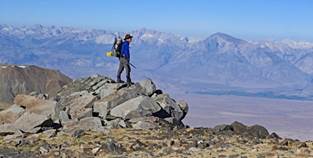
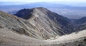
rocks. Almost 80% of the traverse is above 3300m, including 11km above 4000m.
The cumulated elevation gain and loss are, respectively, 3975m and 4256m. The main summits along the traverse
are White Mountain Peak (4344m), Mt. Dubois (4135m), Montgomery Peak (4099m),
and Boundary Peak (4007m). Beyond waypoint 12 the itinerary roughly follows
the crest of the range, but this crest varies from being quite wide on some
sections to being sharp and steep on others. In both cases the crest provides
awesome views over both Chalfant Valley (to the west) and Fish Lake Valley
(to the east), some 3000m below. These two desert valleys are cultivated
(alfalfa, garlic) thanks to the water running down from the White Mountains
and the center-pivot irrigation technique (which created the green discs
visible in the picture). The steepest rock sections are north of waypoint 23
(White Mountain Peak) and between waypoint 43 (last camp) and waypoint 47
(Boundary Peak). Overall, this high-elevation traverse
of a desert-surrounded mountain range is strenuous, but truly spectacular. |
To see day-by-day
pictures of the traverse (in chronological order, with additional comments),
click on the following links.
|
|
|
|
|
|


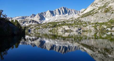
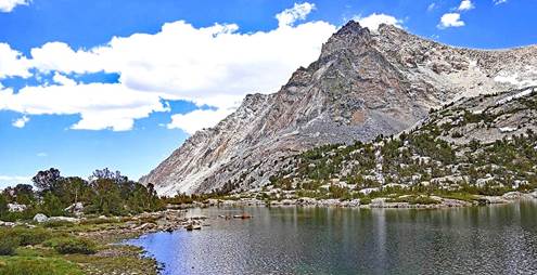
Prior to doing the
White Mountains traverse I did two acclimatization day hikes in the Sierra
Nevada: one from South Lake (2977m) to Bishop Pass (3649m), the other from North
Lake (2821m) to Piute Pass (3482m). Their trailheads are located some 25 to 30
kilometers west of the town of Bishop. They follow well-maintained trails along
beautiful lakes and are hugely popular with hikers, climbers, anglers, and even
mountain joggers. Click on the following links to see photos of these two
hikes.
|
|
|
![]()
Return
to main United States webpage | Return to my
mountaineering/trekking/travel webpage