Morocco (May
2023): Twelve-day traverse of the central part of the High Atlas
![]()
Return to my
mountaineering/trekking/travel webpage
In May 2023 I returned to Morocco to do
a hiking traverse of the central part of the High Atlas. As on many of my
previous trips to Morocco, the itinerary and logistics were arranged by my
friend Oumar
Oulaidi. The itinerary was perfectly designed to avoid roads as much as
possible and cross a great diversity of landscapes. It also stayed in areas
visited by relatively few hikers. (In fact, I saw none during the entire
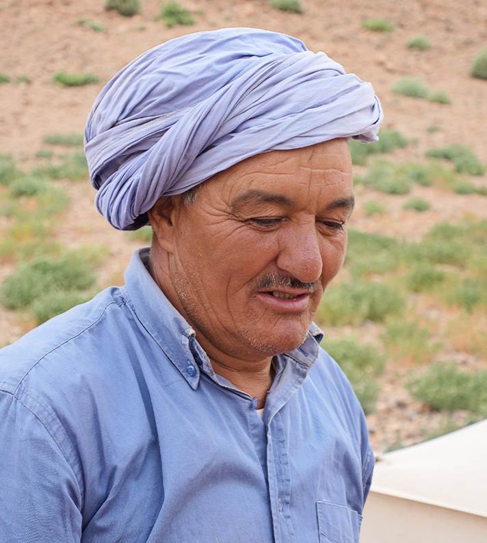
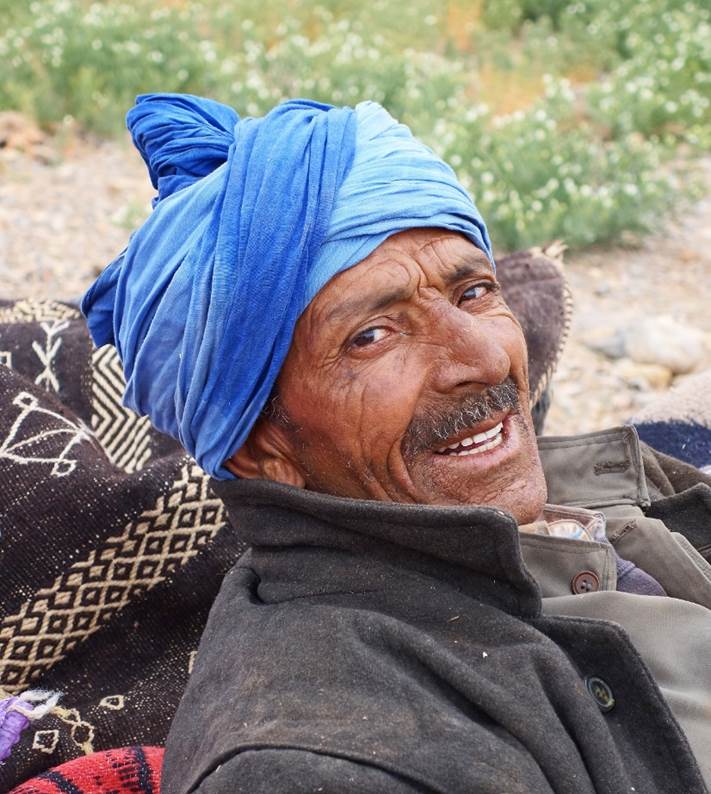
traverse.) During the trek I was accompanied by Brahim and Zaid, both Berbers
living in the Ait Bouguemez valley, respectively in the villages of Ifrane and
Rbat. Our loads were carried by two mules.
|
|
|
|
Brahim |
Zaid |
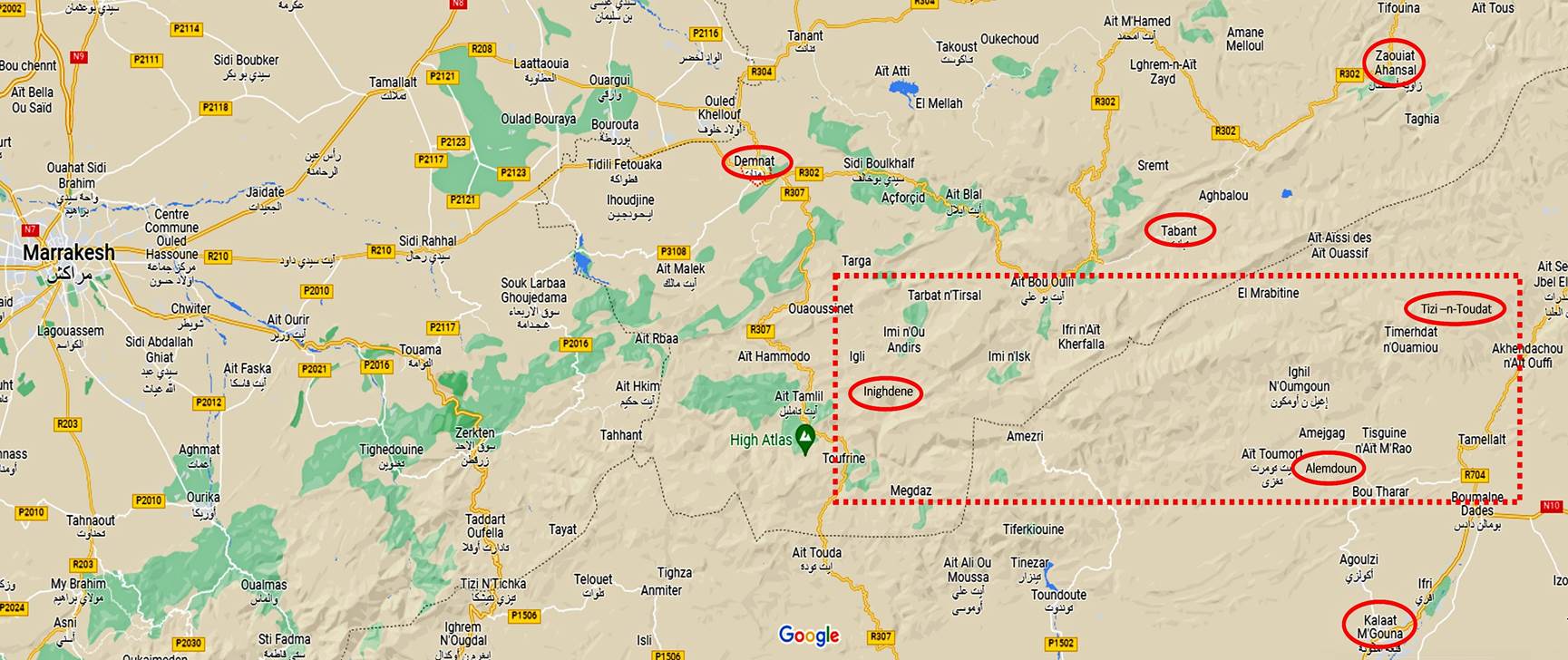
We did the traverse from west to east.
We started in the village of Inighdene, about 31km south-east of the town of
Denmat, 90km east of Marrakesh. We ended the traverse 12 days later near the
village of Alemdoun, 22km north of Qalaat Mgouna, at Oumar's
lodge.
The approximate trek area is shown in the map below. The original plan had been
to end the hike at Tabant in the valley of the Ait Bouguemez after crossing
Tizi n-Toudat (a 2658m pass) south of Zawyat Ahancal. However, as we reached
the southern slope of Tizi n-Toudat, a snowstorm combined with freezing winds
forced us to turn around and, instead, end the hike further south at Oumar's
lodge, where the weather was more lenient. Such a storm event during the second
half of May is extremely unusual. Based on my experience on many hikes in the
Atlas, I had planned for hot days well above 20C and night temperatures well
above 10C, even in the 20s. So, I did not have adequate clothes to withstand
freezing temperatures. After a day of rest at the lodge, Brahim and I decided
to go to the Ait Boughemez valley by car (a relatively new road connects the
two places) and attempt an ascent of Djebel Azourki (3350m). There, another
snowstorm dashed this attempt. It turned out that this exceptionally bad
weather lingered on the Atlas for several more days, with short clearings, at
least until the beginning of June.
The change of itinerary was a little
disappointing. However, I had already crossed Tizi n-Toudat in April 2014 in
much better weather conditions (see here).
Moreover, during several previous trips I had also hiked in the mountains east
of the Ait Bouguenez valley (2004,
2008,
2014).
The damage was therefore minimal.
The
map below shows the approximate hike area (dotted rectangle):
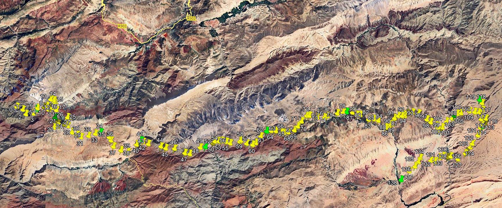
The picture below shows the GPS
waypoints I recorded during the traverse in a satellite photo. To access these waypoints, click here, download the morocco-2023.kmz file,
and open the file in Google Earth. The successive way points are numbered 0
(start of the hike in Inighdene) to 138 (Oumar's lodge in Alemdoun). The
waypoints with green icons are night locations; the last one marks Oumar's
lodge.
The red line in the following
topographic map represents the path followed during the traverse. To download
the four map sheets (scale: 1/100,000) at full resolution used to assemble the
picture below click here:
101-AZILAL (for the top-left corner of the picture), 116-SKOURA (for the
bottom-left corner), 117-QALAT-MGOUNA (for the bottom-right corner), and
102-ZAWYAT-AHANCAL (for the top-right corner).
[For an extensive source of topographic maps of
Morocco click this link: https://jemecasseausoleil.blogspot.com/2017/06/cartes-du-maroc.html.]
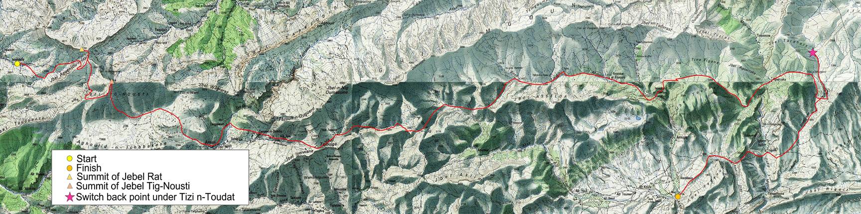
The
traverse first follows a route north of the Tessaout river and includes the
ascents of the summits of Jebel Rat and Jebel Tig-Nousti. After crossing the
Tessaout above the village of Amezri, it follows a path between the Mgoun range
to the north and smaller ranges to the south, until it reaches and crosses the
Mgoun river. Then it heads to the north toward Tizi n-Toudat and, following the
snowstorm, swings south to reach Alemdoun. The straight-line distance between
the start and the easternmost point of the hike is approximately 70km.
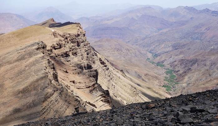
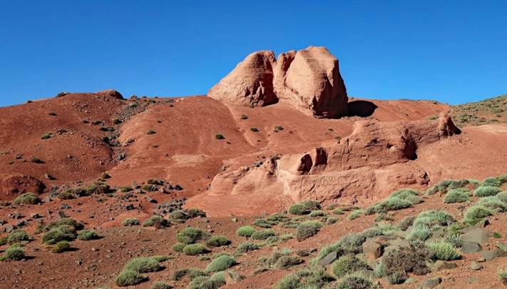
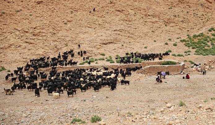
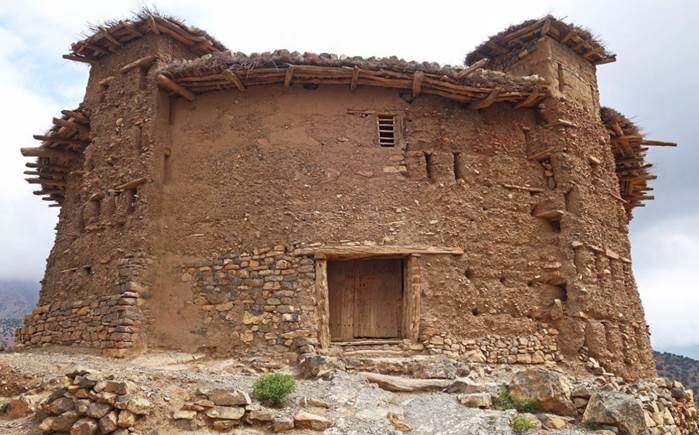
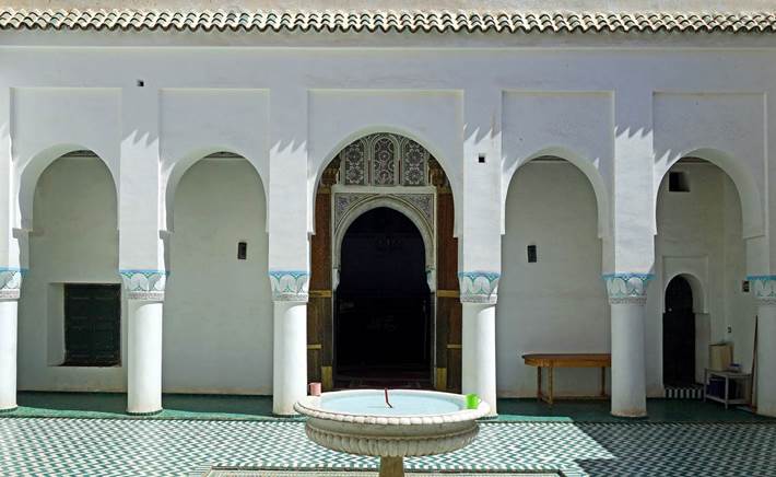
To see pictures of the various parts of this trip, click on the following
links (photos or their captions):
|
|
|
|
|
|
|
|
|
|
||
|
|
|
|
![]()