India (July-August 2018):
Across
Kang La (5450m) and Umasi La (5300m) - From Lahaul to Zanskar to Paddar
|
|
Return to my
mountaineering/trekking/travel webpage
The main purpose of this trip was to do
a two-leg trek across two major passes of the mountain range of southern Zanskar in the Indian state of Jammu & Kashmir. The
first leg crosses Kang La (5450m) from Lahaul to Zanskar and the second leg crosses Umasi
La (5300m) from Zanskar to Paddar
(see maps below). More precisely the first leg starts at the tiny village of Khanjar (elevation: 3850m) in the valley of the Miyar Nala (river) in Lahaul, which is part of the district of Lahaul-Spiti in the state of Himachal Pradesh, and ends
about 3km south of the Barden gompa, southeast of Padum, on the road along the Tsarap river in Zanskar. The second leg starts at the Zongkhul
gompa (elevation: 3700m), northwest of Padum, in the valley of the Malung
Togpo (river), and ends near the town of Gulabgarh in the Paddar region of
the Kishtwar district of the state of Jammu &
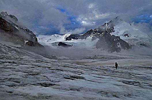
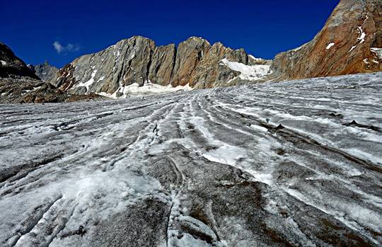
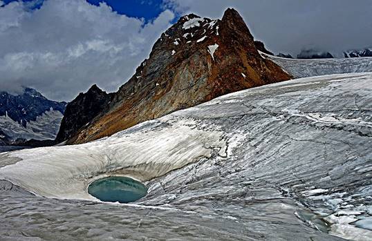
Kashmir. Each leg requires hiking long distances on glaciers before and after
the passes. The first leg is approximately 75km-long with 32km on glaciers. The
second leg is 70km-long with 13km on glaciers. Each leg took 7 days of
hiking at a relatively leisurely pace. Both legs provide extraordinary views
over high peaks and glaciers.
Overall, I first flew to Leh in Ladakh (in Jammu &
Kashmir) and spent two nights in Leh (elevation:
3500m). Then I went by car to Khanjar with a
night-over in Keylong (elevation: 3080m) along the
way. I spent two nights (camp) in Khanjar to
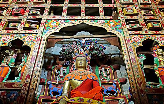
acclimatize more before trekking. Between the two legs of the trek, I spent a
couple of days around Padum (an area that I had
briefly visited in 2013), visiting three gompas (Karsha, Sani, and Zongkhul). At
the end of the second leg, I went by car from Gulabgarh
to Jammu, the capital of the state of Jammu & Kashmir. I then flew back to
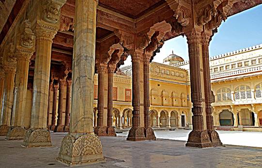
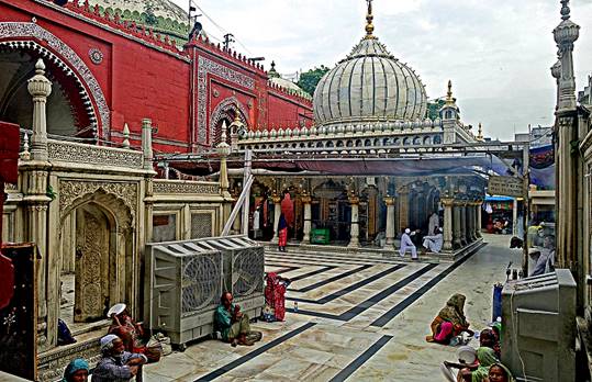
Delhi. I concluded the trip by spending three days in Jaipur and Pushkar (in the state of Rajasthan, south of Delhi) and in
Delhi, before returning home.
Support team:
During the two legs of the trek I was
supported by a team of six Zanskaris, all from
villages located near Padum, led by Tundup Chospel, the same guide as
during my trek of 2016. This was one of the very best support teams I
ever had on a mountaineering trek, in terms of spirit, experience, and
strength. It had been selected by Sonam Dawa, the owner and manager of Adventure Travel
Mark, who also arranged the logistics for the entire trip (including
transportation and hotel reservations). Sonam Dawa had also organized the logistics of my trek of 2016.
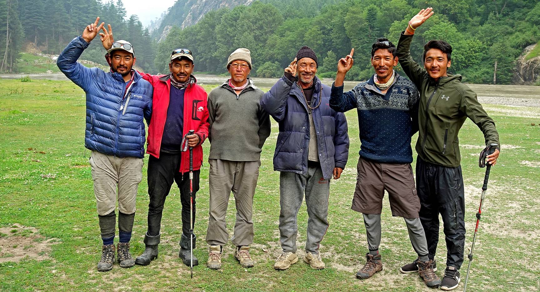
The support team consisted of (from left
to right): Laskhap, Rinchen,
Angchuk, Falkays, Tundup, and Stenzing. Falkays (63) and Angchuk (59)
were the oldest members (but still younger than me!). They were as strong (or
even stronger) as any of the other four, with more experience and wisdom. Just
spending time with this group was a significant part of the joy of the trek.
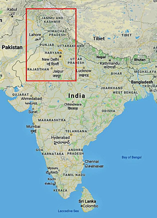
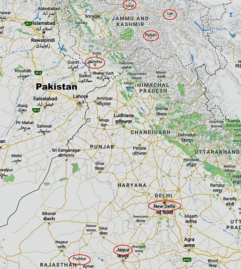
Location maps:
- Northwest India.
|
|
|
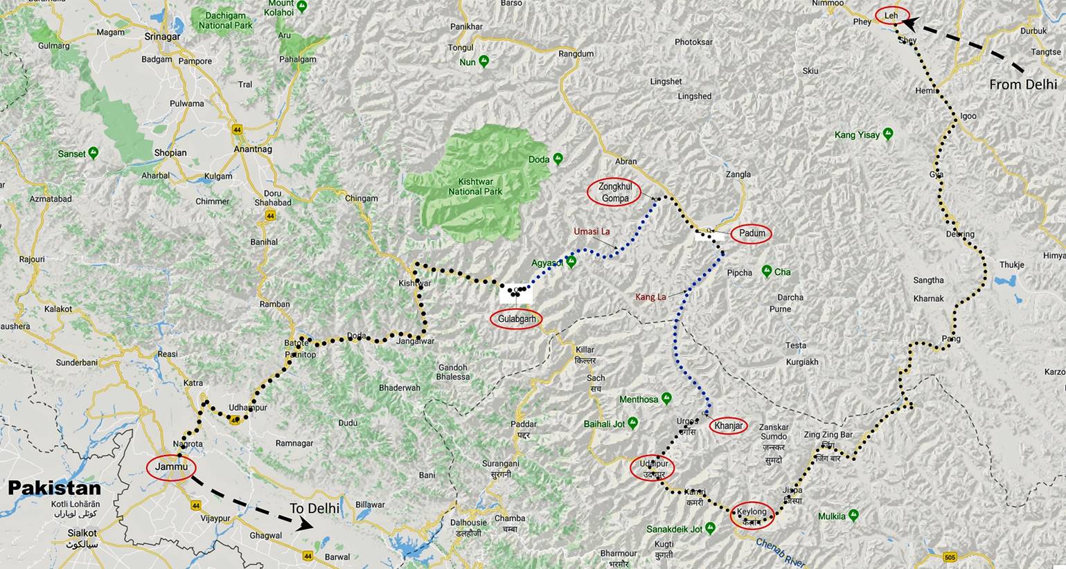
- Trek area, with the approximate
itinerary of the trek shown in blue dotted lines and the road trips in black
dotted lines.
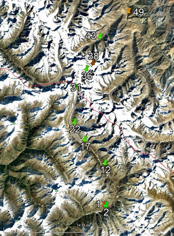
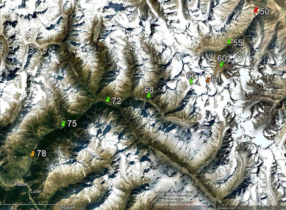
GPS waypoints:
Click here (kmz file) and open the
downloaded file in Google Earth to access the GPS waypoints (numbered 1 to 49
for the first leg and 50 to 78 for the second leg) that I recorded during the
trek: red pins for starts, orange for finishes, green for camps, brown for
passes, and yellow for other waypoints. As my GPS ran out of battery between
waypoints 60 and 62, there are no intermediate (yellow) waypoints between them,
except waypoint 61 (Umasi La) that I placed manually
based on Google Earth views. Most of the trek is covered by the excellent Ladakh & Zanskar South and Center 150K maps
published by Editions Olizane (Geneva, Switzerland).
Waypoints other than the yellow ones
shown in Google Earth views. [The thin red line in the view on the left separates the states of Jammu
& Kashmir on the north and Himachal Pradesh on the south.]
|
|
|
|
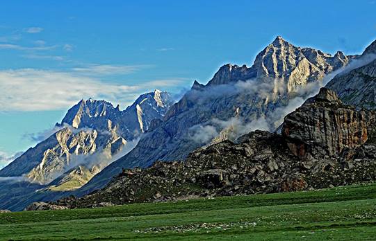
Crossing of Kang La. |
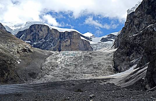
Crossing Umasi La. |
Gear:
We carried a rope, one ice axe, two
harnesses, and two pairs of crampons during the two legs of the trek. We did not
use the crampons and the harnesses at all. We used the ice axe only to poke
suspicious snow cover for hidden crevasses and to cut steps at the very
beginning of the icy descent from Umasi La. We used
the rope on a short steep rock section during the descent from Umasi La (below the glacier). Although we could probably
have done the entire trek without any of these gear items, I still think it was
a good idea to have them with us.
Photos:
Click on the links below to see pictures
of the various sections of the trip.
|
|
|
|
|
|
||
|
|
|
|
|
|
|
|
|
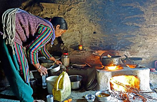
Monasteries
and cheese making around Padum |
|
|
|
|
|
|
|
|
|
|
|
|
||
|
|
|
|
|
|
|
|
|
|
|
|
|
|
|
|
![]()