India
(July-August 2019): A meandrous 24-day trek in the Kargil
and Kishtwar districts of Ladakh
and Jammu & Kashmir
|
|
Return to my
mountaineering/trekking/travel webpage
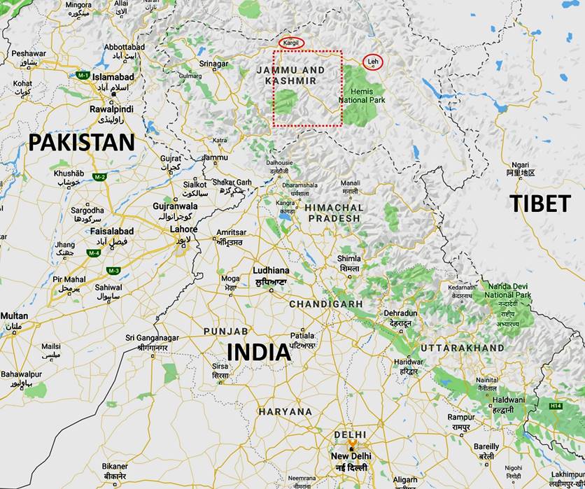
Location maps:
Left: Trek area (box in dotted contour)
in northwest India. Right: Itinerary: red dotted lines for sections actually
done; blue dotted lines for sections planned, but not done (see explanations
below); black dotted lines for intermediate road trips to connect the 3 legs of
the trek.
|
|
|
A
preliminary note:
During this trek the central Indian
government voted to abolish the State status of Jammu & Kashmir and, instead,
divide the region into two Union Territories, called Ladakh
and Jammu & Kashmir. Most of this trek lies in the Kargil
district of the former state, but is now part of the newly created Union
Territory of Ladakh. The Kishtwar
district (that the trek barely enters in its southernmost portion) is now part
of the new Union Territory of Jammu & Kashmir.
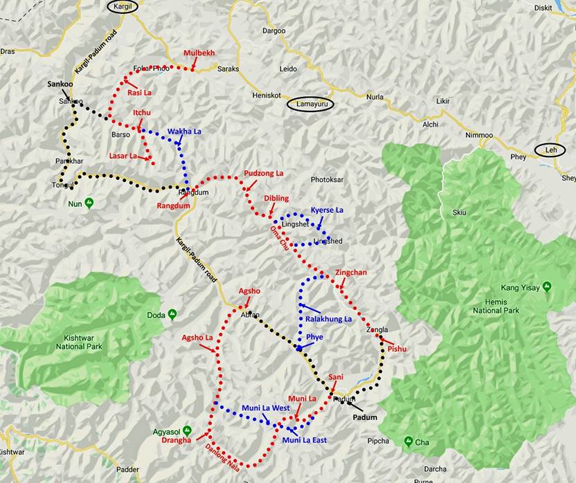
Planning and execution:
My initial goal for this
trip was to trek along a somewhat odd (neither a traverse, nor a loop)
itinerary spanning several distinct regions of Ladakh
and Jammu & Kashmir, some predominantly Buddhist, others Muslim. This
wandering itinerary starts from Mulbekh, a small town
located 36km southeast of Kargil on the road between Leh and Kargil. For convenience
of presentation, I break it down into 3 legs (most of the place names used
below are those found in the two Ladakh & Zanskar, Center and South, 150K maps published by Editions Olizane, Geneva, Switzerland):
1. Mulbekh to Rangdum, a village and a gompa
located on the road between Kargil and Padum, across a series of passes, including Rasi La and Wakha La,
2. Rangdum to Phye, another village between Kargil
and Padum, across several passes, including Pudzong La and Ralakhung La,
3. Agsho (also
written Akshu, Akshow, and Hagshu) to Sani, two more villages between Kargil and Padum, across three
passes (Agsho La, Muni La West and Muni La East).
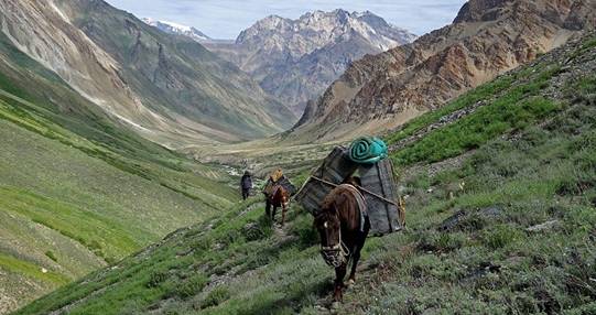
Two support teams had been planned for
this trek: one with horses for the first two legs and another one with porters
for the third leg. The mountains traversed in the third leg are parts of the
Great Himalaya Range, which is less protected from the moisture coming from the
south than the mountains further north. Hence, they get more snow and are more
heavily glaciated, making it very difficult or impossible to use horses.
However, un-anticipated circumstances
(mainly due to the fact that the previous winter had brought much more snow
than usual) and some over-optimism in the schedule forced me to make several
changes to this itinerary during the trek:
1. When we arrived in the village of Itchu (also spelled Ichu and Ichou), the last village before Wakha
La, we learned that crossing the pass with horses would be impossible due to
the large amount of snow. The villagers told us that another pass, Lasar La (south of Itchu), might
be feasible, though so far this season no one had crossed it with animals. So,
we tried Lasar La instead. But it turned out that the
upper part of the pass was too steep, with too much snow, for our horses. So,
we had to turn back, return to the road in the valley between Sankoo and Itchu, and find a
vehicle to drive us to Rangdum (a long detour). With
porters instead of horses, we could have crossed Lasar
La.
2. In the second leg we had planned to
cross three passes (Marpa La, Kyerse
La, and Barmi La) in a single day after passing the
village of Dibling. This was over-optimistic. I was
worried that we could arrive too late in Phye to carry
out the last leg of the trek before my return flight home. Since I expected
this last leg to be the most interesting, I chose to skip these three passes
and take a more direct route along the Oma Chu
(river) below Dibling.
3. Later in the second leg, leaving the
canyon of the Oma Chu to enter a side-canyon toward Ralakhung La required to ford the Oma
Chu (no bridge). Unfortunately, the large amount of snow in the mountain and
the sudden heat that occurred late July had made the crossing of the Oma Chu too hazardous for my taste. So, we decided to skip Ralakhung La and continue our trek along the Oma Chu (then called the Zingchan
Togpo) to Zingchan. We
ended the second leg in the village of Pishu, 25km
northeast of Padum, instead of the village of Phye. From Pishu we took a car to
Padum, where we spent one night, before driving to Agsho for the third leg.
4. I later learned that changes in the
glaciers bordering Muni La West and East during the past 10-15 years had made
their crossing extremely difficult and hazardous, at best. Fortunately, there
was an alternative pass (apparently known as Muni La to local people), not
indicated on any map, that required following a longer path along the Danlong Nala valley further south
in the Padder region of the Kishtwar
district of Jammu & Kashmir. The ″Muni La″ that we crossed is
approximately 4km north of the ″Muni La East″ of the Olizane map.
Of all those changes, the first was the
most harmful, especially since it could have easily been prevented with a team
of porters. The third one was also a big disappointment, as I had considered
crossing Ralakhung La for several years. Together the
second and third changes led me, for five days, to follow the same path
(roughly from the camp before crossing Pudzong La to
the village of Pigmo, north of Pishu)
as during my 2013 trek (see here).
In contrast, the fourth change may have actually been beneficial since the Danlong Nala valley turned out
quite interesting with its summer Bakarwal
shepherd settlements and very different from the rest of the trek (much
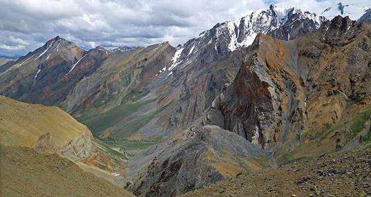
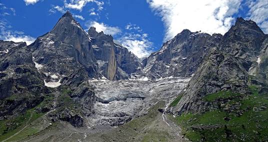
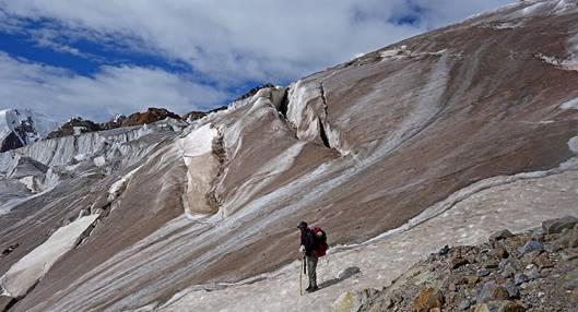
greener). The overall trek was still an amazing one. It was extremely diverse,
with spectacular mountain sceneries, especially during the second and third
legs, and the crossing of multiple Buddhist and Muslim cultures, especially in
remote places like Urgyen Dzong
(an ancient Buddhist hermitage), Itchu, Dibling, and the Danlong Nala valley.
The first leg from Mulbekh
to Rangdum took 8 days, including the road trip to Rangdum on the last day. The second leg from Rangdum to Pishu took 7 days. The
third leg from Agsho to Sani took 9 days. In total,
we completed the trek in 24 days, one day earlier than initially planned, as we
did not use a reserve day scheduled for bad weather. Before the trek I spent
three acclimatization days in Leh (elevation: 3500m),
plus one day of road travel from Leh to Mulbekh. After the trek I spent 2 days of road travel to
return from Padum to Leh. I
then flew back to Delhi, where I spent 2 days before returning home.
Final itinerary:
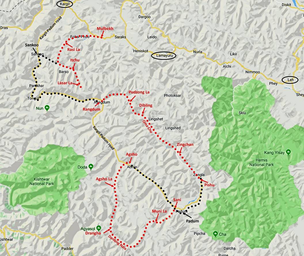
The final itinerary is shown in the above map: the three legs are shown
in red dotted lines and the intermediate road trips in black dotted lines. For
convenience I will continue to divide the trip into 3 legs:
1. Mulbekh to Rangdum,
2. Rangdum to Pishu,
3. Agsho to Sani.
Of the 3 legs, my favorite has been the third one. It definitively
crosses the most spectacular mountain landscapes of the entire trek.
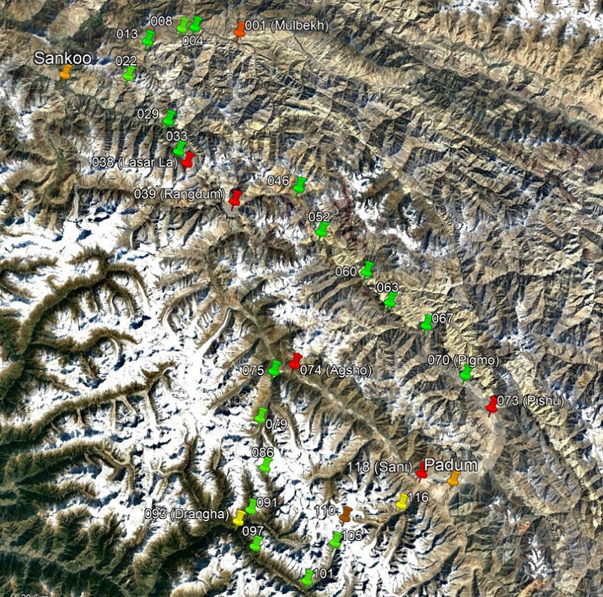
GPS waypoints:
Click here (.kmz file) and open the downloaded file in Google Earth
to access the GPS waypoints (numbered 1 to 118) that I
recorded during the trek: red pins for starts and finishes of legs, green for
camps, brown for passes, and yellow for other waypoints. I also added orange
pins by hand to mark other locations mentioned in the text. Most of the trek is
covered by two of the Ladakh & Zanskar 150K maps published by Editions Olizane (South and Center), except the section between Mulbekh and Itchu. The Kargil 250K map sheet by the US Army covers that part
(click here to get this map).
A Google Earth view with a small
subset of waypoints (mostly camps and starts and finishes of legs) is shown
below. WP #038 is where we turned back on Lasar La.
WP #039 (Rangdum) is both a camp and a start. WP #110
is both a pass (Muni La) and a camp, as we spent a night at that pass.
Logistics and support team:
Like for my previous trips of 2016
and 2018,
the logistics for this trek (guides, support teams, transportation, accommodations,
and food supplies) had been arranged by Sonam Dawa, a Zanskari, the owner and
manager of Adventure Travel
Mark. The guide for the second and third legs was Tundup
Chospel, also a Zanskari,
the same guide as during my previous two trips. Tundup
was also expected to be my guide for the first leg, but a last-minute personal
issue led him to stay in Leh and join the trek only
in Rangdum. On short notice, Sonam
Dawa had found another guide, Nima,
for the first leg. Nurbo, the cook of my 2016 trek,
was part of the support team for the three legs. Dorje
Tundup was the horseman for the first two legs. He
was the same horseman as for my trek of 2013,
a pure coincidence since that trek had not been arranged by Sonam
Dawa. The 5 porters for the third leg were all Zanskaris from the village of Agsho
and around. They were just as remarkable in experience, kindness and
reliability as those of my 2018 trek. As I already wrote in 2018, traveling
with such people is a significant part of the joy of the trek.
|
|
|
|
|
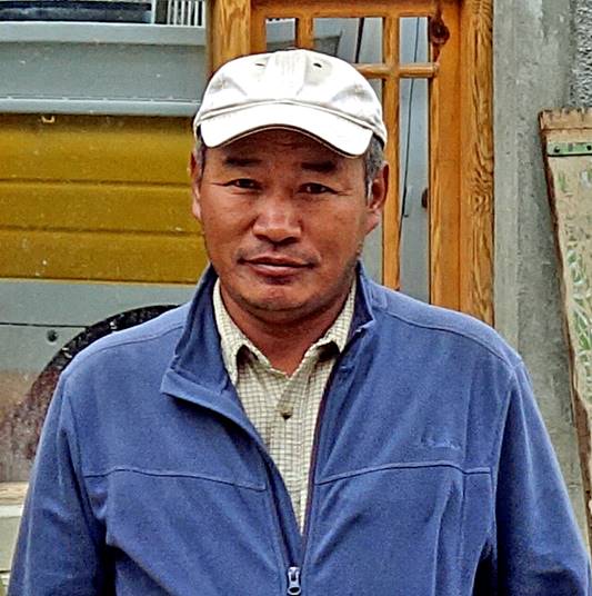
Sonam Dawa |
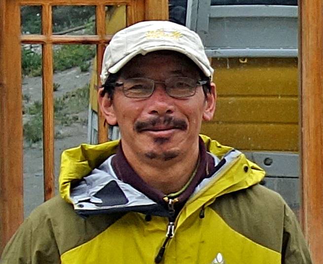
Nima |
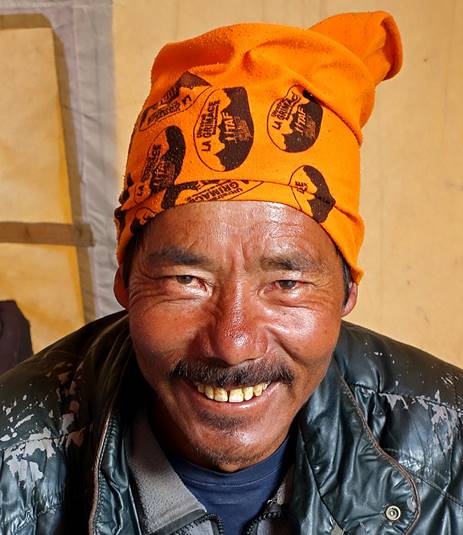
Dorje Tundup |
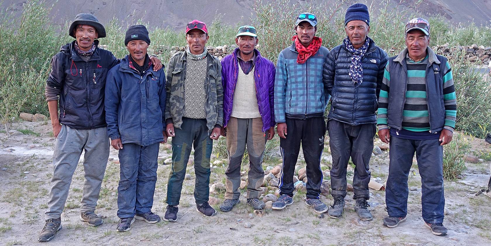
Tundup Chospel
(first from left), Nurbo (second from right), and the
five porters of the last leg of the trek.
[The photo was taken in Sani at the end of the last
day of trek after 12 hours of quasi-continuous hiking, down from Muni La
(5480m), where we had spent our last night. It is no surprise that everyone
looks a bit tired.]
Photos:
Click on the links below to see pictures
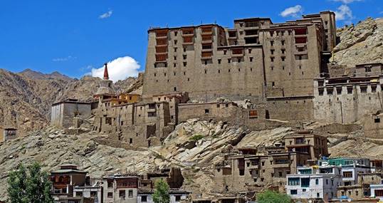
of the various parts of the trip, including photos of Leh
and Lamayuru that I took before the trek, photos of
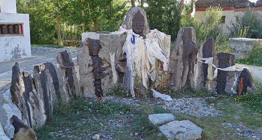
old pre-Tibetan Buddhist statues in Sani that I took after the trek, and photos
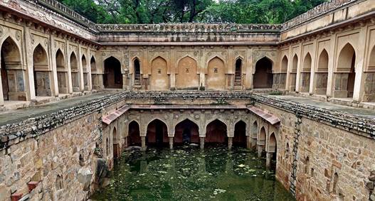
of Delhi at the end of the trip.
|
|
|
|
|
|
||
|
|
|
|
|
|
|
|
|
|
|
|
|
|
|
|
|
|
|
|
|
|
|
|
|
|
||
|
|
|
|
|
|
|
|
![]()